
– Revolutionary War Series –
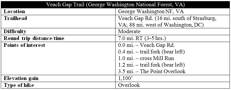
The Veach Gap Trail is a quality hike leading up the eastern flank of Virginia’s Massanutten Mountain, nearby Shenandoah’s quieter and oft-forgotten brother. While covering 1,100 feet in elevation gain, the 3.5-mile ascent is gradual and ends at the fantastic “The Point” Overlook, one of Massanutten’s finest vistas. Better yet, even on a “busy” day, you may encounter just a small handful of other groups on this hike.
The hike
The trailhead for this hike is situated at the end of the unpaved Veach Gap Road, which starts about six miles down beautiful Fort Valley Road from Elizabeth Furnace Campground. The short Veach Gap Road is graveled and relatively well maintained, and the parking area at the trailhead can comfortably fit around 6-8 vehicles.
From the parking area, the trail is rather self-evident, beginning beyond the closed gate as a double-track road. The Veach Gap Trail in part traces the historic Morgan’s Road, thought to be constructed by George Washington’s troops during the Revolutionary War to serve as a possible escape route should Washington lose at Yorktown. While it was never used for this purpose, the road remained a trading route for years to follow.
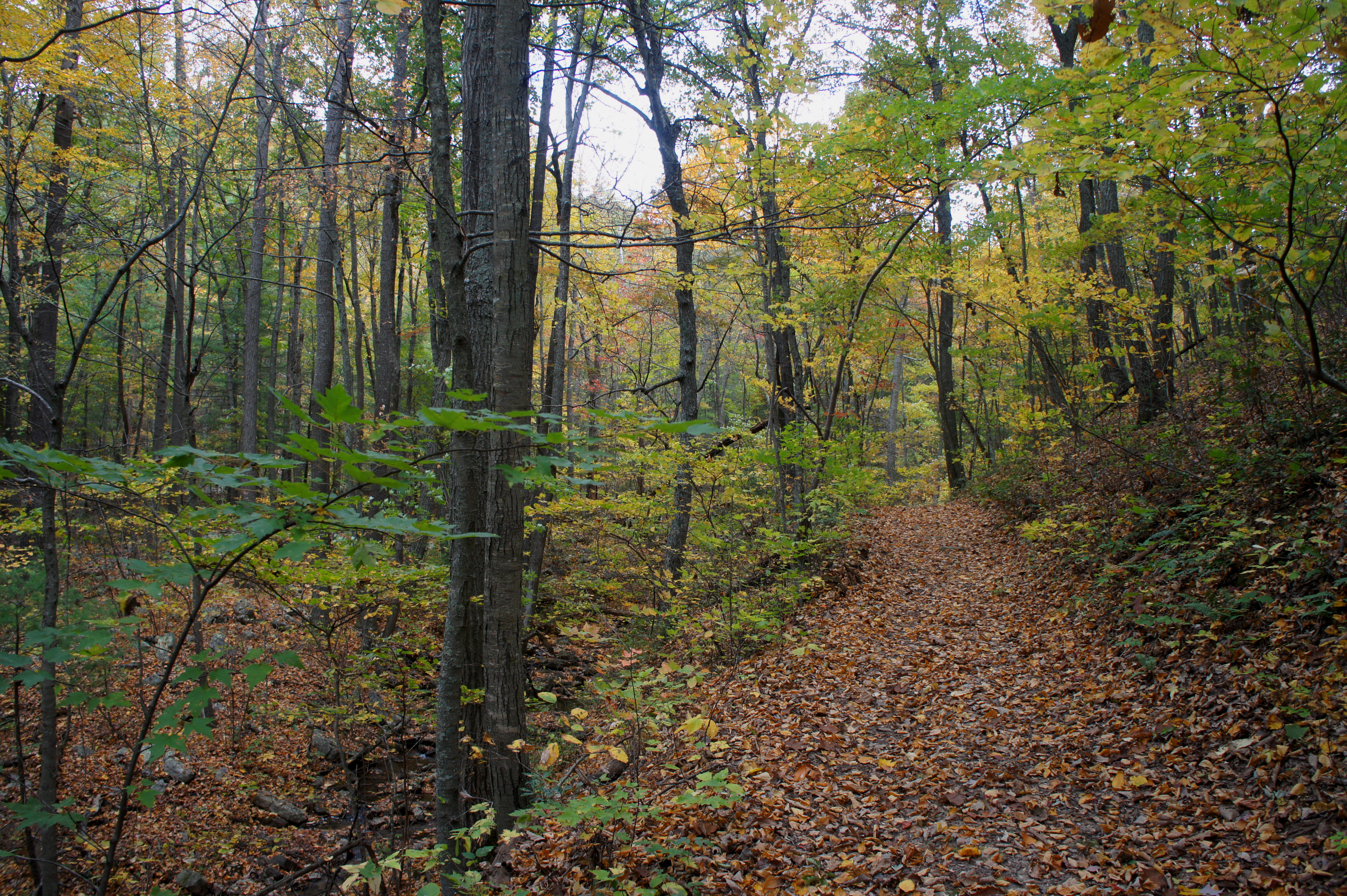
After roughly 1/3 mile, the double-track veers off into a field to the right, while the Veach Gap Trail continues left. The trail beyond—marked with yellow blazes—becomes rockier and narrower, while Mill Run appears for the first time on the left. The route parallels the creek amid cedars, oaks, and rocky outcrops for 15-20 minutes before crossing the stream about a mile from the start.
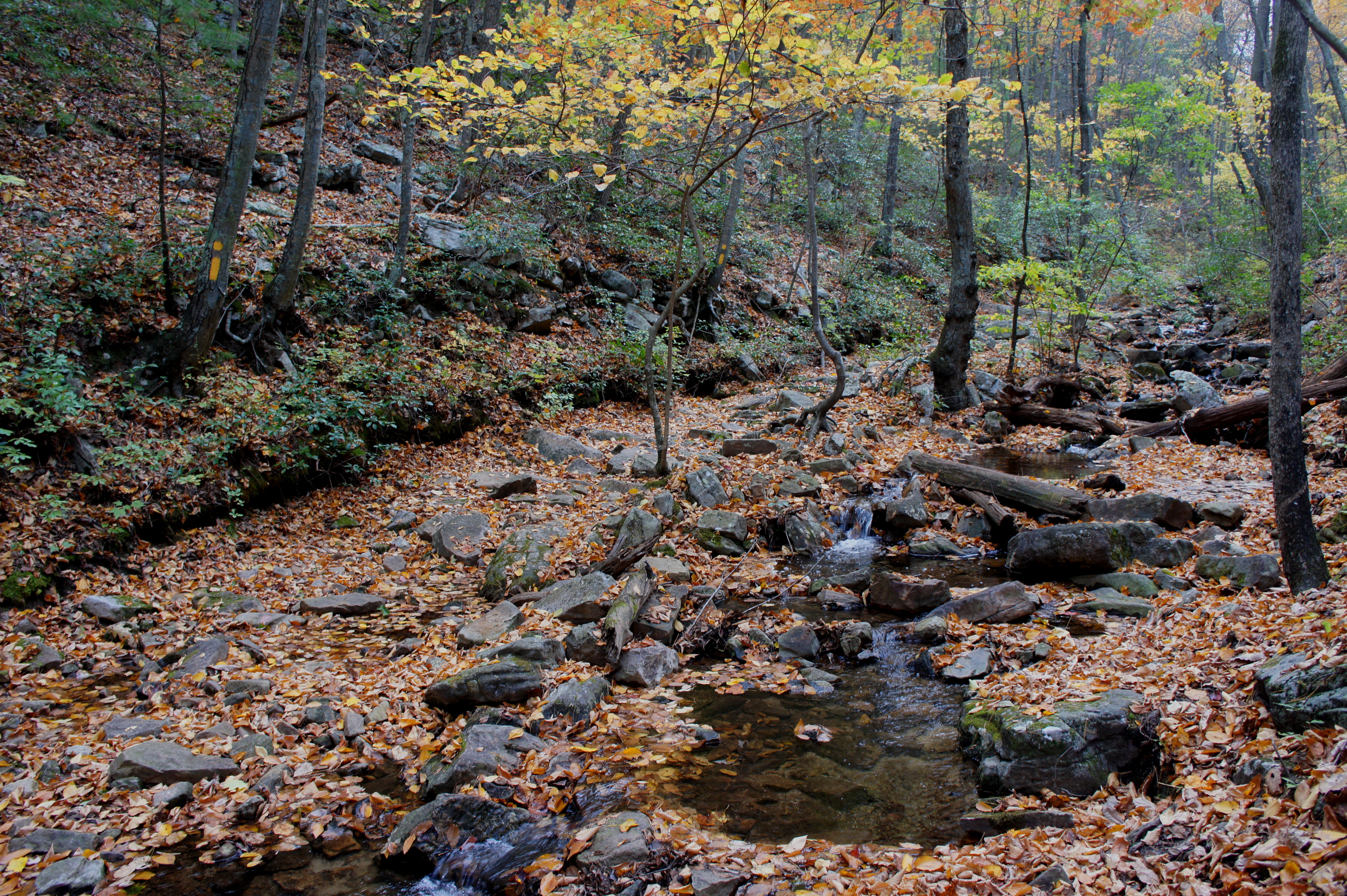
Except after a recent rainstorm, traversing the shallow brook is relatively straightforward, but finding the trail on the other side can be a challenge. In short, the best approach after crossing is to follow a minor depression paralleling the creek for 50-100 yards before the next yellow blaze appears.
From here it is a short walk to the first and only true trail junction. The Tuscarora Trail veers off to the right; instead head left, following signs for “Sherman Gap Tr.” (Note: there is also a faint trail heading straight at the junction—I’m not certain where this goes.) The trail beyond loses the yellow blazes in favor of orange and blue ones.
The pace of the ascent picks up after the junction, and Mill Run is soon left behind as the trail gains elevation. The next 1 ½ mile is relatively uneventful, but eventually the route briefly cuts sharply to the south and traverses a rock field that occasional offers window views back toward Fort Valley and Little Crease Mountain.
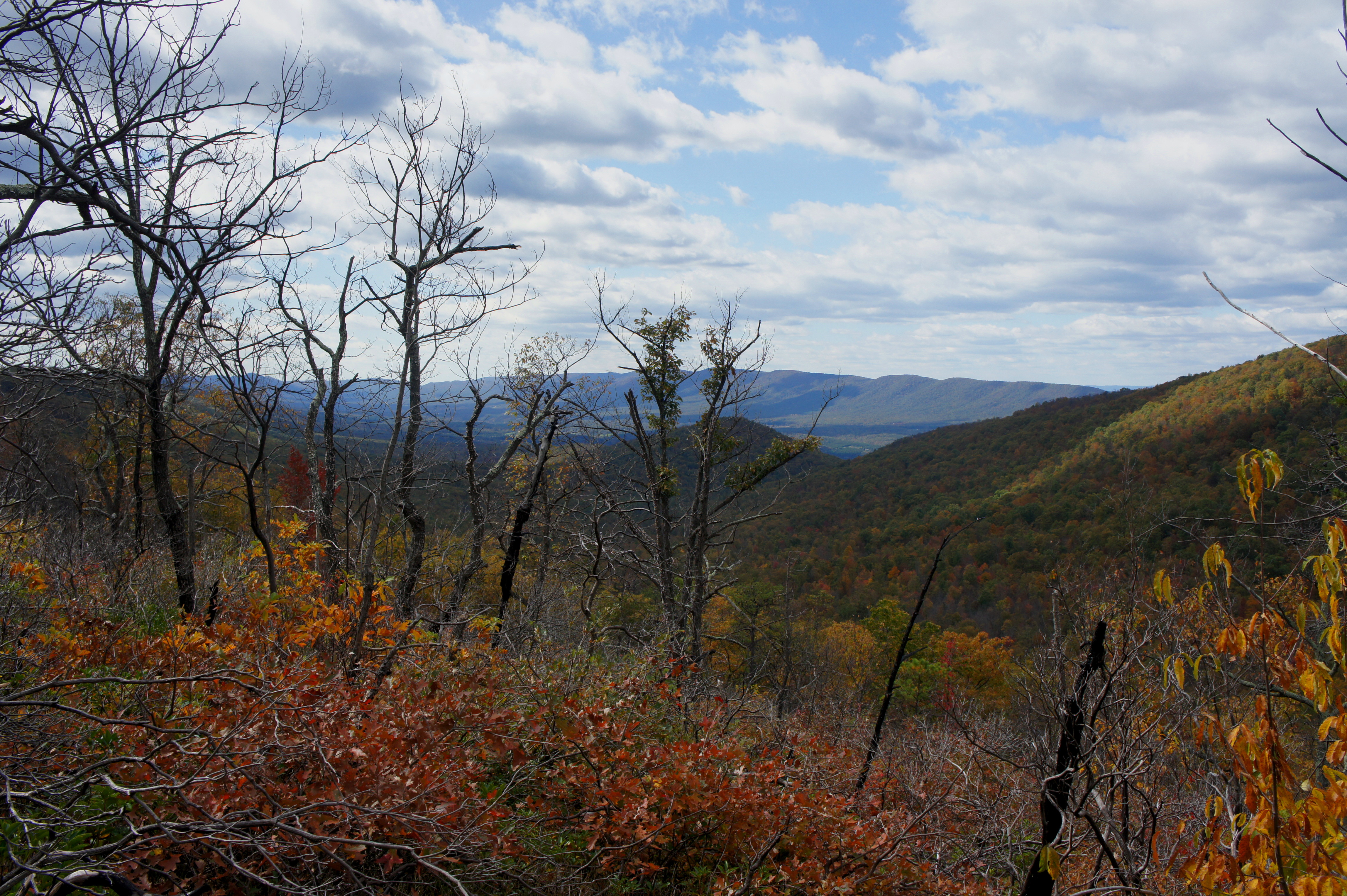
A little over three miles from the trailhead, hikers finally crest the Massanutten ridgeline. A short walk northward leads to the first of three overlooks, this one relatively obscured by foliage.
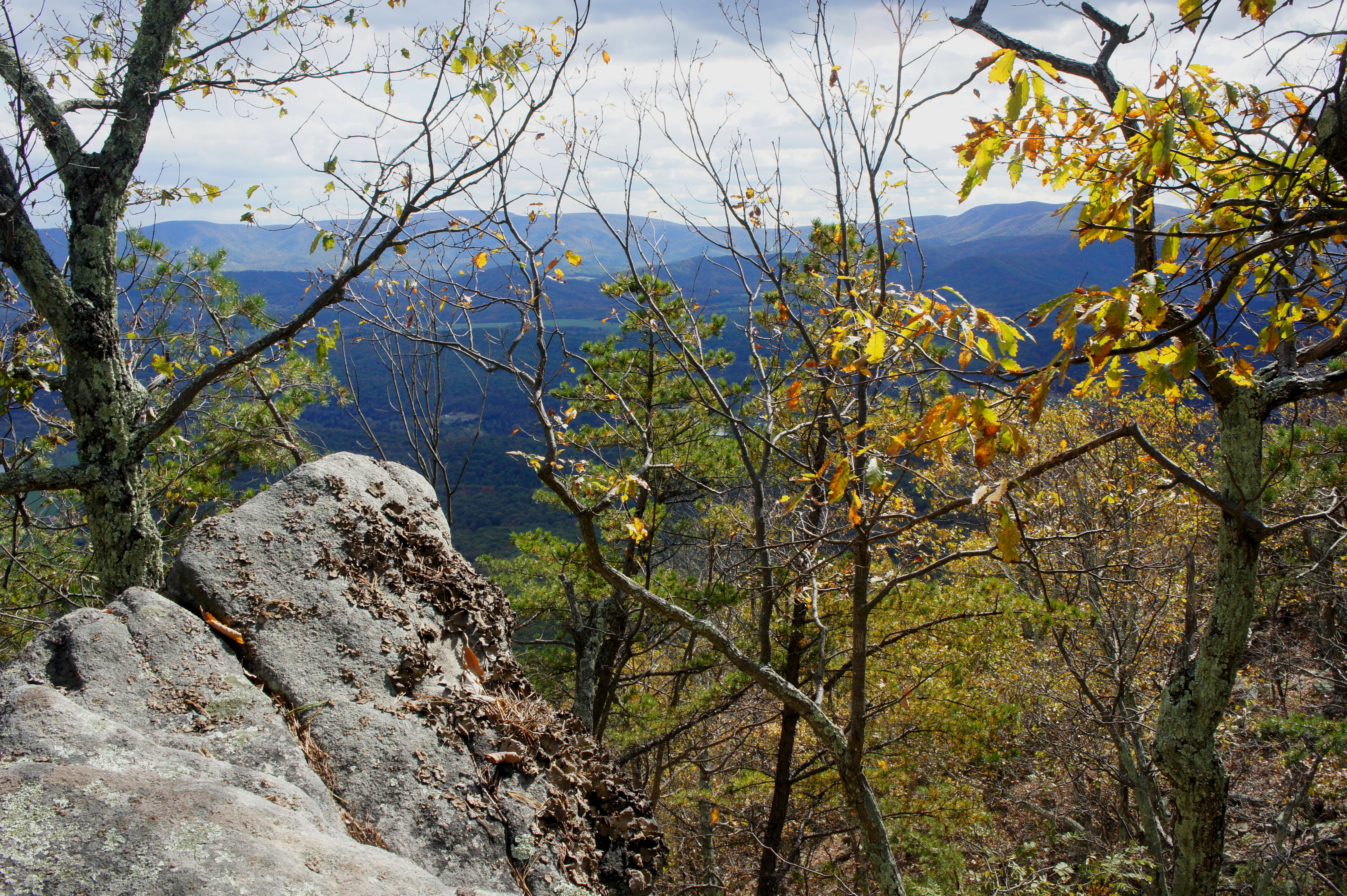
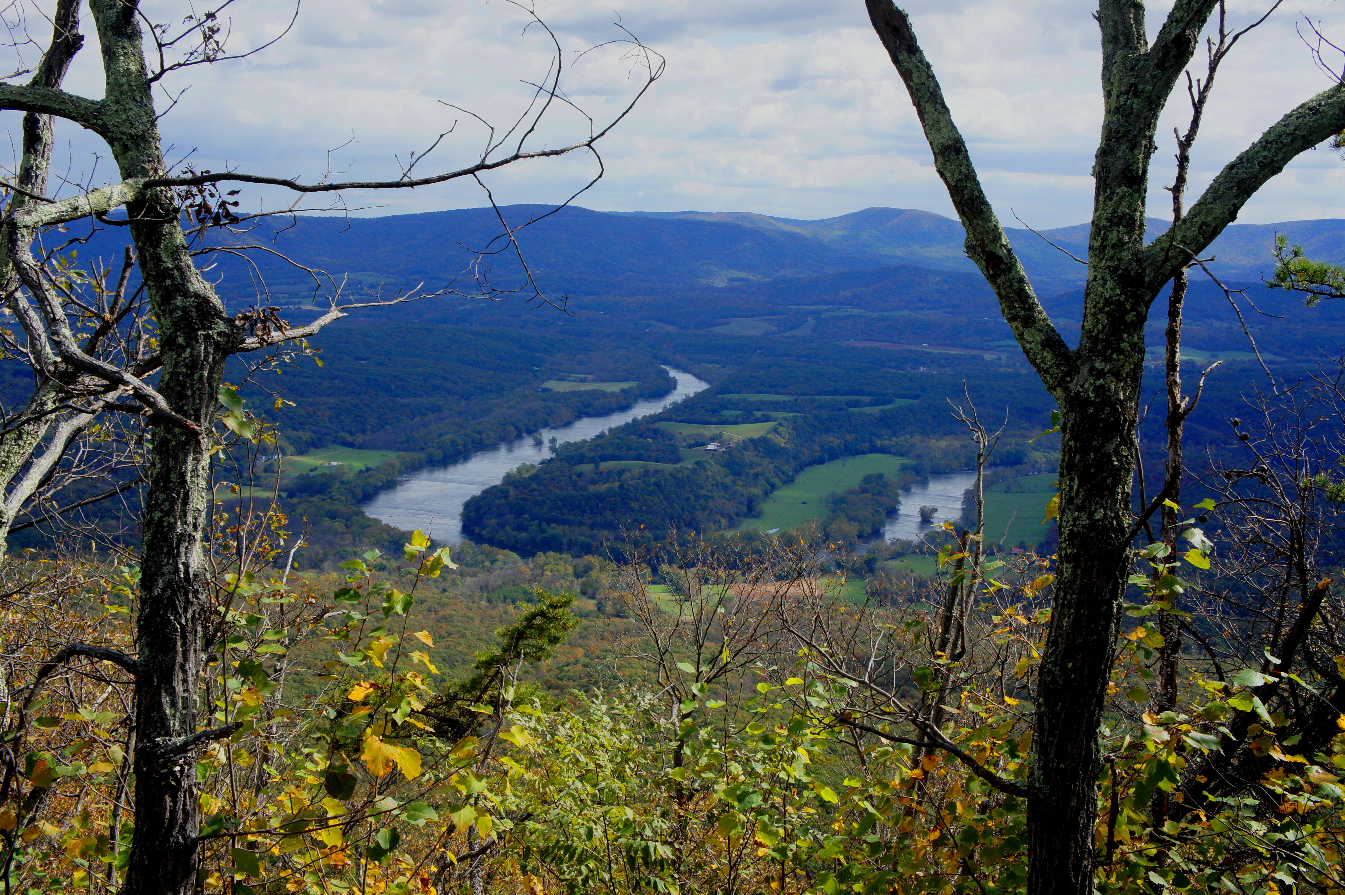
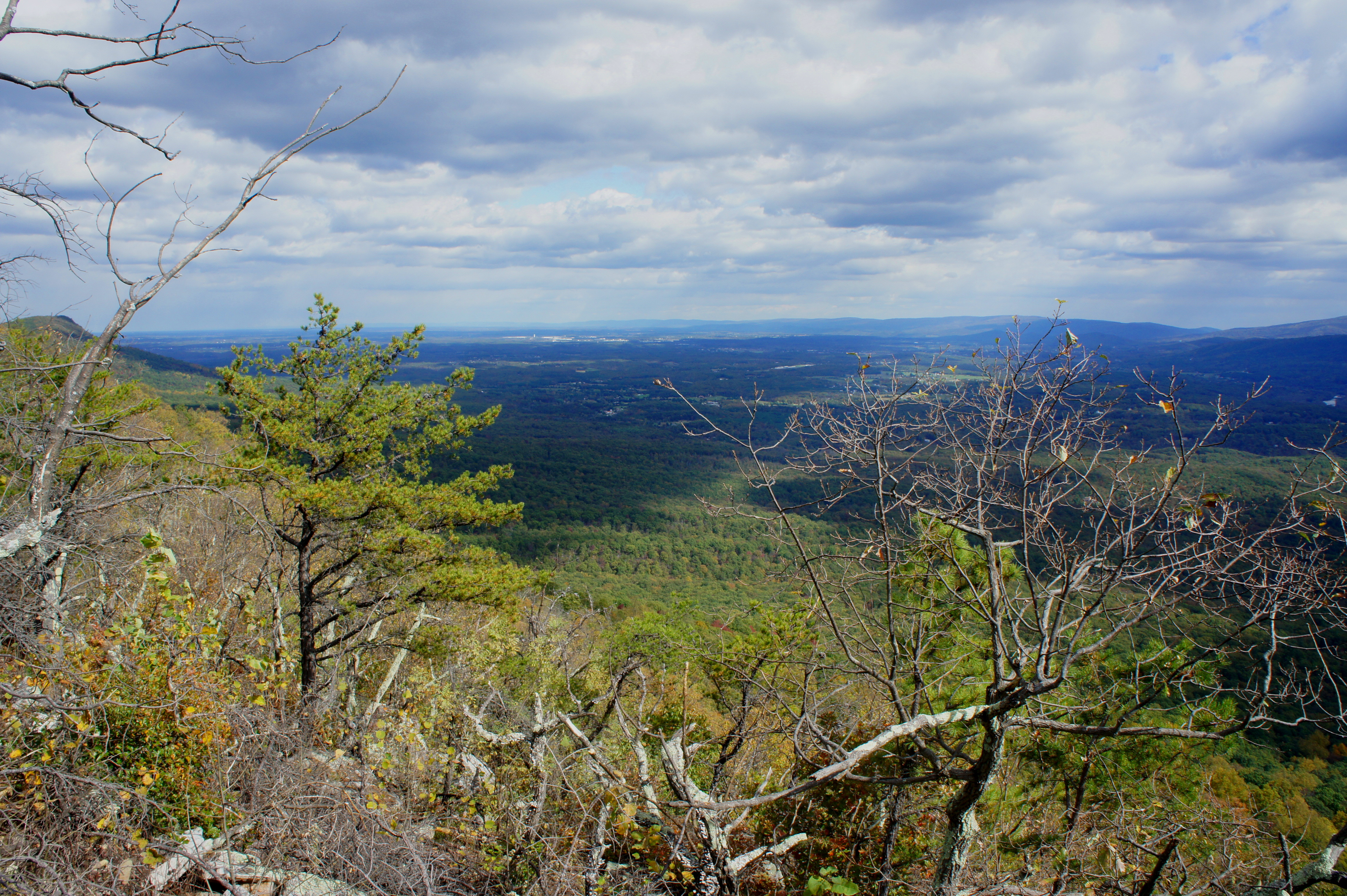
The second is slightly better, but the third and final vista is the winner: this is the so-called “The Point” Overlook, named for the hairpin bend in the Shenandoah River visible more than 1,000 feet below. A large outcropping of rocks offers more than enough room for a small group to spread out and take in the scenery.
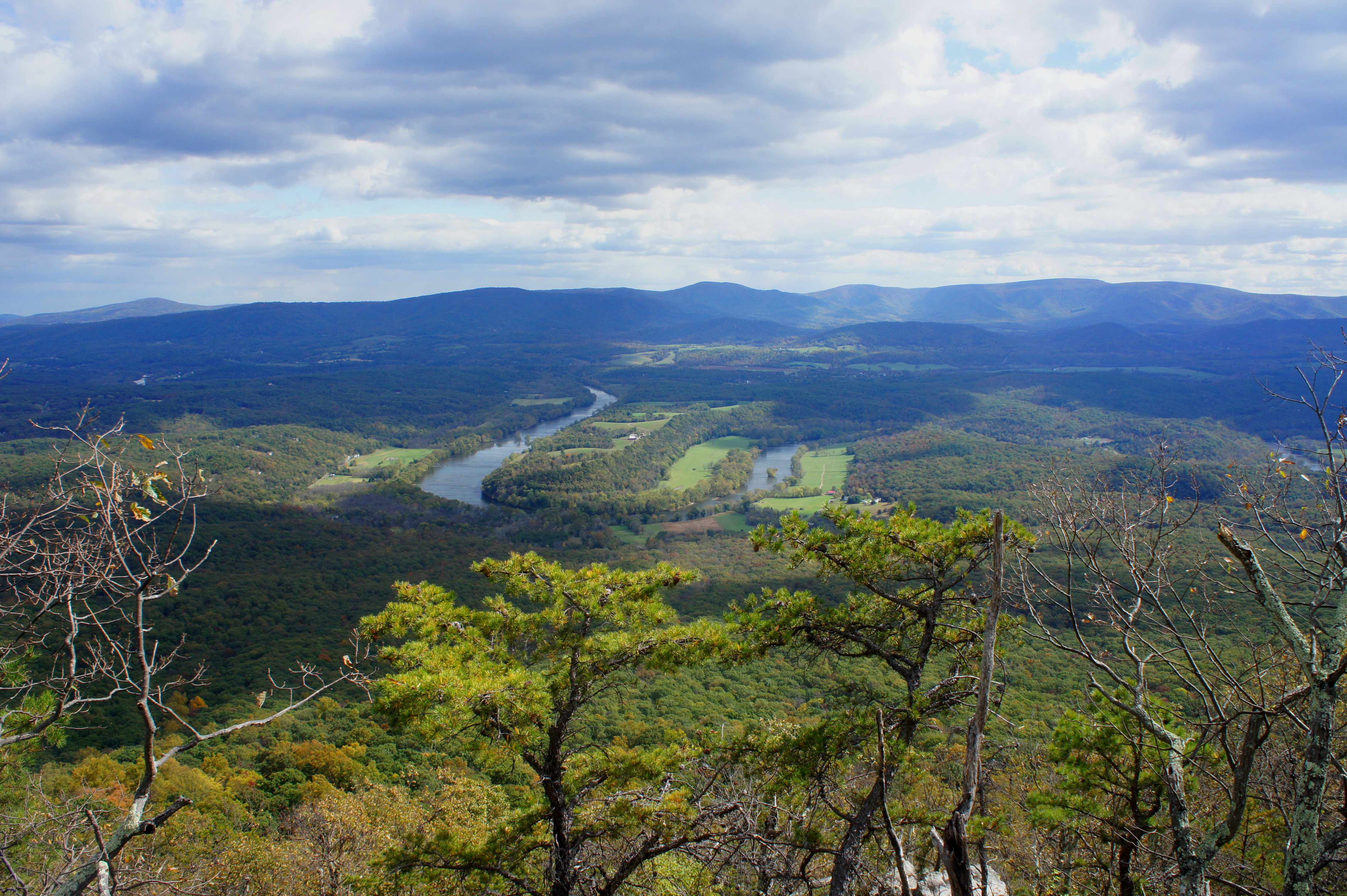
Peeking to the north, one can see over to Shawl Gap and Buzzard Rock, with the towns of Bethel, Buckton, and Front Royal beyond. Across the valley lies Blue Ridge and Shenandoah National Park, highlighted by the heights of Compton Peak (2,909’), Mount Marshall (3,368’), and Hogback Mountain (3,474’). Just to the south of The Point is the hilly landscape of Shenandoah River State Park.
Evidently there is also a fine campsite in the area, but most day hikers will turn around at The Point Overlook, returning the way they came. Allot 3-5 hours for the out-and-back, depending on pace and ability.
