
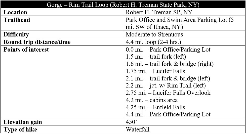
Uplift, receding glaciers, and subsequent erosion have blessed central New York with terrific stone gorges, many containing rushing waters and dramatic waterfalls that drain into the 11 Finger Lakes. Enfield Glen, one such canyon, is the centerpiece of Ithaca’s Robert H. Treman State Park—an 1,100-acre haven for falls-seekers that also features towering walls, dark chasms, and beautiful pools. Visitors can enjoy swimming at the base of 30-foot Enfield Falls (a.k.a. Lower Falls or Treman Falls), but the best hiking is in the upper canyon at and above Lucifer Falls, a 115-foot, high-volume stunner. While shorter options exist, a full, 4.4-mile loop combining the Gorge and Rim Trails offers the most fulfilling hiking experience in the park.

The hike
It is possible to start this loop hike from either end of Enfield Glen in Robert H. Treman State Park: the upper or lower park entrances. The lower park is easier to access and closer to Ithaca, making this the most sensible starting point for the hike—and offering some build-up in anticipation for the hike’s highlights: Lucifer Falls and the upper canyon. After driving into the park via the Lower Park Entrance, follow Park Road for about 2/3 mile to the Park Office and main parking area.
The large parking lot is full mainly of casual visitors to Enfield Falls (donning swimsuits in summer) but the two main hiking routes—the Gorge Trail and the Rim Trail—both begin nearby. Tackling the Gorge Trail first makes for a slightly easier journey, with the uphill spaced out more intermittently, and allows for the most dramatic entrée into the upper canyon.
Gorge Trail & Lucifer Falls (2.2 miles)
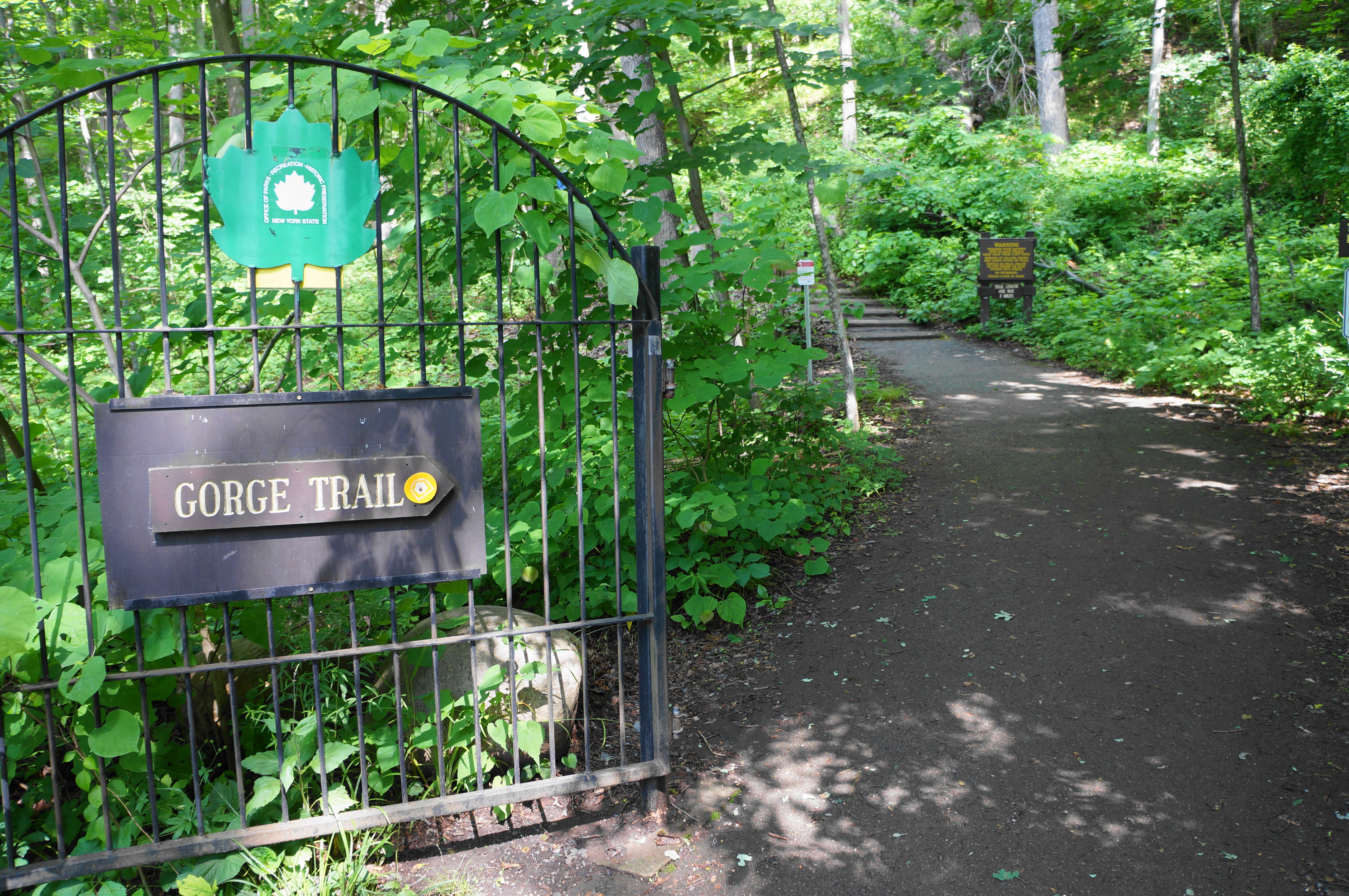
Look for the start of the Gorge Trail leaving the parking lot on the north side, just to the west of the Park Office and restrooms. Follow the signs and pass through the open, iron gate. The tread quickly turns to dirt as the Gorge Trail begins a steep ascent, assisted by switchbacks and four staircases—a quick wake-up call for hikers expecting an easy stroll in the park. After gaining the woody ridge, the track briefly levels at around 2/10 mile, with a fence paralleling the trail on the left. Even though Enfield Falls (Lower Falls) is roughly below, the dense foliage (at least in summer) obscures views of the waterfall and swimming hole.
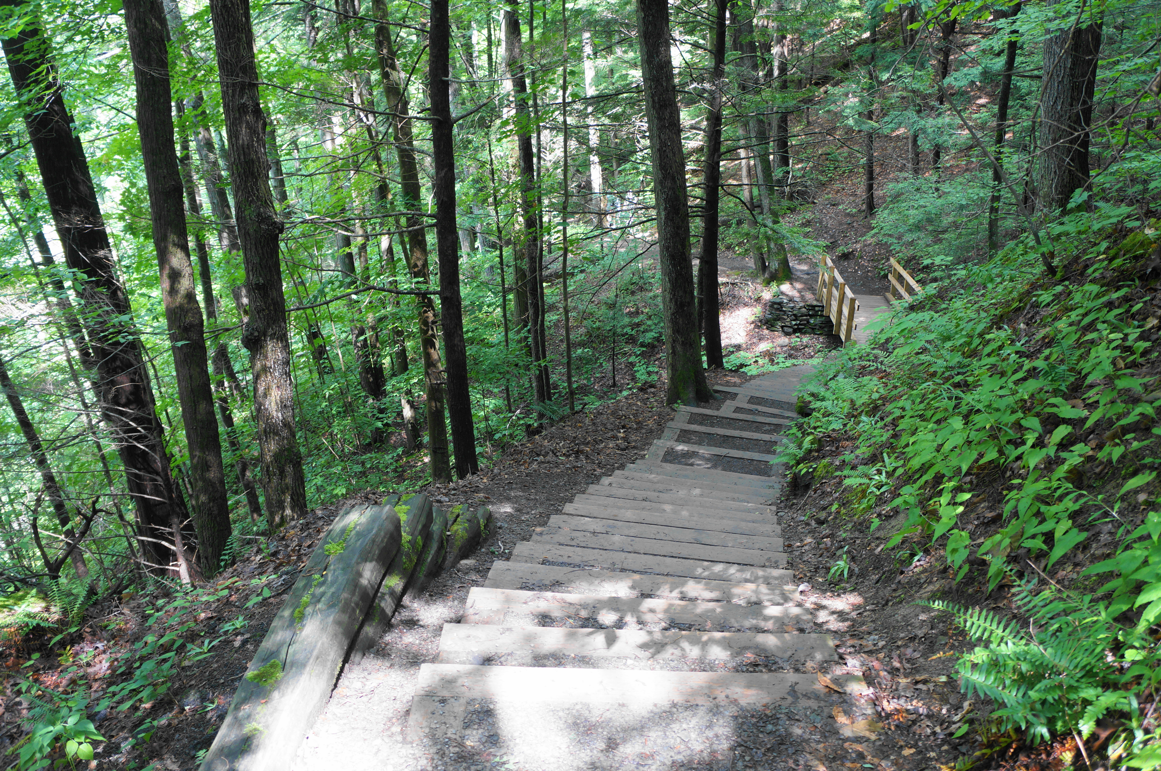
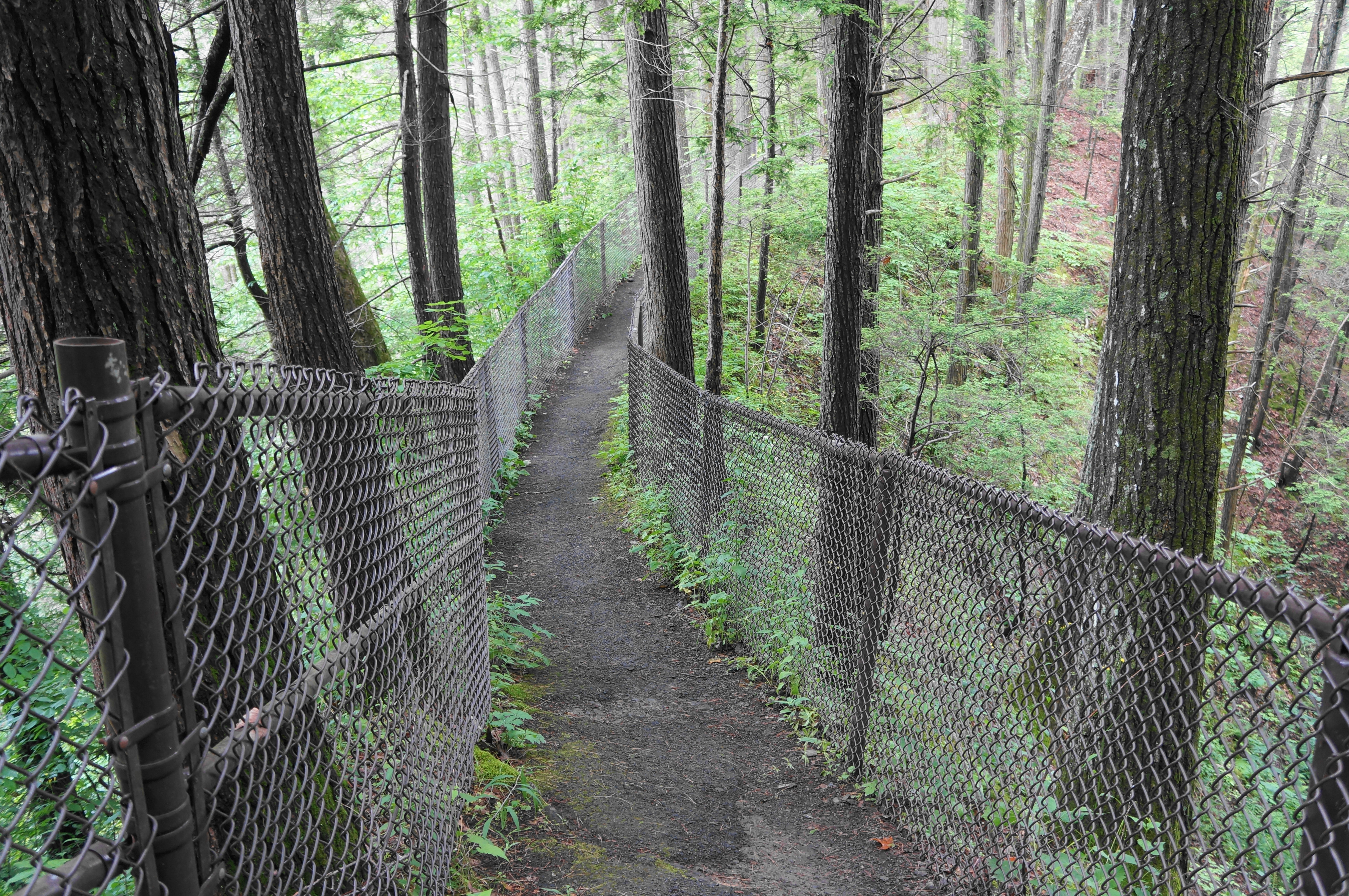
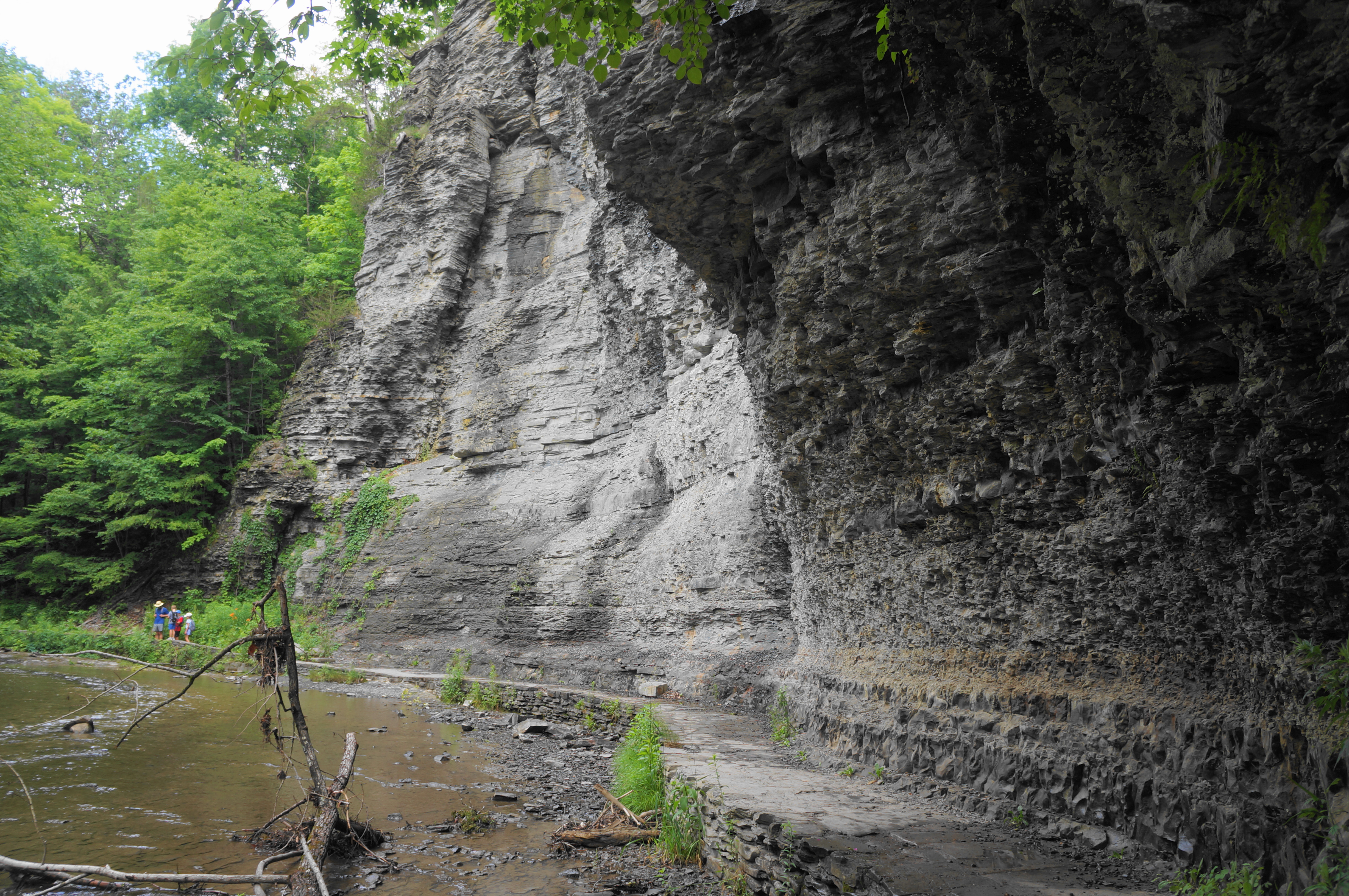
However, the Gorge Trail continues westward, deeper into Enfield Glen. After another short uphill, the trail crests a rim and briefly descends and settles into level section, traversing the mixed forest of deciduous and coniferous varieties. At 4/10 mile, climb again as the path becomes fenced off from the steep slopes again; the remains of asphalt here hearken to an earlier, less “wild” version of the trail that has long been a tourist destination since native Robert Treman donated the land for public use in 1920. Following another staircase down, the trail returns to dirt; within minutes, the Gorge Trail comes within striking distance of Enfield Creek for the first time—the stream is visible through the trees, roughly 15-20 feet below trail level.
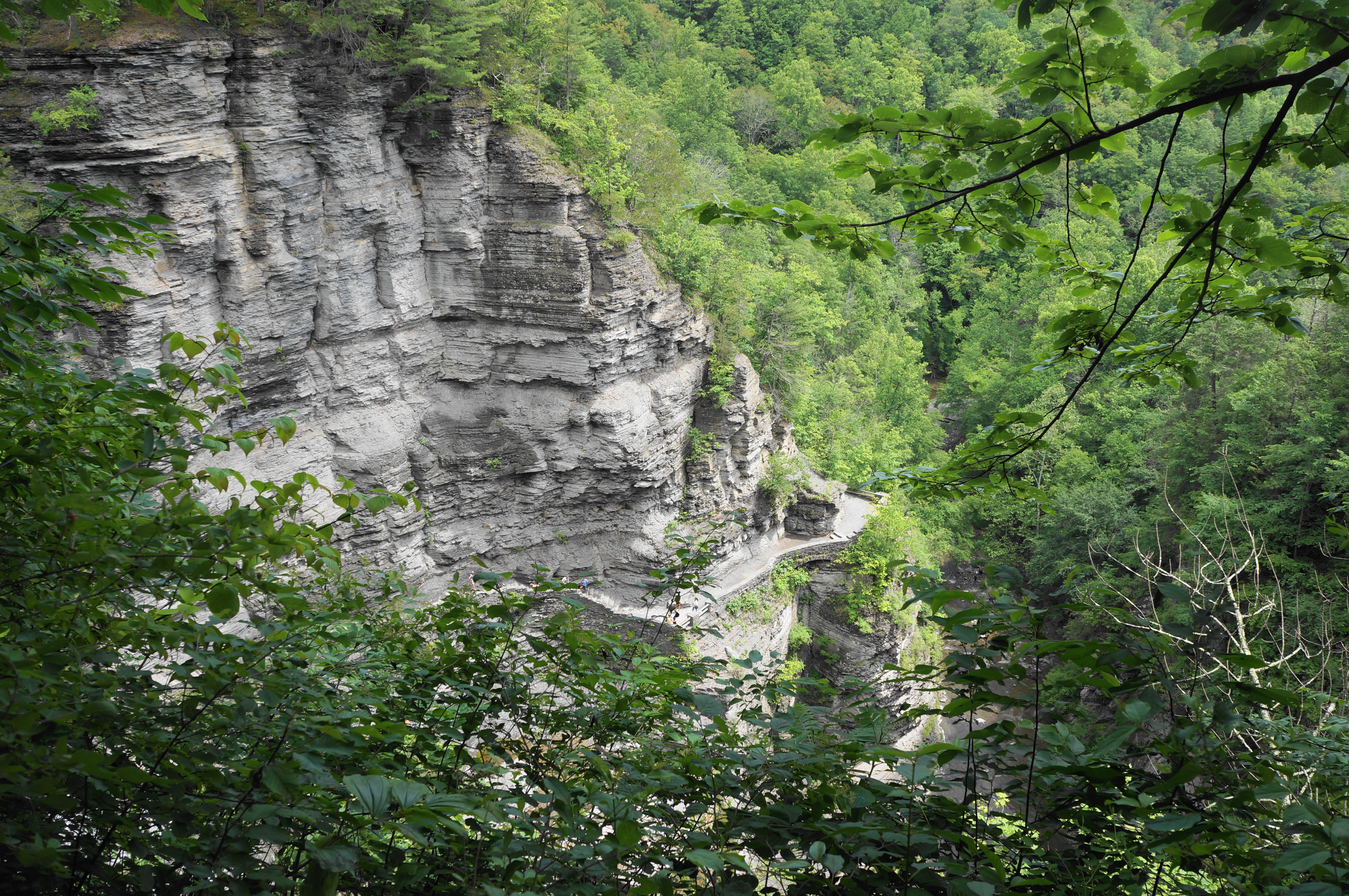
At about 7/10 mile, hikers come across another uphill stairway—this one numbering exactly 100 steps. It is followed quickly by a second staircase of 71. Now well above the glen, the trail dips up and down—again partly asphalted—on a roughly westward trajectory. The crumbly path, flanked on either side by a chain-link fence, traverses a thin ridge at 0.85 mile. The trail then drops to what appears to be an overlook—but views of the now-quick-flowing creek below are again obstructed by the summer foliage.

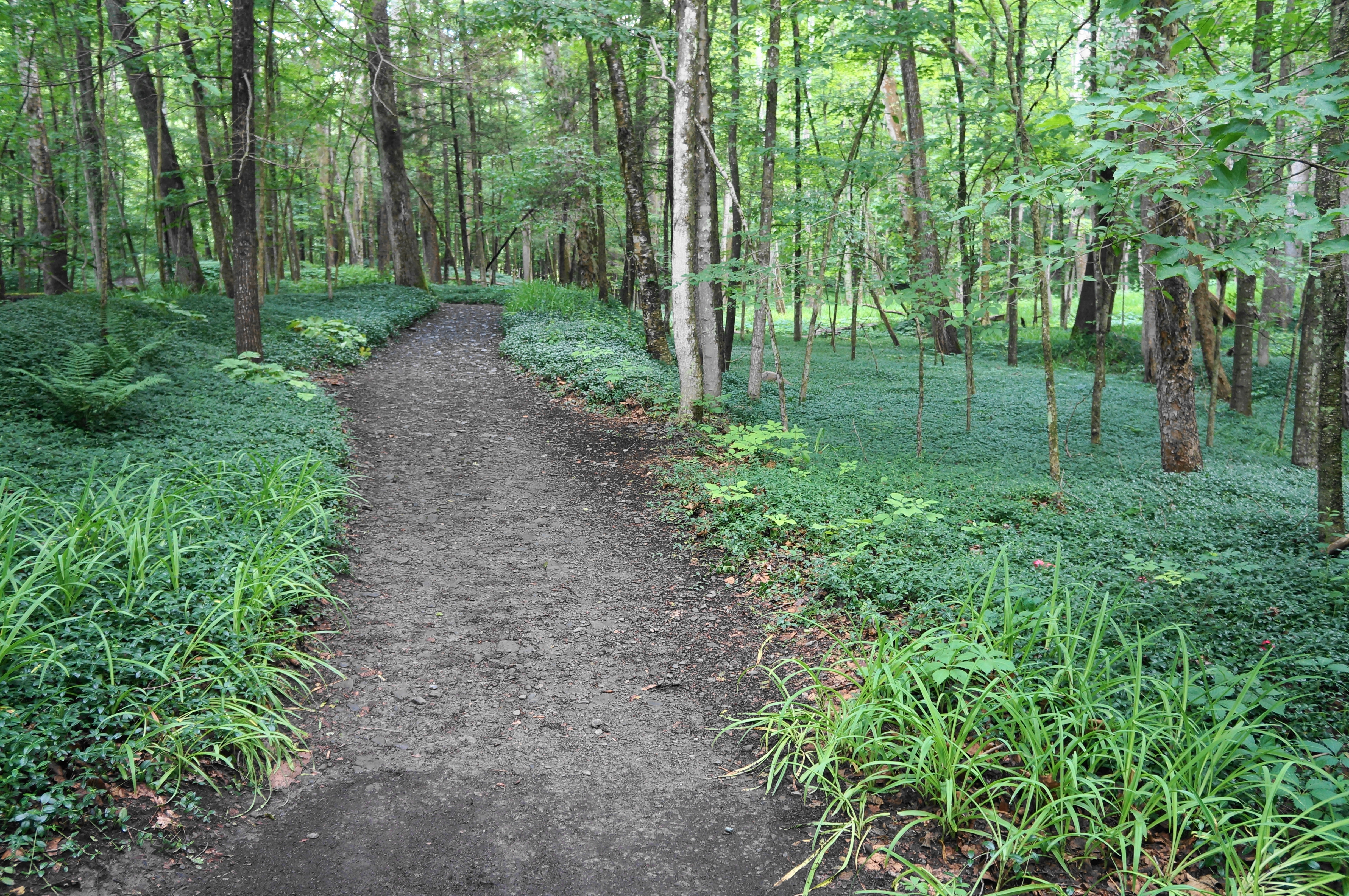
Around the corner and down a well-crafted stone staircase, the views are better—but Enfield Creek is still cruising at a mild ripple here, a far cry from the roaring cascades that hikers will see soon enough. Before then, however, is a floodplain where the ground is carpeted with greenery. This beautiful section is peaceful and lush, and the pathway is wide and largely level as it passes the halfway point for the 2.2-mile Gorge Trail. Stay left as a service road enters from the right.
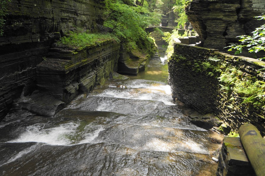
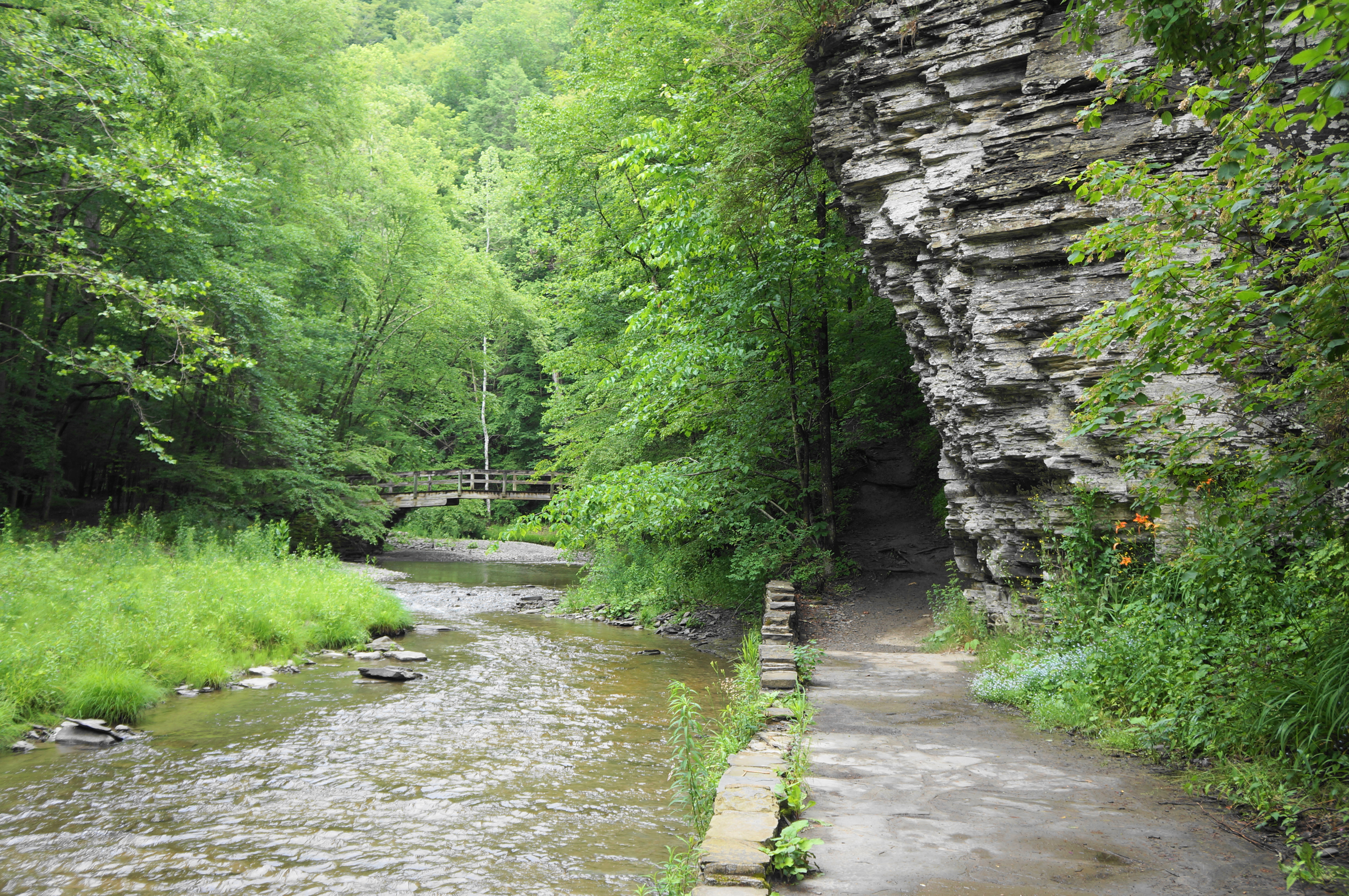
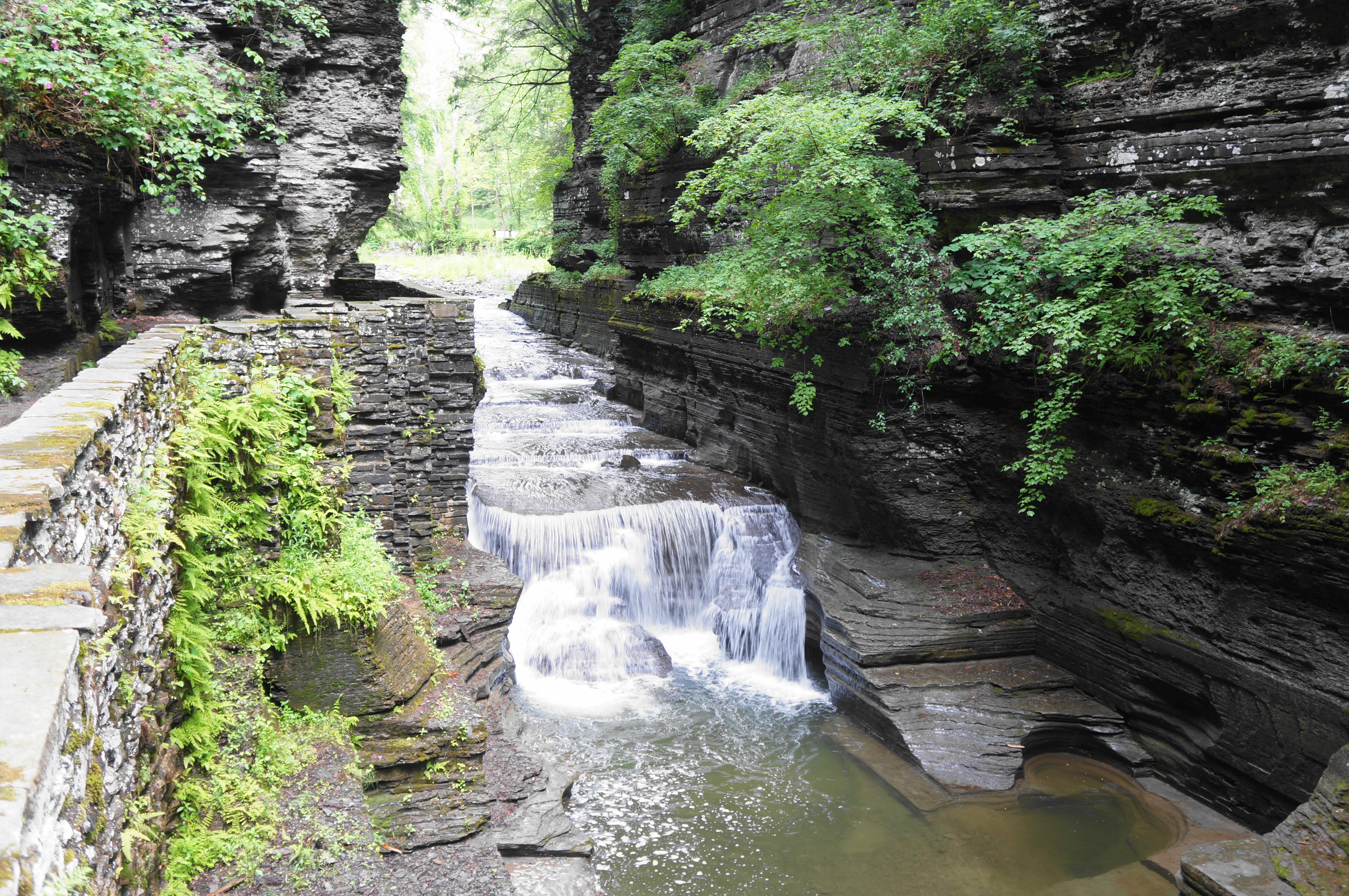
Then, at last, at around 1.2 miles, the trail comes parallel to the creek again, and the scenery steps it up a notch: the gorge narrows and the walls grow taller, and the first of several notable waterfalls is visible ahead. A short walk leads to a close-up of the falls, measuring about 10-15 feet in height. This unnamed cascade is a preview of what’s to come and marks entry into what could be considered the upper canyon.


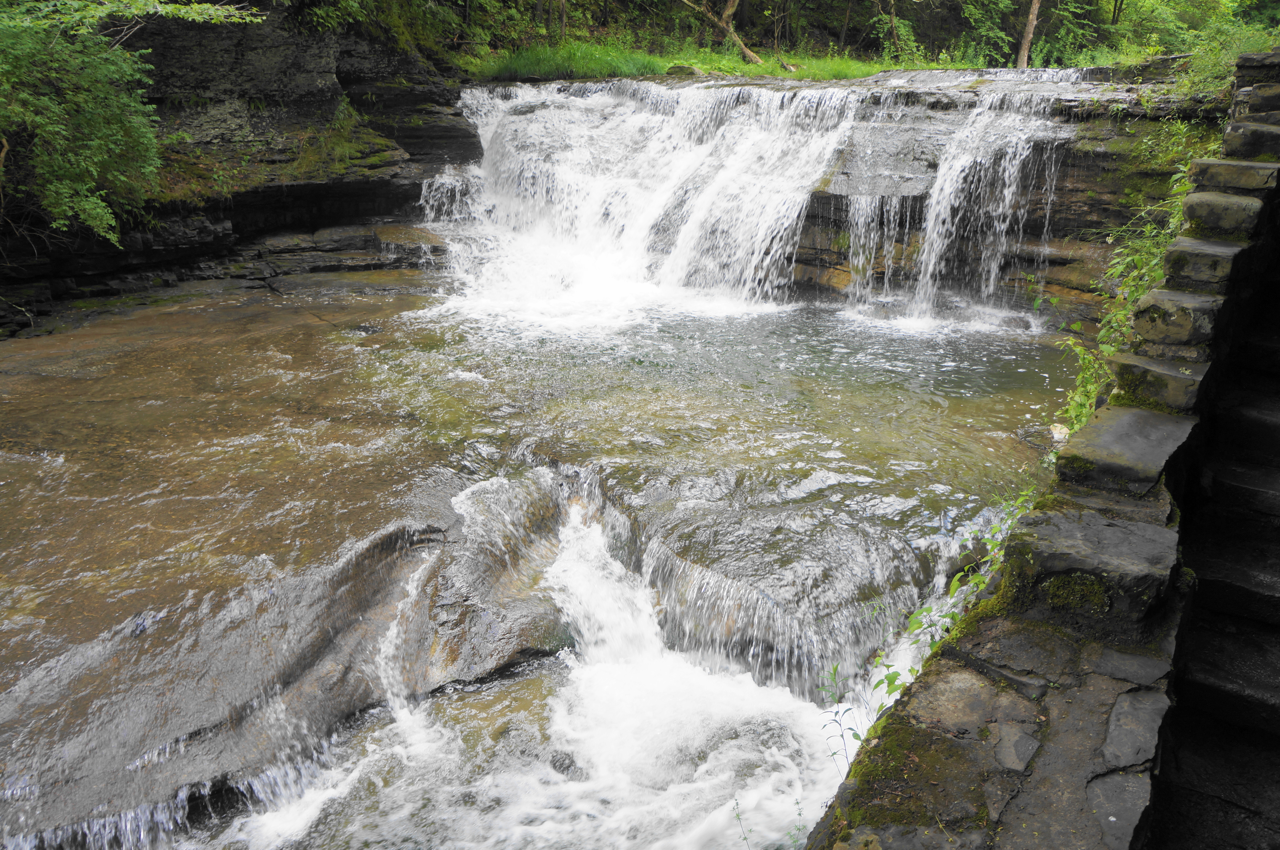
Thereafter, the narrower and wetter path continues past additional cascades, including a short, 2- to 3-foot drop that leads into a mini-punchbowl. The next falls, viewed after passing over a tributary, is also small but set against a backdrop of a high, chalky wall, the most impressive yet seen on the hike. Here the trail arcs around a left-hand turn, under a brief overhang, and returns to the verdant woods.


At 1.5 miles, hikers reach the first official trail junction of the hike: here the less exciting Red Pine Trail offers an alternative route to the upper picnic and parking area. Stay left on the Gorge Trail, with the best scenery yet to come.


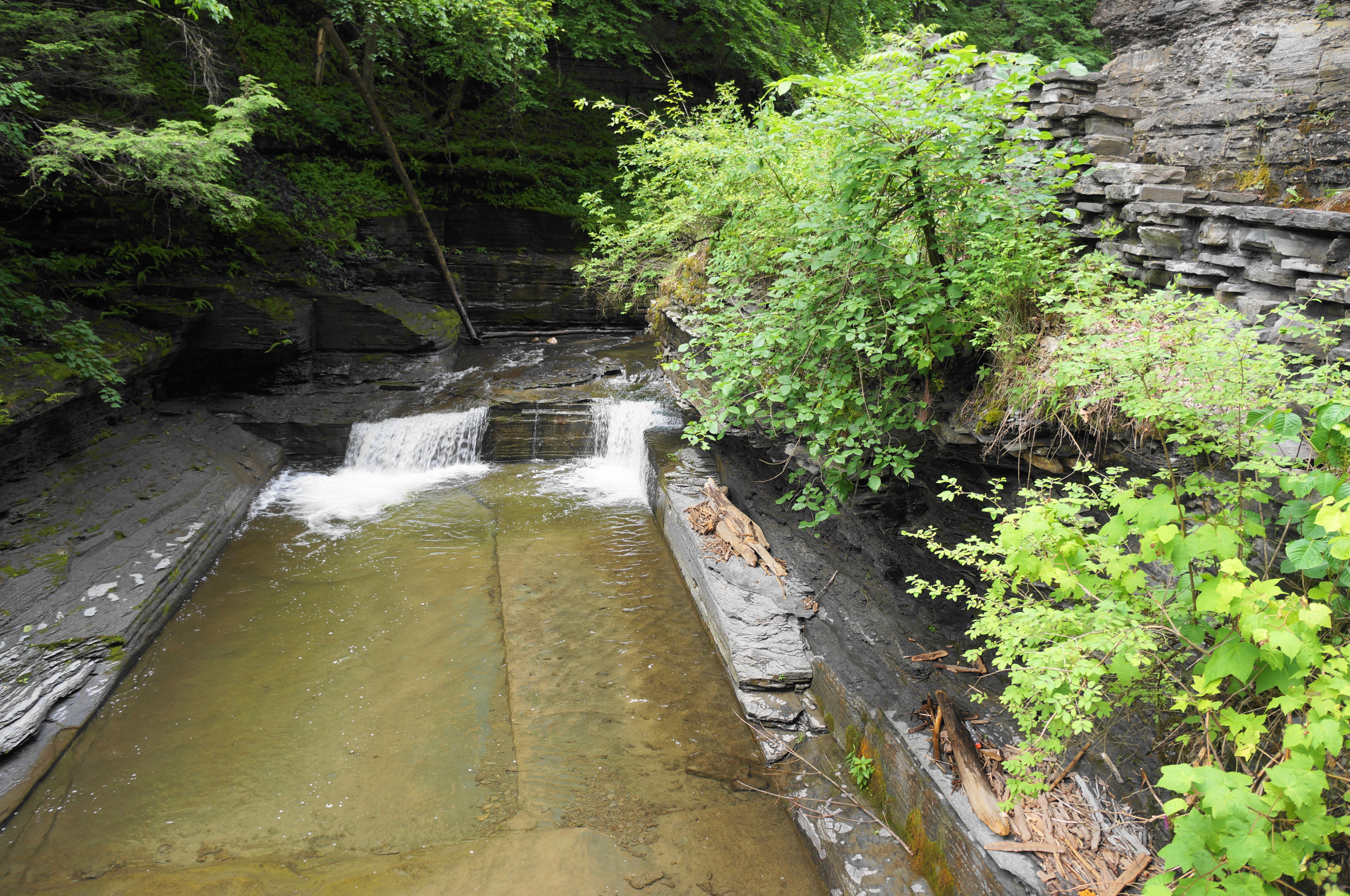
Soon after the junction, another, 10-foot falls can be viewed off to the left. The sight is followed by another, 5-foot plunge a minute later, with this one set below a trail bridge. Continue along Enfield Creek to a fork, where one could choose to cross the bridge, using it as a cutoff and connector to the Rim Trail—but doing so would be a tragedy, as some of central New York’s most stunning landscapes lie just ahead on the Gorge Trail continuation.
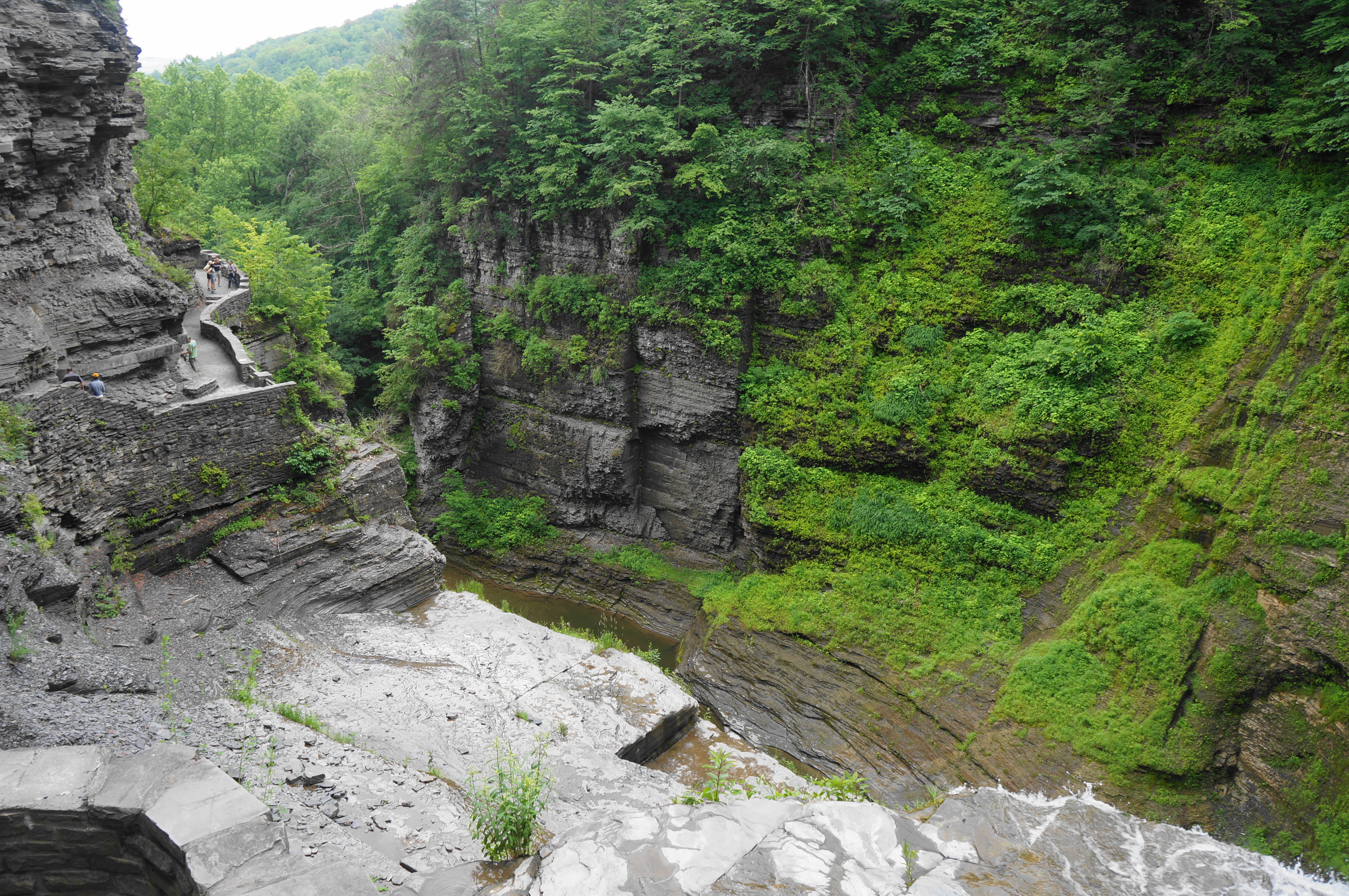
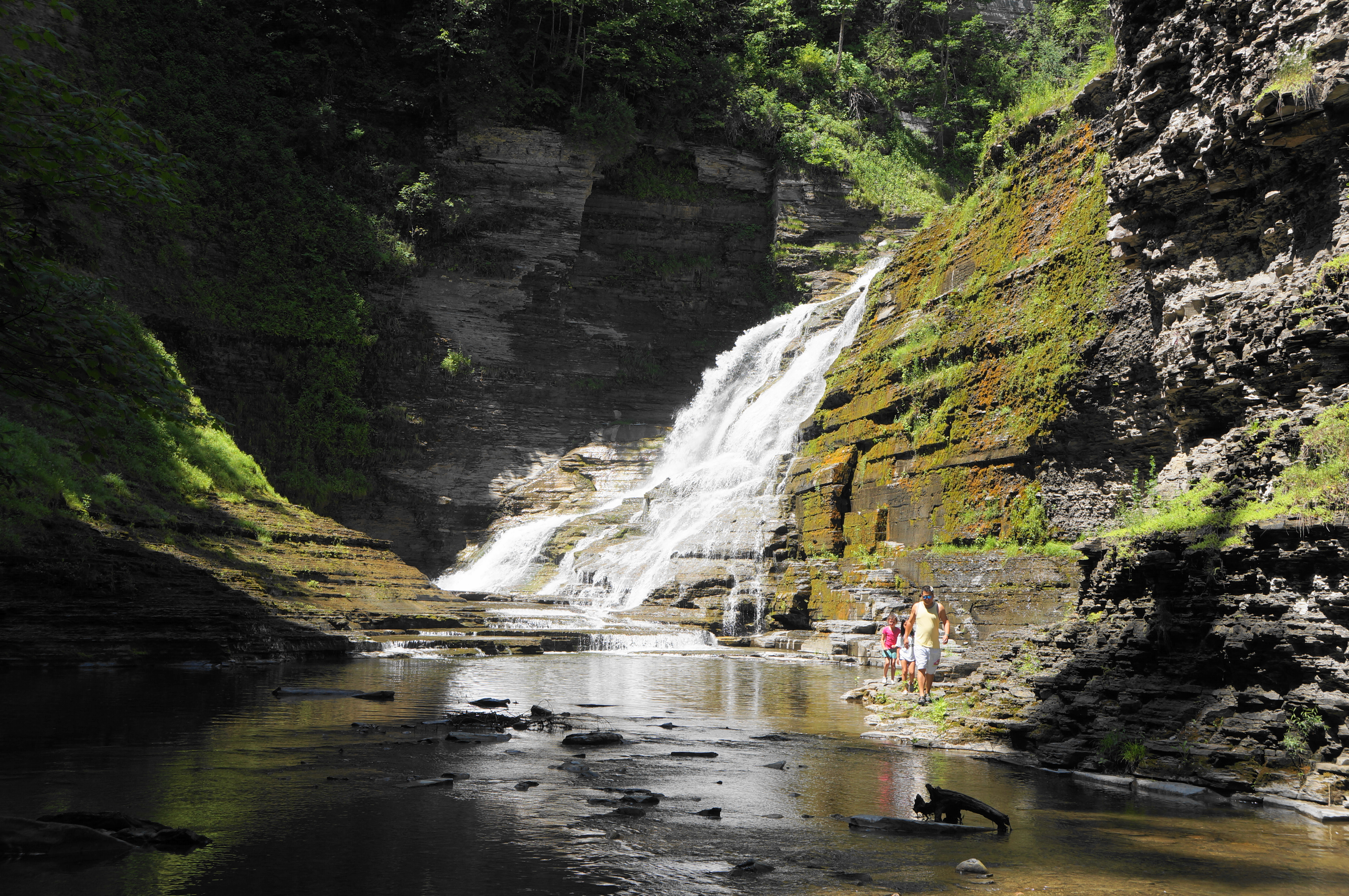
So, leaving the bridge behind, start up a steady incline, with the trail abutting the cliffs on the right. If the ascent feels a little hellish, it is only appropriate, as the imposing Lucifer Falls lies just ahead. The payoff is dramatic, as the intricately-designed trail snakes up the canyon to the right of the multi-tiered falls, descending 115 feet into the narrow gorge. The angle of the canyon makes for awkward attempts to take a fully-encompassing photo, but the thundering falls are an impressive sight, especially after snowpack or heavy rains.


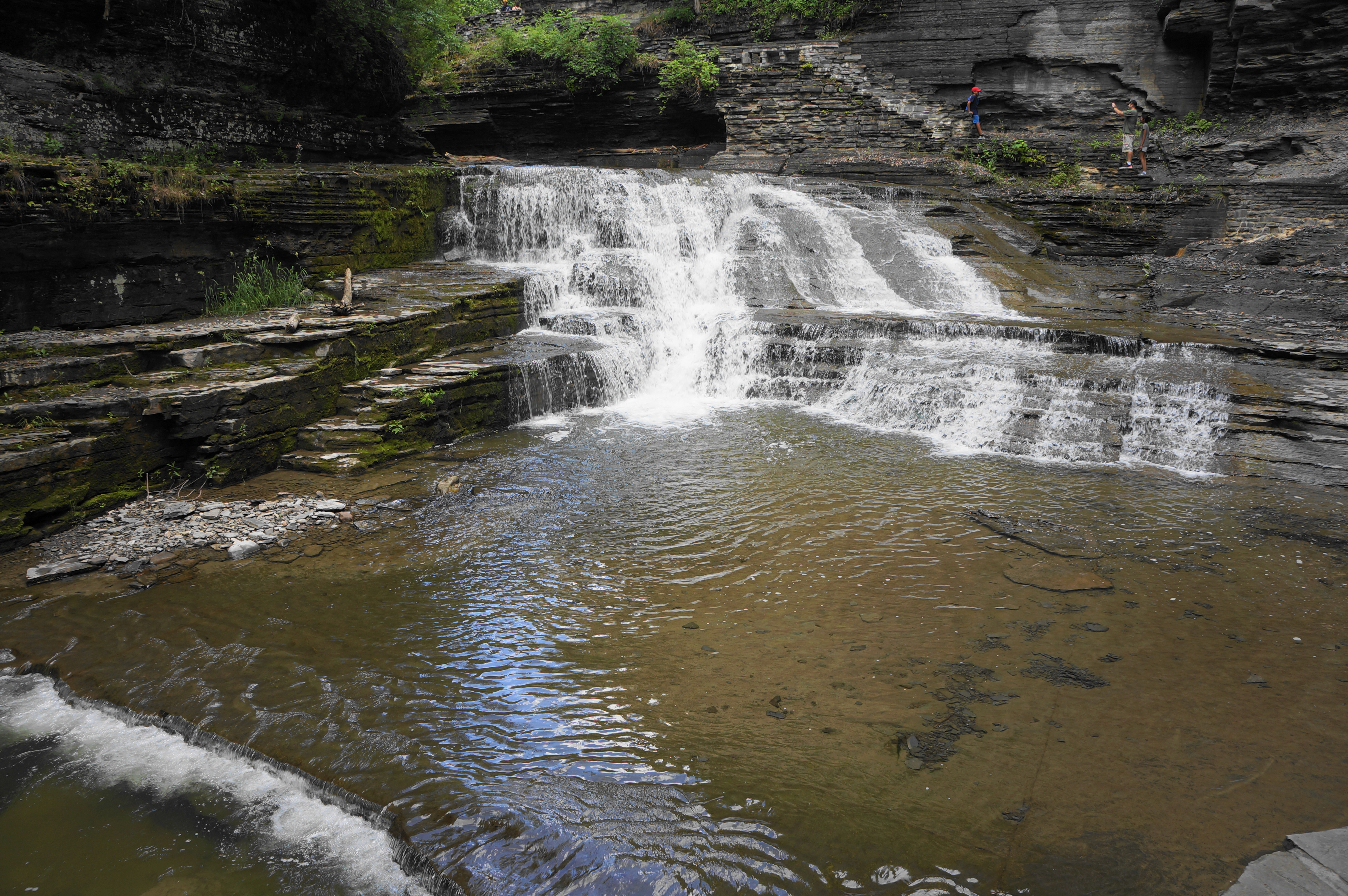
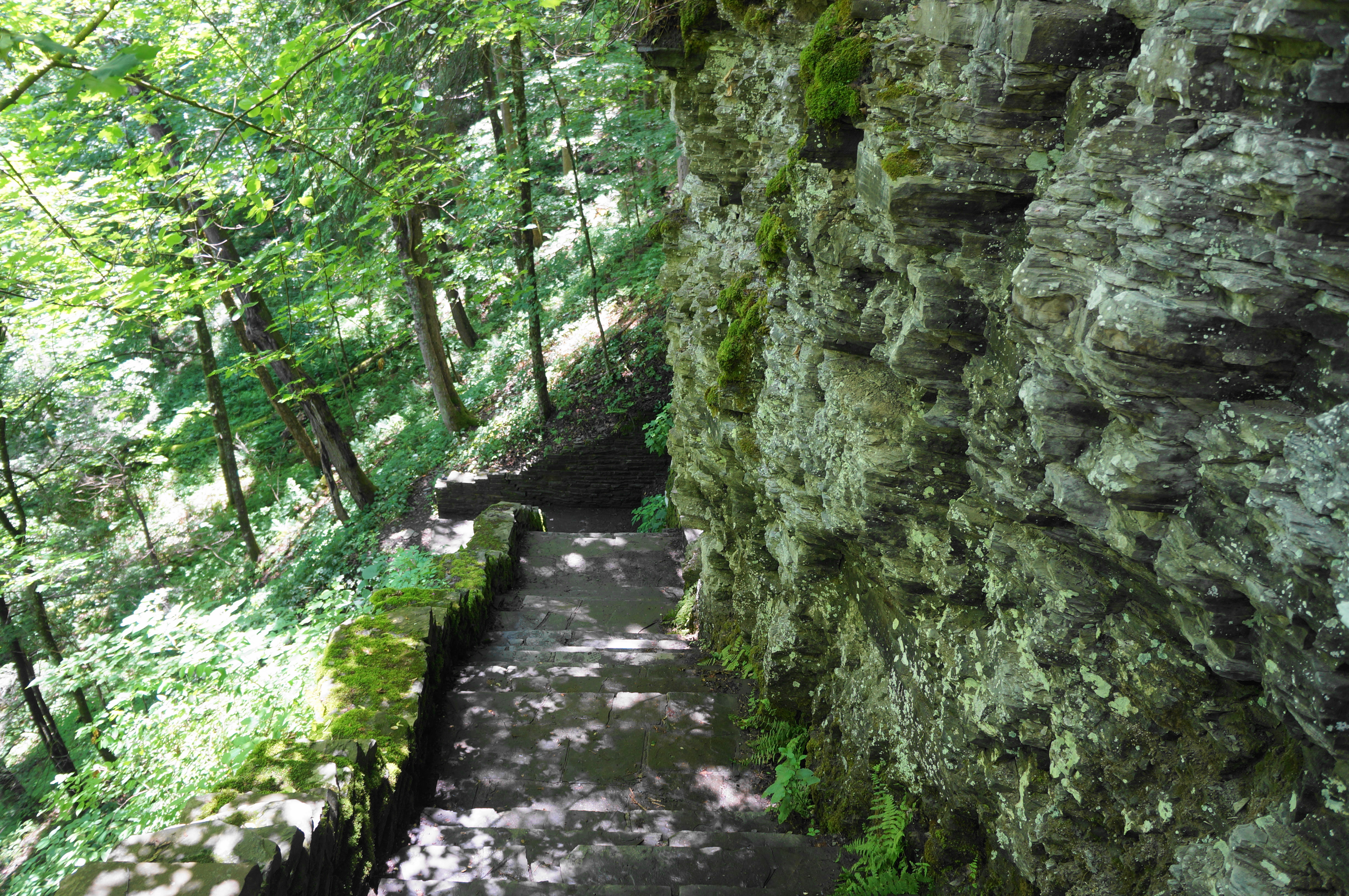
Continue up a set of staircases to reach the top of Lucifer Falls, after which Enfield Glen narrows even further. Stone steps and a bend in the trail lead to views of another impressive falls, this one about 15-20 feet in height. As one climbs to the top of this falls, look back at the surprisingly rectangular waterway—an effect that is also repeated in the pool around the next corner.


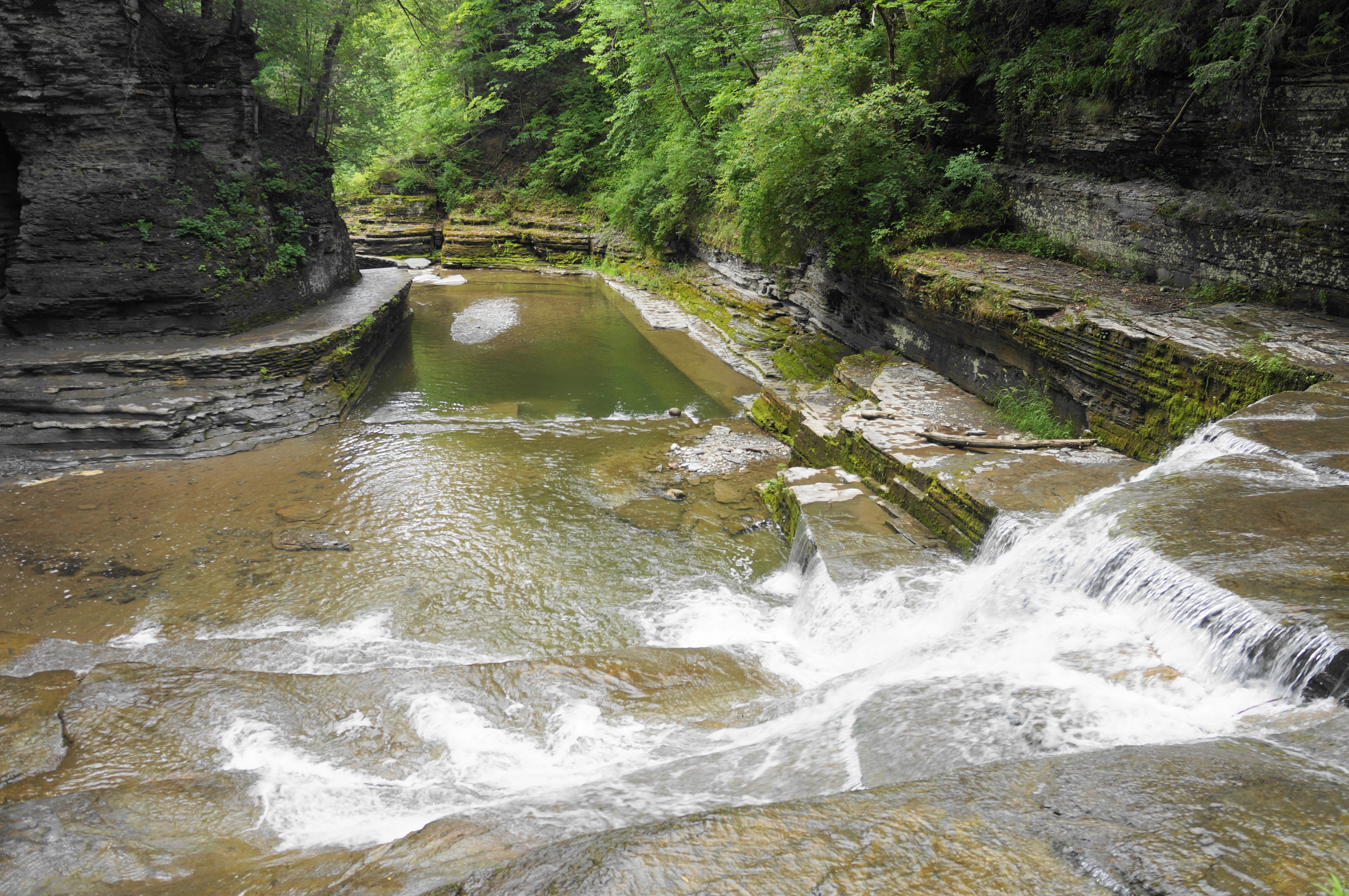
With an awe-inspiring sight now around every turn, switchback up to a stone arch bridge, which passes over a slender flume and offers access to the canyon’s thinnest section. The subsequent 100 yards is classic Ithaca—a beautiful, shady, and narrow coulee dotted with smooth-flowing cascades and enticing pools. Hikers can make their way slowly through the upper gorge, stopping to observe different angles and admire the intricately-carved natural wonder.

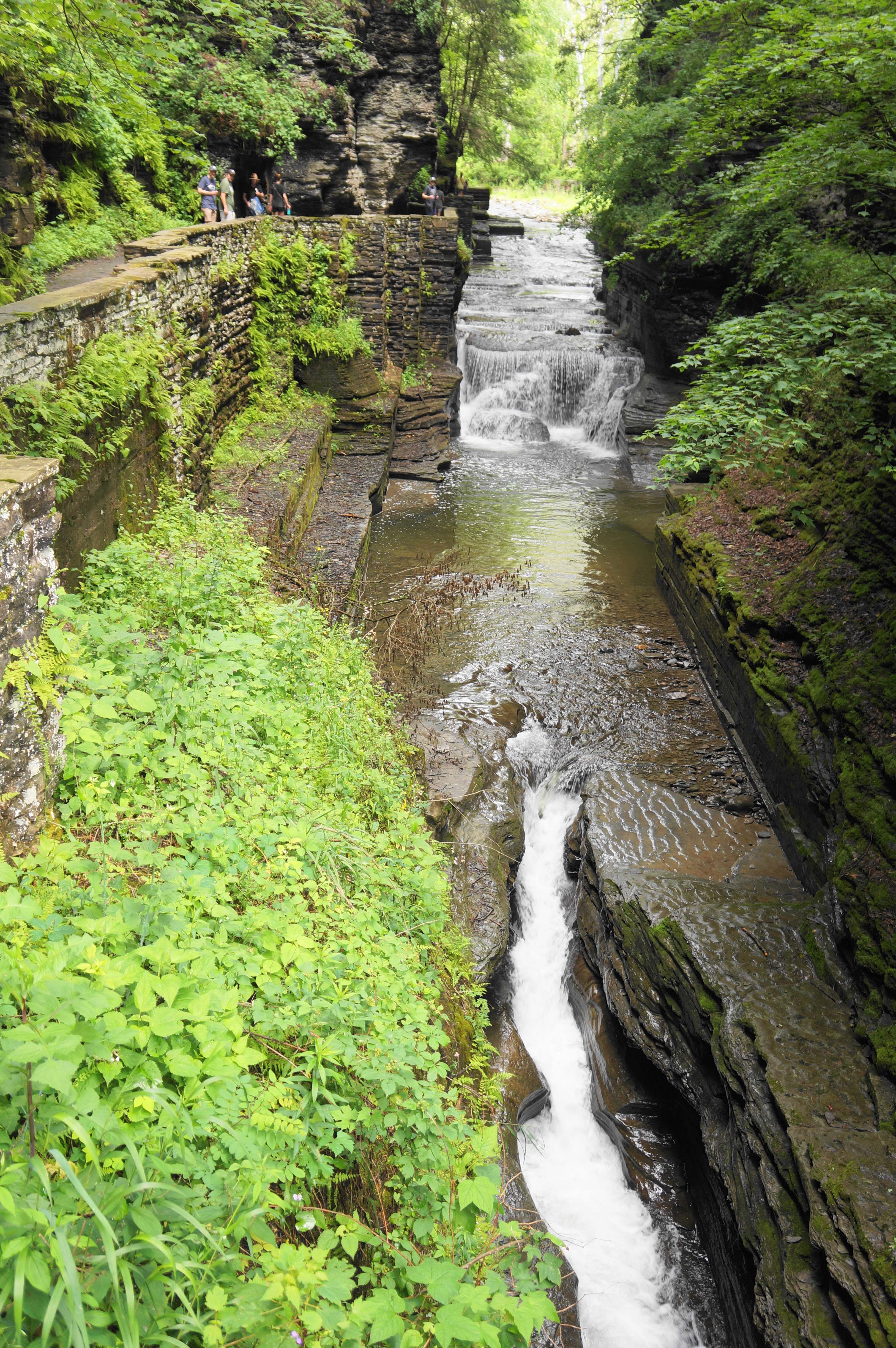


When ready, continue up and out of the gorge, edging around a left-hand bend that leads toward a placid picnic area and open fields. As the sun pours in, pass through a gate and come level with another stone bridge. But here stay left—don’t cross the creek—and follow the signs for the Rim Trail, the thoroughfare that you will use to wind your way back to the start of the loop.


Rim Trail & Enfield Falls (2.2 miles)
The hike is now only halfway done, although the subsequent Rim Trail is not quite as inspiring as its Gorge Trail pairing. Continue past the bridge and come to another junction, this time marking the start of the Rim Trail, which will offer some falls views but is mostly a wooded walk along the shady bluffs above Enfield Glen.
The route begins with a steady uphill, coming to an obscured viewpoint where one can look down at the narrowest section of the gorge. An unmarked path comes in from the right, then there are two spur trails heading right in quick succession. The white blazes indicate that these are no mere side trails but a continuous portion of the North Country National Scenic Trail, a 4,800-mile trek that extends from North Dakota to Vermont. For just this brief moment—perhaps 10-15 yards—hikers can say they were on the North Country Trail! (Note: The North Country Trail also doubles as the Finger Lakes Trail through Treman State Park.)

About 1/10 mile later, another spur leads left to a walled overlook positioned at the rim but again obscured by dense forest cover. One can certainly hear Lucifer Falls from here, but—outside of winter when the leaves have fallen—it’s not possible to see yet.
A short use trail meets back up with the main Rim Trail, which proceeds to round a side ravine high above Enfield Glen. Continue on a steady downhill until reaching the next overlook—a proper one this time, where a break in the tree cover offers a nearly-full look down at the entirety of Lucifer Falls. The sight of tiny specks on the Gorge Trail—the parade of hikers on a weekend afternoon—put the grand heights of the waterfall in perspective. The overlook offers an excellent spot to stop for a snack before the rest of the journey back to the start.

When ready, peel yourself away from the Lucifer Falls vista, and continue down the Rim Trail. Pass through a gate and drop down a switch-backing descent known as the “staircase section.” The sight of hikers huffing and puffing on the uphill makes one thankful for doing the loop in a counter-clockwise direction, turning what would be a brutal workout into a pleasant descent.

At the bottom, a short diversion leads to a distant view of the base of Lucifer Falls. One can only see the lower third of the 115-foot drop, and signs indicate that wandering closer to the falls is prohibited. So content yourself with a faraway look and continue onward down-canyon.
The next mile is relatively ho-hum by the hike’s standards but is largely downhill and makes for quick walking. Follow the blue blazes and stay right at the junction with a connector trail that leads down to the initial bridge seen earlier along the Gorge Trail at mile 1.6. Then proceed over a wooden bridge over a minor tributary, leading into another section that is uphill for about ¼ mile before levelling.


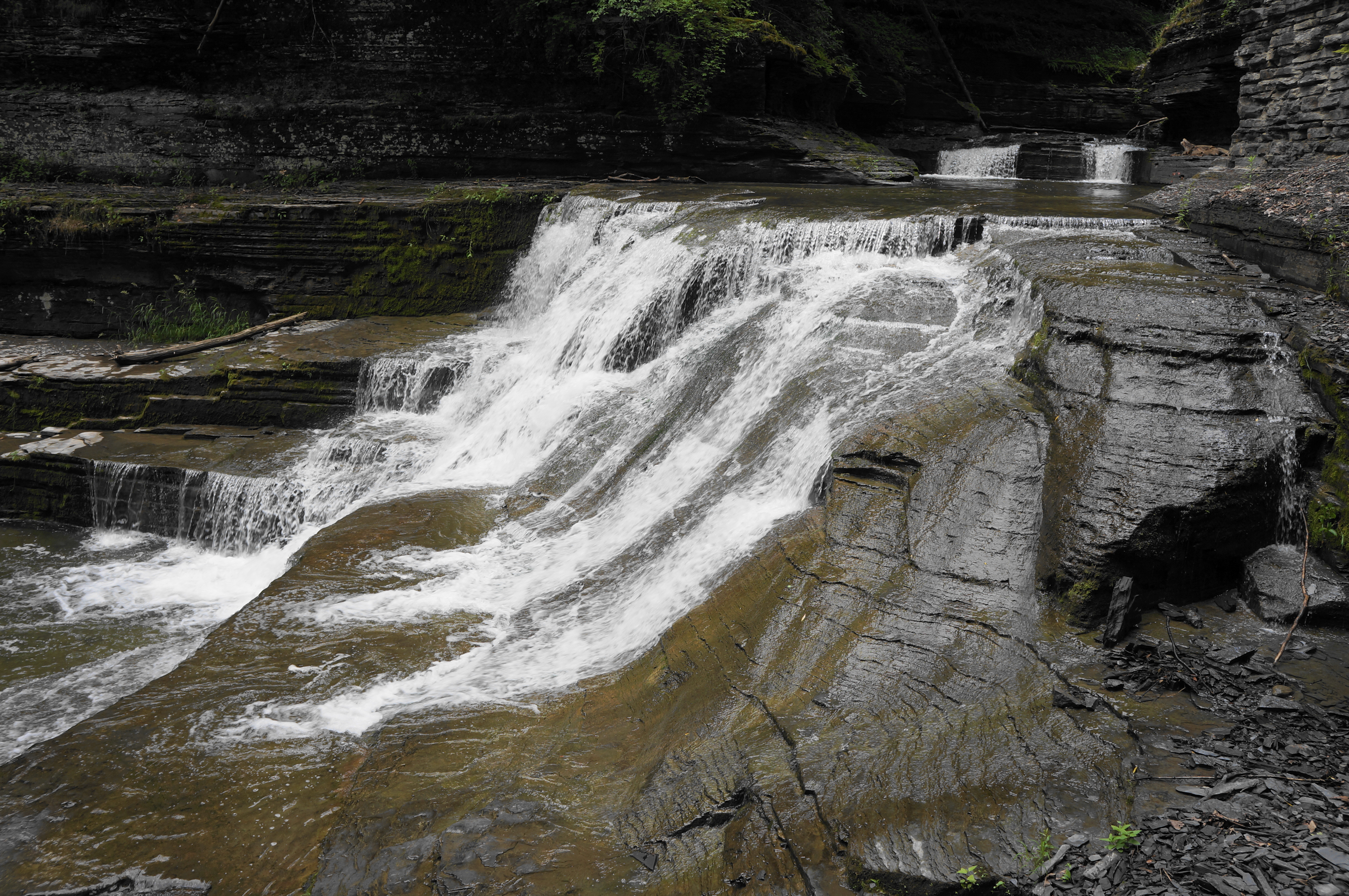
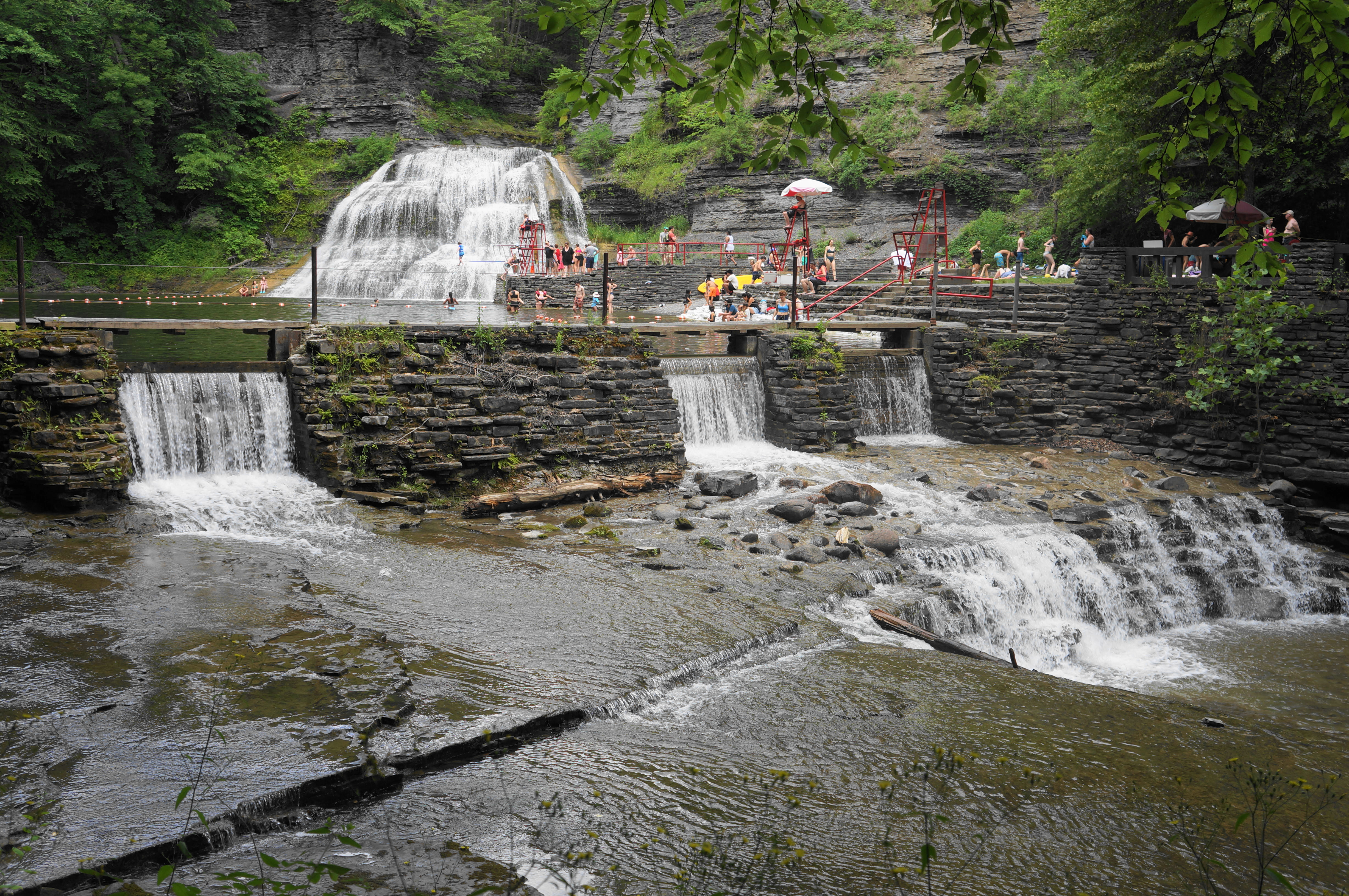
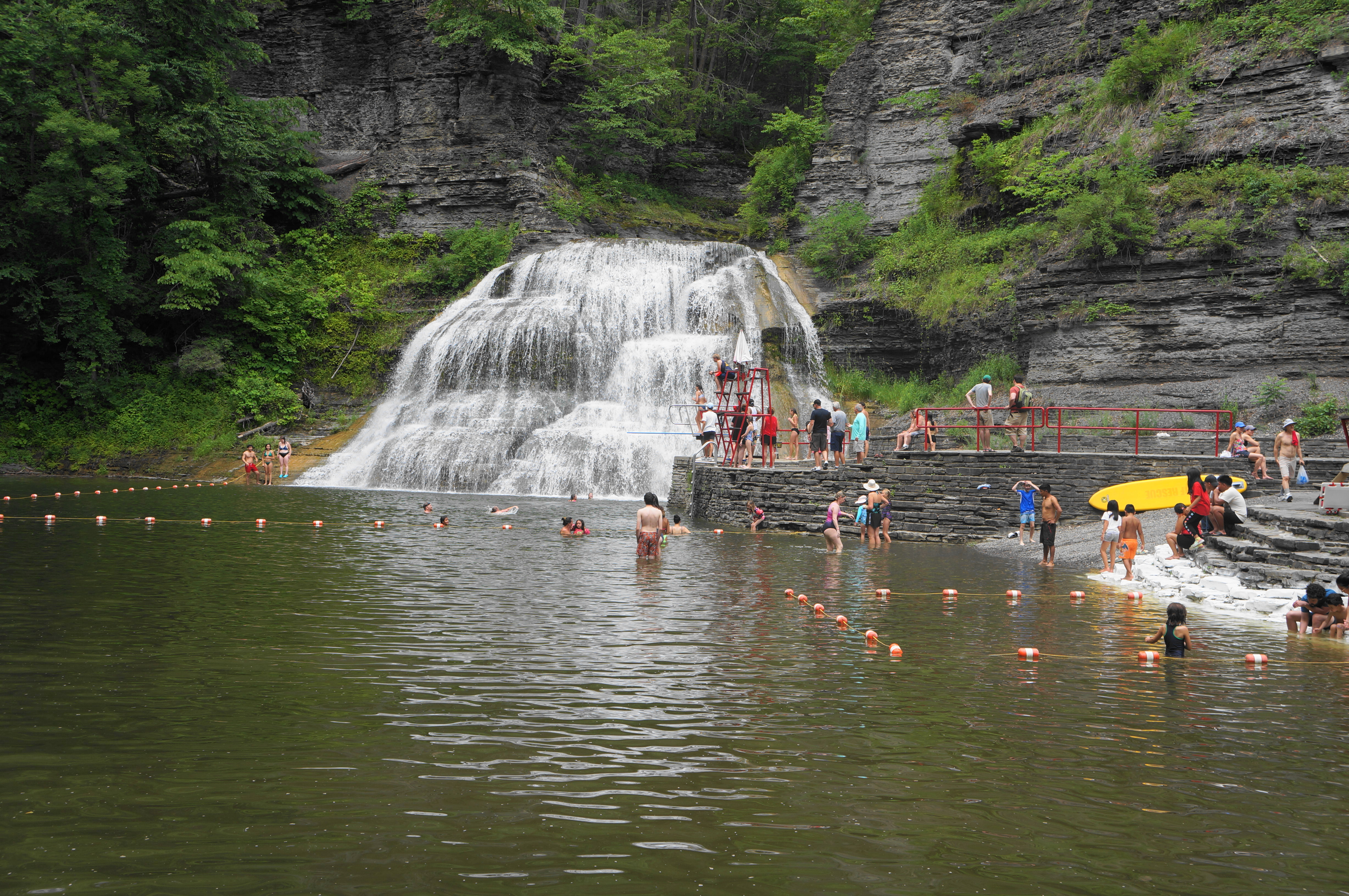
Settle into a downhill tread for the next ¾ mile, coming to a junction at 3.9 miles. Bear left and begin a much sharper descent, soon coming to another unmarked fork. Staying left again offers some partly obstructed views to Enfield Falls (a.k.a. Lower Falls). This 30-foot cascade is a favorite of swimmers and divers in summer, giving the waterfall a somewhat playground-like quality that detracts from its natural beauty. But in the off-season, the area around the falls is quieter and freer of disturbances, allowing visitors to see the waterfall in its natural state.

Soon the spur path meets up with the larger, main track, and the Rim Trail proceeds down a final staircase, culminating at a road in the park’s cabin area. Take a left on the road, then stay on the trail as it hugs the south bank of Enfield Creek and then traverses a small dam (which facilitates the creation a pool suitable for swimming). Here one gets a closer view of Enfield Falls.
Once across, bear right, following the paved path between the bathhouse and creek, then walk the final 150 yards back to the parking lot at the Park Office. This marks the end of the magical hike, clocking in at around 4.4 miles total.

Pingback: Gorge – Rim Trail Loop (Buttermilk Falls State Park, CA) | Live and Let Hike
This is a great hike! Lucifer Falls is really impressive.
For those interested in hiking more of the Finger Lakes Trail/North Country Trail, it is possible to make a longer hike using the south rim trail. Start on Route 13 at the free parking area under the bridge and hike west on the white-blazed FLT (south rim), then follow the orange-blazed connector trail along Fish Kill (a tributary creek) back to the gorge trail and take that down through the gorge and then through the campground back to Route 13, for a nearly 8-mile loop.
I brought my son on that version a few years ago when he was 9. He had never been to Robert Treman before, so I secretly packed swimsuits. When he inevitably oohed and aahed at the waterfall swimming area near the end of the hike, I pulled them out as a surprise. I completely agree with your perspective that the swimming area spoils the natural beauty of the Lower Falls and had never swum there before. However, I knew it would appeal to a kid, and found it to be an extremely refreshing place to swim, 7 miles into an 8 miles hike. Nice cold water. Bring a suit next time!
Thanks for the insights Sara!
Pingback: Top 10 Hikes in 2023 | Live and Let Hike