A quick glance at this and my previous blog from Ithaca’s Robert H. Treman State Park suggests this post may be merely a duplicate. But a closer look reveals that there is indeed also a Gorge Trail and Rim Trail combination in nearby Buttermilk Falls State Park, situated three miles up the road from Treman and about the same distance from downtown Ithaca, New York. Like its sister hike at Treman, this 1.6-mile circuit features majestic waterfalls, shale and sandstone walls, lush canopy, and natural pools. Relative to the towering drops of Lucifer Falls and Enfield Glen, however, the gorge here feels tighter, narrower, and more intimate. The initial, roadside falls at the park entrance may be the highest, but the most memorable scenery lies farther on in the slender passages and flumes of the upper canyon. Combine the Gorge Trail with a more modest return on the Rim Trail for a pretty, 1- to 2-hour hike.

The hike
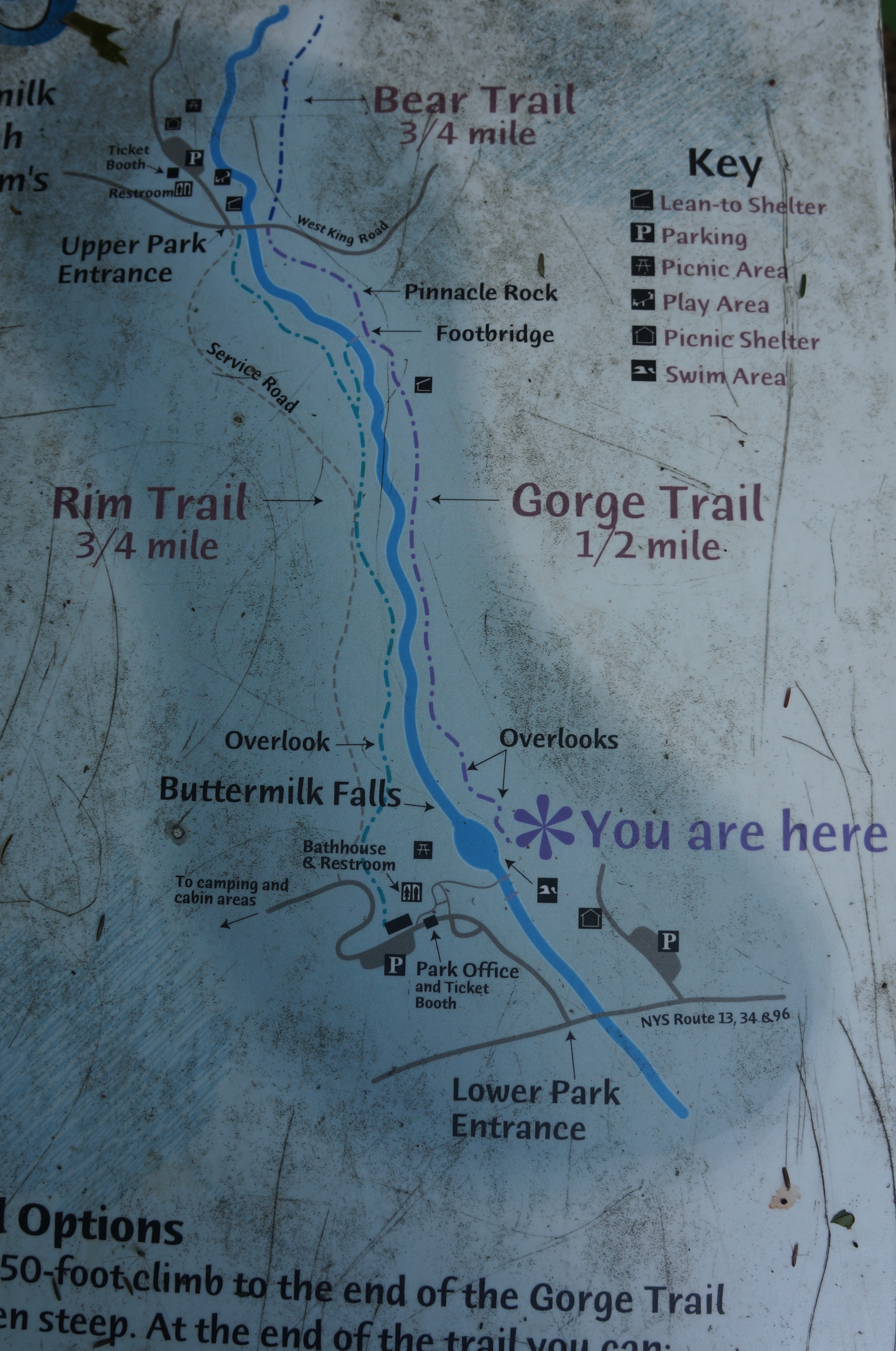
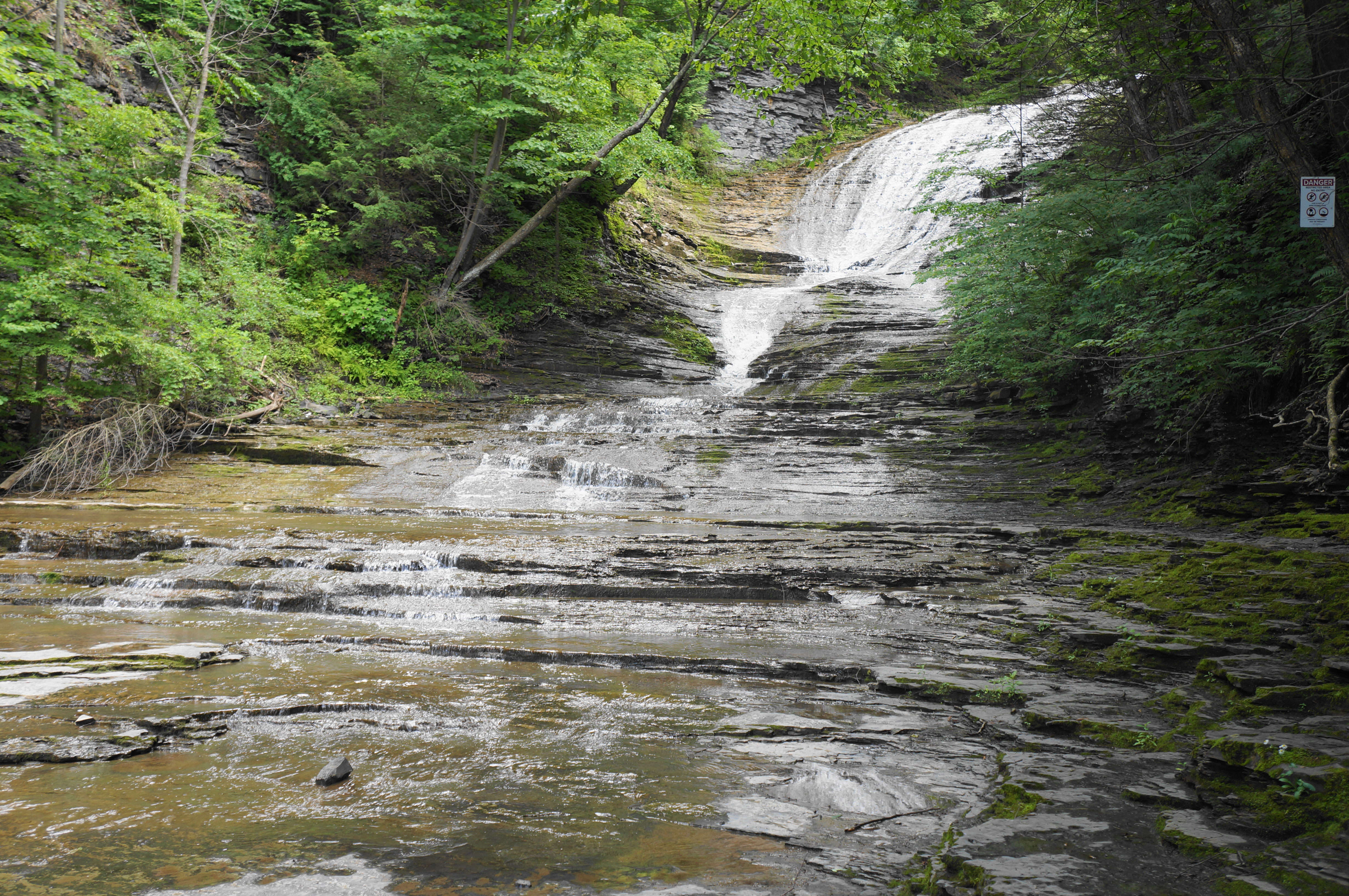
Buttermilk Falls State Park, like nearby Robert H. Treman State Park, has two entrances, but the vast majority park at the lower parking area, near the base of the namesake falls. Here one can find the park office, information boards, water spigots, and restrooms. Most visitors will amble out from the parking lot across the neat lawn to the banks of Buttermilk Creek, which slithers down a slippery slide and into a dark pool, which is dammed and open for swimming (seasonally). This is the main portion of Buttermilk Falls: the cataract is booming in springtime or after heavy rains, but most times it resembles a series of gentler threads gradually whittling away at the moss-laden bedrock.
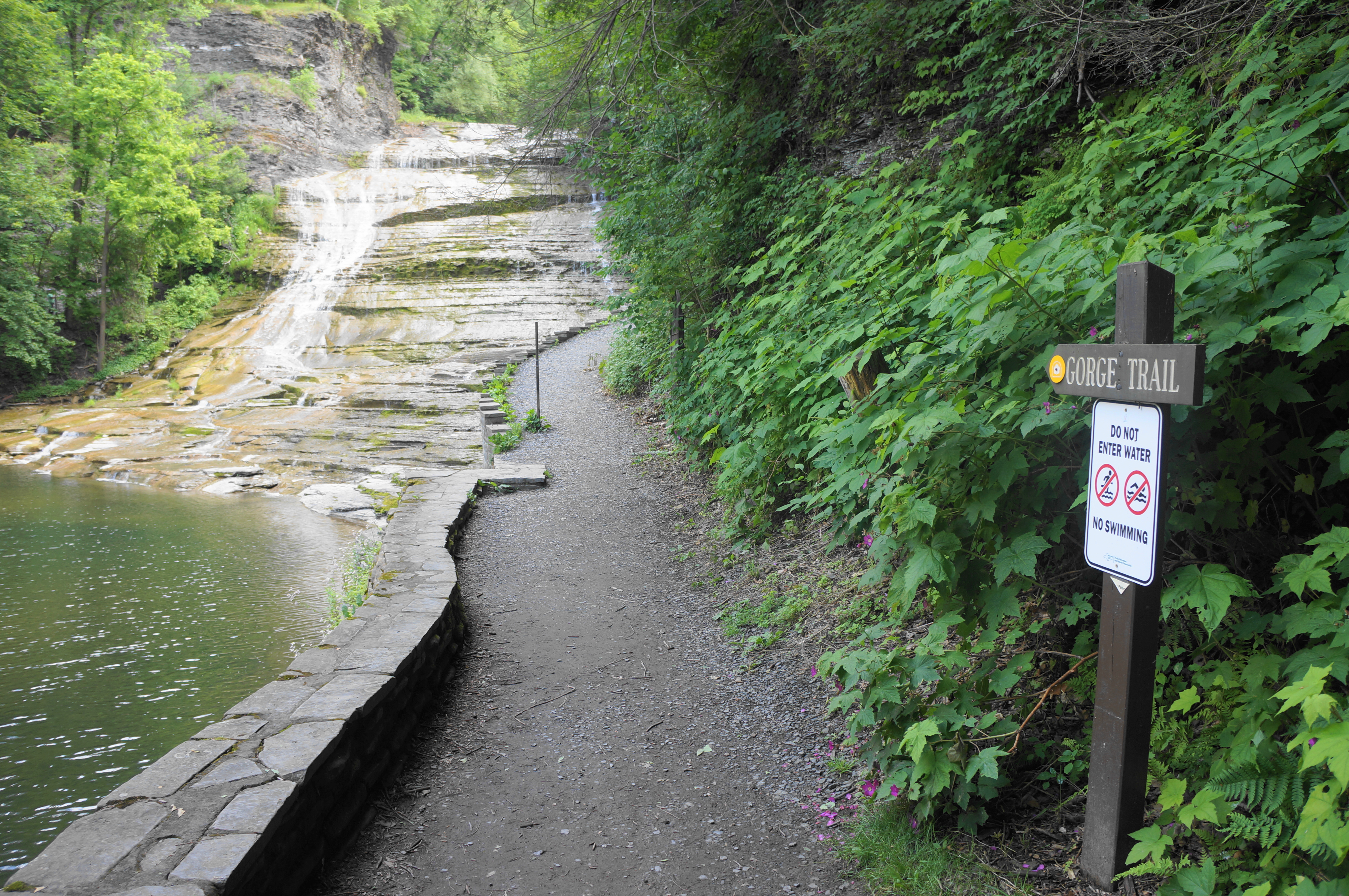
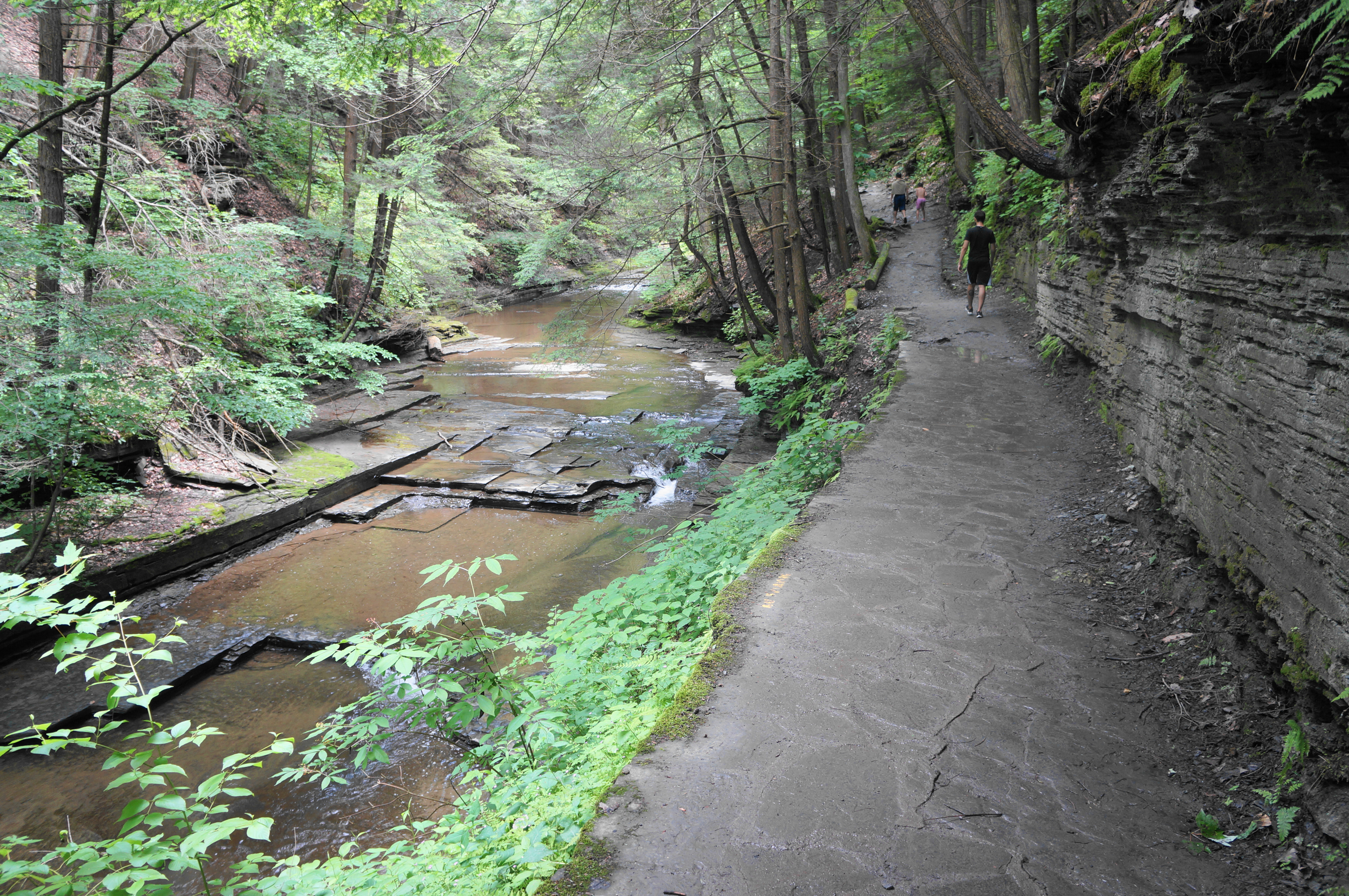
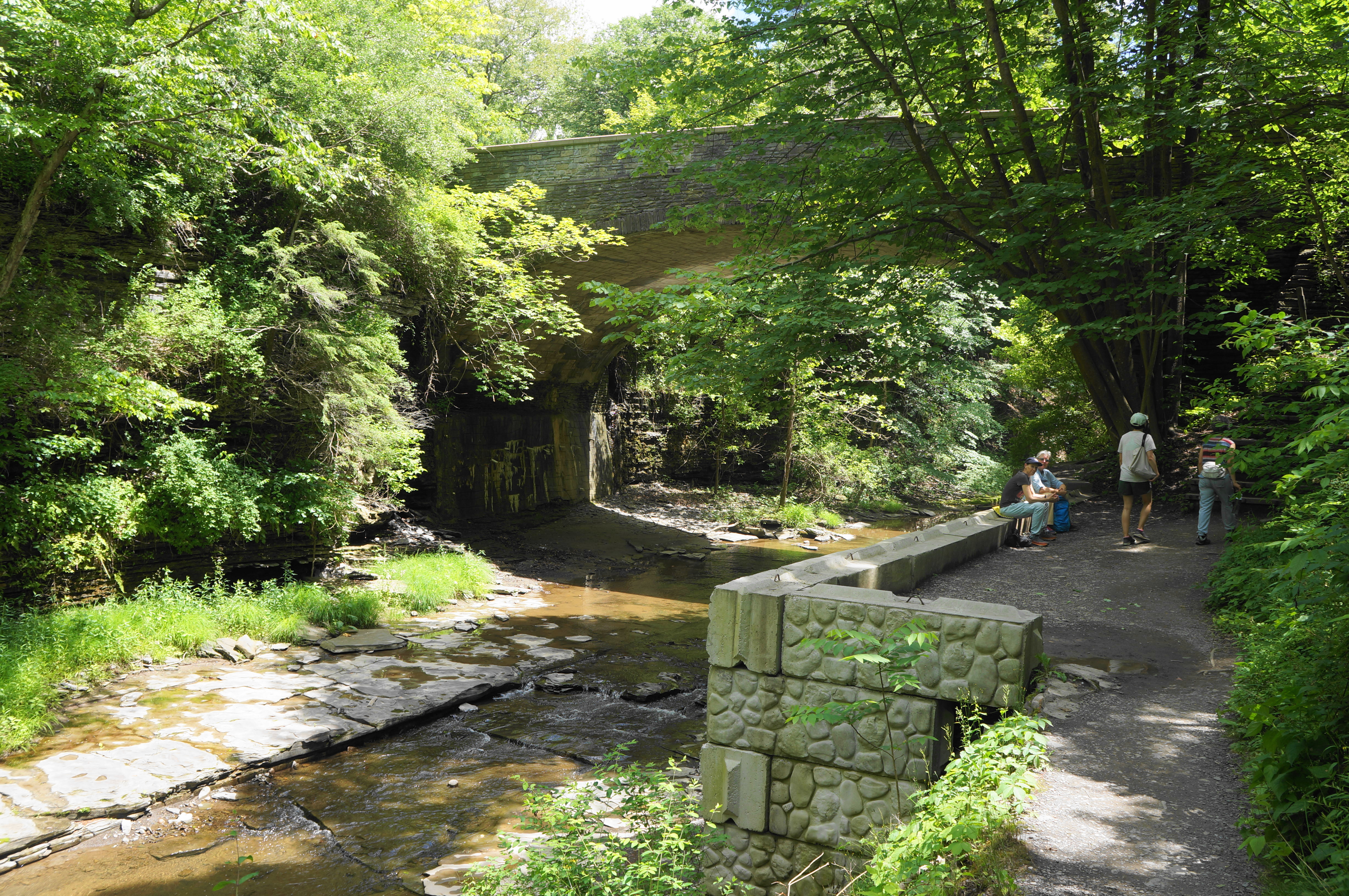
To reach the Gorge Trail, head out past the entrance station and along the entry road, coming to a short and popular bridge over the creek. Here one gets a view of much of Buttermilk Falls, albeit at a distance. Once across, take an immediate left, following a now gravelly track past a park residence on the right. Follow the hard-packed path to an interpretive sign about the Gorge Trail, which gains 450 feet in the next ¾ mile.


Soon the incline begins to pick up, and the Gorge Trail edges along the pool and Buttermilk Falls on the left. Wave back to the picnickers on the lawn before you pass under a protruding set of trees and climb a challenging, though shaded, staircase. The relentless stairway passes an intermediary fall above the lower drop and comes to a spur labeled “Falls Overlook.” Head left on the spur, culminating at a stone viewing platform.


In addition to a view down the falls toward the entrance, a look upstream reveals a previously-concealed secret: a second waterfall that could be reasonably considered part of broader Buttermilk Falls. The popular overlook is often a turn-around point for hikers—yet the best is yet to come.
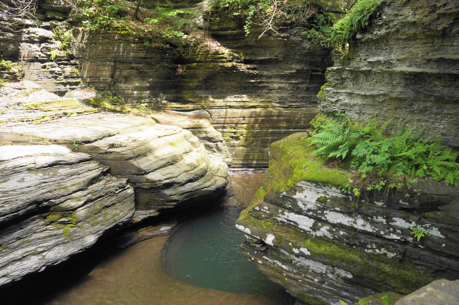
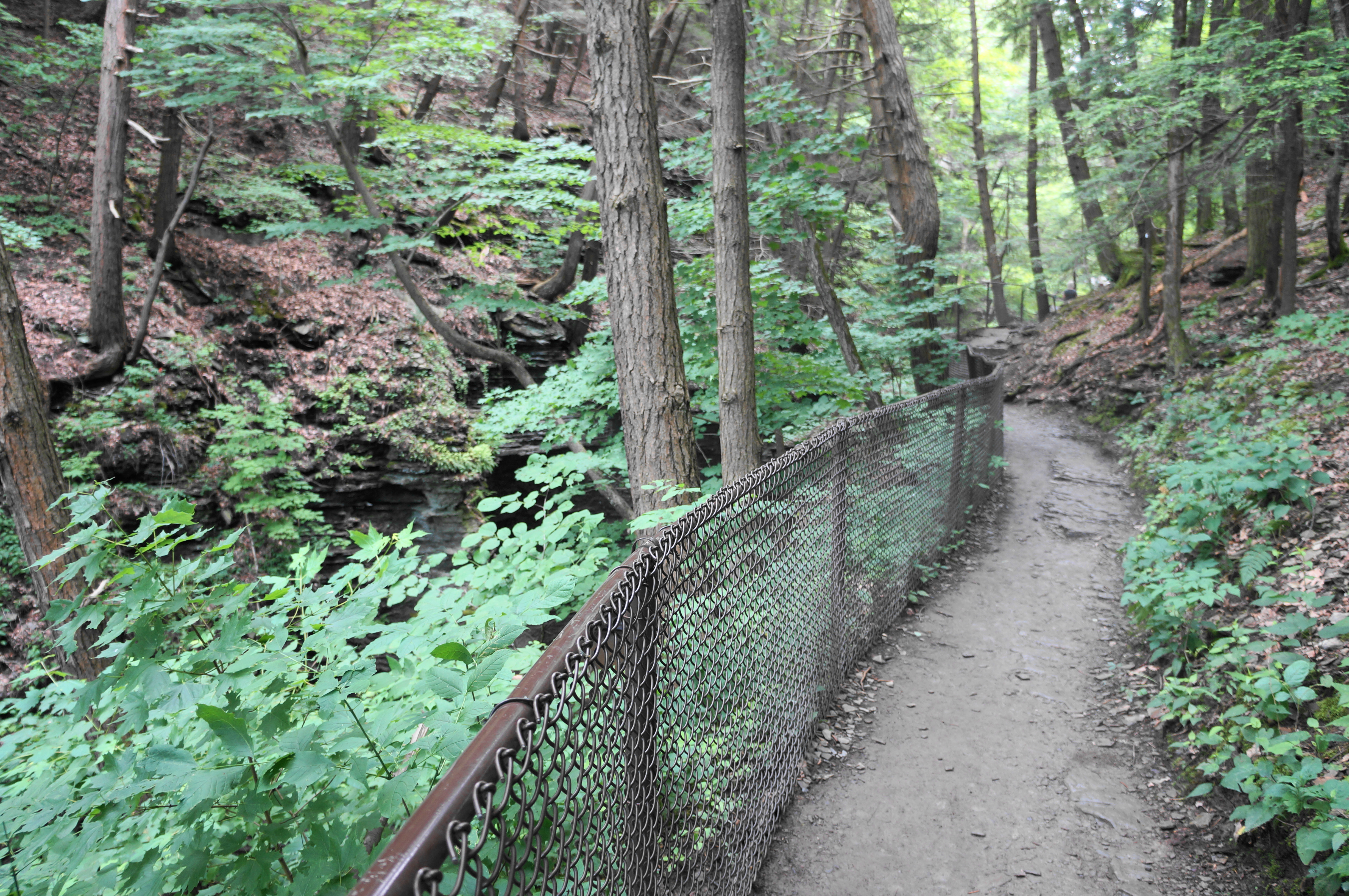
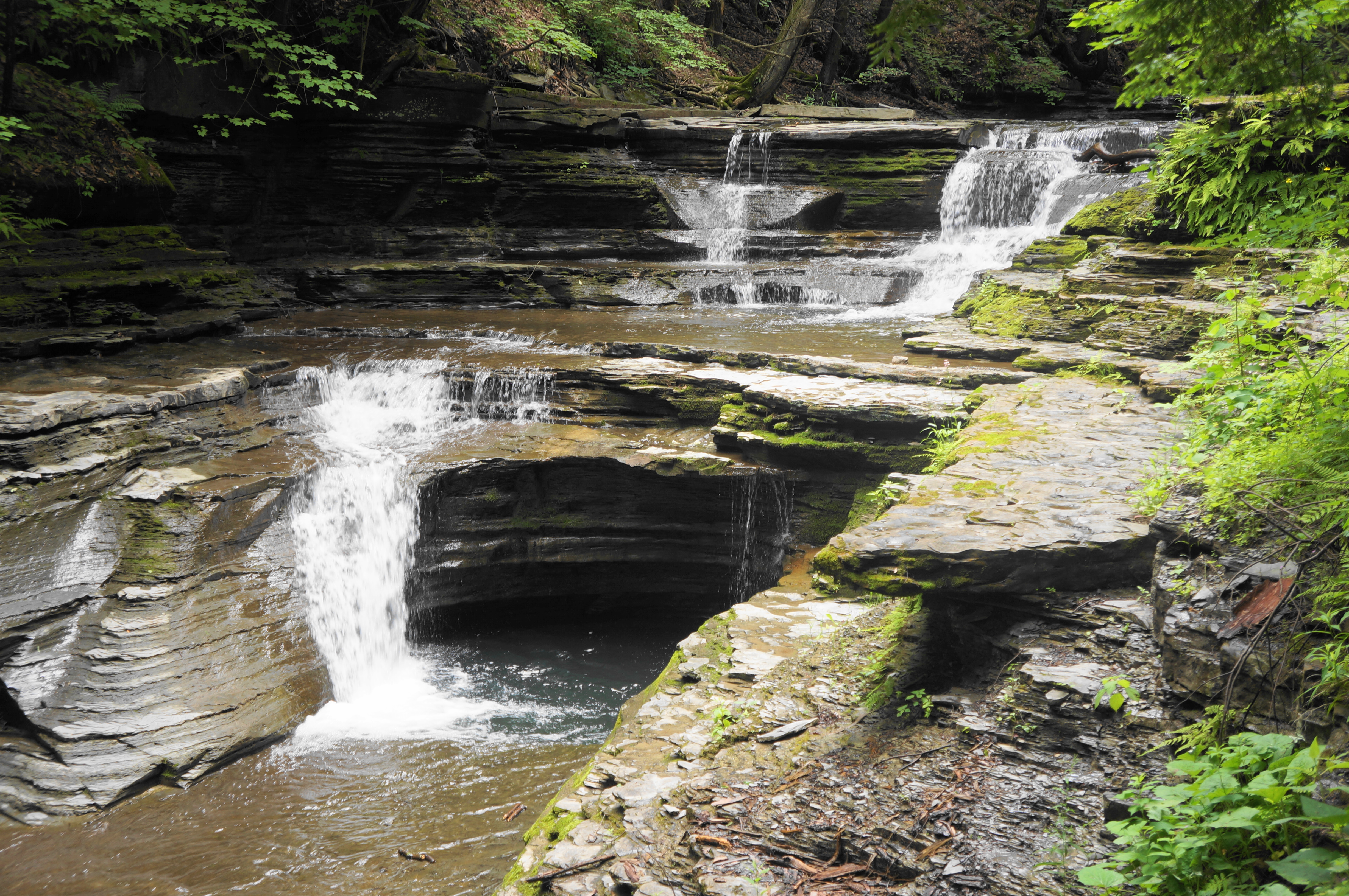
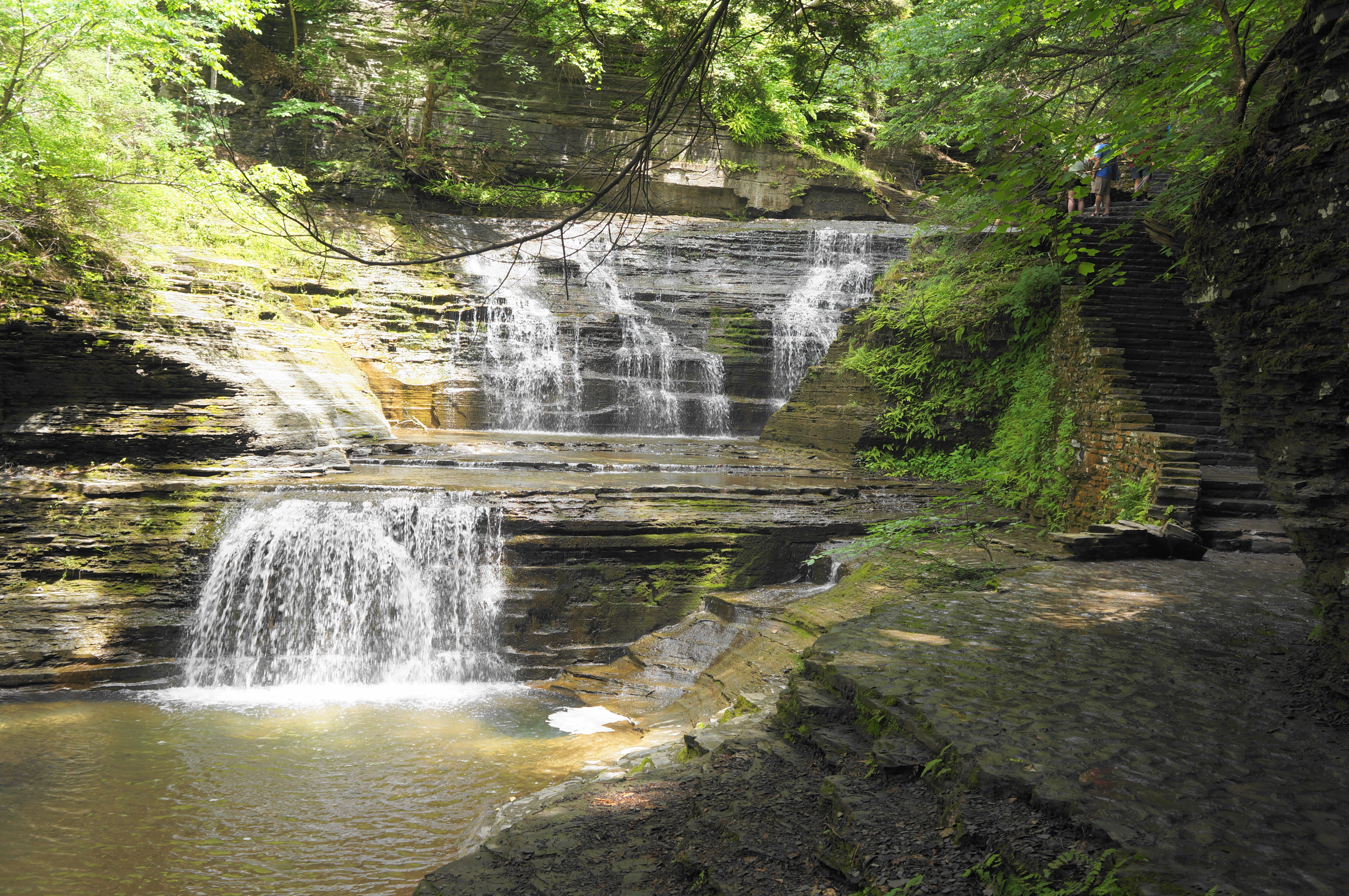
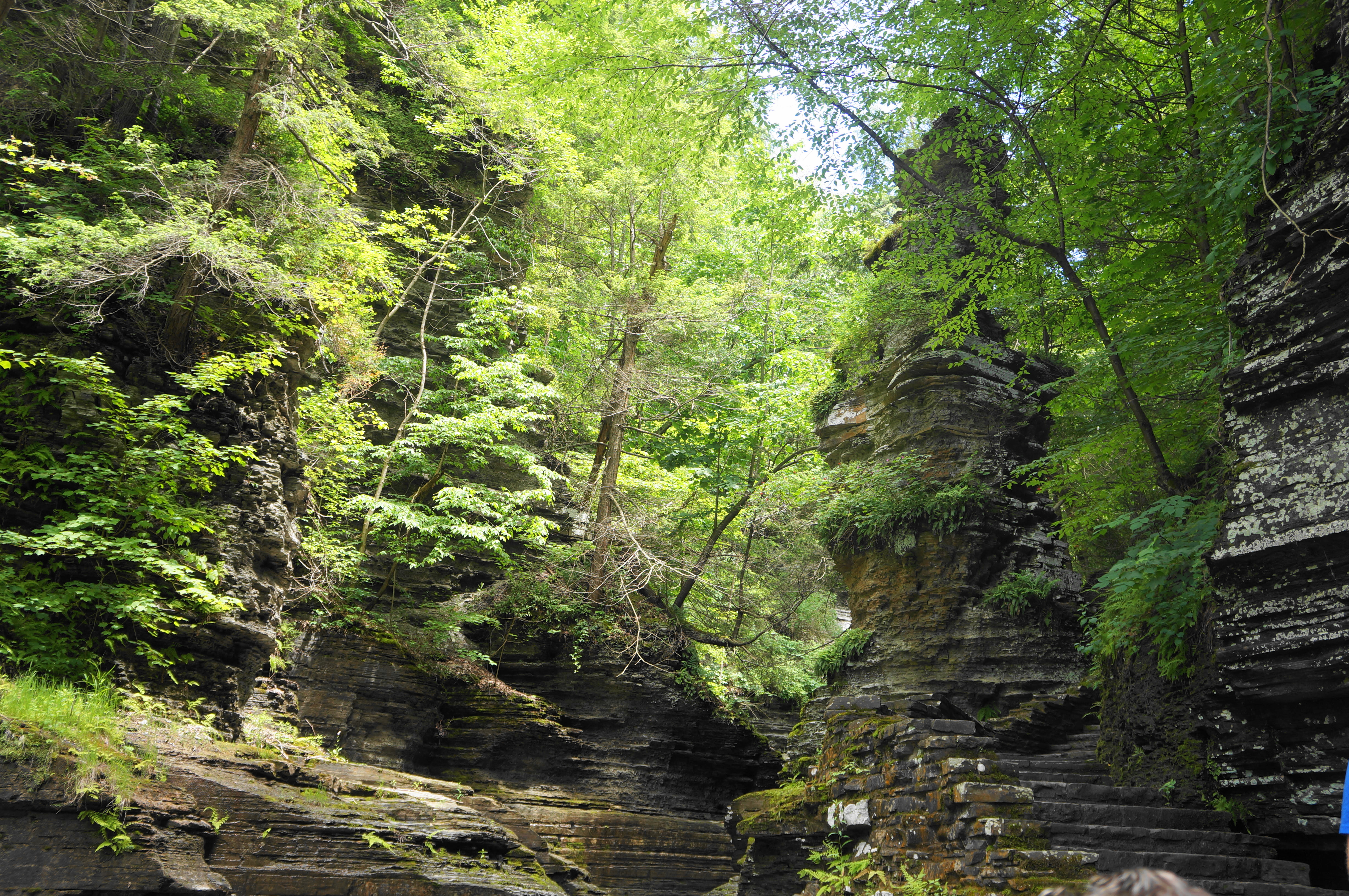
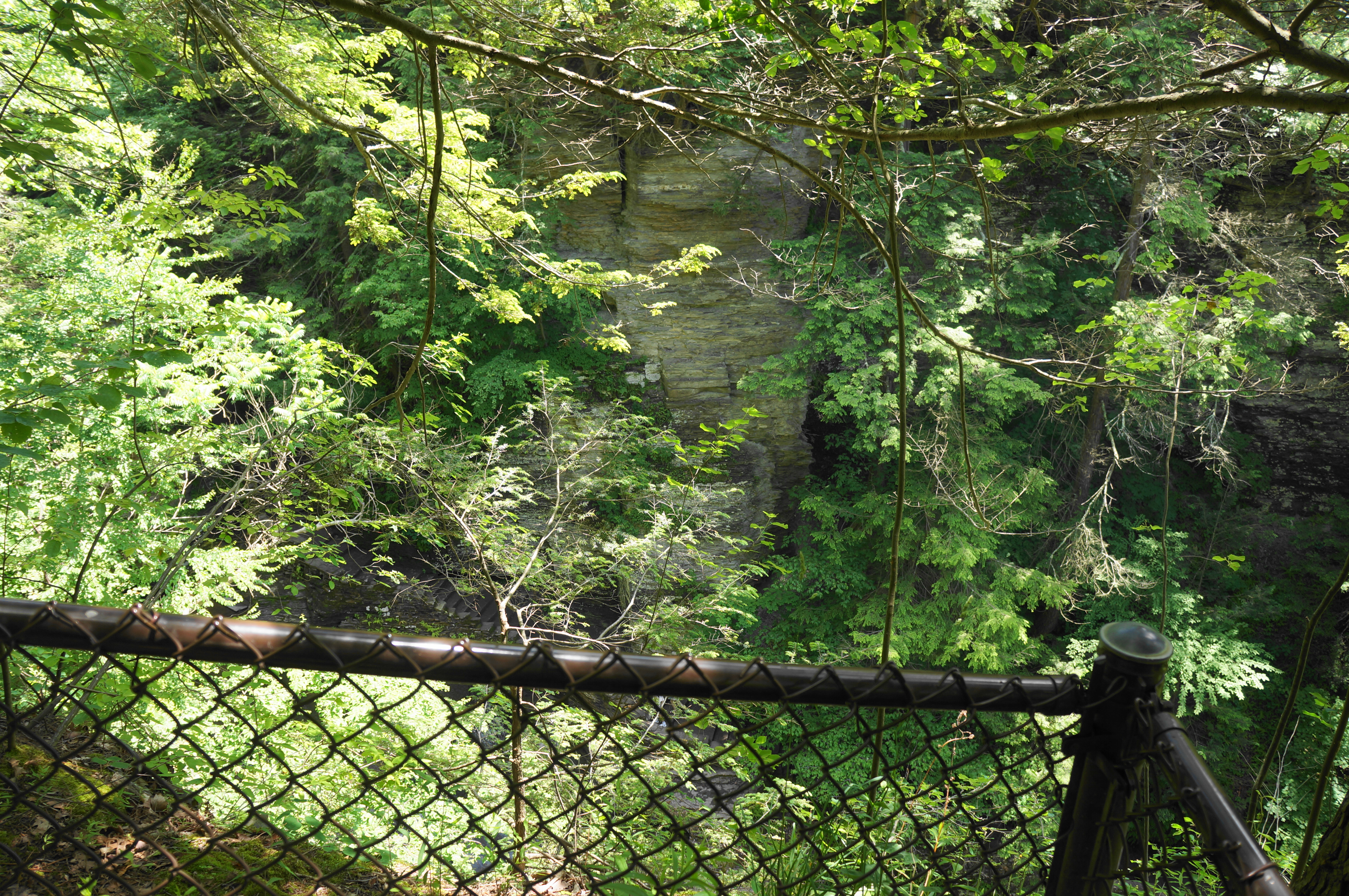
To continue, ascend another spiraling staircase, reaching another overlook where the foliage blocks much of the view. But partial breaks in the trees reveal a series of smaller cascades at the mouth of a thin slot in the heavily-streaked shale. The next section is fantastic and frustrating at the same time, as there is clearly a stunning narrow gorge carved by Buttermilk Creek—but the trail, fenced off on the left, rarely gets close enough for a look down off the rim. The few available peeks reveal narrow chutes and punchbowl pools.


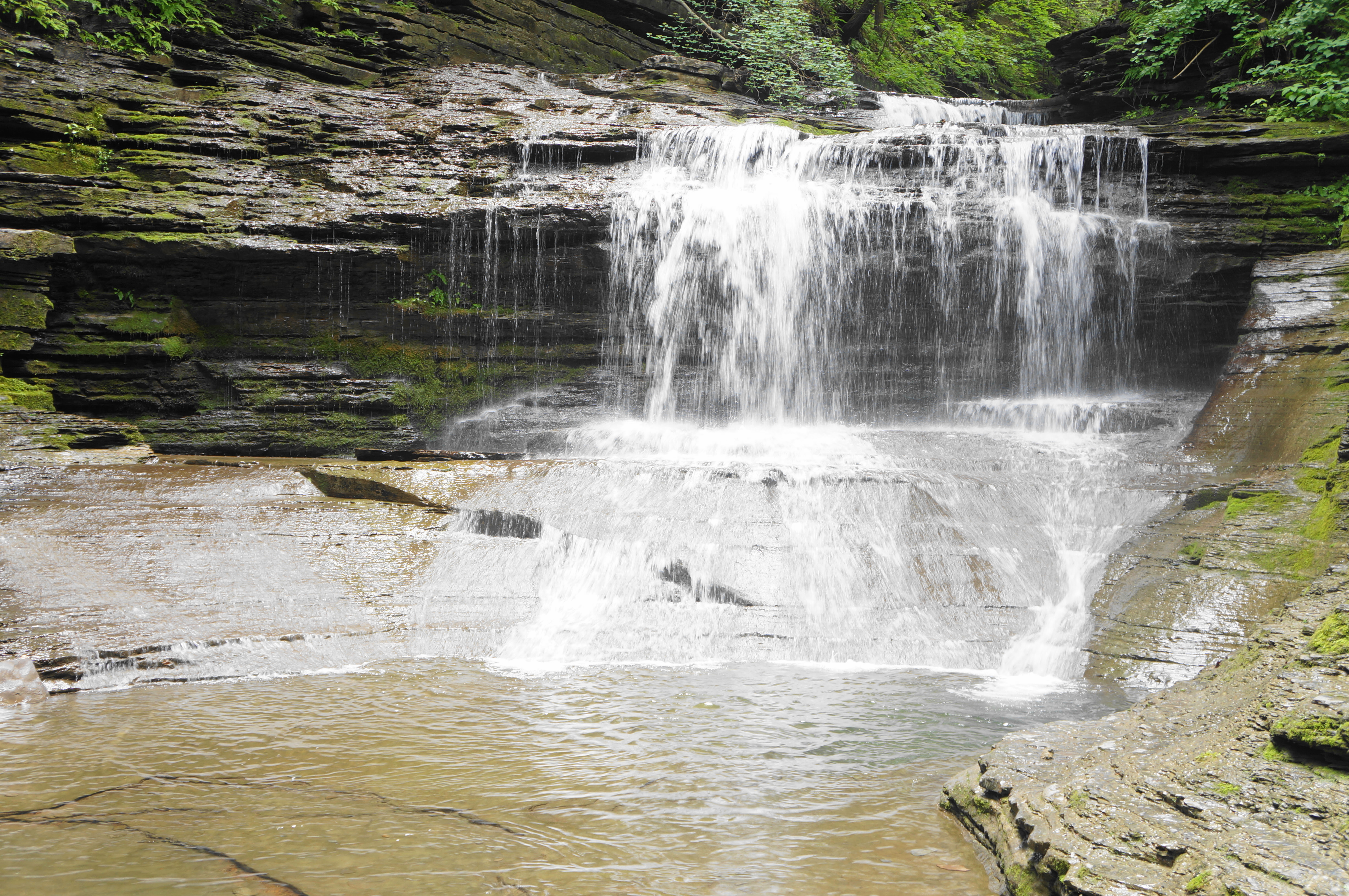
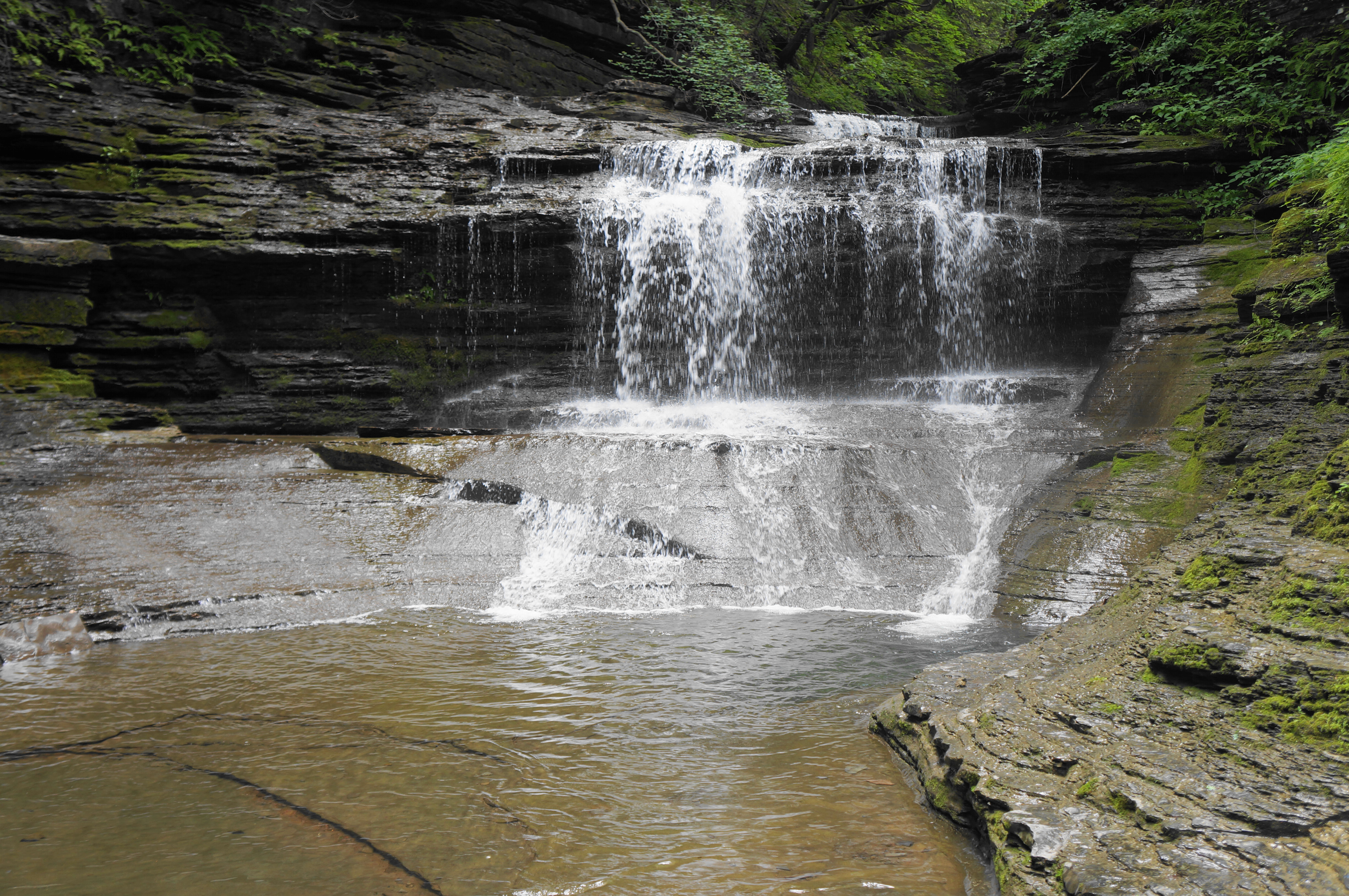
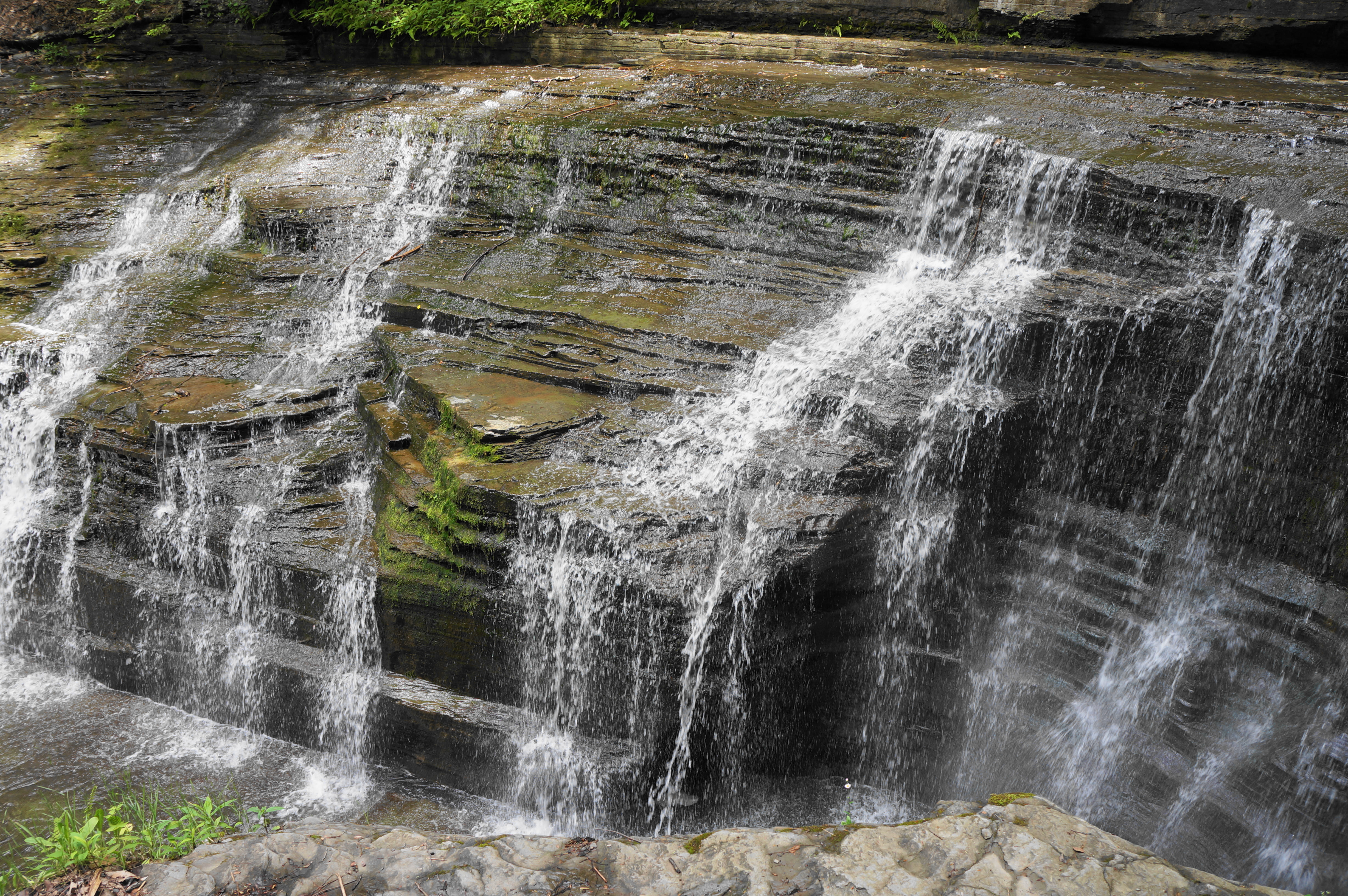
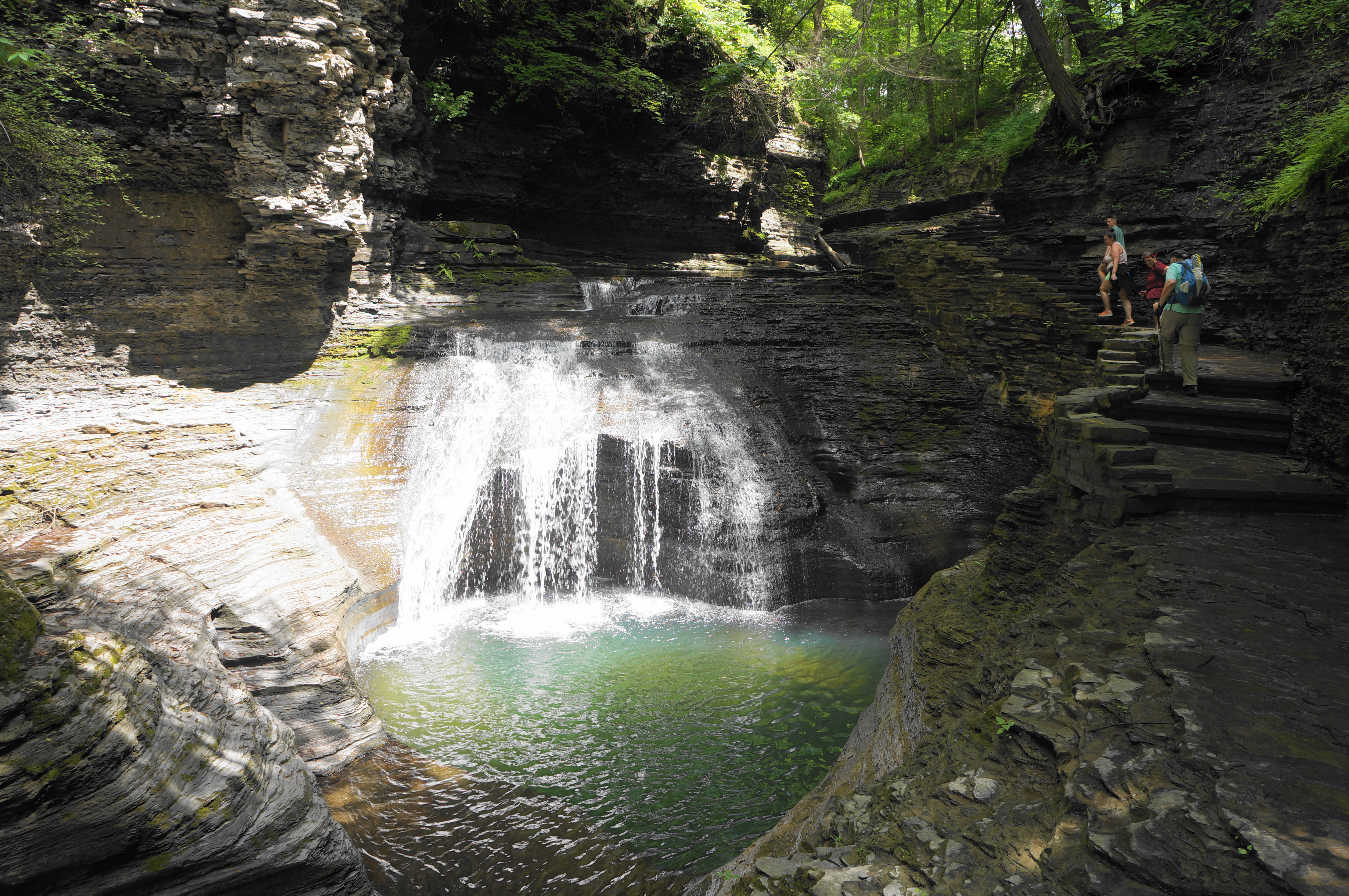
At around 4/10 mile, the glen widens again, and hikers approach a terrific double cascade, about 15 to 20 feet in height and popular with swimmers. From here the Gorge Trail rises more stairs, interspersed with potentially slippery traverses on the dark-hued shale.


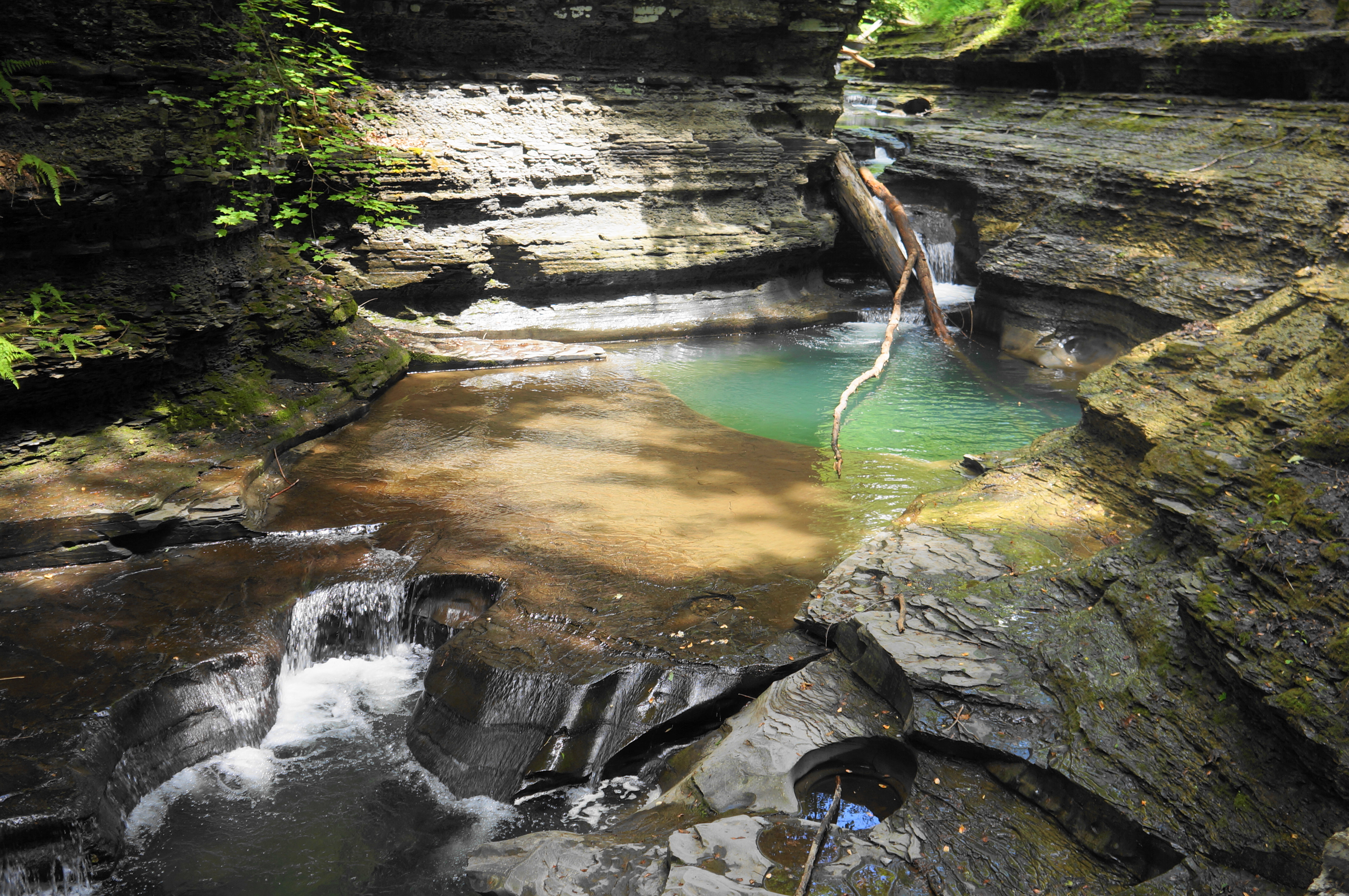
There are two more cascade sections visible from the trail before the terrain levels and the water calms for a brief period. Up to the right is a small lean-to shelter, accessed by way of a steep spur; while a nice resting point, there is no other particular reason, however, to take the spur to the wooden awning.
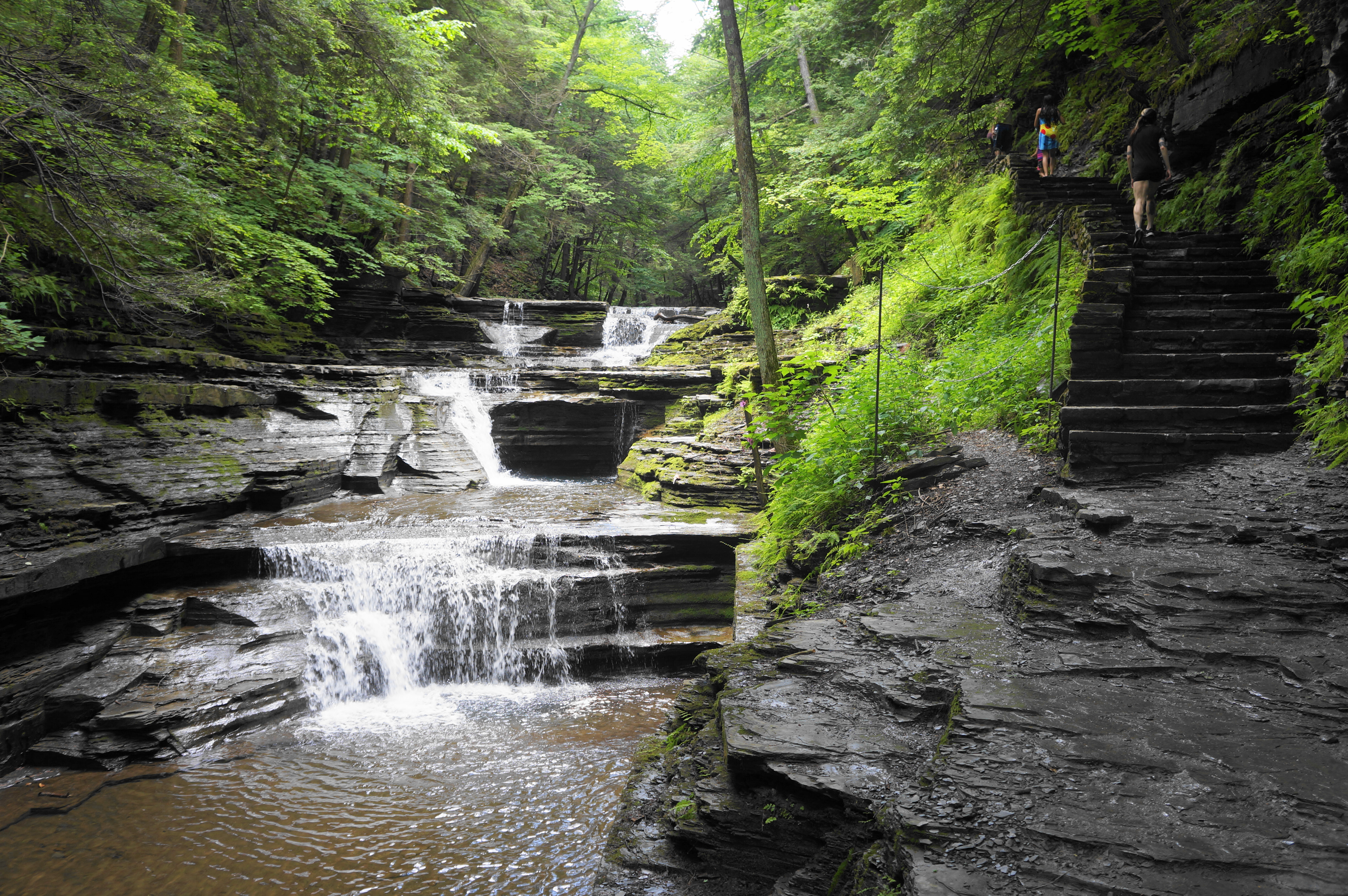

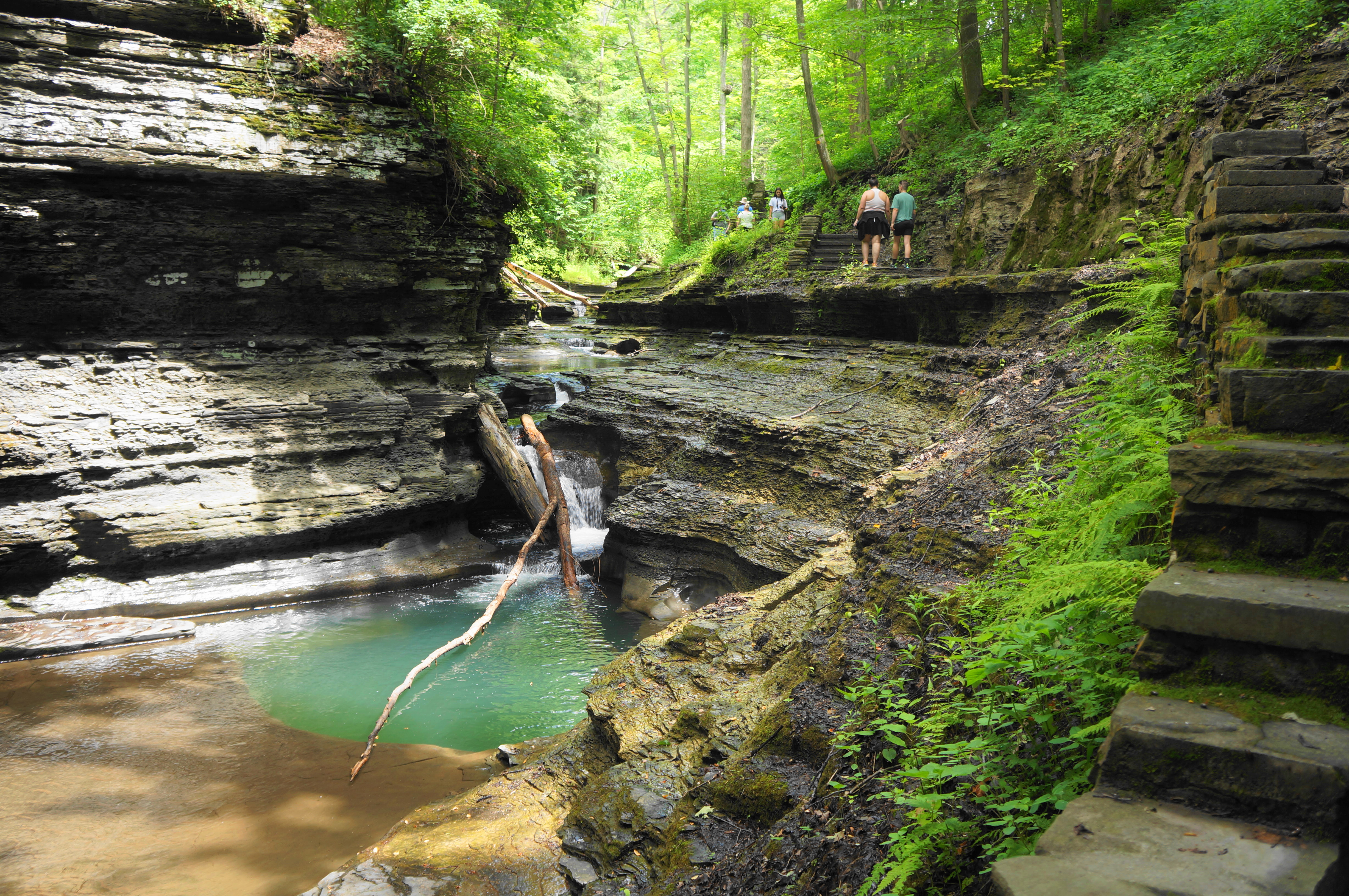
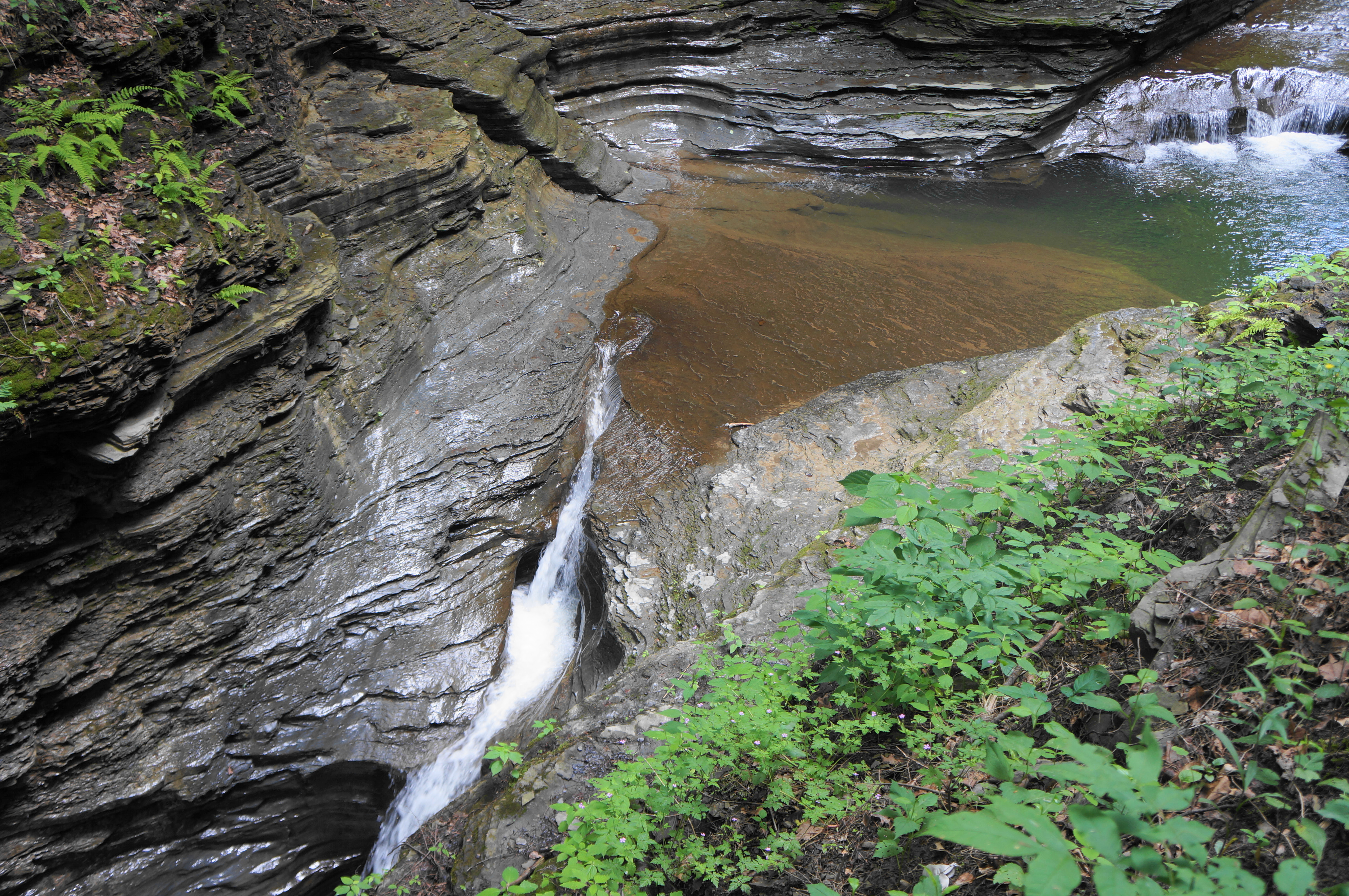
Continue as the trail intersects with a cutoff route over a wooden bridge. Stay along the right bank, however, proceeding farther upstream and entering one of the most scenic stretches of all of upstate New York.


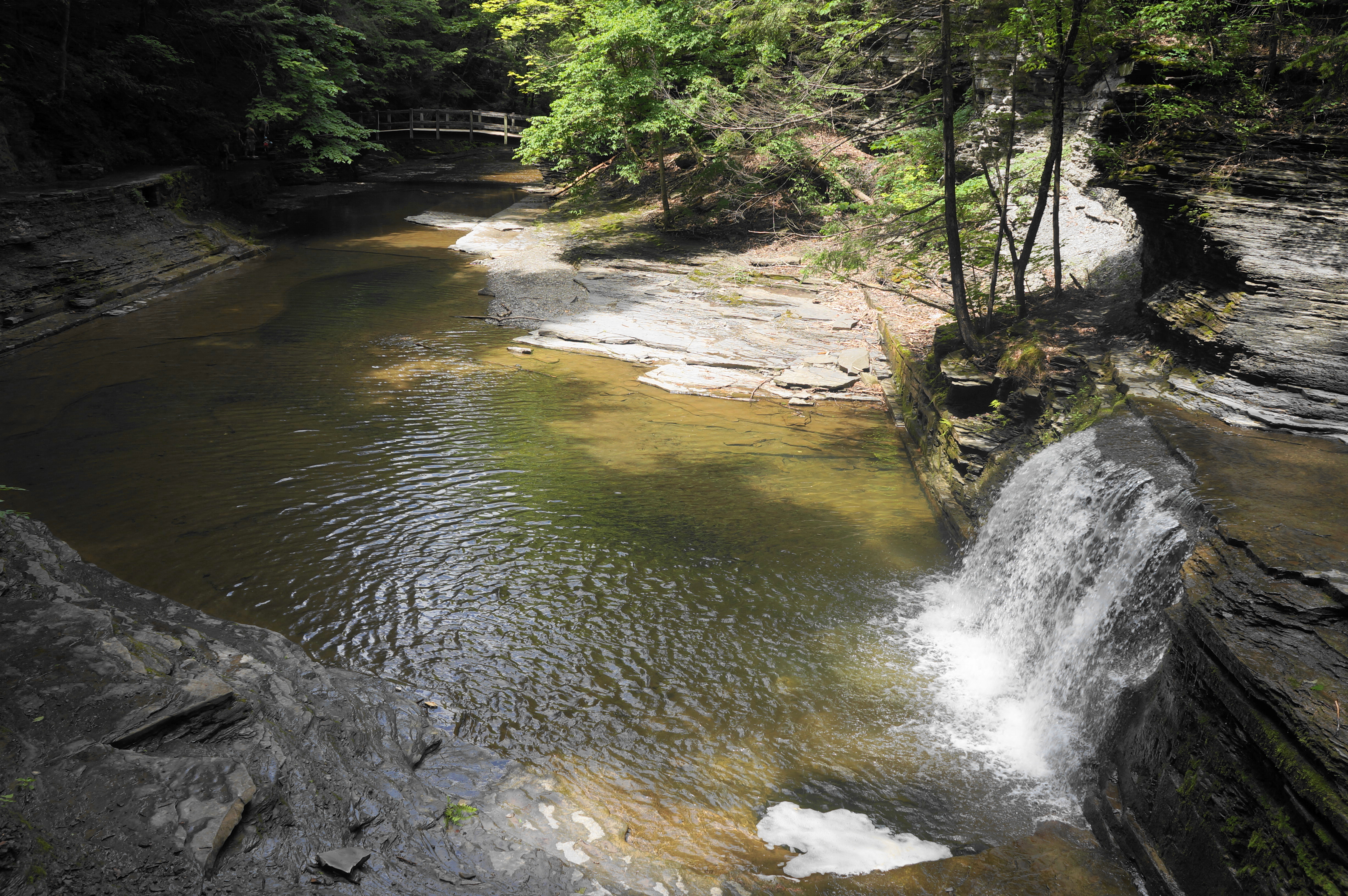
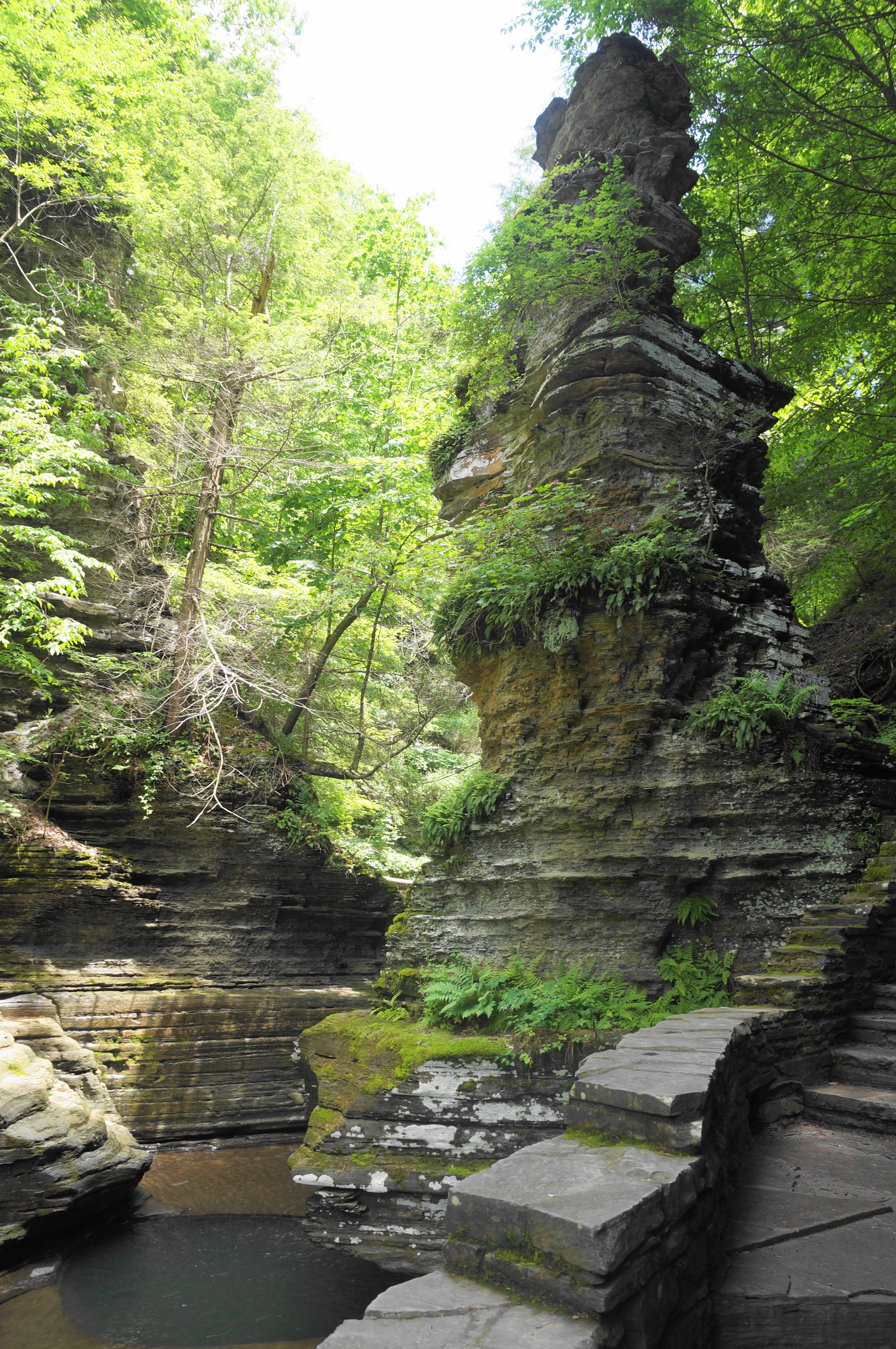
First, the trail—reinforced with stone and concrete—skirts a clear, lovely pool and mounts another picturesque, multi-tiered waterfall. The ascent soon leads to a natural spire known as Pinnacle Rock, a towering sentinel perched at the gates of a particularly narrow and scenic cut.

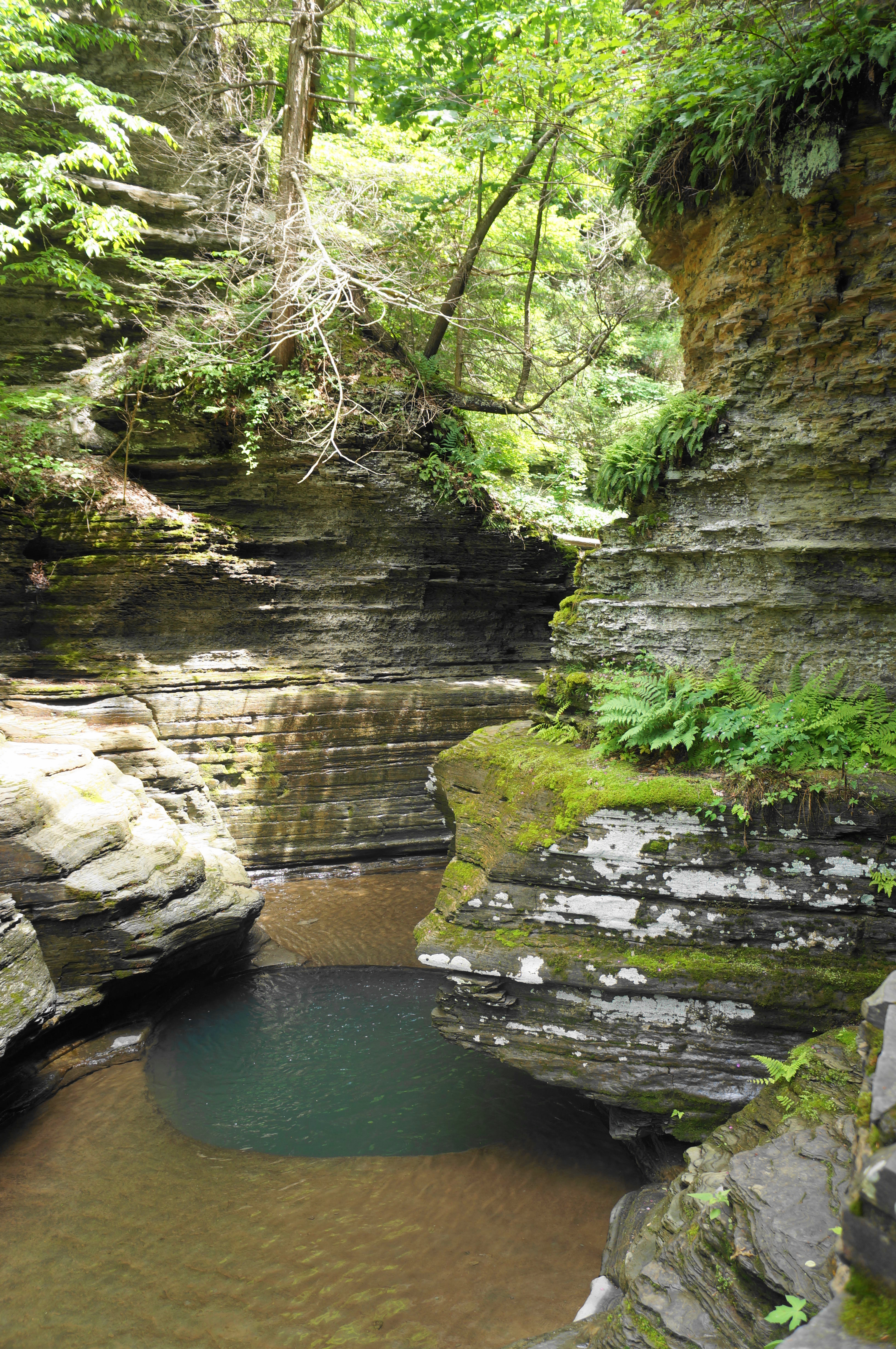


The Pinnacle Rock view is quickly followed by another majestic cascade, dropping into a turquoise basin. Above lies a set of punchbowls that are also an alluring blue-green.

And then, suddenly, it’s all over, as the stream mellows, and hikers reach a bridge above: this is West King Road, which bisects the park and is reached by way of a final staircase. The Bear Trail continues south from here, but Buttermilk Creek is quiet and less scenic (although eventually one reaches peaceful Lake Treman). Instead of taking this path, bear left (east) on West King Road, cross over the stream, and then look left for the start of the Rim Trail.

Like the Rim Trail at Treman State Park, this version too is much less dramatic than its gorge pairing. But the mild and flat surface is refreshing, and the many seasonal overlooks—while obscured almost completely in summer—harbor views down into the Buttermilk Creek gorge after the leaves have fallen for the season.

Follow the path as it merges with a service road at 1.25 miles before separating again, continuing as a partly asphalted trail that parallels the drive. Look for a sign indicating that the Rim Trail is making a clean break, and follow the singletrack down a steady downhill back toward the gorge. After another obscured overlook at around 1.4 miles, cut right and return to a point where the service road again comes into view. The service road merges with a paved drive (leading to the park campground), but the trail keeps to the left, culminating with a final downhill staircase, finishing off the 450-foot elevation loss. Here one comes out by the restrooms and park office; bear right to return to the sunny parking lot.

Pingback: Top 10 Hikes in 2023 | Live and Let Hike