
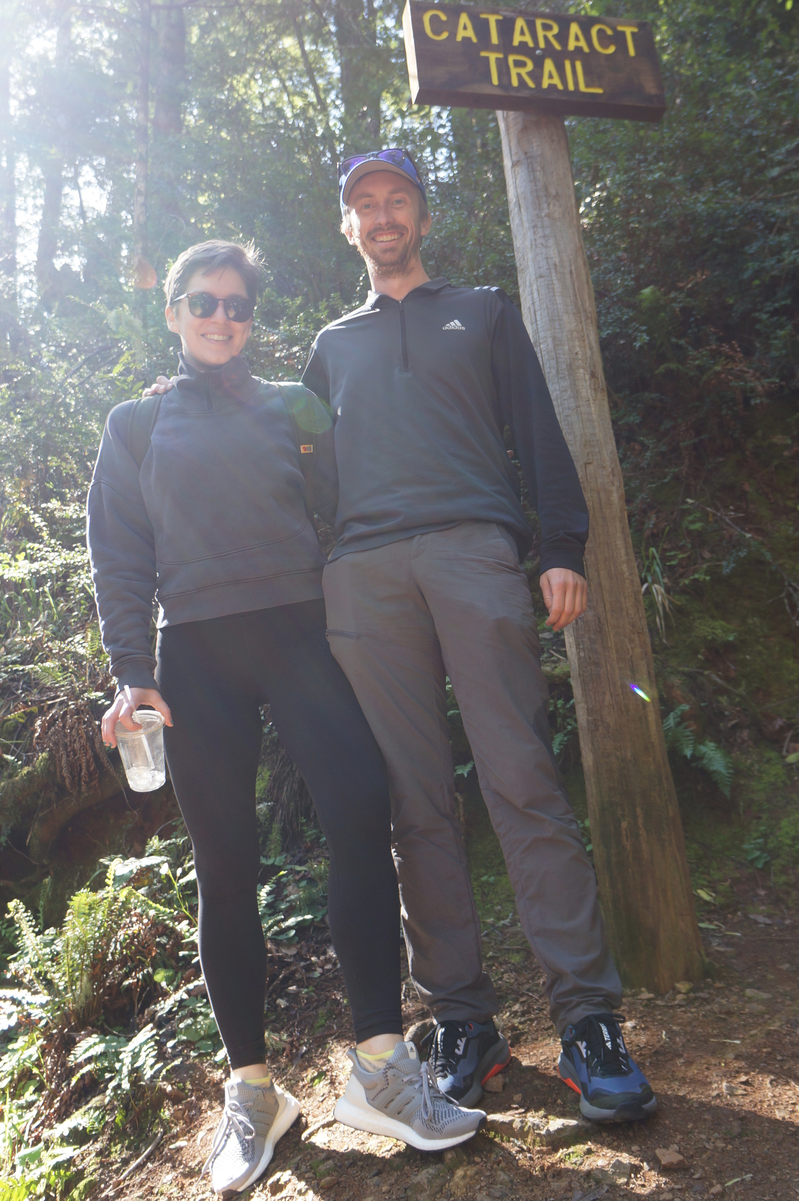
Described as “very rugged and demanding,” the stair-master challenge that is the Cataract Trail is nonetheless one of the most popular and rewarding hikes in the Bay Area’s Marin County. The well-trodden path follows the rumbling waters of Cataract Creek, which originates on the slopes of Mount Tamalpais and terminates at Alpine Lake, a man-made reservoir in the Marin Municipal Water District’s Mount Tamalpais Watershed. Along the way—at least in the wet season of winter and spring—travelers are greeted by majestic waterfalls, one after another, and a lush forest of ferns, coast redwoods, tanoak, bay laurel, and Douglas fir. The Cataract Trail (or Cataract Falls Trail) extends nearly three miles from Alpine Lake to the Rock Spring parking area on Bolinas Ridge; however, the bottom half is most interesting, and thus the focus of this hike. The description below covers a trek from Alpine Lake to the meadows at Laurel Dell, with a short loop portion—combining a portion of Laurel Dell Road and the High Marsh Trail—that features ridgetop views across the watershed.


The hike
There are multiple access points for the Cataract Trail, including the Laurel Dell and Rock Spring parking areas in Mount Tamalpais State Park. However, the preferred option for access to the most impressive stretches of Cataract Creek is to park at the Cataract Trailhead (see map), a sort of makeshift but popular access point along the Bolinas-Fairfax Road, just south of Alpine Dam. The parking area is nestled in a lush gully just above the lakeshore, and there are a pair of portable toilets; parking—on the road shoulder—can be tight and fills up quite quickly on weekends, so arriving early in the morning (or perhaps late in the afternoon) is a must.
Note: This hike was facilitated in part by a collaboration with adidas. We used the opportunity to try out our new Terrex Trail Riders and Ultraboost 1.0 running shoes, which were provided as gifts as part of the collaboration.
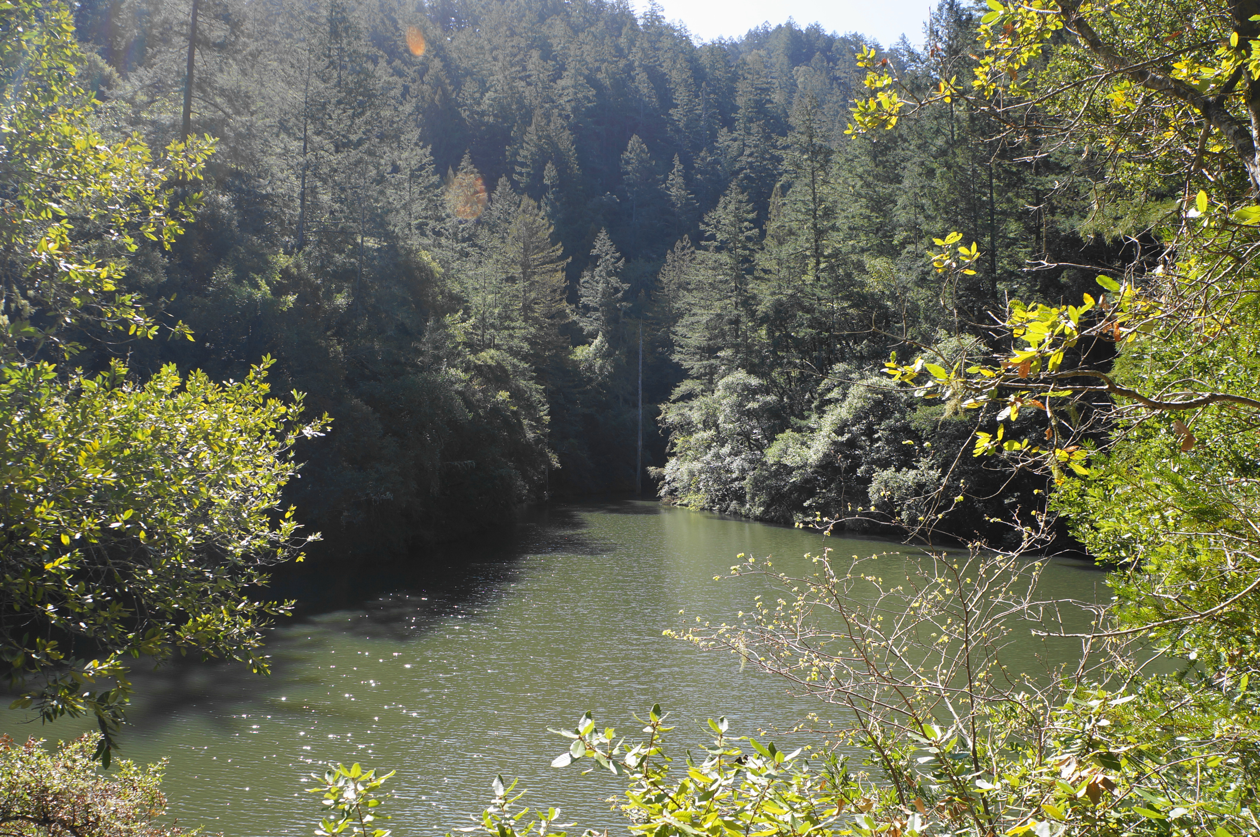
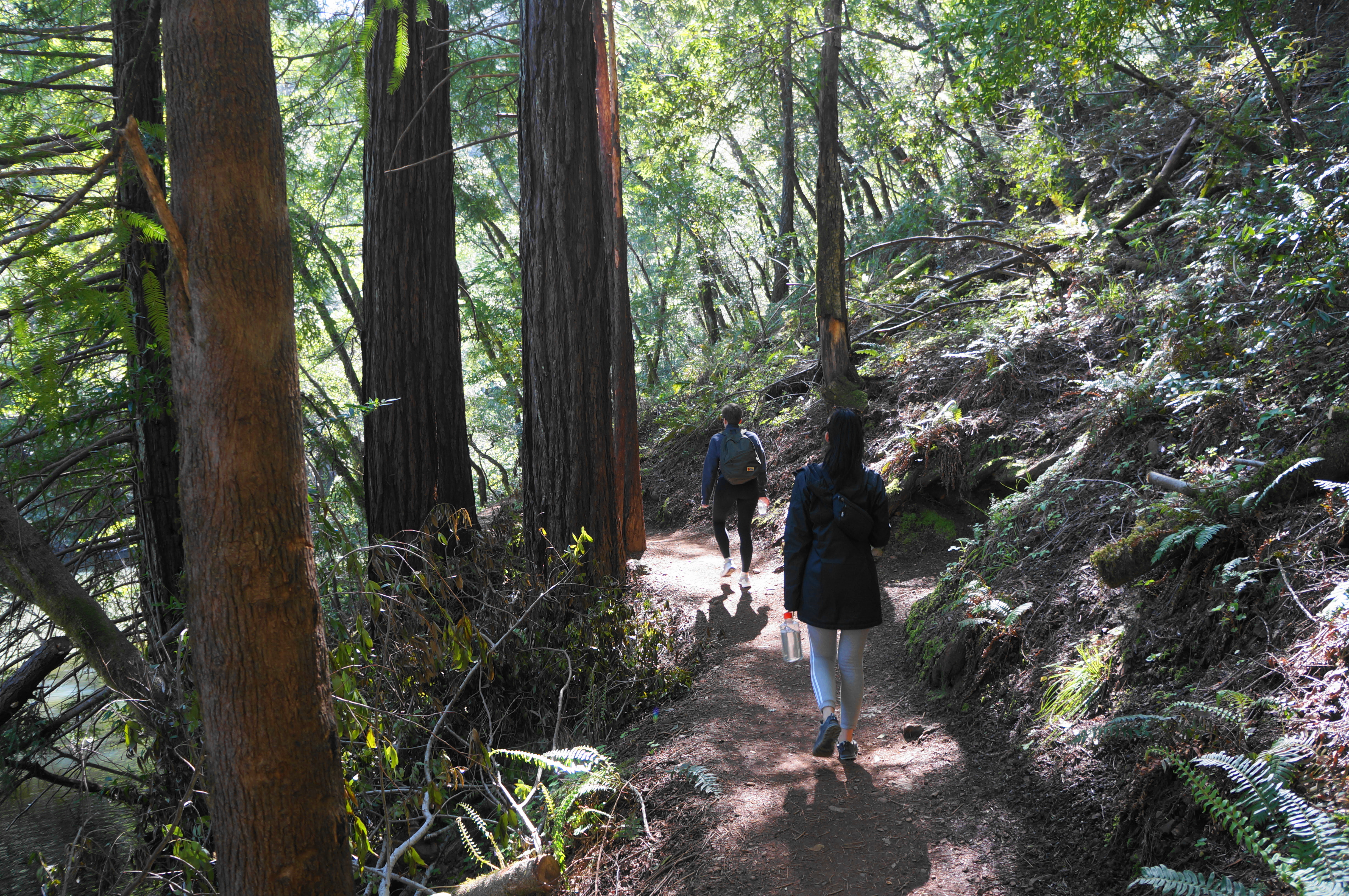
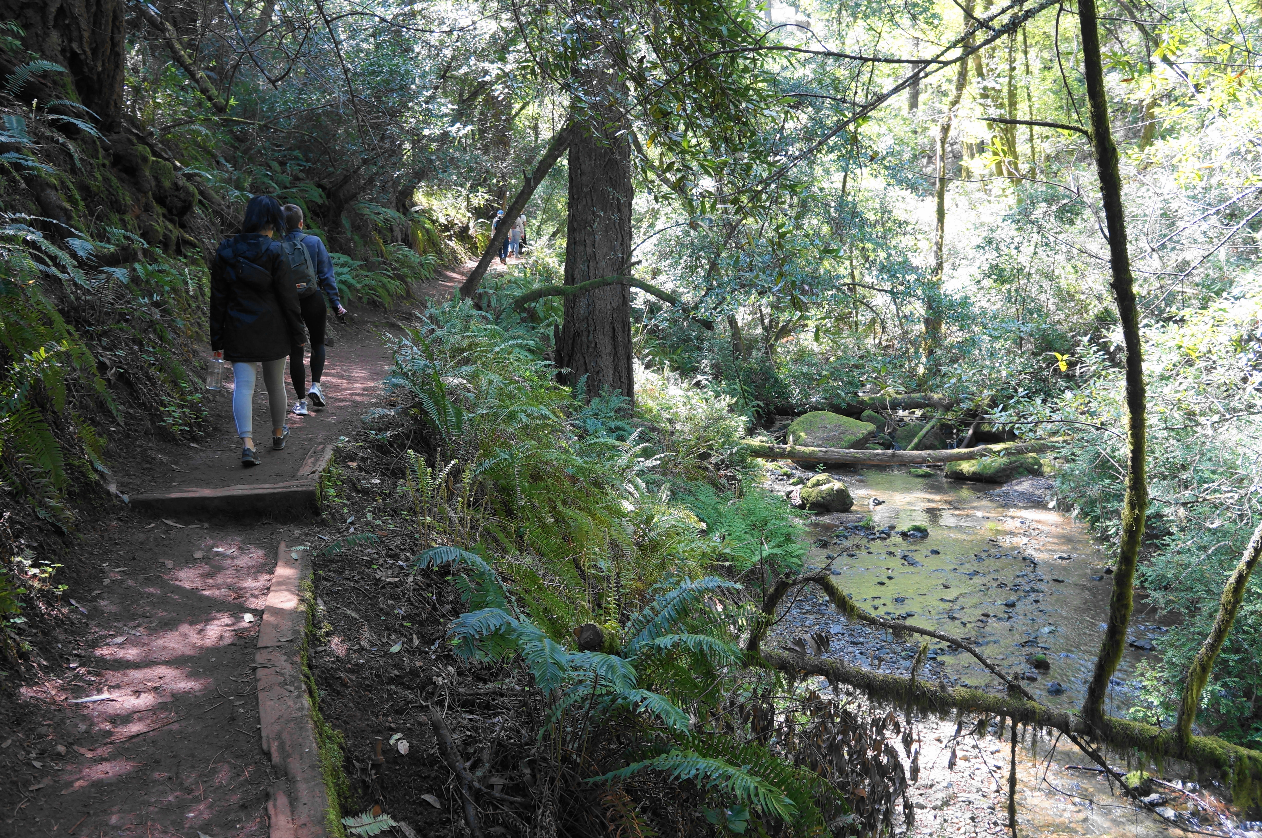
A trail post and sign mark the start of the trail, initially wide and mild as it flanks a moss-laden wall on the right and drops to the shores of Alpine Lake on the left. The reservoir was dammed in 1917 to provide drinking water for Marin residents and today doubles as a recreation area. The waters in the southern inlet here tend to be murky but gleam turquoise-green in the partial sun. After 1/10 mile, the Cataract Trail skirts a small cove, traverses a short bridge over a tumbling tributary stream, and ascends a short staircase before levelling again.

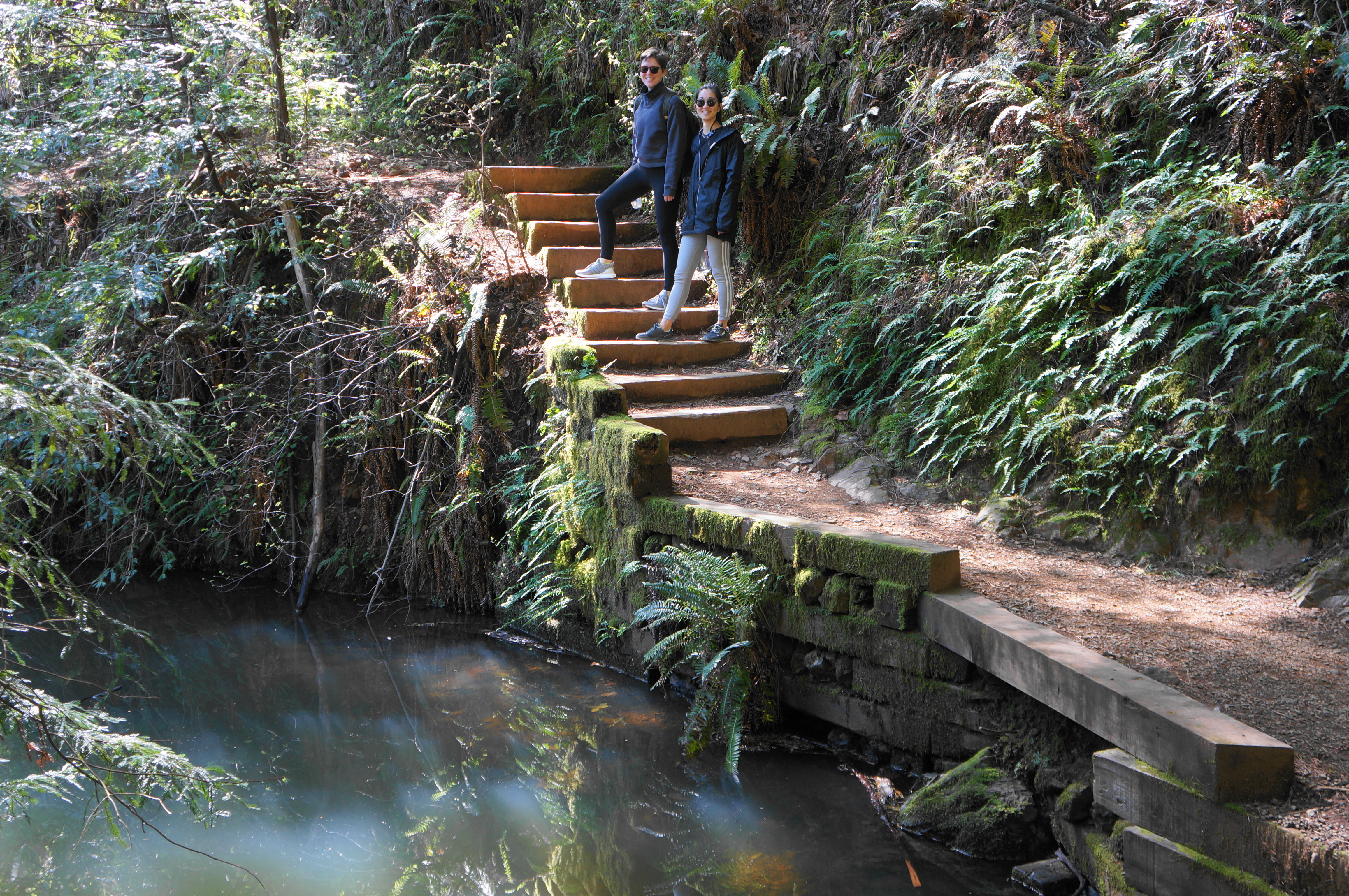
Enjoy the thicker second-growth redwoods as the trail continues southward along the reservoir, and ascend another staircase with a wooden railing, soon coming to the southern end of Alpine Lake. From here the path follows Cataract Creek, which boasts an initial set of small cascades down to the right that is popular with photographers. Stay on the narrower path as it begins to climb more steadily, coming to the first set of significant cascades on the left at about 3/10 mile. Here a tributary also converges with the main drainage and is crossed partway up a steep, stone staircase.

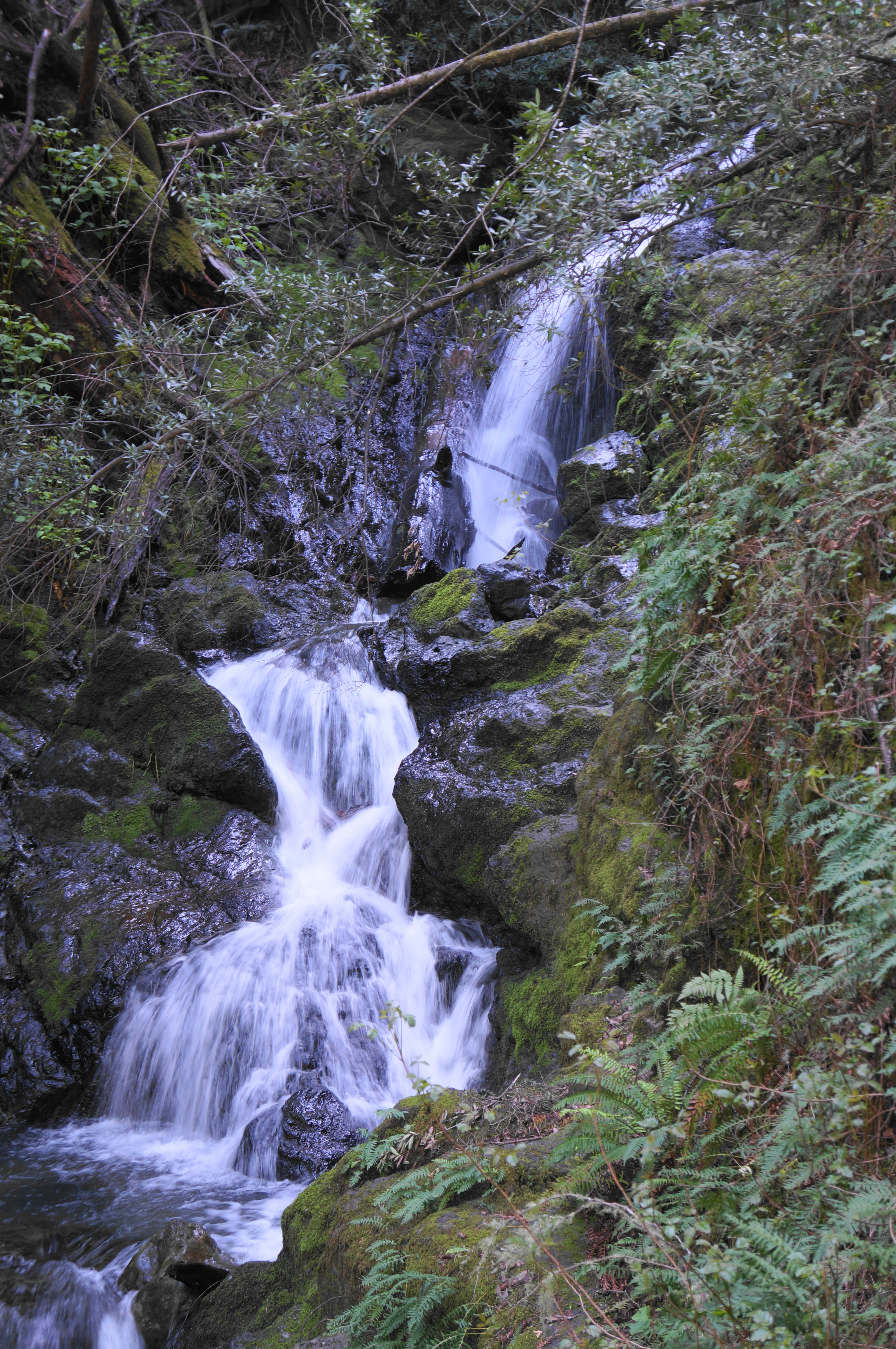
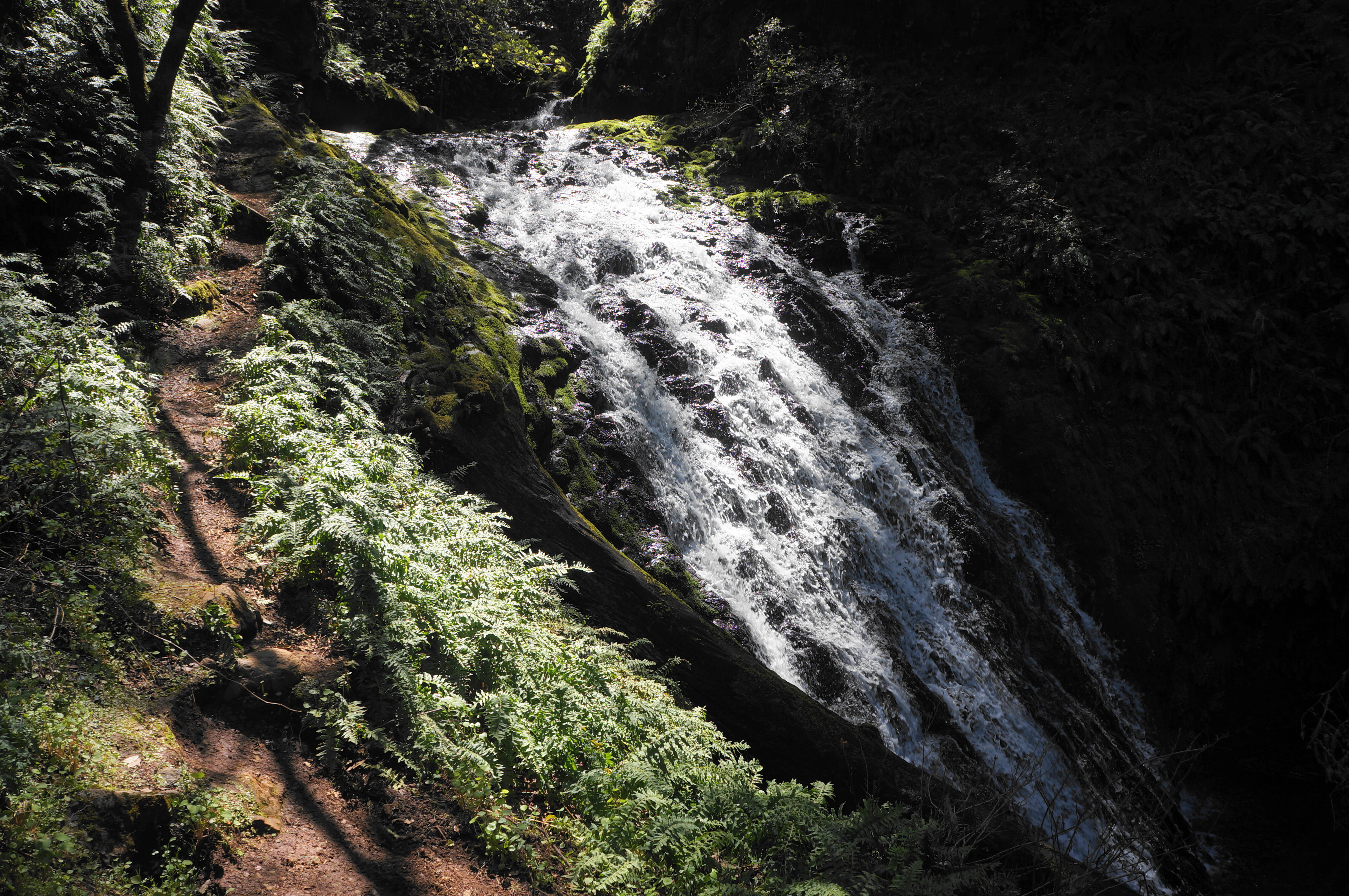
The stone and wooden steps continue thereafter, and the trail rises to a taller, 20-foot cascade that is partly obscured by the overhanging bay laurel. A wooden fence prevents hikers from approaching the creek’s banks, which are notoriously slippery.

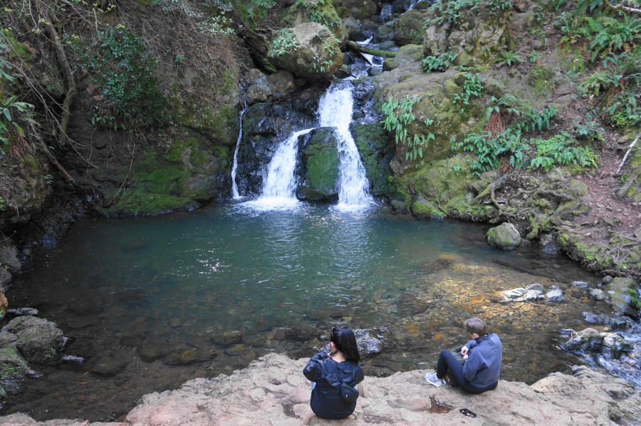
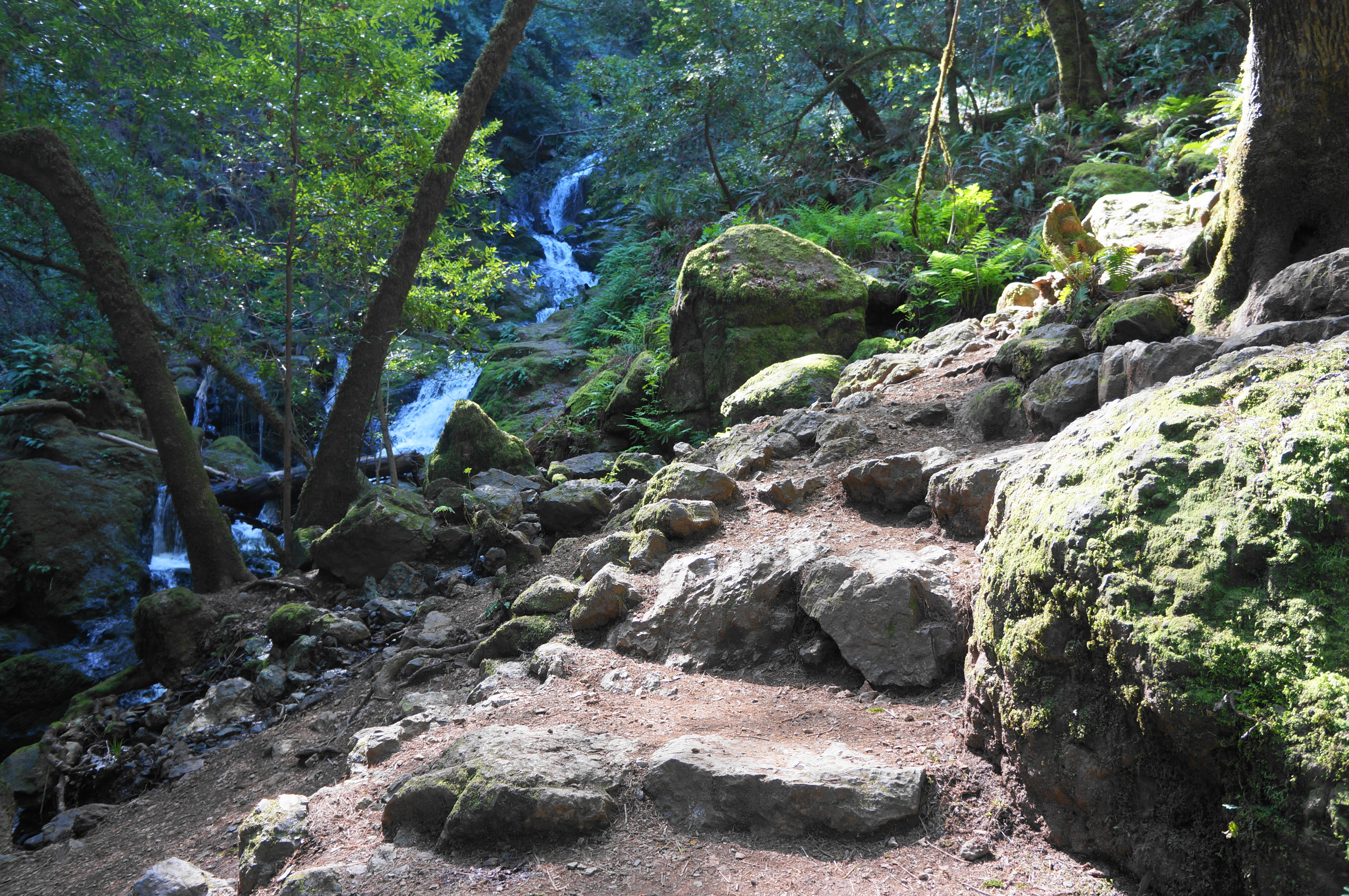
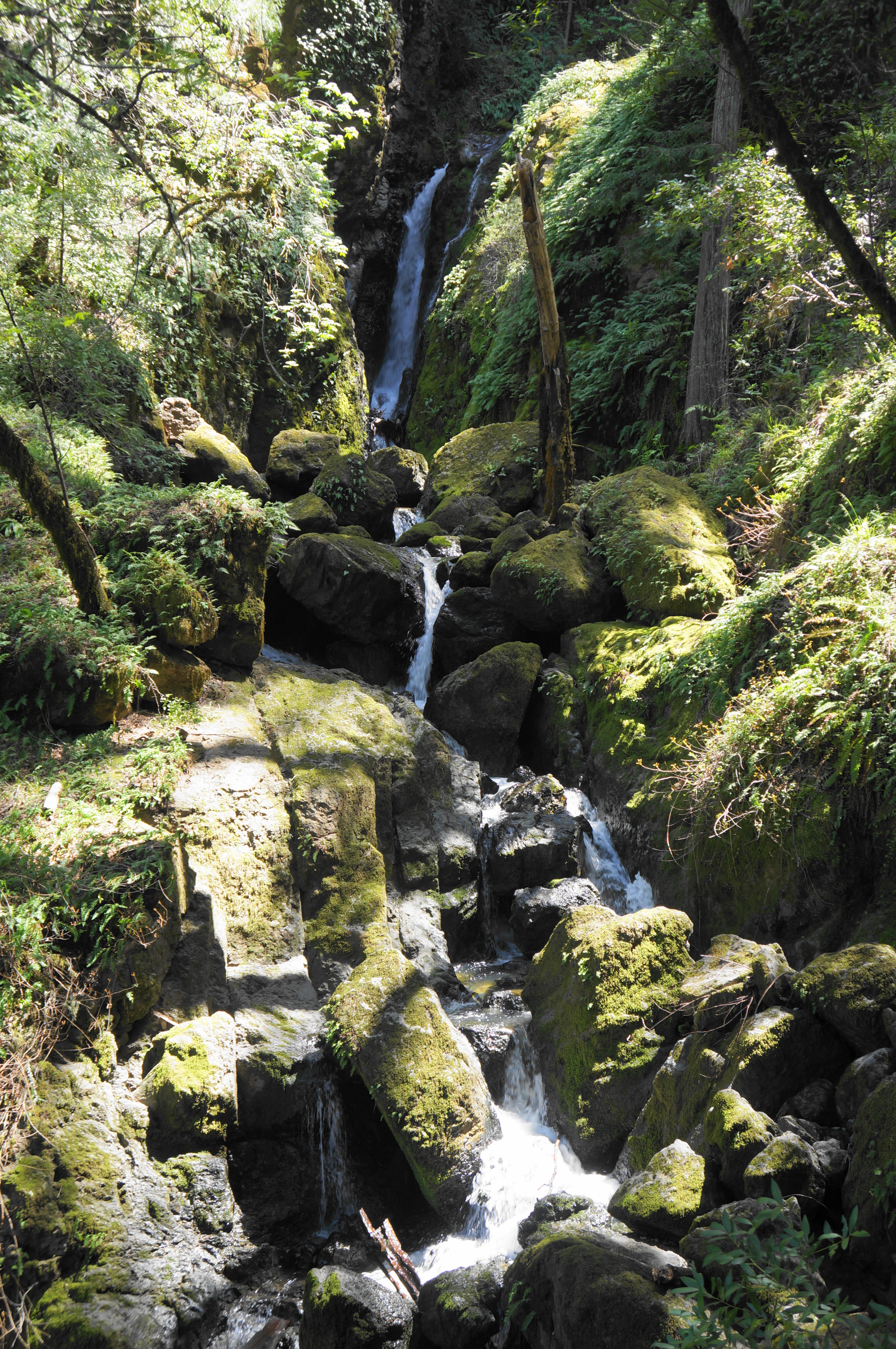
Another winding stair leads to a fenced viewpoint of what is listed on some maps as the proper Cataract Falls. Here the creek tumbles down a narrow chute into a wider, fern-laden passage. The views of the highest drop are distant but unobscured, making this drop arguably the most impressive on the whole hike. Take a breather here before heading on.
The stair-master continues as the path switchbacks briefly away from the creek, then rising back to a spot parallel to the falls. At about 6/10 mile, the Cataract Trail traverses a long, wooden bridge over the creek, with more cascades visible upstream to the right. Round a left-hand bend and rise steeply up the east bank, cresting an outcrop with onward views down to a small but lovely falls and glossy pool. This spot is sometimes known as Helen Markt Falls and makes for a nice snack spot and, if warm enough, a swimming hole.


Steps beyond the view of these falls, the hike comes to its first junction. Bearing left takes one on the Helen Markt Trail, which is sometimes combined with other tracks to form a much longer loop. The Cataract Trail, however, continues right, quickly finding the creek again.

After a brief uphill, the incline soon mellows out, reflecting also the mood of the stream, which here is much slower-flowing and rippling in small pools. This much-appreciated level section lulls hikers into thinking the waterfalls—and climbing—might be over, but soon enough, the slope resumes and scenery returns to match that of the initial 6/10-mile section.

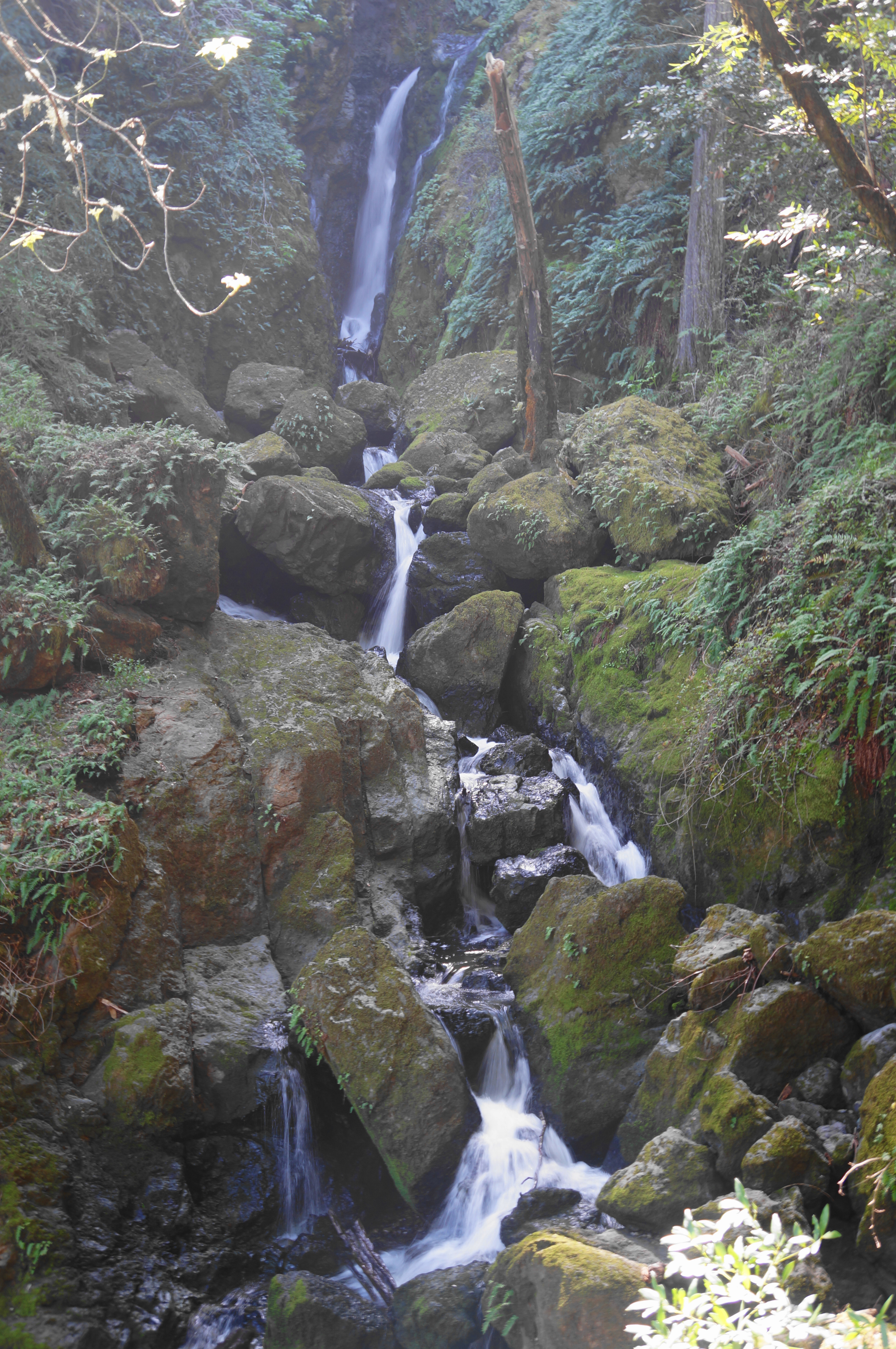
Ascend a set of wooden stairs at about 8/10 mile, then drop to a spur trail, which is worth taking and leads one to a significant waterfall, listed as Midway Falls. This drop, at around 25 feet, is the highest encountered yet.
When ready, return to the main track, which soon passes other cascades and enticing pools—but most are blocked off for restoration and safety purposes. At around 1.1 miles, hikers will reach another particularly pretty area with multitudinous cascades, followed by a set of switchbacks that culminates at a bench on the left. From here it is a short walk to a junction, where a set of steps leads down to another pleasant pool fed by small cataracts.

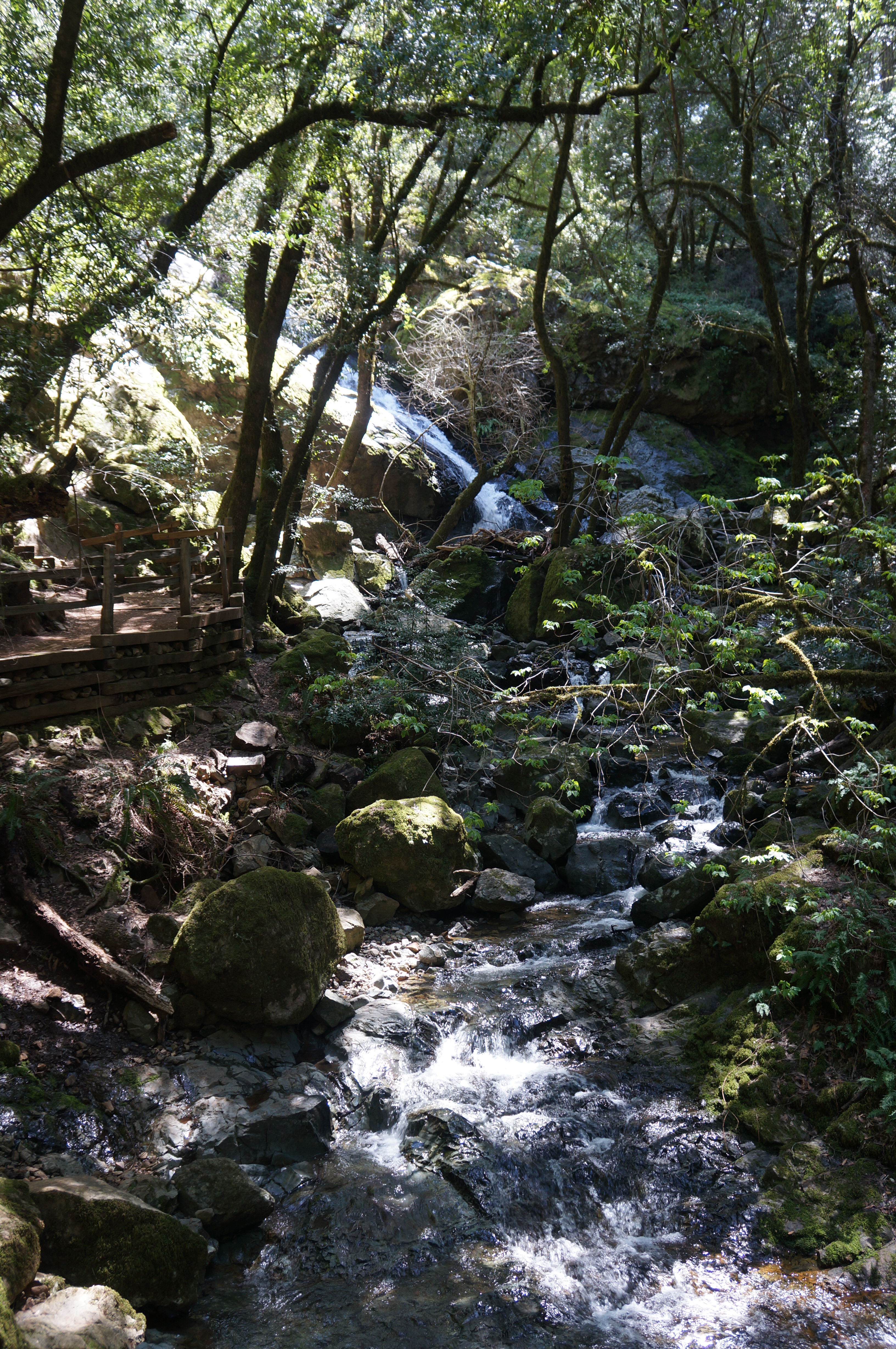
Back on the main trail again, continue upstream and come soon to an obscured overlook of Laurel Dell Falls, a tall chute that is nonetheless largely inaccessible. A wooden fence and restoration signs prevent visitors from reaching the base of the falls.
Soon the trail turns away from the falls and rounds up a slope to a signed junction at 1.2 miles. Hikers can turn around here and return to the start. But curious wanderers will likely want to push a little further, and thus take on the proposed loop portion that begins at this fork.
Start by heading right, coming after about 250 yards to a suddenly open area known as Laurel Dell, where there are picnic tables in the shade of the redwoods and several open meadows. This pretty spot is a way station on several hikes in the area, and there are a pair of pit toilets that hikes can use.

Stop for a picnic here, or continue the loop section but heading left on the gravel Laurel Dell Road. This mellow track heads north through fir and tan oak forest for 2/10 mile to a junction with the 75 Yard Trail. Take a left on this path and walk for—wait for it—75 yards until it merges with the High Marsh Trail, where one should head left again, in the direction of Cataract Creek.
The views are initially limited as the High Marsh Trail follows the north-facing slopes of the high ridge. However, they suddenly explode with splendor as one enters an open meadow at the junction with the Bare Knoll Trail at about 1.9 miles. One can see across the watershed for miles, with a tiny portion of Alpine Lake visible, and beyond to Azalea Hill, Pine Mountain, and the northern reaches of the Water District lands.


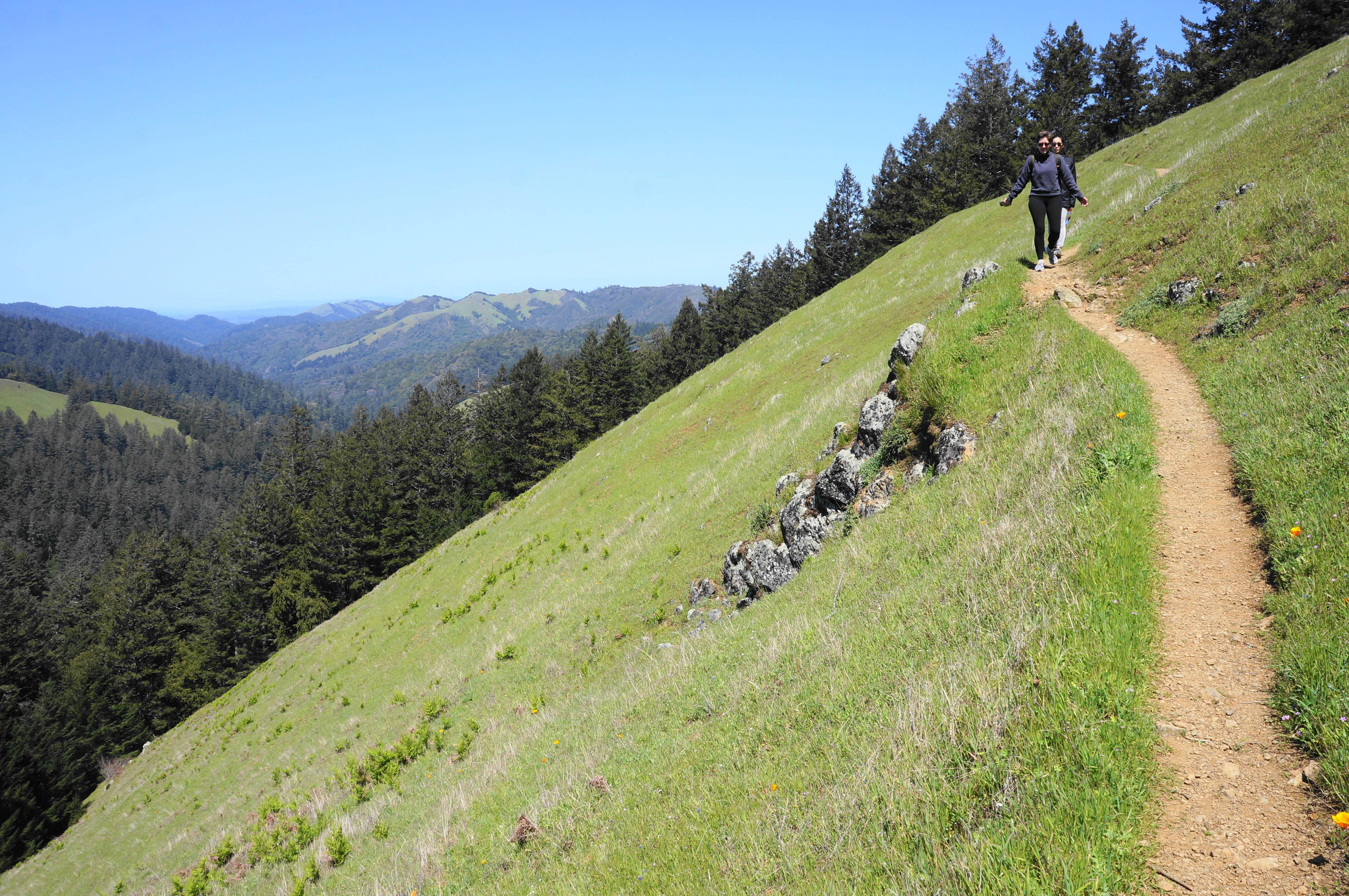
The High Marsh Trail continues straight at the junction and stays in the sun for another ¼ mile, descending mildly but steadily back toward the Cataract Creek drainage. After returning to the woods, it is a quick jaunt back to the start of the loop, where the High Marsh and Cataract Trails converge.
This time head right, embarking on familiar terrain down to Laurel Dell Falls. The rest of the hike retraces the 1.2 miles already completed on the Cataract Trail, but new angles offer perhaps different views not noticed on the way up. The out-and-back culminates back at the trailhead along Bolinas-Fairfax Road, where your car awaits.

Nice shoes!
Pingback: Top 10 Hikes in 2023 | Live and Let Hike
Excellent, detailed information and well written. I recently went to Cataract Falls and the trail was too precarious for me. Rock Spring/Laura Dell entrance near the dam. It was supposed to be easy for beginners. I’m not sure if there is a better access point. I’ll check out the map. Beautiful photos! Thank you for your wonderful article and sharing your experience.