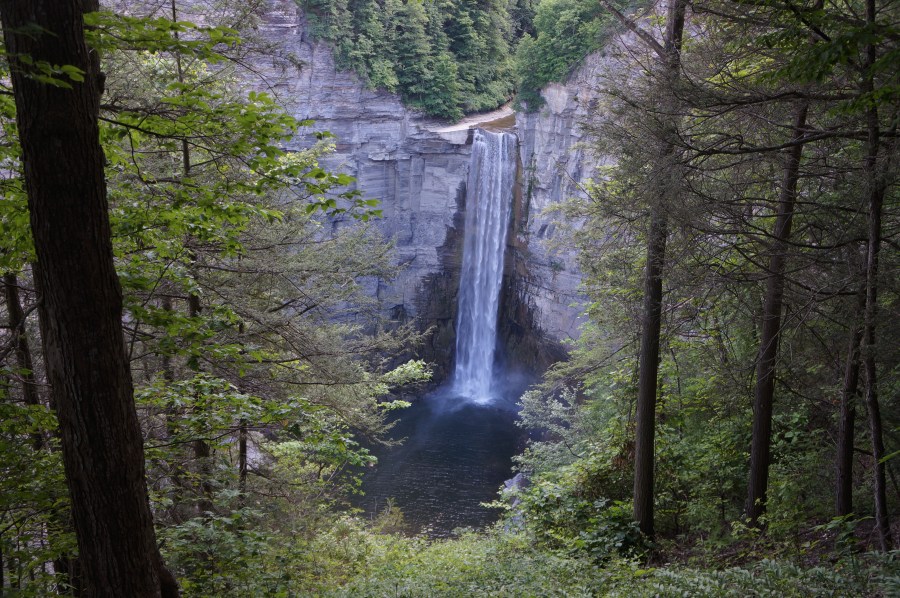
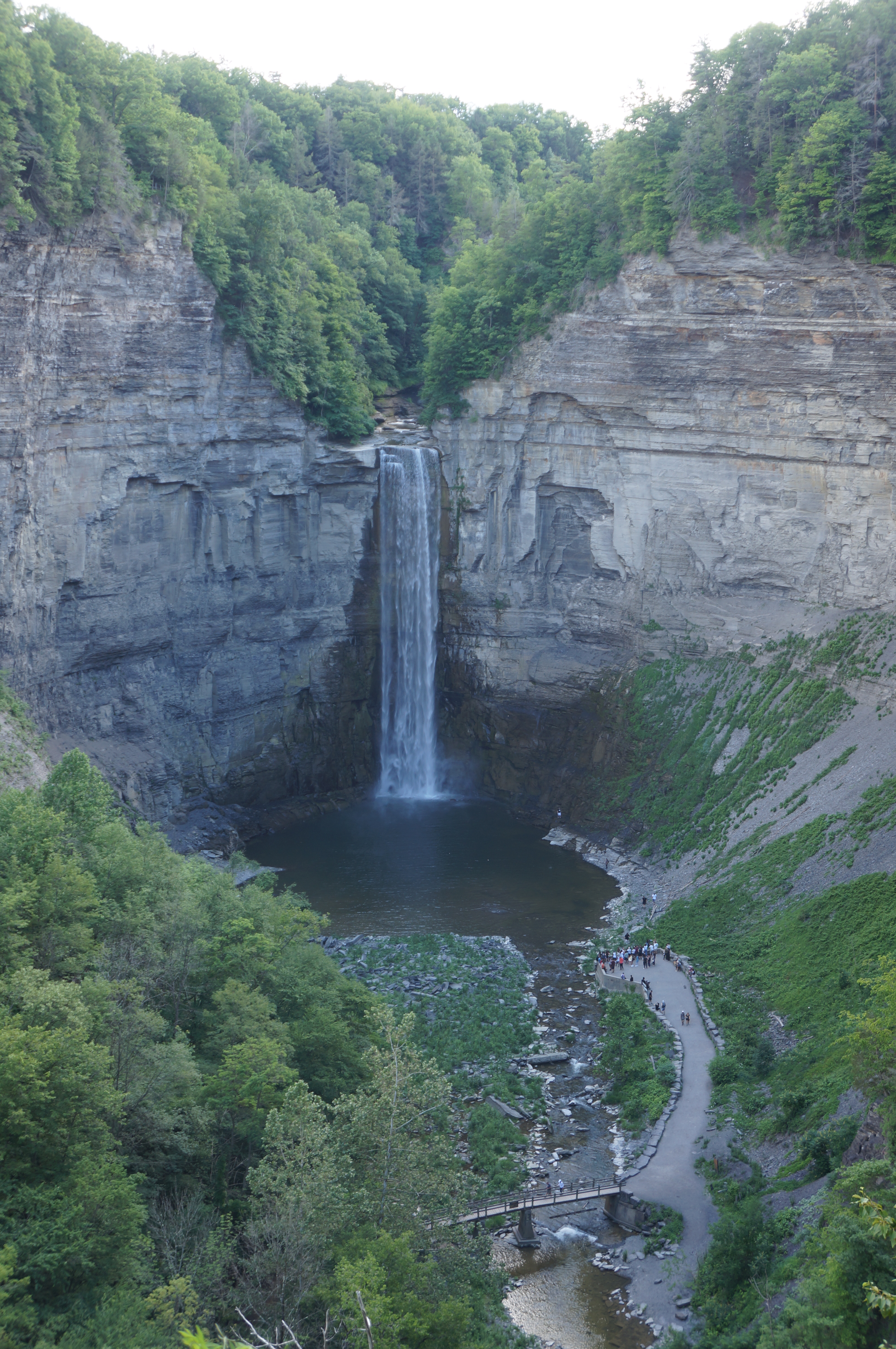
At 215 feet tall, Taughannock Falls in central New York is the tallest single-drop waterfall in the northeast United States, boasting a height that exceeds even the nearby—but much more-famous—Niagara Falls. Taughannock Falls is the centerpiece of a state park bearing its name that is popular for hiking but also swimming and boating on Cayuga Lake, the second-largest of the 11 Finger Lakes. While most hikers in this Ithaca-area park will take the highly-trafficked Gorge Trail to the base of the main falls, the longer North Rim – South Rim Trail combination offers a better workout, fewer crowds, and a look at a bonus waterfall—the 58-foot Upper Falls—along the way. Plan to spend around 1.5-2.5 hours encircling Taughannock Gorge on this moderately-challenging circuit.

The hike
Like many of the other gorges in the Ithaca, the sudden appearance of a 400-foot glacial-carved incision, culminating in a plain at the banks of Cayuga Lake, comes as a bit of a surprise. The drive on New York Route 89 along the lake from Ithaca is mostly surrounded by shady deciduous trees and lakeshore homes, until it approaches Taughannock Creek and a peninsula called Taughannock Point. Many of the masses will turn right (if coming from Ithaca) to the beaches and boat launch at Cayuga Lake, but the main hiking trailhead is on the left, through a small entrance station, where a $9 fee is assessed. Arrive early to get a spot at this small, coveted parking area—or park across the street in the larger lots by the lake.

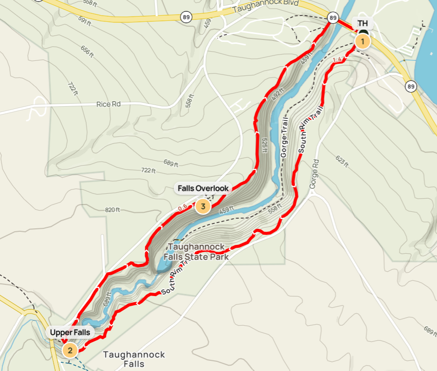
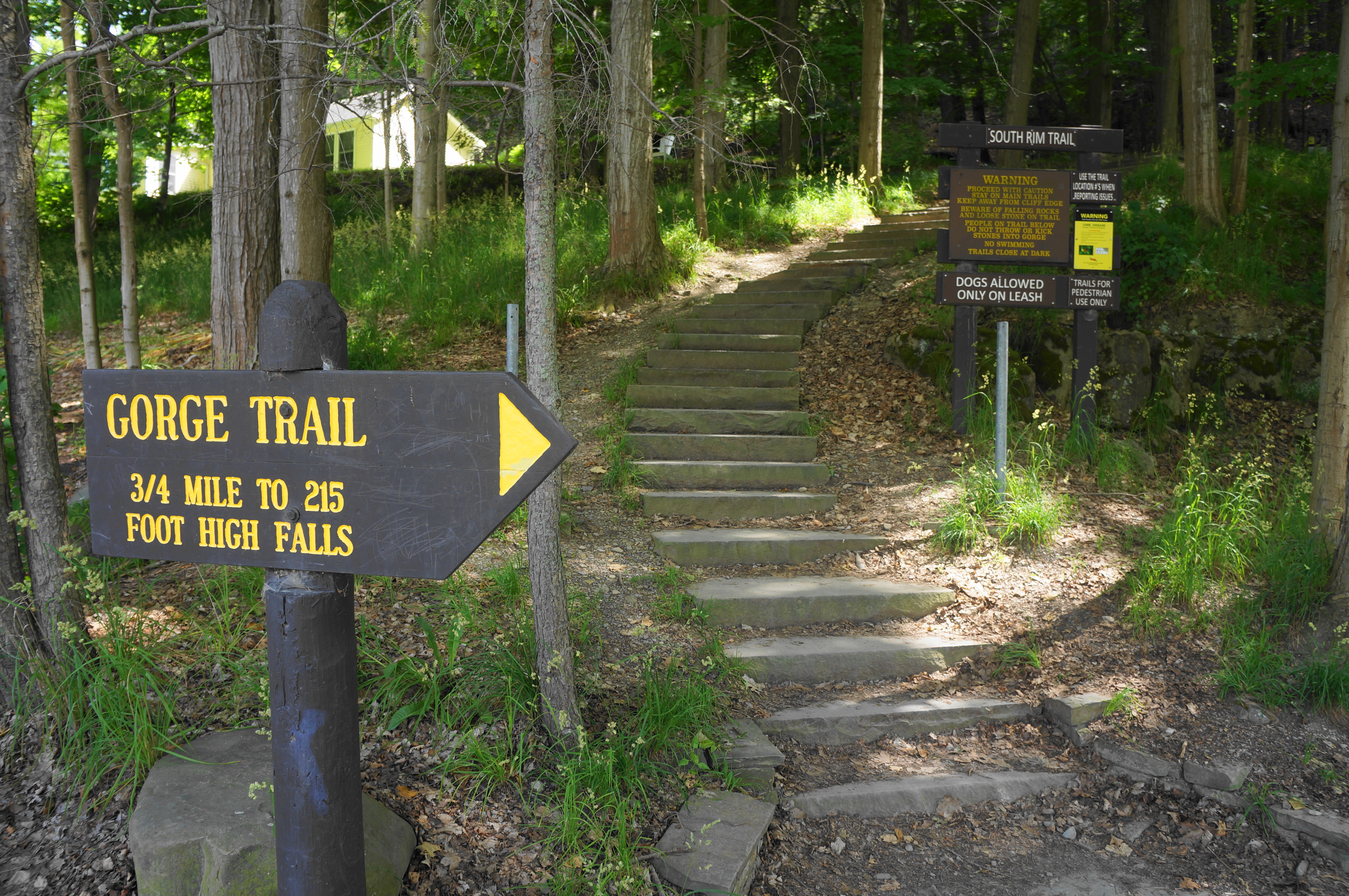
Both the Gorge Trail and South Rim Trail take off from the parking area, with the latter beginning immediately with a set of three staircases that may scare away hikers seeking a leisurely stroll. Head uphill and pass a cul-de-sac on the left, waving to any visitors at the rustic Inn at Taughannock Falls. After the second staircase, the trail weaves closer to the canyon rim, roughly above Lower Falls, a small cataract best viewed on the Gorge Trail below.
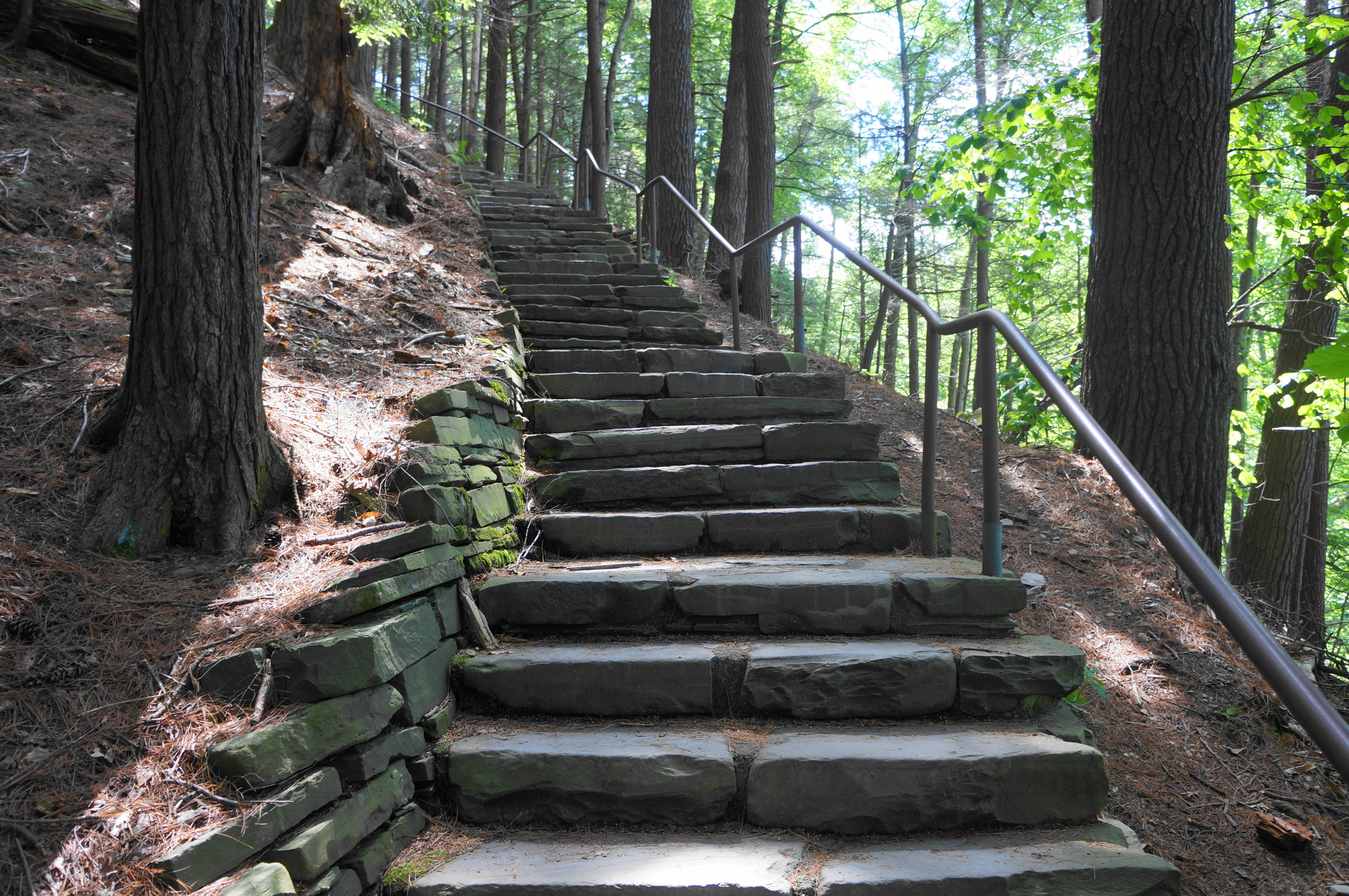
Head up the third—and longest—stone stair-master (with a brief landing 2/3 of the way up), then catch your breath after what is the hardest climb of the entire 3-mile hike. From here the hike becomes considerably mellower, and the distant hum of the highway falls away.
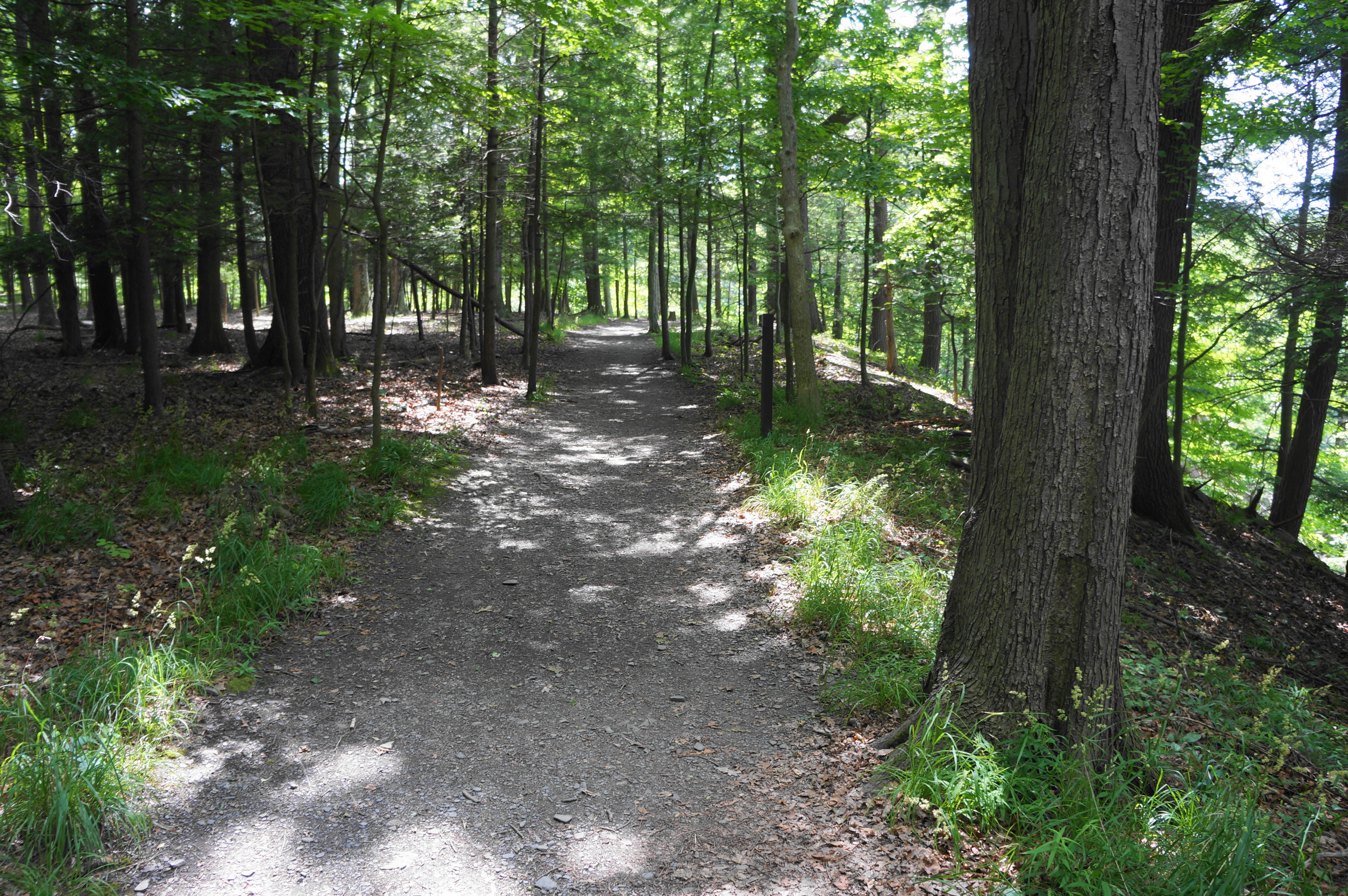
The South Rim is less scenic than the North Rim due to a relative lack of vantage points, but the walk through the mixed deciduous-coniferous forest and the allure of what’s to come is pleasant enough to keep hikers entertained. Skirt a fence and cliff section on the right at about 0.35 miles, then proceed into another uphill stretch, this one much milder than the initial ascent. By 4/10 mile, there is one very distant view of the top of Taughannock Falls—but not enough to spoil the surprise for when it is viewed in full along the North Rim later on.
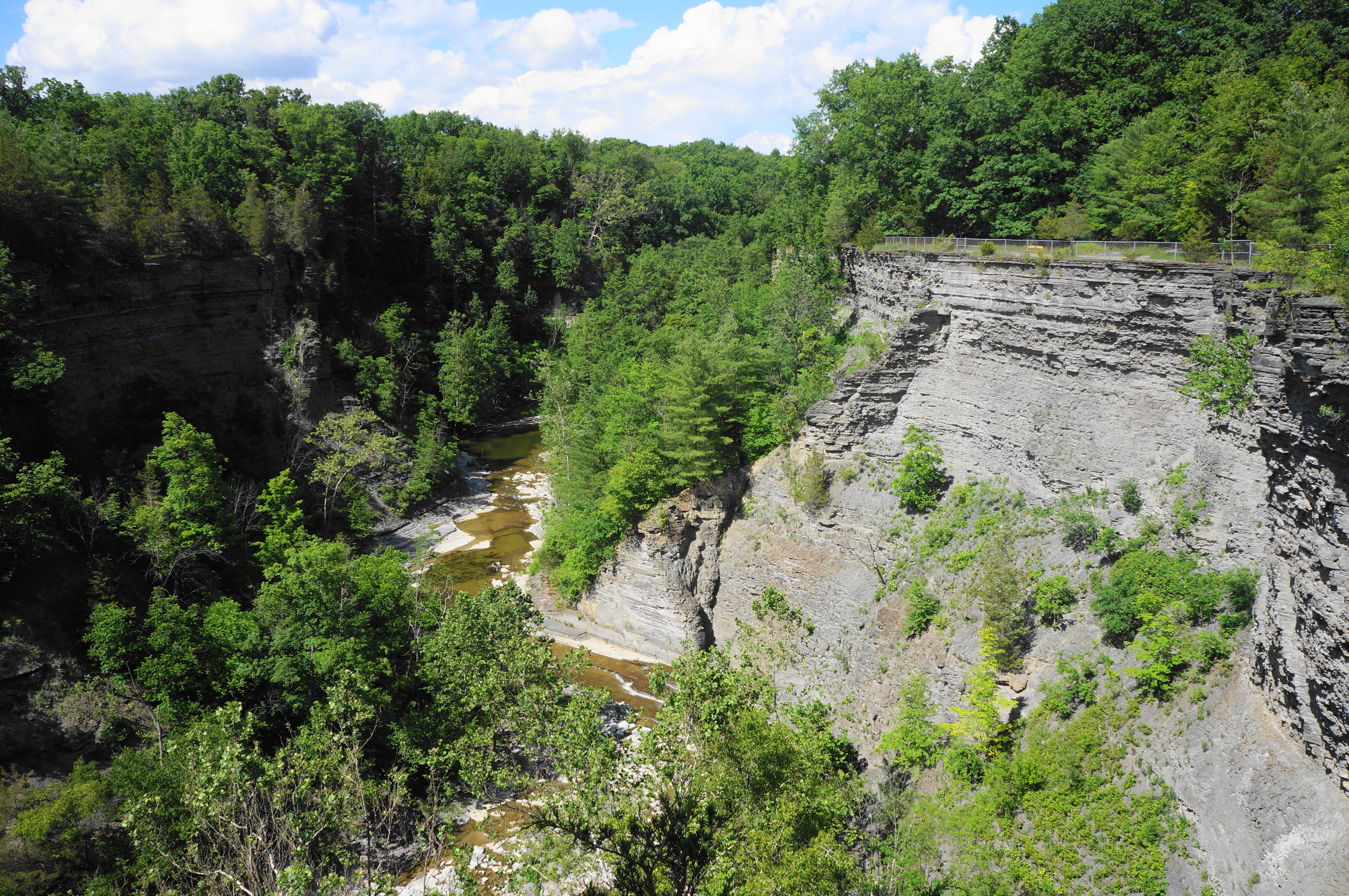
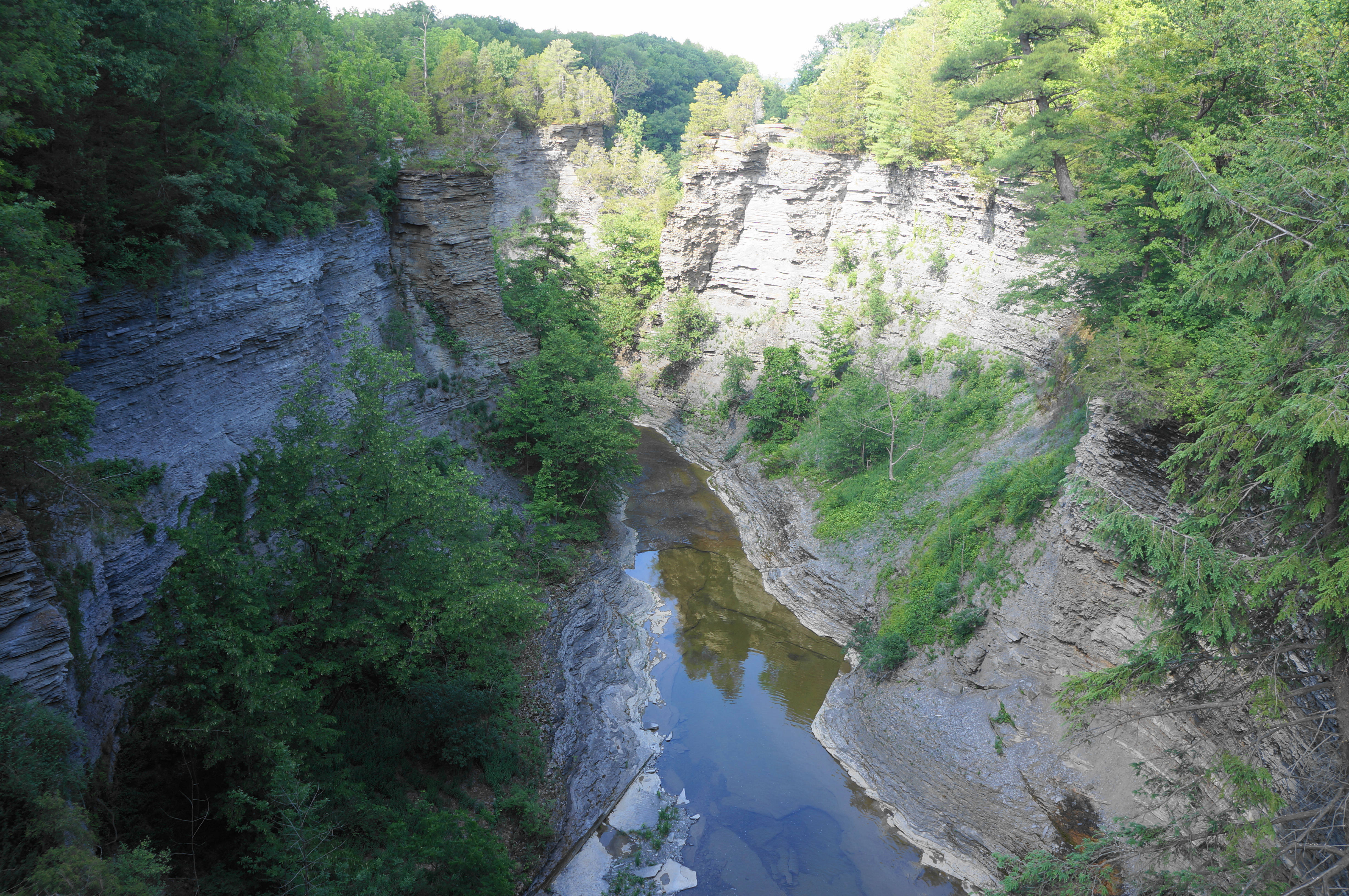
This is a decent time, however, to reflect on how the glacially-carved gorge was made: the sedimentary rocks that make up the canyon (sandstone, shale, and limestone) were laid during the Devonian era around 380 million years ago; tectonic pressure, jointing, and glacial activity set the stage for the creation of Taughannock Gorge, but much of the canyon was produced by erosion in the last 10,000 years. Water and ice carved deep clefts in the foundation rock, producing the high, 400-foot walls seen today.
At ½ mile, the trail comes within striking distance of Gorge Road, and one can see a red barn across the street. A bench at 6/10 mile faces down-canyon with some limited views, then the South Rim Trail comes parallel with Gorge Road and follows the shoulder for a short period. Pass a small parking area at 7/10 mile, after which the trail pulls away from the road again, tending closer to the rim.
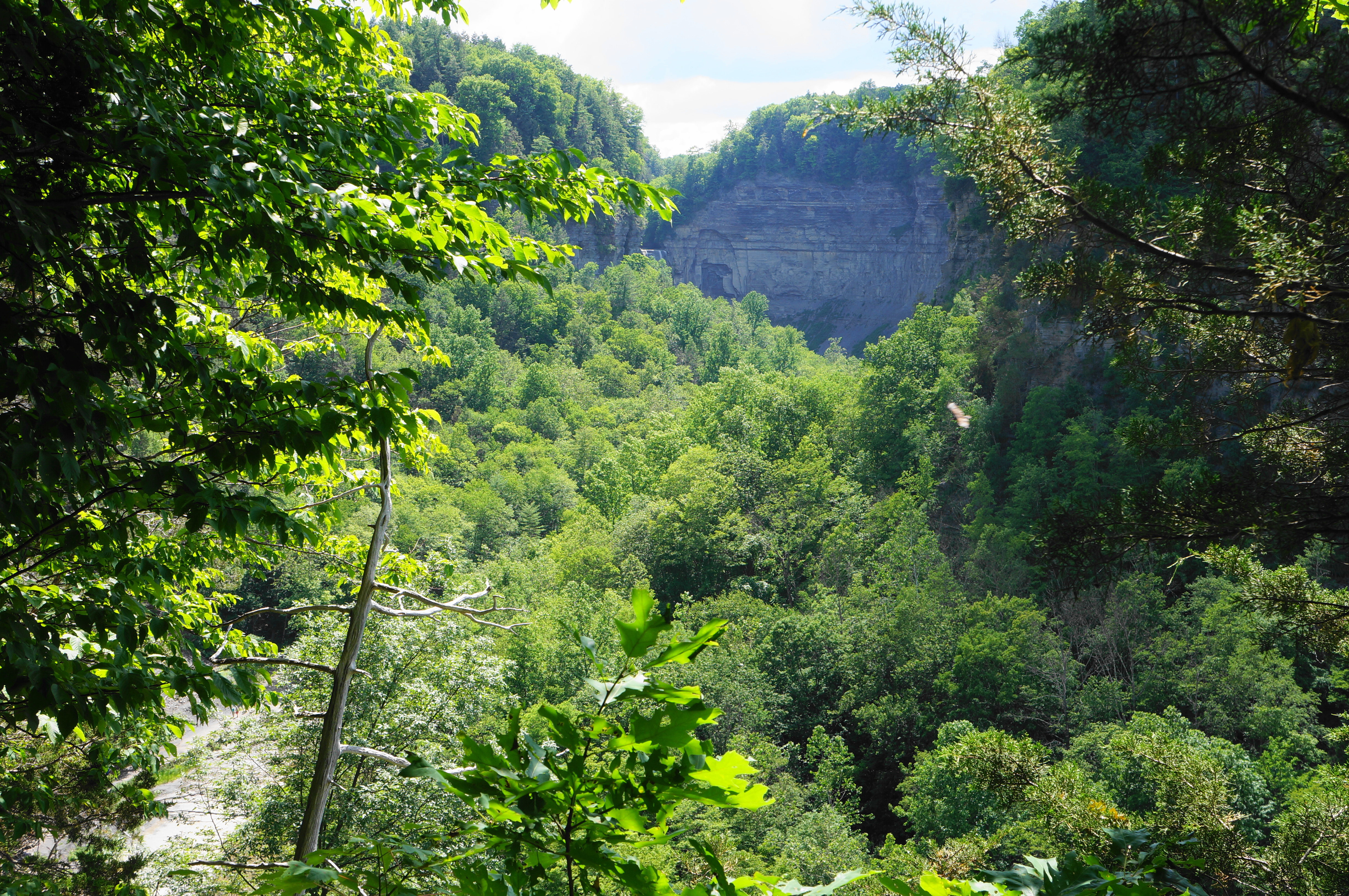
By now hikers are coming even with Taughannock Falls—but the dense tree cover and awkward angles prevent a view of the mighty cataract. Instead the South Rim Trail passes quickly on to the upper canyon, where there is an unmarked junction at 1.15 miles. Bear right, coming suddenly out to a sunny shelf with unobstructed views down into Taughannock Gorge. Here the iron-tinged creek flows around a bend, dropping at one point down a 3- or 4-foot cascade into a transient pool. The shale walls, though, are the showstoppers, dropping precipitously nearly a hundred feet to the canyon floor.


The sunny shelf continues for about 100 yards until the trail returns to the woods. However, it is a quick jaunt to a shady spur, with culminates at another scenic view down-canyon. When ready, continue up the South Rim Trail, reaching within 1/10 mile an underpass and junction. Take a left, climbing up to the bridge, which is not a road but a former railroad bridge—now a biker/hiker path—leading to the hike’s first of two bridges over Taughannock Creek.
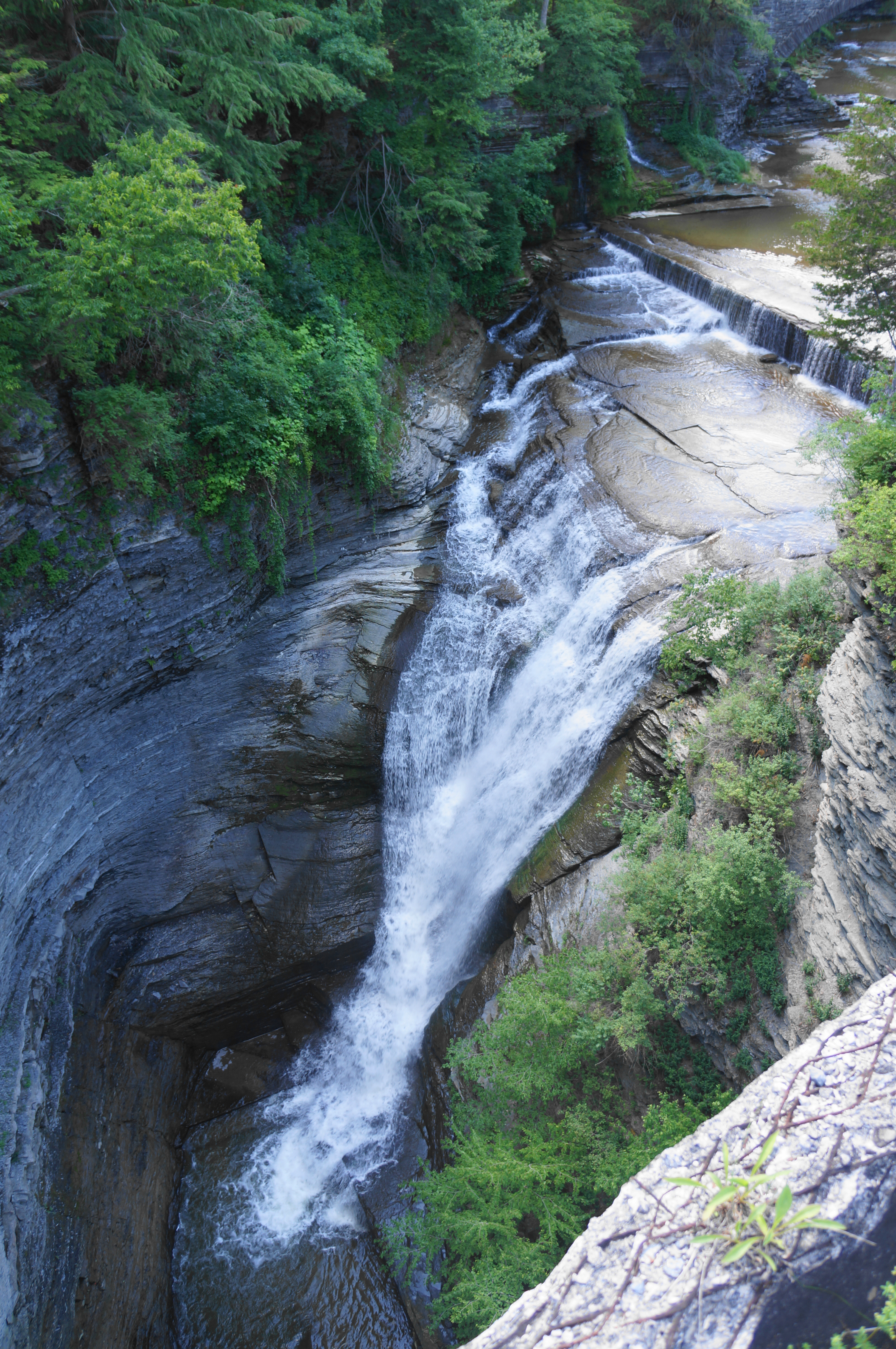
A look down to the left reveals the bonus feature: Upper Taughannock Falls, a powerful, twisting cataract that plunges into a narrow chasm. The unusual angle makes it difficult to capture photos, but the high water volume and thunderous boom makes this a worthy destination in its own right.

After crossing the bridge, round a right-hand turn and start on the North Rim Trail, the more scenic of the two sides of the canyon. The route starts by cutting through a grove of aspens, then parallels Park Road on the left. The path comes even with the drive a second time before returning again to the rim of the canyon. There are no views quite yet, but the North Rim Trail rounds a long bend to come to the lip where Taughannock Falls drops 215 feet. At the two-mile mark, a singular bench offers a picturesque view of the wondrous waterfall—the highest single drop in the American Northeast. This serene spot—if it is not crowded—is even more enjoyable than the official falls overlook to come; it is worth spending time here to take in the beautiful sight.


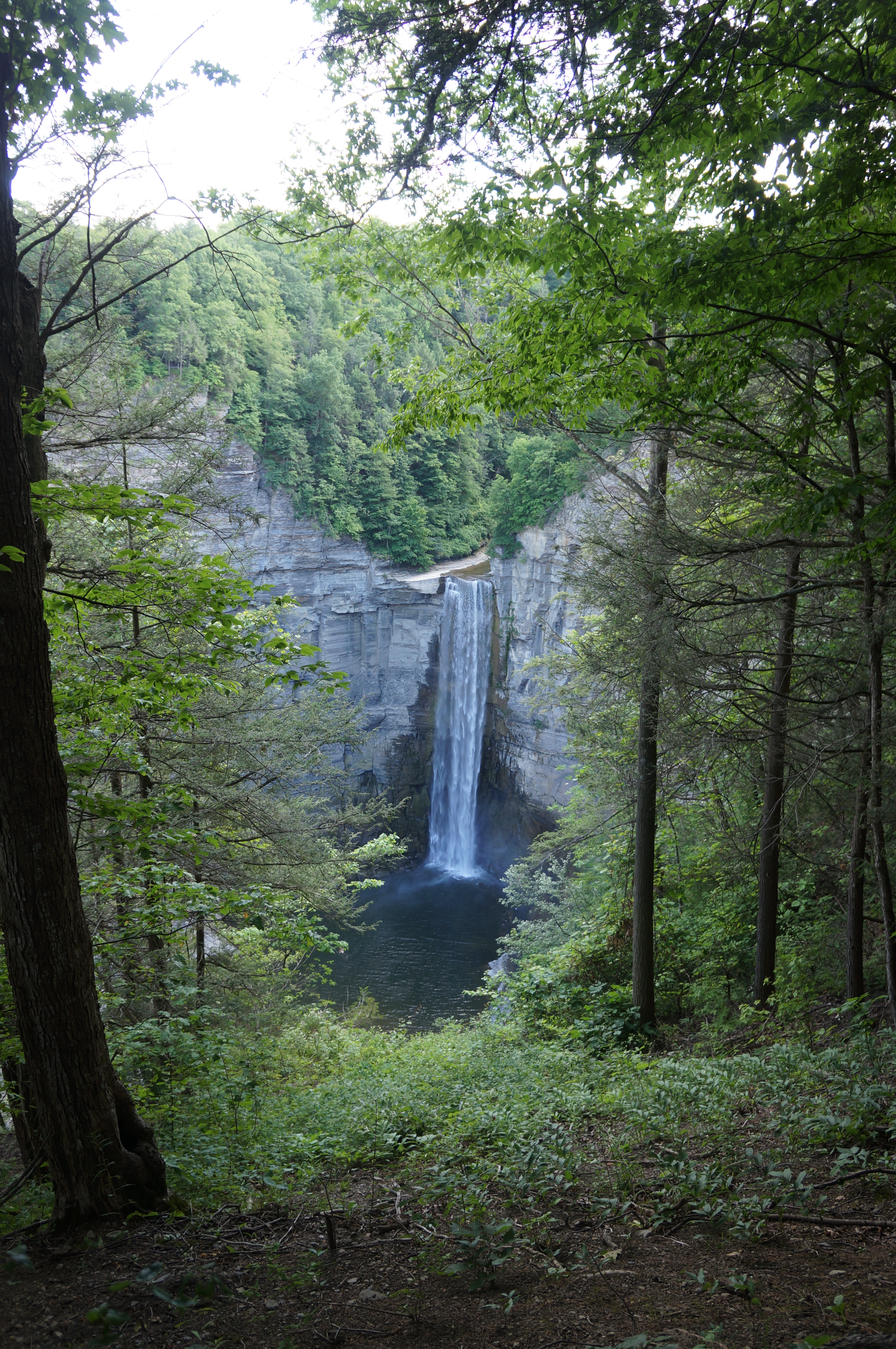
The falls were formed due to a weakness in the shale and relative hardness of the siltstone and sandstone above it, making possible the 200-foot plummet.
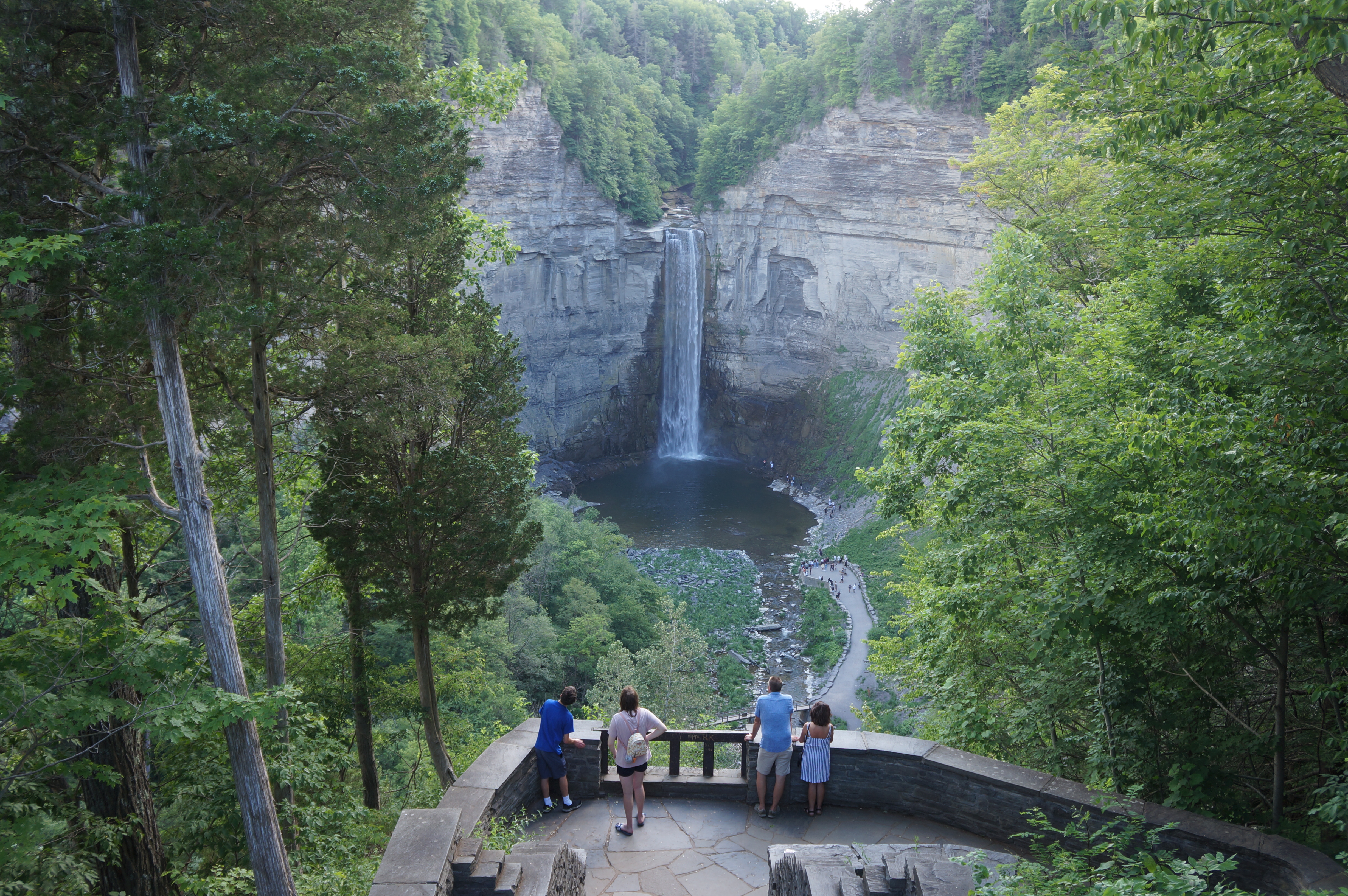
It is a short walk from here to the Falls Overlook, a multi-tiered viewpoint with a majestic view of Taughannock Falls. Several hundred feet below, one can see the end of the Gorge Trail, which culminates at the edge of a pool fed by the mighty waterfall.

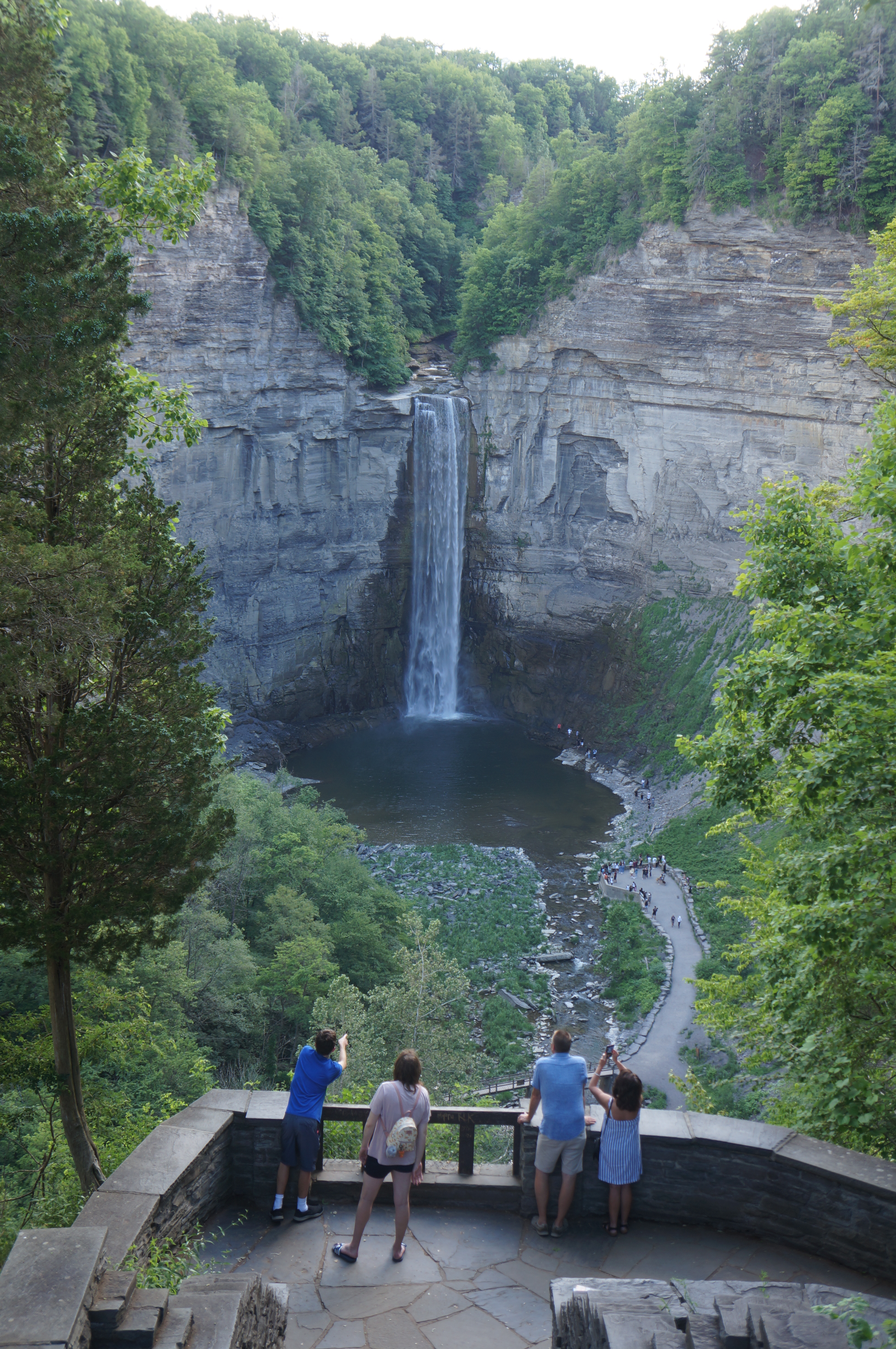
This rim overlook dates to 1850, developed by a local hotelier who ran an inn here, serviced by steam trains and stagecoaches. Today, the viewpoint is more subdued, although the large parking lot, busy sidewalks, and park store make this feels like a Disneyland compared to the sparsely-travelled rim trails.

When ready, resume your walk down the North Rim Trail, heading northwest toward Cayuga Lake. The next section features several vantage points with partly-obscured views down the canyon to the Finger Lake and beyond.
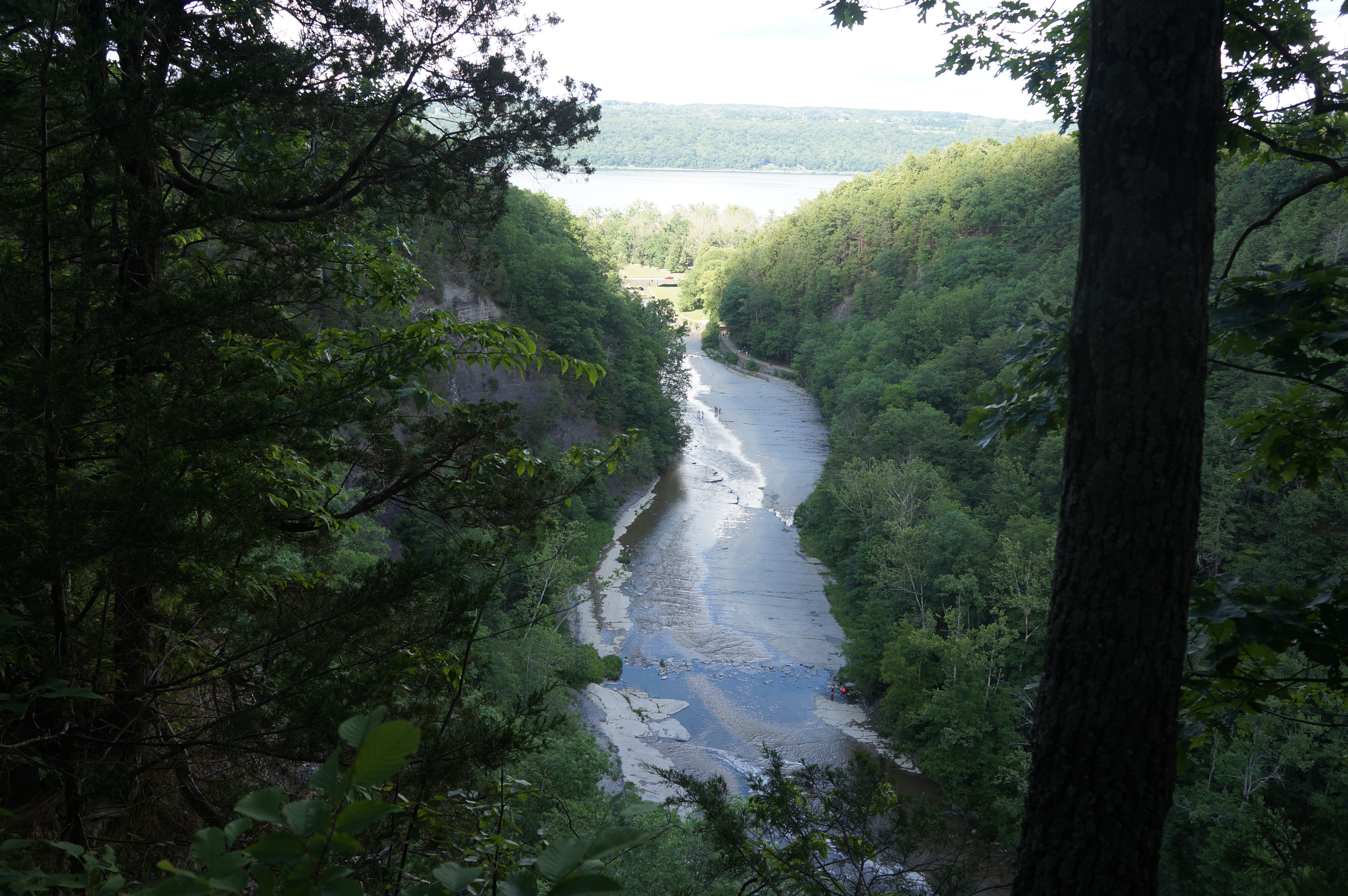
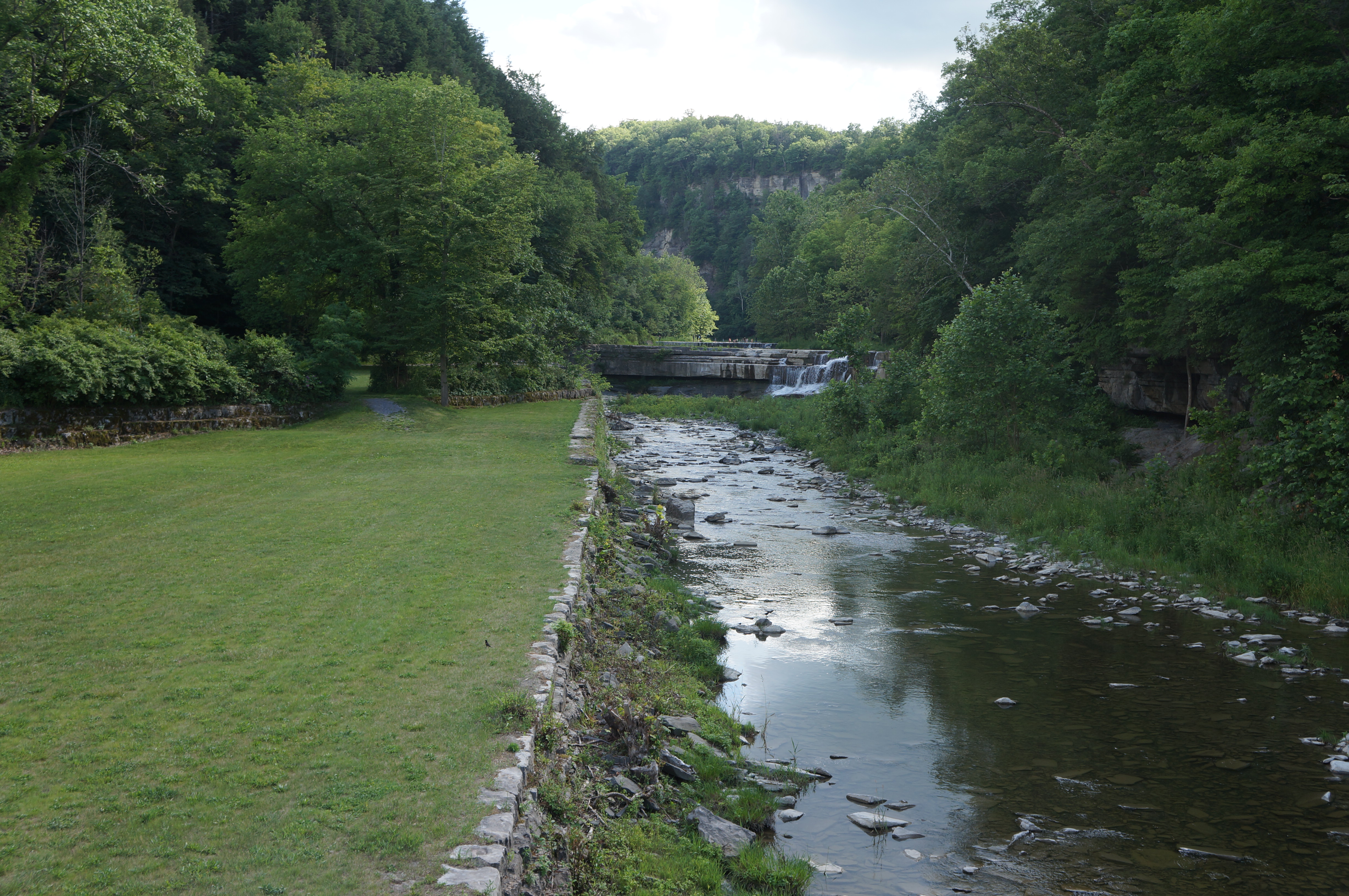
Here the hike also begins to shed the 450 feet that it gained on the way here, steadily descending along the fence-lined rim for much of the next half-mile. Pass the campground on the left and continue to a final, steep staircase (an alternate route bears left and offers a lengthier but milder descent). Proceed down the stairs to the shoulder of State Route 89. To complete the loop, bear right on the sidewalk paralleling the road, crossing over Taughannock Creek a second time, with some distant views to Lower Falls and the tree-lined gorge beyond. Here one can connect back to the parking area where the hike begin nearly three miles ago.

Taughannock Falls look very impressive. Thanks for the nice post, the detailed description and the nice photos too.
Greetings from Greece.
Pingback: Top 10 Hikes in 2023 | Live and Let Hike