
The out-and-back hike to Gaylor Lakes is a popular hike in the eastern reaches of Yosemite National Park; this is a pleasant, 2-hour trek with terrific views across Tioga Pass to Mount Dana and access to two trout-filled lakes below the Sierra Crest. It is nearby Granite Lakes, however, that is the true showstopper, accessed with a little more effort and some off-trail navigation. Here a dramatic bowl, composed of Yosemite’s famed granite that gives the lakes their name, gives way to two majestic alpine lakes that are easily some of the most dramatic in the park. Throwing in a visit to the old Great Sierra Mine—on the ridgetop above the two lake pairs—this 4.6-mile jaunt is an action-packed but lesser-known circuit in California’s most famous national park.


The hike
Tioga Pass (9,945’) marks the eastern entrance to California’s Yosemite National Park and highest point on the park’s road network. Across the high meadow from towering Mount Dana (13,057’), a small parking lot just inside the park boundary acts as the trailhead for the Gaylor and Granite Lakes hike. (Note: Overflow parking is available at another small lot about 1/10 mile south on Tioga Road; a use trail offers access to the main trailhead.)
Here at Gaylor Lakes Trailhead, there is a restroom and an informational sign denoting trails in the area. The high-elevation route begins right away as a huffer-puffer, quickly ascending a mostly wooded ridgeline that brings hikers above the 10,000-foot mark. (Note: This is a difficult hike if one has not yet acclimated to the high elevation of the Sierras for at least a day.) The incline quickly weeds out casual hikers, ascending carved stone steps and putting the noise of Tioga Road (Route 120) behind. At 3/10 mile, trekkers get their first good look back at Mount Dana and Mount Gibbs (12,764’), rising high above Dana Meadows and the broad Parker Pass Creek drainage.
Soon the trail embarks on a steep, sloping zig-zag. By ½ mile, the surrounding pines become noticeably smaller and stunted due to the harsh conditions, and soon the remaining trees and shrubs give way almost completely to a largely barren hillside. Expect unobstructed views to Dana and Gibbs, each with a red-orange hue, and enjoy the new vistas eastward, down toward Lee Vining Canyon and Inyo National Forest.

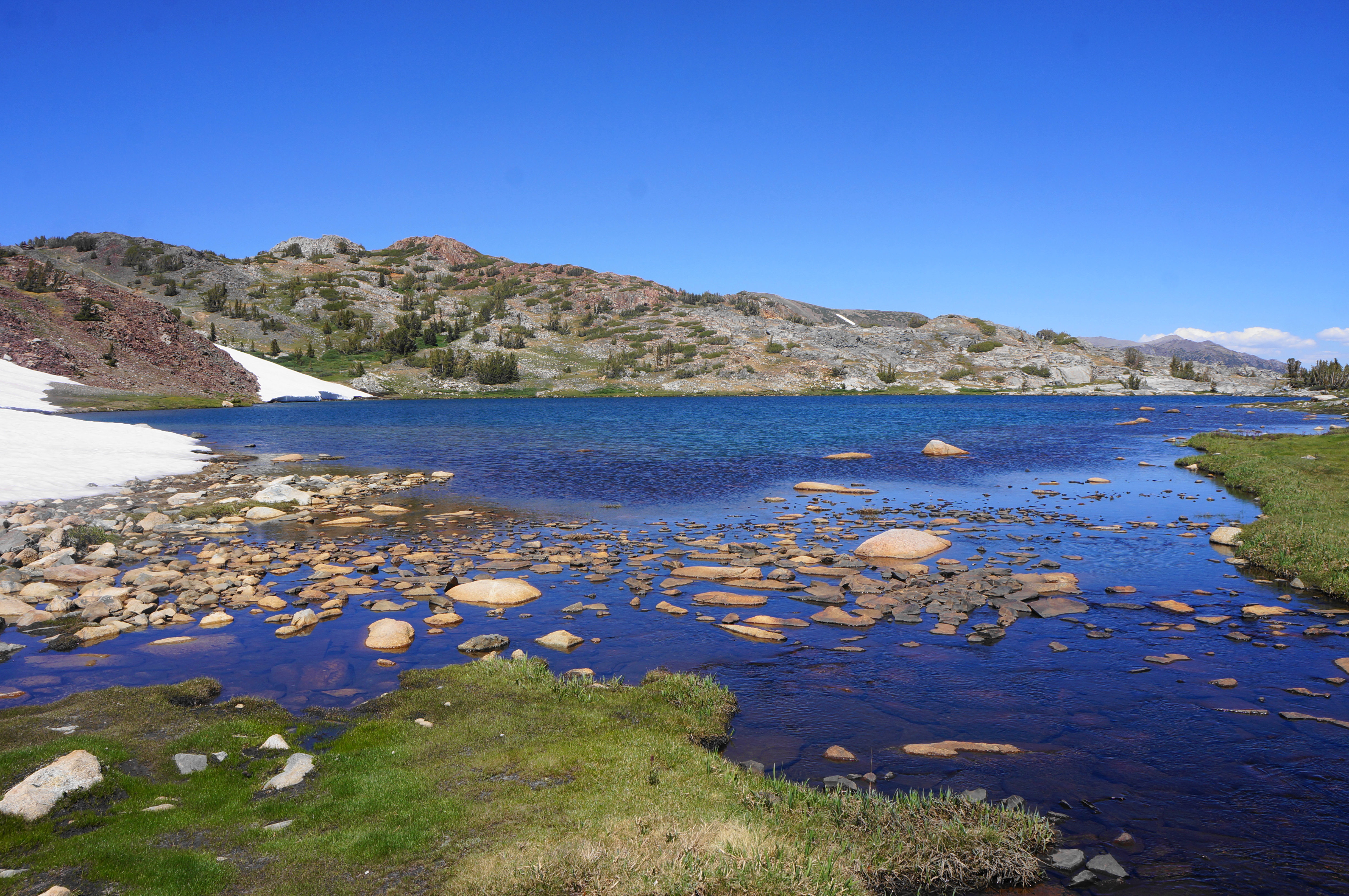
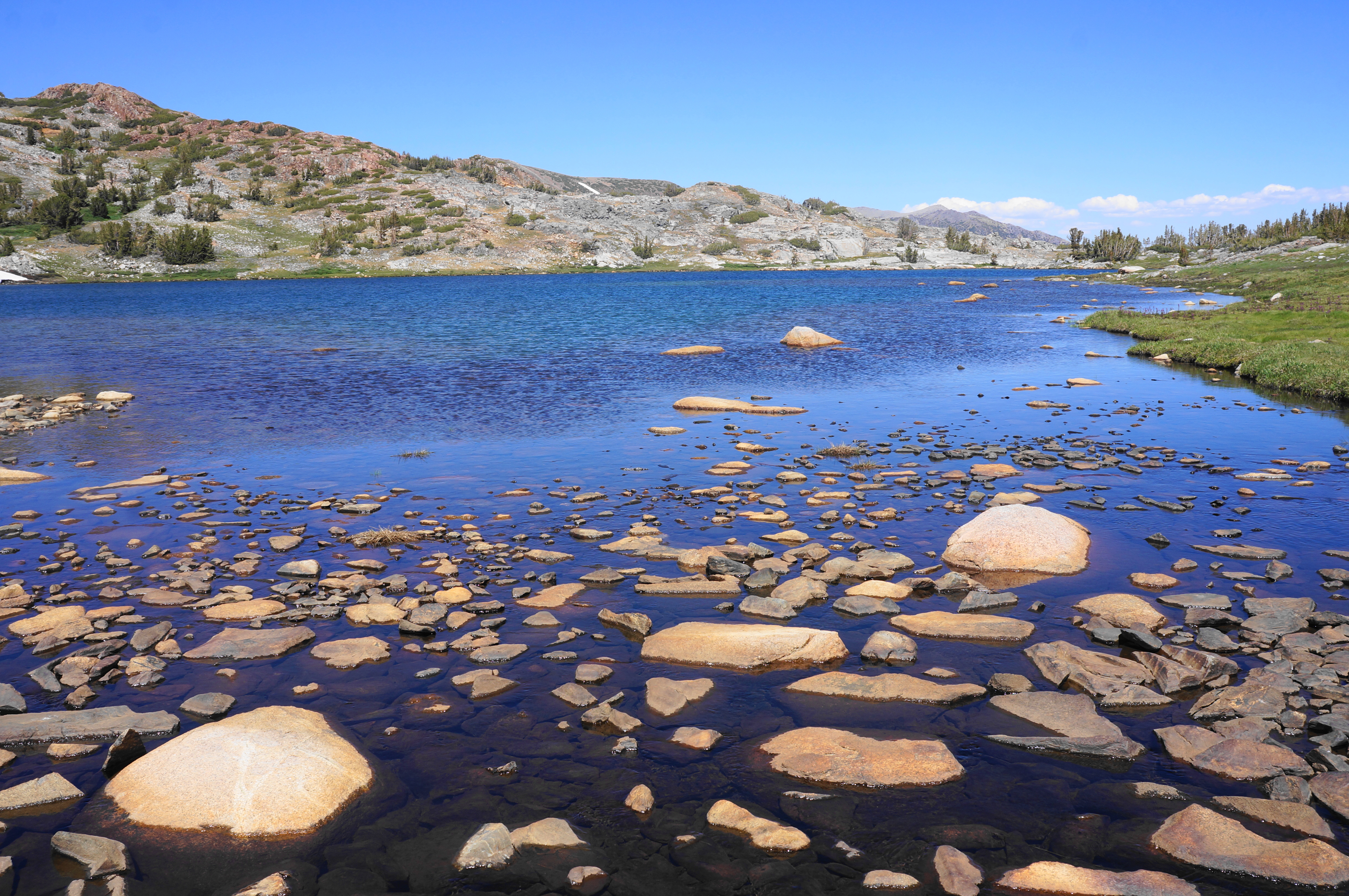
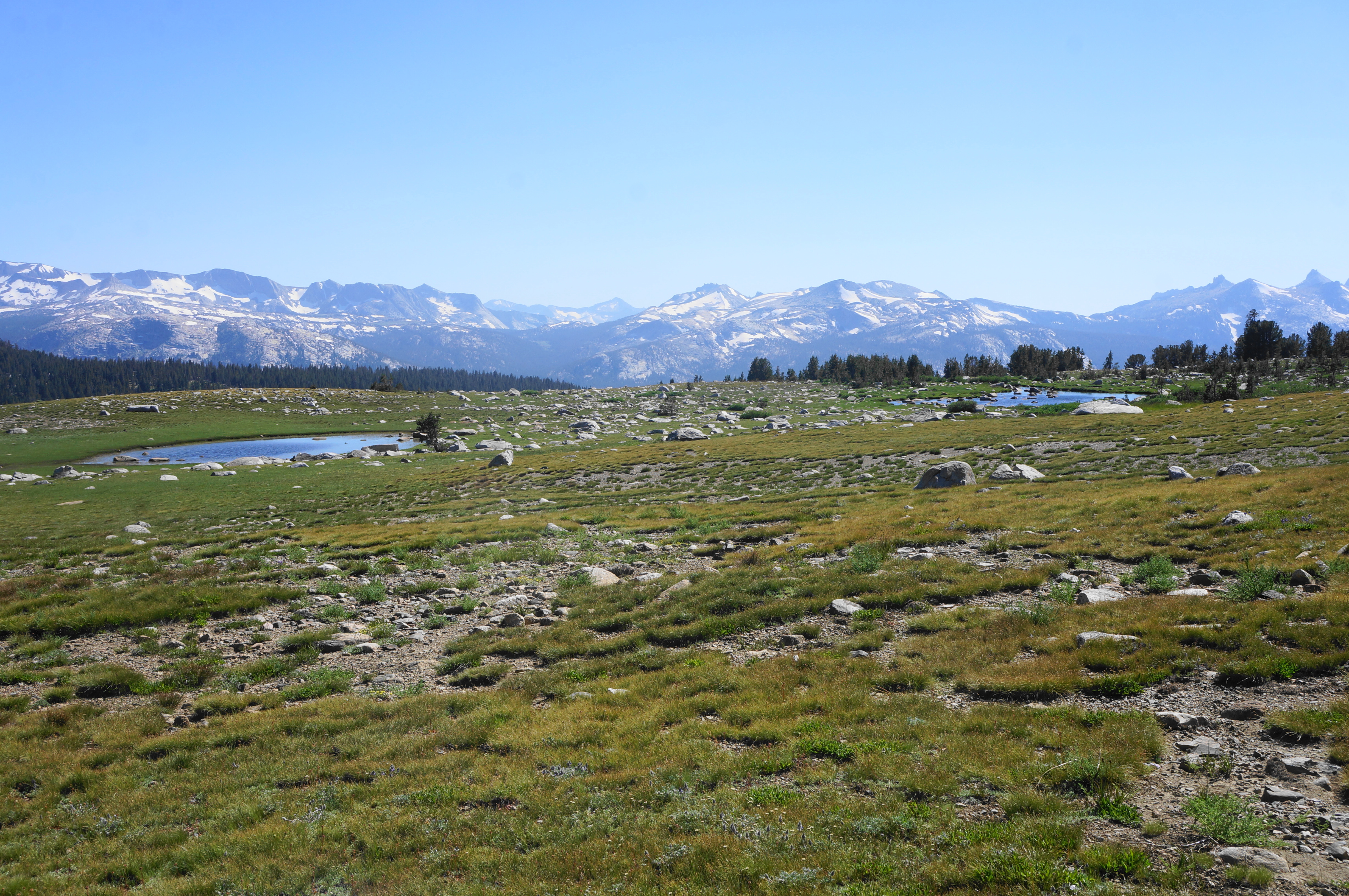
At 6/10 mile, the Gaylor Lakes Trail crests the ridgeline after more than 500 feet in gain, and hikers get their first look west to Middle Gaylor Lake (the lower of the two lakes, but there is an even lower one, further down the basin, that is accessed by way of a different trail). The descent to the lake is shorter but just as steep as the ascent, and soon visitors are at the banks of the cerulean, sun-soaked waters. Don’t be surprised to encounter anglers, fanned out along the shores, on the hunt for trout.

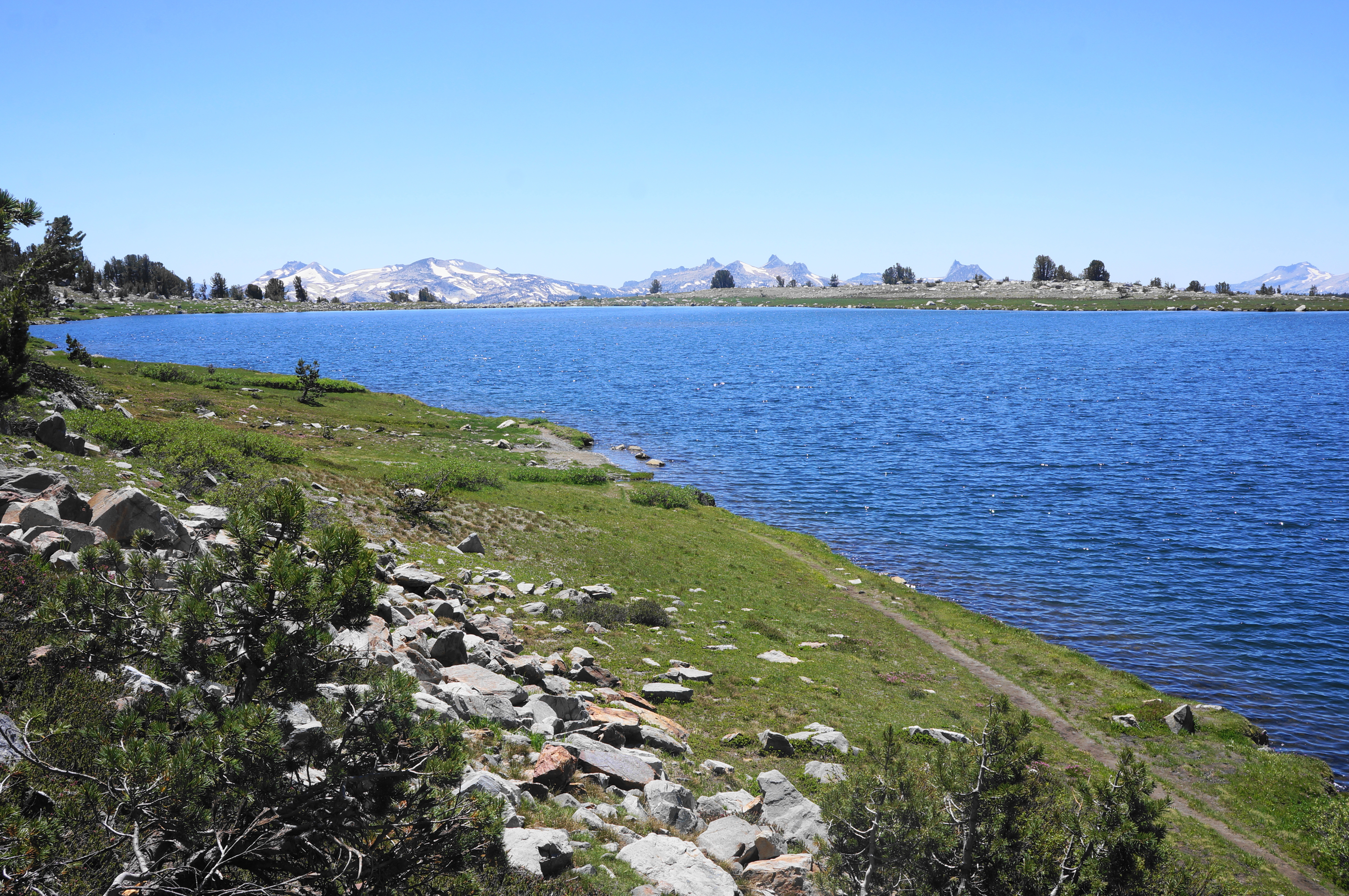


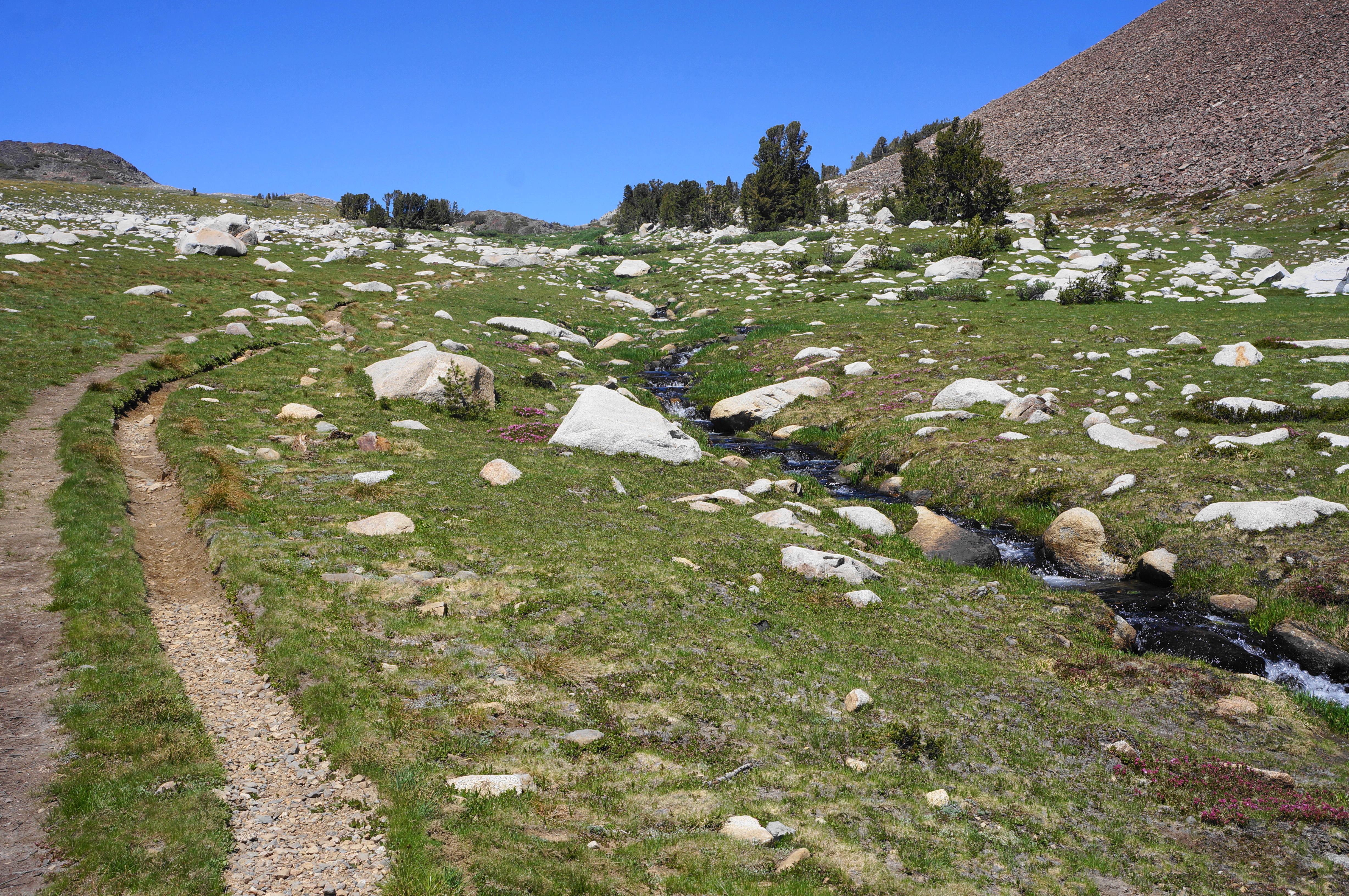
Beyond, farther west, one can see the dramatic bowl in which Upper Granite Lakes sits—but views of the water will have to wait for a bit as the onward trail crosses the stream that feeds Middle Gaylor and turns right (north). The next destination is Upper Gaylor Lake, which beckons after a relatively, mild ascent of nearly a half-mile, across mostly tree-less terrain.

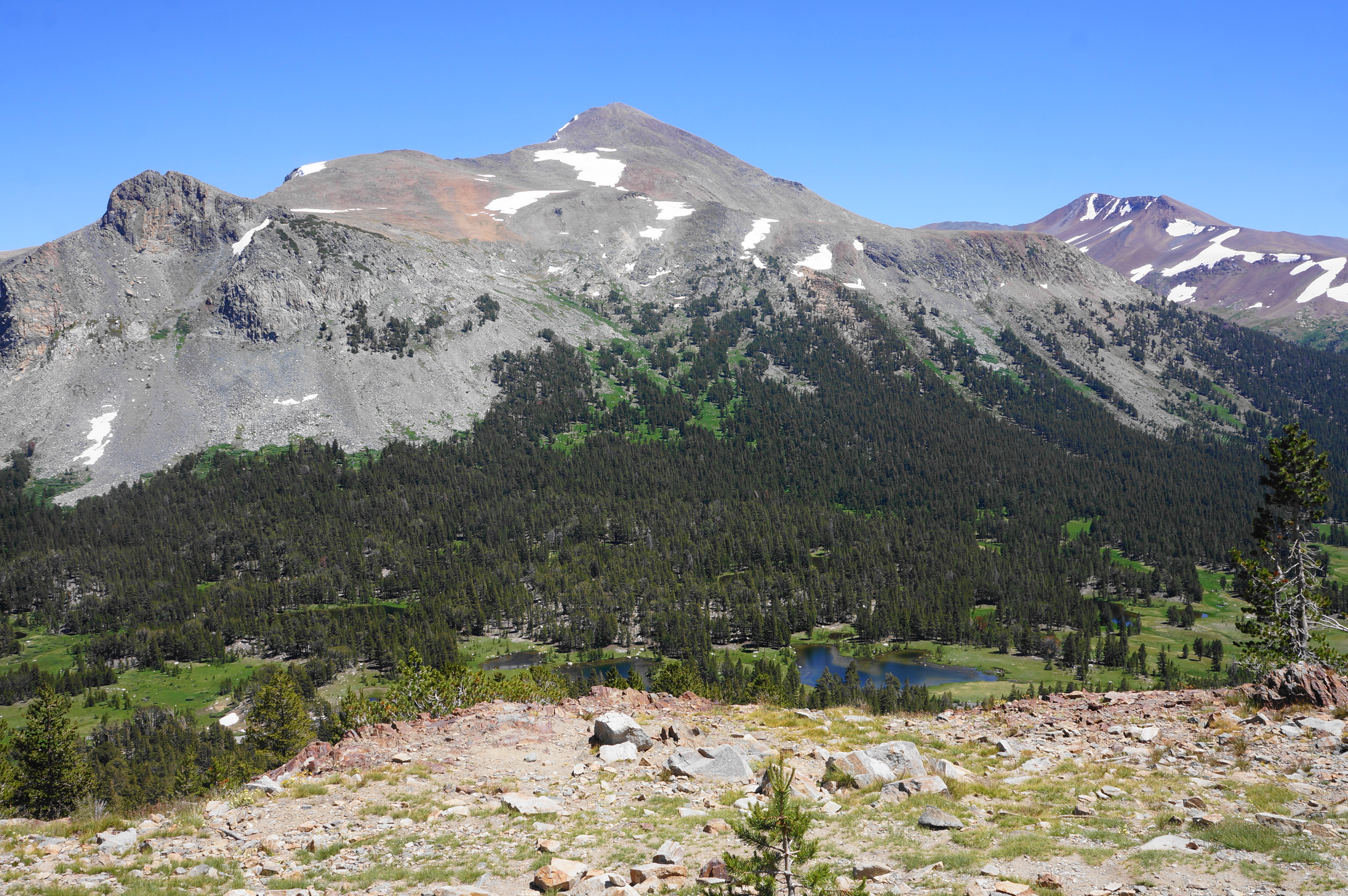
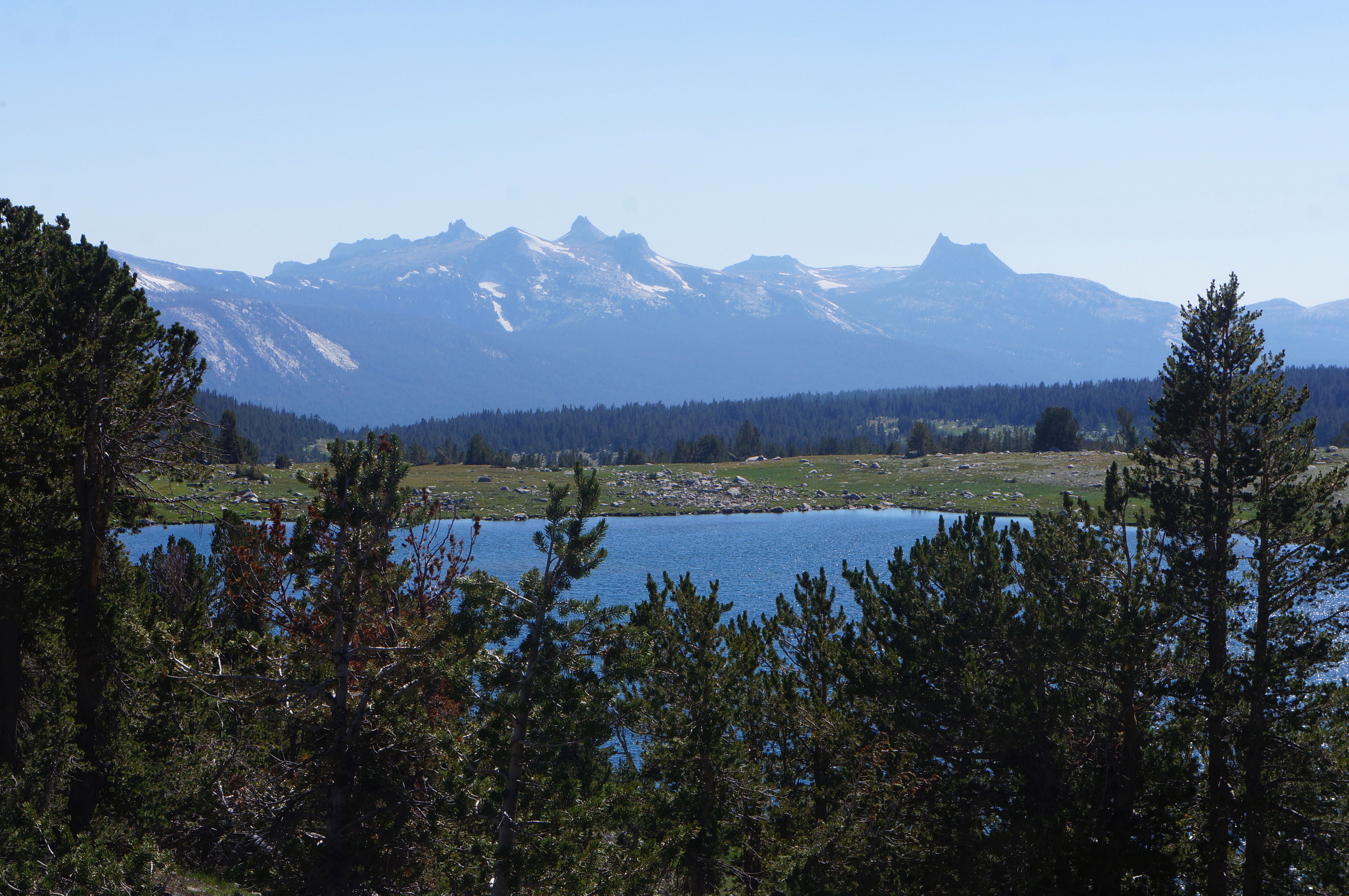
This lake feels more remote and is situated in a col between prominent Gaylor Peak (11,004’) and the high crest to the north. The lake is fronted on one side by ruddy metamorphic rocks, a contrast with the surrounding granite. The ridge ahead bears modest amounts of silver, prompting prospectors to dig and establish a small mining operation here in the late 19th century.

The onward trail to the remains of Great Sierra Mine skirts the lake’s western shore, often snow-clogged until mid-summer. (Note: If there is still a large snowbank here, scramble up the shaly ridge on the left until one can outflank the snowdrift.) A clear trail then proceeds up a steady slope, with terrific views back to Gaylor Peak, the two Gaylor Lakes, and Mount Dana and Mammoth Peak (12,117’) beyond.

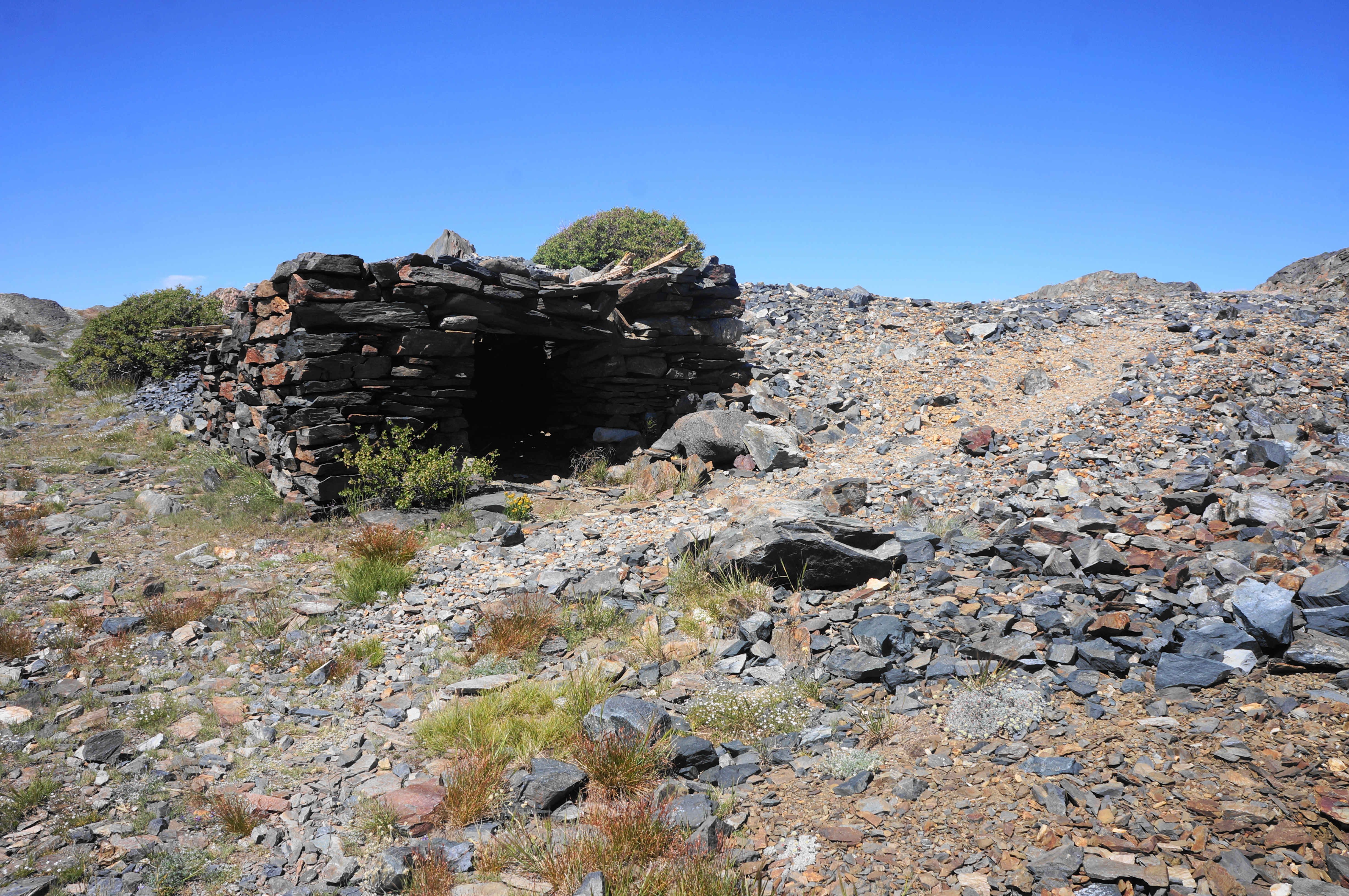
The first noticeable remains become evident after about 1/3 mile from Upper Gaylor. The entire complex includes the ruins of several stone structures (I counted five) and the (surprisingly-unfenced) entry to the mine, appearing as a dark chasm dropping vertically into the earth below. (Note: Be careful not to lose your step; a rescue from this water-logged hole would be challenging.) The Great Sierra Consolidated Silver Company quickly closed up shop on this operation, lasting from just 1881 until 1884, with little production to speak of. Now the area resembles a remote and inhospitable ghost town.


Follow the trail to its end, at the unmarked park boundary. Instead of traversing farther north, over the crest (toward Bennettville, Saddlebag Lake, and Lee Vining Canyon), plan here to head west, off-trail, toward Granite Lakes. The next half-mile requires off-trail exploration (although route-finding is assisted by the lack of tree cover).

In general, head westward, making a couple short climbs before skirting around to the top of a ridge separating the Gaylor and Granite Lakes Basin. At about 2.2 miles, the much-anticipated views of Granite Lakes appear suddenly and with splendor.
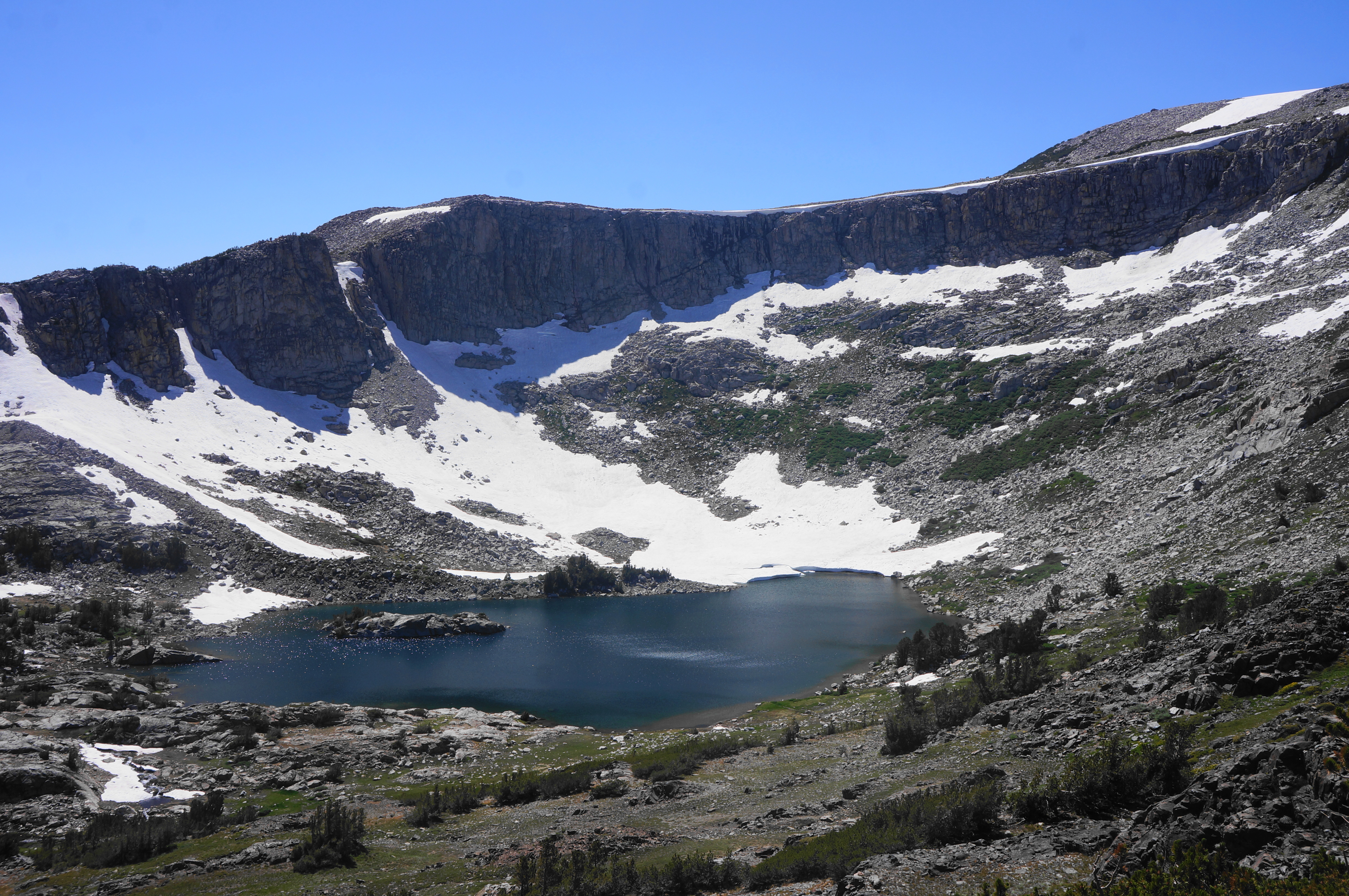

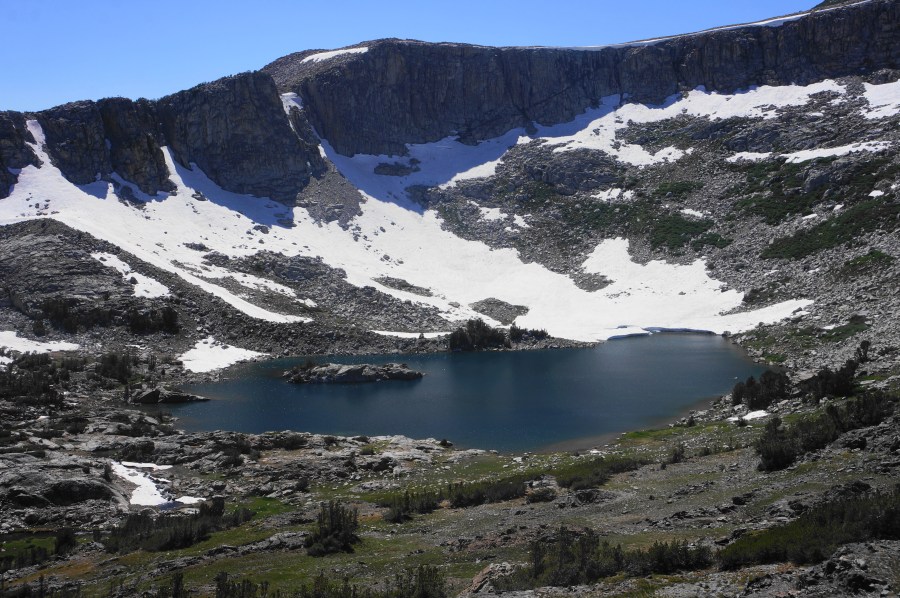
The arcing semi-circle bowl of granite ahead gives way to a basin filled by Upper Granite Lake, larger than Upper Gaylor and speckled with a dark granite island. Just to the south is Lower Granite Lake, the largest of the lakes encountered on the hike. One can see all the way to its lower end, where the meadow appears to drop off to a broad valley, with distant views to the Kuna Crest and Cathedral Range in the heart of Yosemite. The panorama here, especially when the peaks are snow-capped, is simply spectacular.
To reach the lakes, hikers must tackle a slow and somewhat tricky descent in which it is better to wind back and forth to find the easiest slope, avoiding short but precipitous drop-offs. Be careful on the shaly hillside, and try to avoid stepping on the alpine vegetation wherever possible.


After about 1/3 mile of steady descent, hikers are likely to empty out at a point between the two lakes. Follow a very faded track heading right, passing a set of short cascades, to Upper Granite Lake, the most dramatic of the two. Here the waters are surrounded by an amphitheater of rock nearly 1,000 feet high. Granite outcrops offer a good vantage point to peer out and admire the view.


When ready, retrace your steps back to the interlude between the two lakes, and continue straight on a more well-trodden route that parallels Lower Granite Lake. The path follows the lakeshore for its entire length, with constant views—but sometimes nagging mosquitoes.


The lake grows shallower as you approach its terminus and outlet, your cue to leave Granite Lakes behind and set out across the alpine meadow again to complete the loop. Head east and one will quickly spot Middle Gaylor Lake, making navigation easy. After less than a half-mile, rejoin the Gaylor Lakes Trail at the banks of Middle Gaylor.

From here, it is about a mile back to the trailhead. Retread old ground around to the east side of the lake, then gain about 200 feet in elevation to regain the ridgeline. From the crest, it is a brisk 6/10 mile—all downhill—to return to the trailhead at Tioga Pass. And so ends the 4.6-mile walk, a lesser-known gem of Yosemite’s High Sierra.


Sounds beautiful. I am planning trips to New mexico, Iceland, and the Columbia River
Pingback: Top 10 Hikes in 2023 | Live and Let Hike
Thank you for sharing the adventure, appreciate the photos and map:)