
Situated in the underappreciated section of the Sierra Nevada between bustling Lake Tahoe to the north and Yosemite to the south, the Round Top – Winnemucca Lake Loop is one of the more easily-accessible half-day hikes in the Mokelumne Wilderness. The two glimmering alpine lakes sit on a flower-studded shelf below the high peaks of the Carson Pass area—including Round Top (10,153’)—and often continue to bear snow well into June or even July. The circuit is relatively challenging with several steep sections, but the serenity and scenic backdrops of the two lakes make this 5.1-mile jaunt worth the half-day effort. (Note: Many hikers combine this loop with an off-trail scramble to the summit of Round Top or a day/overnight hike to nearby Fourth of July Lake.)

The hike
The main thoroughfare through the Carson Pass area is Highway 88, which connects Stockton in California’s Central Valley with the eastern Sierras and Nevada. This hike begins at a point near the pass over the Sierra Crest—to the east of Silver Lake, Caples Lake, and Kirkwood Mountain Resort. To access the start at Woods Lake Trailhead, follow the paved but crumbling Woods Lake Road from Route 88 for one mile; before reaching the lovely lake and campground, park in the relatively large parking area on the right. Here there is a restroom and access to the Woods Creek drainage. (Note: Woods Lake is a short walk/drive farther on but is worth seeing before or after the hike; it is a stunningly serene lake set against a granite backdrop to the south.)
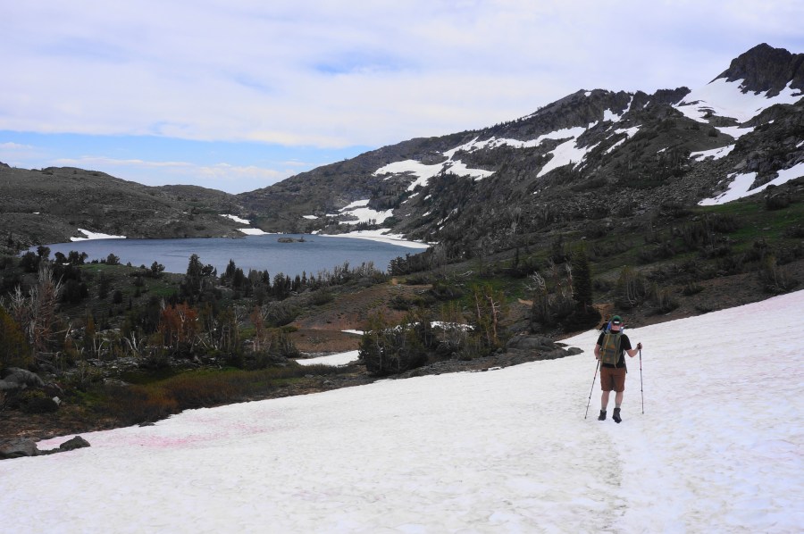
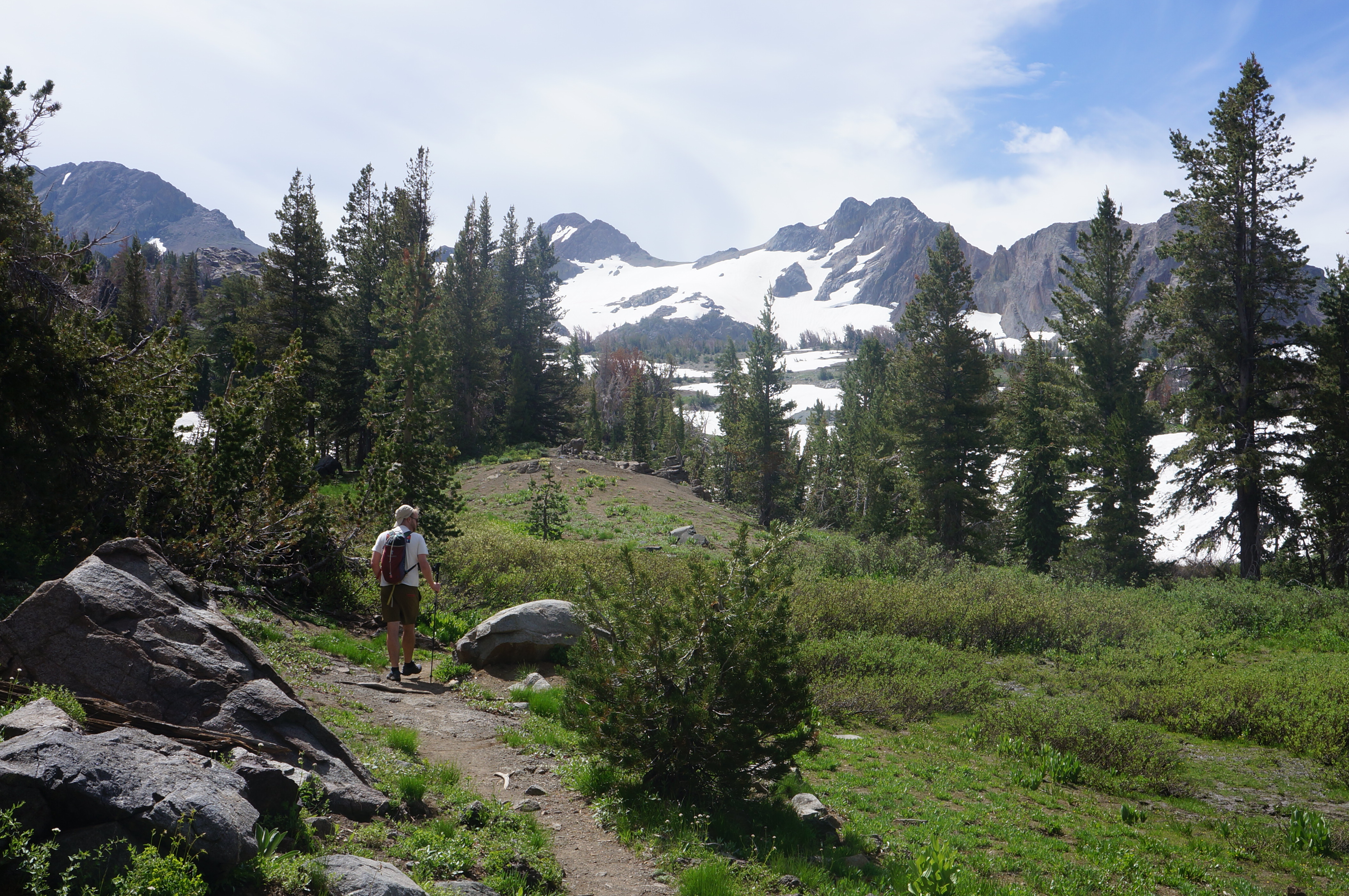
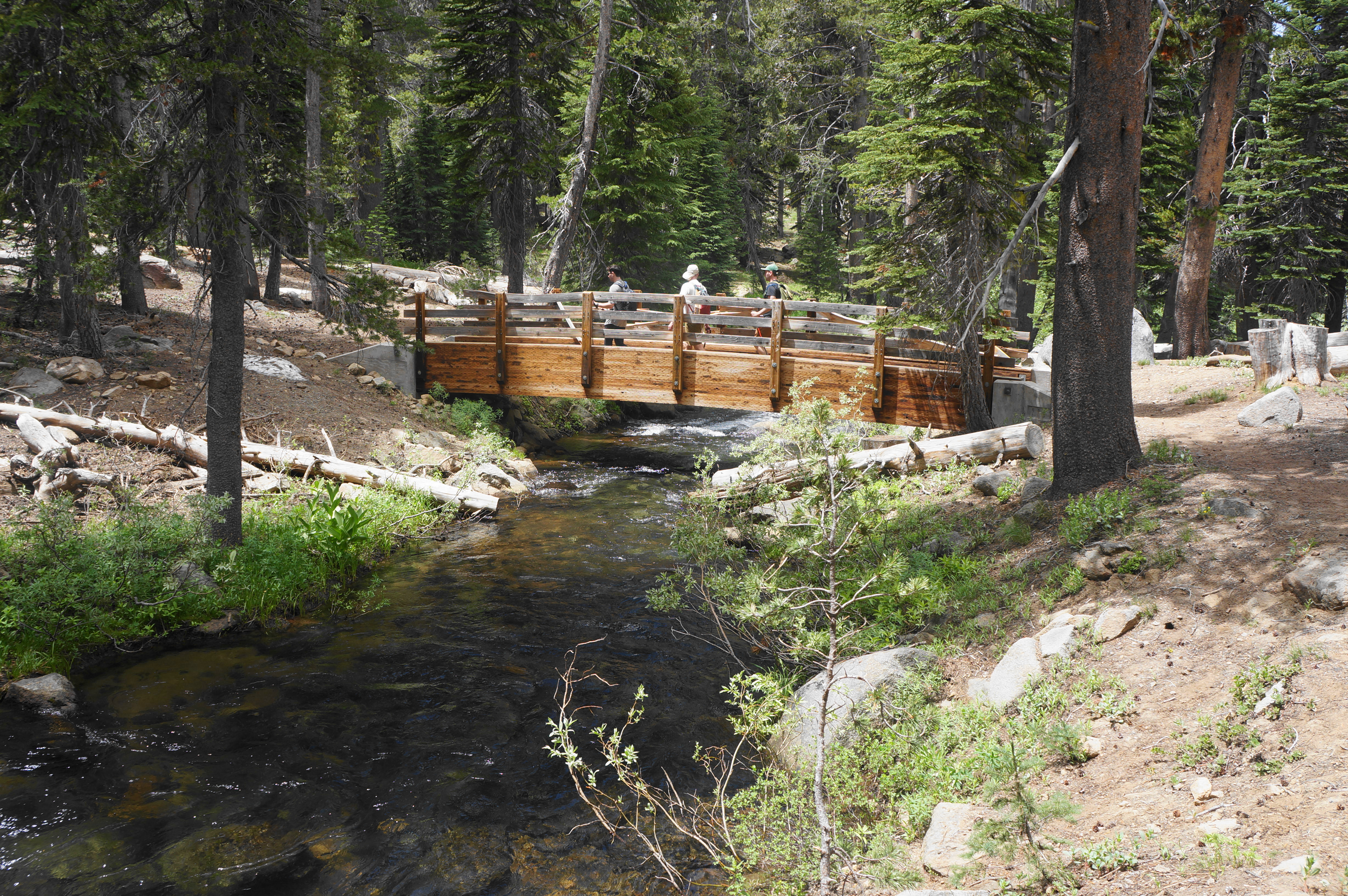
When ready, it’s time to hit the trail, found just across the bridge over Woods Creek. The trail sign indicates that both Round Top and Winnemucca Lakes are equidistant from here (although my reading of the map suggests Winnemucca is a more than a half-mile closer). Winding through a forest of lodgepole pine, red fir, and others, the initial trail heads in the direction of both lakes. It is not exactly wilderness right away, as the singletrack parallels Woods Lake Road down to the left, and a signed junction comes within 1/10 mile. This time, hikers have a choice: head clockwise (to Winnemucca first) or counterclockwise (to Round Top Lake first). Either has advantages: the ascent to Winnemucca is easier, but the descent from Round Top to Winnemucca (counter-clockwise) is dramatic and would not be a fun uphill. (Note: Ultimately, because the Round Top route had considerably more snow (in late July in a record snowpack year), we decided to take this on as an uphill rather than as a potentially sketchier descent.)
Bearing right on the Round Top Lake Trail (a.k.a. Lost Cabin Mine Trail), the narrow path, littered with pine needles, begins a mild but steady climb, initiating a roughly 1,100-foot ascent. Head up a woody slope, then traverse a brief downhill as granite outcrops begin to form on the right. One can see down to the Woods Creek Campground at times, and a junction at ½ mile offers access down the camping area. Stay right, now on a wider, rocky doubletrack that is surely a former mining road.


The route to Round Top Lake continues on, climbing more sharply and rounding a set of bends to a point, around 8/10 mile, where hikers can see down to the azure waters of Woods Lake. By now the trail is a thin singletrack again, and it traverses a stream bed minutes later. The next section is particularly scenic, as the skyline of mountains to the north comes into view. The steep trail rounds a right-hand switchback and comes close to a cascading waterfall before cutting left again and rising to the next level of the stairstep hillside.

After cresting a minor saddle, the trail again approaches the main branch of Woods Creek and Lost Cabin Mine, a now-gated shaft on the banks of the stream. For those who like to see the antiquated remains of an industry long since in decline, there is some rusted old mining equipment at the site that is worth a quick look.


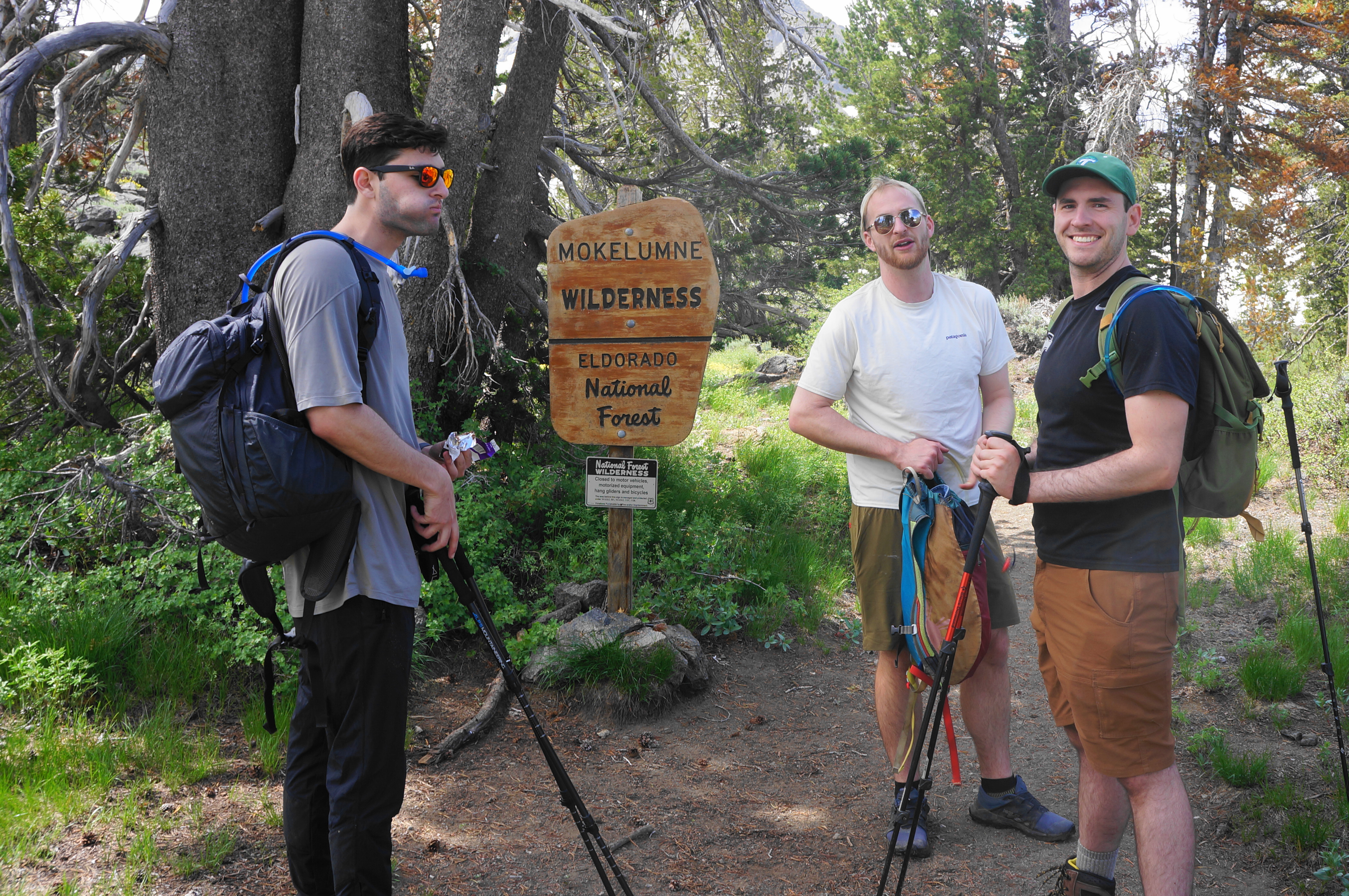
The mine shaft marks about the halfway mark to Round Top Lake, and the remaining stretch is not as steep as the preceding half-mile but steadily gains another 700 feet in elevation in 1.25 miles. Follow the main stream for a bit but do not cross it, rising to an open patch at about 1.7 miles, where the route enters the 105,000-acre Mokelumne Wilderness.
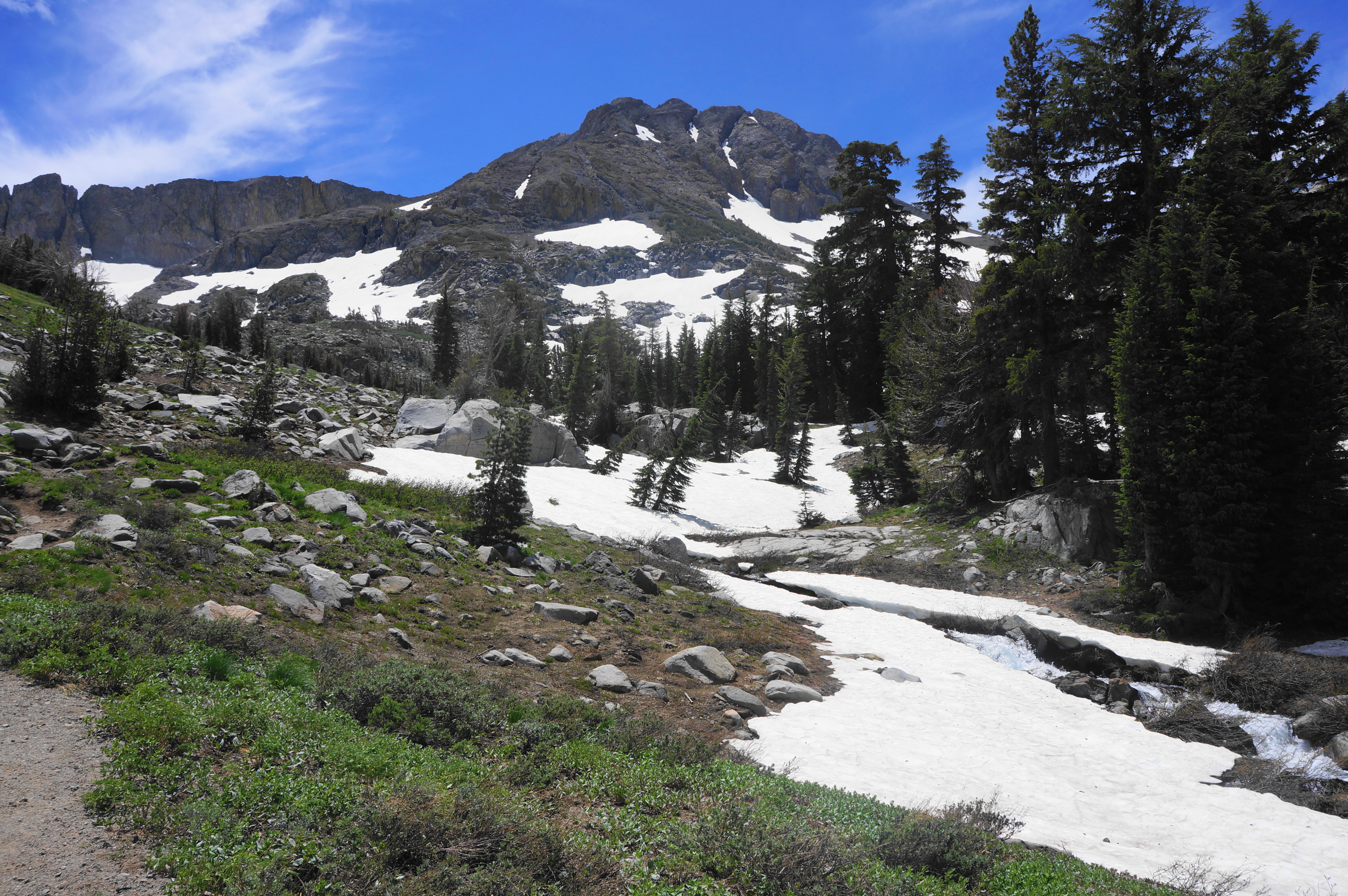
By now one can see the imposing behemoths of Round Top (10,153’) and The Sisters, two high peaks just off the Sierra Crest. Wildflowers can be found here—but so can early summer mosquitoes. The trail comes nearly level for a short stretch before cutting left and climbing the west-facing slope of the modest valley.
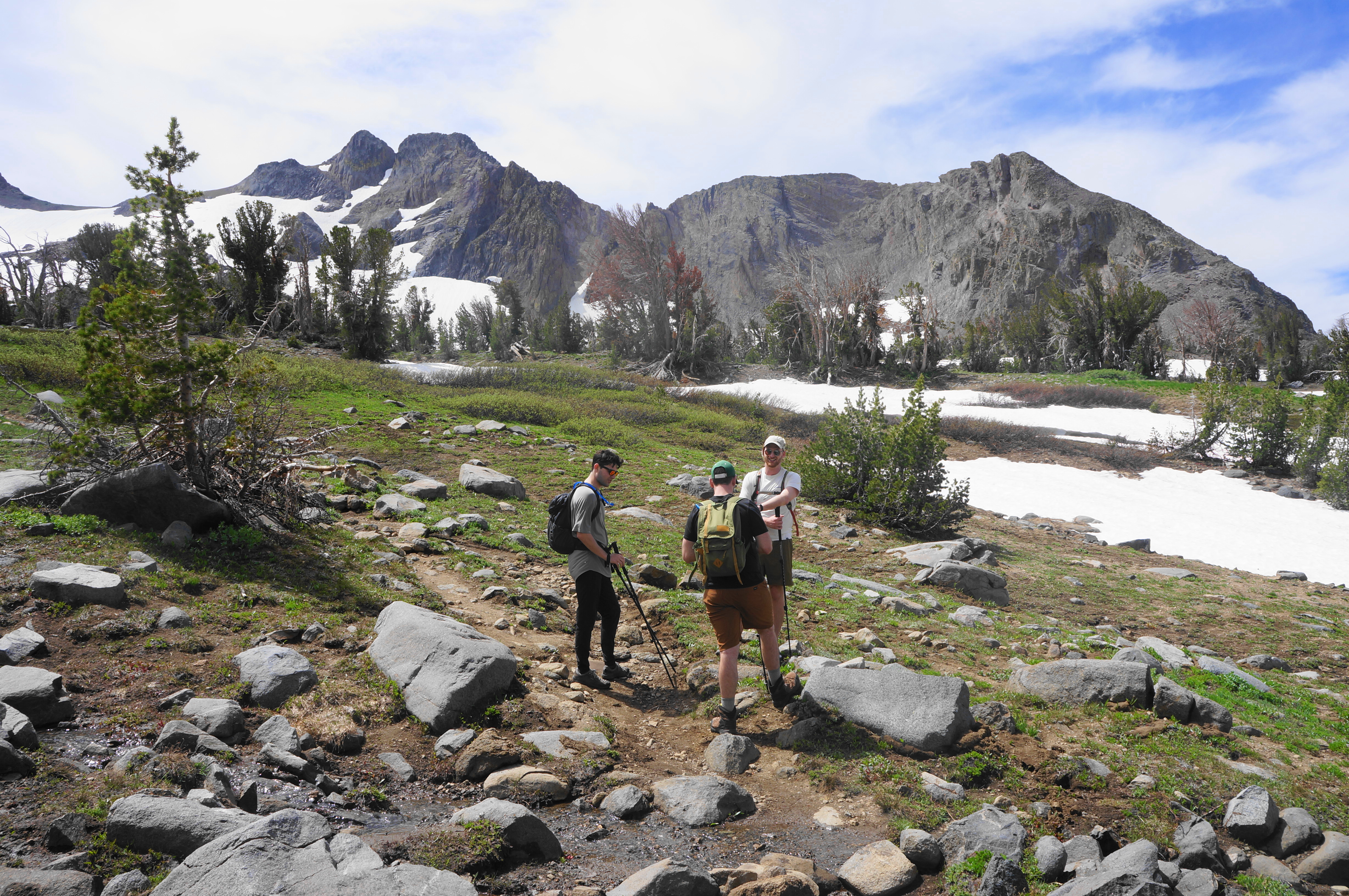
The final push to Round Top Lake offers the most expansive views thus far, with the ridgeline of Thunder Mountain (9,408’), Thimble Peak (9,805’), and Covered Wagon Peak (9,565’) off to the west and the distant peaks of the Crystal Range, near Lake Tahoe, to the north. One can also catch a glimpse at a part of Caples Lake Reservoir in the valley with Highway 88 below.


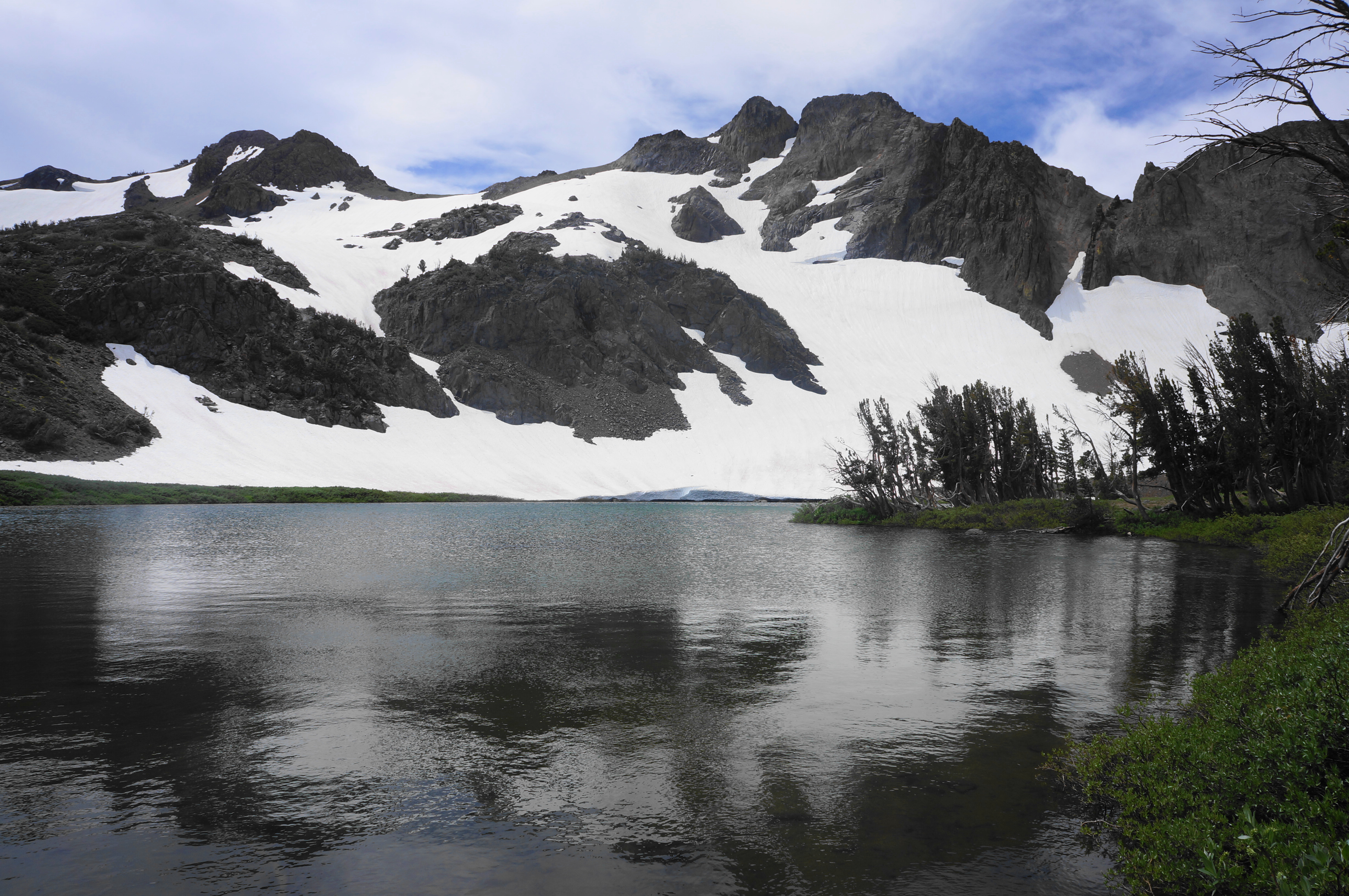
The foliage thins out considerably in this final stretch, and a steady climb leads to a trail junction at 2.4 miles. This marks the end of the Round Top Lake Trail, though the lake is not yet visible. To reach it, head right from the windswept saddle for about a minute, coming to the banks of Round Top Lake, a small but beautiful spectacle in the shadow of The Sisters, which rise to more than 10,100 feet. Huge snowbanks remain in late spring (or into late summer in high-snow years), adding to the allure.
The path continues onward—across the stream fed by Round Top Lake—and eventually to a crest above Fourth of July Lake, but day hikers doing just the Round Top-Winnemucca Lake hike should return to the junction and head straight this time, on a trail labeled on some maps as the Camp Irene Trail.
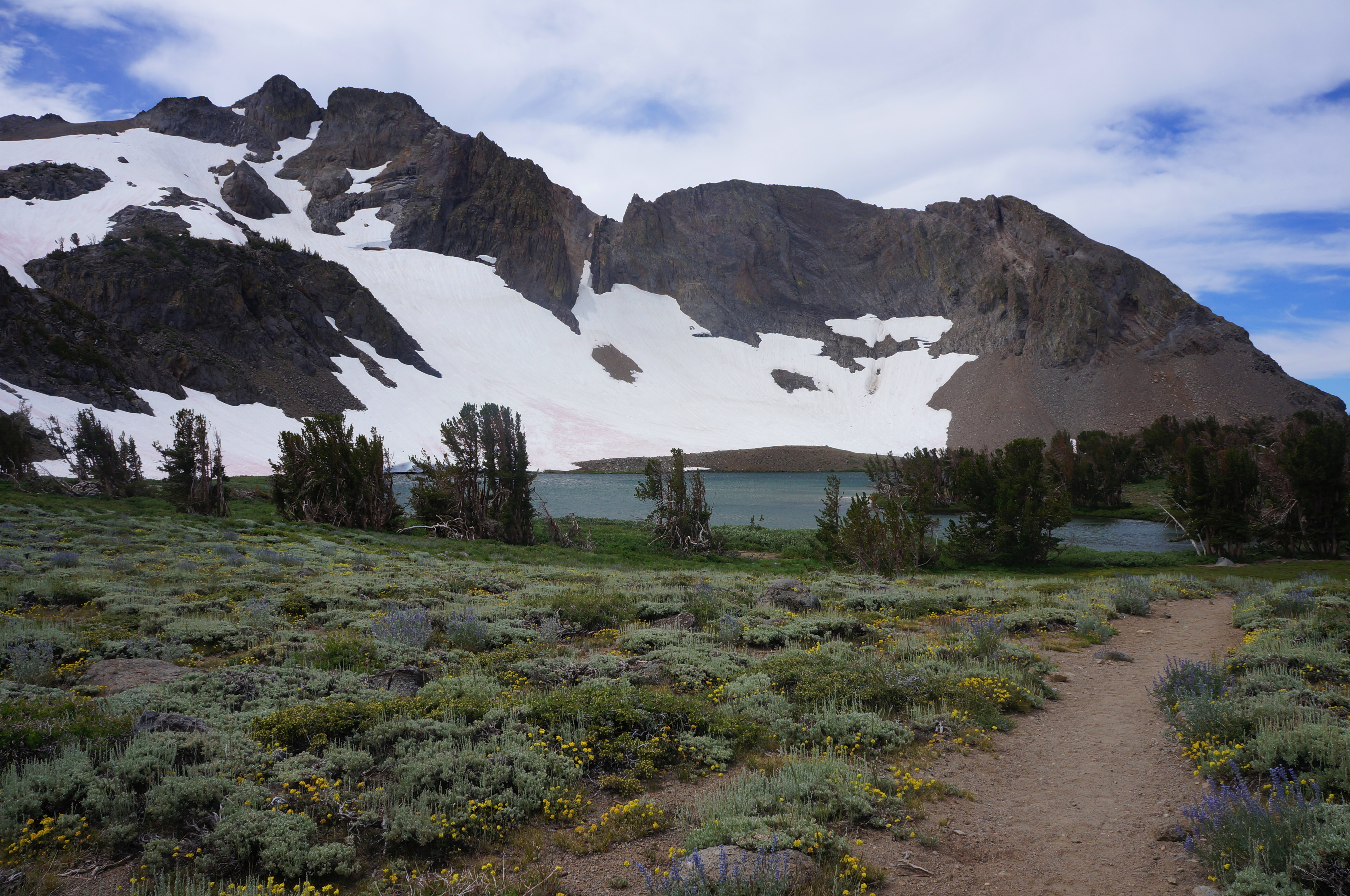
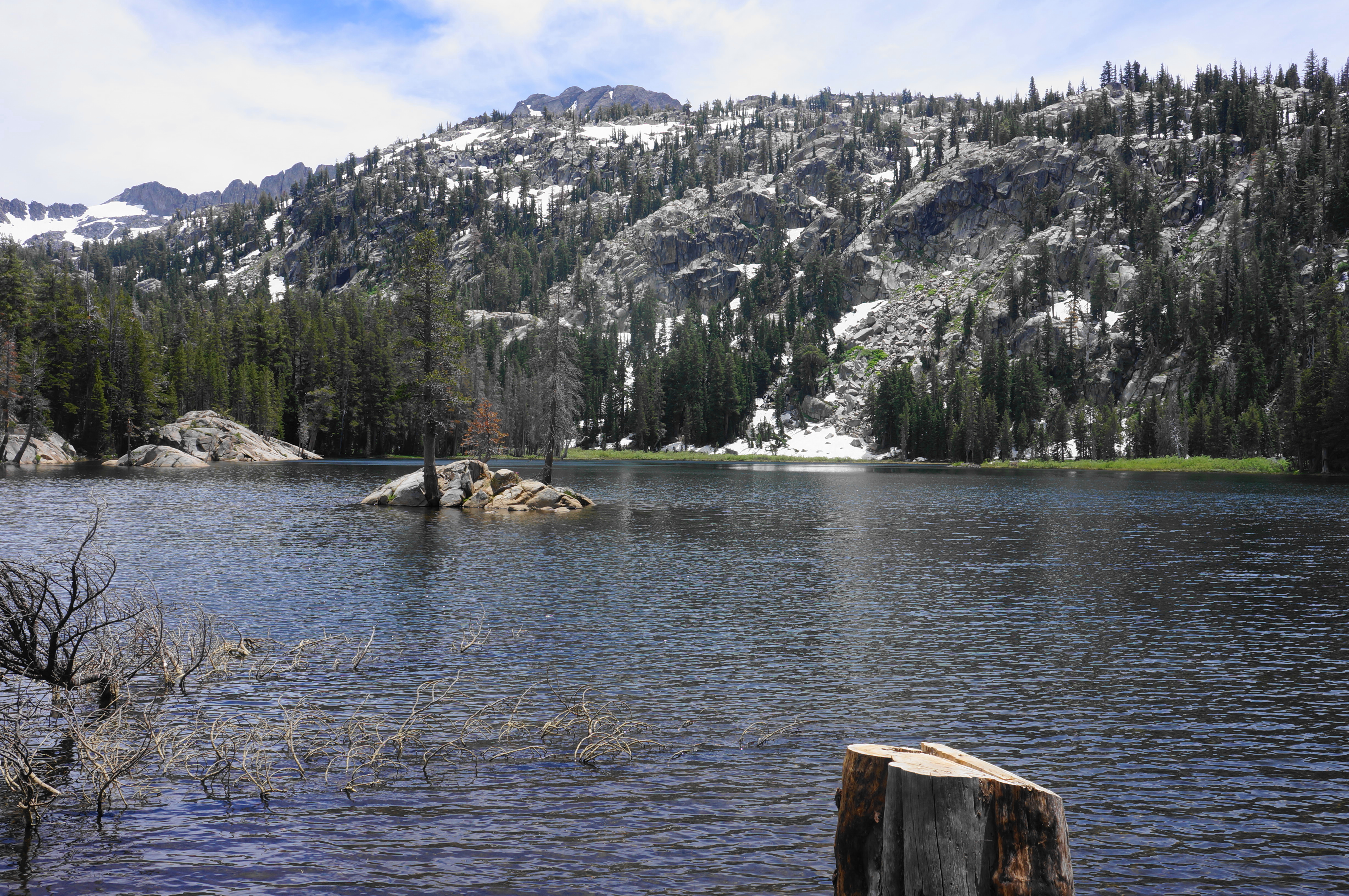
In sight of Round Top Peak, the path rises to a mild saddle between Round Top and Winnemucca Lakes, with the latter coming into view in a dramatic way. The picturesque water basin is considerably larger than Round Top Lake, and contains a pretty island. The Sierra Crest just beyond is not much higher, allowing hikers to peek onward to the Charity Valley area to the east.
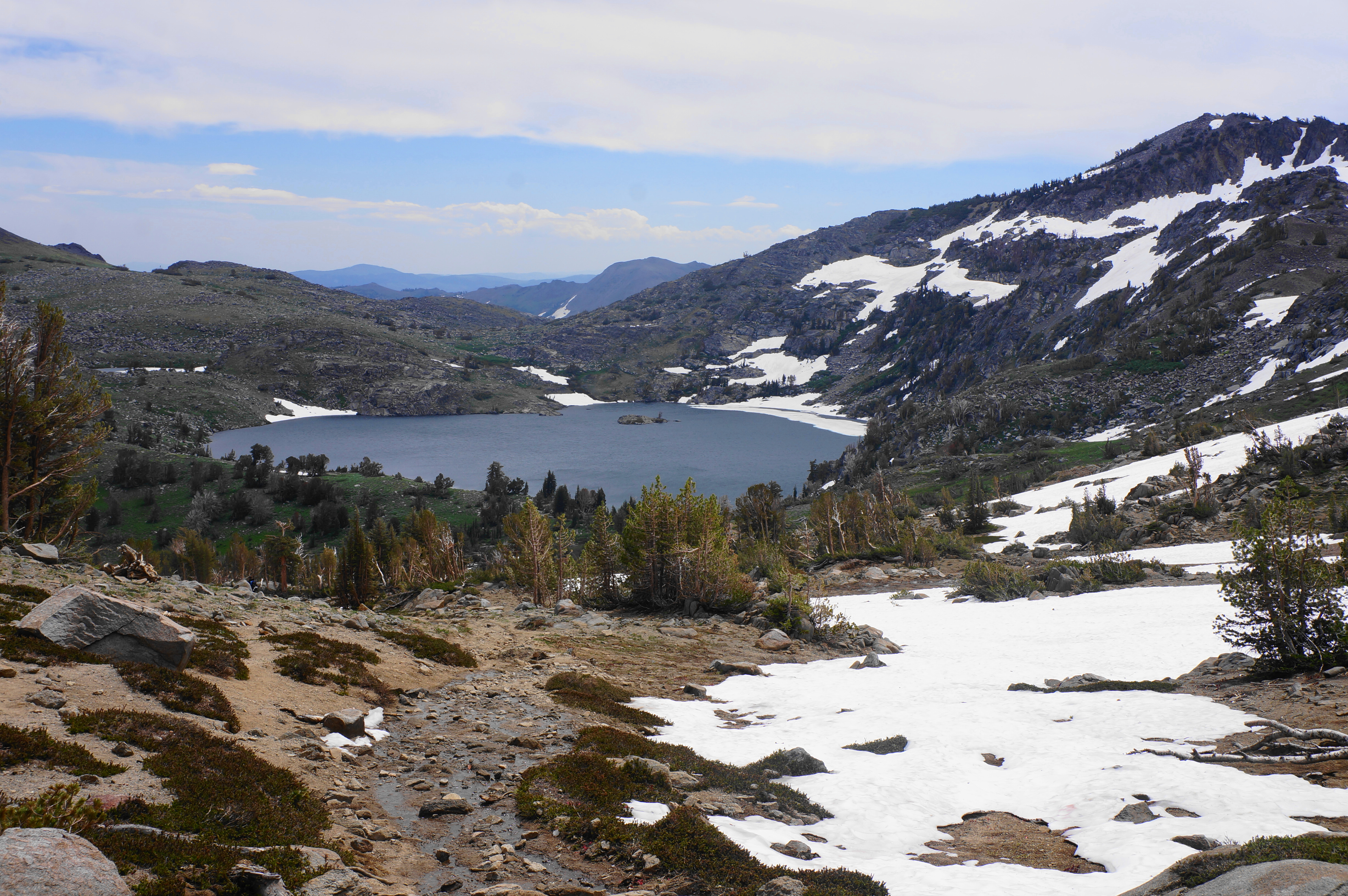


The subsequent half-mile descent to Winnemucca Lake is one of the highlights of the trip, with the rocky path eventually giving way to a meadow trace, crossing a seasonal stream fed by snowmelt. The route reaches tree cover at the banks of the lake at around 3.3 miles, where a spider’s web of social trails dot the landscape, offering access to the lakeshore.


This is a tremendous place for a snack or lunch, and curious hikers can follow the path paralleling the western shores. But, when ready, hikers will want to find the Winnemucca Trail bearing north, dropping back toward the campground and trailhead.

This trail is milder and easier than the ascent to Round Top Lake, and the stream valley is often laced with blooming wildflowers. Red Lake Peak (10,040’), situated above Carson Pass, headlines the views to the north. The tumbling stream fed by Winnemucca Lake follows you almost the entire way, although tree cover becomes thicker as hikers leave Mokelumne Wilderness at about 3.75 miles. There is a curious sight on the left at 4.1 miles; this is an “arrastra,” a stone, circular device used for crushing gold and other ores that the sign describes as “used by early Mexicans” who lived in the area. (Note: The device somewhat resembles a giant citrus squeezer.)

Thereafter, the trail continues to shed elevation, descending into a thicker pine forest, where a sign at 4.7 miles should lead hikers to head right. (Note: The left turn leads to Woods Lake and the campground.) Cross a bridge over the creek at about 4.95 miles, then bisect Woods Lake Road and find the initial 1/10-mile stretch of the trail from the beginning of the hike. Bear right from here and continue the final few minutes to arrive back at the trailhead.
All told, the Round Top – Winnemucca Lake Loop is around 5.1 miles and should take most hikers between three and five hours.

Pingback: Top 10 Hikes in 2023 | Live and Let Hike