Named for a famous early 19th-century French biologist and naturalist, Lamarck Lakes are set below dramatic granite facades in the eastern Sierra Nevada and accessed by way of a steep and challenging trail in the vicinity of Aspendell and Bishop, California. The relentless climb ends at two extremely picturesque alpine tarns, set below the Sierra Crest and high above Owens Valley. Most will take this on as an out-and-back, but a largely forgotten trail offers an alternative route back to the start via the subalpine Grass Lake. Although relatively short at six miles, this scenic loop is a demanding walk that could take hikers much of a day to tackle.

The hike
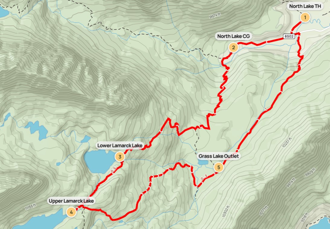
From Bishop, the largest town in California’s Owens Valley, State Route 168 leads up into the Sierras and offers access to North Lake, South Lake, and Lake Sabrina, three reservoirs set in picturesque valleys. The Lamarck Lakes hike begins at the North Lake Trailhead; just before Lake Sabrina, bear right on the narrow and partially-paved track, which is very scenic but somewhat harrowing as it skirts the west flank of the valley forged by the Middle Fork of Bishop Creek. Follow the signs for the North Lake parking area, with access also to the Bishop Park Outfitters park station. (Note: Although North Lake Campground offers quicker access to the Lamarck Lakes Trail, day-use hikers and overnight backpackers must use this alternate parking area unless they have a site at the campground. If there is no parking in the first lot, there is an overflow lot about 50-100 yards to the east.)
North Lake Trailhead to Lower Lamarck Lake (2.4 miles)
From the parking area, hikers heading for Lamarck Lakes should follow the road for 300 yards back to a dusty junction. Bear right and head toward the North Lake Trailhead on the sun-exposed trace, with a seasonal cascade visible up to the left and a craggy mountain—more than 12,600 feet high—ahead. Follow the road to the shadier North Lake Campground, staying right at the start of the loop and edging around to the official Piute/Lamarck Trailhead, marked with a colorful, multi-panel sign. In addition to Lamarck Lakes, this is a primary staging point for trips over Piute Pass (11,417’) and the popular North Lake – South Lake Loop, a multi-day backpacking trek.

At the sign, there is a narrow but evident path heading straight, through a thicket of thin aspens. But this is a bit of a fake-out, as the path quickly empties out into a much larger track that cuts through the campground. Bear right, passing two attractive campsites on the left, and come soon to the first trail junction; here the Piute Pass route heads right, while the Lamarck Lakes Trail continues left.
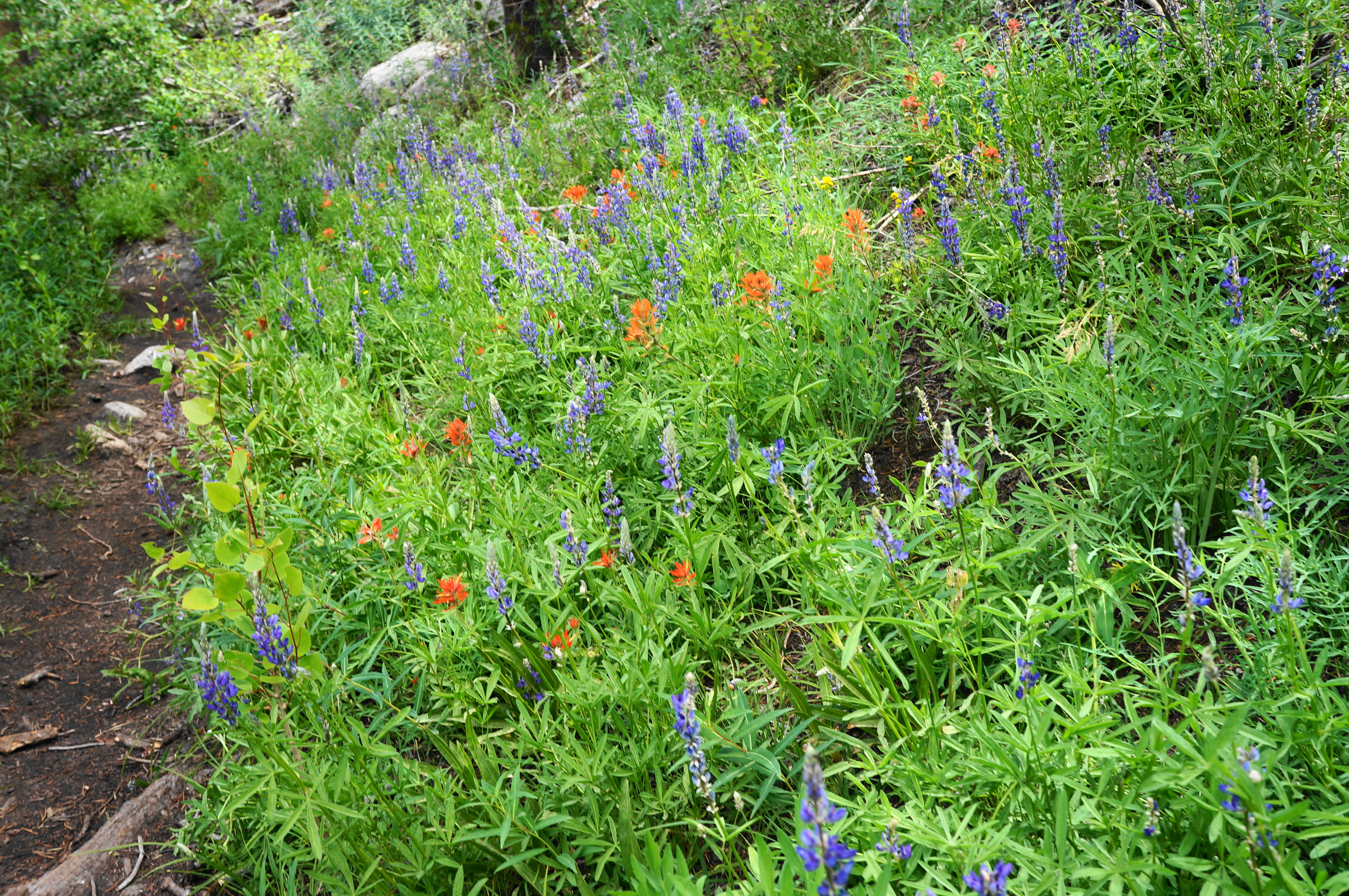
The path gets muddier as one approaches the North Fork of Bishop Creek but largely dries after crossing a bridge over the stream. Look for lupine and paintbrush in wildflower season. After entering the John Muir Wilderness, get ready to climb—and climb and climb and climb. The Lamarck Lakes Trail will gain 1,300 feet in elevation in the next mile and a half.
The overture involves eight back-to-back switchbacks, followed by a twist that might be described more as a longer, left-hand bend. Then it is back into five more switches, rising to a woody gap at 1.25 miles (1/2 mile from the creek crossing). The Lamarck Lakes Trail then emerges out into the sunny open for the first time, revealing a look to creamsicle-hued Piute Crags and the imposing needles of Mount Emerson (13,204’).

From here the trail leads into another trio of switchbacks, then an uphill gradient that leads to a brief section that is truly flat, with a couple nice-looking possible campsites. By now hikers have hiked about 8/10 mile from the North Lake Campground.
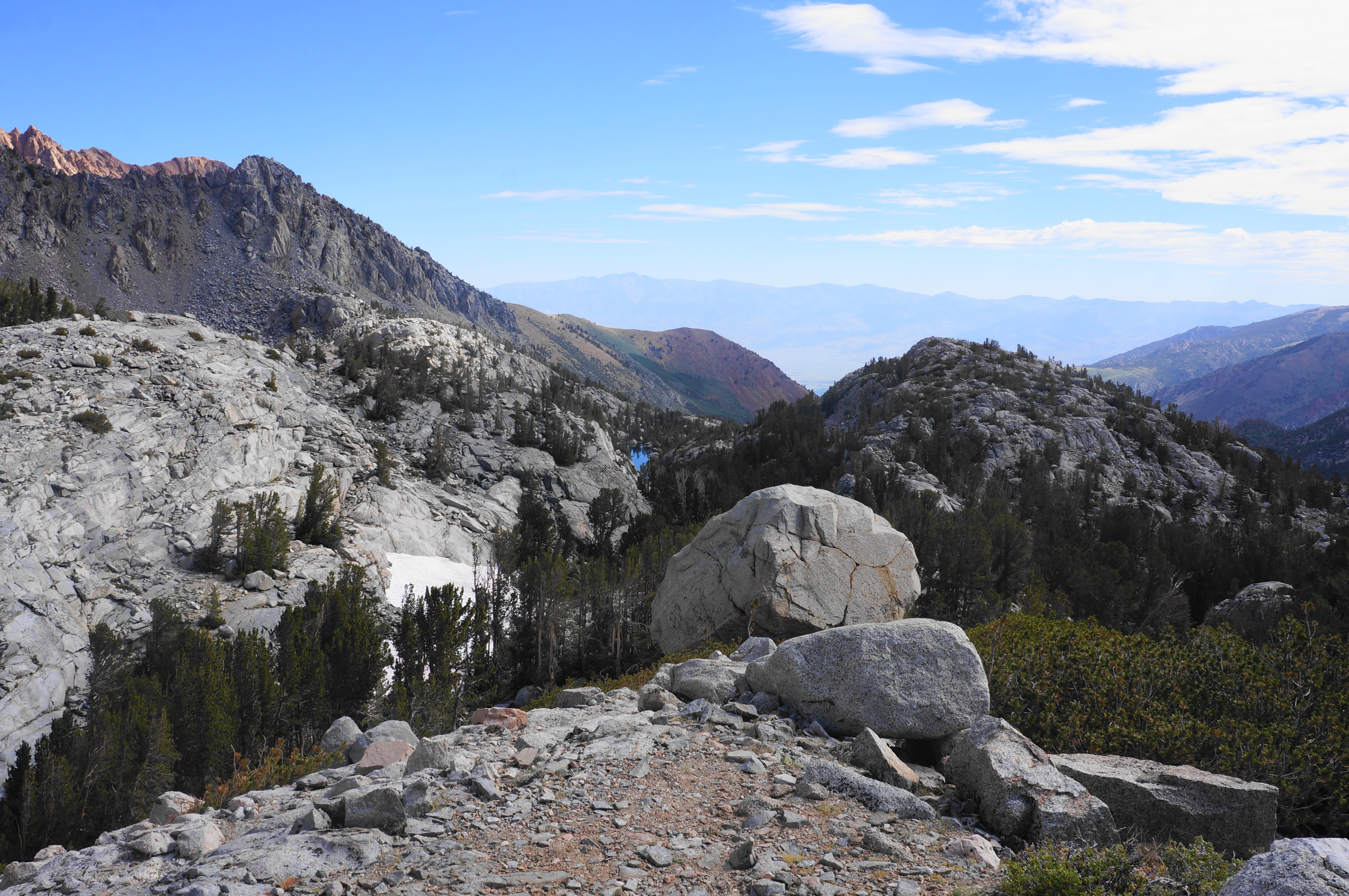
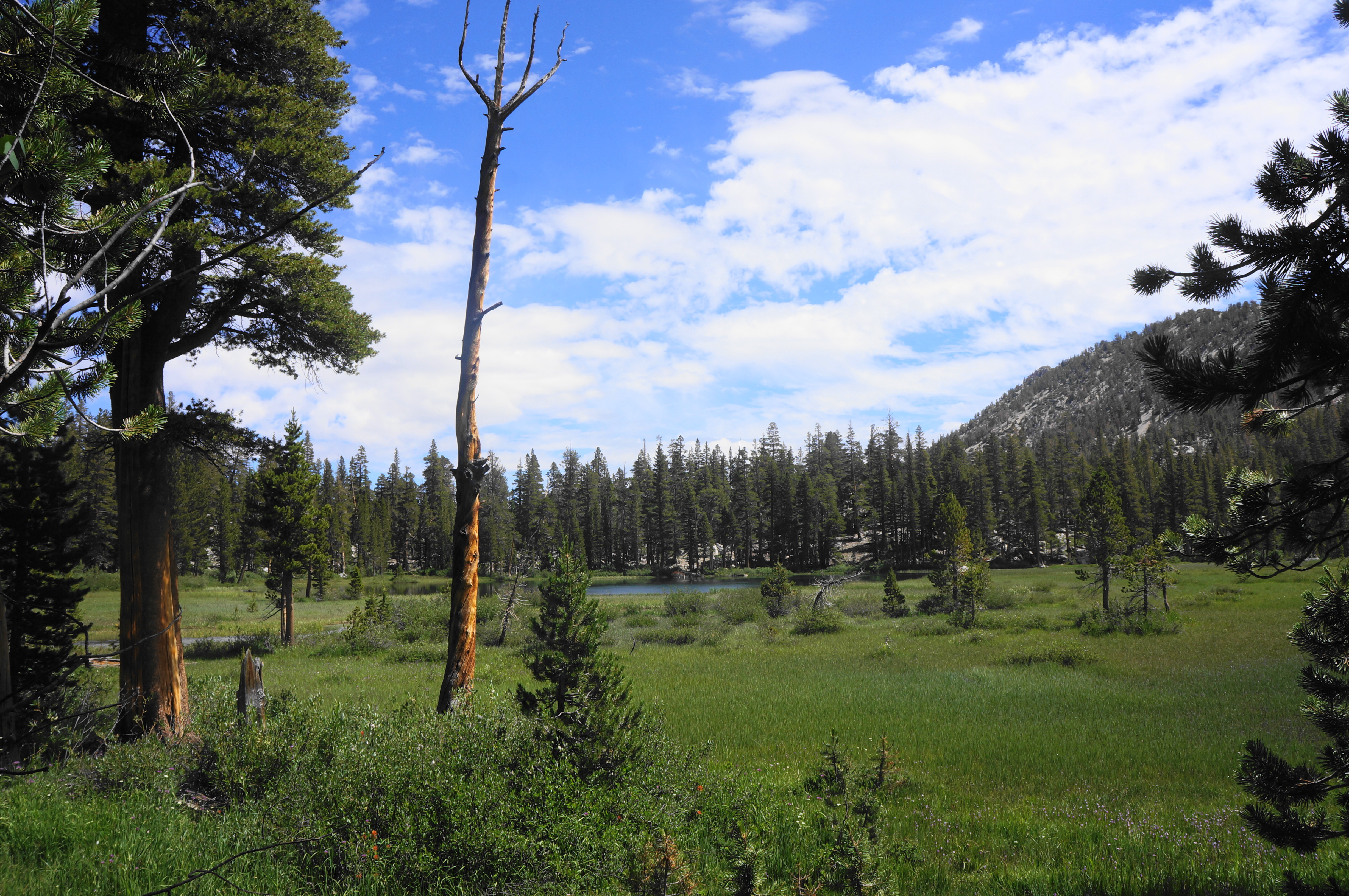
Tackle a few more, milder switchbacks, then come to a junction with the Grass Lake Trail, which offers access to its namesake. Stay right on the Lamarck Lakes Trail, rising to the base of a granite bulge that ushers in another challenging climb. The half-dozen steep switchbacks are made more bearable by the broad views down to the valley toward Bishop and an emerging look at the verdant meadows above Grass Lake. Peeking through a gap to the south, one can see to the next cluster of mountains, including Thompson Ridge above Lake Sabrina. Eventually the trail rises to a point where one can see all the way down to the parking area at North Lake.
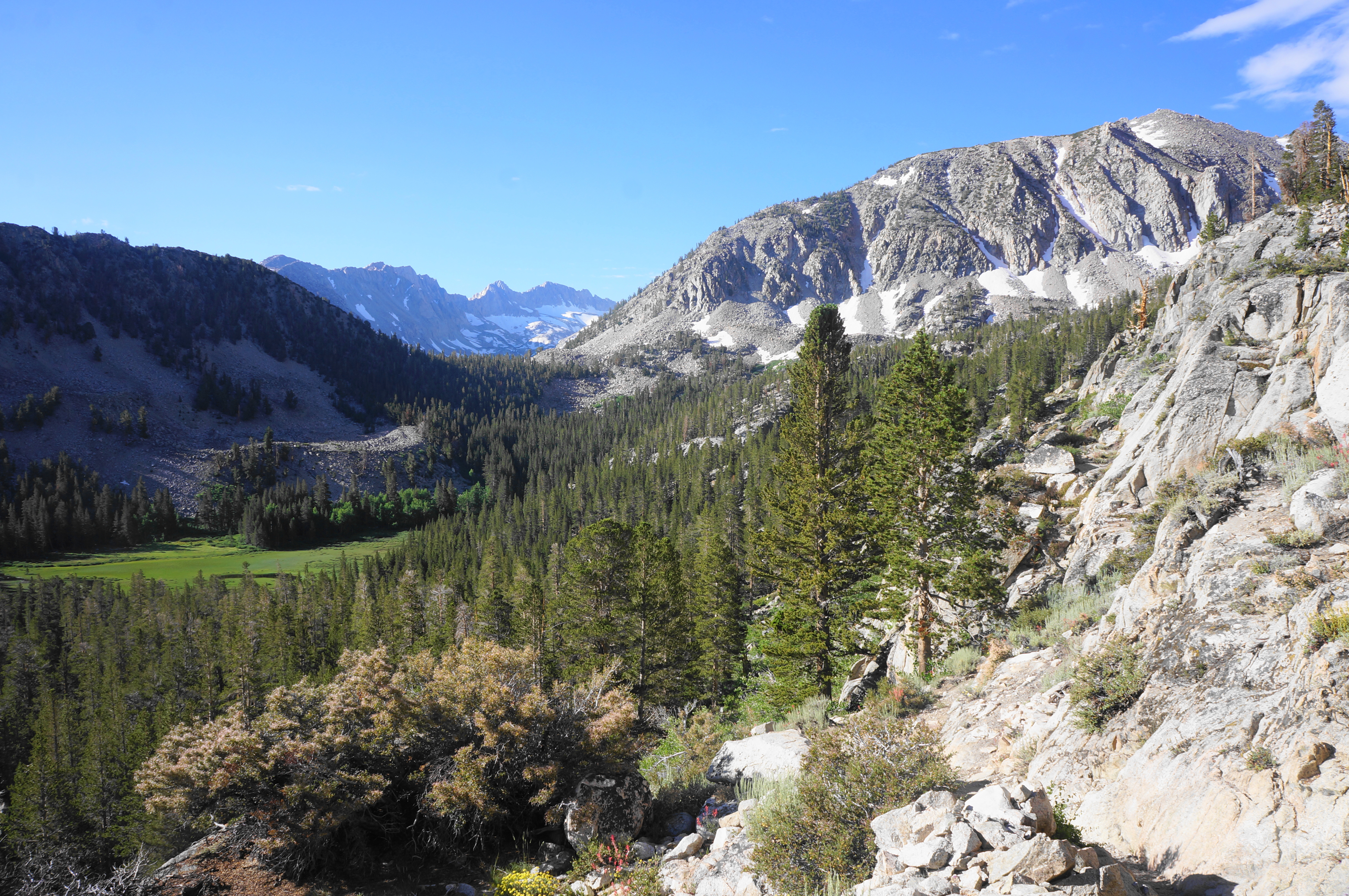
Continue to climb steadily, with views down the valley remaining until about 1.85 miles, when the path winds away from the rim. Pass through a half-sun, half-shade area for about ¼ mile, edging largely southwest toward Lamarck Lakes. By 2.1 miles, one can hear a stream ahead, but the path first ascends another set of sun-exposed switchbacks—rewarding hikers with the most expansive view yet. Grass Lake, previously obscured, can now be seen, hundreds of feet below.

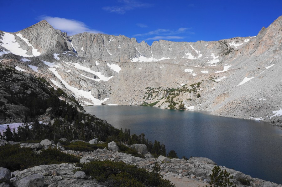
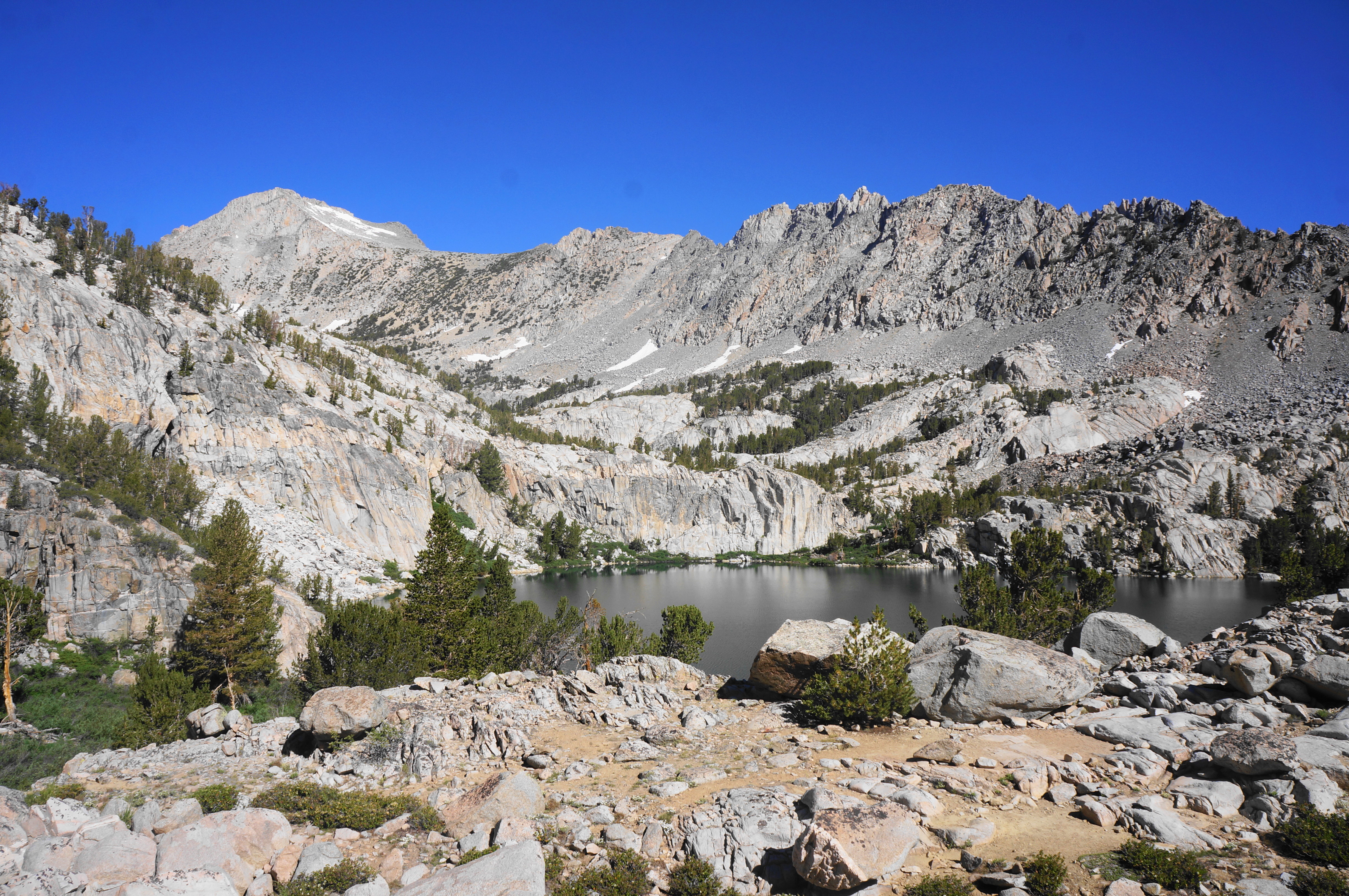
The route finally levels off for a bit at around 2.3 miles. Then it is up and over one last lip until, at last, a short spur leads to the serene shores of Lower Lamarck Lake. The sheer granite walls on the opposite bank add to the allure, in addition to the reflection of an unnamed but spectacular crag (12,153’) towering above. The basin up to the right, behind the lake, bears the so-called Wonder Lakes, with the sawtooth Sierra Crest beyond. The waters at Lower Lamarck are calm and rather shallow, frequented by the area’s famous mosquitoes after the spring snowmelt.


Lower Lamarck Lake to Upper Lamarck Lake (0.6 miles)
Lower Lamarck Lake itself is a worthy destination. But those seeking to complete the 2-for-1 can continue on for another 6/10 mile to the much-larger Upper Lamarck Lake. From the lower lake, work your way back eastward for about 10-20 yards, then find a trace heading right, curving around to the lake outlet. Drop to a stream crossing set below an emerald pool with babbling cascades. The traverse may require getting your feet wet, in which case it’s perhaps best to temporarily ditch your boots.


Once across, rise to a spot with great views down the valley, then round an awkward bend and parallel the emerald pool before cutting away from Lamarck Creek. Instead the path follows a mostly dry (or low flow) drainage before rising to the base of a rock slide overlooking Lower Lamarck Lake from a different angle.

Continue uphill as you round a bend, where the continuation of Lamarck Creek is visible again, but situated some 20-30 feet down in a thin canyon. The trail to Upper Lamarck soon approaches the tumbling stream at the base of a minor rock jam. You’ll need to cross the creek here, finding the onward trail on the other side. (Note: This could be a little tricky at high flow.)
Once across, the ascent is not done with you yet, with the trail rising up more switches and over a narrow notch, reaching a junction with the route to Lamarck Col (and the alternative route down) at about 2.9 miles. Stay right, on the north side of the stream, for a brief period, then look for a spot where the trail cuts across Lamarck Creek again for final crossing. (Note: After a very wet winter, this section was still snow-covered in August 2023. If this is the case, avoid crossing any snow bridges over the stream and instead turn around and cross back at the Lamarck Col junction; following the north bank is also an option but the route soon fizzles out as the creek abuts a protruding granite face.)


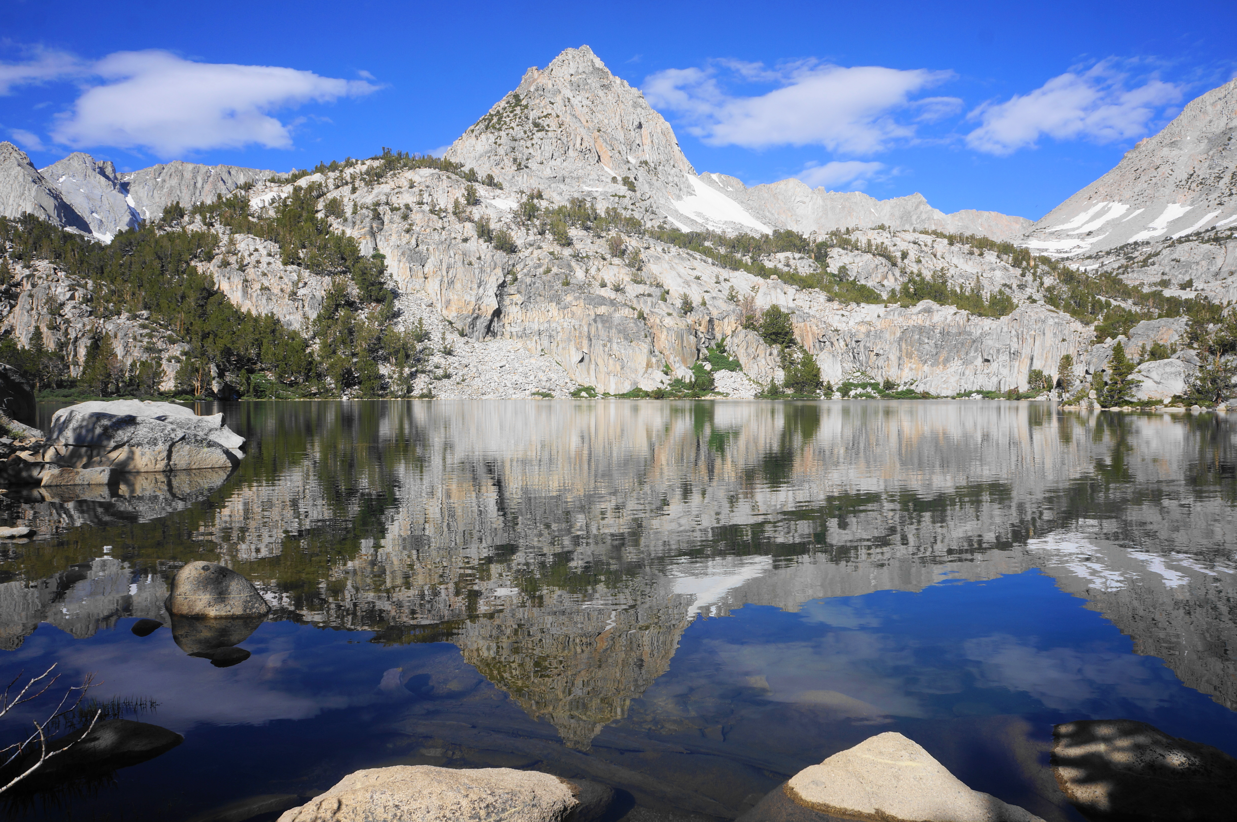
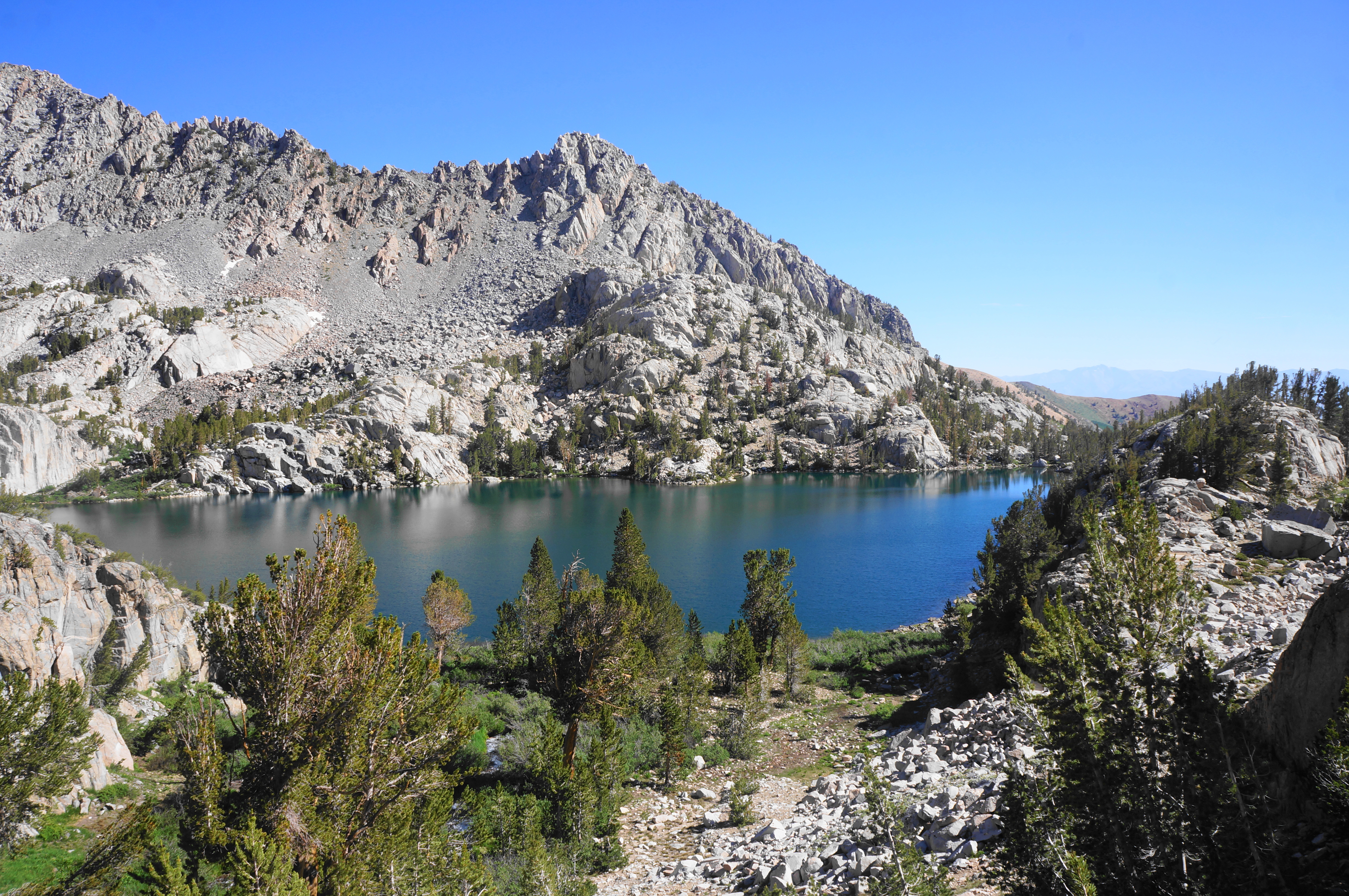
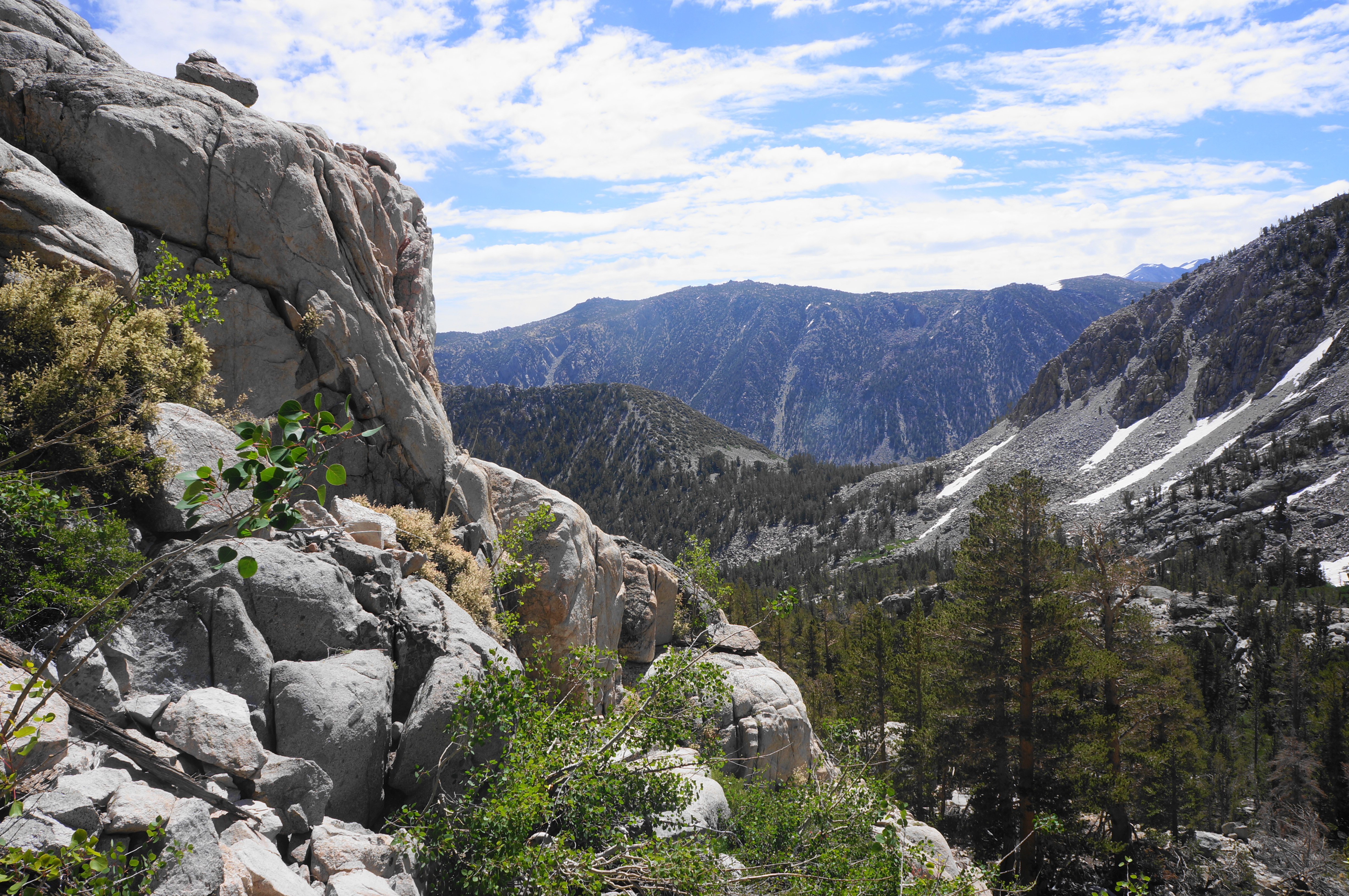
With the trail now on the left side of the creek, it ends at a natural dam, where the creek squeezes through a narrow passage, with the Upper Lamarck Lake unfolding ahead. Unlike its lower cousin, the backdrop to the lake to the west is nearly devoid of trees, leaving views only of scree, snow, and the towering Sierra Crest and Mount Lamarck (13,417’).
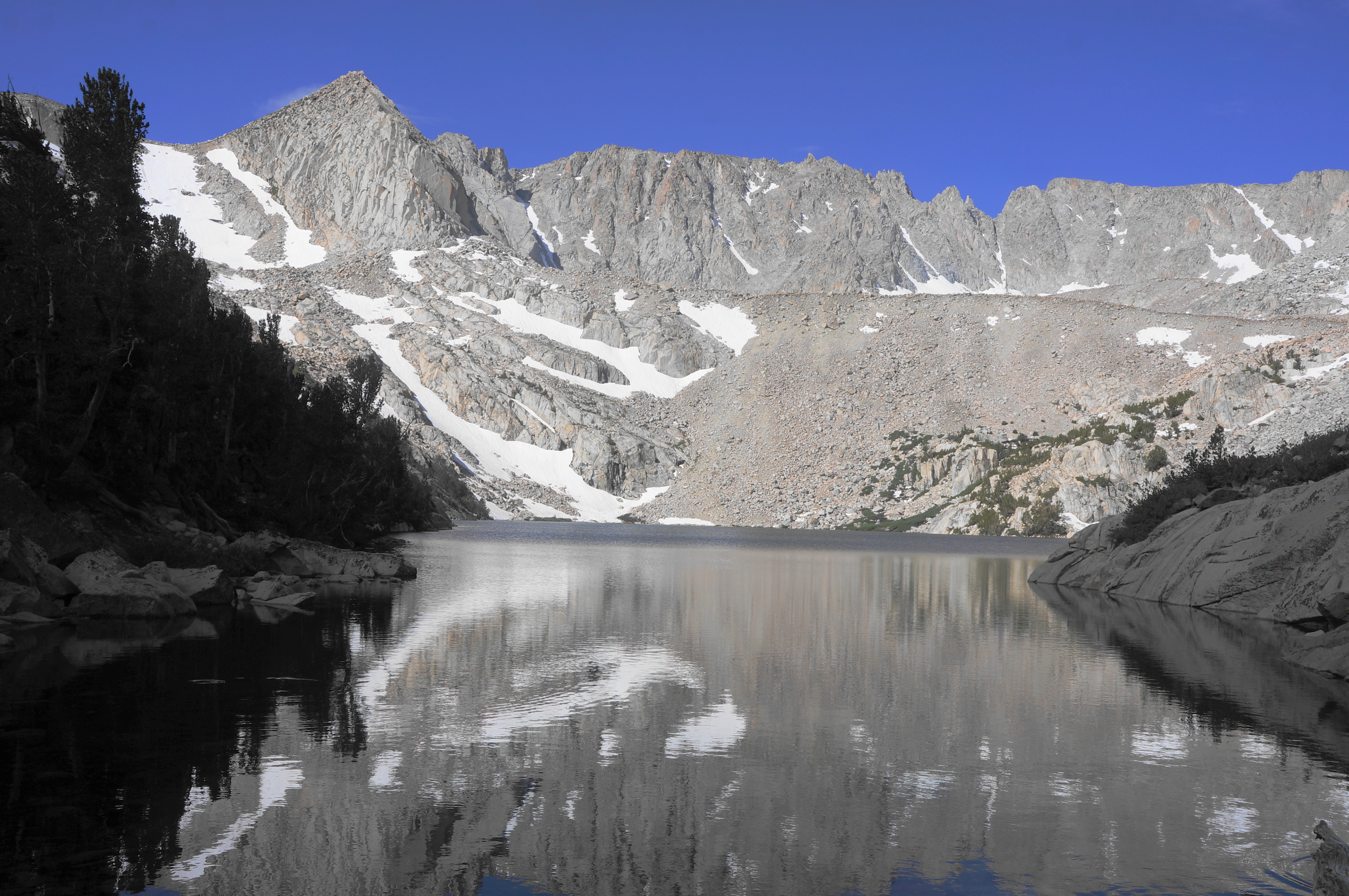
This is the three-mile mark and the turnaround point for the hike, but for those willing to scramble a bit, the knob to the southeast of the lake offers a nice bird’s eye view of the lake. From here one can see the entirety of the lake, with the basin bearing Wishbone Lake and Sky High Lake hidden behind a steep scree slope. The ridgeline off to the left offers access to Lamarck Col via a challenging unmaintained trail, and a look back east provides a look to Owens Valley and the White Mountains.


Upper Lamarck Lake to North Lake Trailhead via Grass Lake (3.0 miles)
While most visitors will likely just return the way they came, there is indeed an alternative route—no longer shown on maps of the area—that provides access back to North Lake via the meadows and pleasant streams of the Grass Lake area. To find this track, work your way back to the junction with the route to Lamarck Col, cross the stream to the south side, and crest a pass with what appears to be several campsites.
Then look for a path that breaks off from the route to the col, instead edging southeast. The path puts the upper and lower lakes out of sight and drops into an adjacent valley that is verdant and surrounded by granite slopes. (Note: If you are heading uphill and toward the Sierra Crest, you have taken the wrong path, this one heading for Lamarck Col.) This unofficial trail is curious in that it completely lacks signs, cairns, or any sign of trail markers—yet the route is well-worn enough that it is relatively easy to follow all the way down to Grass Lake.
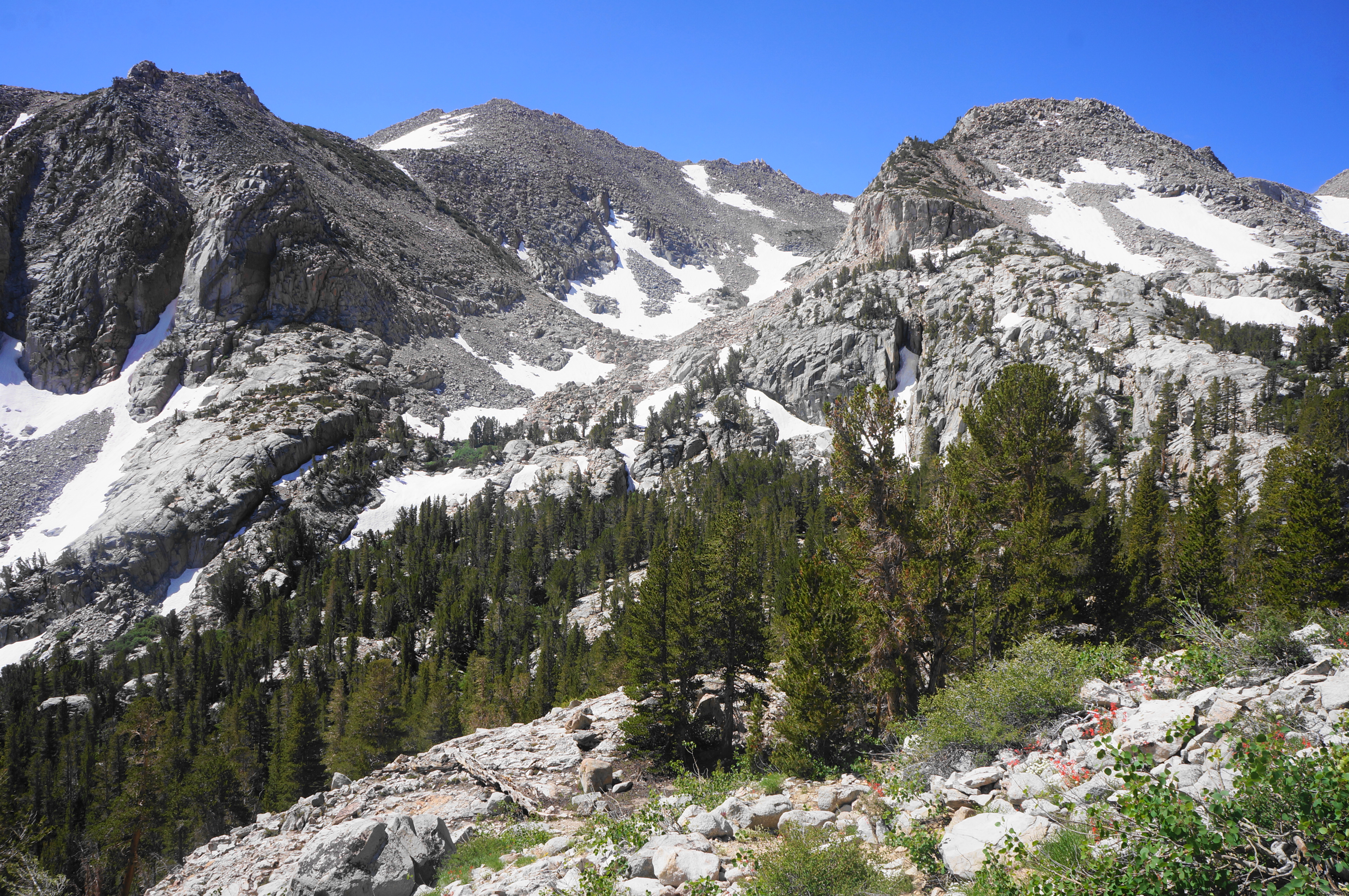
After around ½ mile of descent on a switch-backing trail, come to a spot with cliffs down to the right and an outcrop with a fine look down to Grass Meadows (but not the lake). Then the trail drops to a dry drainage with switchbacks and more shade, firmly dropping from alpine to subalpine terrain. Pass a dense cluster of white pines around 3.9 miles (9/10 mile from Upper Lamarck Lake), by which time one can hear flowing cascades. It takes awhile until the trail approaches the tumbling stream, however.

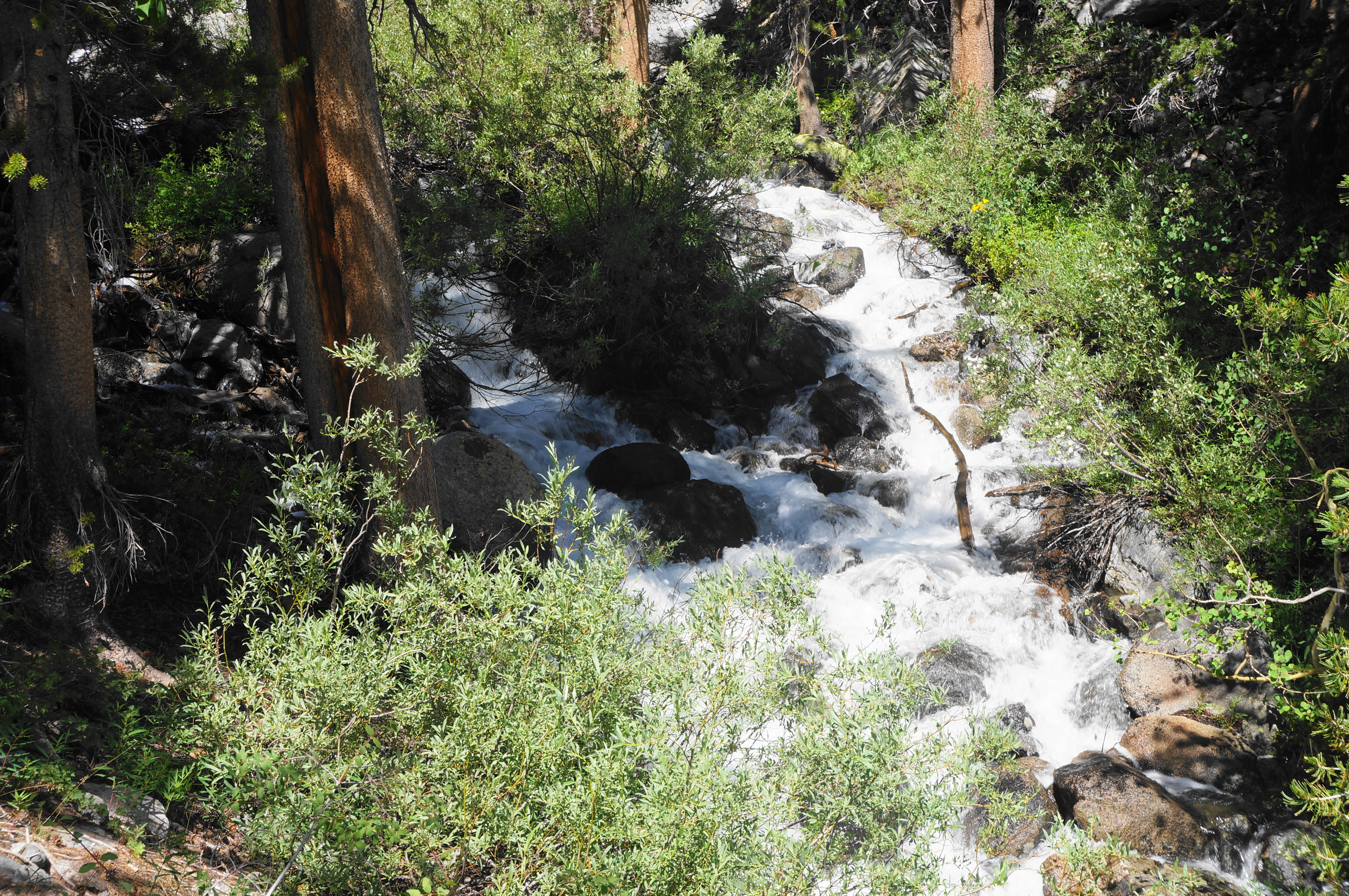
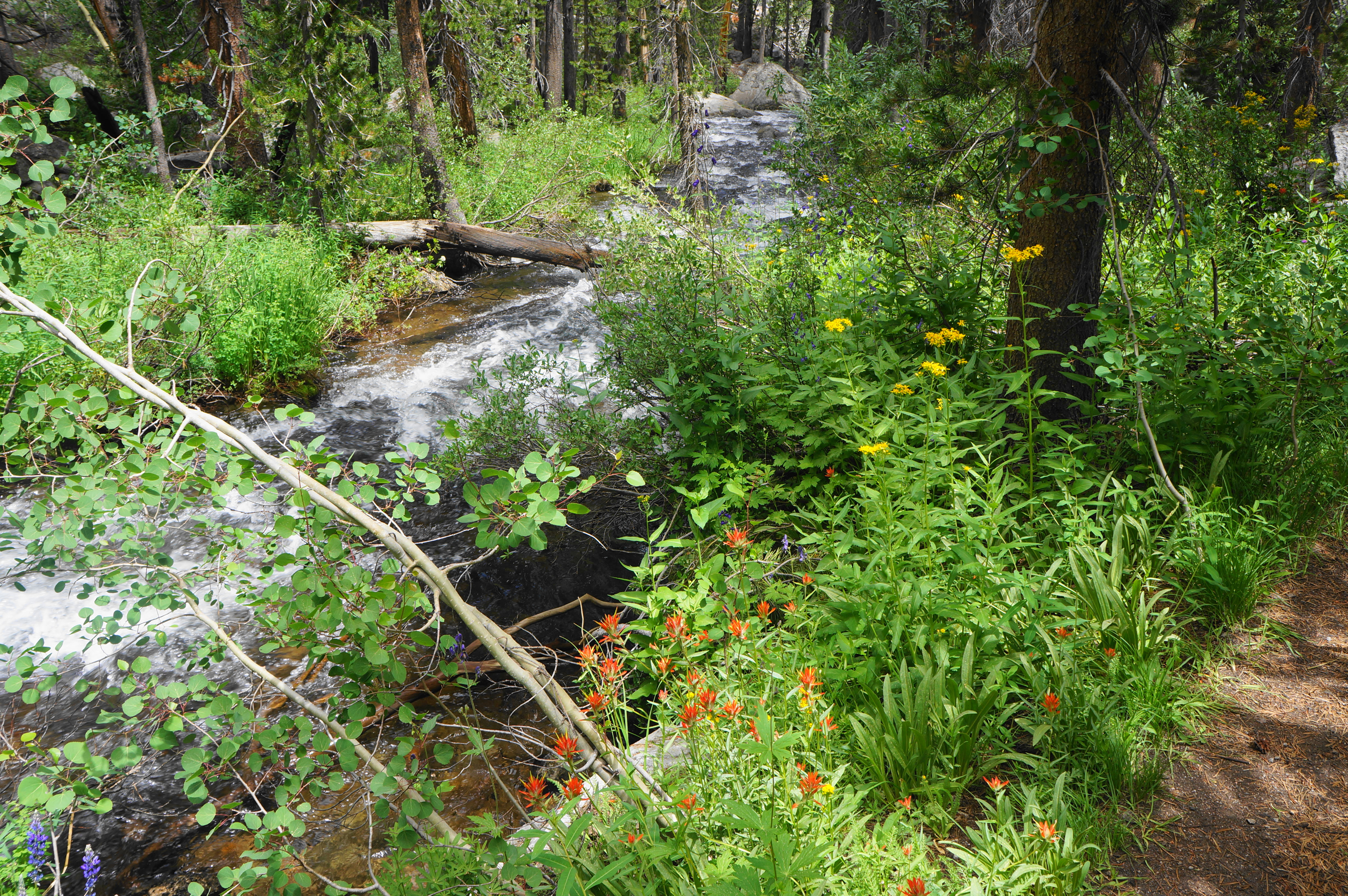
In the meantime, the Grass Lake route comes suddenly out into the sun again, then descends steep switchbacks and again approaches the sounds of water. This time, a short detour leads to the source of the roar: an impressive waterfall, surrounded by dense brush.


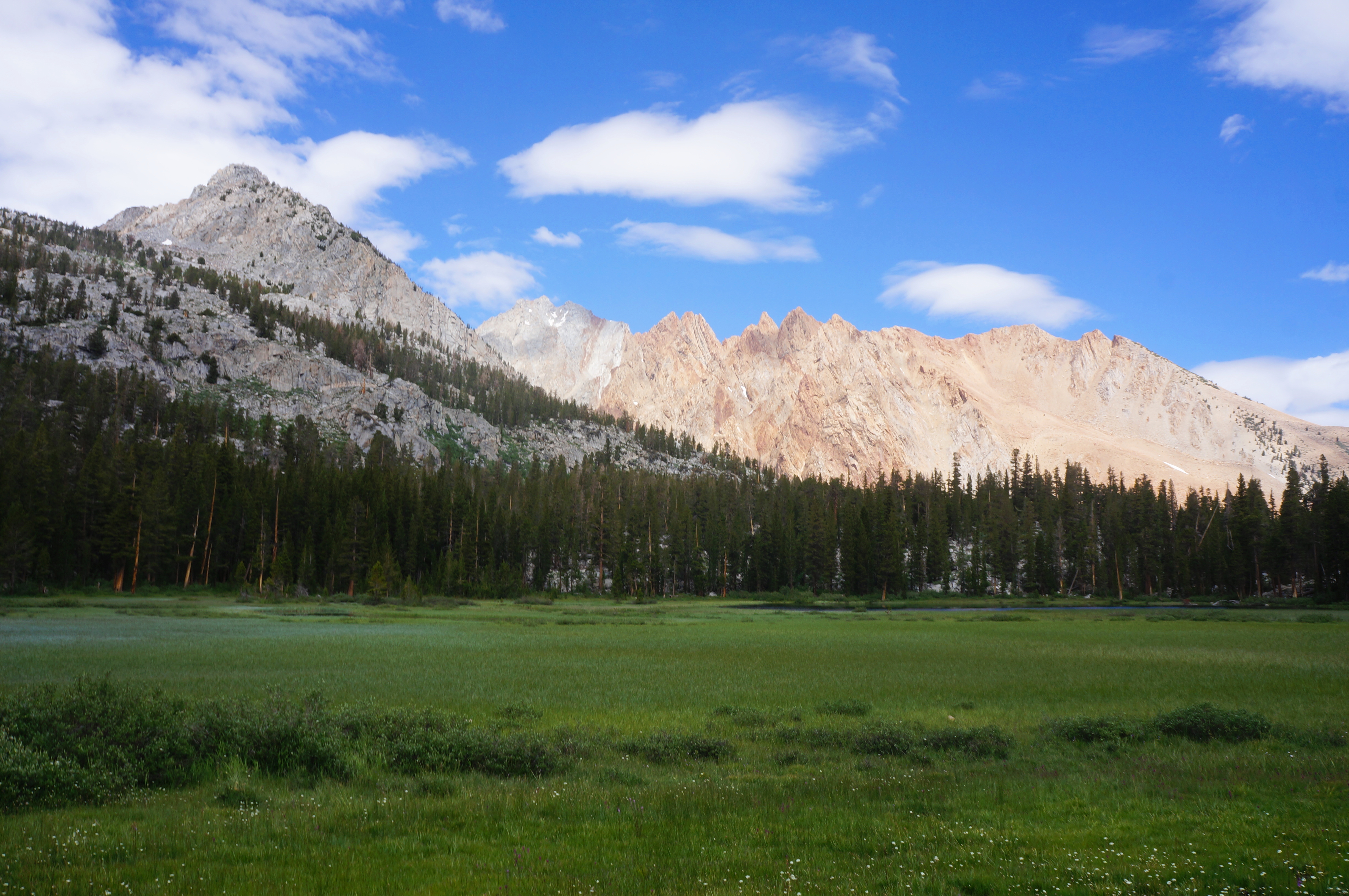
In another 2/10 mile, the trail approaches the stream again and suddenly dies out. The onward route is not obvious at first, but soon one can find a narrow social trail that leads away from the stream and around to the edge of the Grass Lake meadow. The lake itself is somewhat distant, but the area surrounding it is also open and very marshy, with high grasses (and mosquitoes!) overtaking the plain.

Follow the path around to a point where one can more easily cross the water-logged meadows, then carefully traverse the bog (not usually wet enough to rise above your boots), coming out the other side back at the edge of the woods. The views back across the meadow to the creamsicle-hued crags are stunning for their contrasting colors.


The unofficial trail ends at a junction at the outlet of Grass Lake, where Lamarck Creek resumes its rapid, cascading descent. A true trail heads north, across the stream, to the north side of the lake, while another track—labeled on some maps as the Grass Lake Outlet Trail—bears right, staying on the south side of the stream. Follow the latter as it parallels the waterway, passing frequent colorful wildflower displays.
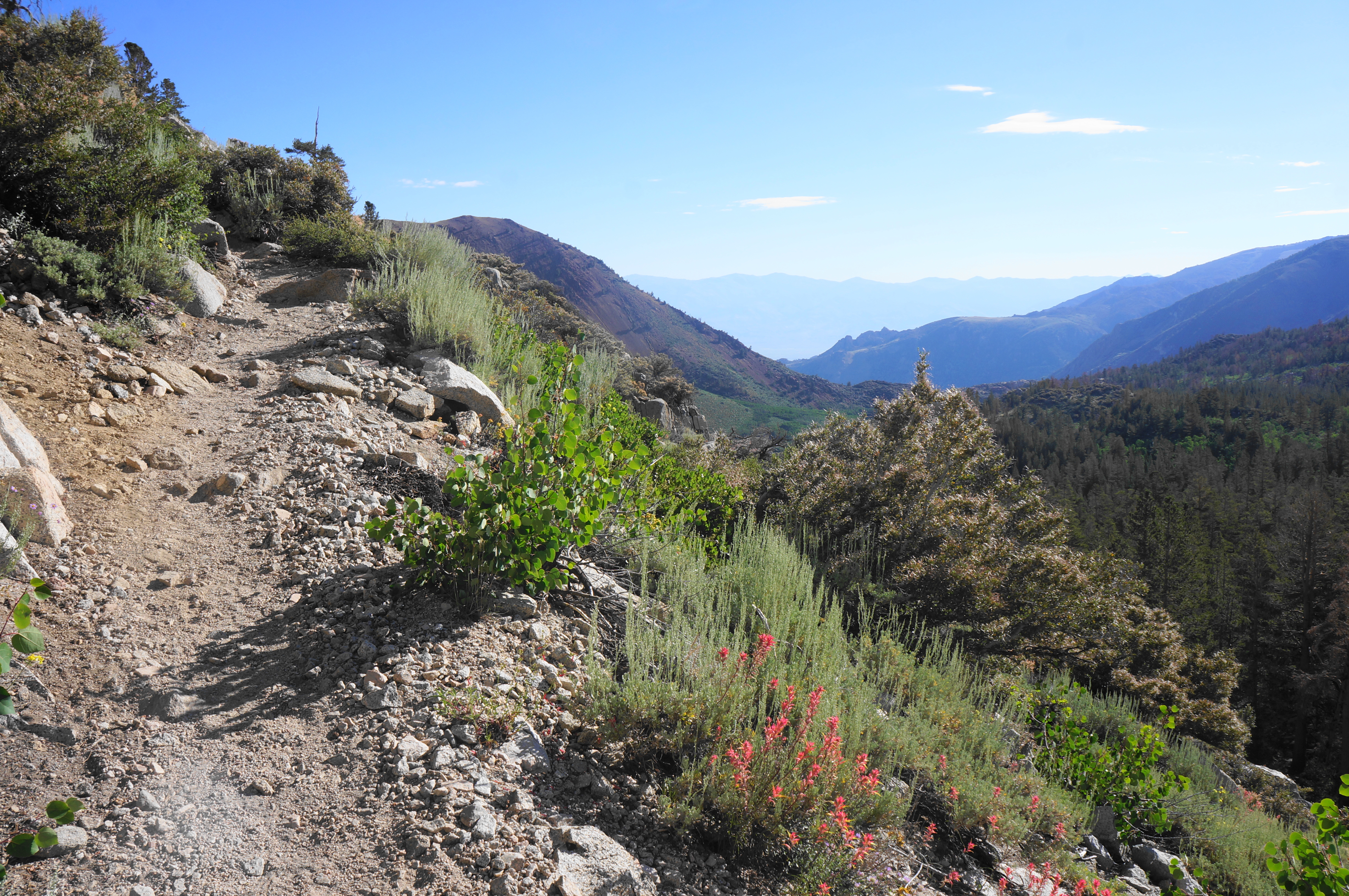
Compared with the preceding section, this trail is much more established—even as it still remains largely unknown to many visitors. After around ¼ mile away from the banks, the trail returns streamside at around 4.8 miles, then continues a mild descent. After a half-mile more of pleasant strolling, the trail suddenly begins to shed elevation quickly, dropping around 350 feet after officially leaving John Muir Wilderness.
Soon one can spot the North Lake Road and the North Fork of Bishop Creek below, and a final steep incline leads to a sudden, grassy flat. Come streamside but do not cross—instead following the mild path as it snakes around to a spot where the trail empties out at North Lake Road. From here, bear left to find the initial road junction from the start of the hike, and take a right to return to the North Lake parking area and trailhead.

All told, the loop and out-and-back options both clock in at around six miles, making for a rewarding but sometimes exhausting hike, one of the best in the Bishop area. Expect to spend at least a half day completing the Lamarck Lakes jaunt, and combine with visits to nearby Lake Sabrina or South Lake for an excellent weekend outing.

Pingback: Top 10 Hikes in 2023 | Live and Let Hike