
The simple names—First Lake, Second Lake, etc.—belie the picturesque setting of Big Pine Lakes, nestled in a majestic valley across the High Sierra Crest from Kings Canyon National Park. Once a relatively well-kept local secret, the Internet and social media have turned the lakes into a popular destination, but backpacking quotas and the lengthy distance (nearly a 10-mile round-trip to/from Second Lake) help keep the crowds relatively mild. Visitors are rewarded with unparalleled views of Temple Crag (12,976’), Cloudripper (13,525’), and the Inconsolable Range, in addition, of course, to the turquoise-hued lakes. Camping is available at the lakes, and many tackle the hike as a 2- to 3-day backpack, but it is possible also to complete as a lengthy and strenuous day hike. The below describes a 13-mile stem-and-loop that covers six of the basin’s nearly two-dozen named lakes and gains more than 3,100 feet in elevation. (Note: Scoring a backpacking permit is absurdly difficult—the quota for reserved slots, released six months prior to the hike date, is often filled within seconds—so I opted to complete the journey as a long day hike (no permit required) in August 2023.)


The hike
The approach to the Big Pine Creek area starts as an unassuming drive on Glacier Lodge Road from the namesake town of Big Pine in eastern California’s Owens Valley. Situated in a rain shadow on the eastern flank of the Sierra Nevada, the Big Pine Creek drainage is, at first, surrounded by semi-arid scrub. But as the road approaches the Sierra Crest, the snow-capped peaks and glacier-sculpted valleys take shape, rich and green with pines and fed by tumbling, perennial streams.
Ten miles up the road from the town of Big Pine, look for the North Fork Big Pine Trailhead on the right (labeled “Big Pine Creek overnight parking” on Google). (Note: Most hikers will want to start the hike here. For backpackers, this is the only option for overnight parking. Visitors with campground reservations at Big Pine Creek Campground can shave off about a half mile of hiking each way. Day hikers without campsites can take their chances on getting a parking spot at the day use lot (see here), but space is extremely limited (maybe 5-6 cars).) Unless arriving quite early in the morning, the best decision is to just start at the North Fork Big Pine (overnight parking) lot.
North Fork Big Pine TH to Big Pine Lakes Loop (4.3 miles)
The North Fork Big Pine Creek Trail begins from the two-tiered parking area, initiating the lengthy, 13+-mile walk. It will be more than 4.5 miles until hikers see any lakes, but the open views and rushing rivers more than entertain along the way. Start with a climb up to a sage-dotted shelf, with open views up the South Fork drainage toward the Palisade Peaks. Pass a dusty, makeshift parking lot on the left, followed soon by the horse/mule corral at Glacier Lodge.
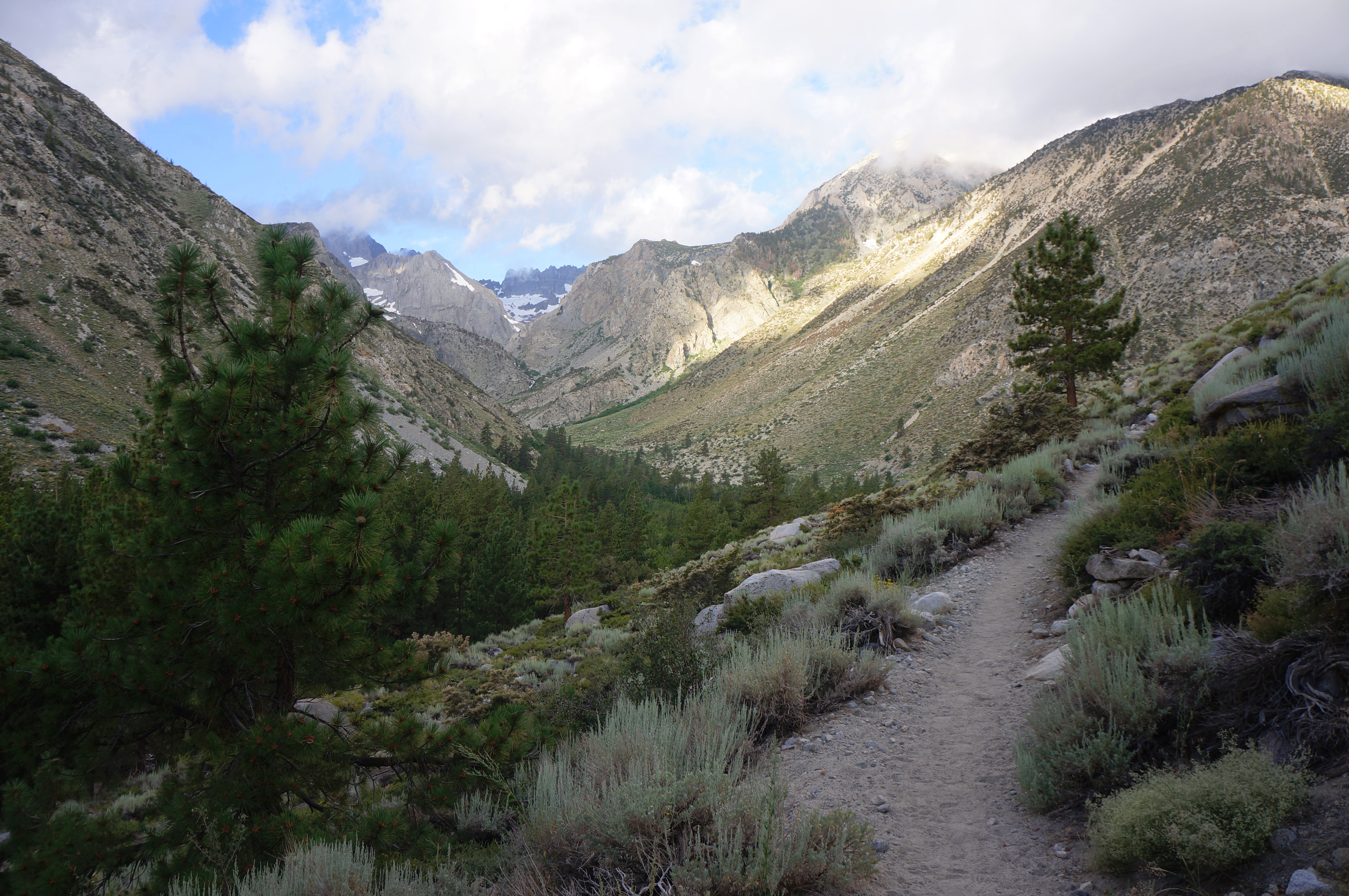

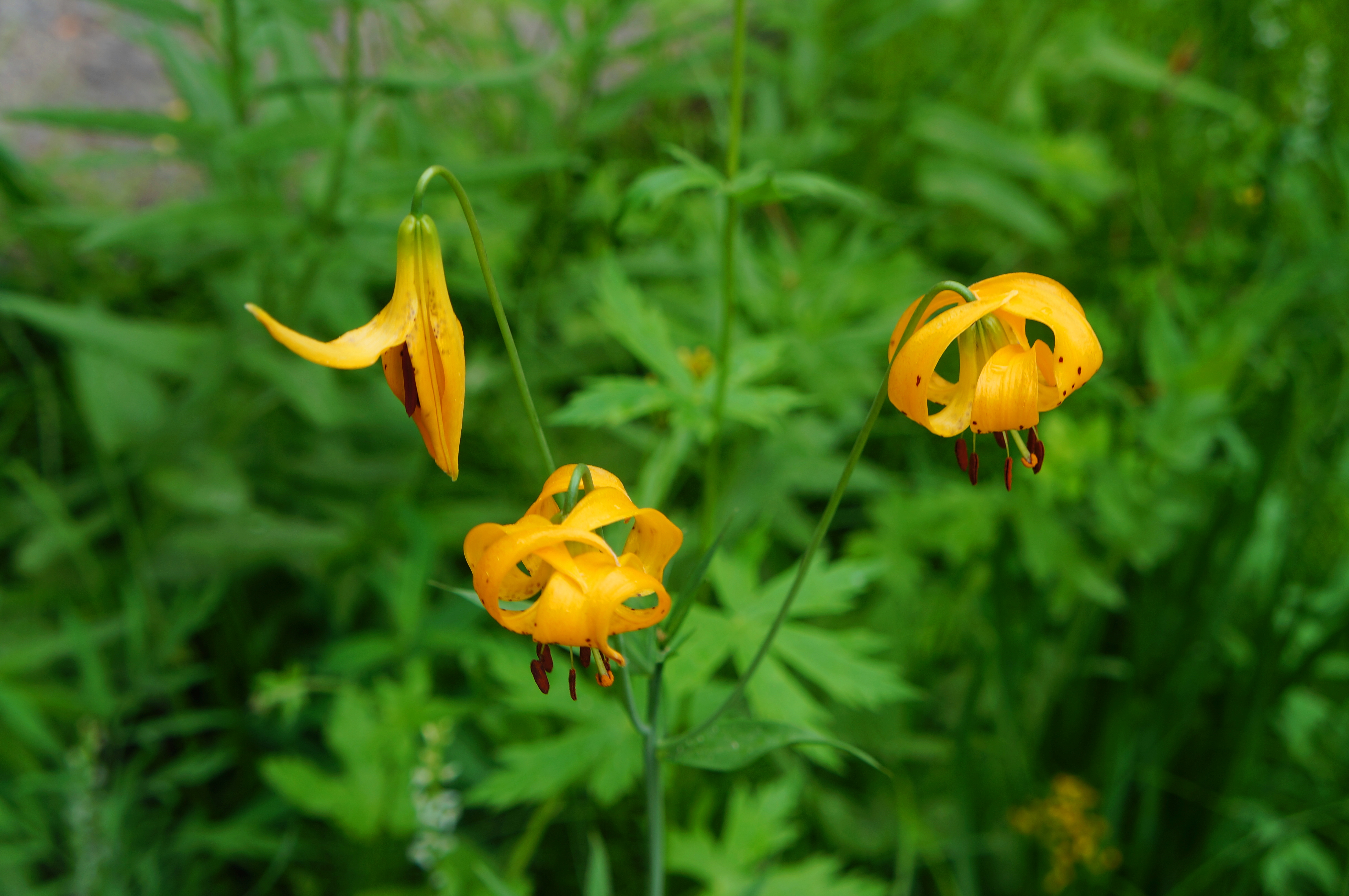
Brace for a steeper uphill at around ¼ mile, with a short flat beyond. Although not yet visible, one can easily hear the rush of Big Pine Creek, hidden in the Jeffrey pines below. Soon the trail passes above the campground and Glacier Lodge, edging westward until the canyon clearly splits. The rumbling cascades grow louder as the North Fork comes rushing in, and hikers can begin to peer around the corner at about 9/10 mile. Meanwhile, the trail has gained around 150 feet in elevation, and seasonal wildflowers blanket the slopes of the ridge.

At about one mile, the track passes a secluded picnic area down to the left, situated along First Falls, a series of mighty cascades that are nonetheless obscured from view. Soon hikers can see down to a path and bridge over the North Fork. This is the alternate route to/from Glacier Lodge Road (described later, below). An access route comes in from the left; stay right on the main trail.

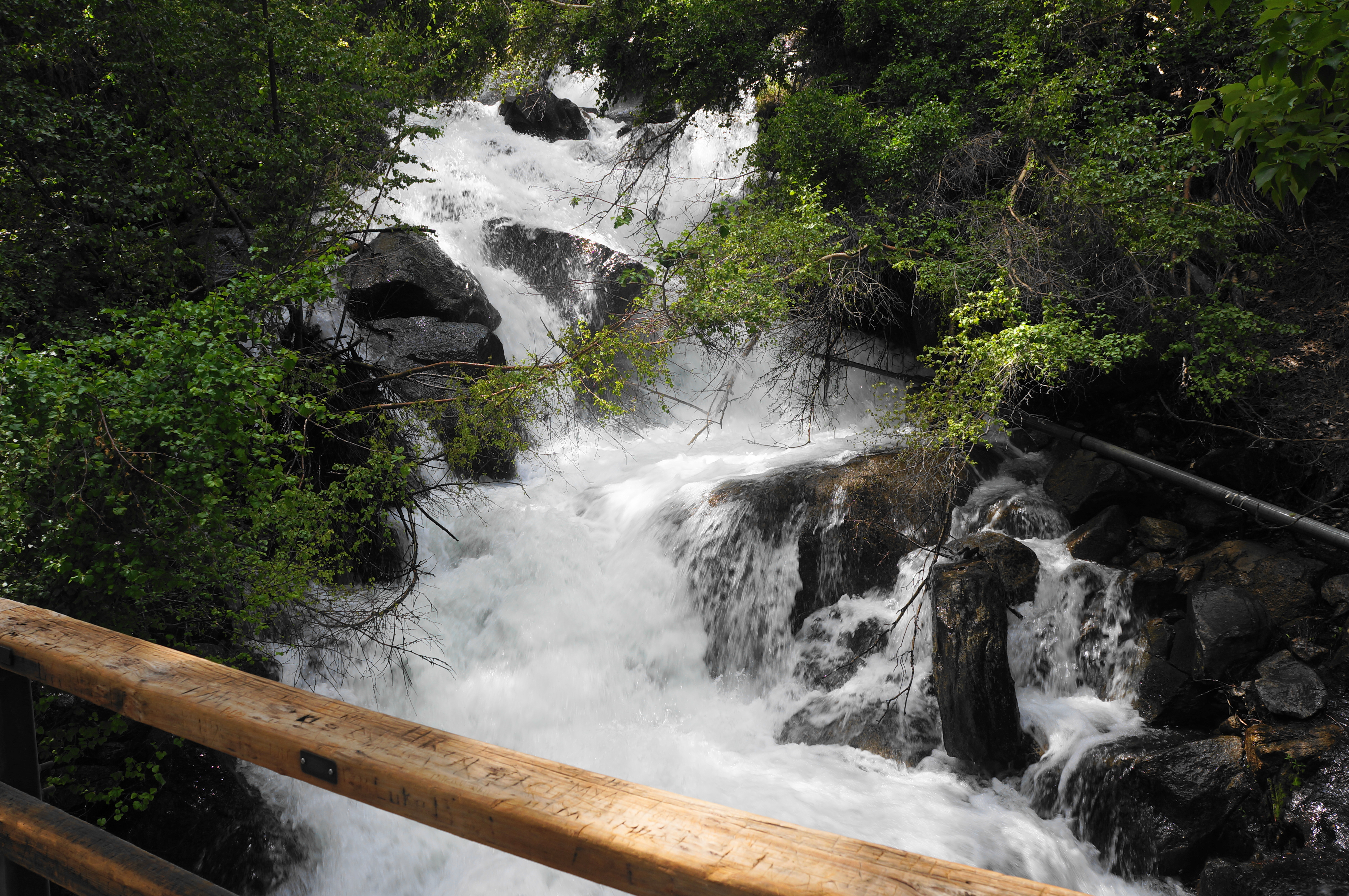
The trail continues up-canyon as the towering mountain of Sky Haven (12,898’) rises ahead. Soon the cascading creek becomes visible again, revealing impressive Second Falls. This waterfall—really more of a sequence of cascades—is a key waypoint on the hike, with the trail arcing toward the falls while hugging the north flank of the North Fork canyon.

The scenic track ascends to a four-way junction at 1.6 miles. Here the Baker Summit Trail heads right, rising to Baker Lake and Thunder and Lightning Lake to the north. To the left, another track leads down to the base of Second Falls and offers an alternative route back to the trailhead. Your route continues straight, determined to clear the next level above Second Falls.
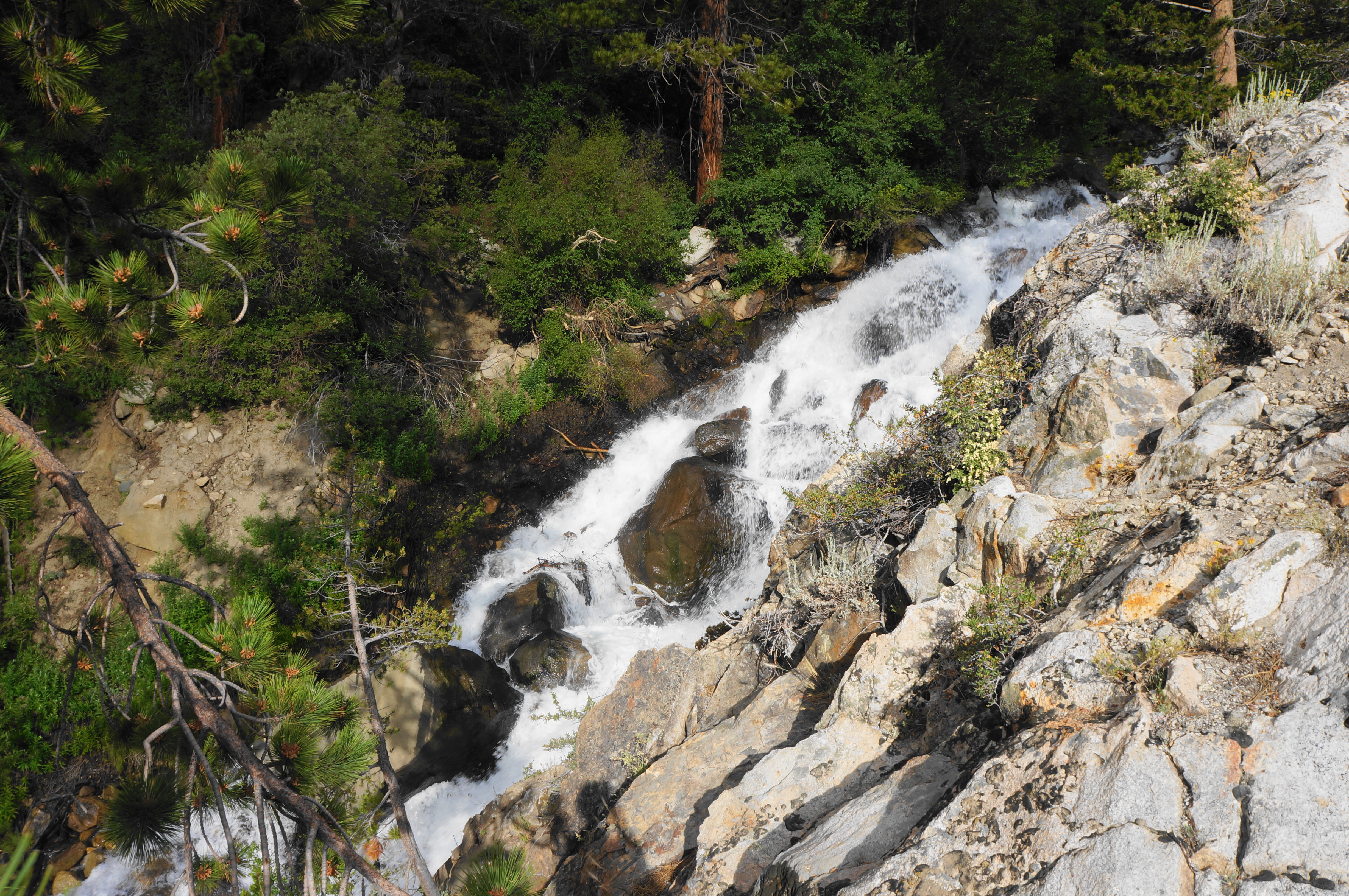
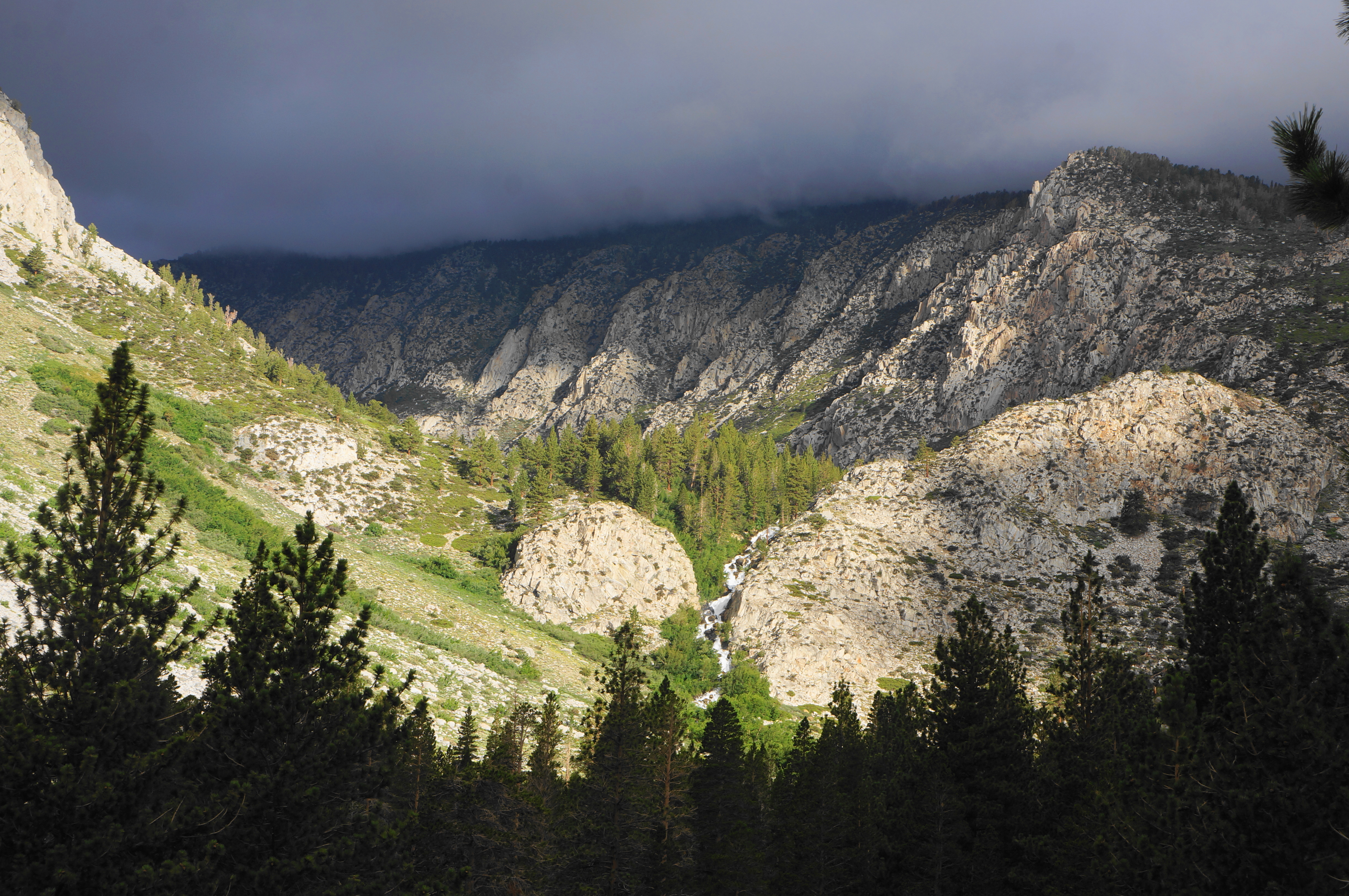
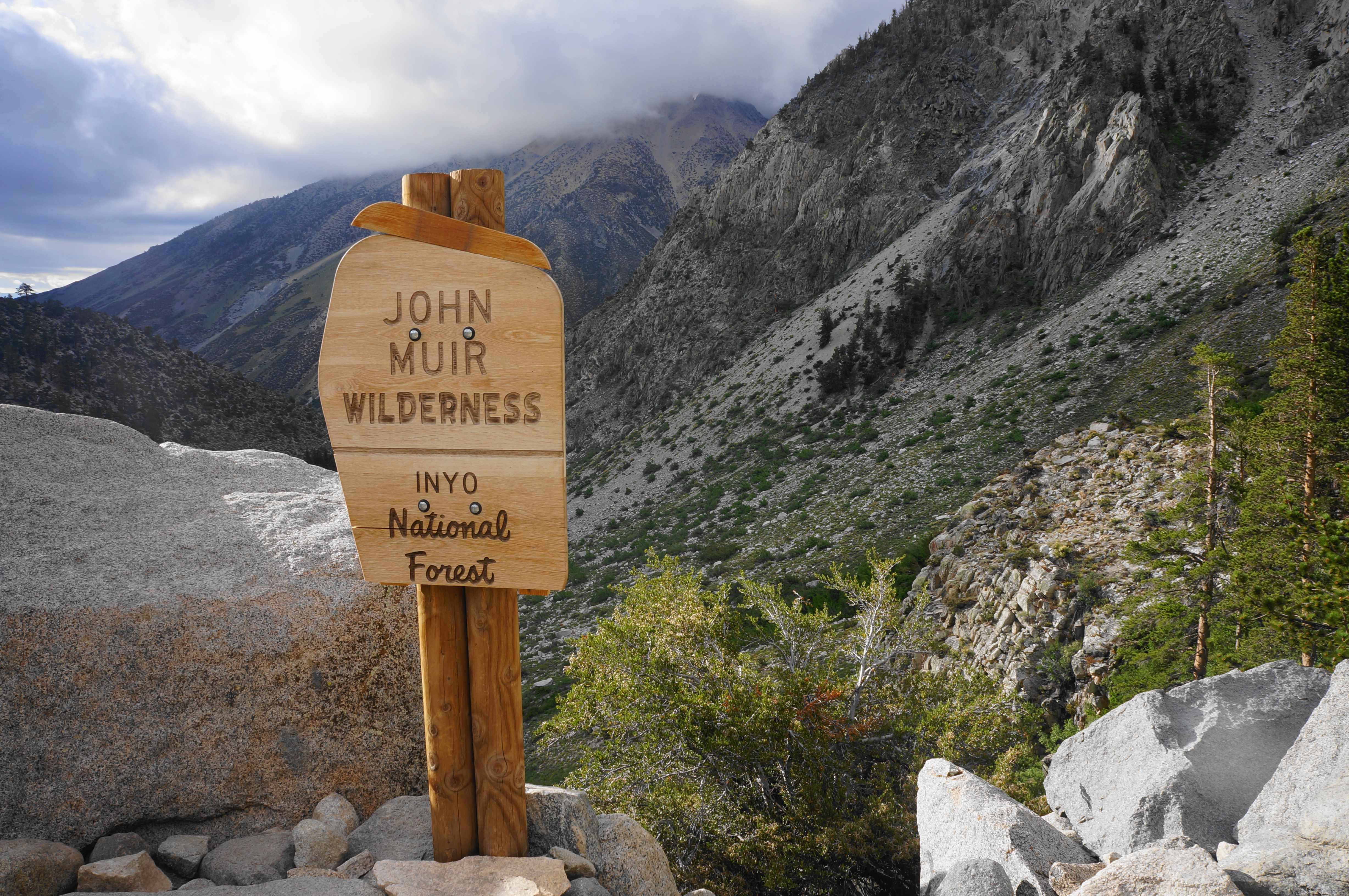
The onward route traces around to a point adjacent to the cascading stream and begins a set of three switchbacks, leaving the valley floor well behind. At the third, the route comes close to the banks of the North Fork, now rushing over Second Falls. After two more switchbacks, the trail enters the massive, 650,000-acre John Muir Wilderness.
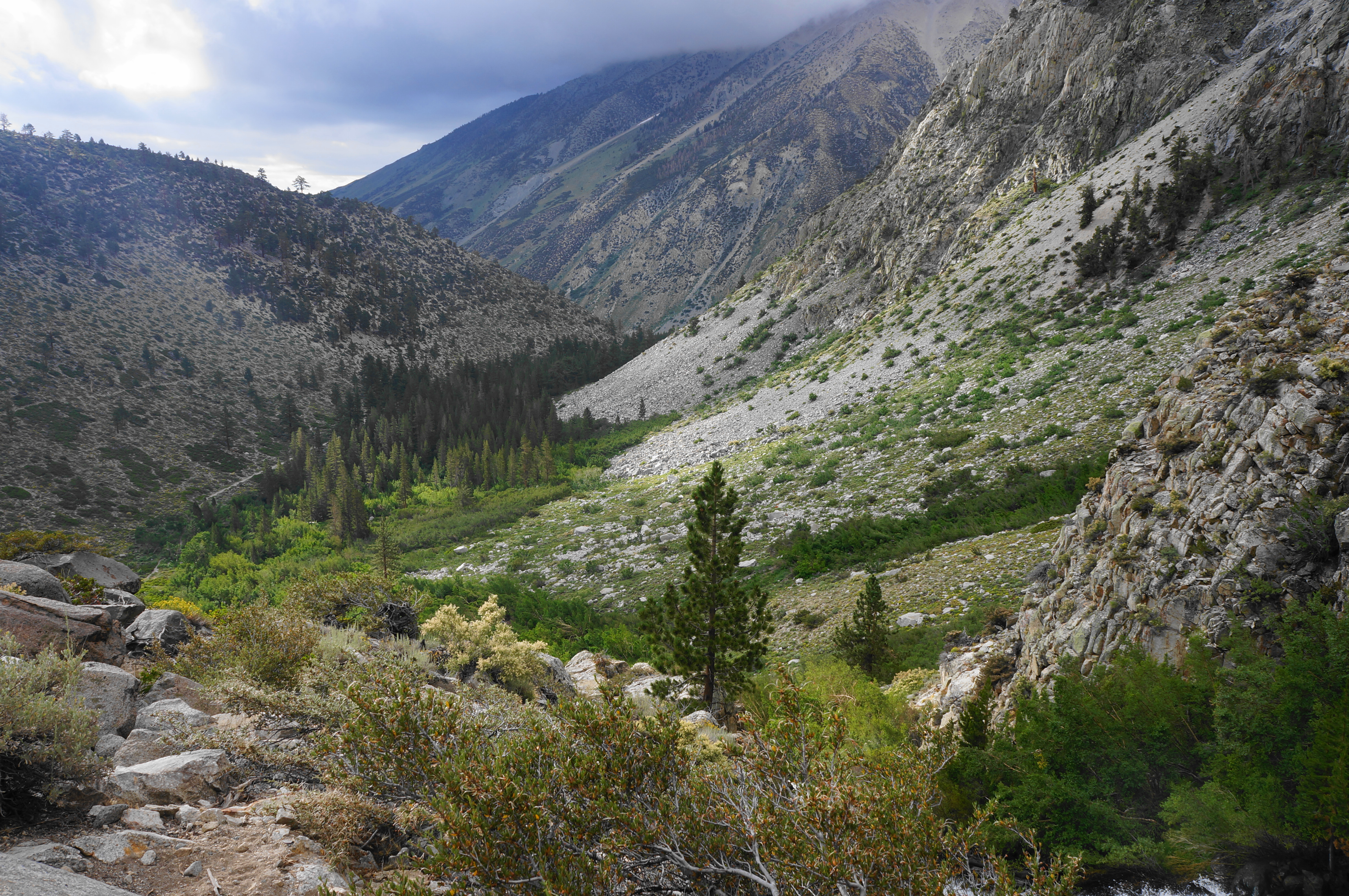

Enjoy the last look back down the V-shaped valley before the trail enters a very narrow gorge, just steps from the rushing stream. This scenic stretch marks the transition into a gentler, sandy section where the relentless elevation gain eases. Having ascended around 1,200 feet in the past two miles, hikers get a well-deserved break as the sandy track threads through a manzanita patch for around ½ mile.
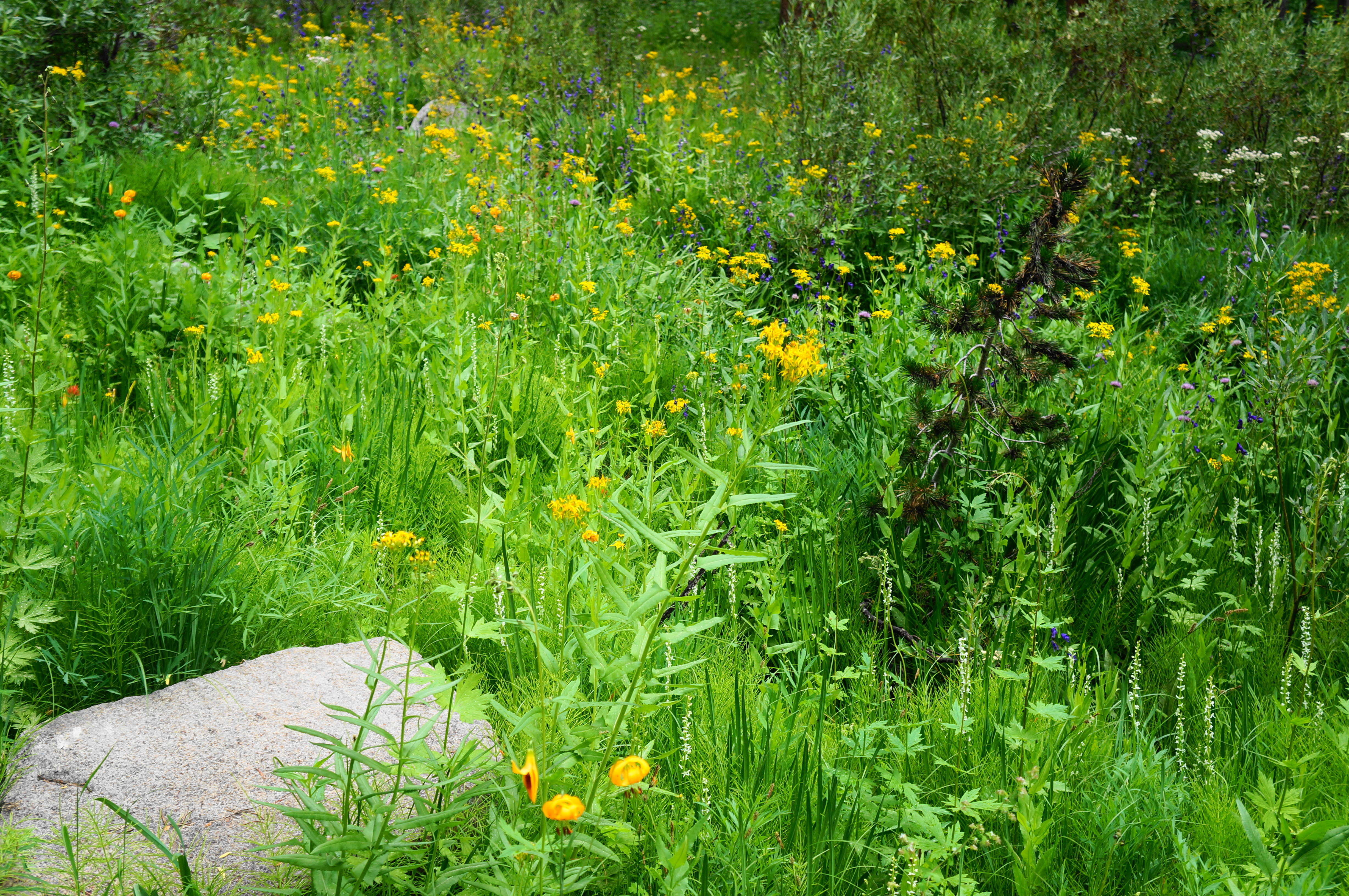
The mild uphill continues to a stand of aspens at around 2.5 miles, inaugurating a woodier section with pleasant shade and streamside views. After passing the Big Pine Creek Wilderness Ranger Station (a.k.a. the Lon Chaney Cabin) on the left at 2.75 miles, enter an open but brushy section that boasts seasonal wildflowers and passes another set of impressive cascades. Take five switchbacks in turn, then lead into more uphill as the bends grow wider.
At 3.25 miles, arrive at another set of cascades, with a boulder slide and the steep slopes of Mount Alice (11,630’) on the opposite side of the streamway. Continue uphill and come parallel to the creek again, after which the climbing briefly ceases again. Trace a gentle portion of the stream, then ascend another incline at 3.7 miles. Cross a tributary minutes later, then take on another set of switchbacks.


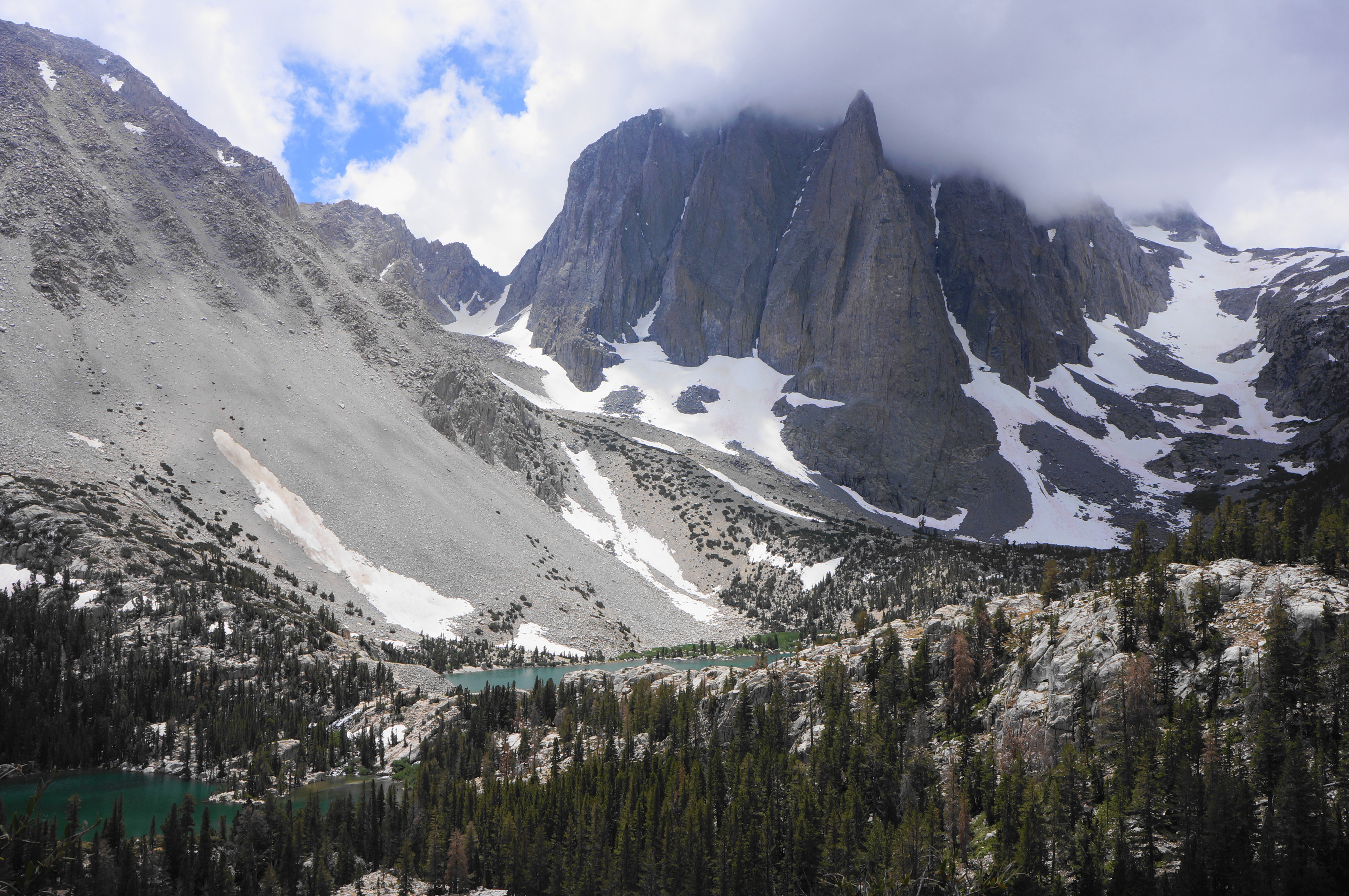
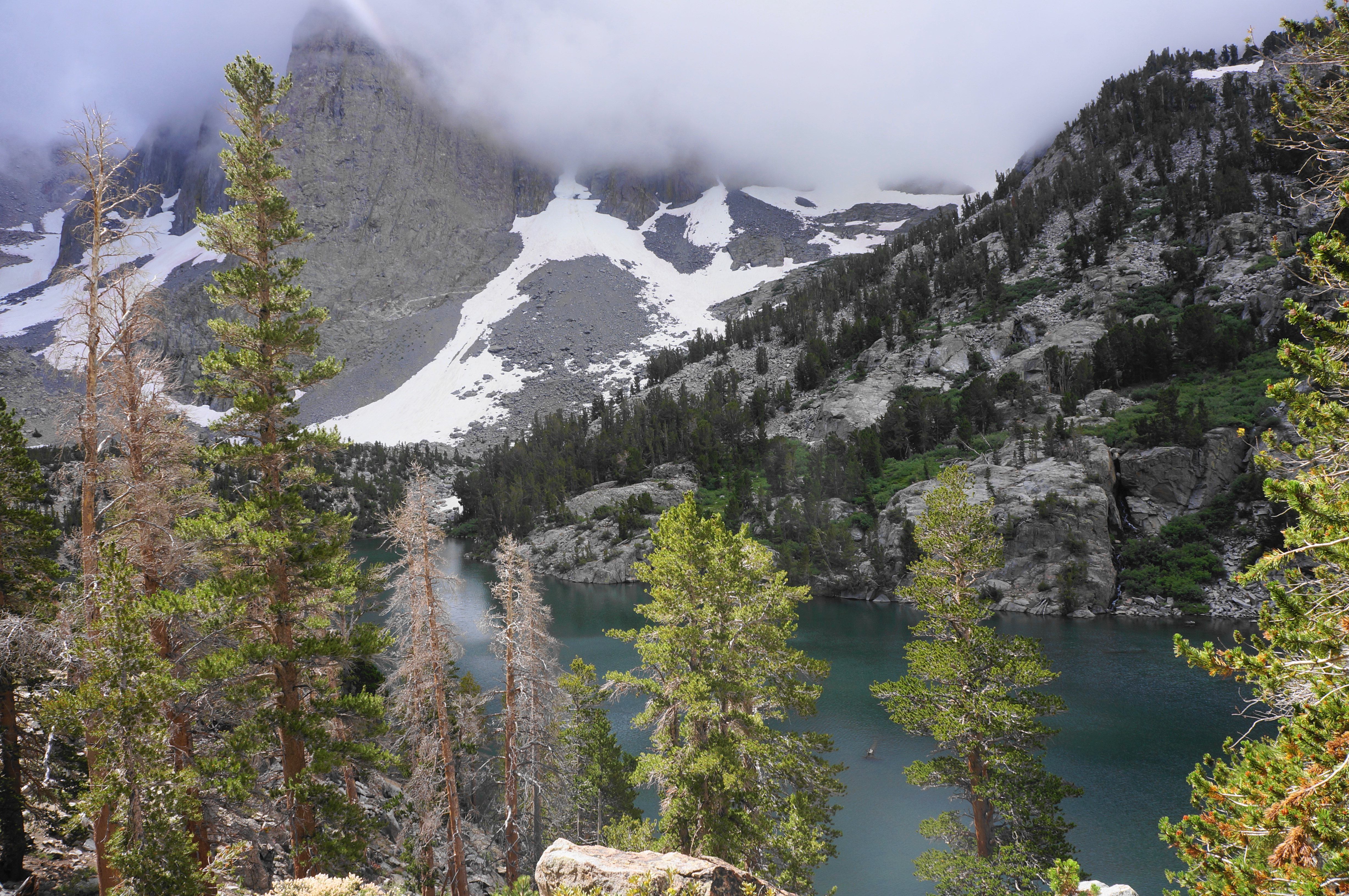
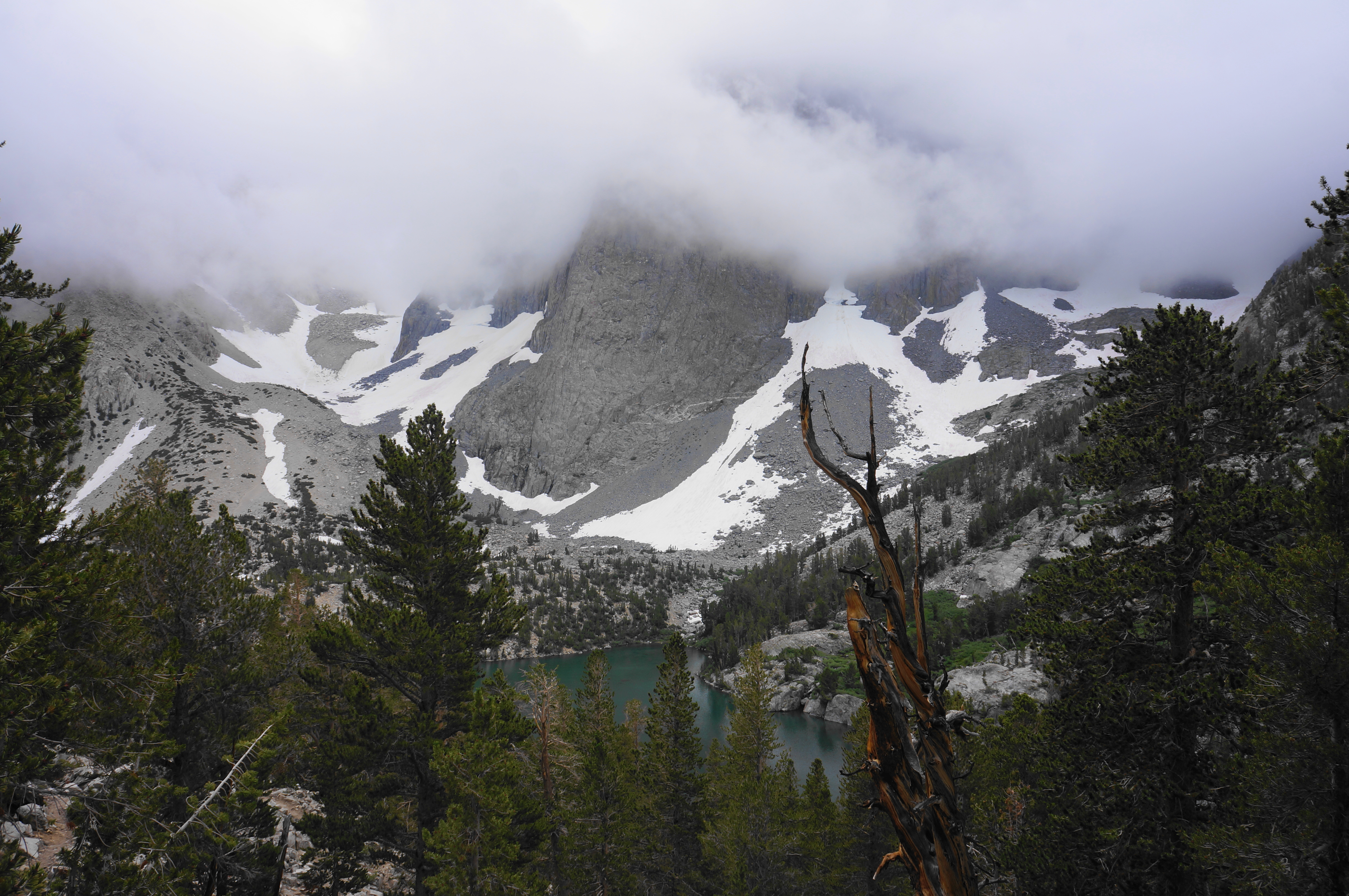
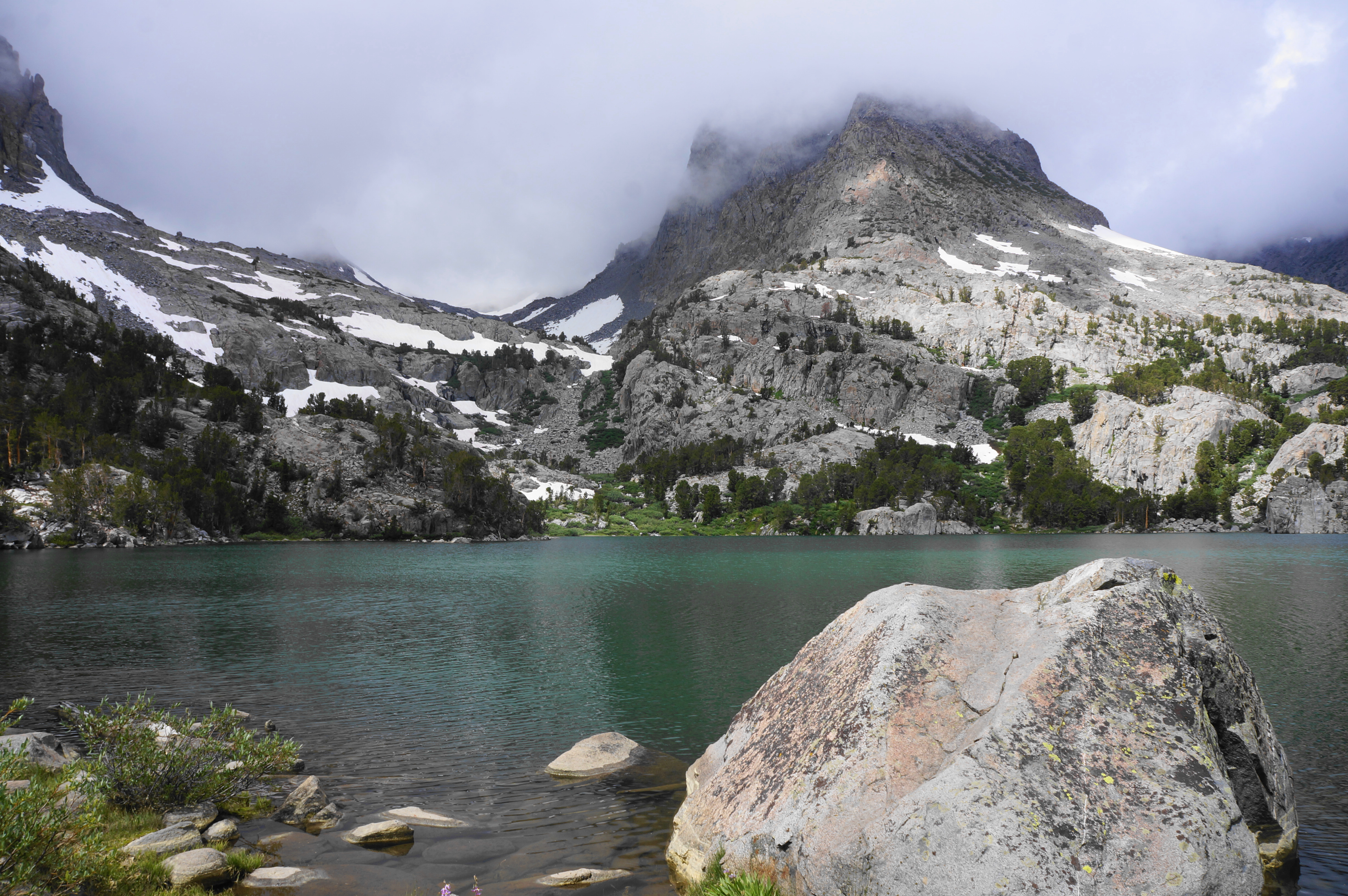
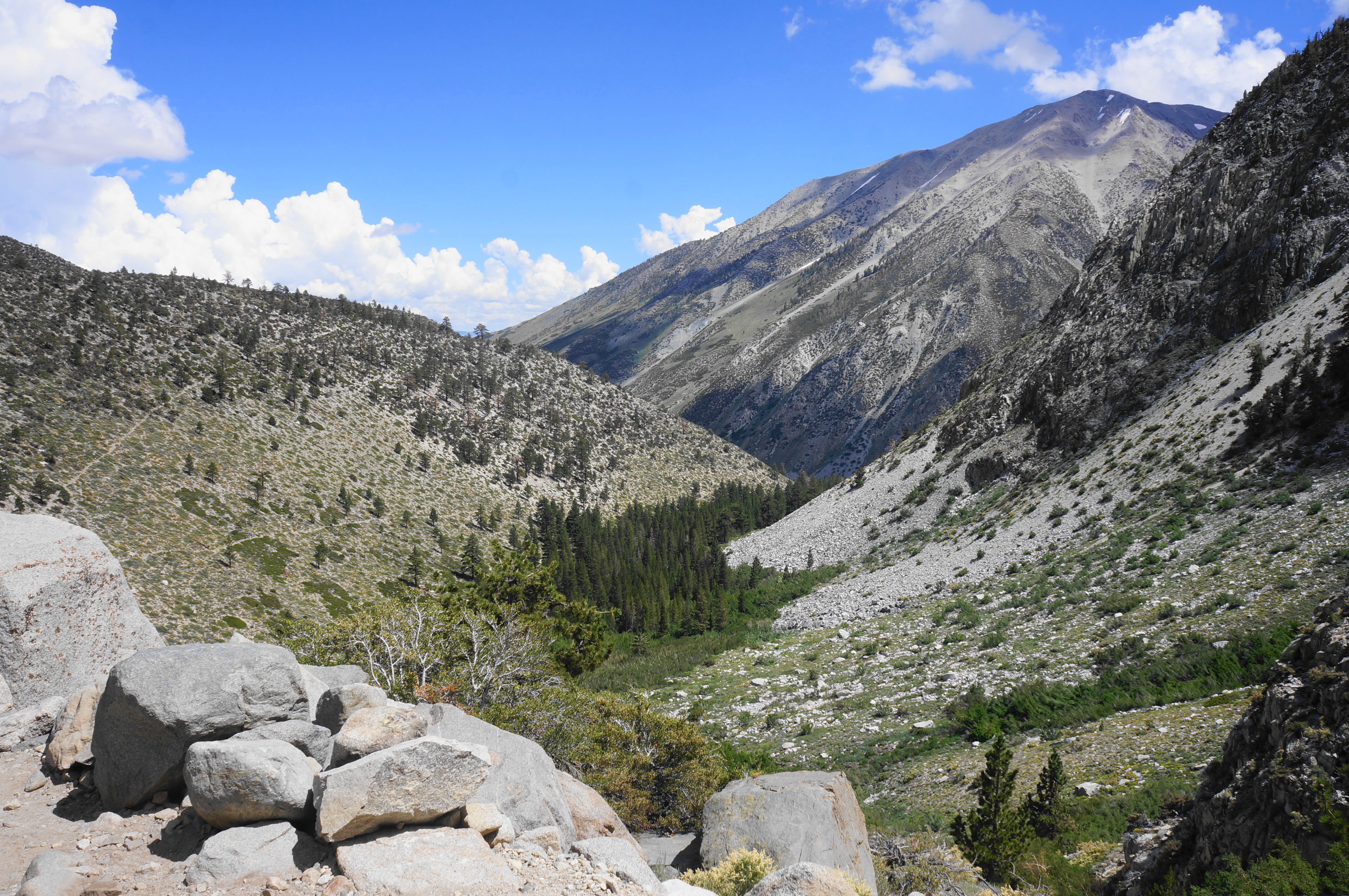
After cresting another shelf, hikers get good views to Temple Crag, which—at 12,976 feet—is far from the tallest peak in the Sierras but possibly one of the most stunning. The impressive granite face rises prominently above the Big Pine Lakes Basin and forms a terrific backdrop to nearby Second and Third Lakes.

Cross a seasonal tributary at 4.1 miles, then take on a final set of switchbacks before the start of the loop portion of the hike. The junction comes at around 4.3 miles from the trailhead.
Big Pine Lakes Loop (4.2 miles)
This starts the loop portion of the hike, which extends for almost four miles, plus short detours. This is where the scenery kicks into high gear, making this one of the most spectacular four-mile stretches in the eastern Sierras.


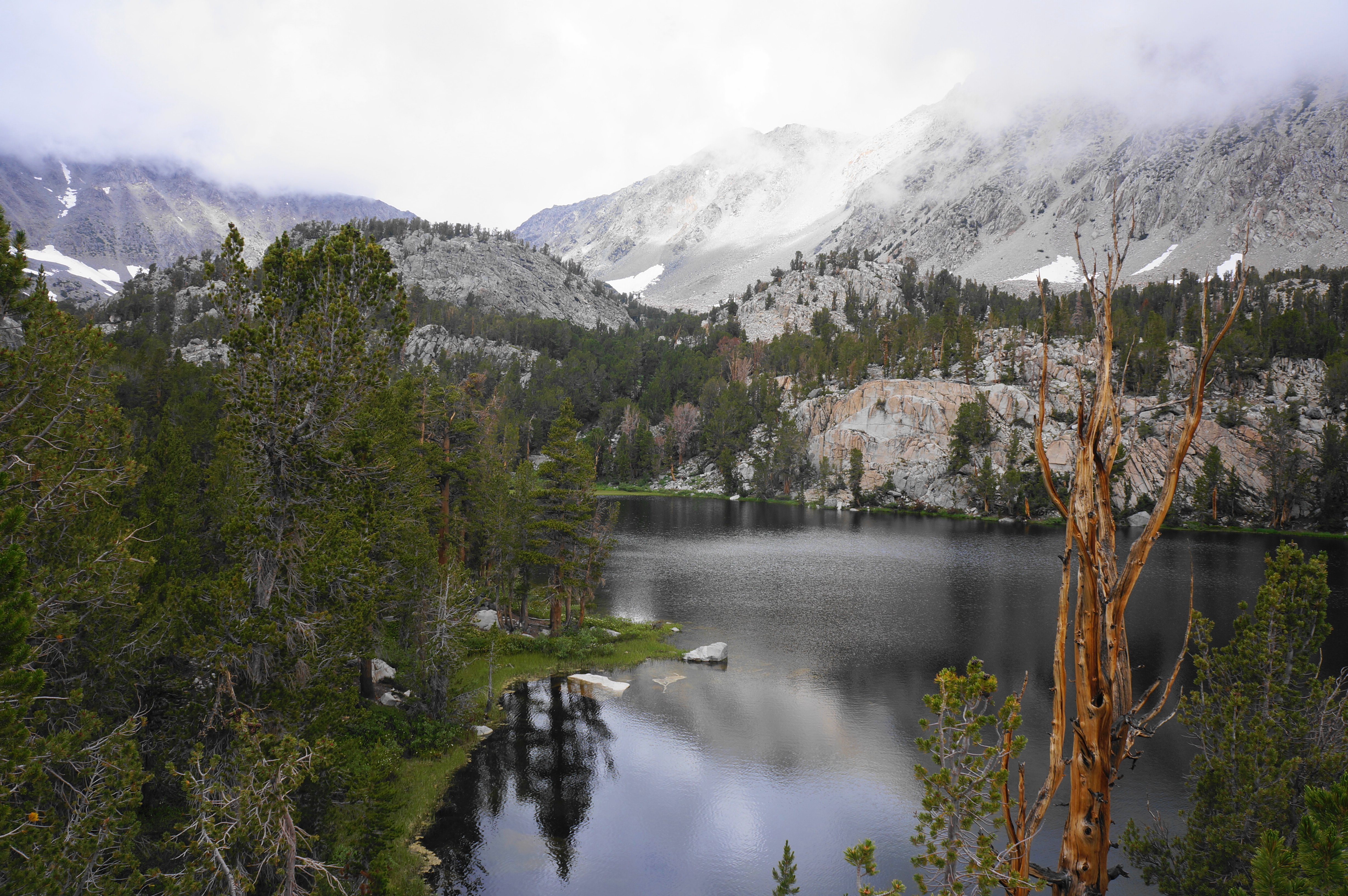
Begin by heading left, crossing a stream that is fed by Black Lake and the snowmelt above. Rise to a crest between two granite outcrops, then enter a long bend that edges around to an overlook of the first of six lakes, creatively named First Lake. The name does not do justice to the glacial-fed cirque lake, which takes on a turquoise hue in the sunlight. The lake is fed by the North Fork and set below the ridgeline between Mount Alice and Temple Crag. Access, however, is limited, with no obvious routes leading to the shoreline.
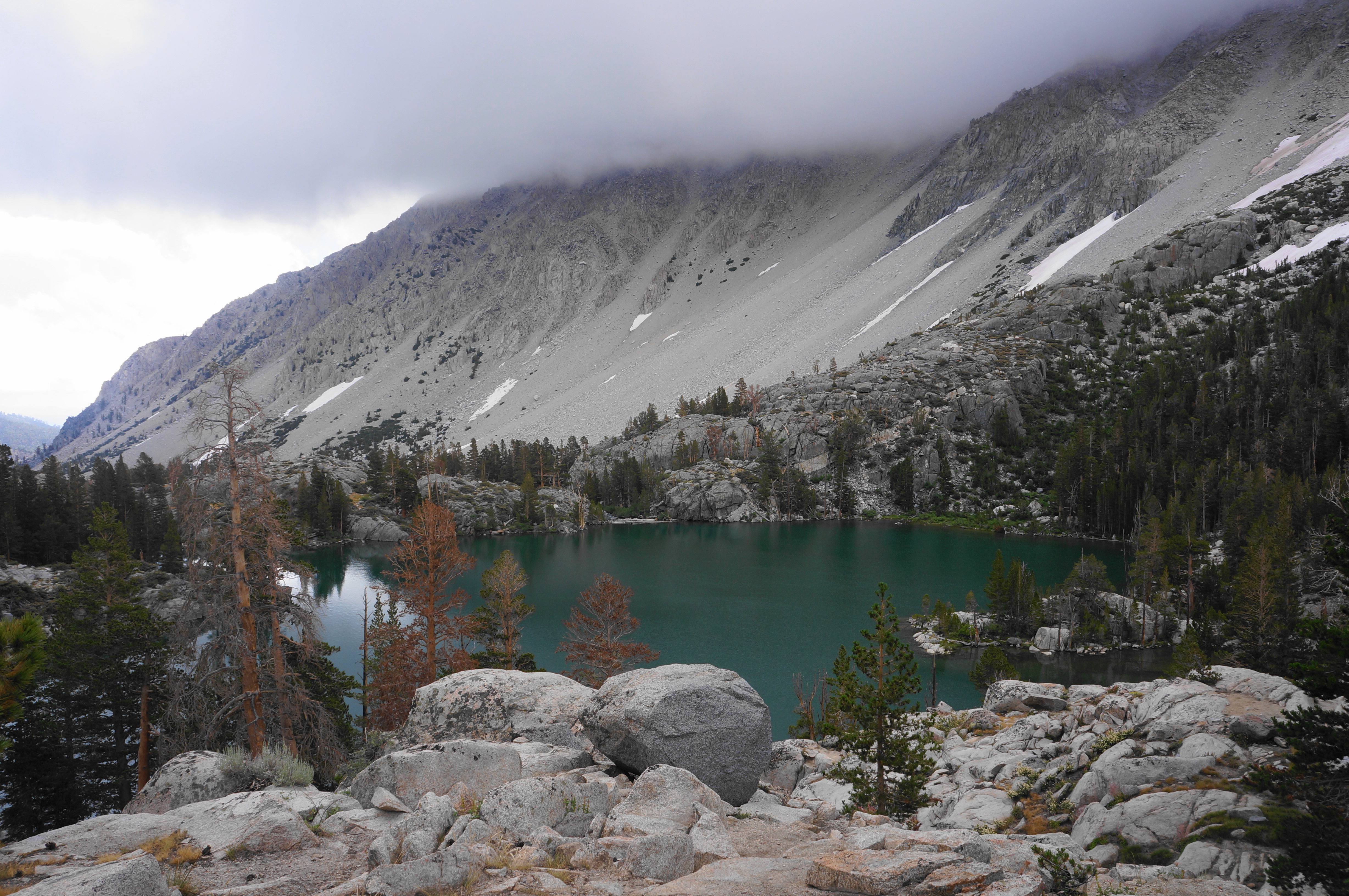
This is in part because the views of the next lake—Second Lake—are even better. Ascend stony steps to another view of First Lake, then come to a crest situated high above the second. For better or for the worse, the aquamarine lake—set below mighty Temple Crag—is Instagram-famous. Expect to see backpackers here, with many scattered across various dispersed camping sites on the bluffs above Second Lake. When the weather is good, overnighting here is exquisite.

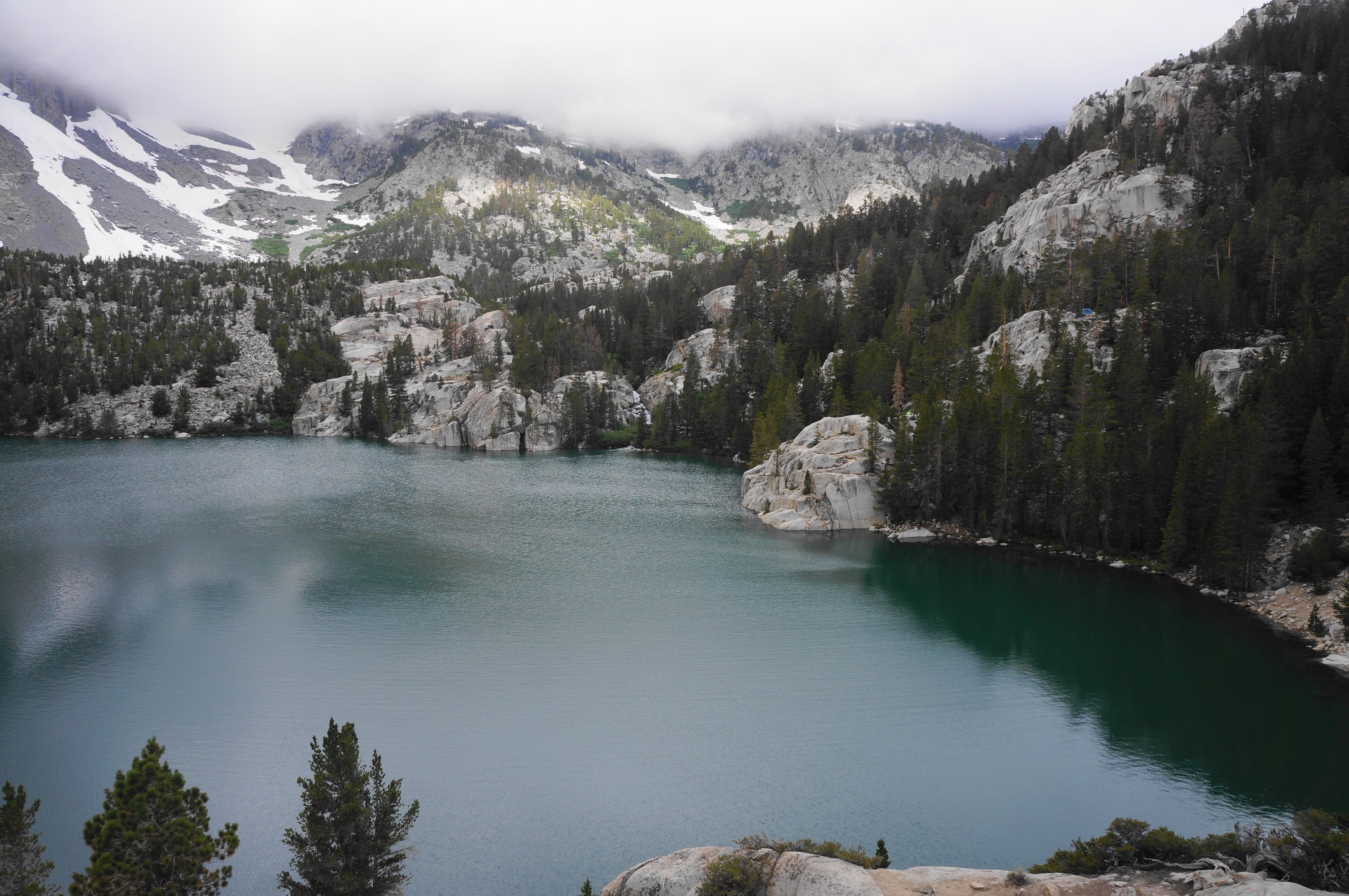
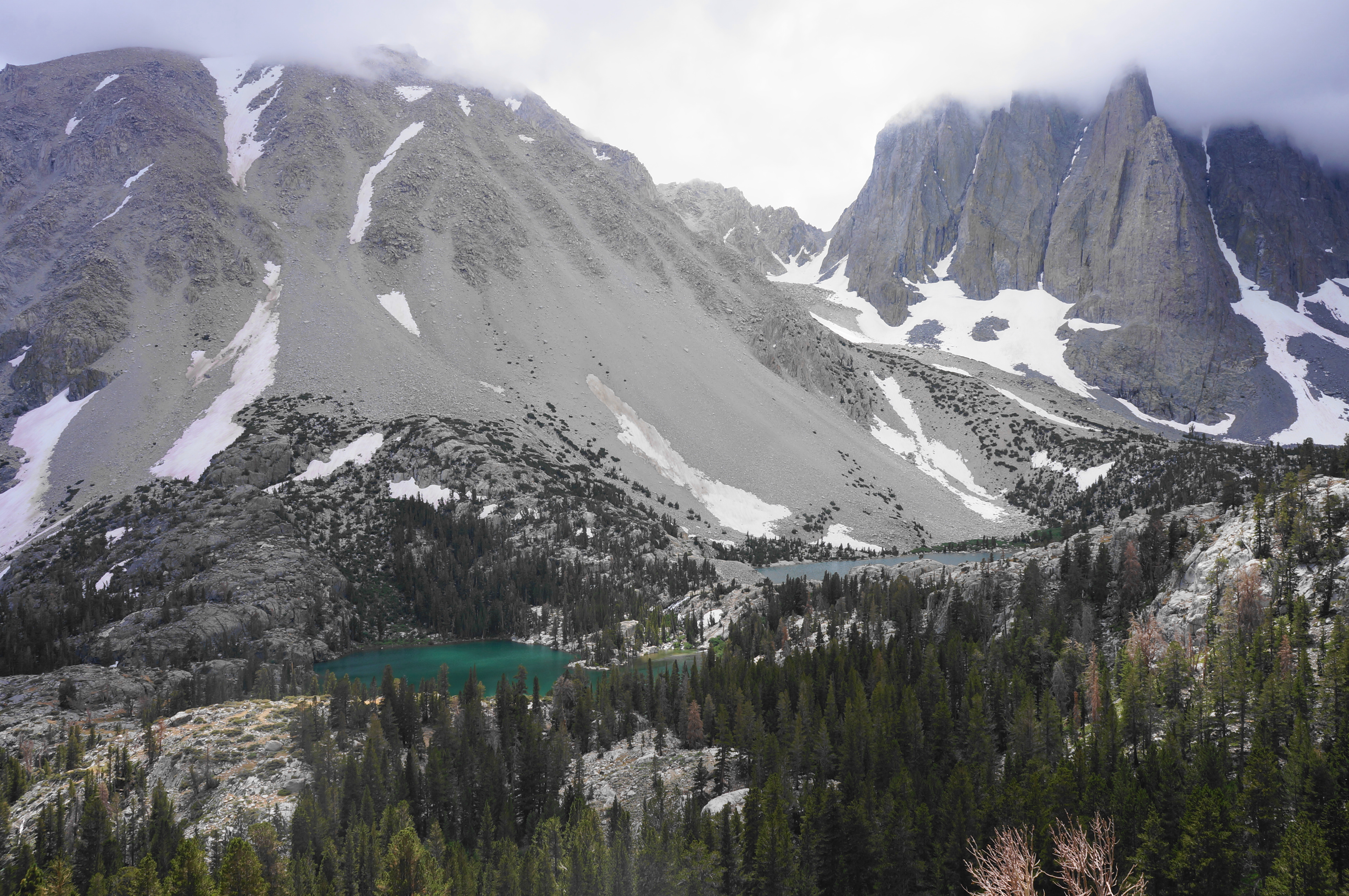
Take time to enjoy the views before continuing onward, skirting the bluffs above the lake on the north side. Pass additional campsites as the trail descends to a spot within sight of the North Fork again. Head into a short uphill until Third Lake becomes visible on the left; a short spur leads down to the banks. Like Second Lake, this thinner basin has tremendous views of Temple Crag.

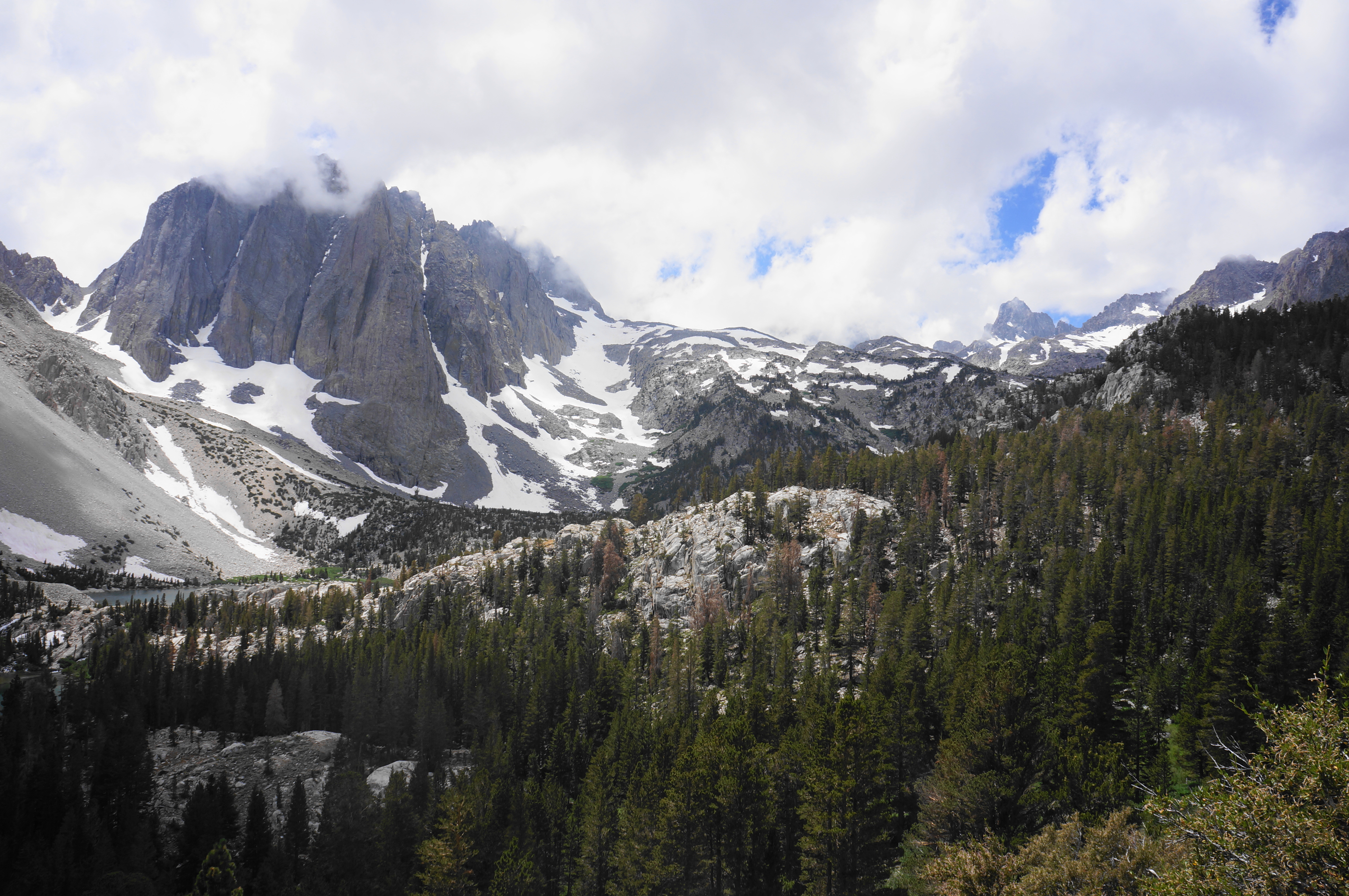
The views are arguably better as the loop trail continues to thread uphill. Eight switchbacks in turn climb more than 150 feet in elevation, with fine looks back to Third Lake and the craggy granite backdrop. After the switchbacks comes a straightforward incline up to a quiet and woody plateau. Enter a meadows area where you will cross a series of small streams, then come to a junction with the Palisade Glacier Trail. This track leads up to a spectacular glacier (the southern-most in the U.S.)—which, in high-snow years (like 2023 when I visited), is inaccessible without ice and climbing gear even well into the summer.
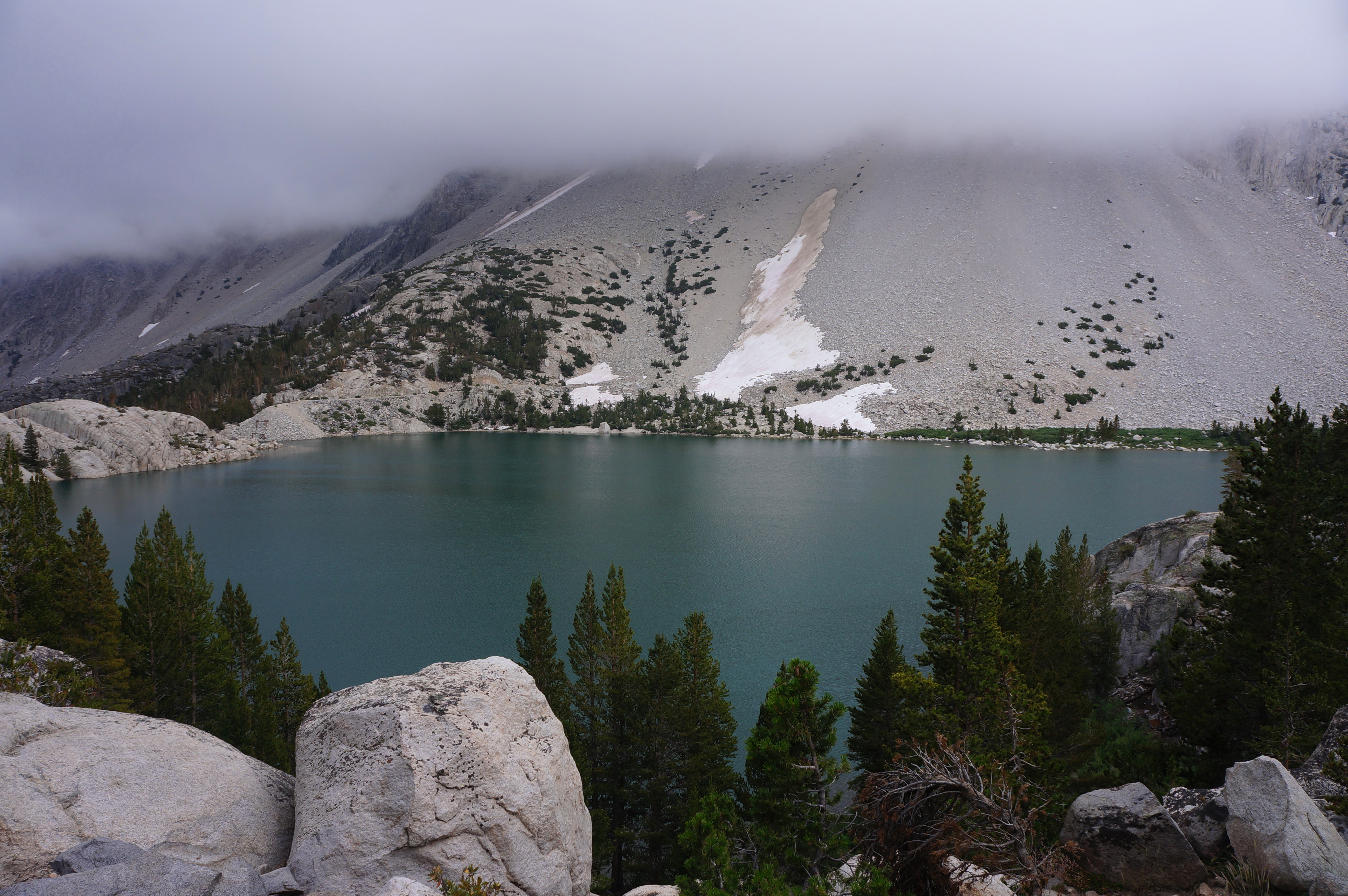
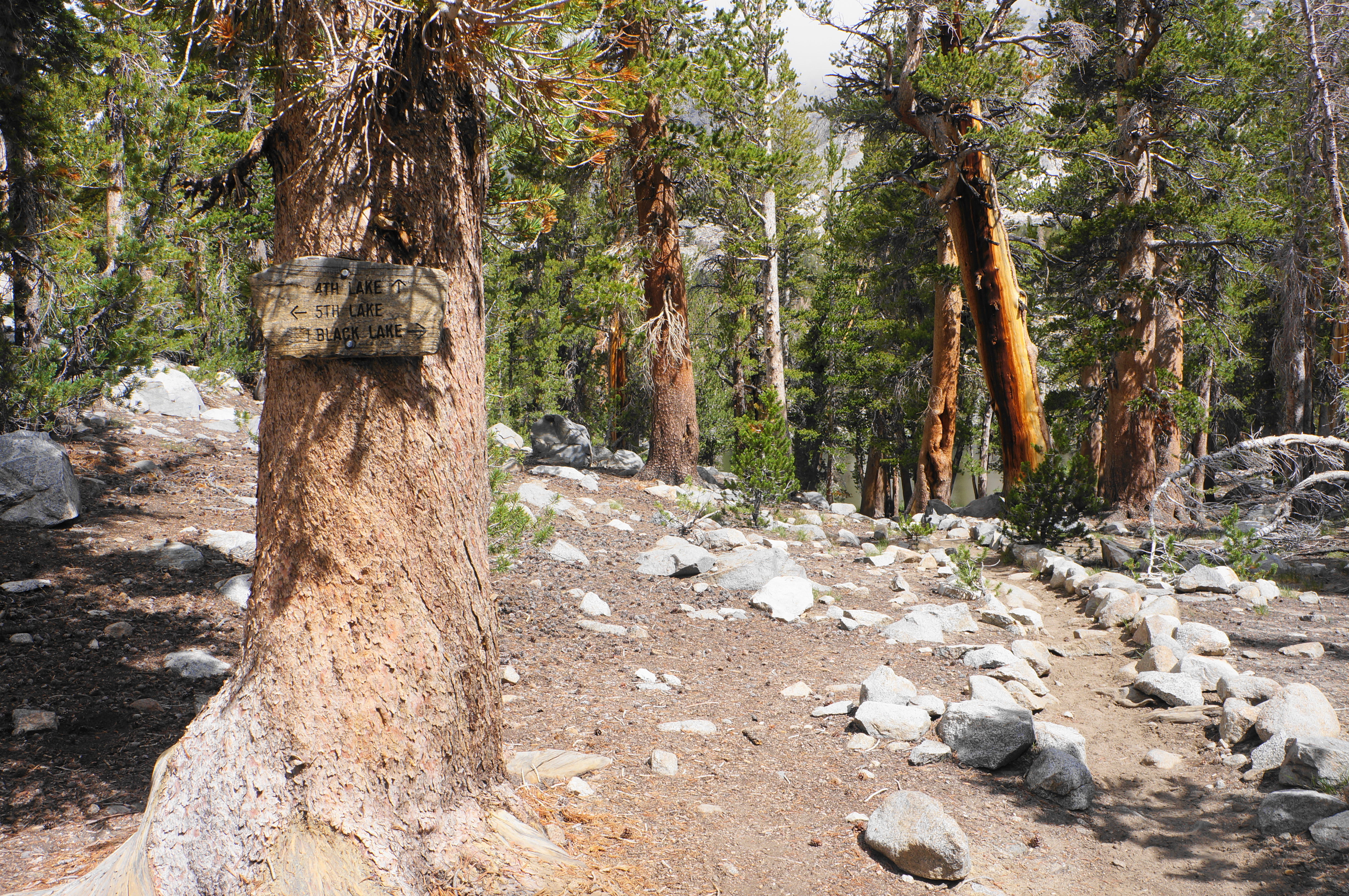
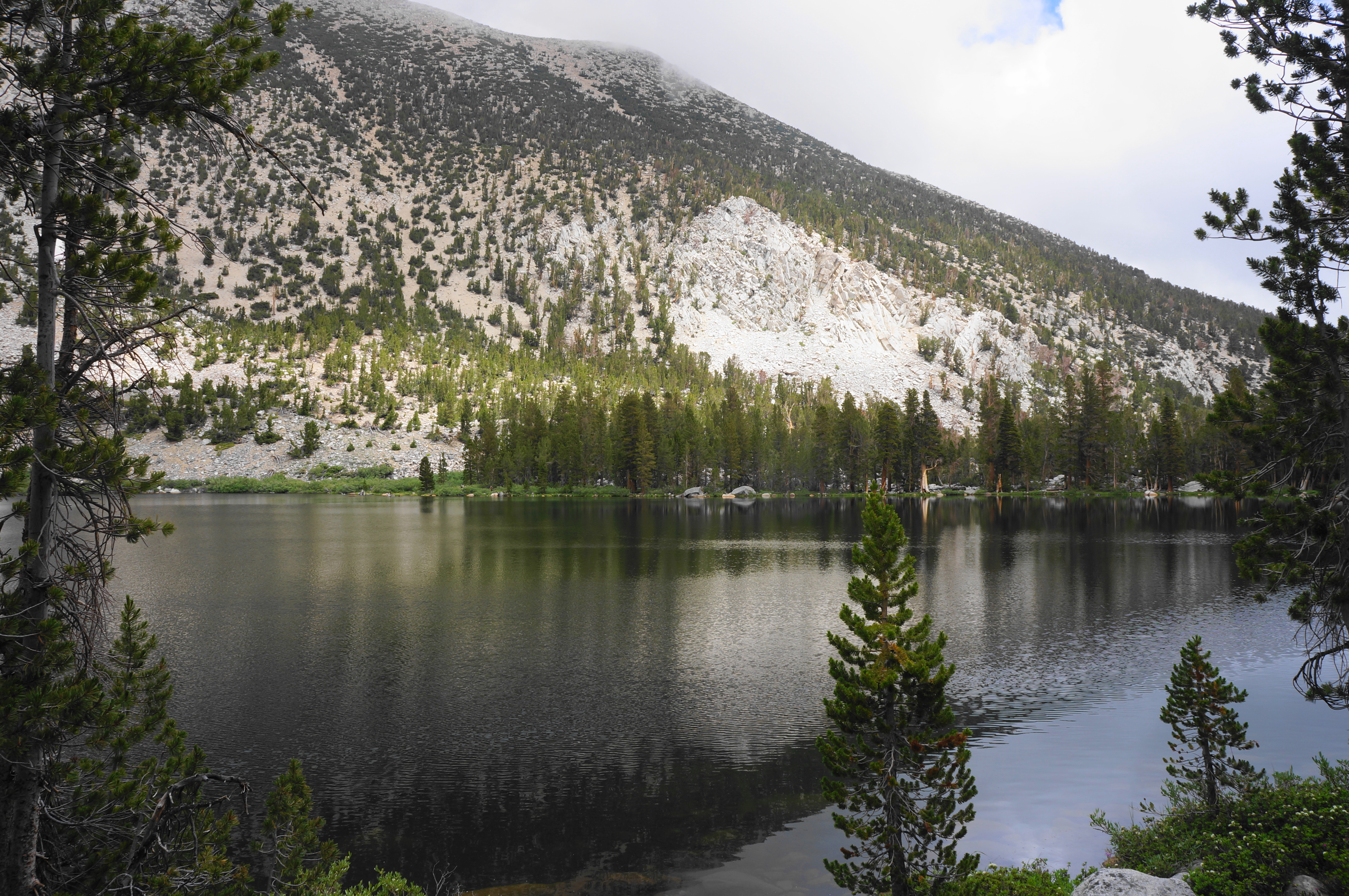
Staying right on the main track, the subsequent section is a relentless ascent for 2/10 miles, culminating at a four-way junction. Hikers have a choice here – straight leads up to Summit, Sixth, and Seventh Lakes; right leads down to Black Lake and back toward the trailhead. It is worth first here bearing straight and dropping to the banks of Fourth Lake, another lovely basin set below Sky Haven and arguably the easiest of the first four lakes to access.

If you’re willing to add another 3-4 miles round-trip, you can continue on from here all the way up to Seventh Lake. But those opting for a shorter version should turn back and return to the four-way junction.
In any case, however, it is worth bearing right (west) to see impressive Fifth Lake. The 0.2-mile detour is rather placid, following the stream before culminating at the lake, the second largest in the basin. The emerald-hued waters are set below Two Eagle Peak (12,966’), Mount Robinson (12,967’), and Jigsaw Pass in the heart of the Inconsolable Range. Best of all, the scenic shores are easily accessible, yet relatively rarely-visited, offering solitude on a hike that is otherwise rather popular. If camping, this would make for a great spot—though be sure to set up well away from the water’s edge.


When ready, return the way you came, coming back to the four-way junction once again. This time head straight on the route toward Black Lake. A short ascent leads to a set of outcrops with a bird’s eye look at Fourth Lake, with Cloudripper on the horizon. After this additional lake tease, the trail drops to a marshy section with a feeder pond downstream from Fourth Lake. Cross a stream below the pond outlet, greeted by a staircase on the opposite side.


After rising to a gap at about 7.1 miles, the trail begins the first of several steady downhills, dropping down a woody hillside to the banks of Black Lake. Lacking the turquoise hue of the other lakes, this one is perhaps not as spectacular, but it is still set in a pretty basin below the chalky slopes of Sky Haven. The trail skirts the lake’s southern shores for a period, allowing hikers to see the lake from several angles, coming to the gentle outlet before crossing the drainage fed by the lake minutes later.

Traverse a blocky rock field, with views down-canyon, then settle into a steady descent, with window views east to Temple Crag and First and Second Lakes. The vistas improve as the trail strikes out across a sage-dotted hillside. With looks back to the two lakes, Temple Crag, and the Palisade area in the distance, this is arguably the most spectacular stretch of the entire hike. Enjoy the spectacular Sierras scenery as the valley unfolds and the trail drops down a set of switchbacks.


As the trail sheds elevation, the views of First and Second Lakes eventually fade, and hikers return to tree-line as they complete the loop at the junction below First Lake. By now, the hike has covered nearly 8 ½ miles.
Return to Trailhead via Alternative Route (4.9 miles)
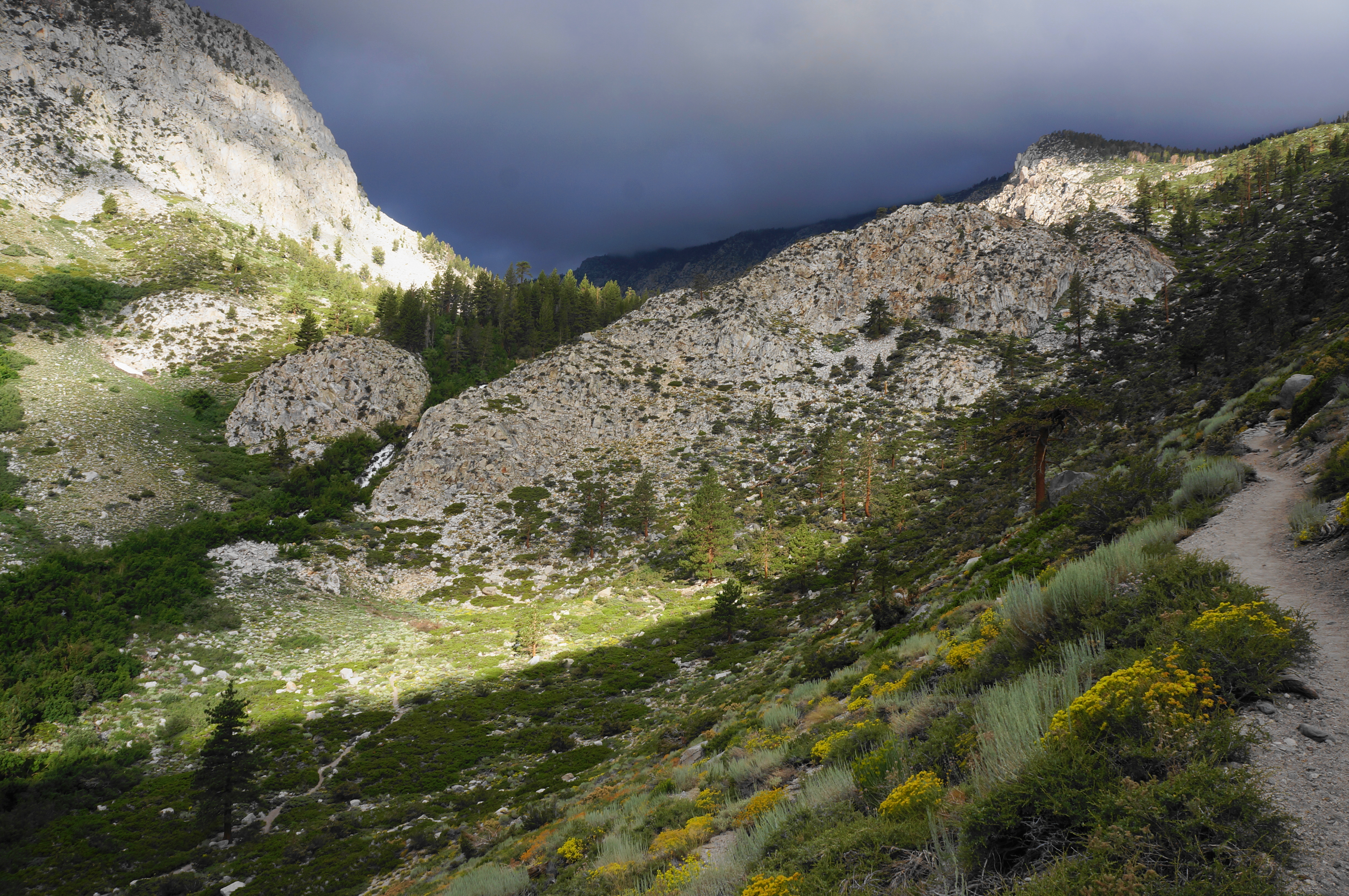
From here, take a left, following the familiar, lengthy entry route back toward the trailhead. The almost entirely downhill tread is pleasant and straightforward, with hikers passing the wilderness cabin and Second Falls again. Once back at the four-way junction with the Baker Summit Trail, consider bearing right to take a slightly-longer, but considerably different, alternative route back to the start. After dropping to the valley floor and coming close to Second Falls, the sandy track enters Jeffrey pine forest and parallels the roaring North Fork as it tumbles down the hillside.
At another junction at about 12 miles, bear right, cross the bridge over the creek, and bear left at the next fork, following the sign marked “trailhead.” This is the route to the day use parking area at Glacier Lodge. While an unobstructed look at First Falls is difficult to attain, the now-narrow trail does follow the roar of the cascades before and after a short swing out into the open, with views up the South Fork drainage. Descend a series of steep switchbacks—brutal if done in reverse—and come close to the cascades at a couple of points. Stay left at the junction at 12.4 miles, then cross a bridge over the North Fork.

From here, there is one more set of switchbacks before the trail empties out at a dirt road. Take a right, then follow a sign heading left, with the combined Big Pine Creek drainage now off on the right. The trail shortly returns to singletrack as it sneaks below summer cabins before returning to a wide double-track again, and the day use parking area (the one with limited parking) is reached at about 12.7 miles. The only downside of this alternative route, of course, is that the day-use and overnight parking areas are not exactly next to each other. So returning to the initial trailhead requires about 2/3 mile of road walking; continue straight on Glacier Lodge Road, ignoring the turn heading right to the campground and main lodge. Just before approaching the parking area on the left, look for a short use trail heading up a slope on the left. Follow it up to a surprise rock field, navigating between the boulders and returning to the parking area, often exposed to the hot afternoon sun. This marks the end of the approximately 13.4-mile hike, one of the most memorable in the eastern Sierras.

I camped here for 1 night. IMO the Sixth Lake is the most impressive. Well worth the detour.
Pingback: Thousand Island Lake Loop via High Trail & Shadow Creek Trail (Ansel Adams Wilderness, CA) | Live and Let Hike
Pingback: Top 10 Hikes in 2023 | Live and Let Hike