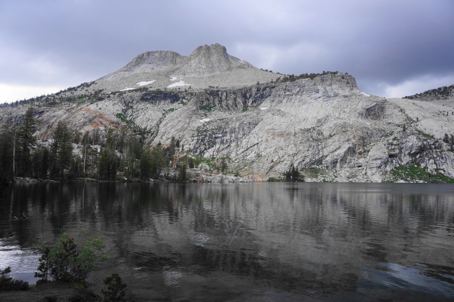

Requiring only a 1.2-mile hike to reach, May Lake is one of the most-accessible subalpine lakes along Tioga Road in California’s Yosemite National Park. This makes the lake, set in a basin below imposing Mount Hoffmann (10,850’), one of the most popular day hikes in the area (although the crowds pale in comparison to nearby Yosemite Valley). May Lake High Sierra Camp, set on the south side of the lake, is also the closest of the official backpacking camps to the road, making this a good option for amateur backpackers and large overnight groups. Better than even the lake are the views back south across the granite playground of Yosemite, a worthy off-trail jaunt from the High Sierra Camp.

The hike
The turnoff for May Lake is found along the scenic stretch of Tioga Road between Crane Flat and Tuolumne Meadows, a few miles west of the popular Tenaya Lake area. (Note: Tioga Road is only open during the summer season.) Look for the May Lake Road, which heads north from Tioga Road and cuts off about two miles, bringing one closer to the lake. (Note: The May Lake Road, while paved, is full of potholes and cracks, so drive slowly and carefully.) The May Lake Trail starts from the end of the road, heading north from a spot between the restrooms and an unnamed, stagnant pond that is a favorite for Yosemite’s resident mosquitoes.


Start down the May Lake Trail as it passes the pond on the right, meanders through the mixed pine forest, and ascends a cobblestone rock cut to gain the next level. The impressive façade of Mount Hoffmann is visible ahead. Continue to bear north on the gentle and well-trodden path, gradually climbing to a point where the dirt is replaced by slickrock, with cairns or other markers indicating the way forward. Enjoy partial views to the south at about 4/10 mile, but better vistas lie just ahead.

The ascent eases briefly for the next ¼ mile, but it returns again at about 7/10 mile, with a rockier scramble up a series of blocky granite shelves. Hikers are rewarded with wider views to the Cathedral Range, Tenaya Canyon, and more.

The uphill slog continues for about 1/3 mile before culminating at a junction and the High Sierra Camp. Bear left to reach the lake, right for the onward trail (which continues toward Murphy Creek, Glen Aulin, and the Ten Lakes area). There are a number of spots where one can dip ones toes in the subalpine lake, made dramatic by the towering backdrop of Mount Hoffman and its sheer granite walls. (Note: Some visitors continue from here up a hairy off-trail route to the summit of Mount Hoffmann.)


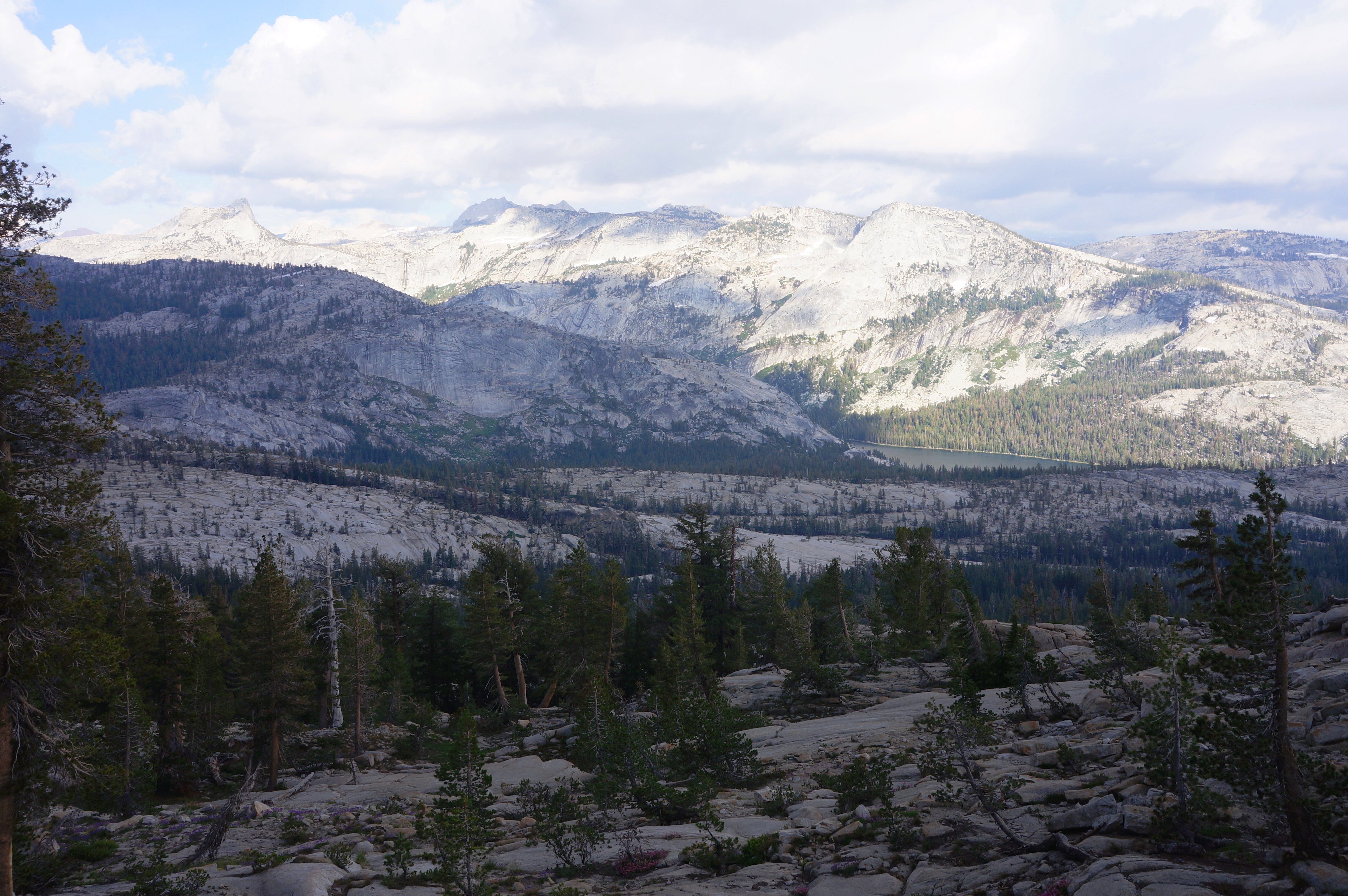
When ready, return the way you came—but don’t miss first the opportunity for spectacular views from the outcrops just to the south and east. From here, accessed by way of a short off-trail scramble, one can see southeast to Tenaya Lake and the Cathedral Range and southwest to Yosemite Valley and Half Dome, which peeks just above a rim of granite. After taking in this highlight of the hike, return to the trail and walk 1.2 miles, largely downhill, to return to May Lake Trailhead.


Pingback: Top 10 Hikes in 2023 | Live and Let Hike
My wife and I hiked up to May lake on our honeymoon. We wanted to stay below in the campground but it was the weekend of 4th of July. So we didn’t have many options. We stayed in a small 2 man tent and had bears circling our tent after dark. We banged on pans and blew whistles to distract them. They knocked down our food from a tree we threw it up on. It was a memorable night, to say the least. My wife has not camped since. I don’t think she knew what she was getting into. We are still married after 40 years and we enjoy telling this story to our friends. They love it.