
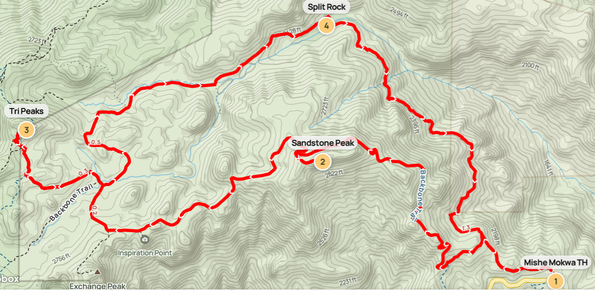
Santa Monica Mountains National Recreation Area comprises a patchwork of individual parks and open spaces—pockmarked by encroaching development—in the rocky and rugged highlands above Malibu, Los Angeles, and the San Fernando Valley in southern California. Even with the vacation homes and mansions lining the mountain slopes, the protected lands preserve a sense of wilderness replete with stony outcrops, imposing canyons, and desert fauna from cougars to rattlesnakes. The rugged landscape tops out at Sandstone Peak (3,111’), the highest point in the park, featuring panoramic views toward the Pacific Ocean and Conejo and San Fernando Valleys. This challenging, 7-mile trek combines the Sandstone Peak Trail with nearby Mishe Mokwa Trail and a spur to Tri Peaks, another clutch of high points in the Boney Mountain area. Expect to spend a half or full day on this hike, which should be avoided in summer due to sweltering temperatures.

The hike
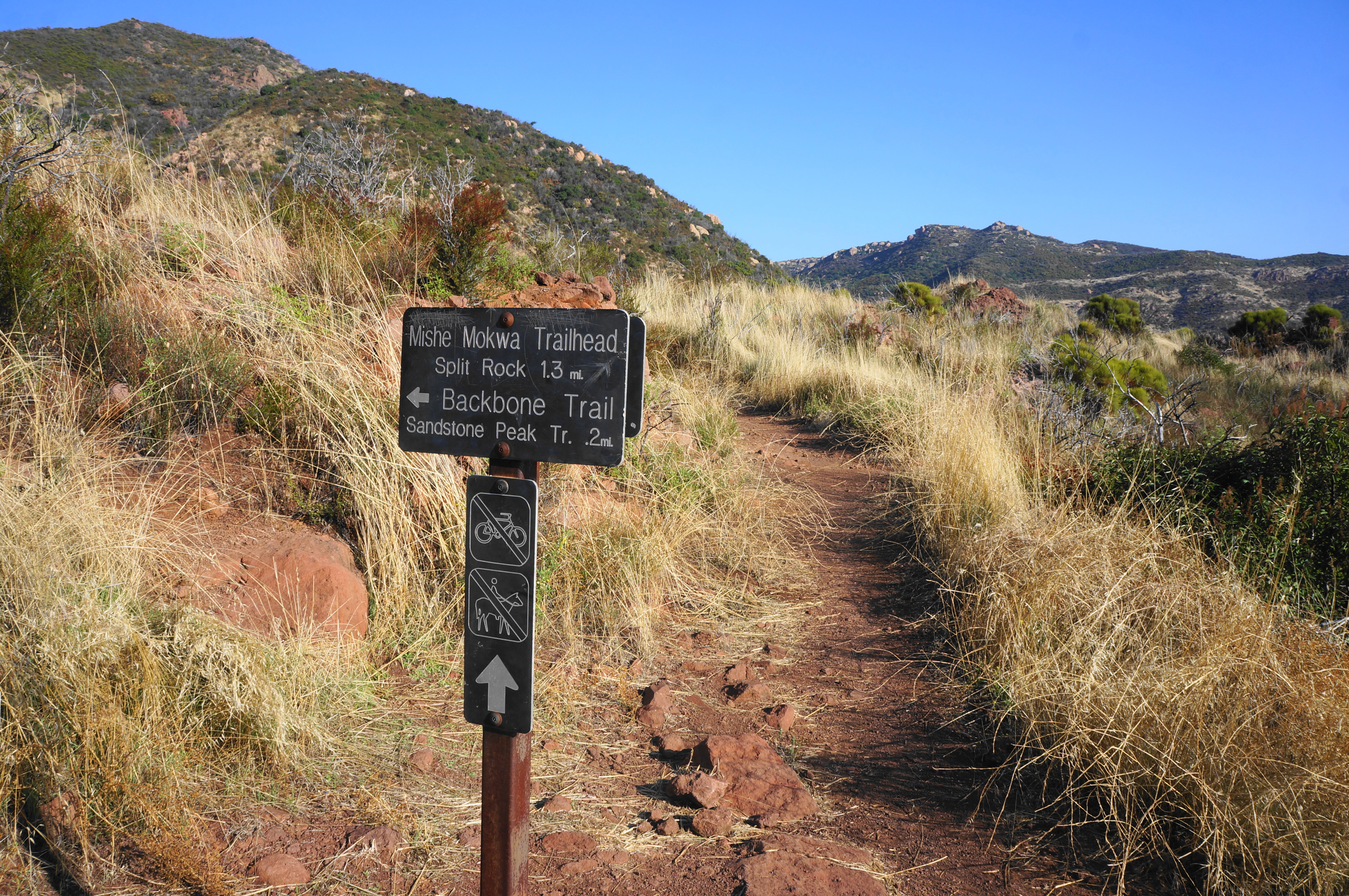
Sandstone Peak is situated in the Circle X Ranch area of Santa Monica National Recreation Area. This section of scrubby chaparral and impressive outcrops was a former Boy Scout camp and now one of the best hiking areas in the park. Plan to start this hike at either the Sandstone Peak Trailhead or Mishe Mokwa Trailhead, both situated on Yerba Buena Road in the western part of the range. (Note: The overall hiking distance using either is within 1/10 mile, with virtually identical elevation gain.) The latter trailhead, used by yours truly, is positioned at a high divide known as Triunfo Pass, and includes two unpaved parking areas, one on each side of the roadway. Here the terrain drops dramatically into deep canyons to the north and south, with the windswept slopes largely devoid of vegetation rising above 10 feet.
Sandstone Peak/Backbone Trail (3.1 miles)
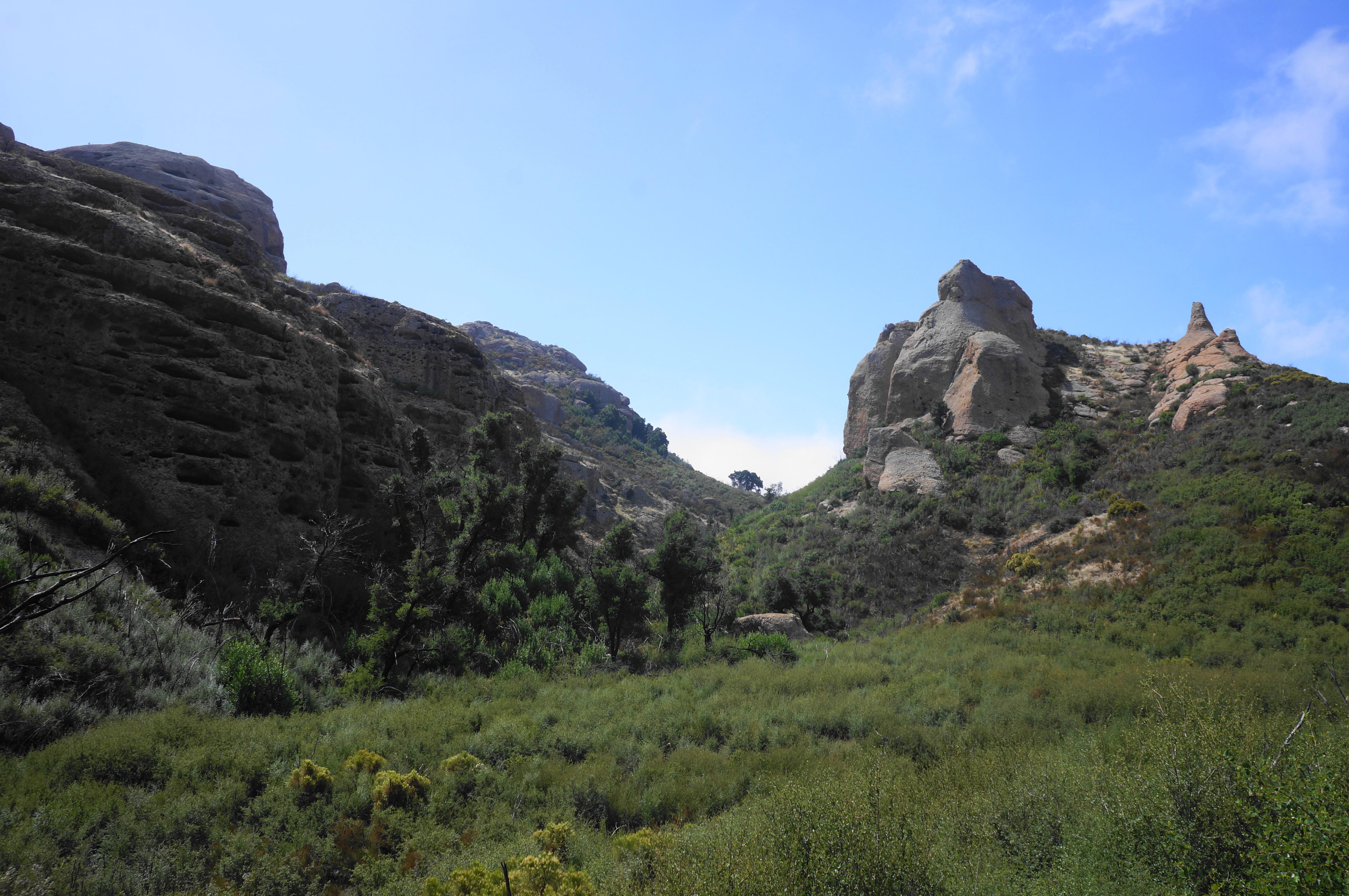
Make your way to the north side of the road, where one will find the Mishe Mokwa Trail, which here doubles as part of the 67-mile Backbone Trail, an end-to-end trek spanning the length of the Santa Monica Mountains. Pass through the entry gate and begin to climb, relatively gently at first. The ruddy track traces a ridge above Yerba Buena Road, which comes in and out of view. At 2/10 mile, hikers get their first look to the sandstone heights of Inspiration Point (which will be encountered later in the hike), peeking in the background through a window between hills along the ridgeline.

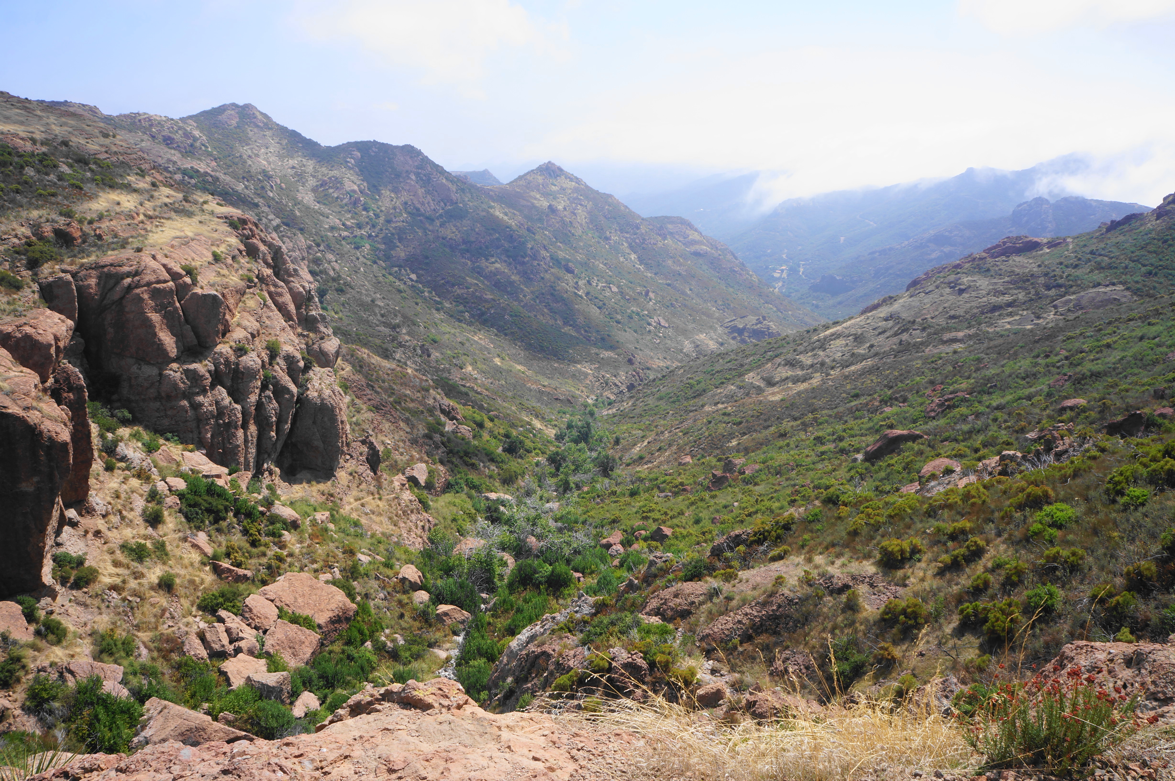
Here the trail levels for a brief period, then resumes a steady ascent, edging north and away from the road. At ¼ mile, hikers get their first views down Carlisle Canyon, a broad drainage leading down toward Lake Sherwood and Conejo Valley. The red-orange walls and spires to the north are called Echo Cliffs, considered to be a top rock-climbing destination in southern California.

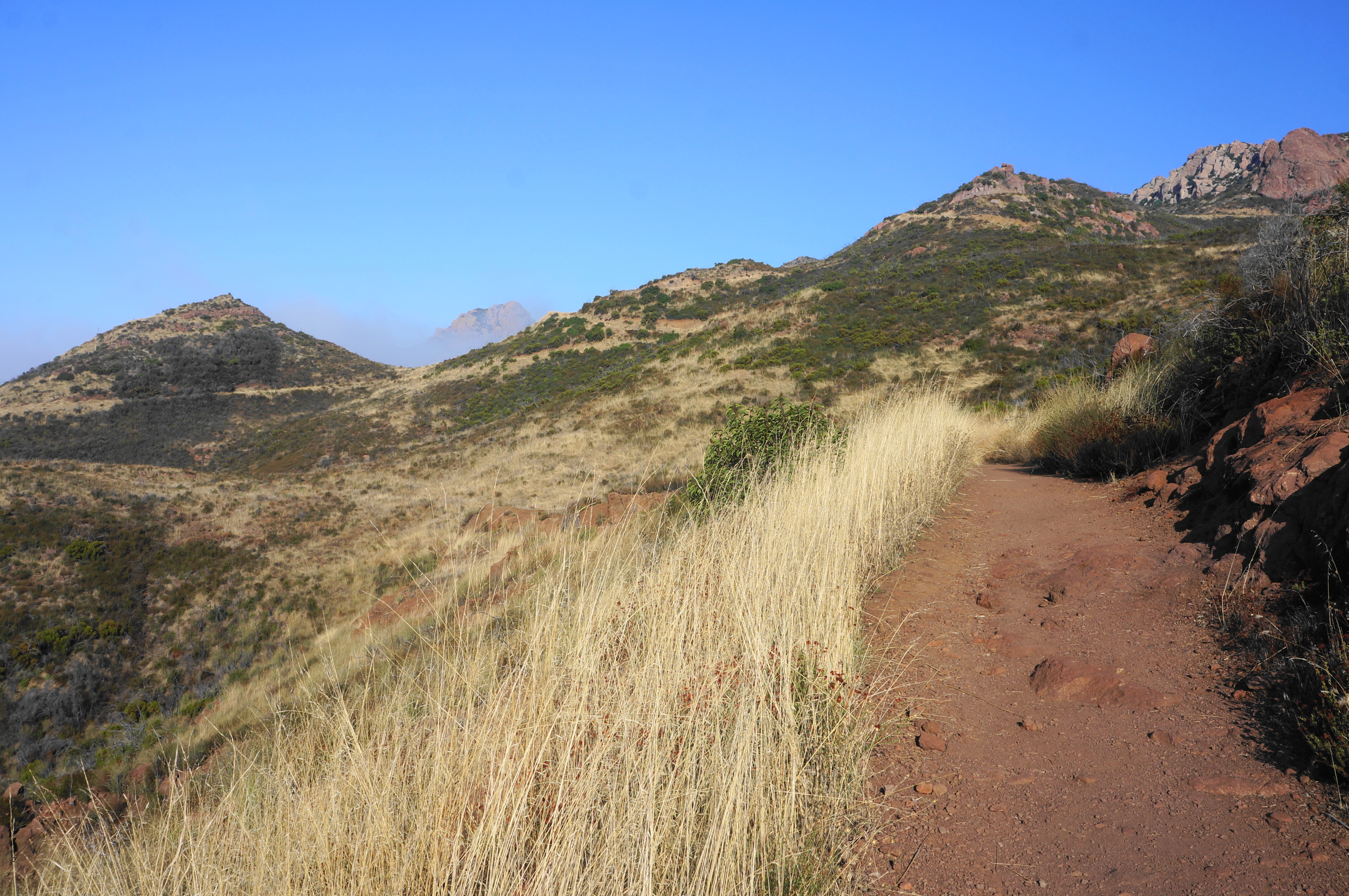
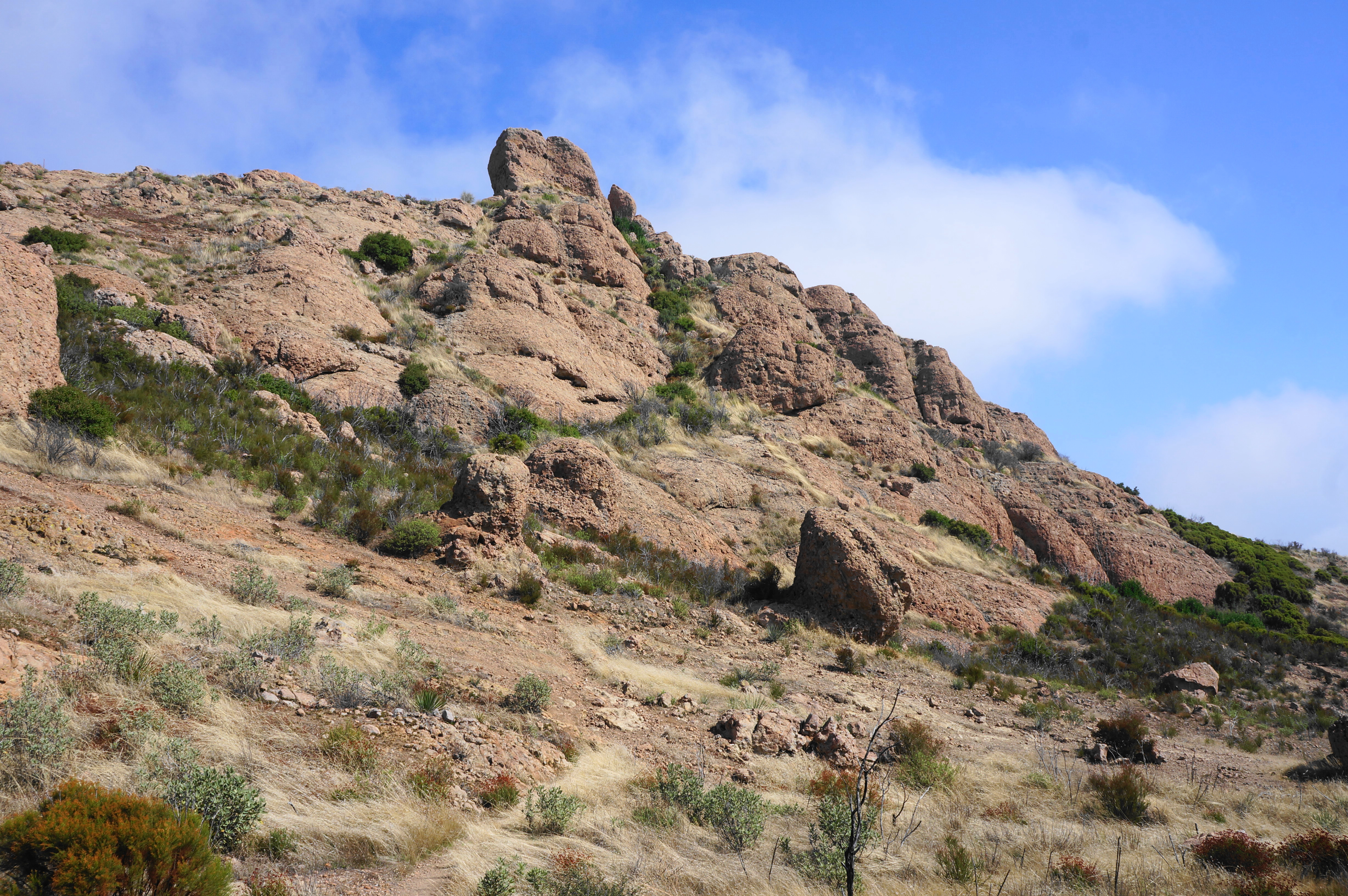
Climb amid the red volcanics until reaching a junction at 0.35 miles, where the Mishe Mokwa and Sandstone Peak routes diverge. Those seeking to cover the tougher terrain first should bear left, continuing to ascend the ridgeline toward the park high point. From here the Backbone Trail swings back to the south-facing slopes, with the road again visible—this time about 250 feet below. Traverse a small depression and come to a second junction, this one ½ mile from the trail’s start. This is where the route from Sandstone Peak Trailhead enters, merging with the onward Backbone Trail. Stay right.
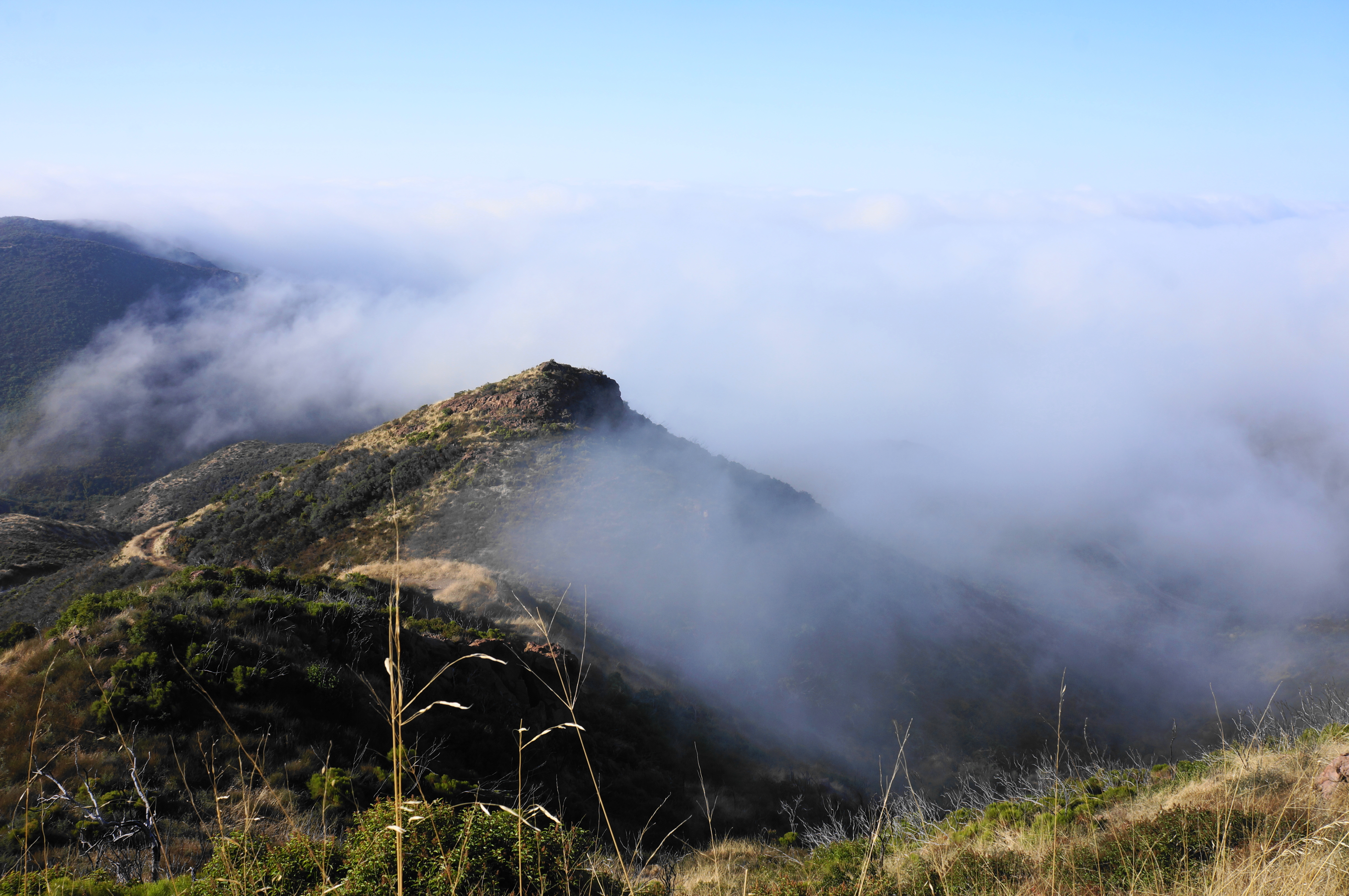
It is steps from here to one of the hike’s finer vistas, where the terrain drops to the south and east, with (weather-permitting) distant Pacific Ocean views. More of the divide west of Sandstone Peak is also visible, although the summit remains obscured from view.
The next stretch includes three snaking switchbacks, with views alternating north and south. The incline also picks up as one weaves below higher and higher outcrops, eventually settling on the east side of the ridgeline with more emergent views to Echo Cliffs. Lake Sherwood also comes into sight, way at the bottom of Carlisle Canyon.


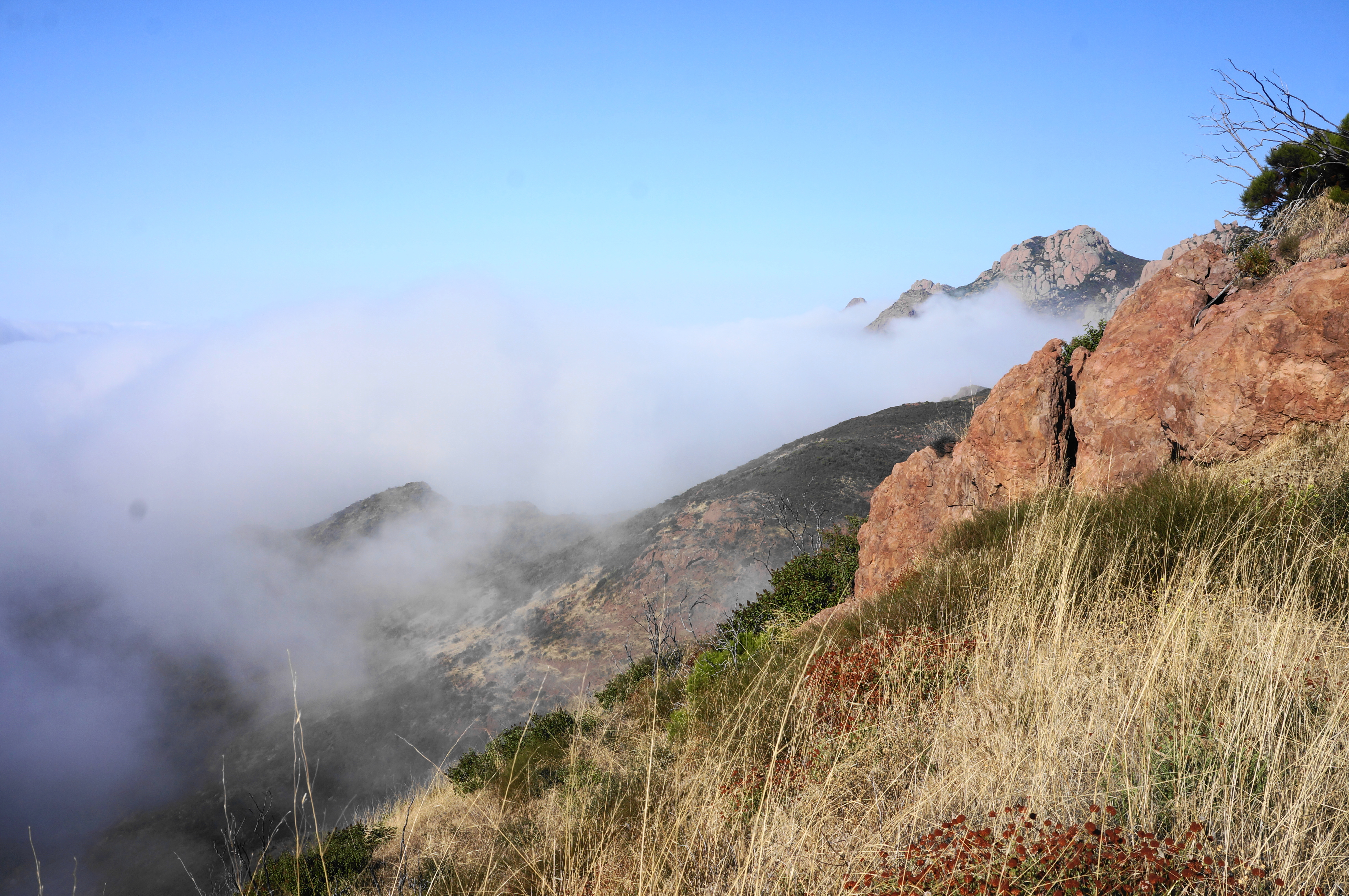
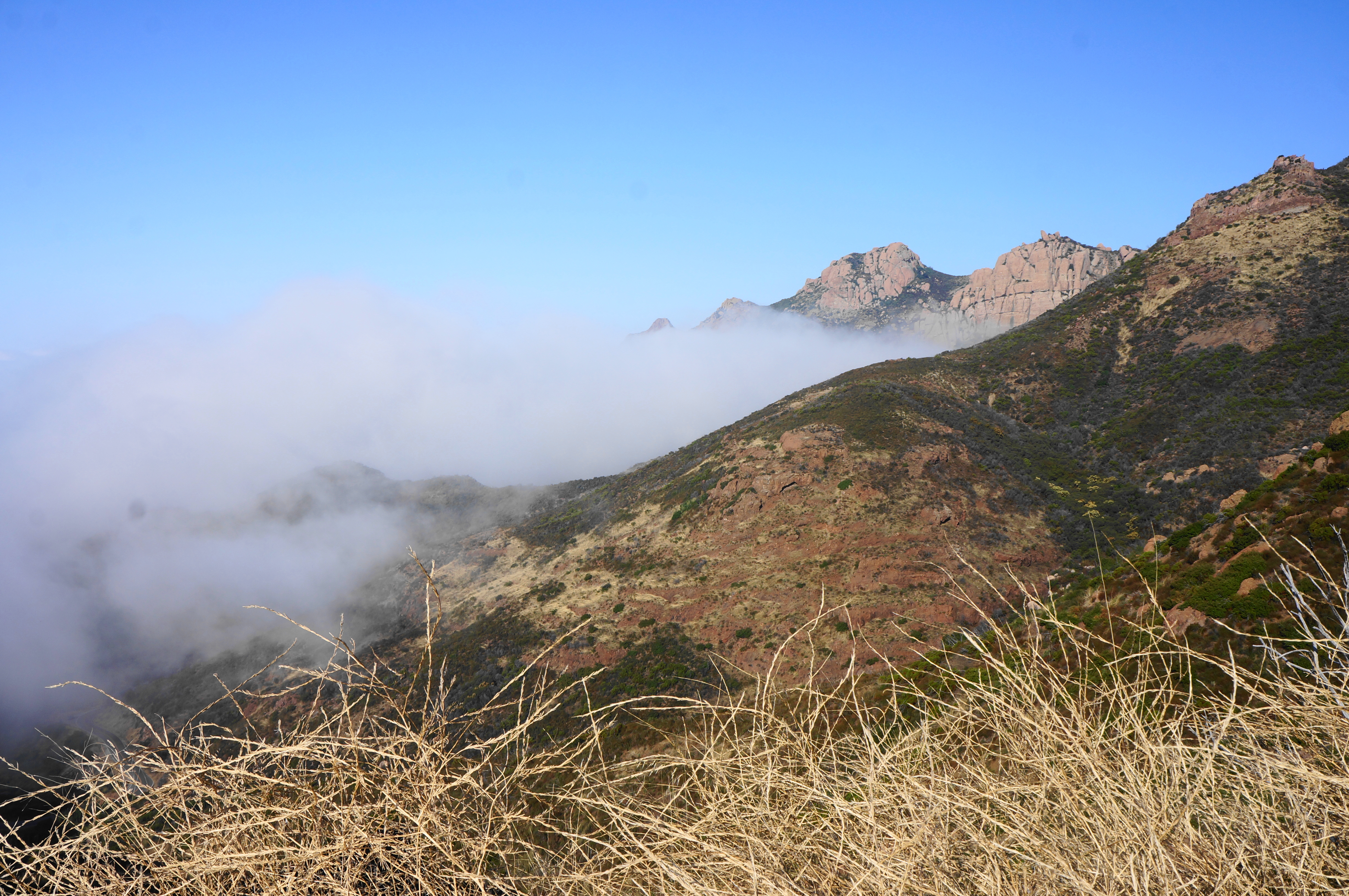
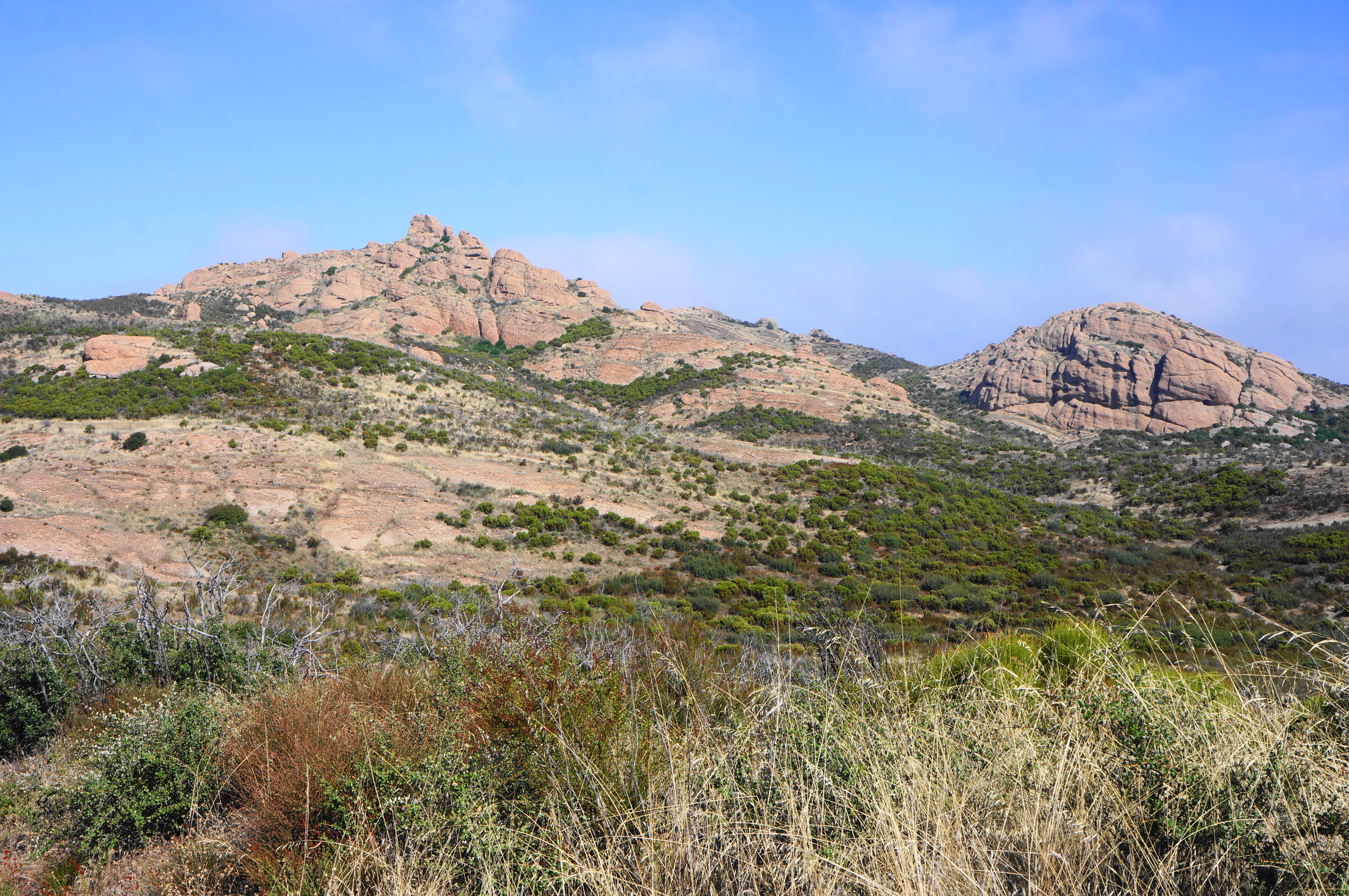
After rounding a left-hand bend and traversing an up-and-down section, the path comes to another saddle, this one set below Sandstone Peak. A sharp pair of bends pushes hikers to around 3,000 feet, with the incline easing a bit as the Backbone Trail traverses westward. Soon the multi-knobbed heights of Boney Mountain—itself a collection of peaks—can be seen to the west; among these is Tri Peaks.

The Backbone Trail then comes to an open bend where the trail splits. By now you have actually passed Sandstone Peak, but the summit can be reached via an informal track that doubles back east. This involves a bit of a U-turn, following an unmarked route up an initially steep slope. After the stout climb, work your way up at an easier angle, with a few social trails offering different options. At about 1.75 miles, rise to the two-headed summit of Sandstone Peak.
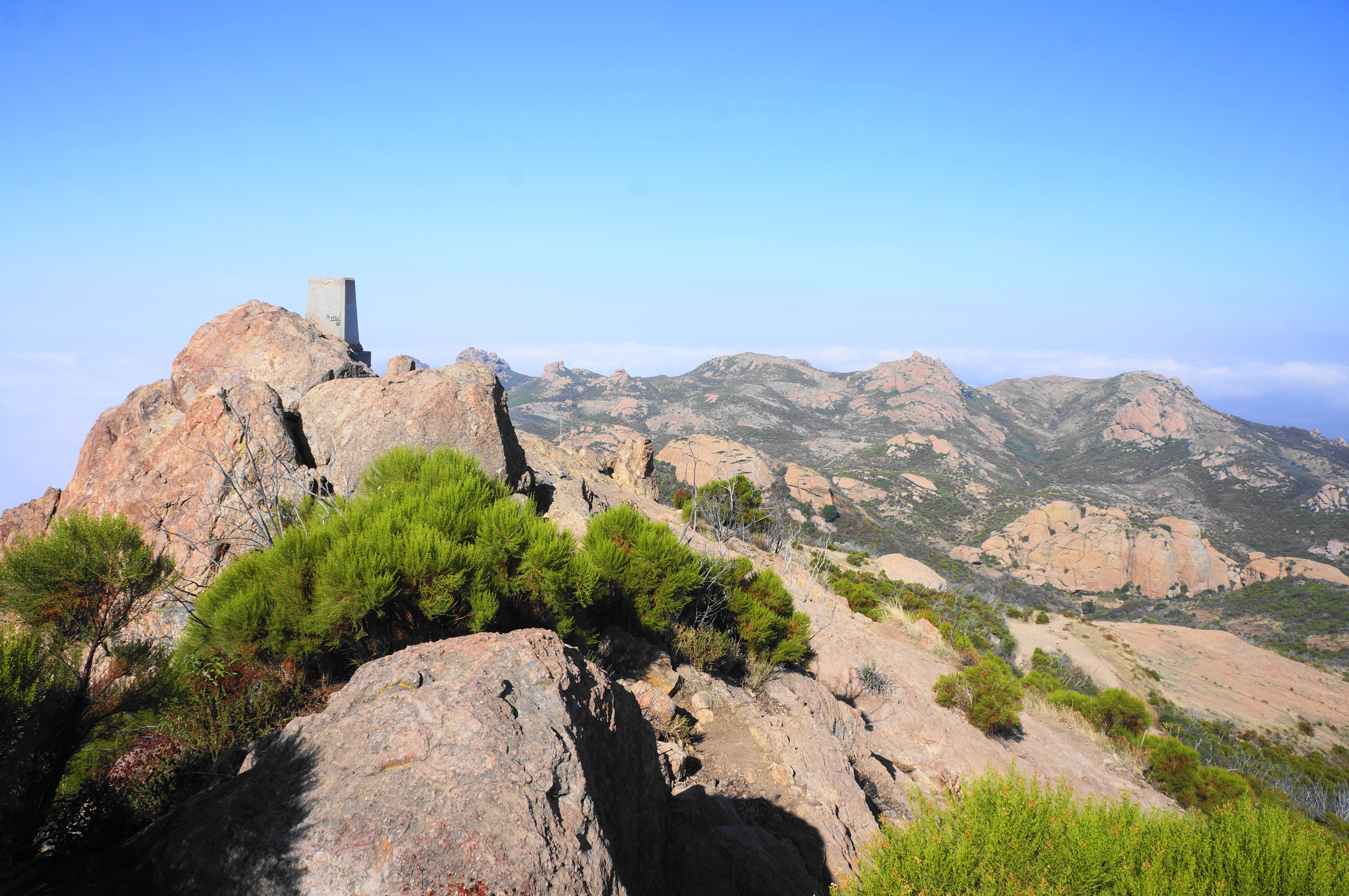
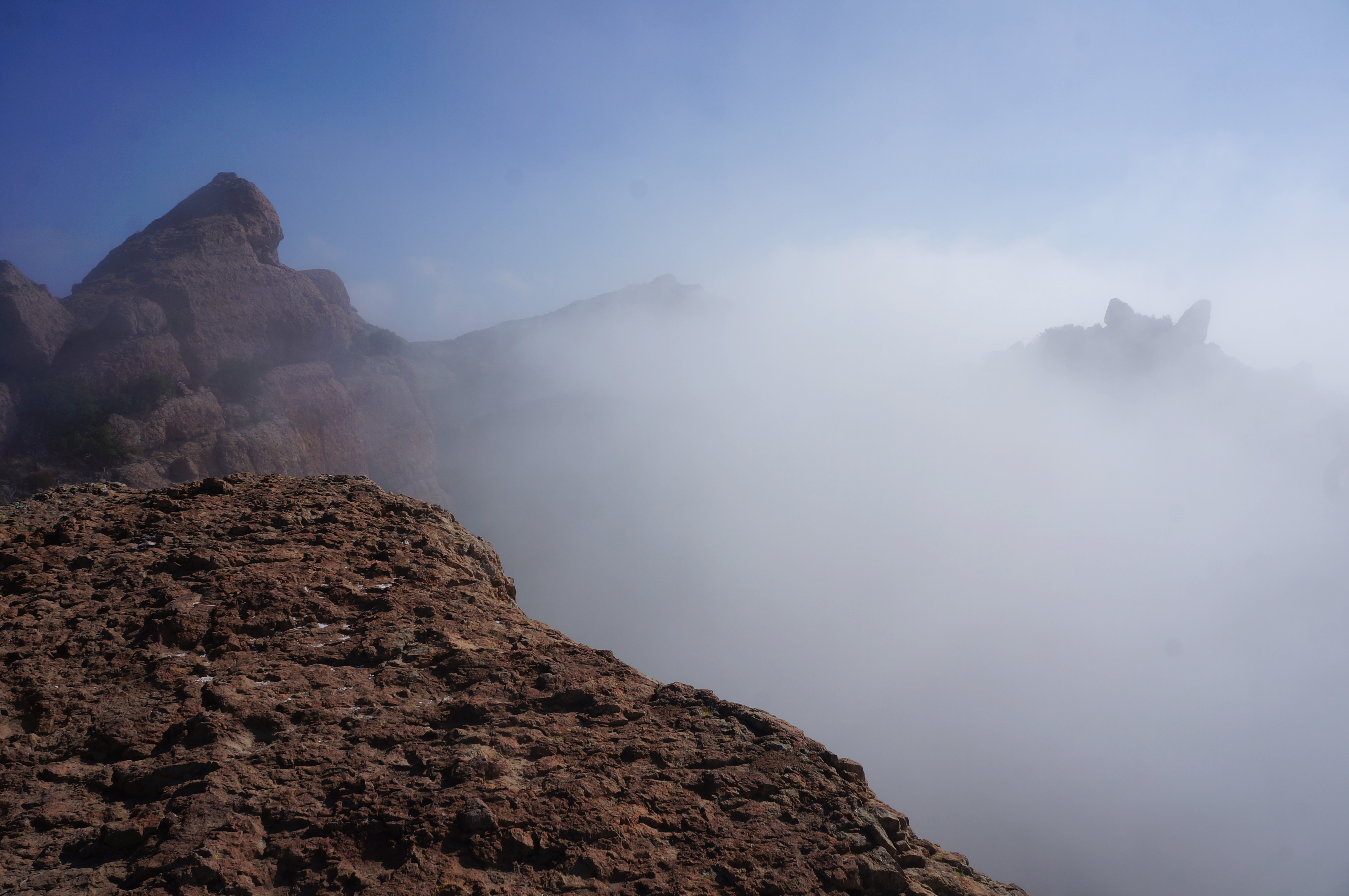
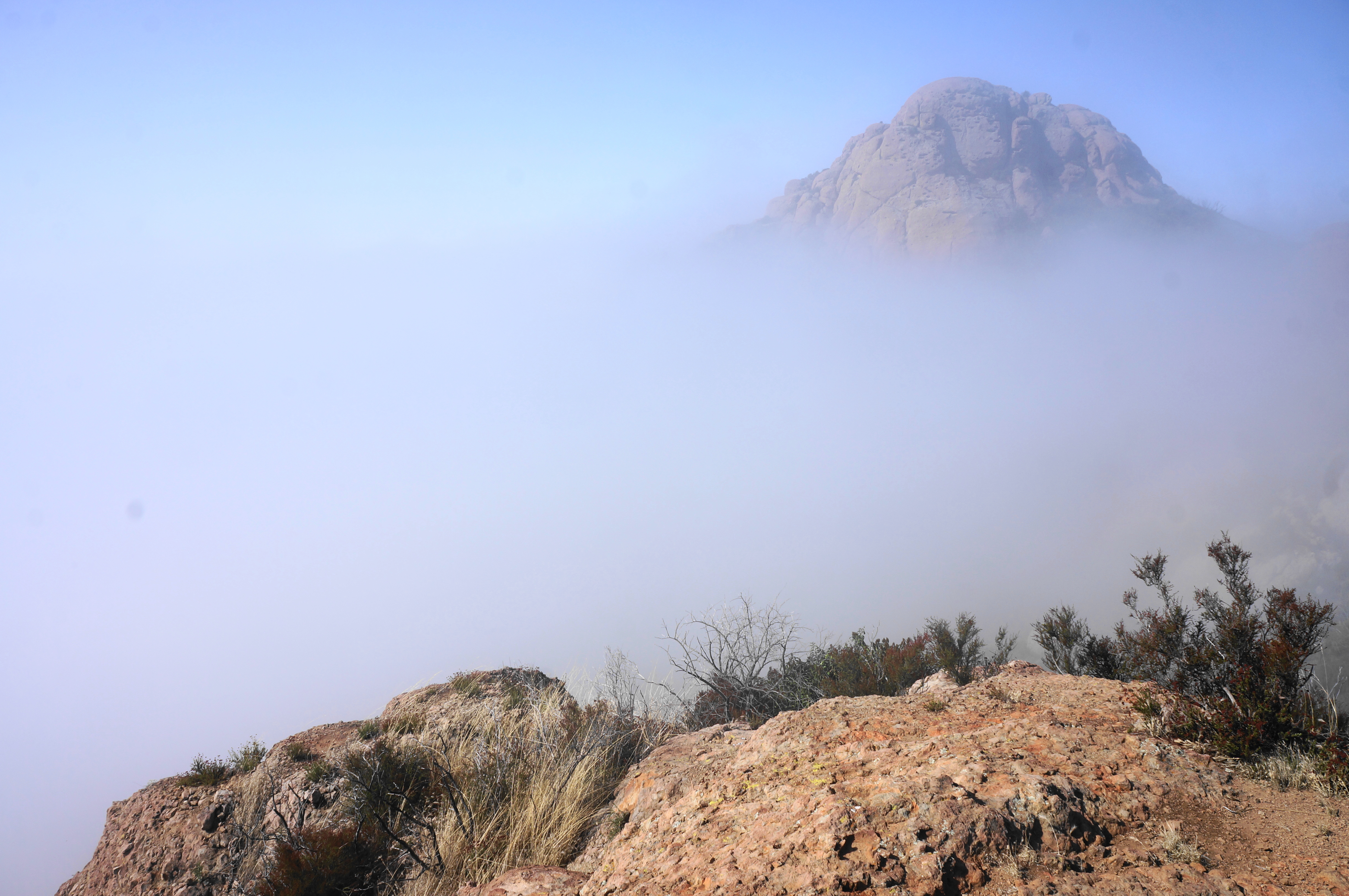
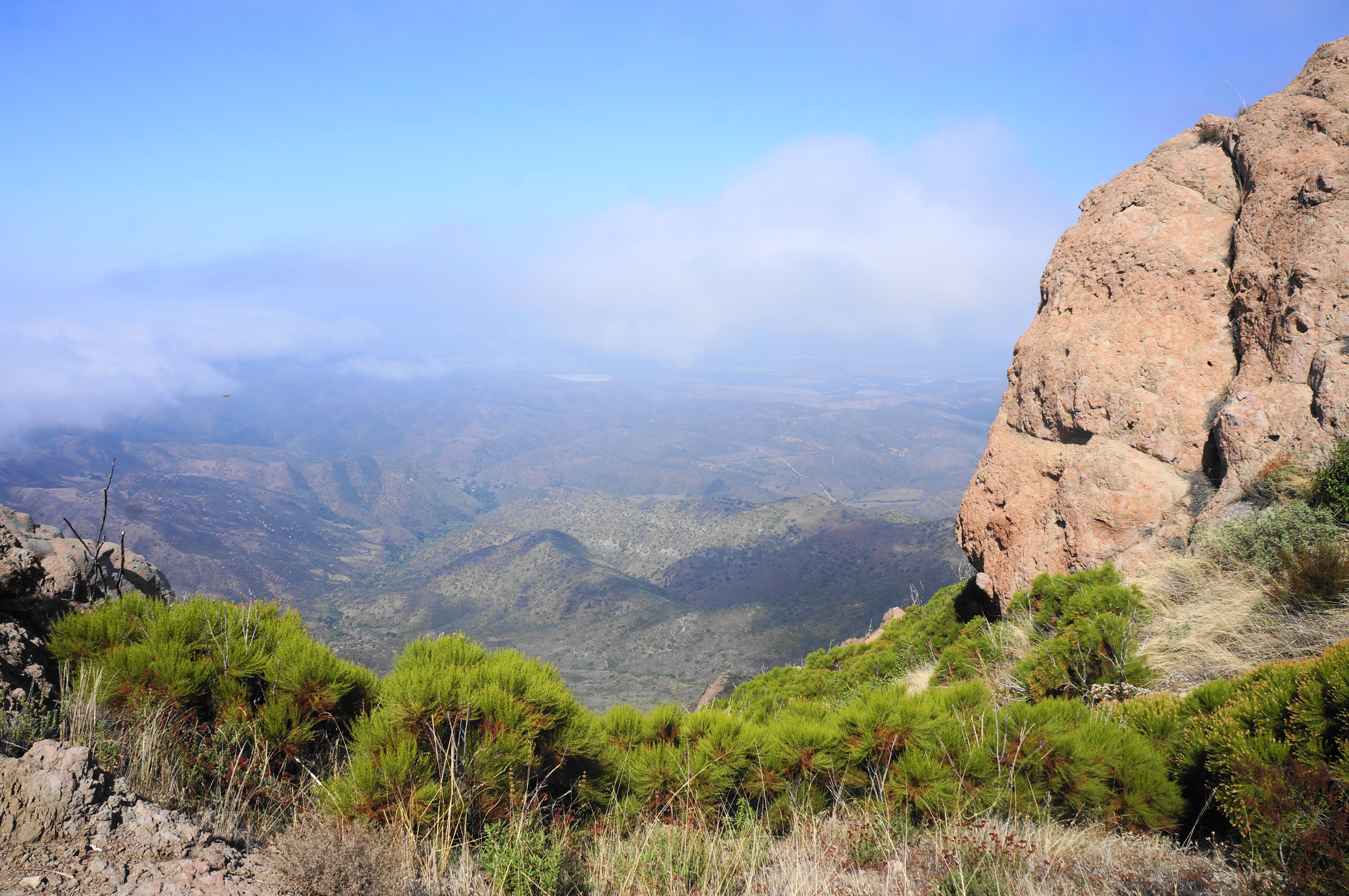
This is the highest point in the Santa Monica Mountains, affording a 360-degree panorama that, on a clear day, can stretch dozens of miles onto the horizon. The southward view is often fog-filled, blocking views of the ocean; visibility looking north is usually better, with views across Conejo Valley to the Las Posas Hills, Topatopa Mountains, and other components of the Transverse Ranges.

Looking east, one can also look all the way back…to the parking area where you started! This puts the 1,100-foot climb into stark perspective.

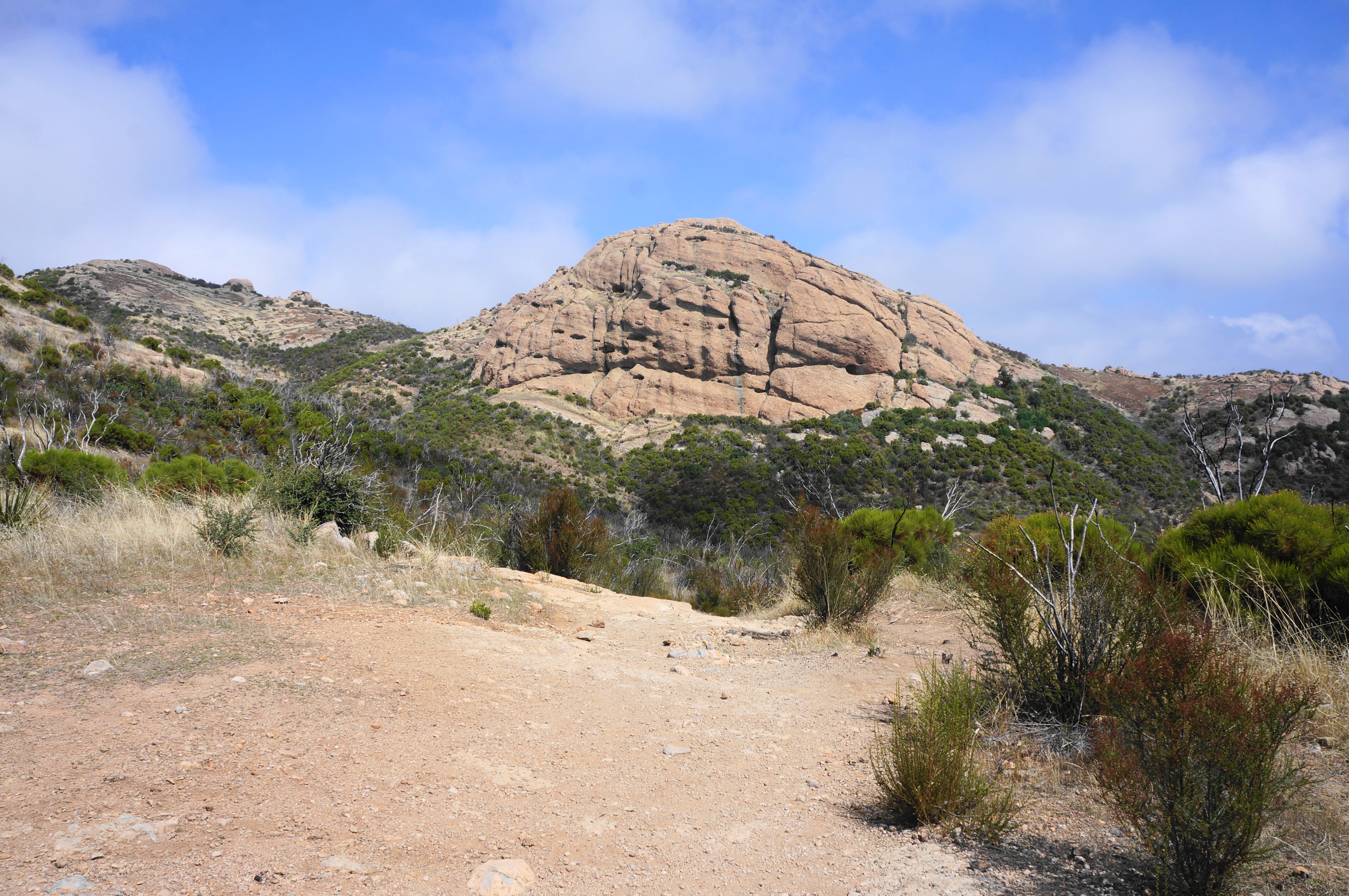
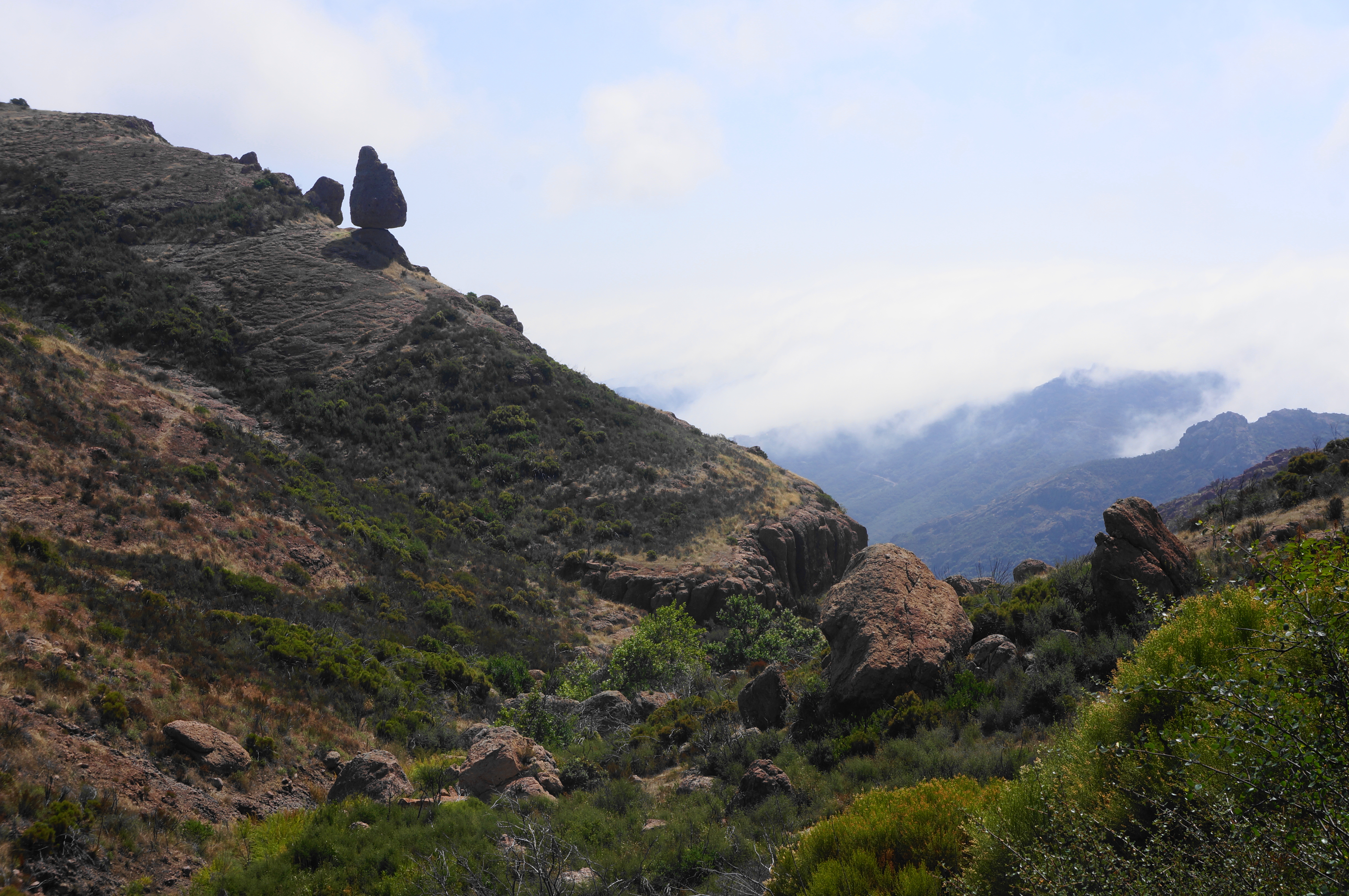
And yet the hike is not even halfway done at this point. When ready, return to the main trail and the open saddle. Here the trail becomes a wider gravel road, rounding a sharp right-hand bend and descending. This leads soon into a left-hand turn and a divide between minor tributary drainages. Continue to snake westward at a mild downhill clip, coming to another saddle in view of an imposing thumb-shaped spire. This is part of the clutch of sandstone visible from way back at ¼ mile into the hike.

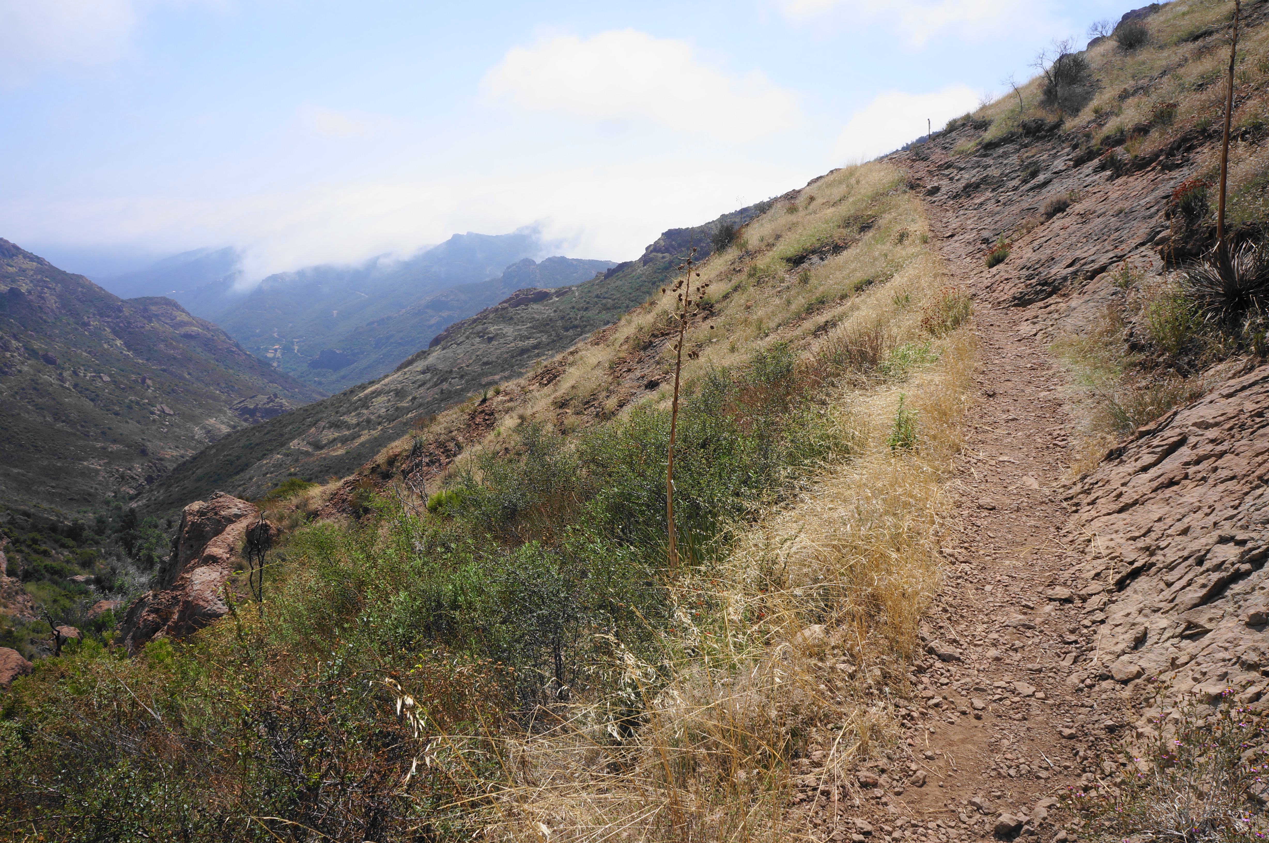
Tread further on the mellow trail, eventually coming to a spur trail at 2.7 miles. This marks the short detour to Inspiration Point, a worthy destination. Follow the slightly uphill track through scrubby chaparral to the viewpoint, which—in clear weather—offers a look down toward the ocean.

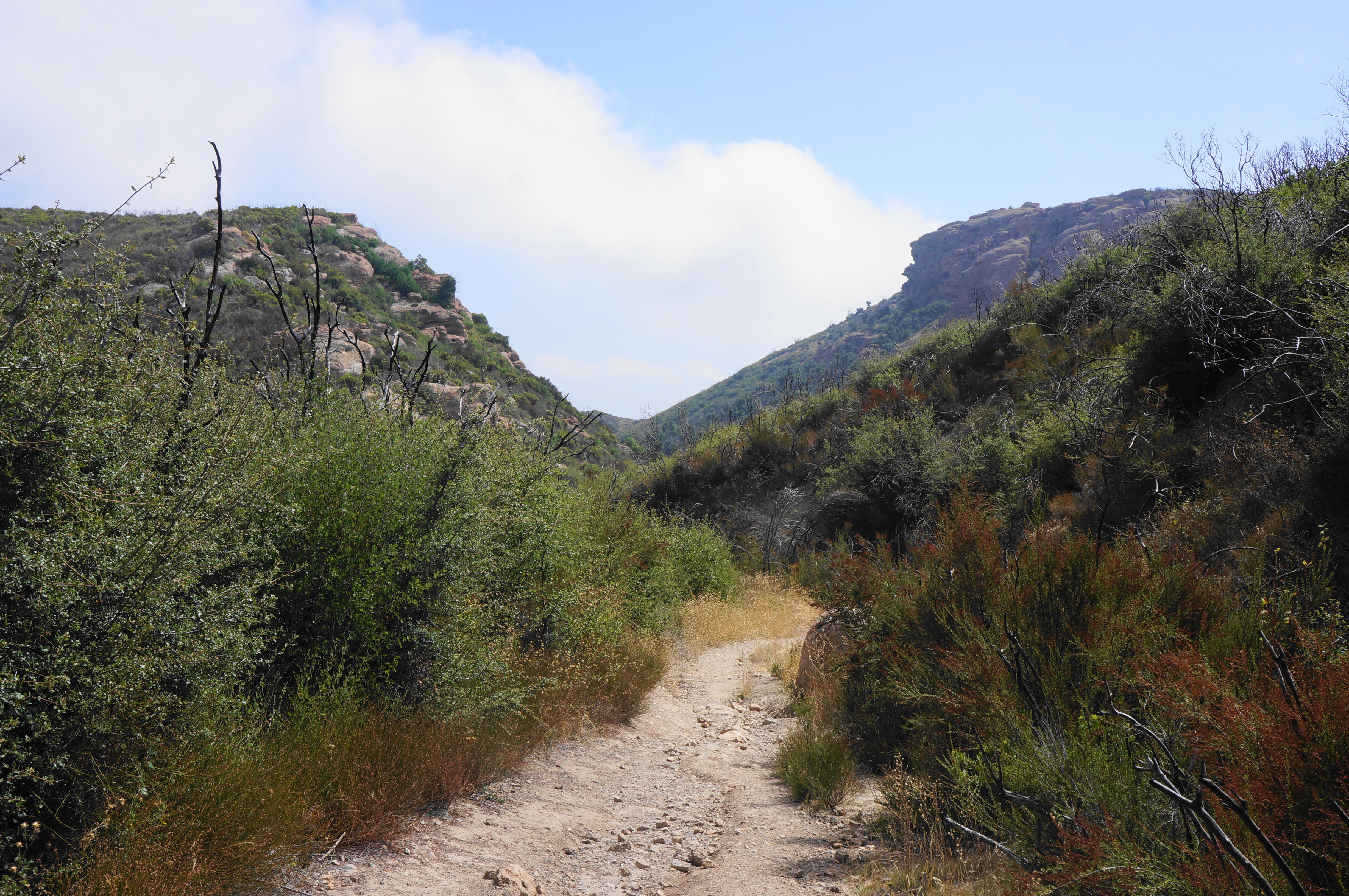
Return to the main trail and bear left, descending to a spot in sight of Tri Peaks, where another spur (leading to water tanks) comes in from the left. Skip this detour, staying right and descending northward to a relatively open basin, where a constellation of different trails converge. At 3.1 miles, hikers will reach a junction: the Mishe Mokwa Trail bears right, while the optional side trip to Tri Peaks leads left, across the (usually dry) drainage.
Tri Peaks (1.1 miles)
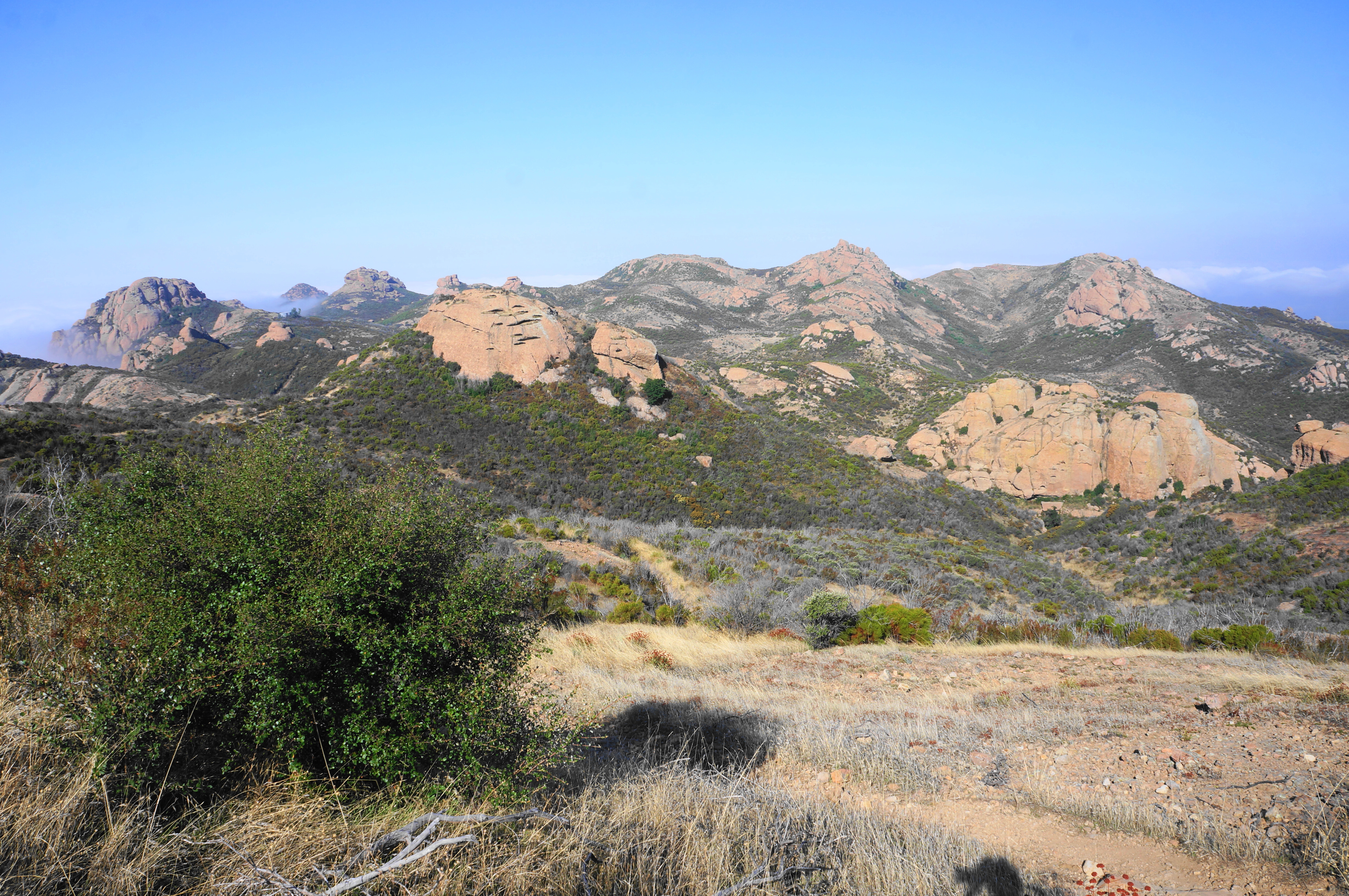
The diversion to Tri Peaks brings one into the heart of Boney Mountain, which comprises a series of high knobs, boulder outcrops, and snaking ridges. The views are not as extraordinary as those of Sandstone Peak, but—if one still has the energy—it is worth the one-mile detour.
Begin by heading left at the aforementioned junction, immediately crossing the dry drainage. Come to another fork thereafter, and stay right—departing from the Backbone Trail for the first time—on the Tri Peaks Trail. The access route soon narrows and heads straight up a side wash before turning and rising steadily as it winds toward the bulky peaks.

Come to another intersection and bear right, traversing grassy terrain until a point where the trail seems to disappear entirely. A closer look reveals that a fainter trail continues left, rising to a point where one can cut back right, skirting a ridge to ascend Tri Peaks. A window view north offers a look down across neighboring Point Mugu State Park to Potrero and Pleasant Valleys.


The route goes dim as it approaches the base of tall boulder outcrops, but this is in part because the summit does not appear to be accessible without some serious Class 4 climbing. Instead plan to settle for views from the base that are nearly as good, then return the way you came, tracing back to the broad wash and the junction with the Mishe Mokwa Trail.
Mishe Mokwa Trail (3.0 miles)
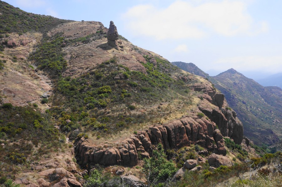
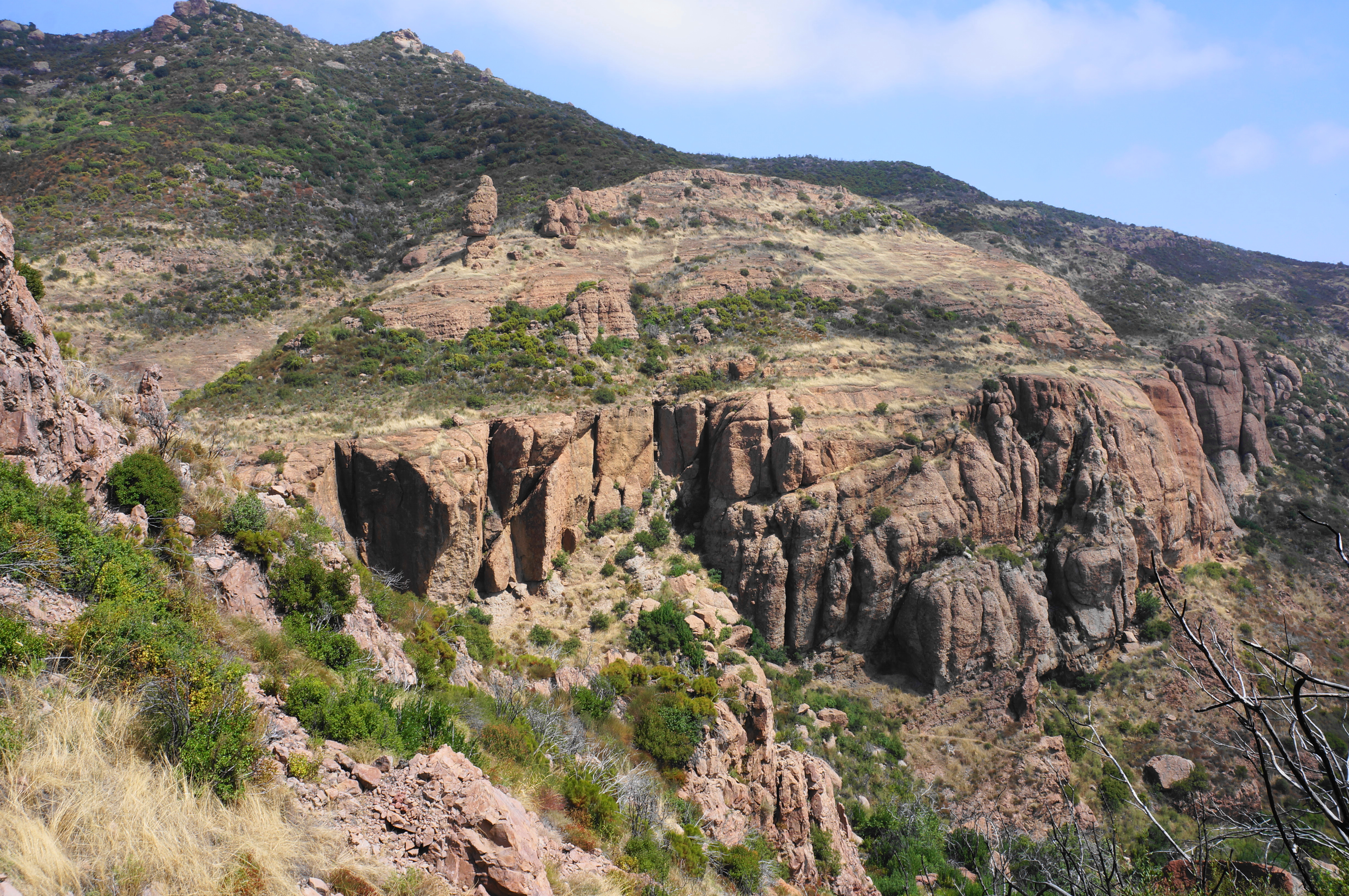
The highlights of the Mishe Mokwa Trail section are the close-up views of the Echo Cliffs and a look across the canyon to Balanced Rock, an extraordinary mushroom-shaped feature towering above the cliffs. But the 3-mile walk begins more humbly, gently winding across a gentle plateau and into a drainage set below Mount Boney Peak.
As the track files down-canyon, the surrounding canyon walls and outcrops appear larger and more imposing, and the trail eventually shifts from the right side of the wash to the left. Enjoy the mellow downhill as the path drops to a stand of charred oaks, evidence of the recent Woolsey Fire, which ravaged much of the park in 2018. Pass a spur trail heading left to Balanced Rock (you will see it later from the other side of the canyon), then drop to another drainage crossing at Split Rock, a shady picnic area named for a modest boulder with a cleave down the middle.


From Split Rock, the onward trail climbs to heights overlooking Carlisle Canyon as it approaches the Echo Cliffs and drops down several hundred feet in quick succession. The guardian of this transition is the impressive Balanced Rock, viewed from a distance but unmistakable as an towering sentinel, one of the most distinguished natural landmarks of the Santa Monica Mountains.
Continue up and down to clear a series of minor washes, with Balanced Rock now situated above the impressive Echo Cliffs. The rest of Carlisle Canyon—wider and deeper—unfolds just beyond. At around the six-mile mark, the trail rises a sunny crest, with the first of a series of photo stands set up by rangers to track ecological recovery since the Woolsey Fire.

Edge southward and east on the Mishe Mokwa Trail, then take on a broad semi-circle spanning more than ¼ mile, culminating with a climb back to the original split encountered hours ago. This closes the loop, with only the initial 1/3-mile section remaining. Bear left, following the descending track as it parallels—and soon ends at—Yerba Buena Road. This marks the end of the 7.2-mile, strenuous hike.

Pingback: Top 10 Hikes in 2023 | Live and Let Hike
Pingback: Mishe Mokwa Trail . by Alice B. Clagett – with the music of Chris Zabriskie - AWAKENING WITH PLANET EARTH