
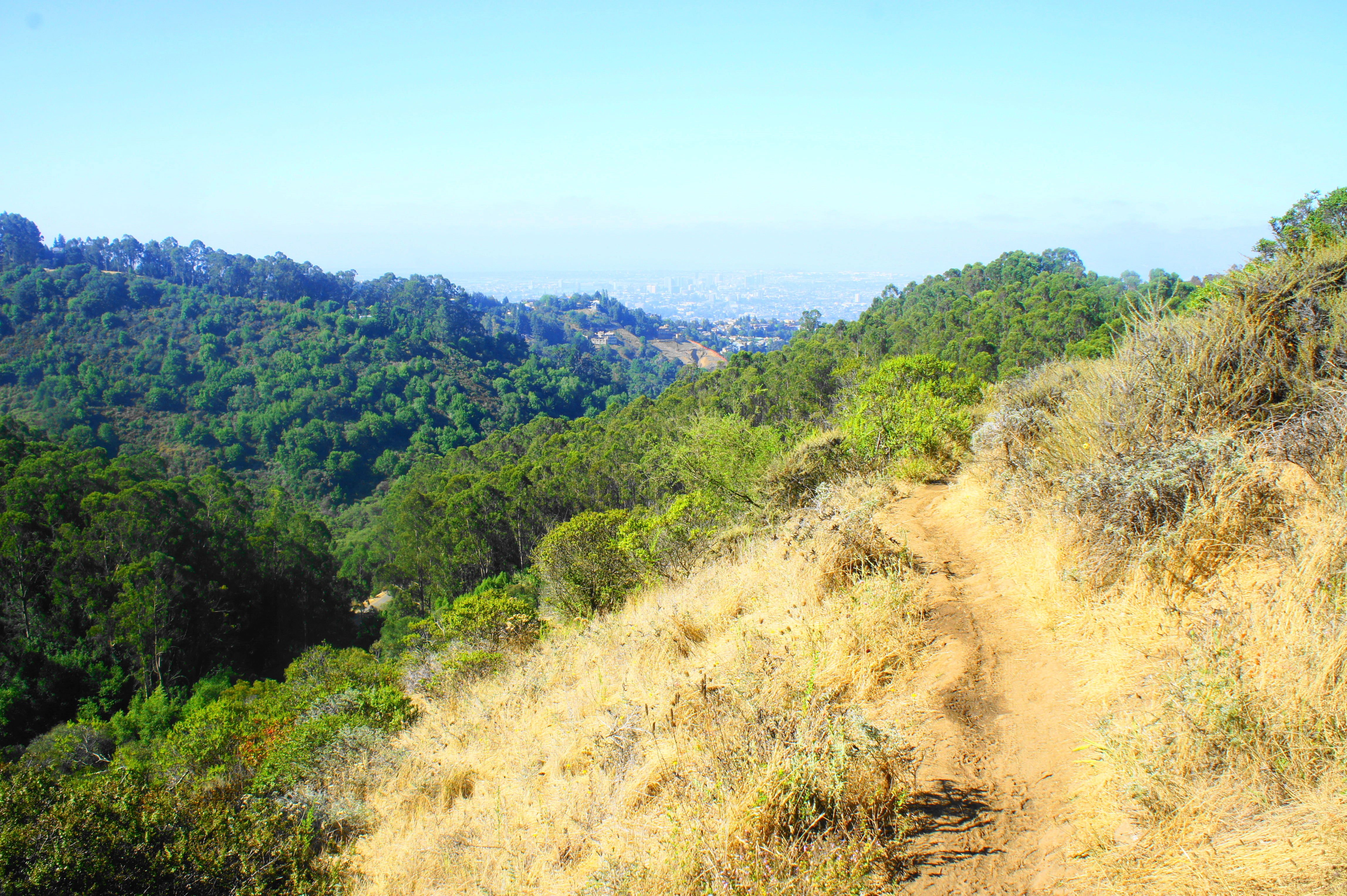
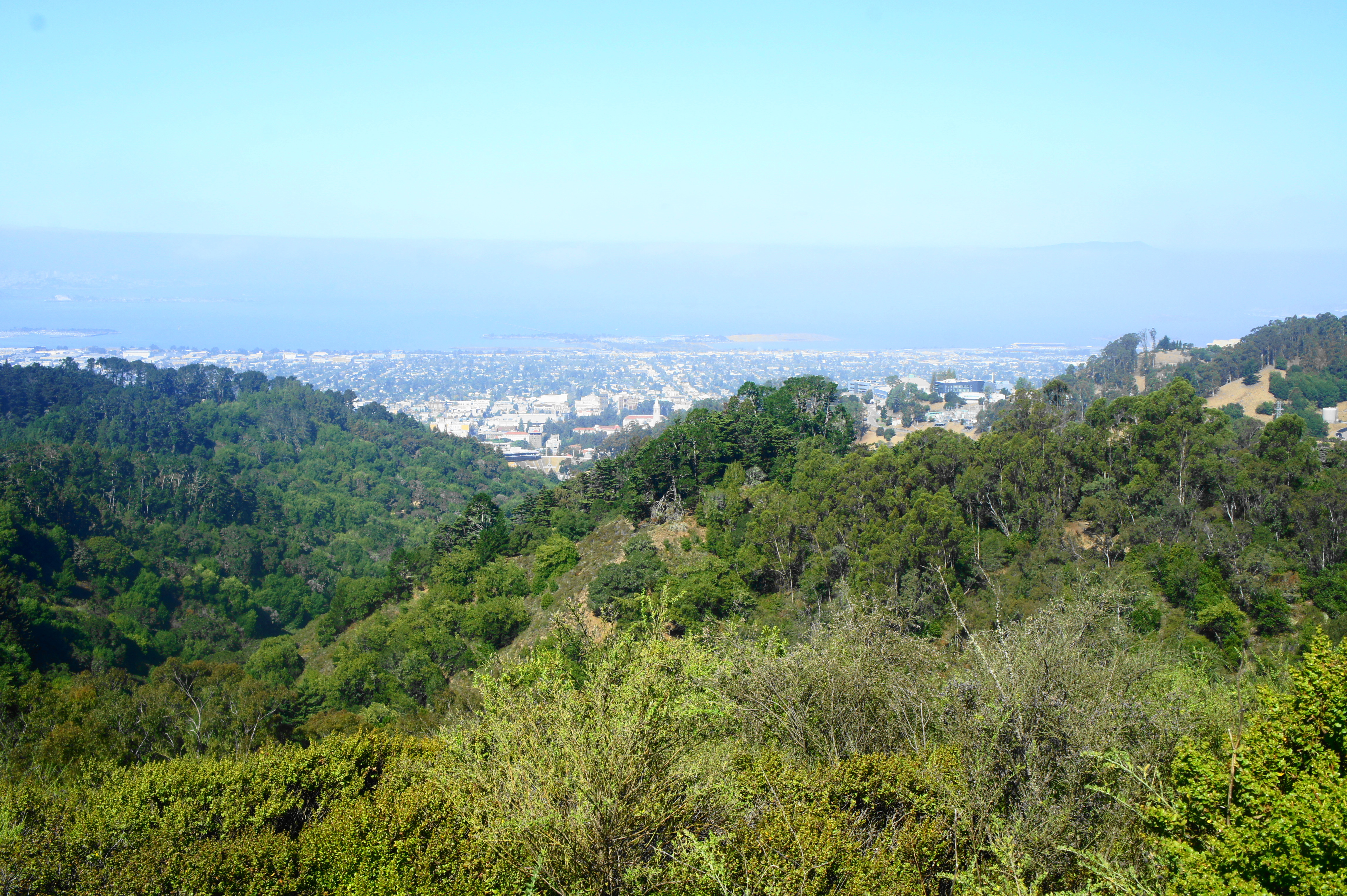
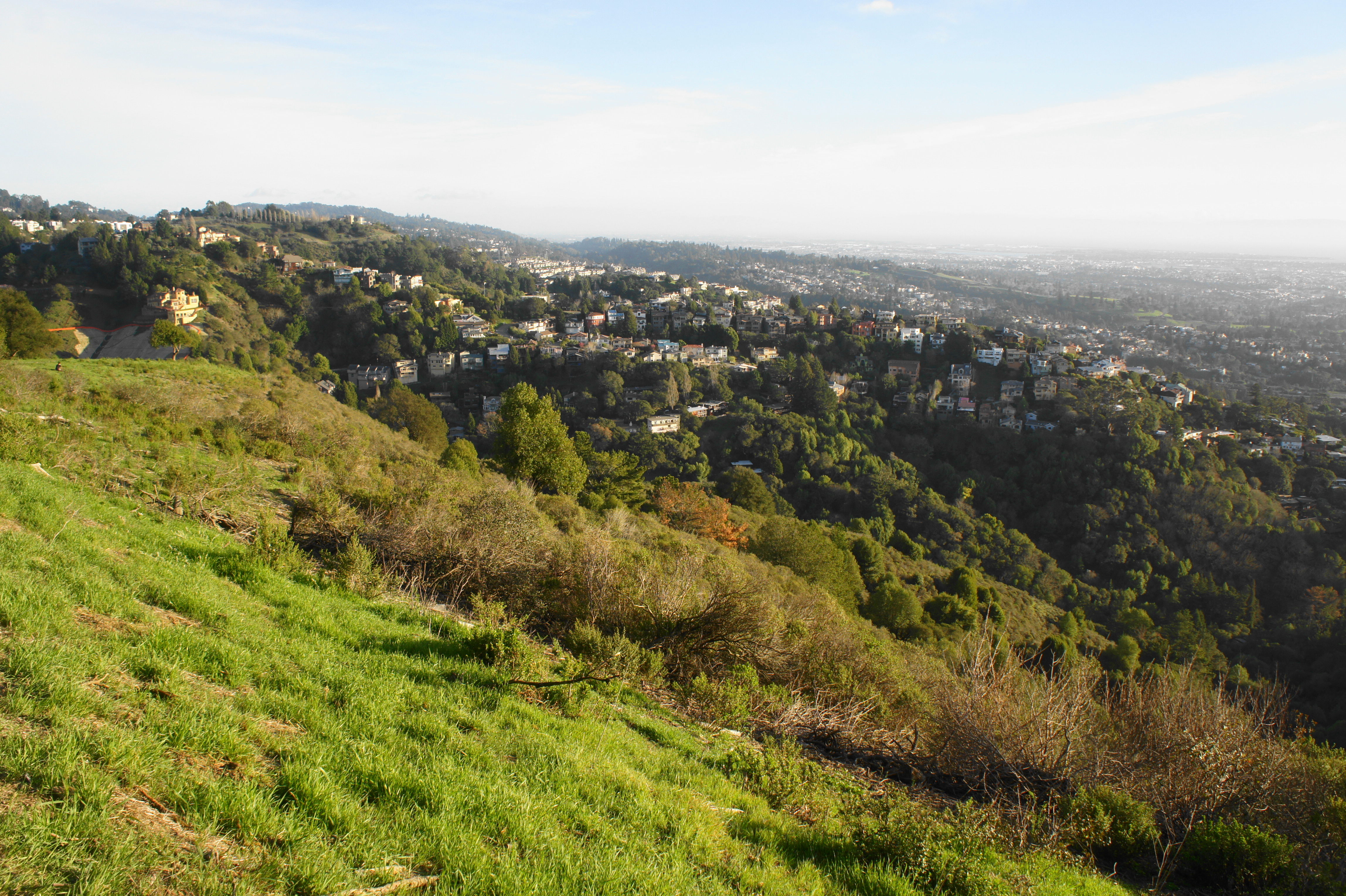
When Berkeley residents talk about walking on the “fire roads,” chances are they are referring to the network of hiking and biking trails in Claremont Canyon Regional Preserve or on adjacent lands owned by the University of California, Berkeley. Together this milieu of paths crisscrosses woody and scrubby terrain in the heart of the Berkeley Hills. Some walks boast 180-degree panoramas of Berkeley, Oakland, and the San Francisco Bay; others are intimate strolls amid the bay/oak, eucalyptus, redwood, and pine groves that dot the landscape. It’s hard to beat the ease of access, even for city dwellers without a car, as many trailheads are situated just off bus routes in the city of Berkeley. (Some even start from the Downtown Berkeley BART station.) But visitors seeking to explore this scenic stretch of the Berkeley Hills will have to work for it, as more than 1,000 feet separates the base from the ridgetop. Expect steep and challenging climbs.
Technically the land ownership and jurisdiction here is split in two, with the East Bay Regional Parks District covering the 208-acre Claremont Canyon Regional Preserve, and UC-Berkeley administering a much larger swathe that includes parts of Panoramic Ridge and all of Strawberry Canyon. (Note: There are also smaller jurisdictions such as John Garber Park, technically run by the city of Oakland.) But the trail network tends to blend together, with lines between the parks often unclear and rather irrelevant. (For the best maps, see the Claremont Canyon Conservancy and Claremont Canyon Regional Preserve websites; a couple other hikes—such as the “C”—are not shown but can be relatively easily found with the instructions below.)
There are perhaps dozens of possible trailheads, many situated along Centennial Drive, Claremont Avenue, or Grizzly Peak Boulevard. The ones highlighted below are:
- Campus Drive (map): A residential cul-de-sac partway up the Berkeley Hills in North Berkeley; offers access to the Olympus Path.
- Dwight Way (map): Next to UC-Berkeley’s Clark Kerr campus, this is a popular starting point for runners on the Clark Kerr Track and hikers heading up Panoramic Ridge on the Stonewall-Panoramic Trail and connecting routes.
- Foothill Parking Lot (map): This large but often crowded parking area is administered by UC-Berkeley and requires a small fee (although enforcement is suspect). It is situated behind the Greek Theatre, partway up the hillside, just off Cyclotron Road. It offers access to the “C” (see hike below).
- Garber Park (map): Here there is a small roadside gravel pull-off that offers access to the 13-acre John Garber Park in Claremont Canyon.
- Lower Fire Trails Trailhead (map): A relatively large but bumpy dirt lot in Strawberry Canyon along Centennial Drive.
- Marker 18 (map): Parking is rather sketchy at this pull-off along Grizzly Peak Boulevard; a better option is perhaps to walk from the nearby Steam Trains parking in neighboring Tilden Regional Park.
- Marker 20 (map): Denoted as marker 20 on the Claremont Canyon Conservancy map, this rutted roadside lot is situated off busy Grizzly Peak Boulevard, high in the Berkeley Hills.
- Marker 29 (map): Marker 29 on the Claremont Canyon Conservancy map, this roadside lot off Claremont Boulevard has a couple deep ruts (so be careful) but relatively spacious parking; it offers access to the Gwin Canyon, Summit House, and Willow Trails.
- Panoramic Way (map): A very small lot, enough for only 3 cars, along a tight-squeeze road hundreds of feet above Berkeley and Claremont Canyon.
- Space Sciences Laboratory (SSL) Lot (map): This UC-Berkeley pay-to-park lot is situated much of the way up the Berkeley Hills, near the junction of Centennial Drive and Grizzly Peak Boulevard. It offers access to the Upper Jordan Trail.
- Stonewall Road (map): Alternative access to the Stonewall-Panoramic Trail at the base of Panoramic Ridge, slightly harder to reach than the Dwight Way entrée.
- Vista Lot (map): Alternative access to the Olympus Path, this parking lot is operated by UC-Berkeley and situated off Centennial Drive adjacent to the Lawrence Hall of Science.
This area is perhaps not the best for solitude, as locals regularly use the trail system for short jaunts throughout the day, but there are options for casual and ambitious hikers alike. Below I recount experiences on 13 different walks, prioritizing loops where possible but also including a couple of one-way hikes that require a personal shuttle or drop-off at the top of the hills.
Olympus Path (0.3 mi. out-and-back)
Trailhead: Campus Drive (Alternative: Vista Lot)
Difficulty: Easy
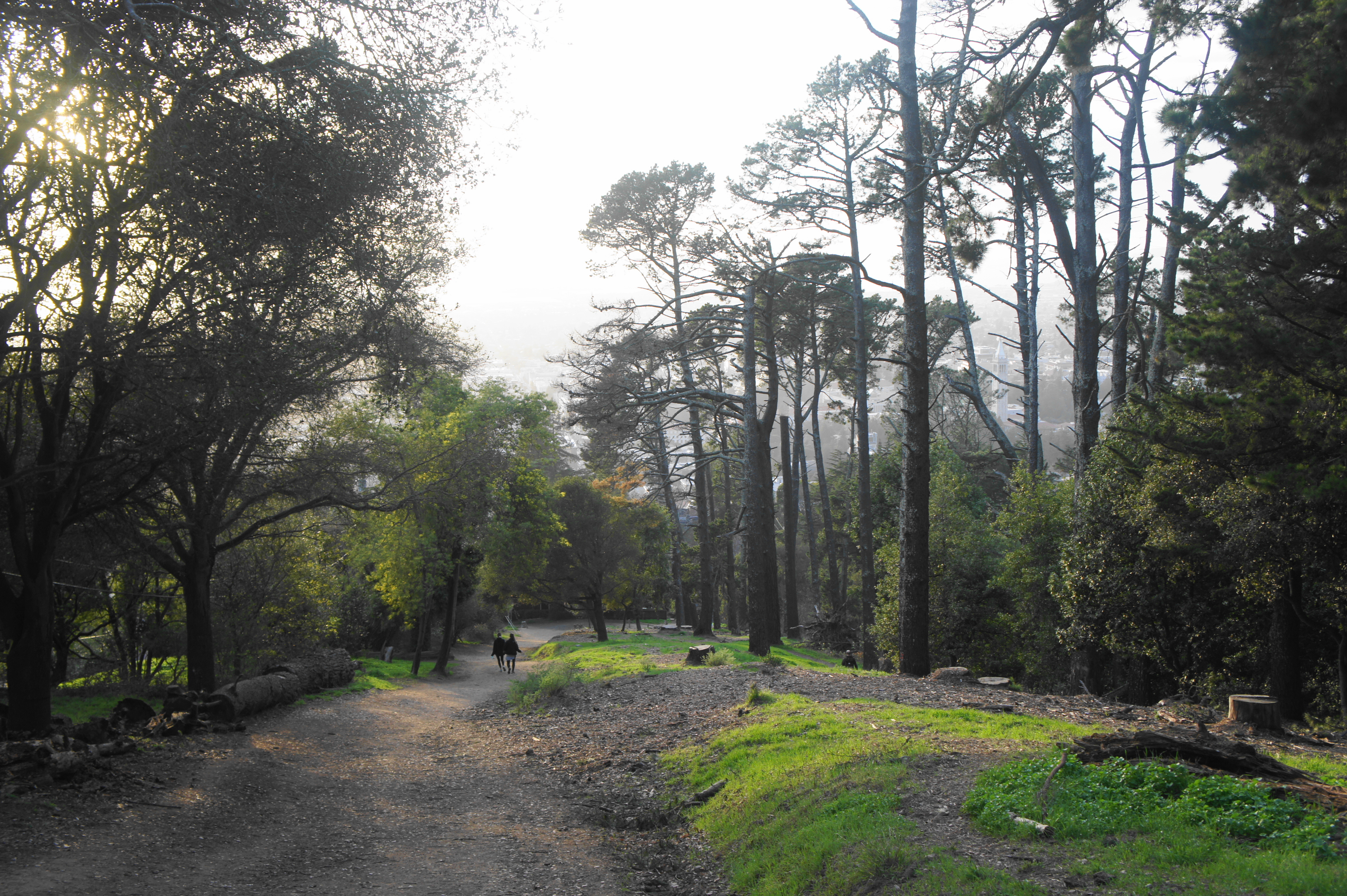
This walk shows up on maps simply as “Olympus” and is the shortest hike on offer here but provides outstanding views on the hillside between Campus Drive and the Lawrence Hall of Science above downtown Berkeley. From the cul-de-sac at the end of Campus Drive in North Berkeley, find the singletrack heading south and then east, zigzagging up a grassy slope in view of Lawrence Hall. Wind up another set of switchbacks, stay straight at the junction with Olympus Avenue and end at the Vista Lot on UC-Berkeley property. Here one can enjoy sweeping views of Oakland, San Francisco, and the Bay. Return the way you came.


The Big “C” (0.6 mi. out-and-back)
Trailhead: Foothill Lot
Difficulty: Moderate
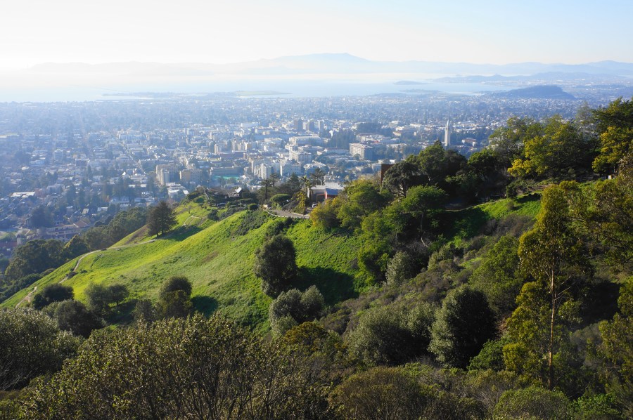
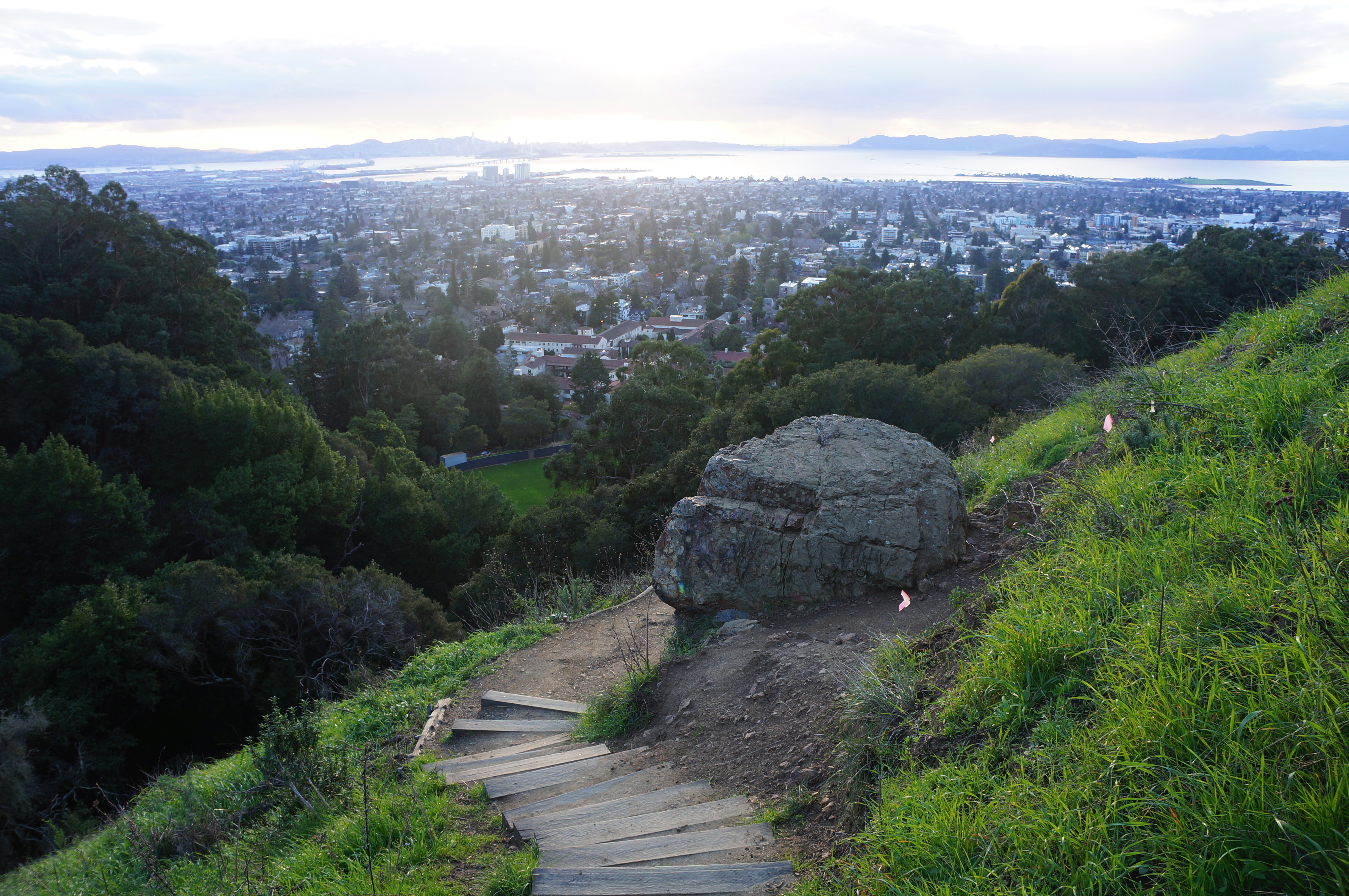
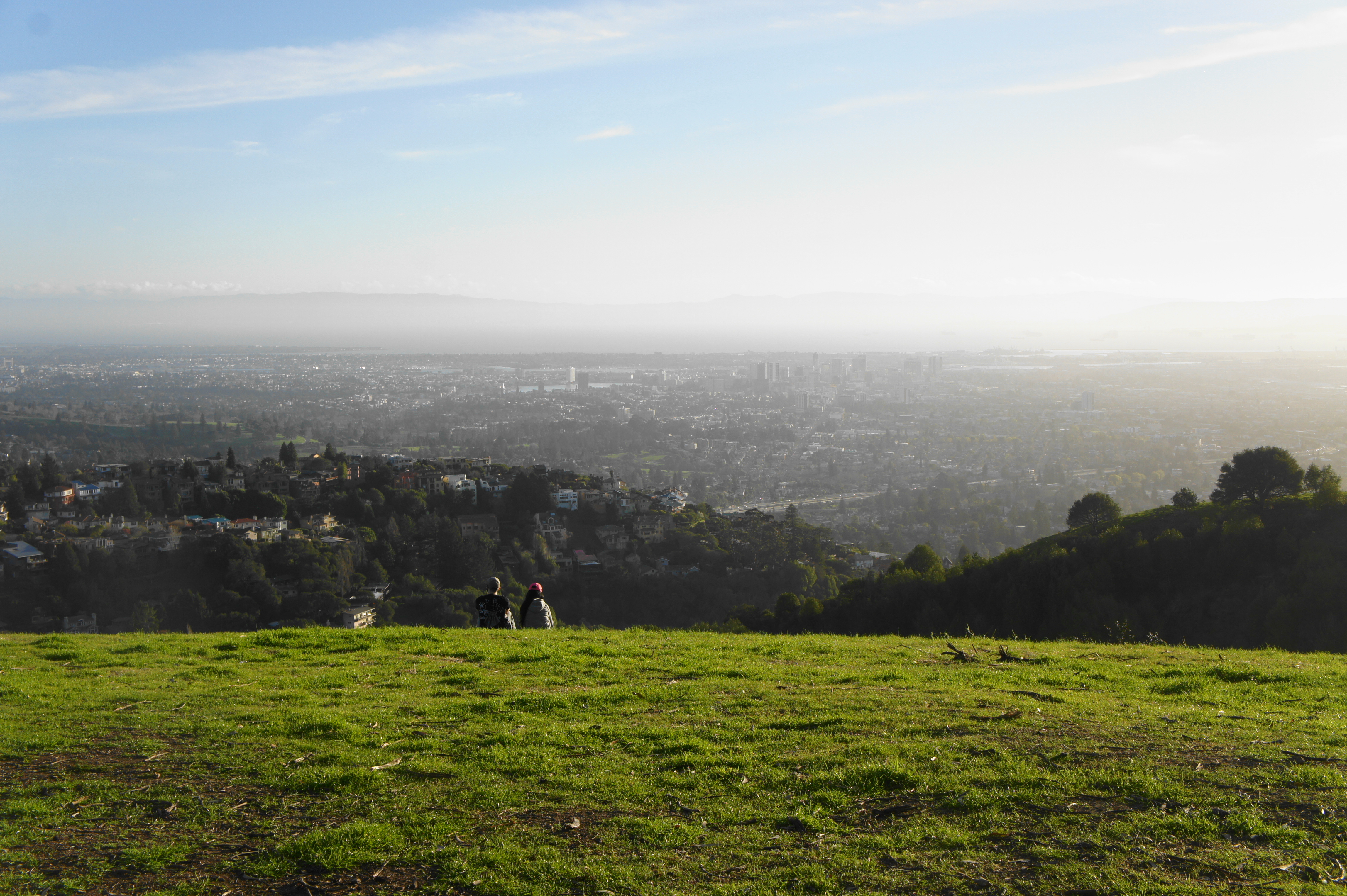
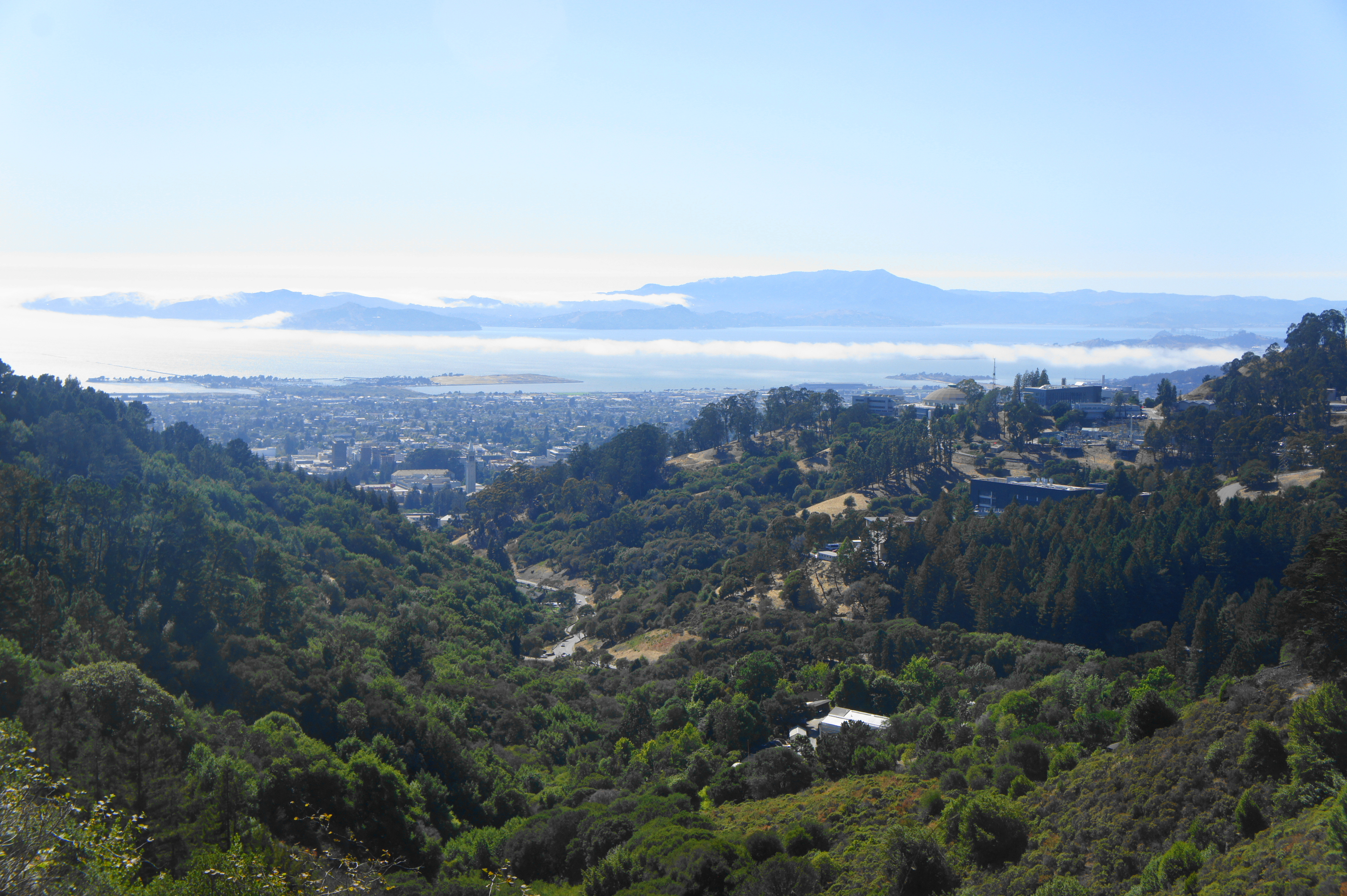
Towering above the Berkeley campus, partway up Tightwad Hill, is a large, spray-painted “C” (for “Cal”), a popular student getaway from the crush of classes. Walk from campus or park at the Foothill Lot (behind the Greek Theatre), where an initial paved track rises steeply up the hillside. Zig-zag up the hill, enjoying a majestic campus view halfway through, then stay on the wide track as it snakes around to the east side of the “C” and then rises to meet it, at 3/10 mile. From here one gets a stellar view of Berkeley, San Francisco, and the Golden Gate Bridge. Return the way you came, capping off a nice walk with 200 feet of elevation gain and loss.
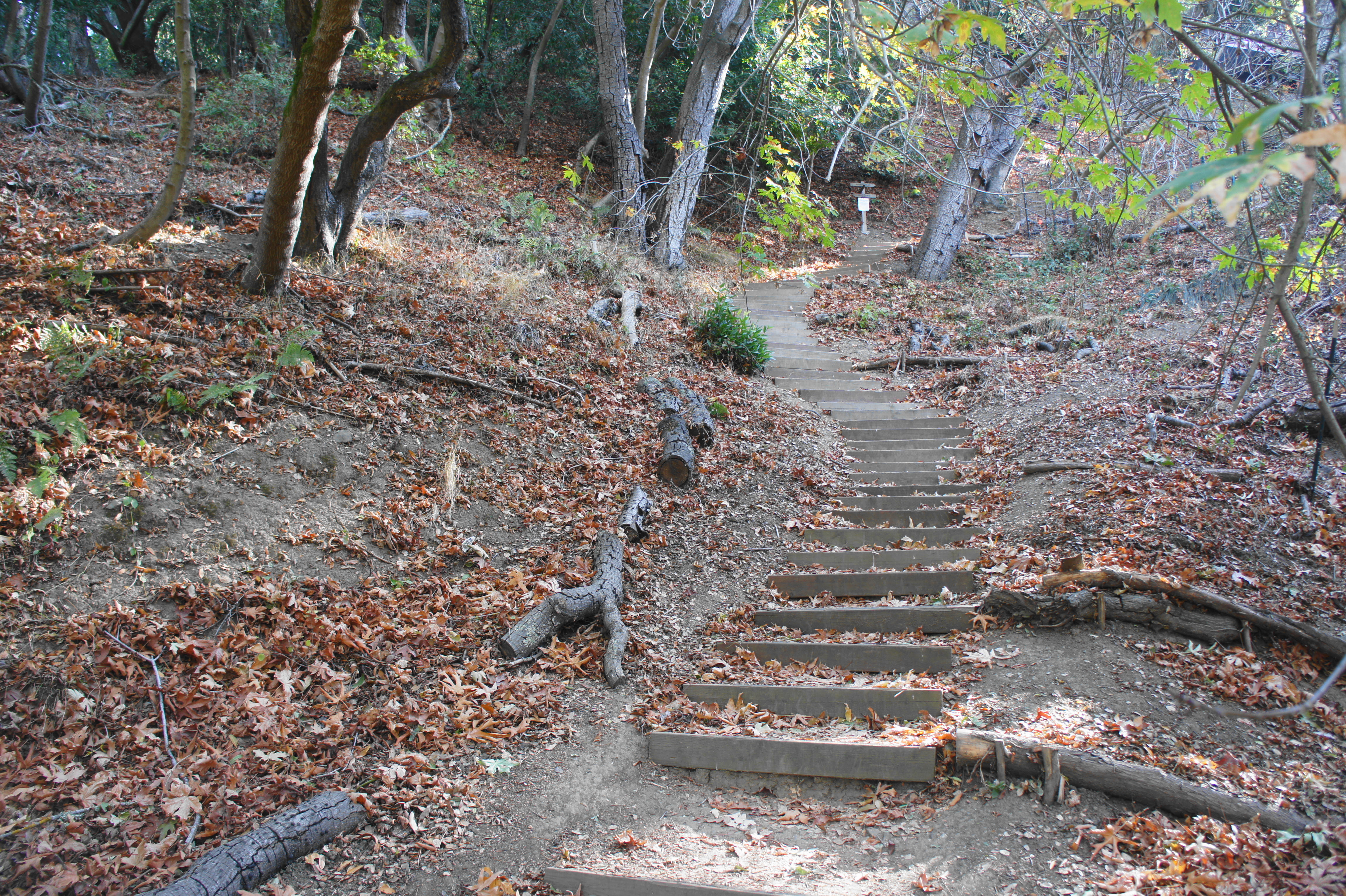
Garber Park Loop Trail (0.6 mi. stem-and-loop)
Trailhead: Garber Park, Claremont Boulevard (Alternative: Rispin Drive)
Difficulty: Moderate
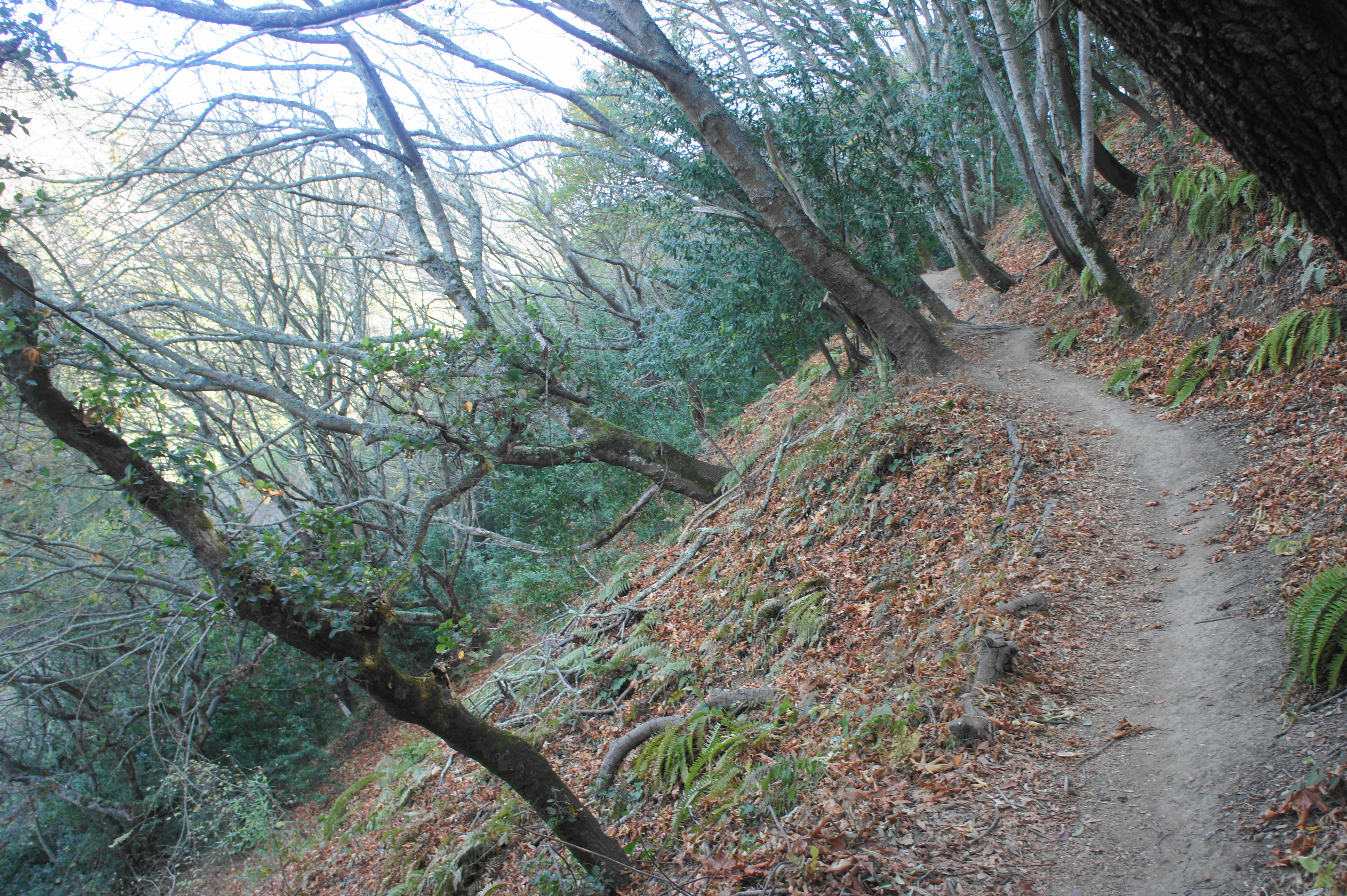
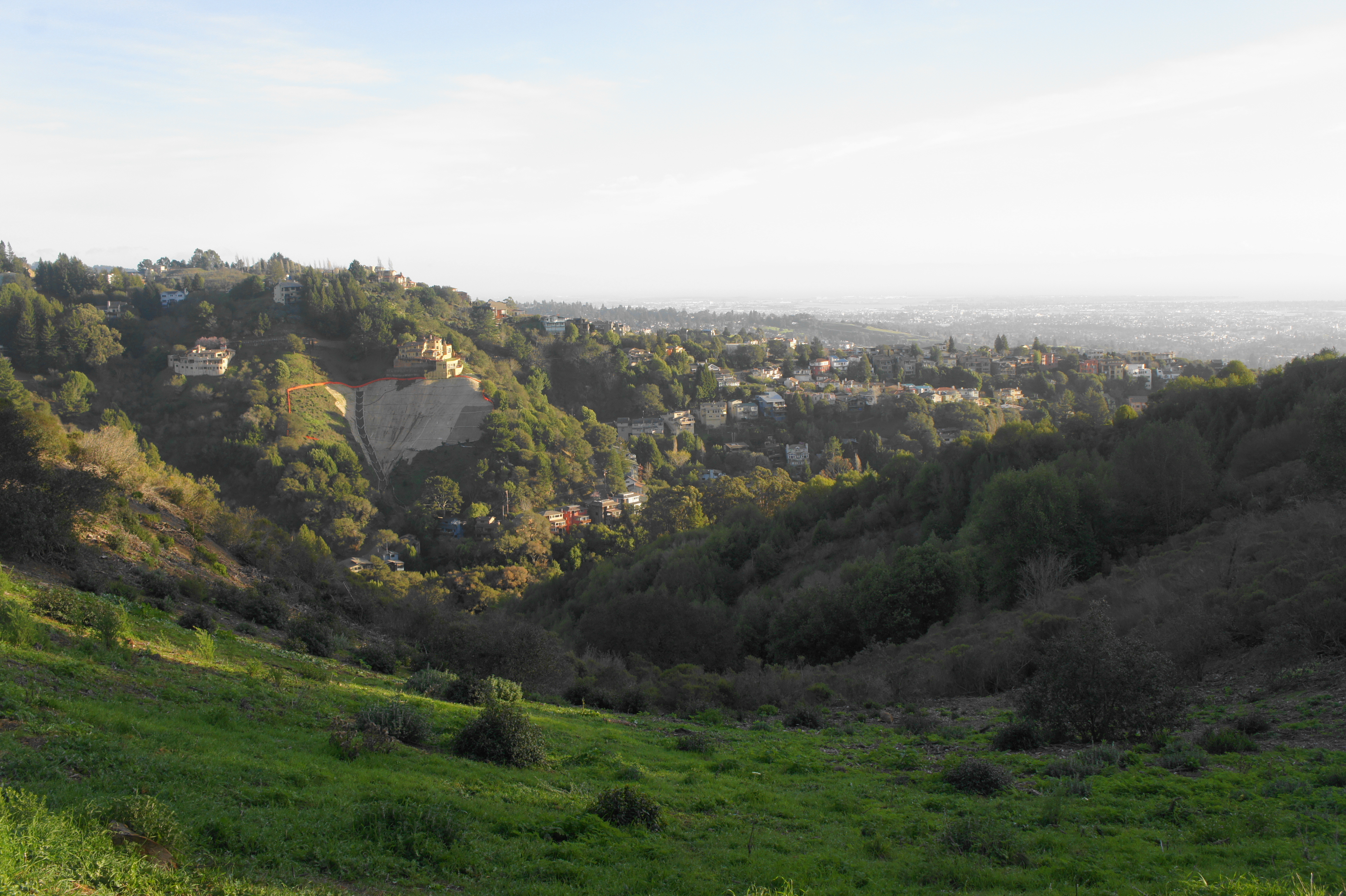
Wedged between Claremont Avenue and residential homes on the Claremont Canyon’s southern slope, John Garber Park protects 13 acres of pretty bay/oak woodlands, with a few stone ruins and towering eucalyptus scattered about. Main access to the park’s loop trail is via a turnoff along Claremont Avenue, about 2/10 mile from the Claremont Hotel. The trail quickly ascends switchbacks and reaches a fork and start of the loop section at 1/10 mile; bear left, leaving the intimidating staircase to the right for later, then follow the shady hillside under a canopy of bay, oaks, and buckeyes. Just beyond old stone ruins at ¼ mile, bear right at the fork, continuing the circuit. After passing the trail’s only sunny patch and a spur that heads up to Alvarado Road, hikers must descend a half-dozen switchbacks, bear right at the Evergreen Drive spur, and drop down the staircase. From here, retrace the initial 1/10 mile (left) back to Claremont Avenue.

Summit House – Willow Trail Loop (0.8 mi. loop)
Trailhead: Marker 29, Claremont Boulevard
Difficulty: Moderate
Starting at a small turnoff at the “29” marker along Claremont Avenue, this short loop hike climbs nearly to the crest of the Berkeley Hills then weaves down through a diverse woodland. Follow the Summit House Trail for 2/10 mile, then stay left at the junction and small redwood grove. Ascend steeply through a forest of bay, oak, and redwood trees, then bear right on the Willow Trail at about the 4/10-mile mark. After a short climb leading to obscured views of the surrounding canyon, the Willow Trail drops sharply by way of a series of staircases and footbridges over eroded ravines before traversing a thicket of the trail’s namesake. Bear right at ¾ mile, then climb back to the trailhead at 8/10 mile. (Note: One can also access this loop from the intersection of Claremont Avenue and Grizzly Peak Road, but there is limited parking and requires descending a steep, 1/10-mile connector trail, so perhaps not recommended.)


Side Hill Trail Loop (0.8 mi. loop)
Trailhead: Marker 20, Grizzly Peak Boulevard
Difficulty: Moderate
The Side Hill Trail is a “cheater” path of sorts: beginning along lofty Grizzly Peak Road, the dramatic vistas of Oakland, Berkeley, and the San Francisco Bay come nearly right away. Park at the “20” marker, just south of the intersection of Grizzly Peak and Lomas Cantadas, then walk 20-30 yards down the road to the start of the Side Hill Trail. The narrow path quickly emerges from a dense thicket to a sloping hillside with views of Claremont Canyon and the Bay, dropping in fits and starts to a junction at roughly 1/3 mile. After bearing right on the fire road, hikers pay for the easy views with a steep climb of more than 300 feet to clear a high hilltop. From here, descend to a junction, then bear right (twice), returning to Grizzly Peak Boulevard.
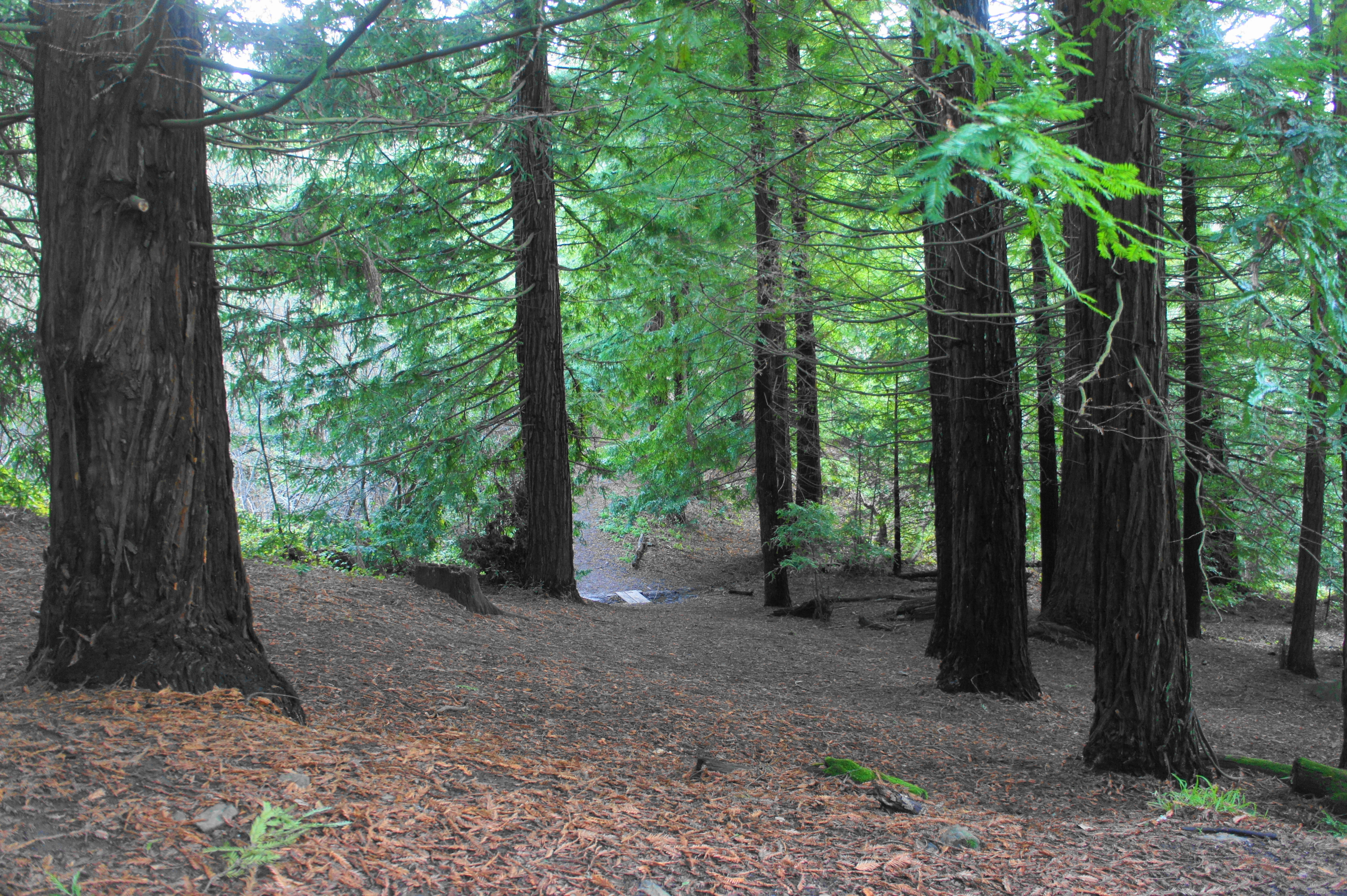
Upper – Lower Jordan Trail Loop, including Woodbridge Metcalf Grove (1.0 mi. loop)
Trailhead: Panoramic Way (Alternative: Lower Fire Trails Trailhead)
Difficulty: Moderate
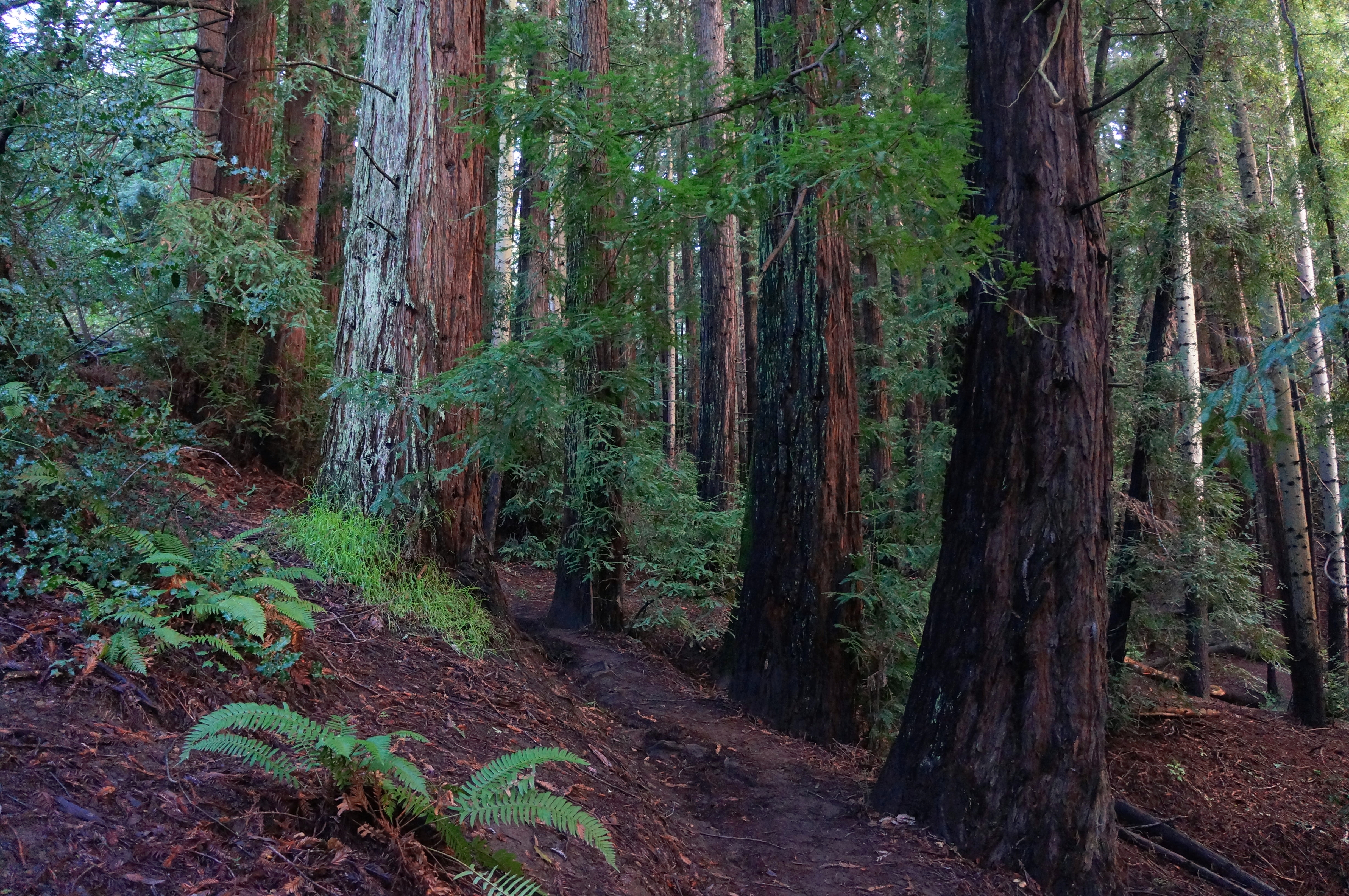
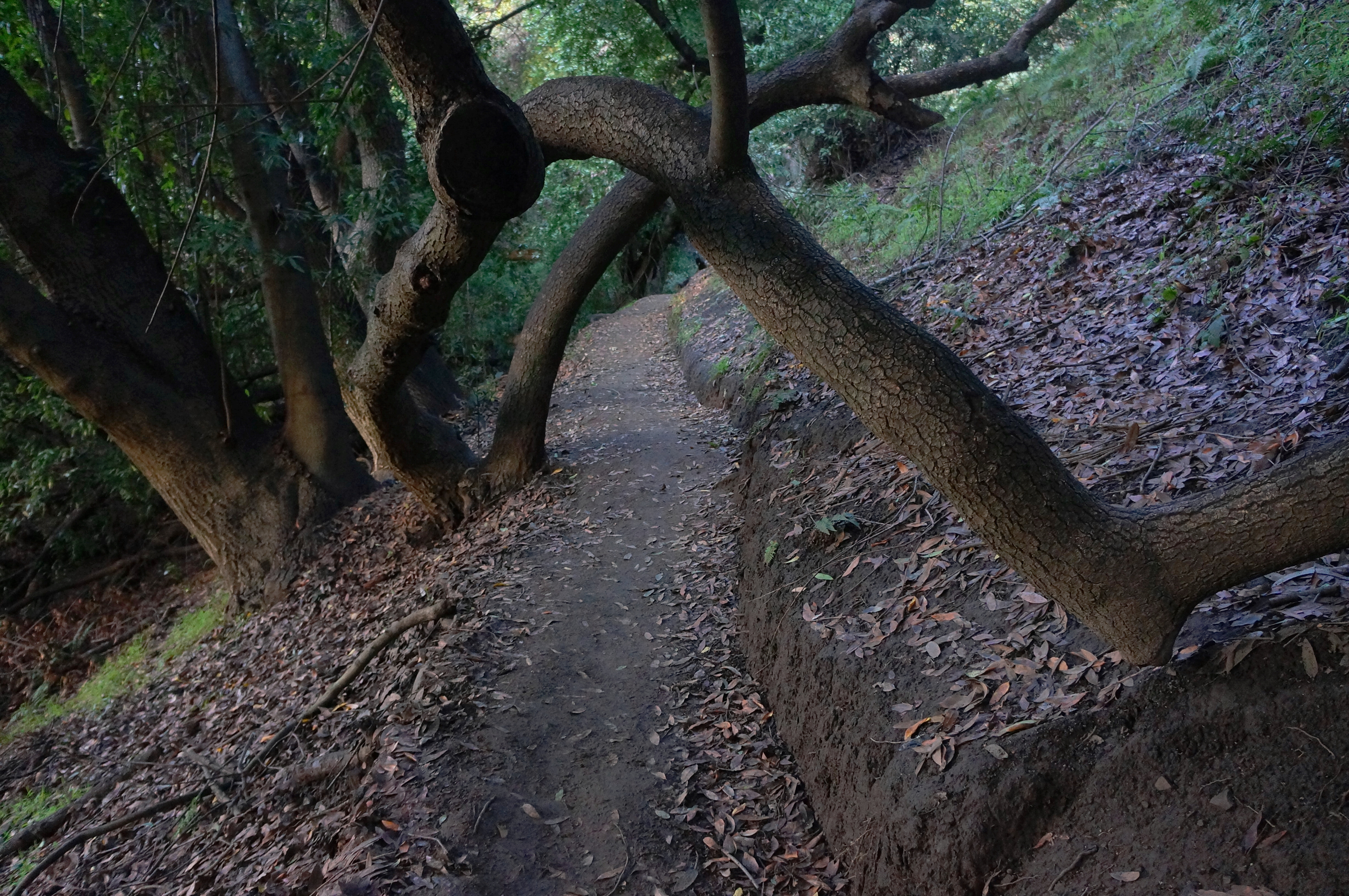
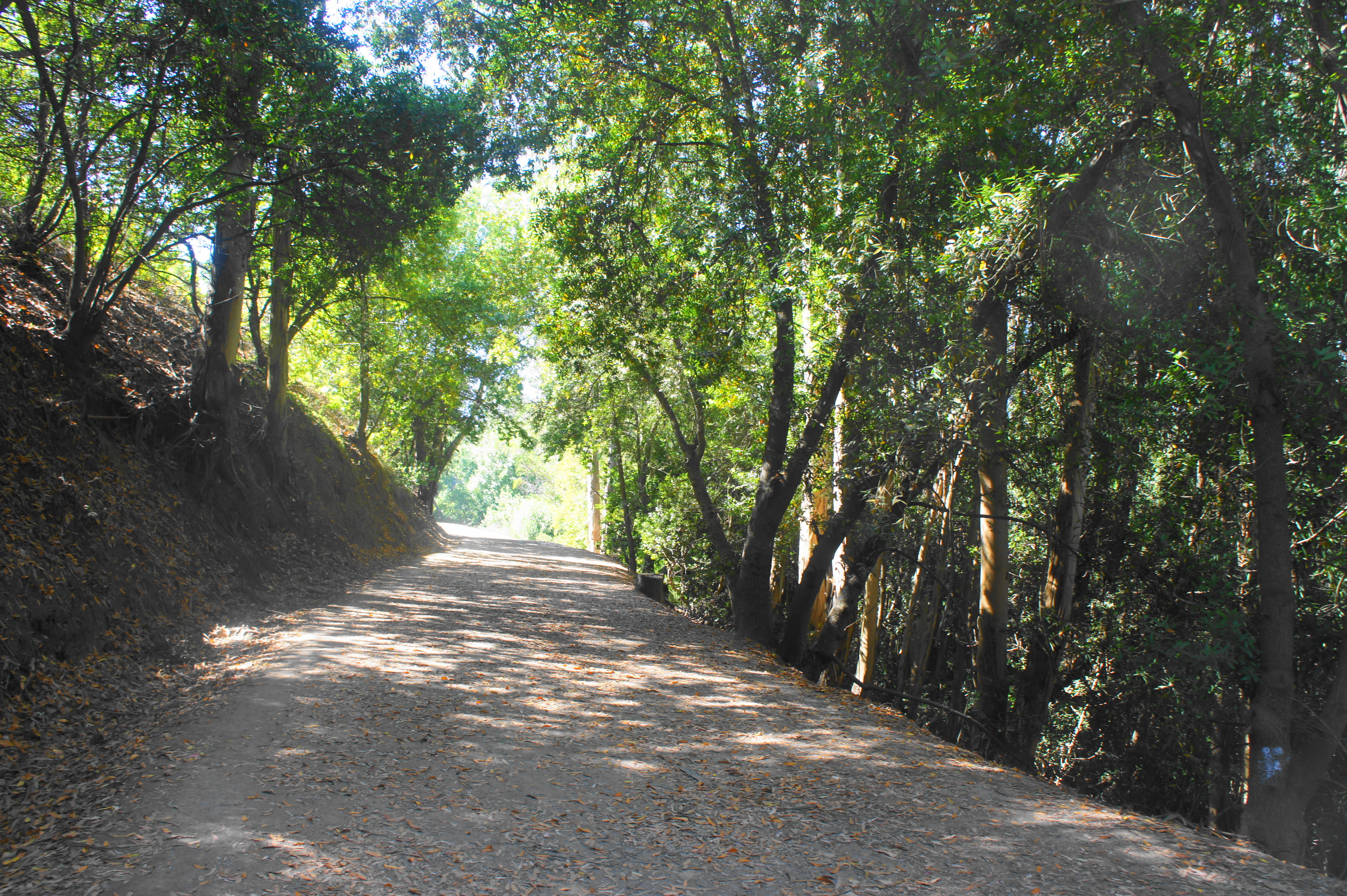
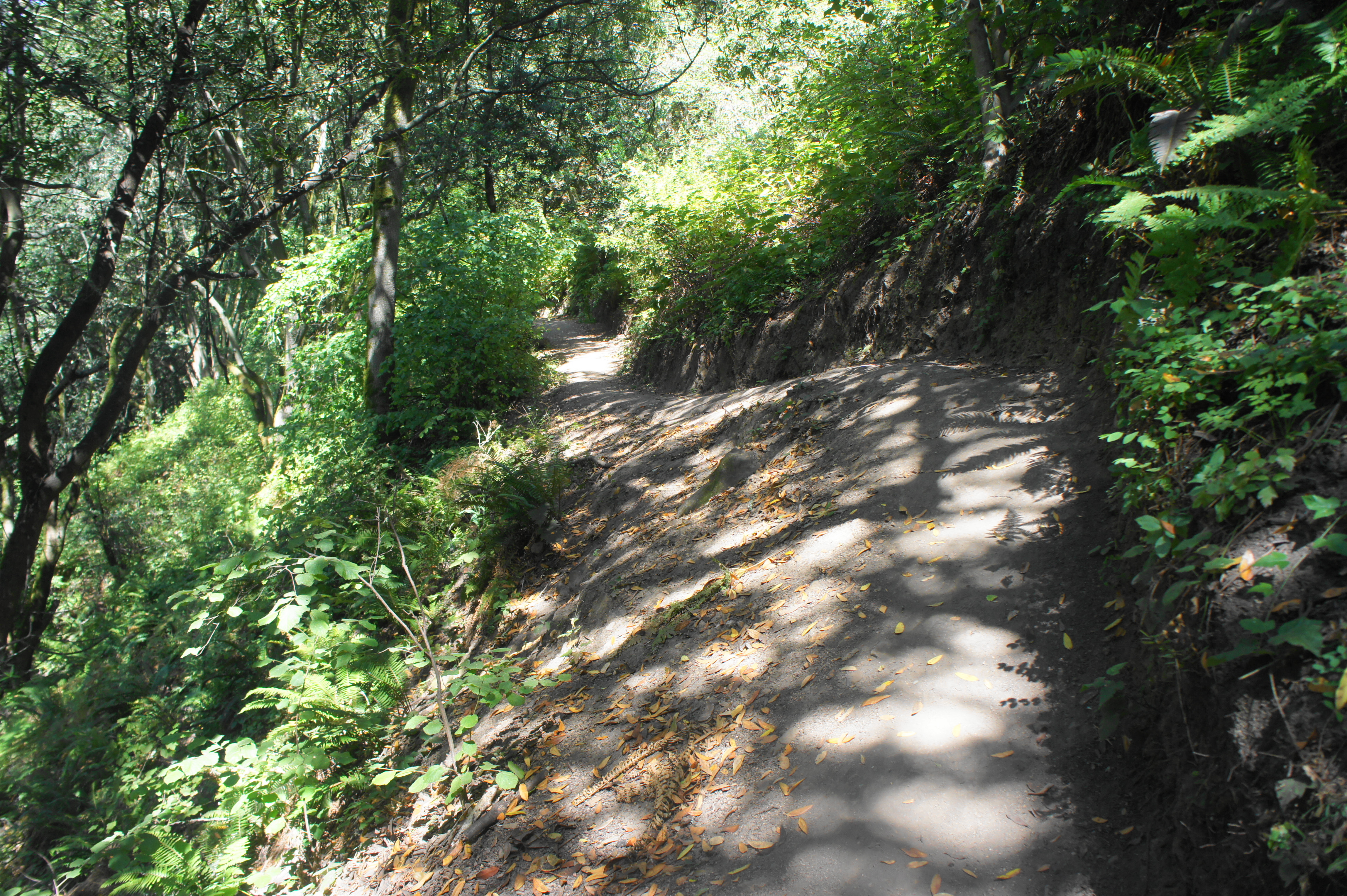
Combining portions of the Upper and Lower Jordan Trails with a singletrack through the lovely Woodbridge Metcalf redwood grove, this 1-mile circuit is an ideal “after work” evening jaunt. From the tight-squeeze parking area on Panoramic Way, stay left and descend partly into Strawberry Canyon, tracing under pines, oaks, and bay laurel to a point at 4/10 mile, where a narrow but evident track heads right, ascending through the terrific Woodbridge Metcalf Grove, planted by students in 1926. The ¼-mile connector trail ascends through the maturing redwoods and intersects with the Upper Jordan Trail; bear right and follow the track to Panoramic Place, then drop down a hillside with Berkeley views to return to the start.

Derby Creek – Clark Kerr Loop (1.1 mi. loop)
Trailhead: Stonewall Road (Alternative: Dwight Way)
Difficulty: Moderate
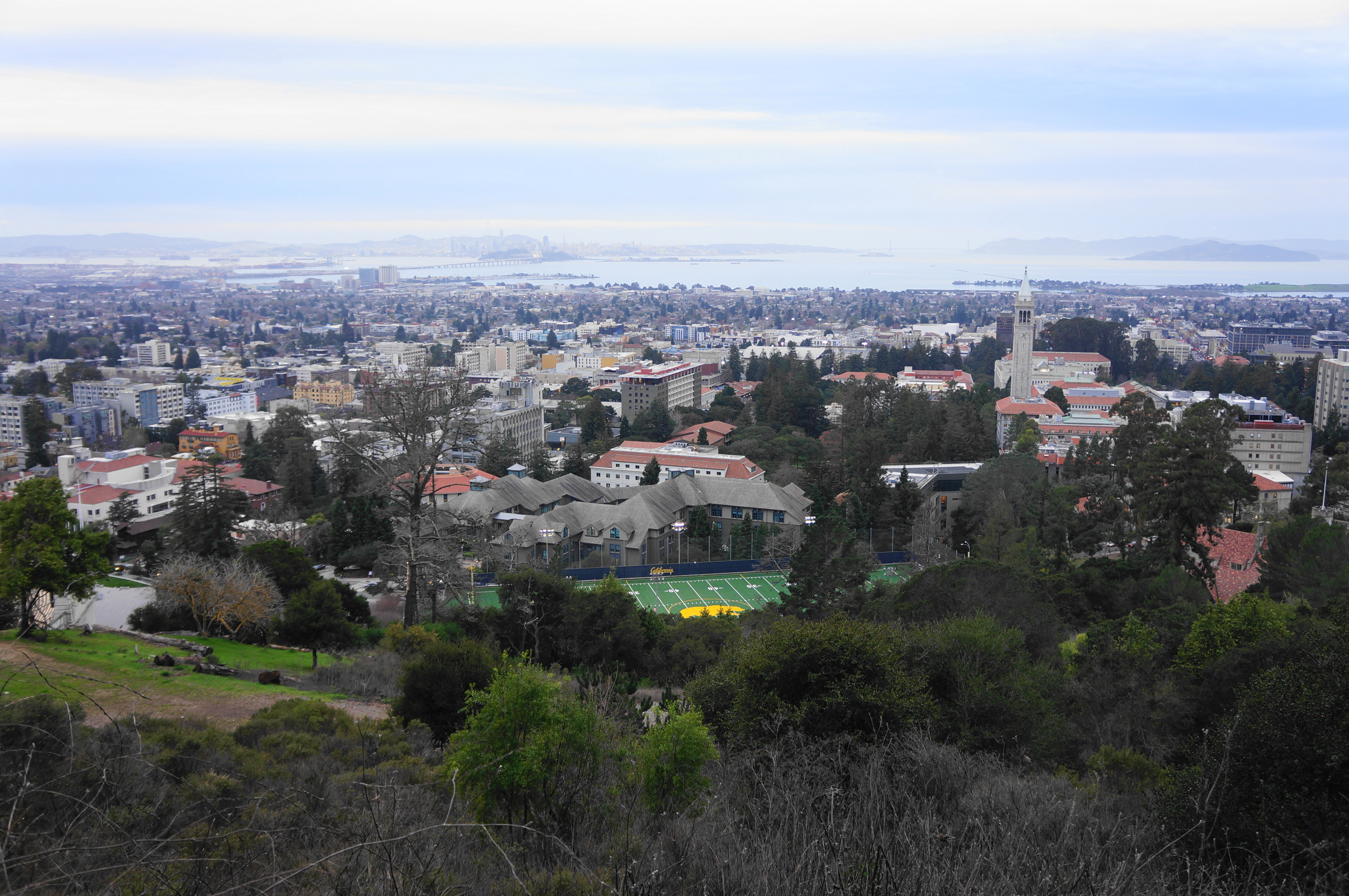
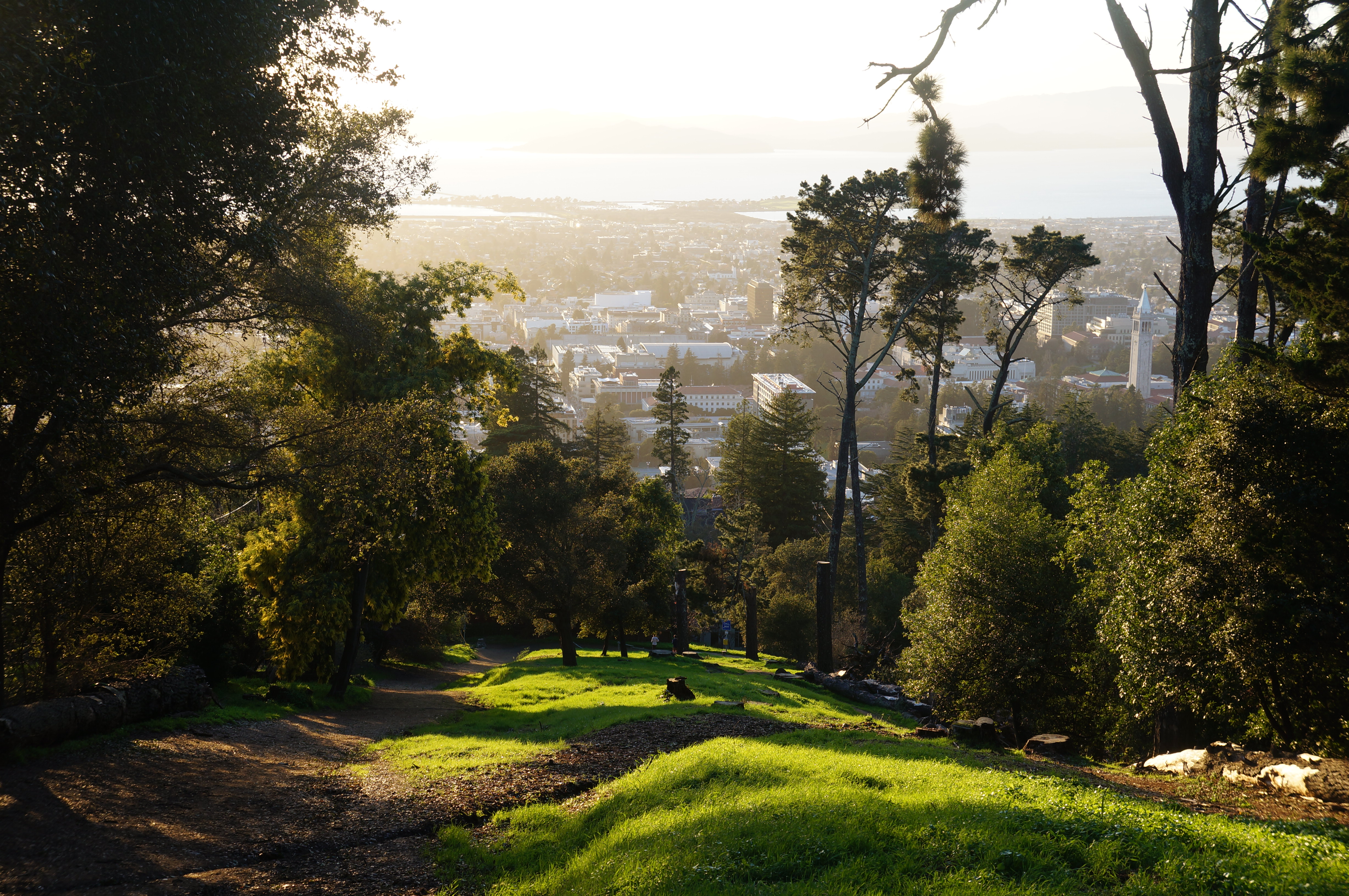
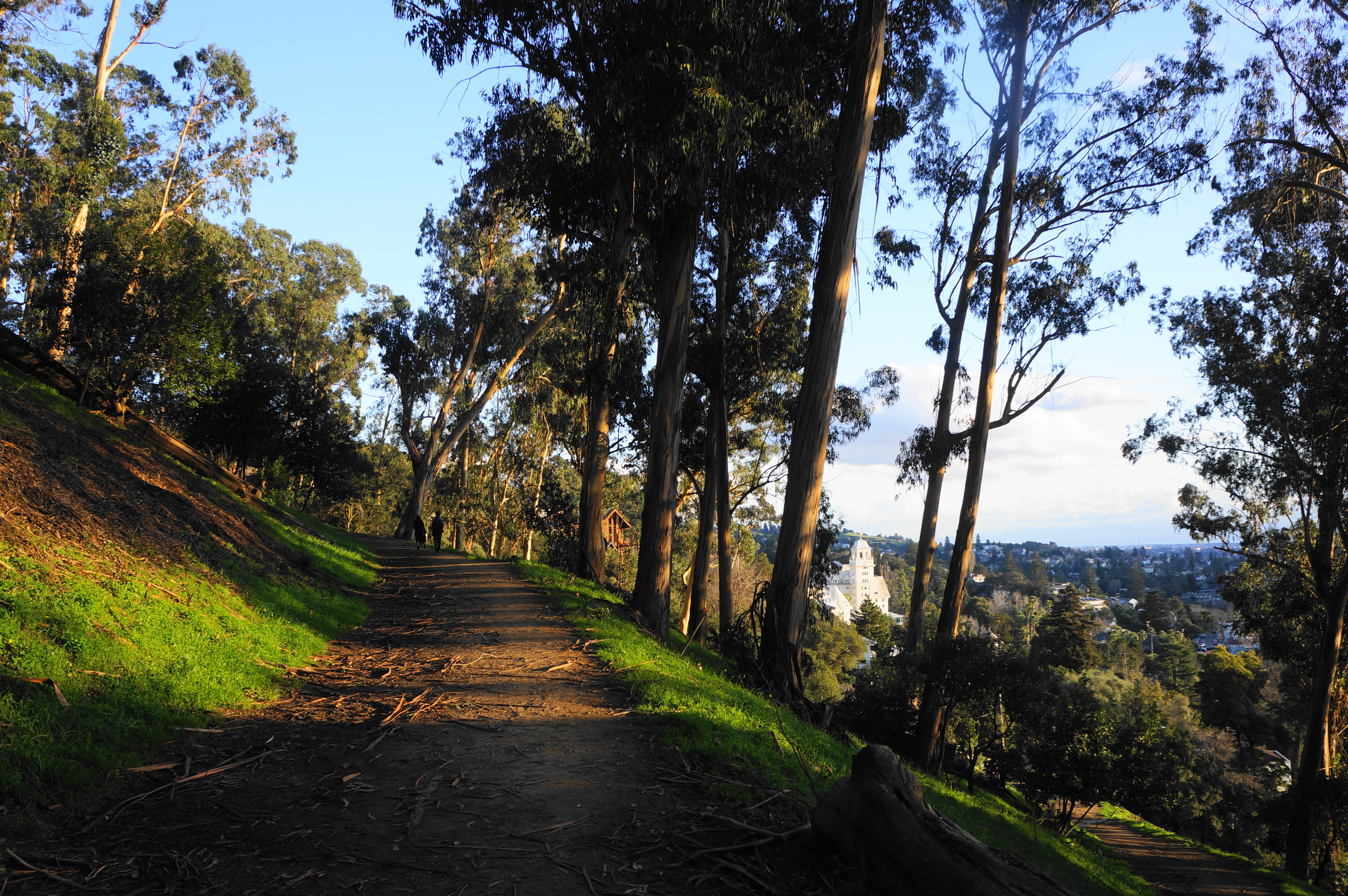
Rising partway up popular Panoramic Ridge, this clover-shaped circuit combines intimate bay/oak woodlands with towering eucalyptus groves and open Bay views. It is perhaps the quintessential evening stroll for Berkeley students and residents. From Stonewall Road, rise sharply on the Stonewall-Panoramic Trail, round a right-hand switchback, and stay left as the wide track snakes up to a popular vista point overlooking Berkeley. Here look for a hidden, unmarked singletrack heading to the thick woods; take this path as it curves around the Derby Creek drainage, passing over small bridges and under wiry bay laurel. Come out into the open and bear left at the fork, descending a series of well-crafted staircases all the way down to Dwight Way; bear left and walk to the far side of the running track, then drop parallel with the beach volleyball courts and bear left, following the wide trace back to Stonewall Road.
Panoramic Ridge Vistas via Stonewall Road & Clark Kerr Fire Trail (1.4 mi. loop)
Trailhead: Stonewall Road (Alternative: Dwight Way)
Difficulty: Strenuous
Almost certainly the most popular hike in Claremont Canyon Preserve, this strenuous loop rises sharply to vistas overlooking Berkeley and the Bay then winds down a narrow singletrack to return to the start. From the Clark Kerr Track or Stonewall Road, climb the extremely steep Stonewall-Panoramic Trail for 7/10 mile, passing two vista points with benches looking back at the Bay. The rutted path and severe incline makes for slow going, but eventually hikers will reach paved Panoramic Way, where they should bear left, follow the road downhill for 1/10 mile, take a short dirt connector path, then follow Panoramic Way again to another dirt singletrack. Bear left and descend to a basin with two benches, then take the winding staircases down to a fork, bear right, and continue all the way back to the eucalyptus grove at Dwight Way and the Clark Kerr Track.


Upper Jordan – Grizzly Peak Fire Trails Loop (2.1 mi. loop)
Trailhead: 18 Marker, Grizzly Peak Boulevard
Difficulty: Moderate
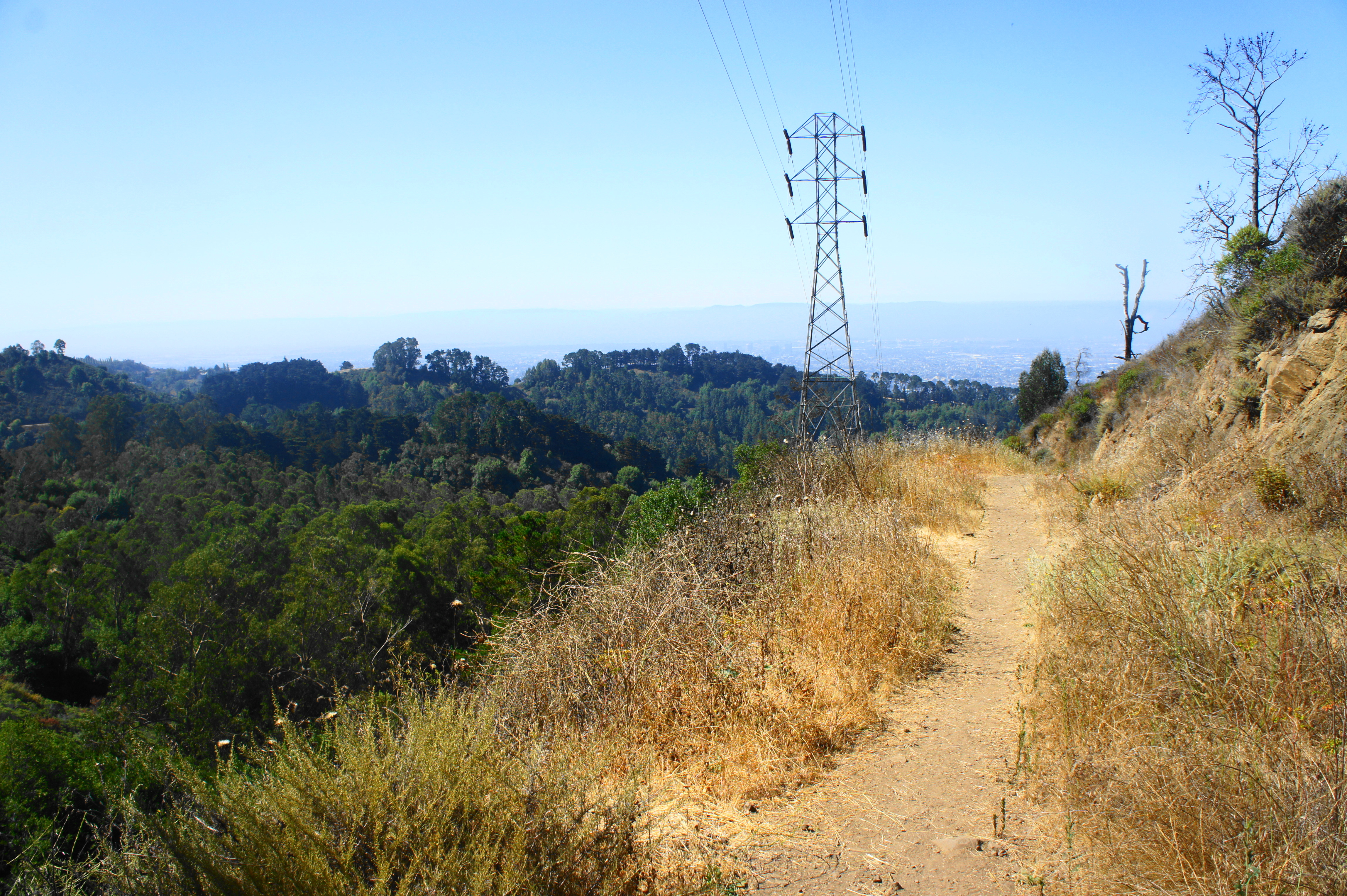
This longer circuit starts from Grizzly Peak Boulevard and connects a series of fire roads and hidden trails into a modest loop. Start at sign “18” on Grizzly Peak (opposite South Park Drive), then climb the hill to a junction at 1/10 mile. Bear right, dropping to an open glade, then continue straight up to a shady knoll. From here the wide track drops sharply, emerging into the open with good views of Berkeley and the Bay. At 4/10 mile, bear right at the fork, then descend to the super-wide Upper Jordan Trail. Follow the meanders westward for 2/3 mile, where a narrow, unmarked path climbs off to the right. Take this track as it climbs up and around a bend, under a set of power lines, and then reaches a junction within sight of Grizzly Peak Road at 1.9 miles. Take a left, then bear right on the path that parallels the road, returning to the trailhead.

Panoramic Ridge End-to-End (2.1 mi. one-way)
Trailhead: 20 Marker, Grizzly Peak Boulevard (Alternatives: Dwight Way, Stonewall Road)
Difficulty: Moderate
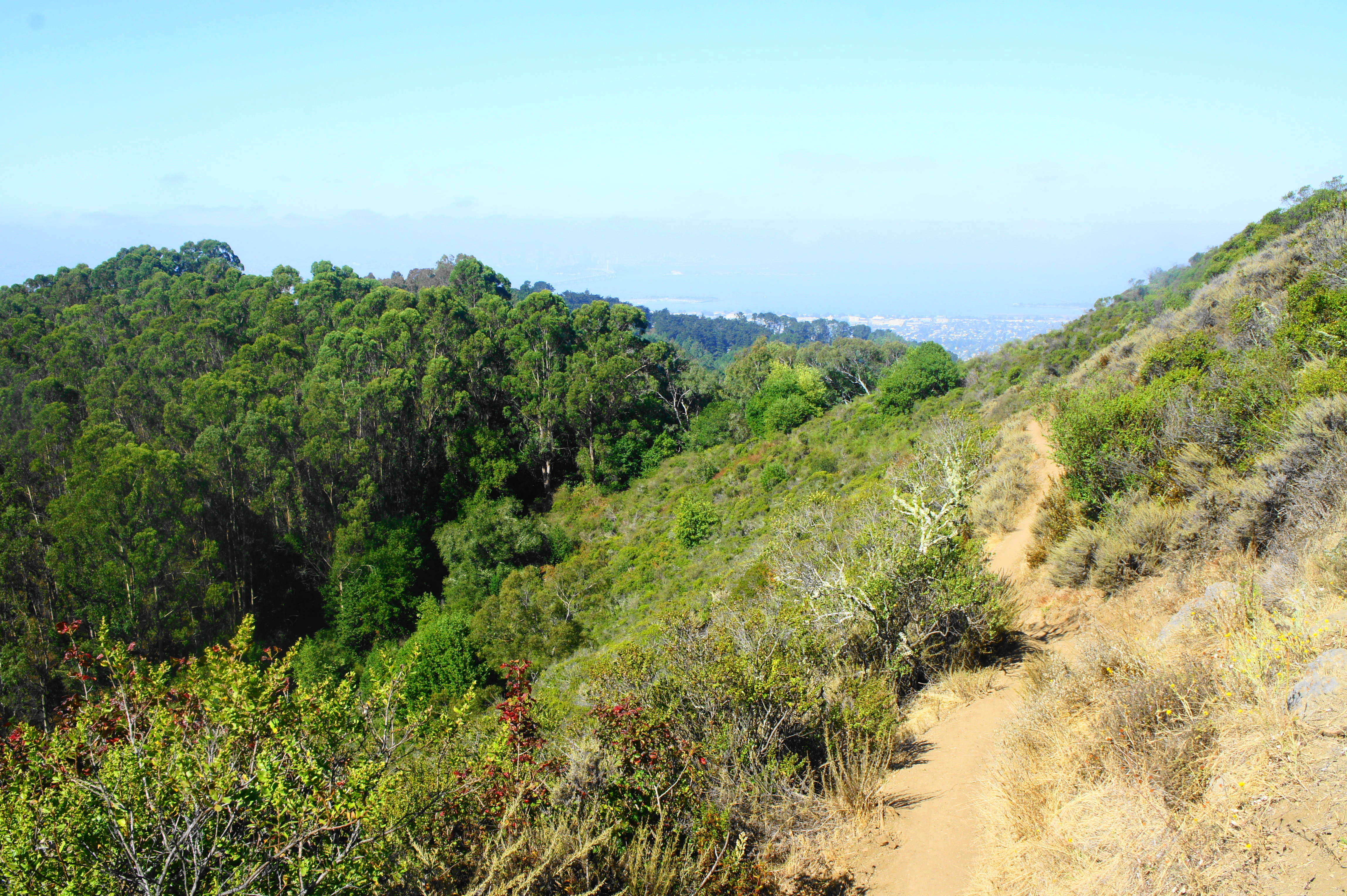
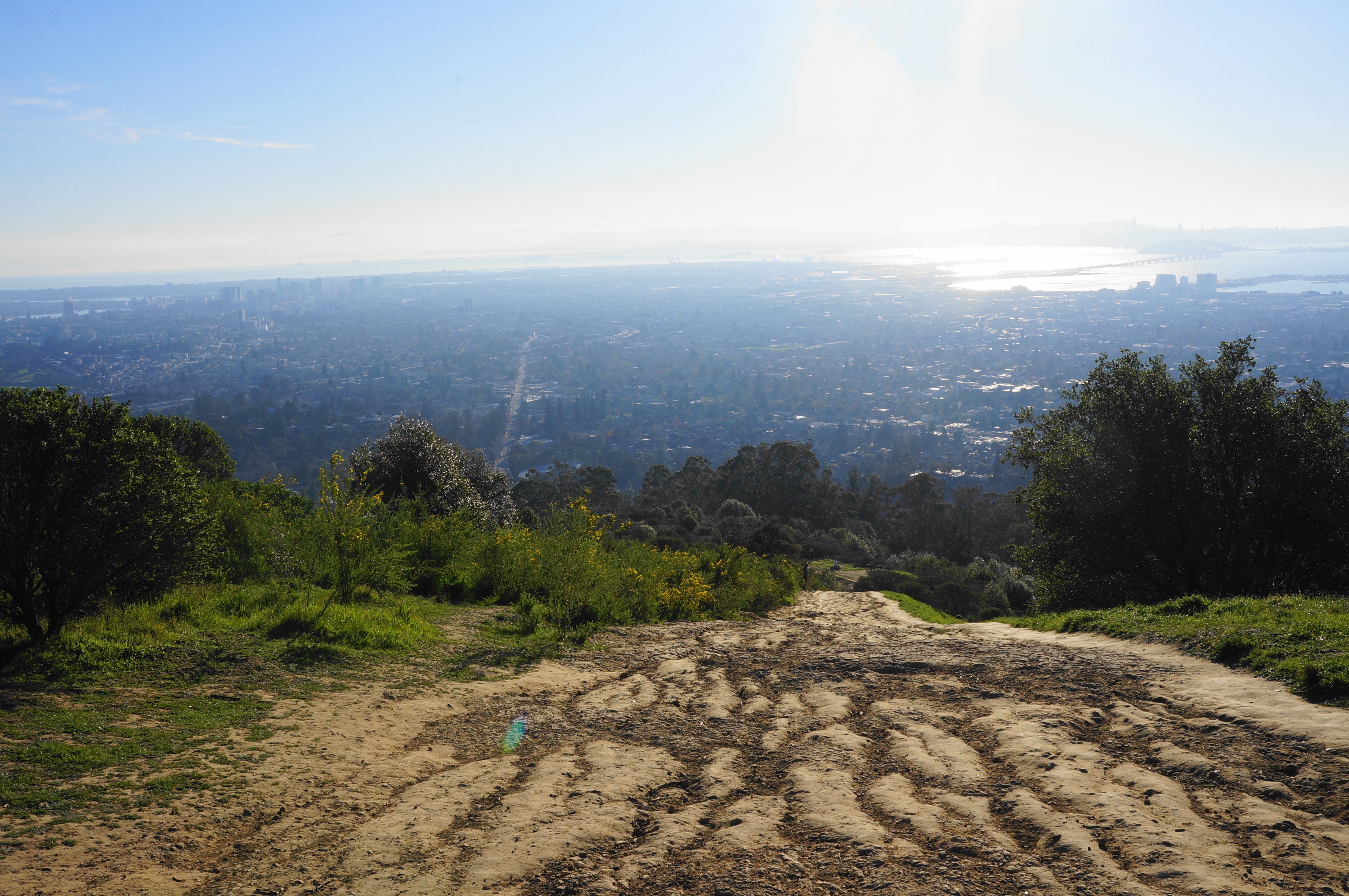
Panoramic Ridge is the centerpiece of the area and features some of the best views of Berkeley and the Bay Area. This one-way shuttle hike (see also above and below for loop options) descends the Side Hill Trail (see above) to Stonewall-Panoramic Trail (a.k.a. East-West Trail), a lengthy fire road that gradually sheds the dense thicket of eucalyptus and oaks, revealing views down Claremont Canyon to Berkeley and Oakland. Follow the westerly track as it climbs to two fine hillsides with open vistas, then—after briefly following a paved driveway—descends sharply down a rocky slope. This portion, despite being very popular, is a brutal climb, but the downhill is considerably easier, enjoying views of the Bay much of the way. Follow the continuing path to a junction amid the eucalyptus at 1.75 miles; bear left to drop to Stonewall Road or right (on a narrow singletrack through the trees) to descend to an exit at Dwight Way, both in Berkeley. Hiking in reverse (uphill) makes this hike very strenuous; the shuttle, one-way option is considerably more pleasant, though the crowds are a bit of a bummer.
Gwin Canyon Trail (2.2 mi. out-and-back)
Trailhead: 29 Marker, Claremont Boulevard
Difficulty: Moderate
Despite barely leaving earshot of busy Claremont Avenue, this 2.2-mile out-and-back is surprisingly rugged, following an up-and-down trail to decent views of Berkeley, Panoramic Ridge, and the San Francisco Bay. Follow the trail from the 29 marker for 50 yards, then bear right, dropping to an intersection with the Willow Trail. Bear right on the Gwin Canyon Trail, which skirts a steep-sloping hillside for ¼ mile before edging eastward to its namesake canyon. At about ¾ mile, the trail climbs a series of bends, affording views down-canyon, to a clearing at the end of residential Norfolk Road. Continue left on the trail for much better vistas; although it ends unceremoniously at a metal fence, the trail offers views that extend as far as the Bay and Mount Tamalpais. Return the way you came.


Panoramic Ridge – Upper Jordan Trail Loop via Side Hill Trail (2.3 mi. stem-and-loop)
Trailhead: 20 Marker, Grizzly Peak Boulevard
Difficulty: Moderate
This loop also spans a portion of Panoramic Ridge, a hilly spine with outstanding views of Oakland and the Bay. Take the Side Hill Trail from marker “20” on Grizzly Peak Road, following the narrow path for 1/3 mile, then bear left and right at the next two junctions, dropping to the Upper Jordan Trail. Bear left on this wide path, enjoying sweeping views down Strawberry Canyon to Berkeley and beyond, then, at 1.25 miles, climb the unmarked but evident path heading up the hill on the left. After a mild ascent, the trail merges with the Stonewall-Panoramic Ridge Trail (a.k.a. East-West Trail). Bear left and climb two steep hills with excellent views of Strawberry Canyon, Oakland, and San Francisco Bay. At the four-way junction at two miles, stay straight, then follow the Side Hill Trail back to the start.


Upper Jordan – Lower Jordan Fire Trail (3.6 mi. one-way)
Trailhead: Space Sciences Laboratory (Alternatives: Lower Fire Trails Trailhead, Panoramic Way)
Difficulty: Easy
The Jordan Trail is a very popular fire road hike connecting the upper reaches of UC-Berkeley with the main campus. Best done as a one-way shuttle hike (although out-and-back isn’t terrible), take the fire road from the Space Sciences Laboratory (SSL) (off Centennial Drive) as it descends gradually through woods of oaks, pines, and eucalyptus before finally emerging into the open after one mile. Here the trail skirts Hamilton Gulch and weaves over to Panoramic Ridge, with excellent views of Strawberry Canyon and UC-Berkeley campus. Follow the westward path until 2.7 miles, when the route skirts Panoramic Place and then drops sharply through a Monterey pine grove to the parking area at Panoramic Way. From here the main track bears eastward, descending to Hamilton Gulch and ending at the dirt parking lot along Centennial Drive, just east of the Strawberry Canyon Pool.


Pingback: Top 10 Hikes in 2024 – Live and Let Hike