
Brushy Peak Regional Preserve is set in the hills just below its namesake, a scrubby round top that rises above a largely treeless section of the Diablo Range in eastern Alameda County. The recovering pasture lands in the 1,979-acre park sure feel like the very edge of the East Bay; just over the windmill-lined hills to the east lies the vast Central Valley.
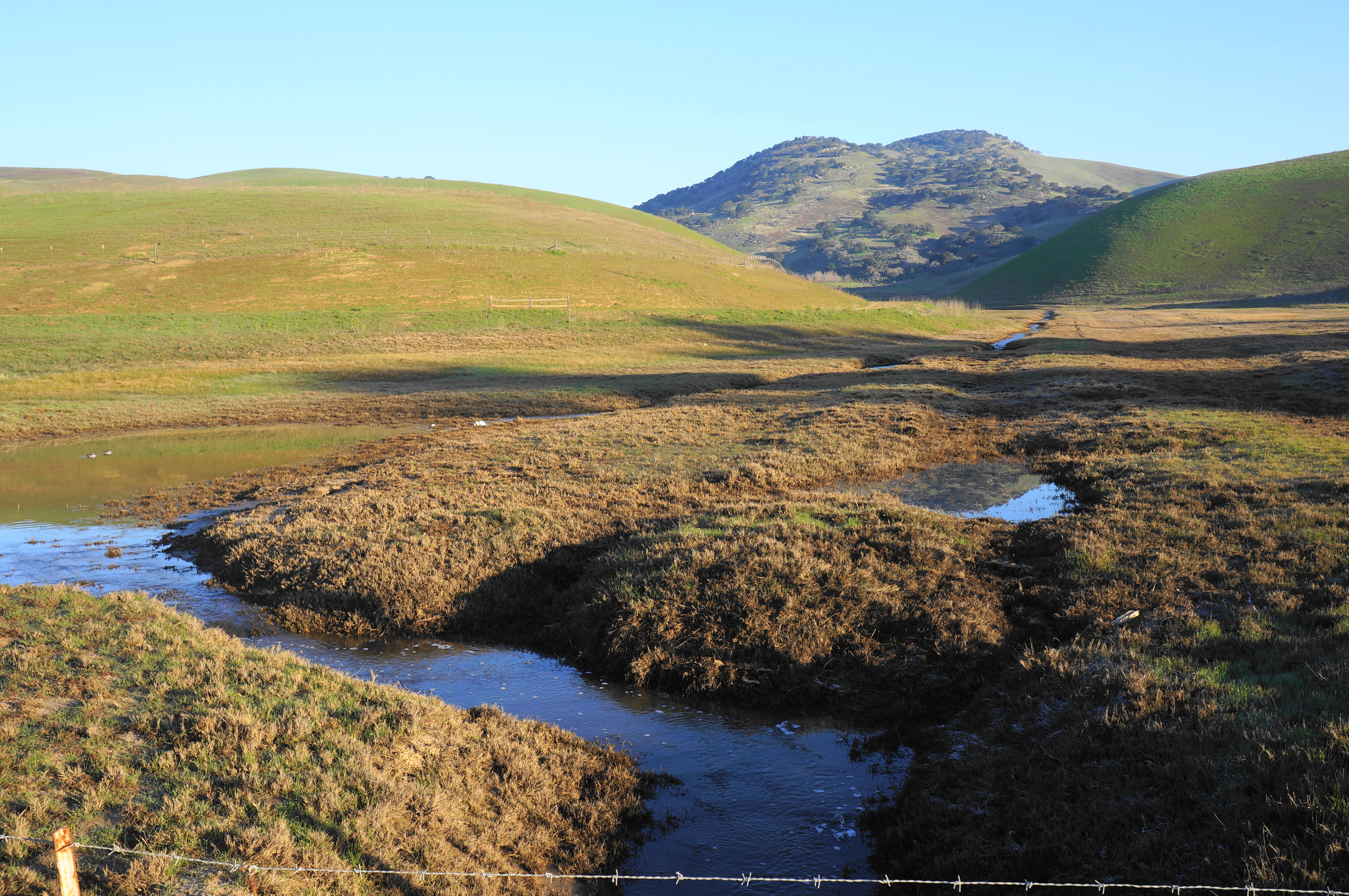
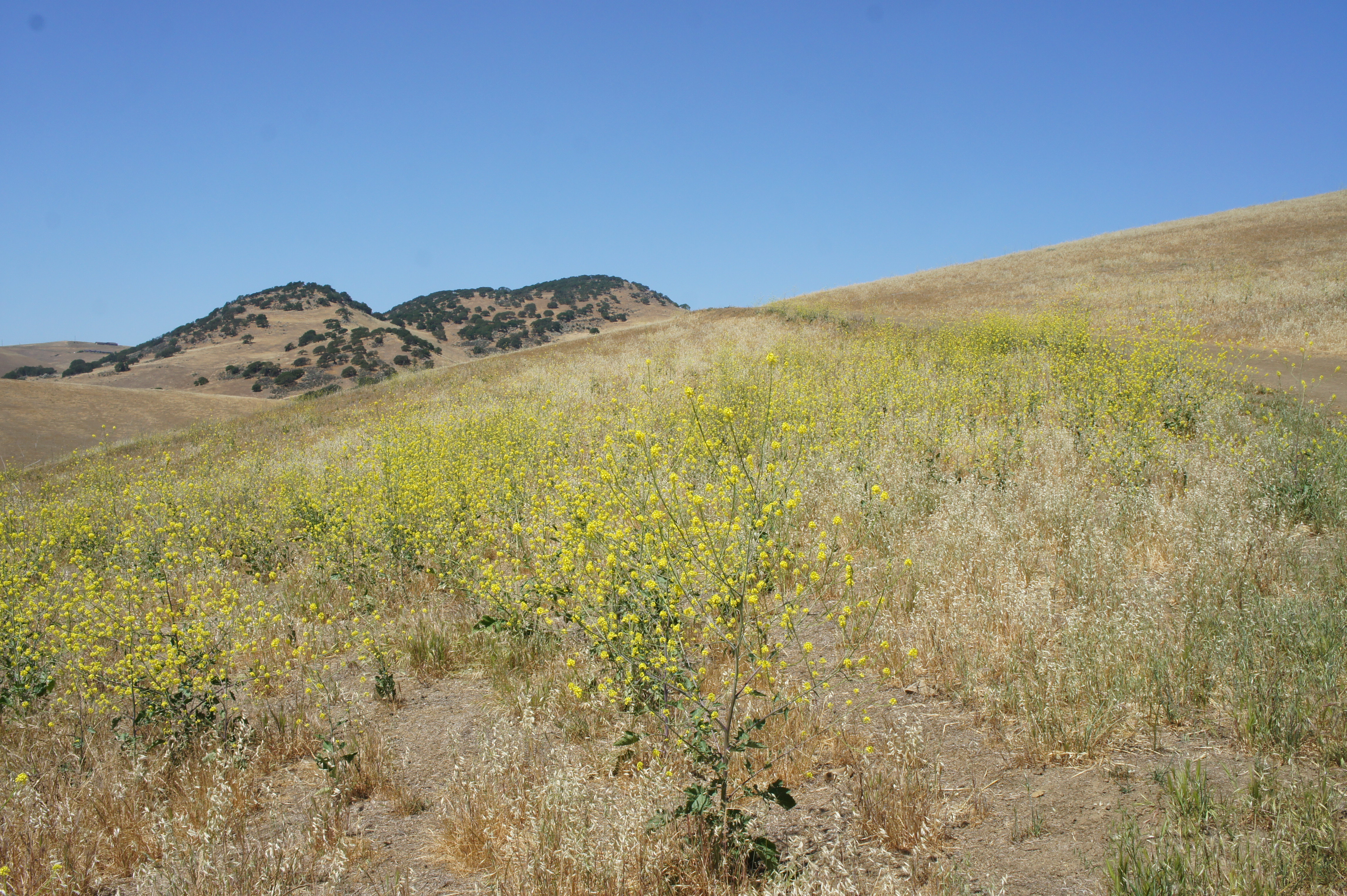
Brushy Peak also has starkly different vibes depending on the season. In summer and fall, the mostly sun-exposed hillscape is dry, windy, and hot…very hot. The scorching landscape, dusty tracks, and barren soils make this feel like the Wild West. (Indeed, this once a favorite hideout of famed Mexican bandit Joaquin Murietta.) Being closest to the Central Valley, this is one of the first parks to turn golden yellow after the end of the spring rains, and moisture and shade are at a premium. In the winter and spring, however, it’s a very different story. Baked, dry mud flats turn to rich and noisy wetlands; seasonal lakes attract ducks, frogs, and even seabirds. The golden savannah turns attractively verdant with landscapes reminiscent of Ireland or Scotland.
A small but interesting network of hiking trails explores the former ranch lands below the sandstone peak, with most traversing open savannah. The Brushy Peak Loop Trail, the premier hike in the park, rises up to the oaks and wild outcrops of the peak (although its summit remains out of reach). Elevation gain can be swift and sudden, leading to sweeping views south across Livermore and the Tri-Valley and east to Altamont Pass and the Central Valley.
Below I highlight five possible routes, all starting from the sole official trailhead in the park: Laughlin Ranch Staging Area. Here, situated at the end of a narrow but paved road from Livermore, there are two large gravel parking lots and a restroom. The Brushy Peak and West Side Loop Trails head north toward the mountain; the Laughlin Ranch Loop rises south and east.
Laughlin Ranch Loop (2.0 mi. loop)
Difficulty: Moderate
Probably the quickest and easiest circuit in the park, the Laughlin Ranch Loop traverses open hillsides with views to Brushy Peak and Livermore. From the staging area, pass the bathrooms and go through two cattle gates, beginning the counter-clockwise loop. Rise mildly, passing a eucalyptus grove, then bear left at the fork, where hikers get their first look at Livermore Valley. Ascend steadily toward the high-flying windmills, then drop to a hidden ravine that is devoid of tree cover. Bear north as the trail follows a usually dry drainage downhill, then bear left again and follow the wide path past another stand of eucalyptus, returning to the start.


Tamcan – Brushy Peak Trail Loop (2.0 mi. loop)
Difficulty: Moderate
This very slightly longer circuit skirts west-facing hillsides and follows a usually dry drainage southwest back to Loughlin Ranch. Catch the Laughlin Ranch Loop bearing east, then south, through the ranch property, then bear left on the Tamcan Trail, which follows a dusty drainage with some limited shade. Bear left at the next fork, climbing to a grassy slope overlooking the park’s central drainages and Brushy Peak, then skirt a hillside topped with windmills on the right. After dropping to the Brushy Peak Loop Trail at 1.25 miles, bear left, passing a seasonal pond on the left before returning to the main parking area.


West Side Loop Trail (2.2 mi. loop)
Difficulty: Moderate
A slightly longer loop, this hike tracks around the western slopes above the main drainage before skirting the largest pond in the park and treading back to the start. Pass through the gate just west of the parking area, then bear left at the first fork, beginning a steady climb. The views back toward Livermore improve as the old ranching road rises, and Brushy Peak eventually returns to view. Begin a descent at around 9/10 mile, reach a side drainage, and then drop steeply back east toward the main valley north of Laughlin Ranch. Stay right at the junction with the Brushy Peak Loop Trail; continue descending until reaching the large seasonal pond on the left—bustling in spring but sad and nearly dry in summer/fall. From here, it is about ¾ mile back to the start via the valley set below Brushy Peak running north-south.


Dyer Ranch Trail (4.2 mi. out-and-back)
Difficulty: Moderate
This longer out-and-back links the staging area with a neighborhood access point in the southern reaches of the preserve. (Note: There is no parking allowed at the southern access point.) From the staging area, ascend the Laughlin Ranch Loop to a junction at 2/3 mile, then bear right and descend the overgrown path as it hugs a fenceline with views across Livermore Valley. Reach the old ranch area at about 1.25 mile, then descend through a notch and pass a modest pond before the terrain opens up to a level plain. Pass through a gate and bear west for 3/10 mile to reach Laughlin Road, then return the way you came.


Brushy Peak Loop Trail (4.5 mi. loop)
Difficulty: Moderate
Flirting with the 1,702’ summit, the Brushy Peak Loop Trail offers the most interesting geological and ecological diversity in the park and ascends to elevations more than 700 feet above the staging area. Take the West Side Loop Trail from the park entrance and bear right at the first fork, meandering northward along the main drainage through the park. Pass a large seasonal pond on the right and rise to a junction at 1.1 miles, bearing right and climbing on the Brushy Peak Loop Trail. Ascend a drainage dotted with sandstone, coming nearly to the park boundary, then round a sharp right-hand bend before reaching a high saddle at the 2-mile mark. After cresting, enjoy the terrific views of the windmills, Livermore Valley, and Diablo Range, bearing east through oak groves and open hillsides. Eventually the trail drops to a lower ridge, then descends further to clear a deeper gully with several eucalyptus groves. Round a corner at 3.3 miles and follow the track downhill for 1.2 miles to return to Laughlin Ranch.


Pingback: Hikes in Brushy Peak Regional Protect – Stay and Allow Hike - Yosemite Fitness
Pingback: Top 10 Hikes in 2024 – Live and Let Hike