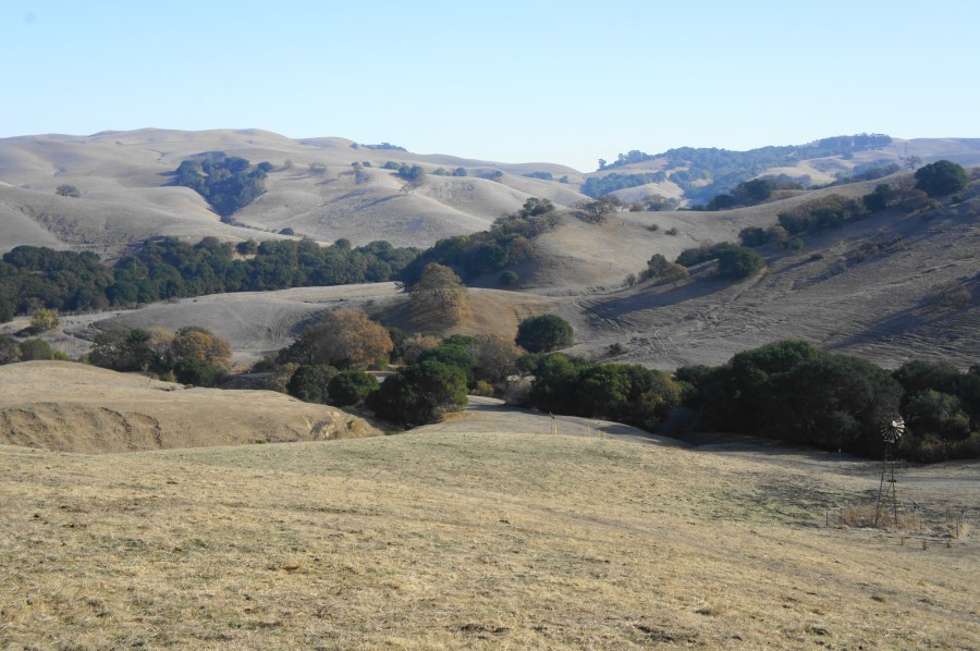

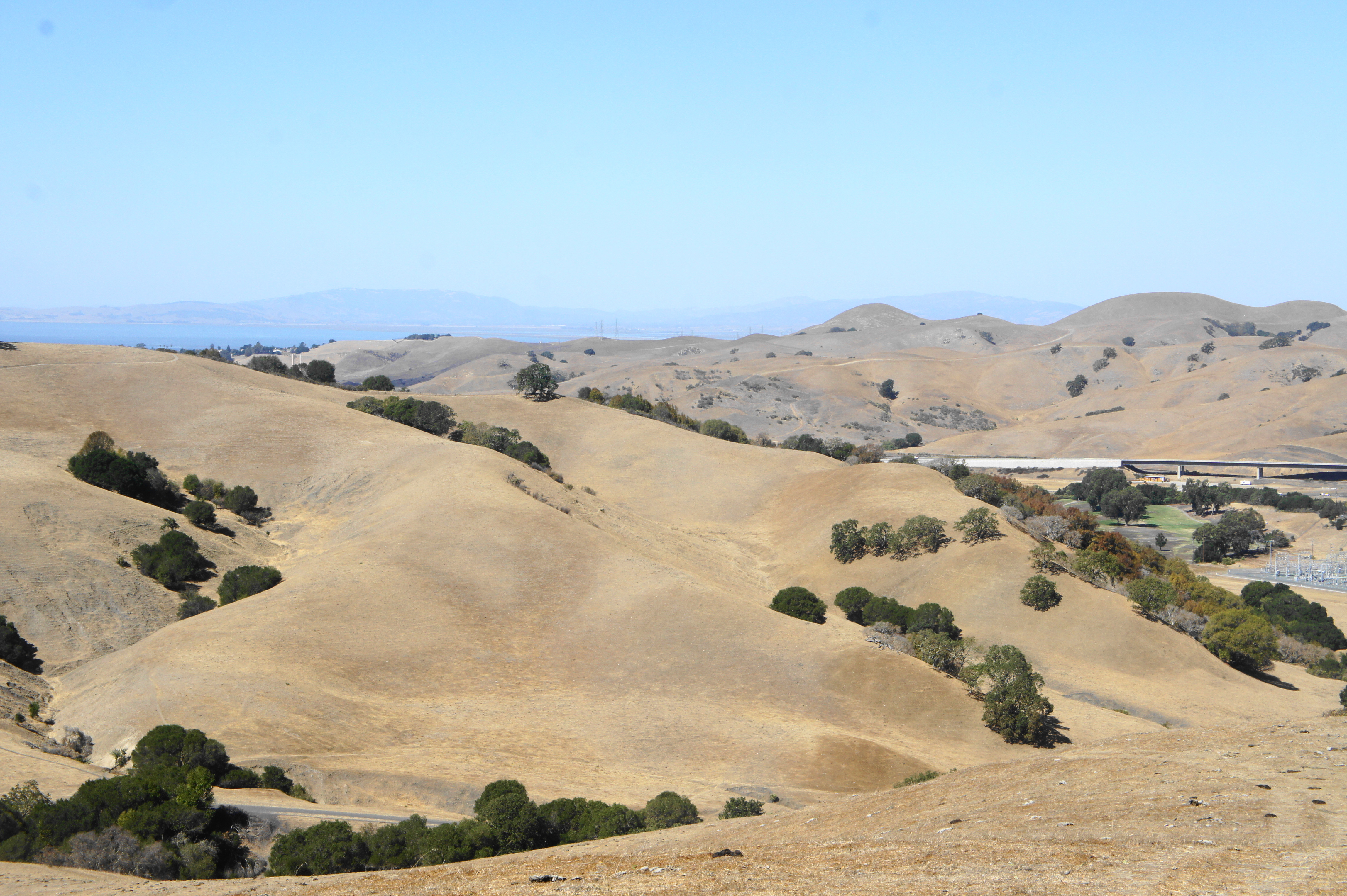
Fernandez Ranch, one of the many properties acquired and managed by the John Muir Land Trust, spans nearly 1,200 acres of open pastures and bay/oak woodlands in the hills above Franklin Canyon, between Hercules and Martinez in northern Contra Costa County. The property was acquired over the course of 2005-2010 and has since been turned into a lovely park for hikers, mountain bikers, and casual picknickers. Flat basins and meadows with tall grasses give way to rapidly-ascending slopes, part of the (somewhat undefined) clutch of hills in the northern East Bay known as “Franklin Ridge.” The hilltops separate the Rodeo Creek and Pinole Creek Watersheds and offer wide-reaching views to the Berkeley Hills, Briones, Carquinez Strait, Mount Diablo, and beyond. (Note: Set back from the Bay, expect steamy summer temperatures, though the woodlands lining Franklin Ridge in this section offer some appreciated shade.)
Several hiking trails crisscross the park and connect with a broader trail network extending to adjacent East Bay Municipal Utility District (EBMUD) lands. A sole trailhead (map), situated off Christie Road (just south of CA State Route 4) services all the hikes featured below. (Note: Entering the EBMUD property requires purchasing a $3 day-use permit.)
Windmill – Woodrat Trail Loop (2.3 mi. stem-and-loop)
Difficulty: Moderate
The shortest hike featured, the Windmill and Woodrat Trails can be combined for a modest stem-and-loop hike with pretty oak woodlands and some open vistas. From the parking area, cross a wide bridge over Rodeo Creek and stay right, following the Windmill Trail for 6/10 mile, past its namesake. Bear left on the narrow Woodrat Trail, which hugs the west flank of the Fern Creek drainage and splits twice. Bear left both times, then follow the snaking path as it gradually ascends out of the woods, offering modest views, then spits out at a saddle at the park boundary at 1.4 miles. Bear right on the Windmill Trail, which drops steeply without switchbacks, then levels off, traversing an open plain back to the start.


Windmill – Whipsnake – Black Phoebe Trail Loop (2.7 mi. loop)
Difficulty: Moderate
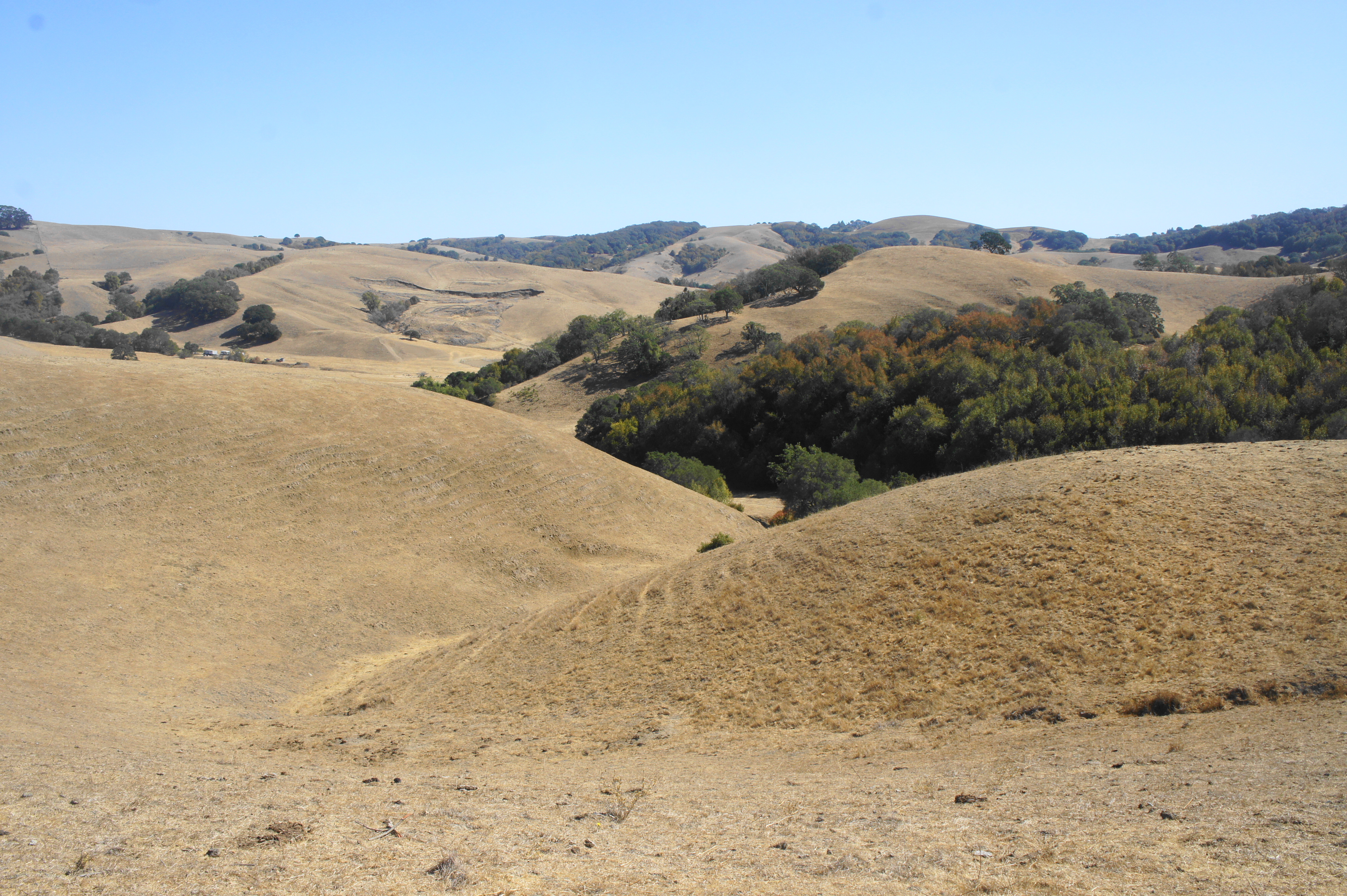
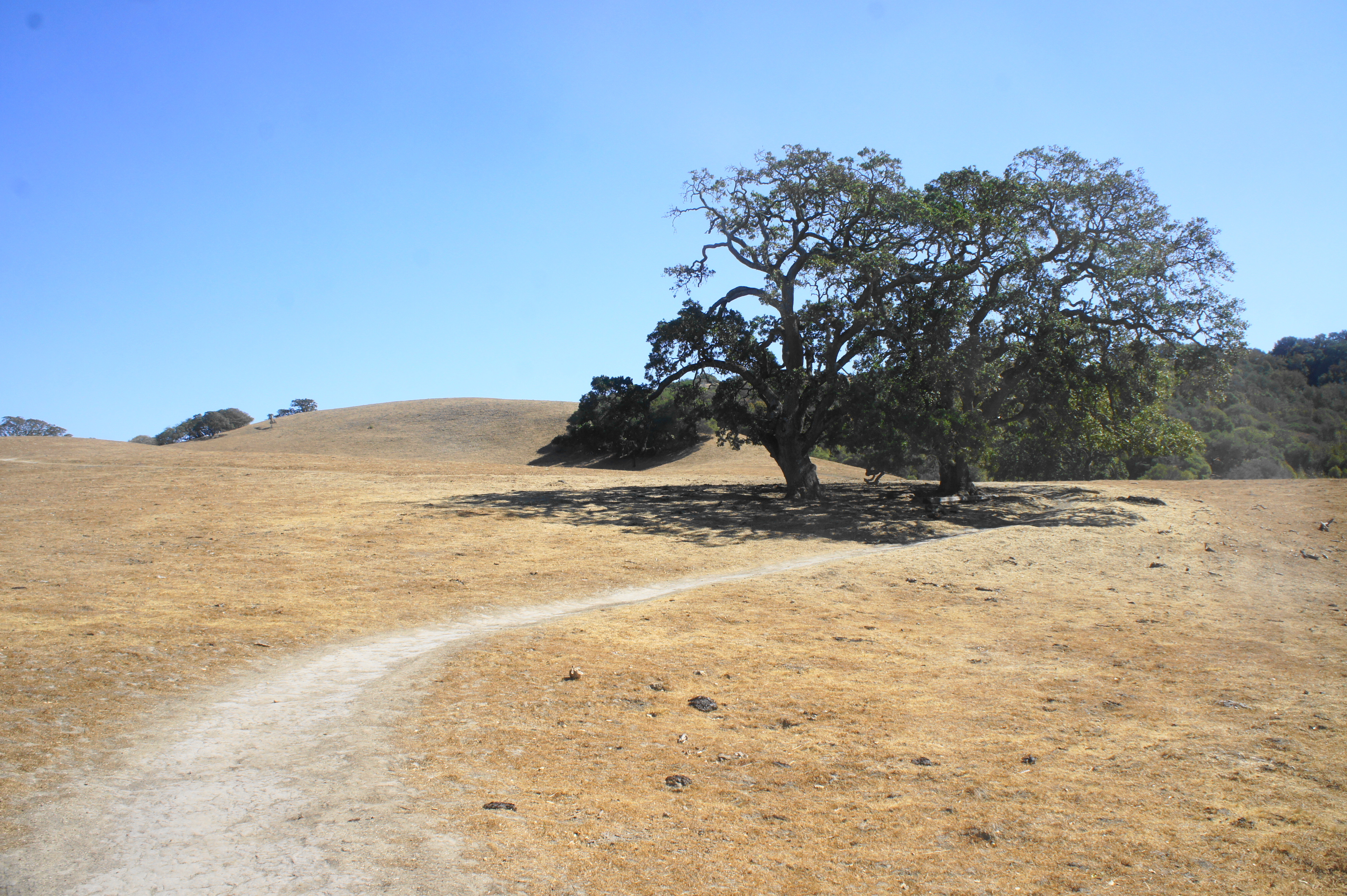
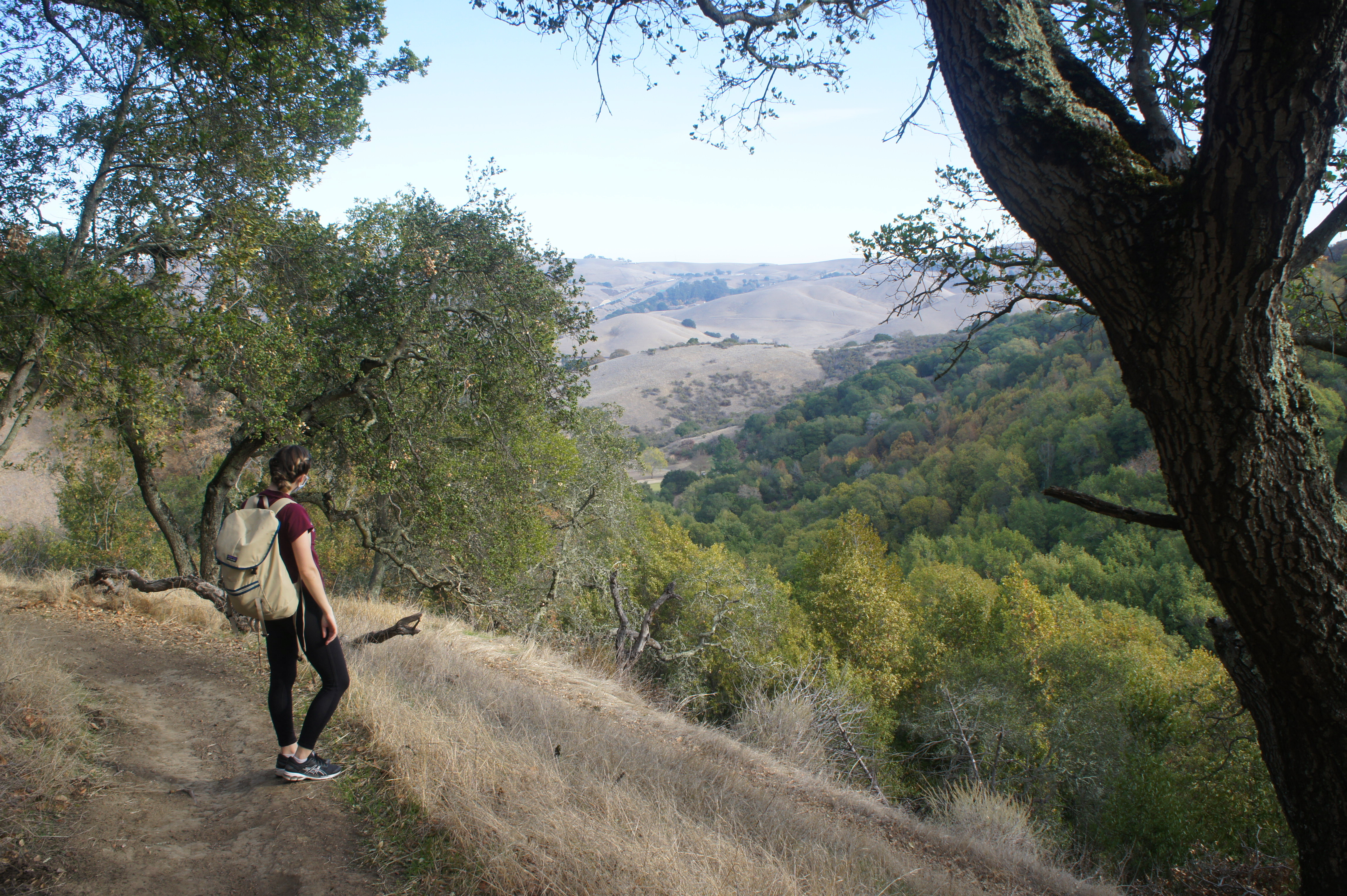
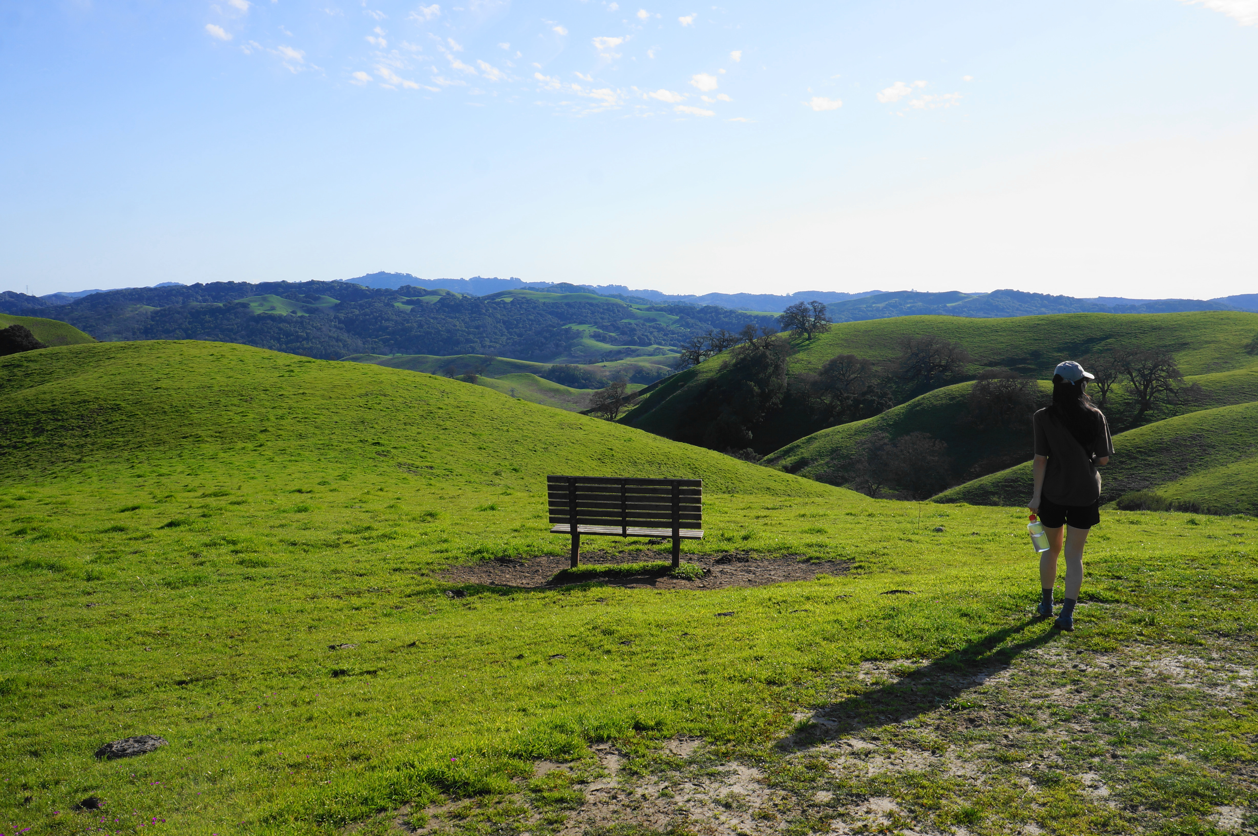
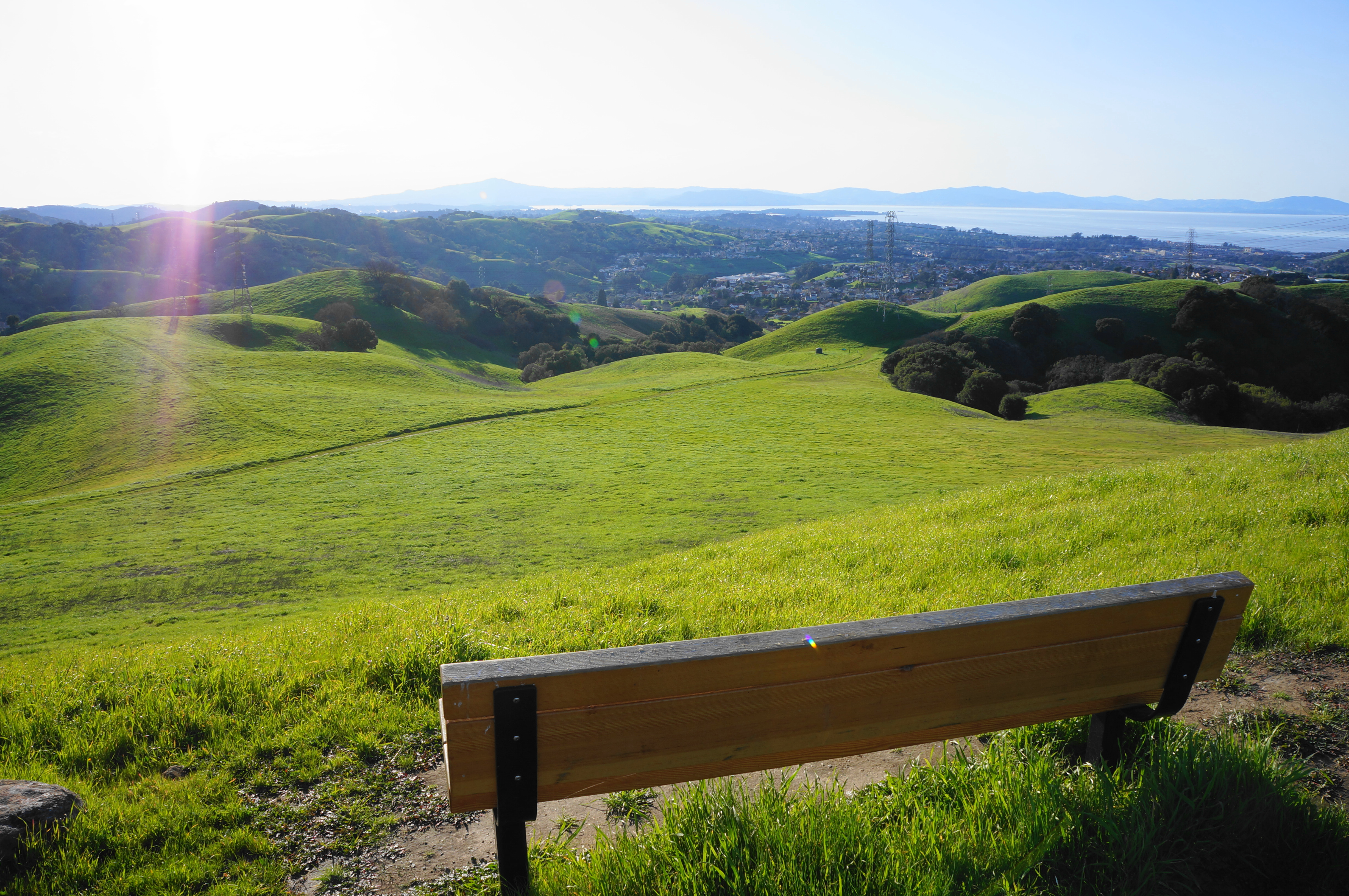
This varied combination of three trails rises through oak woodlands to a beautiful plateau and meadow area before descending amid thick brush to a flat plain popular with cows. Start by taking the Windmill Trail for 6/10 mile to the Woodrat Trail; bear left and then left again on the Whipsnake Trail, which promptly crosses Fern Creek. Follow the uphill bends to a lovely opening at the Oak Knoll Bench, then take the sun-soaked track through Upper Meadow to the Viewpoint Bench, which overlooks Franklin Canyon, with the North Bay visible beyond. The Whipsnake Trail descends thereafter, shedding nearly 400 feet before turning into the Black Phoebe Trail, a flat and accessible track that parallels grazing land and Rodeo Creek. Follow this trail back to the bridge over Rodeo Creek and parking lot.
Windmill – Woodland Trail Loop (3.6 mi. stem-and-loop)
Difficulty: Moderate
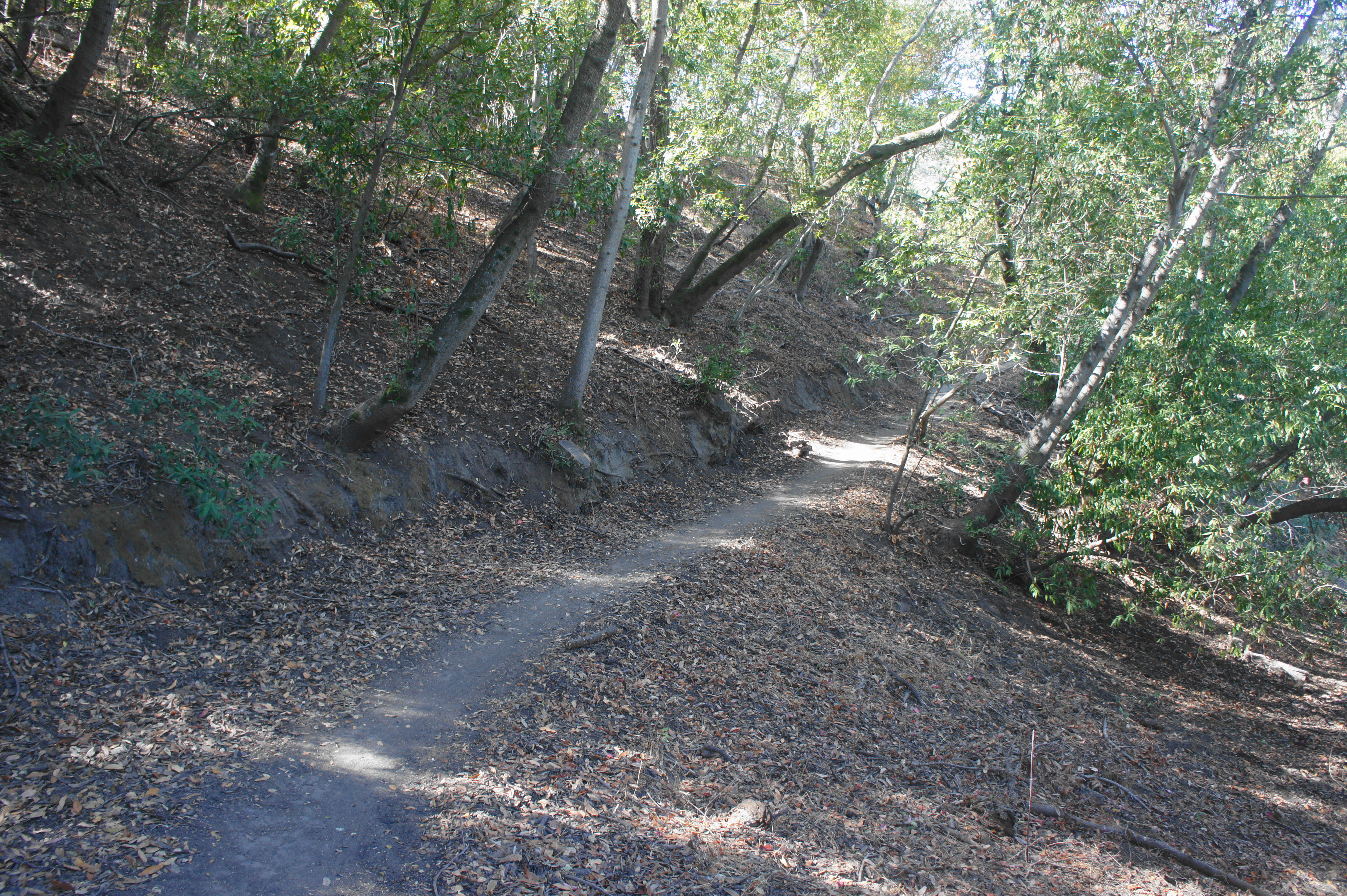
The Windmill Trail runs up the gut of Fernandez Ranch before rising steeply to a saddle in the high hills, while the winding Woodland Trail is one of the prettiest and most pleasant in the park. Follow the wide Woodland Trail for nearly 9/10 mile, passing Fern Creek, the windmill, and two junctions on the way up to the scenic pass, situated at 670 feet above sea level. Pass onto EBMUD land, then bear right and follow the climbing trail for 7/10 mile, enjoying panoramic views that stretch to the North Bay and Mount Tamalpais. Bear right on the Canyon Loop and then Woodland Trail, following the latter for 1.4 miles through dense thicket and then along open slopes, returning to the Windmill Trail; bear left and return to the start after 4/10 mile.


Windmill – Woodland Trail Loop + Franklin Ridge Trail (5.3 mi. stem-and-loop)
Difficulty: Moderate
This longer route takes the aforementioned circuit and adds an out-and-back to the western park boundary on the open ridgeline above the town of Hercules. Follow the Windmill Trail for 9/10 mile to the high gap at 670 feet, bear right and traverse EBMUD land to another gate at 1.5 miles, reentering Fernandez Ranch. Stay left at the next two forks, following Franklin Ridge westward across open pastures and under power lines, culminating at a gate at the park’s edge at 2.4 miles. Return 8/10 mile to a junction with the Canyon Loop Trail; bear left and then right soon on the Woodland Trail, winding gently back toward Fern Creek and the windmill. Bear left on the Windmill Trail and follow it back to the trailhead to cap off the 5.3-mile hike.


Windmill – Woodland Trail Loop + Paul’s Peak & Canyon Loop Trail (5.3 mi. stem-and-loop)
Difficulty: Strenuous
The Canyon Loop Trail is, well, a little under-established, following a faint track steeply down toward Franklin Canyon Golf Course, only to round a corner and sharply ascend a tremendous slope to gain it all back. But combined with the adjacent Paul’s Peak Trail (a.k.a. Vista Trail on other maps), this makes for a reasonably interesting—if strenuous—jaunt. Follow the Windmill Trail to the high gap at 9/10 mile, bear right on the Bay Area Ridge Trail through EBMUD lands, pass through a gate, and head left at the first of two junctions in quick succession. Follow the onward path for 1/10 mile, then take a right and immediate left, ascending a switchbacking path to the summit of Paul’s Peak, where a 360-panorama awaits. When ready, return to the junction and stay left this time, finding a faint but real trail that drops into a nearby drainage, crosses it, and parallels the east side of the tributary. After shedding more than 350 feet, coming within sight of the Franklin Ridge Golf Course below, the trail makes a sudden right turn, rounding to a ridgeline and rising straight up the hillside, with no switchbacks. After a crest and brief descent, look for the Woodland Trail heading left and follow it for 1.5 miles to the Windmill Trail; bear left, tracing Fern Creek and returning to the trailhead.


Pingback: Top 10 Hikes in 2024 – Live and Let Hike