
An eight-mile channel used as a highly-trafficked shipping lane, Carquinez Strait is the gateway from the Sacramento River Delta to San Francisco Bay and separates Solano and Contra Costa counties. While much of the shoreline is residential or industrial, some portions have become protected parklands, including a patchwork of non-contiguous units making up the 1,600-acre Carquinez Strait Regional Shoreline. The park spans portions of a complex of hilltops known generally as “Franklin Ridge,” positioned just south of the strait between the towns of Crockett and Martinez. Many hiking options abound, ranging from short jaunts to challenging half-day walks, with nearly all affording terrific, sun-soaked vistas.
Orientation is best done with a map, which highlights two smaller, western units (abutted by quaint shoreline towns of Crockett and Port Costa) and a larger eastern unit (next to Martinez). (There is also a very small, unmarked unit with a short vista hike, just to the west of Interstate 80 and the Carquinez Bridge.) The bulk of the walks are in the east, within striking distance of Martinez; these hikes feature windswept hills, woody ravines, and the broadest panoramas in the park. But the western units are quieter, with serene woodlands and golden prairies closer to San Francisco Bay.
There are many trailheads, a mix of formal staging areas and roadside pull-offs. In the western units, they include:
- Bull Valley Staging Area (map): primary access point for the largest of the western units, set atop a ridge with access to Carquinez Overlook and Eckley Pier.
- Carquinez Strait Scenic Drive (map): unmarked roadside gravel lot offering access to the sparsely-visited unit south of Port Costa.
- Eckley Pier (map): small parking area and dead-end cul-de-sac across the railroad tracks from Eckley fishing pier.
- Port Costa Staging Area (map): large and popular staging point with access to the George Miller Regional Trail, a former road that links the western and eastern units.
- Vista Point (San Pablo Avenue & Vista del Rio) (map): small, unmarked gravel pull-off at the junction of San Pablo Avenue and Vista del Rio, on the west side of I-80, and the access point for the short, 0.5-mile hike noted below.
In the eastern unit, there are many possible trailheads, all in Martinez, including:
- F Street (map): lesser-used trailhead, near Alhambra High School and Martinez Hillside Apartments, with access to the southern reaches of the park.
- Nejedly Staging Area (map): main trailhead for the eastern unit, with some of the most direct access to Franklin Ridge, via several interlocking trails.
- Panoramic Drive (map): very small parking area in a residential area up a series of winding roads into the hills; access to Hillside Place, which turns quickly into a trail.
- Rankin Park (map): well-manicured local park run by the city of Martinez, with playgrounds, baseball/softball fields, picnic areas, and an outdoor swimming pool; trail access begins from the upper “additional” parking lot behind the softball fields.
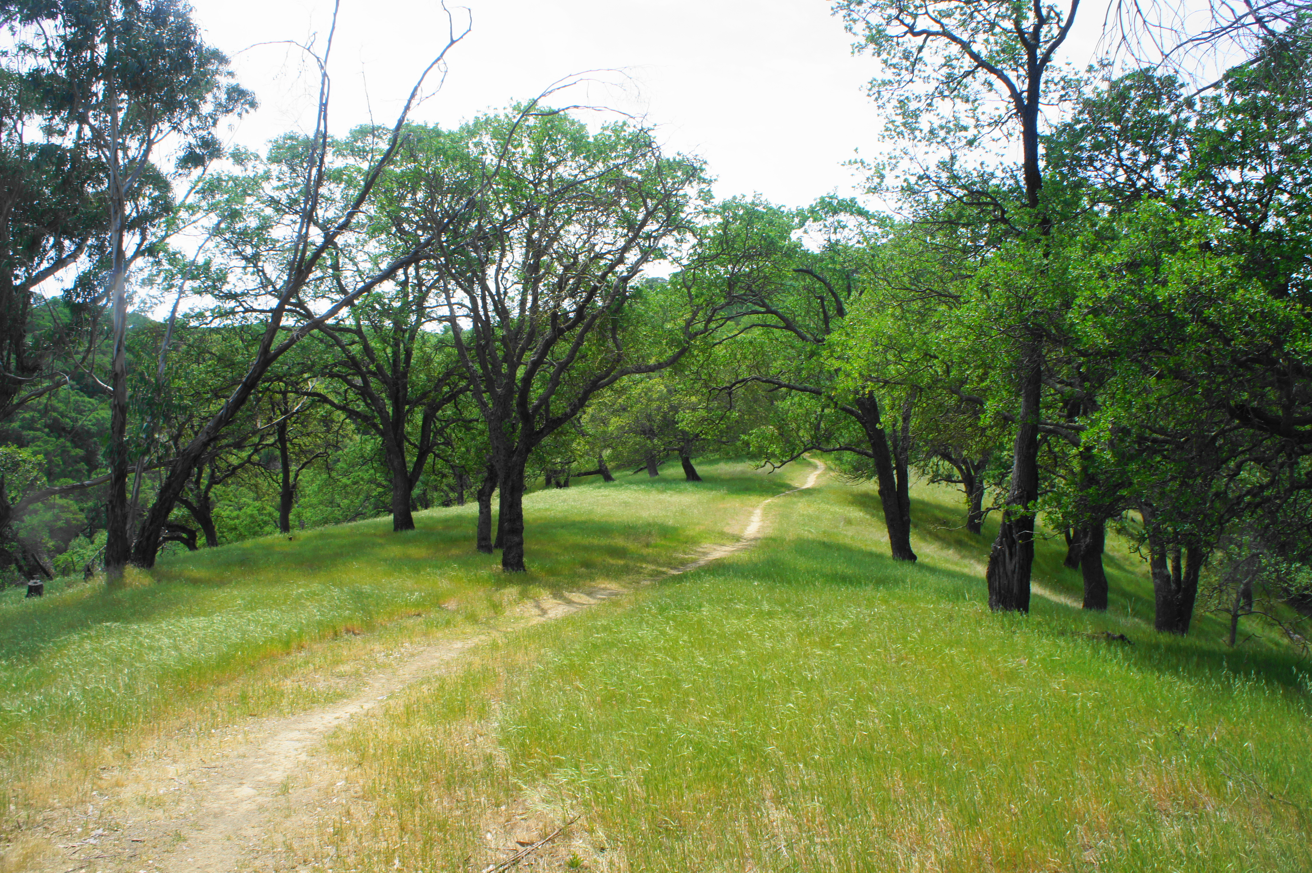
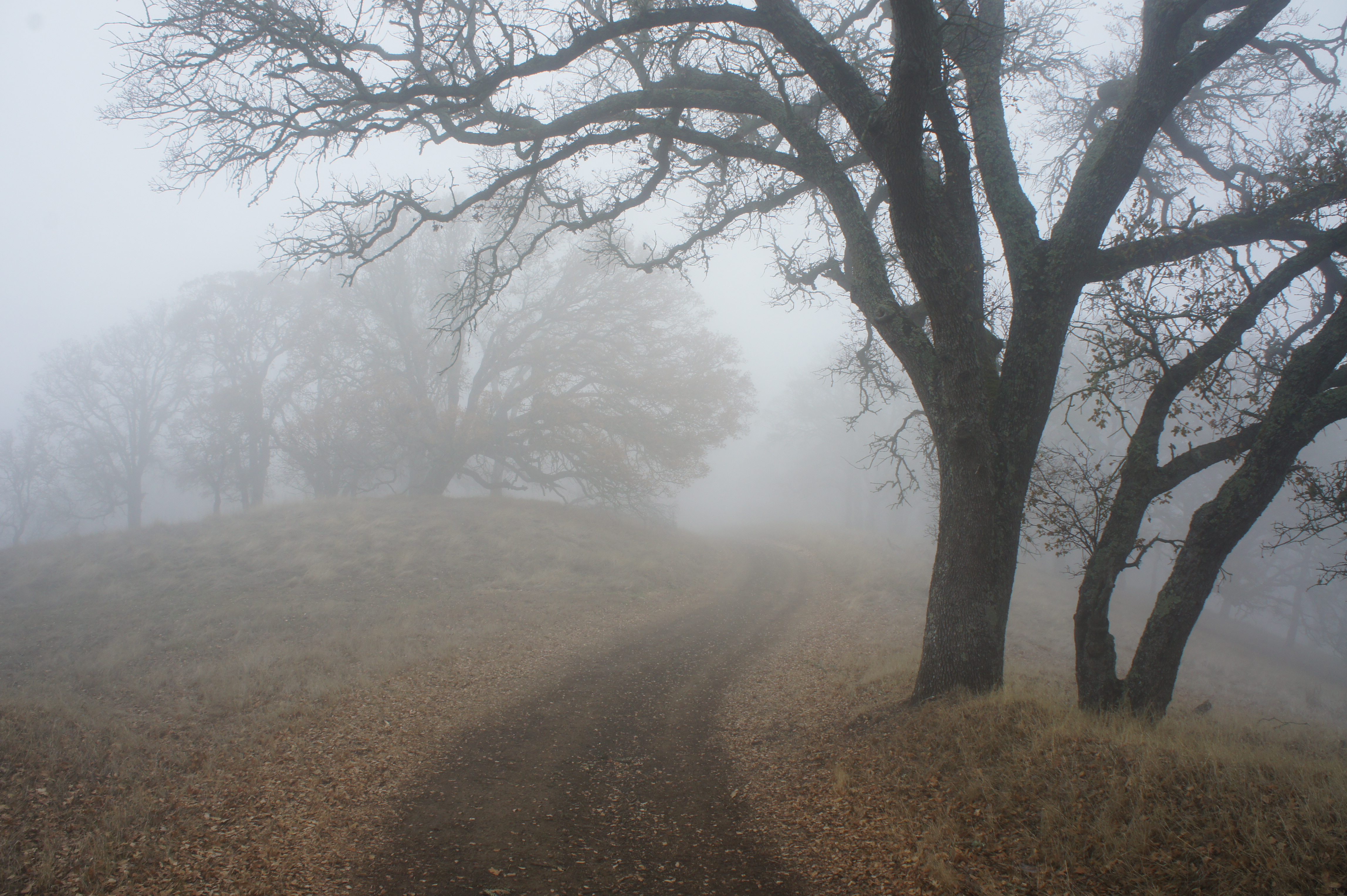
Like most other parks in the East Bay, the trail network comprises mostly a series of fire roads and former gravel drives used by cattle ranchers, although there are some singletracks. I have featured 16 possible options below, most in the 1- to 3-hour range. All are best in the winter and spring when the brown hills turn to a verdant green, and all require some form of climbing that is likely to get the heart pounding. The hikes are previewed below, organized by location (western and eastern units).
WESTERN UNITS
Vista Point (0.5 mi. out-and-back)
Trailhead: Vista Point (San Pablo Avenue & Vista del Rio)
Difficulty: Moderate
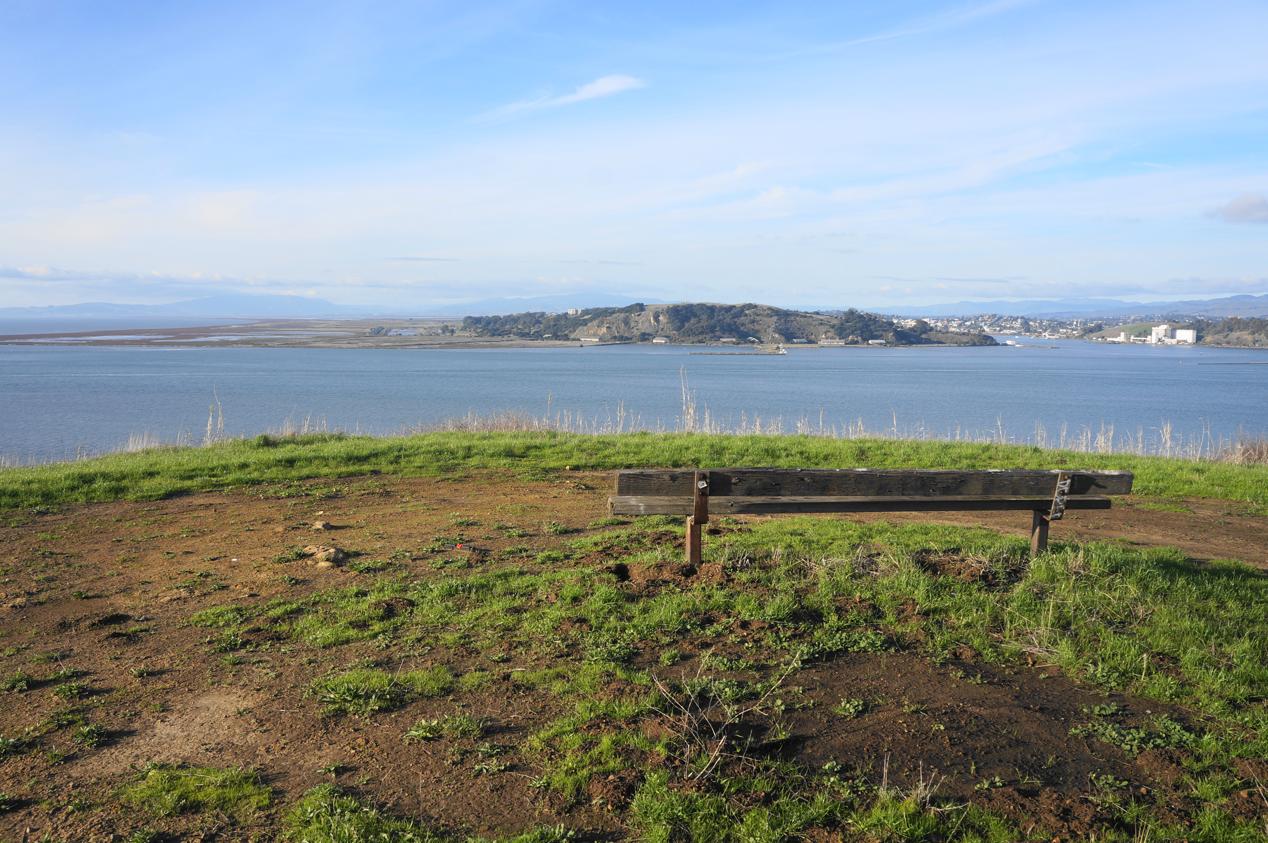
Yes, there is an official “Vista Point”—a well-trafficked roadside turnoff—nearby, but this alternative route, requiring a ½-mile out-and-back hike, offers solitude and an even better view across Carquinez Strait and the North Bay. From the small gravel pull-off (see map) at the junction of San Pablo Avenue and Vista del Rio in Crockett, pass through the slit in the metal fence, entering the parklands; stay left, climbing the hillside, with a eucalyptus grove down to the right. Ascend steeply for 1/10 mile, then crest a ridgetop and drop a level, culminating at a grassy shelf with a single bench and a grand view, spanning Mount Tamalpais, San Pablo Bay, Mare Island, and Carquinez Strait. When ready, return the way you came, capping off a ½-mile walk.


Port Costa Overlook (1.0 mi. out-and-back)
Trailhead: Carquinez Scenic Drive
Difficulty: Easy
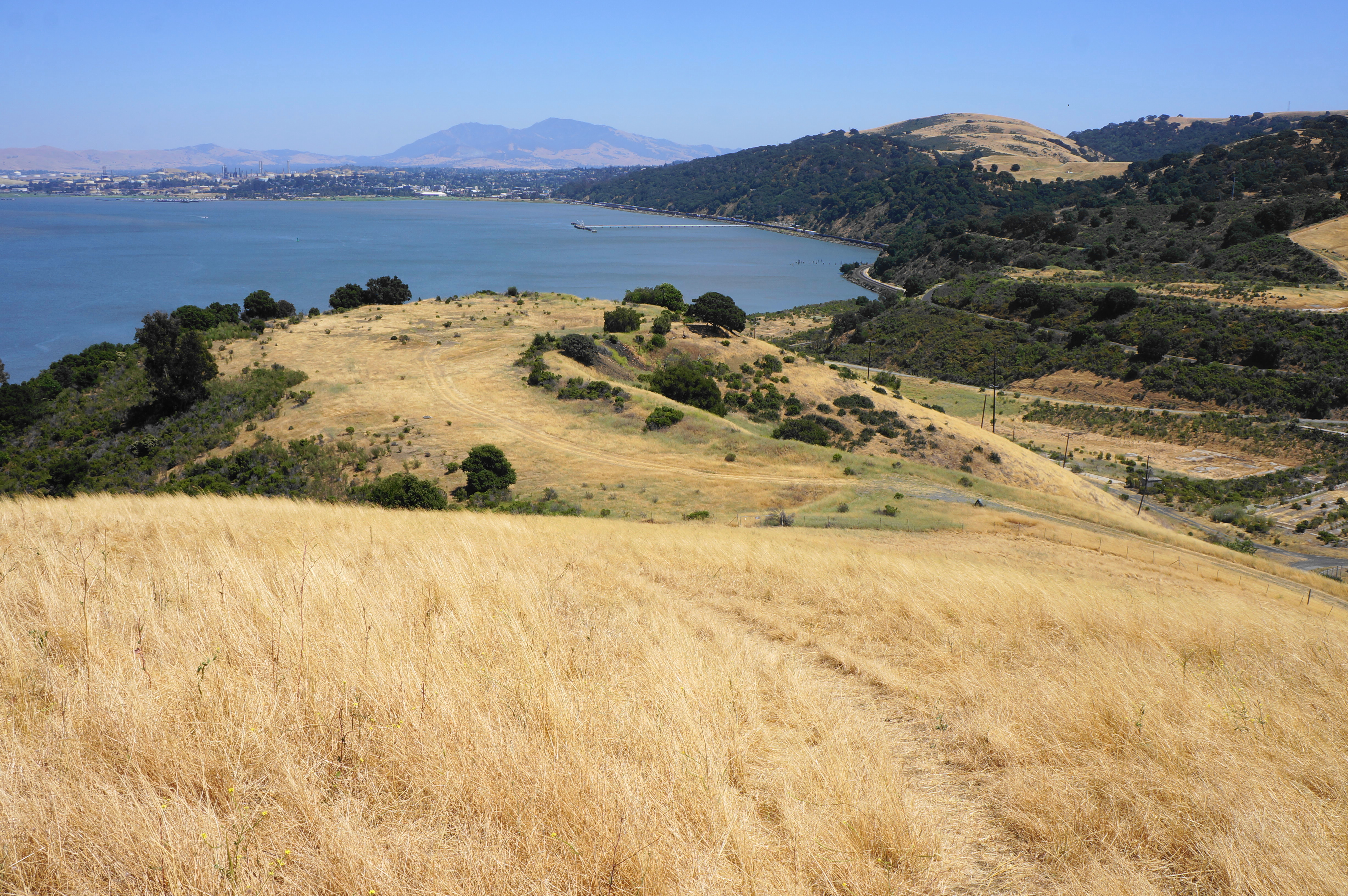
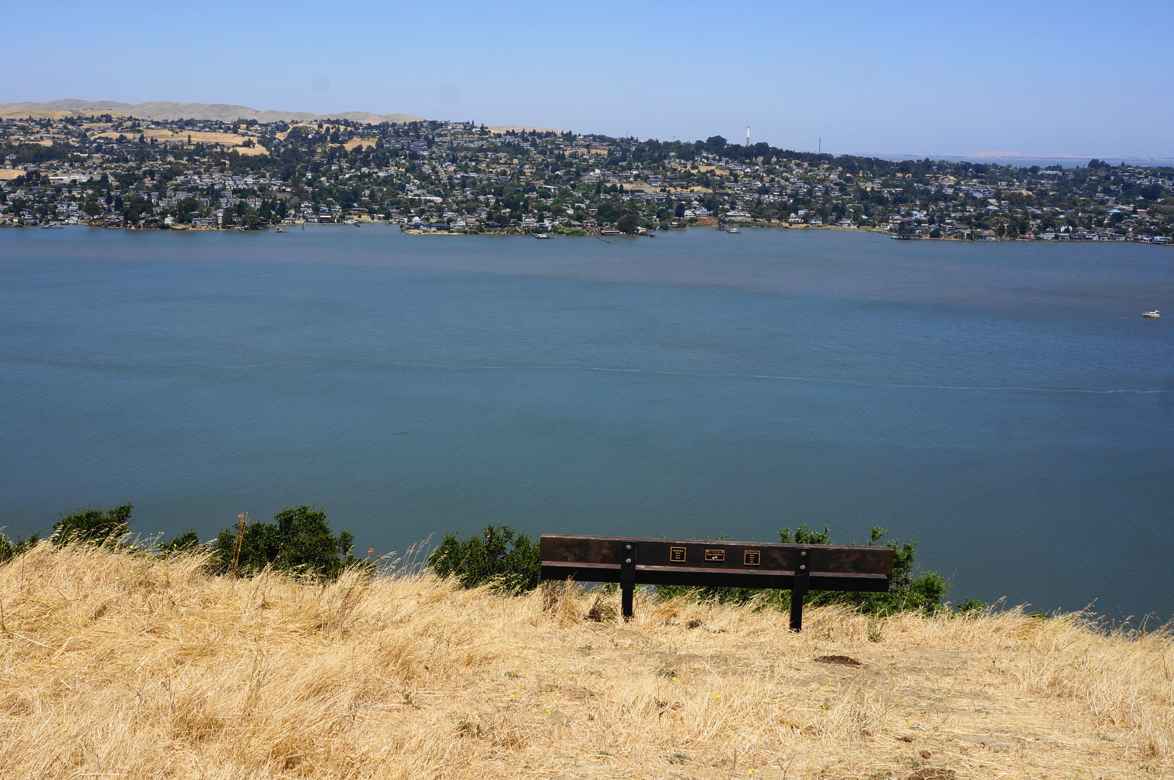
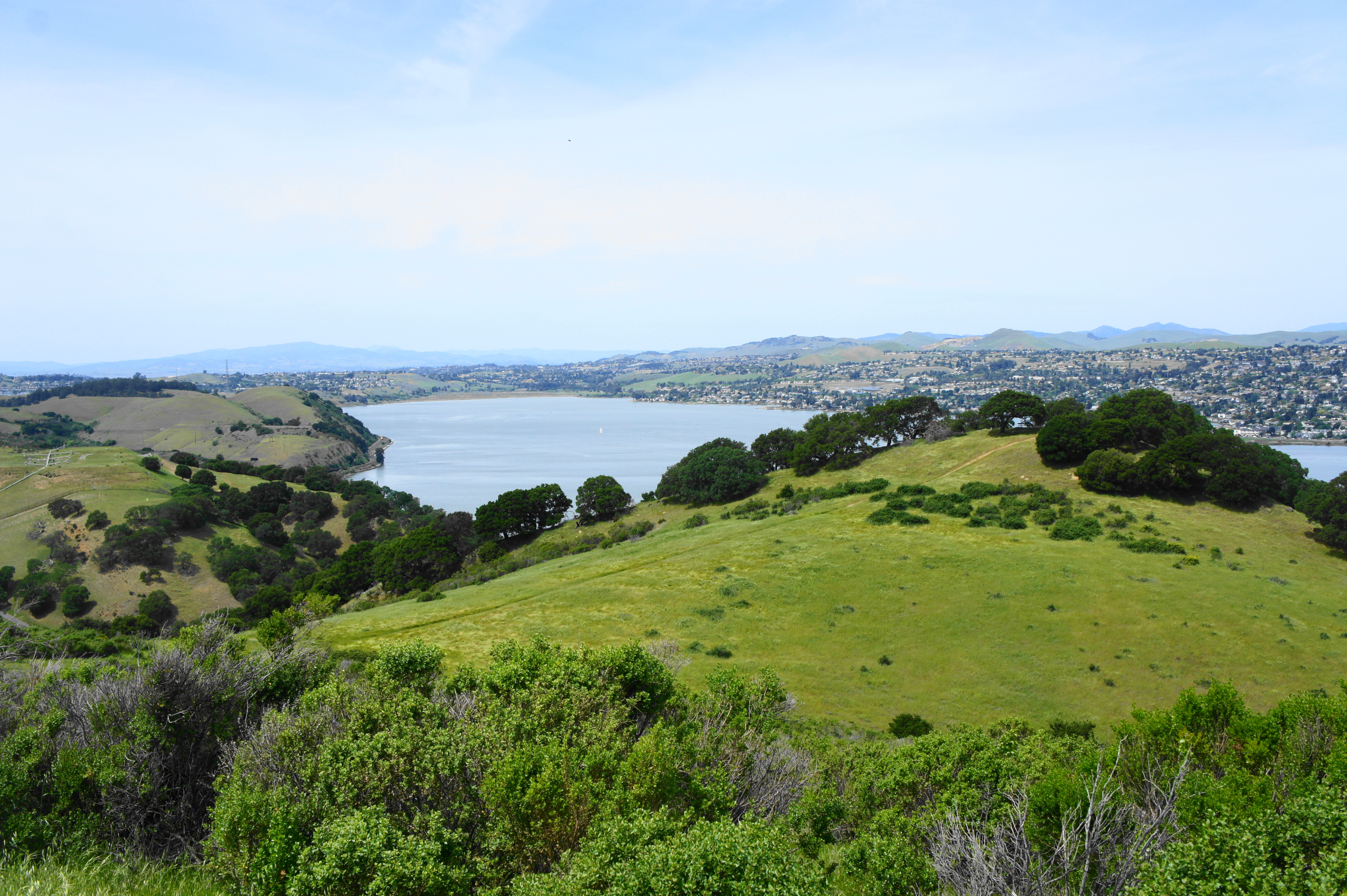
Trees are sparse on this sun-soaked hike across a non-contiguous tract of park land just east of Port Costa; the highlight is an excellent overlook 358 feet above Carquinez Strait. Park at the roadside parking lot along Carquinez Scenic Drive, just east of the split with Reservoir Street. Head north, then east, on the wide tract, coming to a junction at 3/10 mile. Bear left, skirting a cattle watering hole on the right, then climb to a vista with a bench and expansive views across the strait to Vallejo, Martinez, and Mount Diablo. Return the way you came. (Note: There are other trails in this small tract, but they are dead-ends and not easily combined in a loop.)

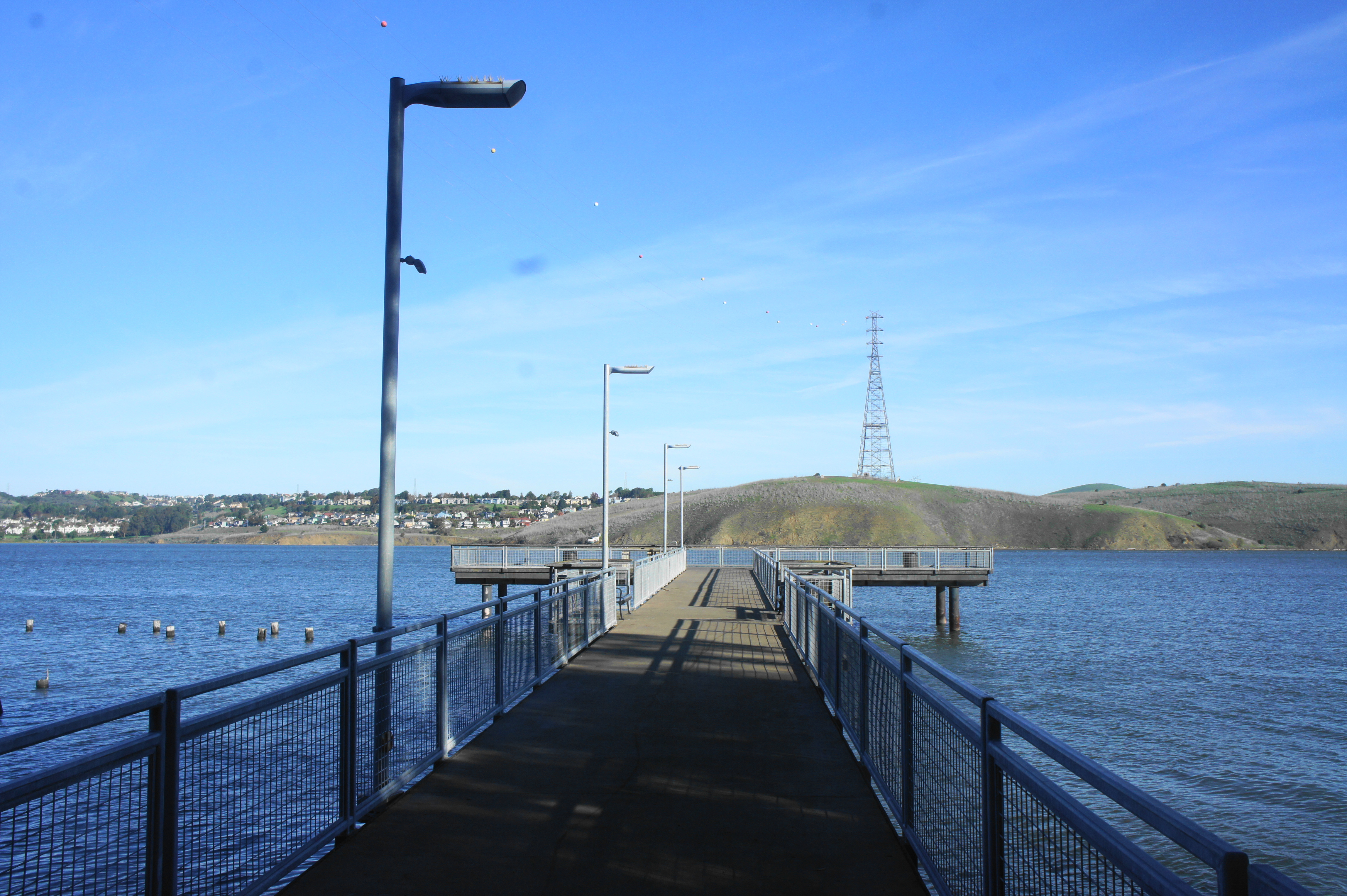
Bull Valley Trail to Eckley Pier (1.0 mi. out-and-back)
Trailhead: Bull Valley Staging Area (Alternative: Eckley Pier)
Difficulty: Easy
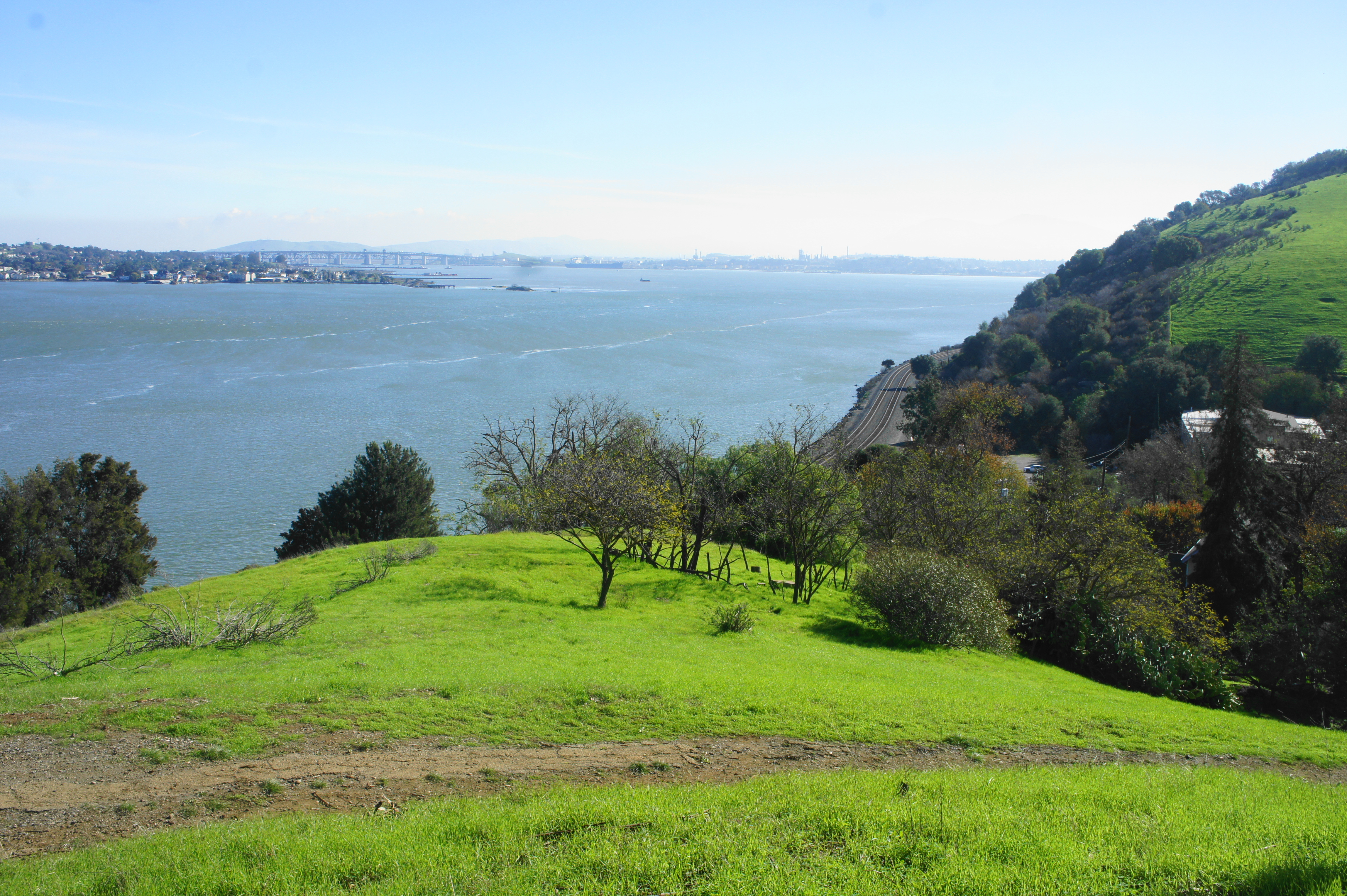
Enjoy the unobstructed vistas along this short hike, connecting the Bull Valley Staging Area with Eckley Pier, a popular fishing spot along Carquinez Strait. From the Bull Valley parking area, head north and then west along the wide Bull Valley Trail, passing a bench and then steadily descending toward the pier, with nice views across the strait to Dillon Point and Benicia. Pass through a gate, bear right on the loop road, and then carefully cross the active railroad tracks to reach Eckley Pier. Here one can spot the wreckage of the S.S. Garden City, a once-active steamboat destroyed in a fire in 1983, with the Carquinez Bridge beyond. Return the way you came, or continue on the Bull Valley Trail to Winslow Street (see below).


Bull Valley Trail to Winslow Street (1.3 mi. out-and-back)
Trailhead: Eckley Pier
Difficulty: Moderate
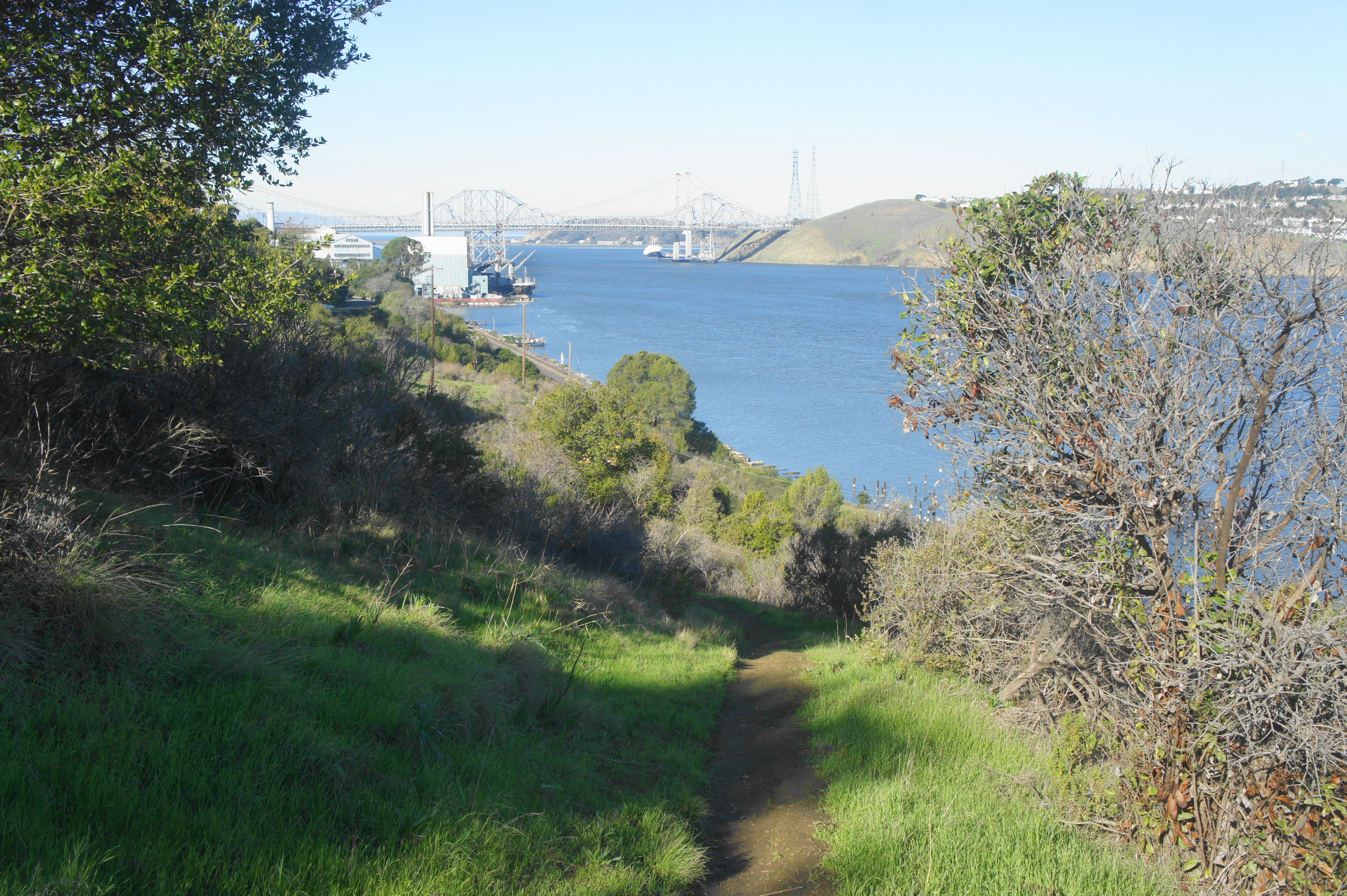
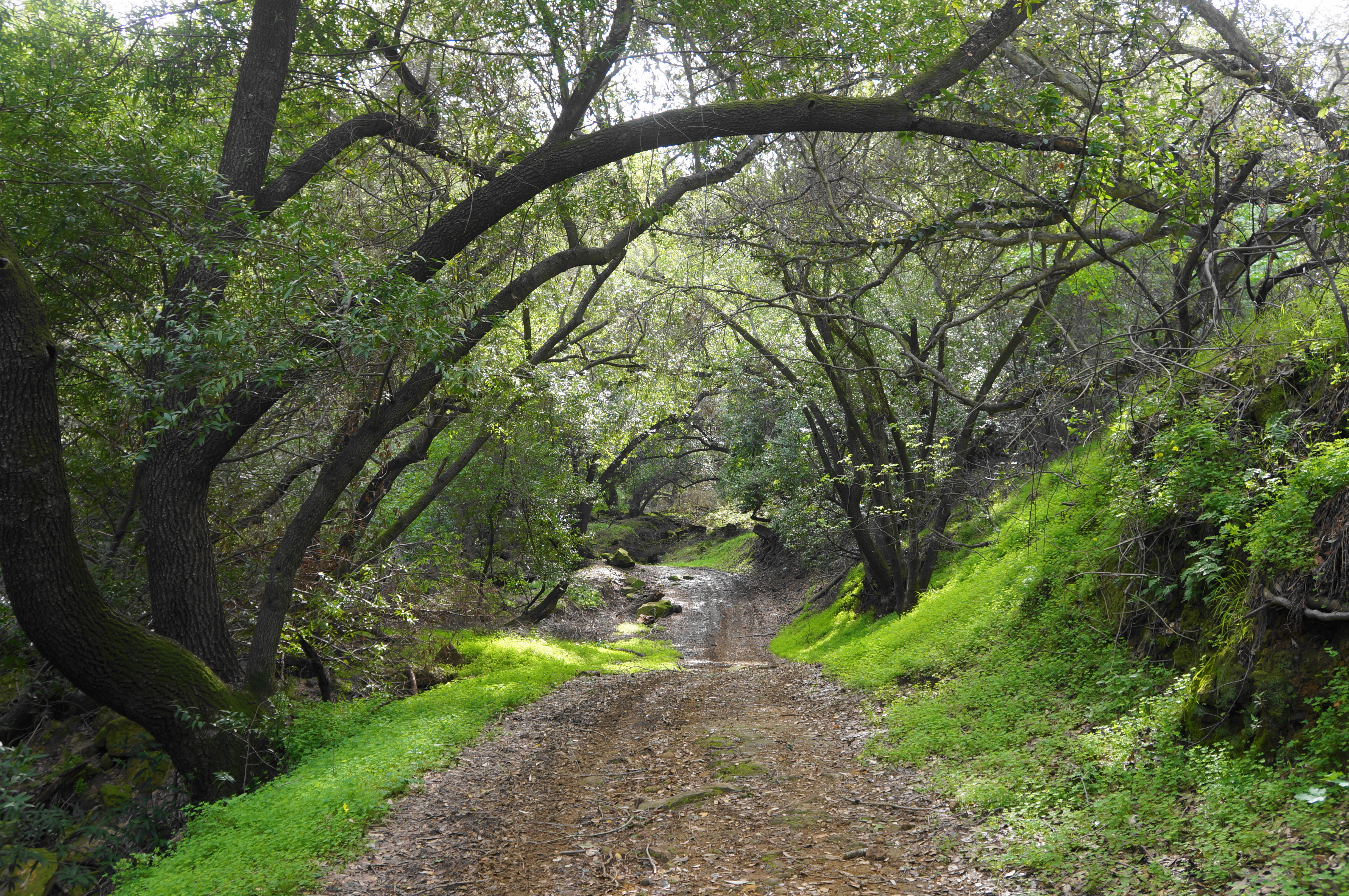
From Eckley Pier, a lovely singletrack snakes partway up a ridgeline, affording excellent views of the strait and Carquinez Bridge and ending at a shady gully at Winslow Street. The trail heads west from the southern end of the road loop at Eckley Pier, rising quickly up a set of switchbacks through thick eucalyptus forest. Cresting two hilltops, hikers are awarded with nice vistas, after which the trail drops to a dark ravine under a canopy of pines and eucalyptus. At the fork, head right to climb to Winslow Street, the end of the trail. Return the way you came.


Carquinez Overlook Short Loop (1.8 mi. stem-and-loop)
Trailhead: Bull Valley Staging Area
Difficulty: Easy
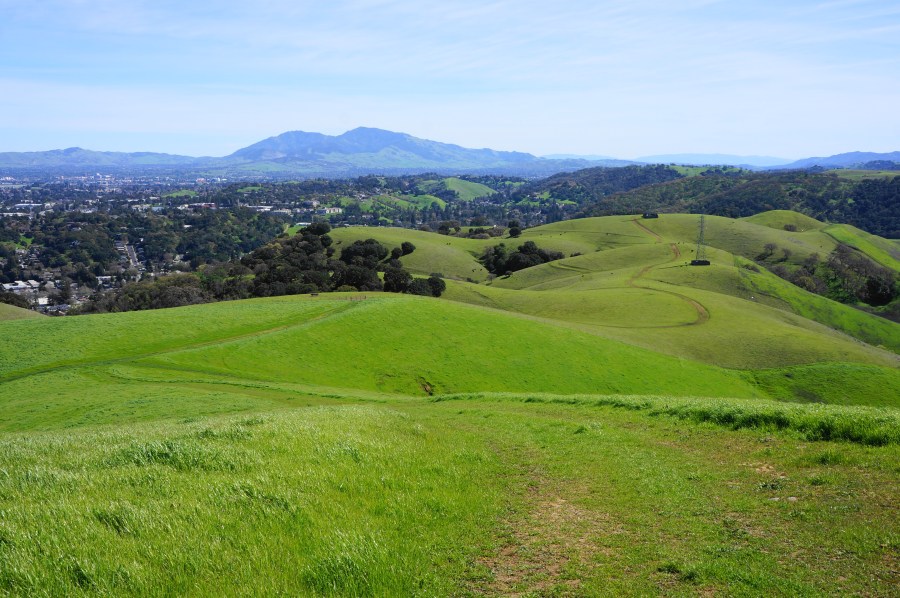
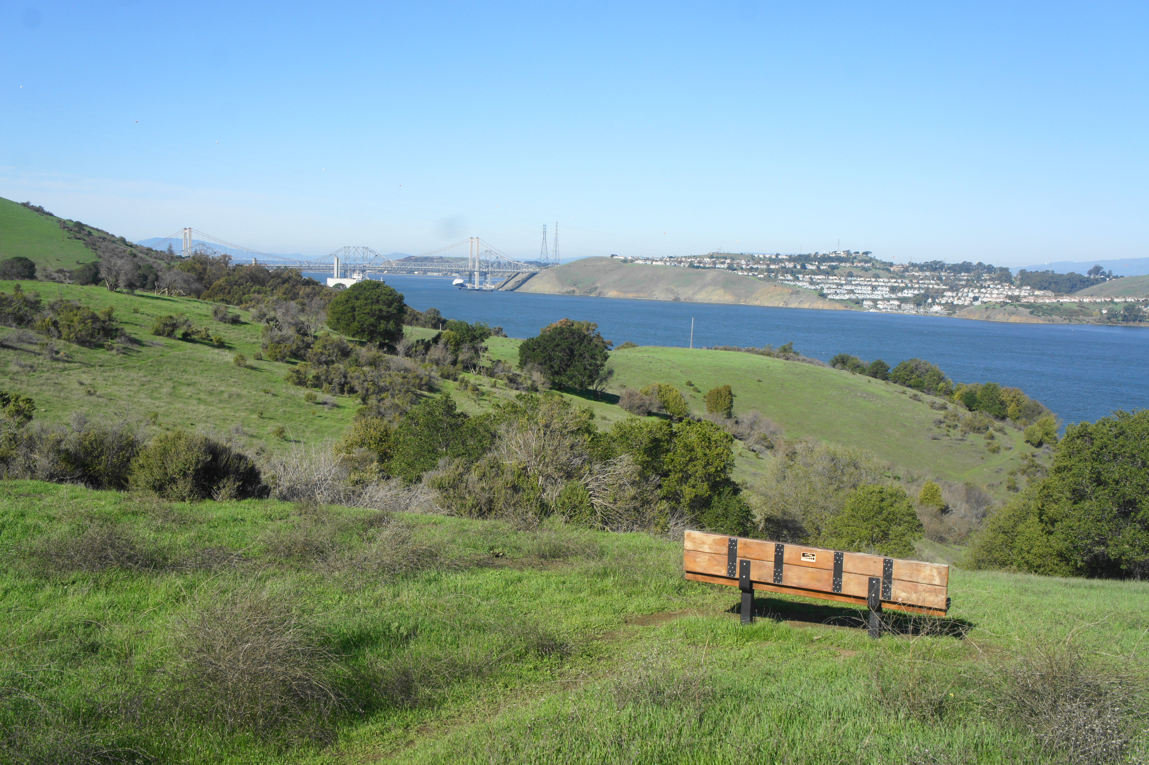
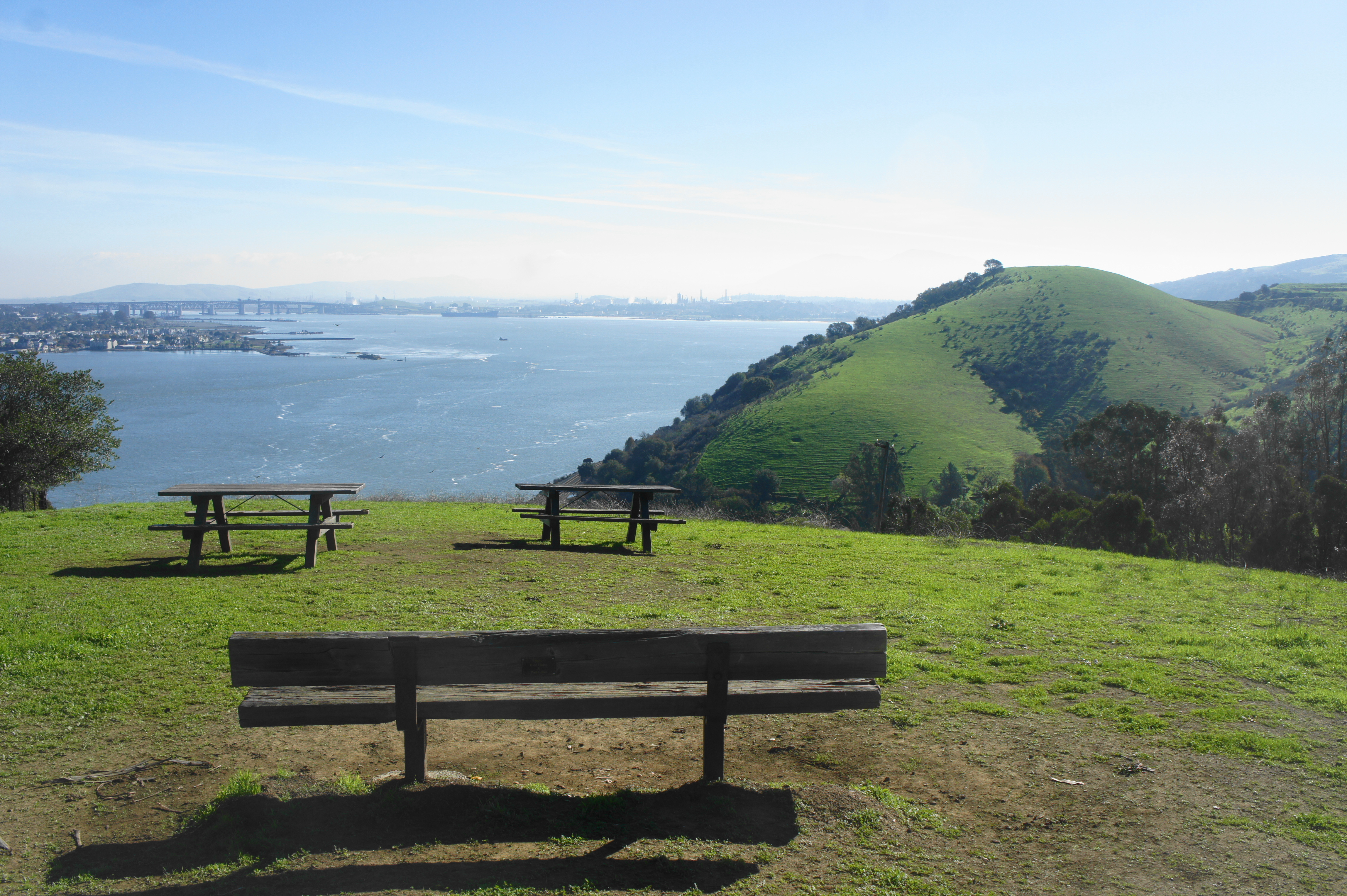
One of two loop options along the ridgetop just east of Bull Valley Staging Area, this splendid circuit features panoramic views and lovely eucalyptus groves. From the staging point, bear right at the initial fork and climb to a bench overlooking the strait and Carquinez Bridge. Bear left at the fork and course along north-facing slopes, entering a young eucalyptus grove. Stay left at the junction at ½ mile, then descend to an excellent overlook with two picnic tables and a bench; from here, hikers can see east to Martinez and Mount Diablo. Continue along the wide path and bear left at the next fork; head right and round a sharp bend with additional views, then make your way westward, returning to the main track. Ascend to clear the hilltop again and return to the fork first encountered at ½ mile; bear left and return to the start.

Carquinez Overlook Long Loop (2.0 mi. stem-and-loop)
Trailhead: Bull Valley Staging Area
Difficulty: Easy
This longer alternative traverses similar terrain but briefly dips into the quaint community of Port Costa before returning back to Bull Valley Staging Area. Follow the Carquinez Overlook Trail east for 7/10 mile, passing the great vista with the two picnic tables (noted above). Then bear left at the fork, dropping all the way down a scenic slope to Prospect Avenue. Follow the road past quirky houses for ¼ mile, then bear right on the trail continuation, which passes behind fenced backyards and gradually climbs to crest the ridge again. Descend to the original junction at 1/10 mile, then bear left and return to the staging area to complete the two-mile hike.

George Miller Trail (3.2 mi. out-and-back)
Trailhead: Port Costa Staging Area (Alternative: West End of Carquinez Scenic Drive)
Difficulty: Easy
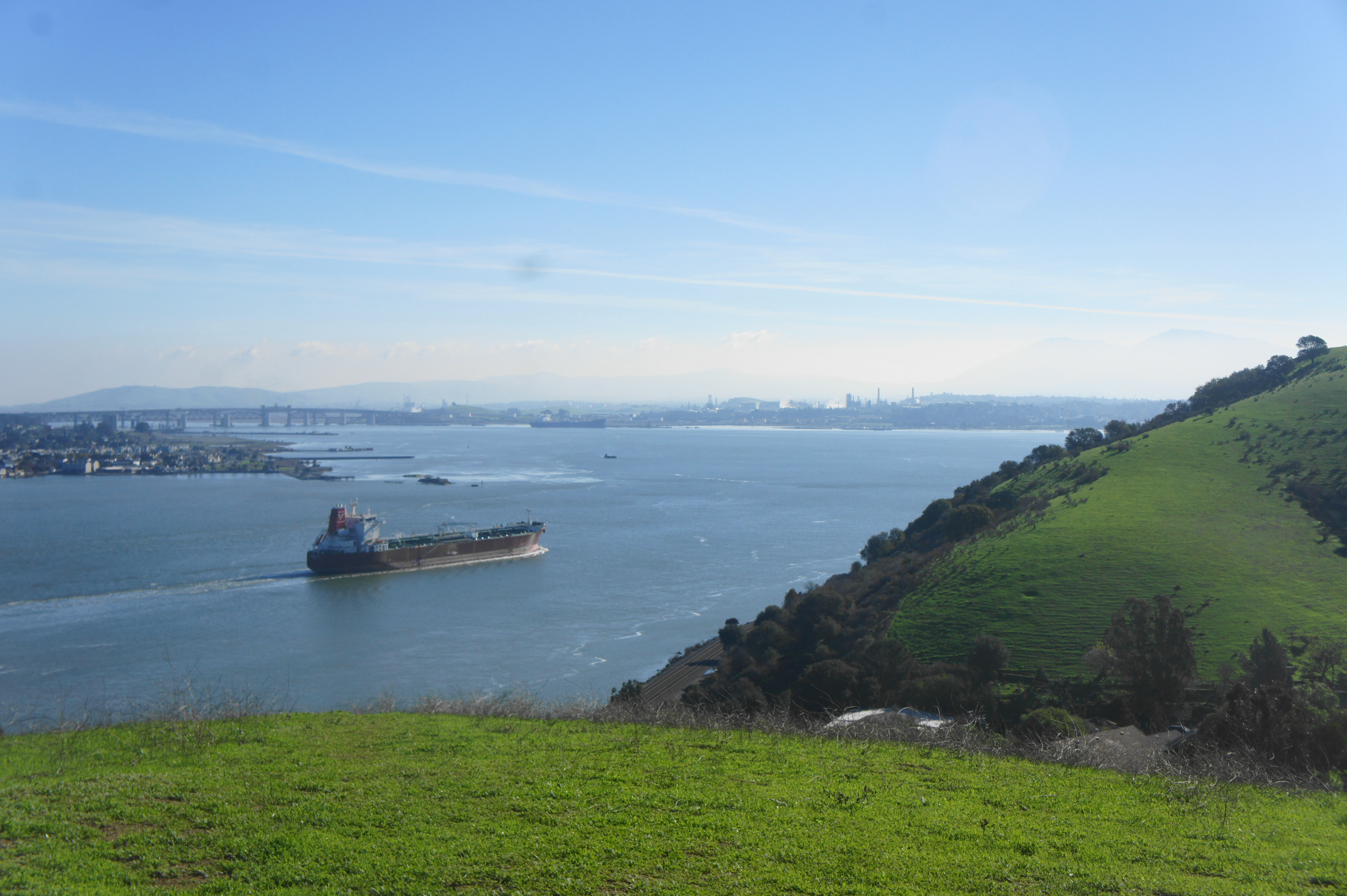
Named for a former U.S. congressman, the George Miller Trail is a former roadway, now open only to walkers and bikers, and connects the eastern and western portions of the park. From the gravel lot at Port Costa Staging Area, take the paved roadway south as it weaves through Little Bull Valley and comes out twice to open vistas looking north and east across Carquinez Strait. The trail ends at a point about 1.8 miles from the start, coming out onto Carquinez Scenic Drive in a broad, woody drainage below Franklin Ridge. Return the way you came for a 3.2-mile out-and-back hike.


EASTERN UNIT
Rankin Park Short Loop (0.7 mi. loop)
Trailhead: Rankin Park
Difficulty: Moderate
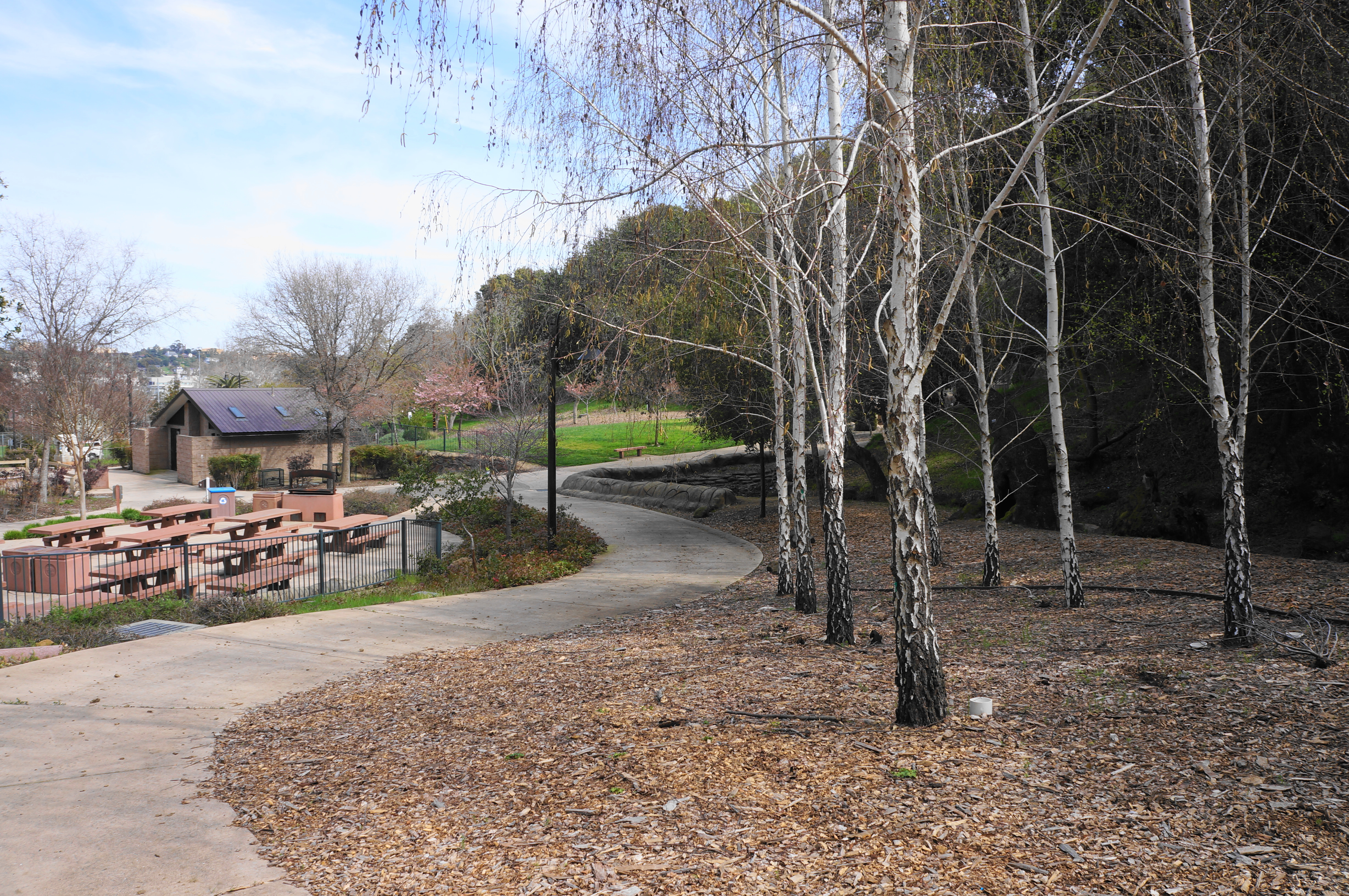
Martinez’s Rankin Park and Aquatic Center is most often used for picnicking, swimming, baseball, and softball—but there is also access to Franklin Ridge via a forested hillside. A short, heart-shaped loop makes for a mildly-challenging jaunt with some limited views. From the additional parking area, take the winding, paved path past Canyon Picnic Area; follow a minor stream as the route turns to dirt, climbing into the bay-dominated woods. Stay left at the junction at 2/10 mile, cross the creek, and continue up to a shelf with some partly-obscured views to Martinez and the strait. Drop to a junction at 1/10 mile and bear left, continuing downhill via a second drainage to return to the playground/picnic area, ending the 7/10-mile hike.

Hulet Hornbeck – California Riding & Hiking Trail Loop (1.1 mi. loop)
Trailhead: Nejedly Staging Area
Difficulty: Moderate
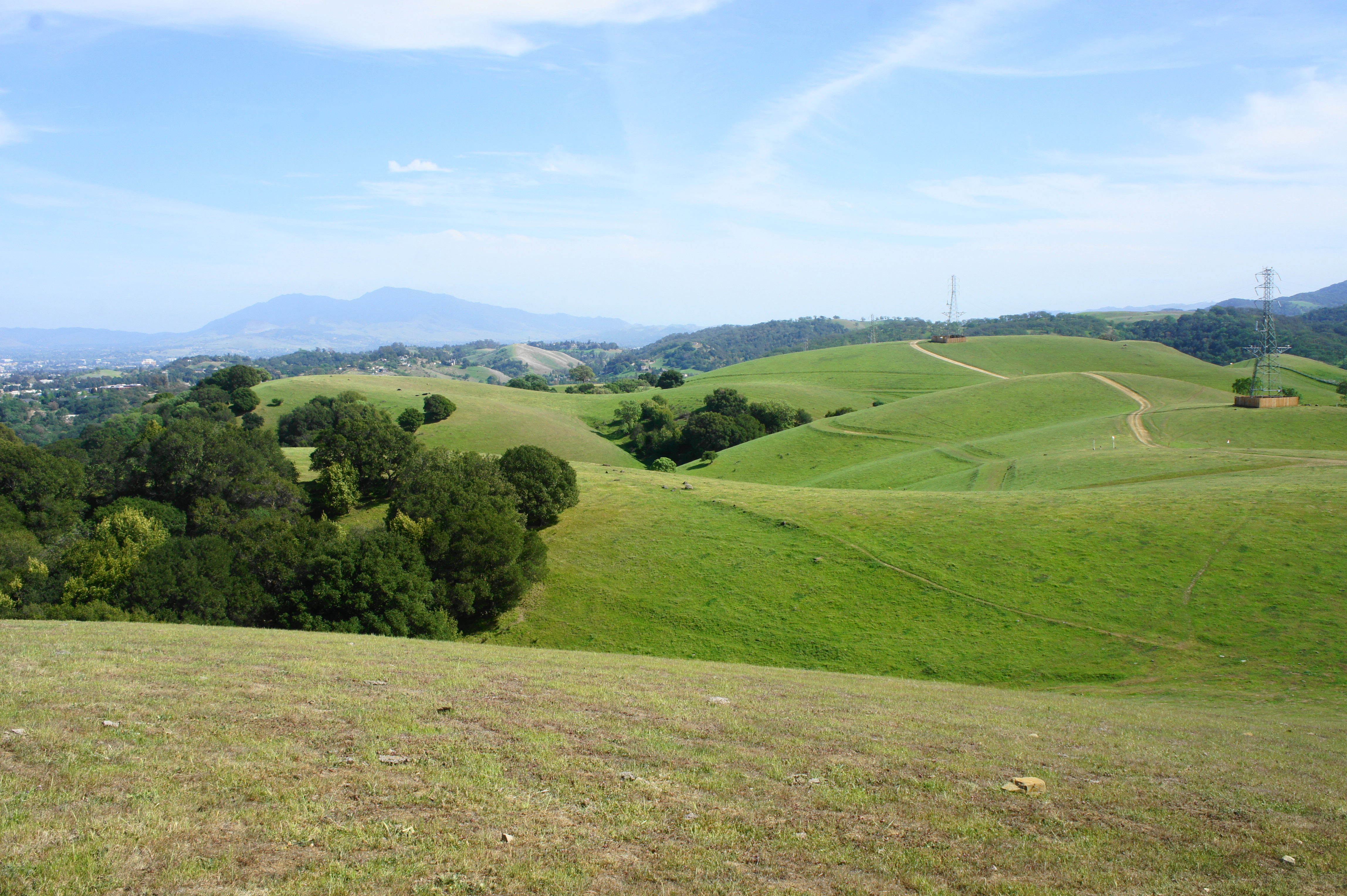
The shortest loop option from Nejedly Staging Area, this hike climbs nearly 500 feet to a high saddle on Franklin Ridge. From the upper parking lot, pass through the gate and take a sharp right, following the unmarked but well-worn California Riding and Hiking Trail as it bends northward through a small eucalyptus grove, then climbs a steep, oak-studded ridge. At about ½ mile, the route emerges above the trees, with a junction just ahead. Look back for unobstructed views of Carquinez Strait and the Sacramento River Delta. Bear left at the fork, then left again on the Hulet Hornbeck Trail, which drops immediately into a shady ravine. Descend the winding path to its end, back at the staging area, capping off a 1.1-mile round-trip.


Hulet Hornbeck – Rankin Park Trail Loop (1.4 mi. loop)
Trailhead: Nejedly Staging Area
Difficulty: Moderate
This slightly longer loop ascends the Hulet Hornbeck Trail from Nejedly Staging Area to Franklin Ridge before descending the Rankin Park Trail back toward the start. Pass through the gate past the upper parking lot, then climb steeply up an oak/bay-studded ravine, reaching a junction after ½ mile. Bear left, enjoying sweeping views of the Carquinez Strait area, then left twice more, reaching the Rankin Park Trail. Follow the wide track downhill until 1.1 miles—just before a gate—where an unmarked but well-trodden singletrack bears left. Descend this narrow trail as it angles behind a gated cemetery and cuts westward, dropping down a series of bends back to Nejedly Staging Area.


Rankin Park Trail Loop (1.7 mi. loop)
Trailhead: Rankin Park
Difficulty: Moderate
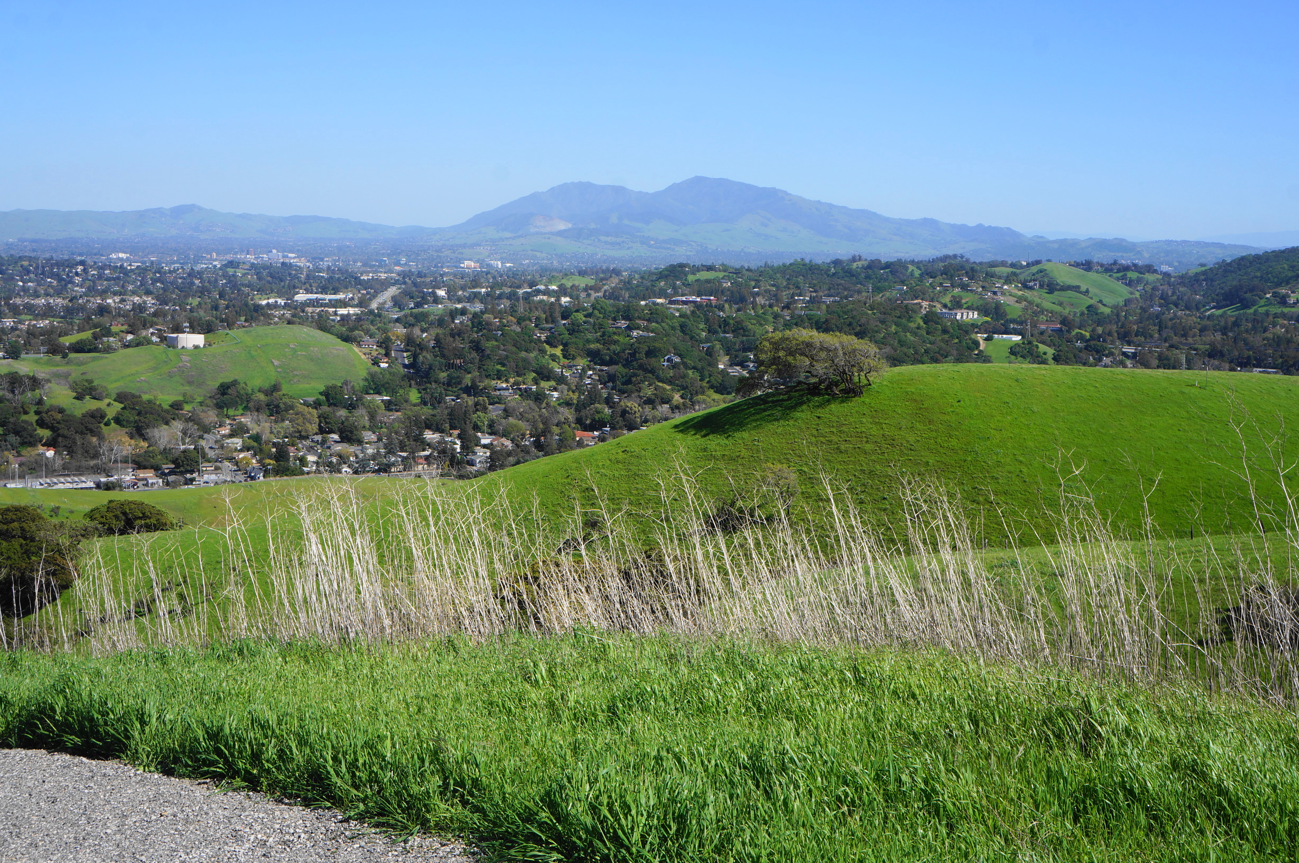
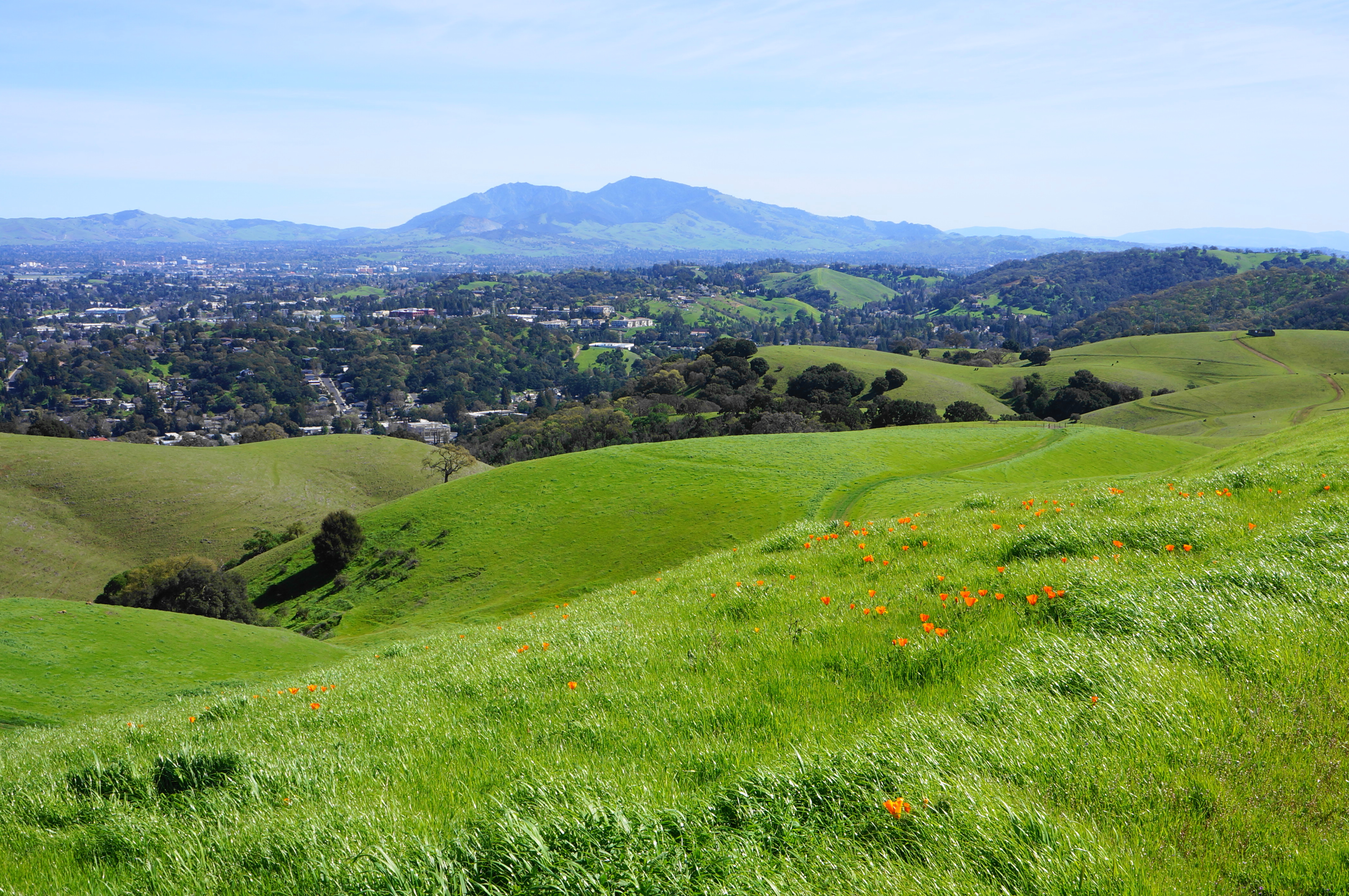
A longer loop option from Rankin Park, this moderately-difficult loop traverses mostly-wooded terrain but does briefly crest a gap atop Franklin Ridge. From the upper parking area at Rankin Park, find the fire road heading northeast and follow it to a dirt track (left) that rises sharply up two steep hills, paralleling the cemetery on the right. Pass under power lines as the incline eases, then continue through a gate and ascend up around a bend with views back to the Benicia-Martinez Bridge, the city of Martinez, and Mount Diablo. Come to an unmarked junction at 6/10-mile; heading either way is fine, although right is preferred because it rises to the crest of the ridge. Stay left at the next two forks and head back down, passing a spur to a creaky windmill on the left. There is a seasonal pond at around 0.95 miles, where the more obvious track bears left, but the onward route is actually a singletrack edging uphill to the right, passing through a gate. Follow the singletrack up to a ridgeline, then descend and route eastward, looking for an unmarked path heading left at 1.2 miles. Take this left, descending a set of sharp bends and returning to a wide fire road; bear left and follow this track, skirting a drainage, back to the start.


Hulet Hornbeck Trail Loop via F Street (South) (1.8 mi. stem-and-loop)
Trailhead: F Street
Difficulty: Moderate
The end of F Street in Martinez offers alternative access to Franklin Ridge, and this moderate stem-and-loop climbs to the Hulet Hornbeck Trail and bears south around a short loop with the park’s closest views of Mount Diablo. Pass through the gate at the start, then bear straight, ascending to a windy saddle on Franklin Ridge at ½ mile, then bear left on the Hulet Hornbeck Trail, following power lines above. Amid open views of Martinez and Mount Diablo, bear left—just before a gate at 8/10 mile—on a faded but noticeable grassy track, which weaves back to the initial junction; bear right and retrace your steps from here back down to F Street.


Hulet Hornbeck Trail Loop via F Street (North) (1.9 mi. loop)
Trailhead: F Street
Difficulty: Moderate
This slightly-longer loop from F Street leads right (north) at the junction atop Franklin Ridge, then weaves across pretty slopes and returns via a winding track amid windswept hills and smatterings of oaks. Head straight up to the Hulet Hornbeck Trail at ½ mile, heading right and following the track for 6/10 mile. With a large shed on the left, bear right as the trail ascends to a curious knoll with a single palm tree and two picnic tables, then descend slightly. Bear right on a partly faded track leading up to a weather station (if you reach a gate at the edge of the park, you’ve gone too far), then follow this path downhill, rounding a right-angle bend followed by a steep descent (toward the running track at Alhambra High School). Pass through a gate, then follow the path back to the start at F Street.


Hillside Place to Hulet Hornbeck Trail Loop (2.1 mi. stem-and-loop)
Trailhead: Panoramic Drive
Difficulty: Moderate
Stitching together a ridgetop hike and shady, unnamed single-track, this hike forms a 2.1-mile stem-and-loop from Panoramic Drive. Find Hillside Place as it turns into a paved track closed to vehicle traffic, ascend steadily past a reservoir on the right, stay on the path as it turns to gravel, pass through a gate, and enter the park. Come to a junction atop the ridge at 4/10 mile, stay right, and pass through an open area with several comms towers. Rise to a gap with a cow shed, then bear right, traversing Franklin Ridge. Drop down to a gate, bench, and Carquinez Strait view at 9/10 mile. Beyond, drop to a junction, bear right and stay right again at a fork within eyeshot of the rusty windmill. Pass a pond on the left and take a singletrack up to a gate and then down into oak/bay woodlands. Stay from here on a pretty, unmarked path that fades at spots but weaves in and out of two ravines, treading eastward back to the reservoir. Here one will find Hillside Place again; bear left and descend back to the start.


Franklin Ridge Loop Trail (3.2 mi. loop)
Trailhead: Nejedly Staging Area
Difficulty: Moderate
Since it is hard work to reach the ridgetop, it’s worth staying awhile. Extend the Hulet Hornbeck – CA Riding & Hiking Trail Loop described above by adding the milder but longer Franklin Ridge Loop Trail, which features sweeping vistas and a hidden stream valley. After 6/10 mile on the steep CA Riding & Hiking Trail, bear right on the Franklin Ridge Loop Trail, following it for the next mile as it skirts a grassy hillside with fine views of Carquinez Strait. After passing several spurs that lead to viewpoints, the trail descends, wraps around a corner to the south, and then splits at 1.7 miles. Stay left on the wide path as it climbs mildly through a backwoods ravine, eventually reemerging into the sunlight at about 2.3 miles. Stay left at the next two forks, cresting a high saddle, then descend the shady Hulet Hornbeck Trail back to the start.


Hulet Hornbeck Trail to John Muir National Historic Site (3.25 mi. one-way)
Trailhead: Nejedly Staging Area (Alternatives: Rankin Park; Mount Wanda Trailhead)
Difficulty: Strenuous
The last hike on offer is a one-way shuttle (or lengthy and challenging out-and-back) that follows the ridgetop from Nejedly to nearby Mount Wanda and John Muir National Historic Site. From the Nejedly lot, ascend either the Hulet Hornbeck Trail (easier) or California Riding & Walking Trail (more scenic) to the ridgetop, then straight on the eastward path, passing the radio towers, windmill, and cow shed. Take a hard right at the latter for a worthy detour: drop to a gate, pass through it, then bear left immediately and climb to a local high point; the views beyond to the Tri-Valley, Briones, and Diablo Range are fantastic. After cresting, descend a sharp slope, returning to the main throughfare, and continue heading southeast. Pass through a cattle gate, stay right at successive turns, and briefly connect with pavement as the route exits parkland, with an easement offering onward passage. After another gate at 2.8 miles, take a downhill, with a chain-link fence on the right, to the valley floor. Now you are roughly behind John Muir’s house; head left to connect with residential Canyon Way, or right to clear an underpass below Highway 4, rise to brief heights, then drop again to finish at Mount Wanda Trailhead.


Pingback: Top 10 Hikes in 2024 – Live and Let Hike
Pingback: Hikes in Briones Regional Park (Bear Creek Staging Area) – Live and Let Hike
Pingback: Hikes in Briones Regional Park (Park Office & Briones Road Staging Area) – Live and Let Hike
Pingback: Hikes in Briones Regional Park (Alhambra Creek Staging Area) – Live and Let Hike
Pingback: Hikes in Briones Regional Park (Reliez Valley Staging Area) – Live and Let Hike
Pingback: Hikes in Briones Regional Park (Springhill Road Staging Area) – Live and Let Hike
Pingback: Hikes in Briones Regional Park (Lafayette Ridge Staging Area) – Live and Let Hike
Pingback: Top 10 Hikes in Briones Regional Park – Live and Let Hike