
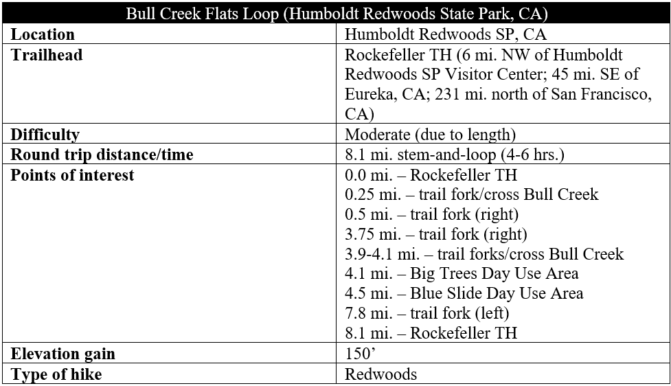
Outside of iconic Redwood National Park, about an hour and a half north on Highway 101, there is perhaps no better place in the world to view California coast redwoods than Humboldt Redwoods State Park, a massive, 53,000-acre tract with about 17,000 acres of old-growth redwoods—the largest forest of its kind in the world. The park’s most impressive titanic trees grow in the floodplains of the Eel River and Bull Creek, with most visitors casually viewing them on the scenic 31-mile Avenue of the Giants. But for a more rewarding and intimate experience, consider venturing out on the park’s extensive trail system. The roughly 8-mile jaunt described here encircles the Bull Creek Flats area, which boasts nearly endless redwood views and, despite its length, is very mild with limited elevation gain. (Note: The hike can also be extended to include the neighboring Big Trees Area, extending the distance to around 10 miles.)
The hike
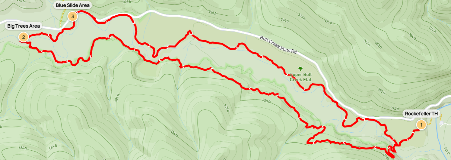
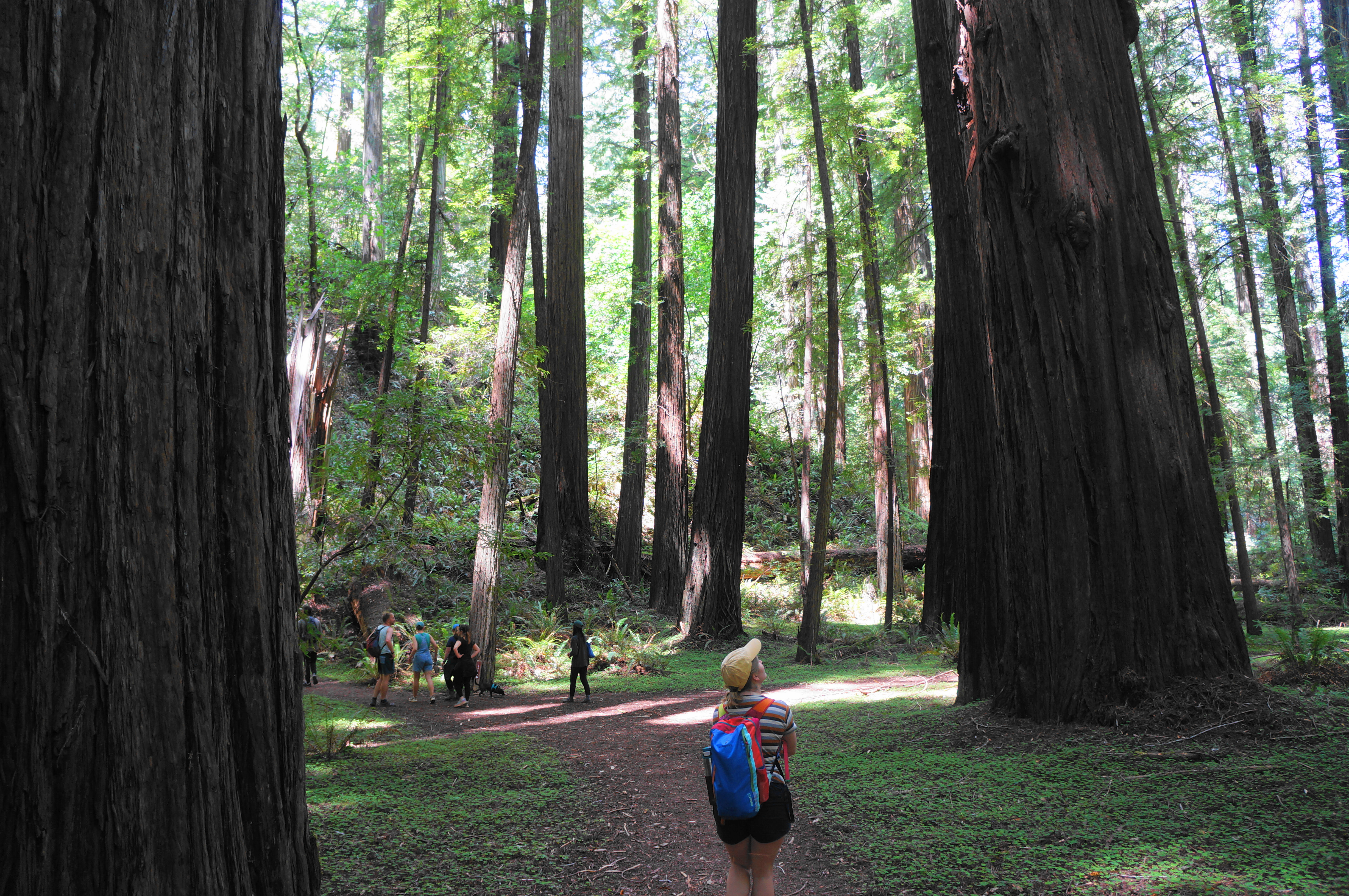
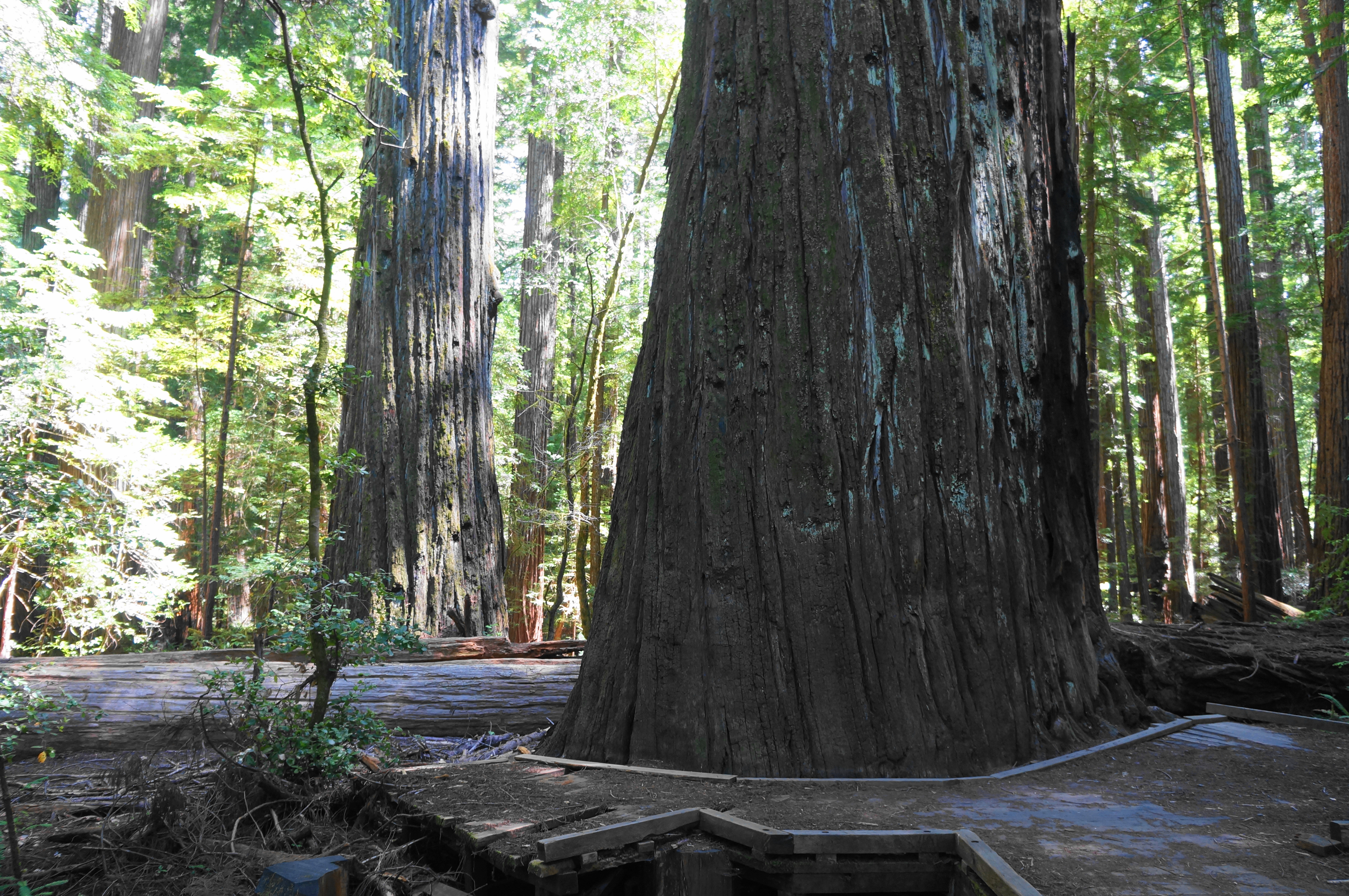
There are a few possible entry points for the hike, but the closest to the Avenue of the Giants is the Rockefeller Trailhead (see map), situated just off Mattole Road, a paved route running west from Dyerville, on the same side of the South Fork of Eel River. Park at the small lot, much less-visited than nearby Founders’ Grove. The trailhead marks the start of the Rockefeller Loop, which explores a small part of a forest by the same name, the largest contiguous old-growth redwood grove in the world.
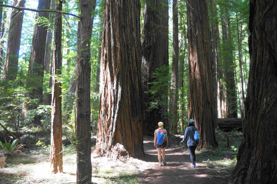
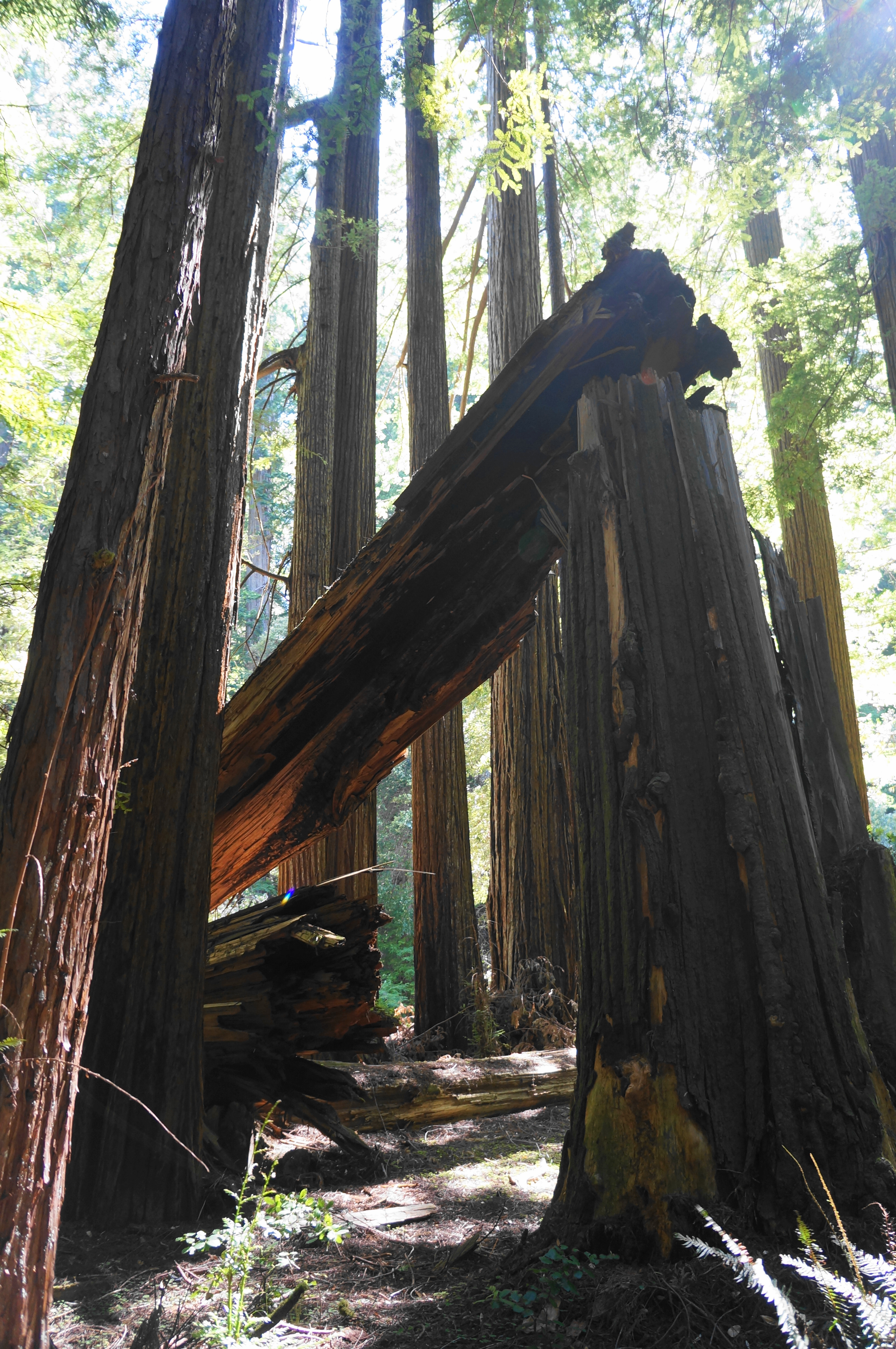
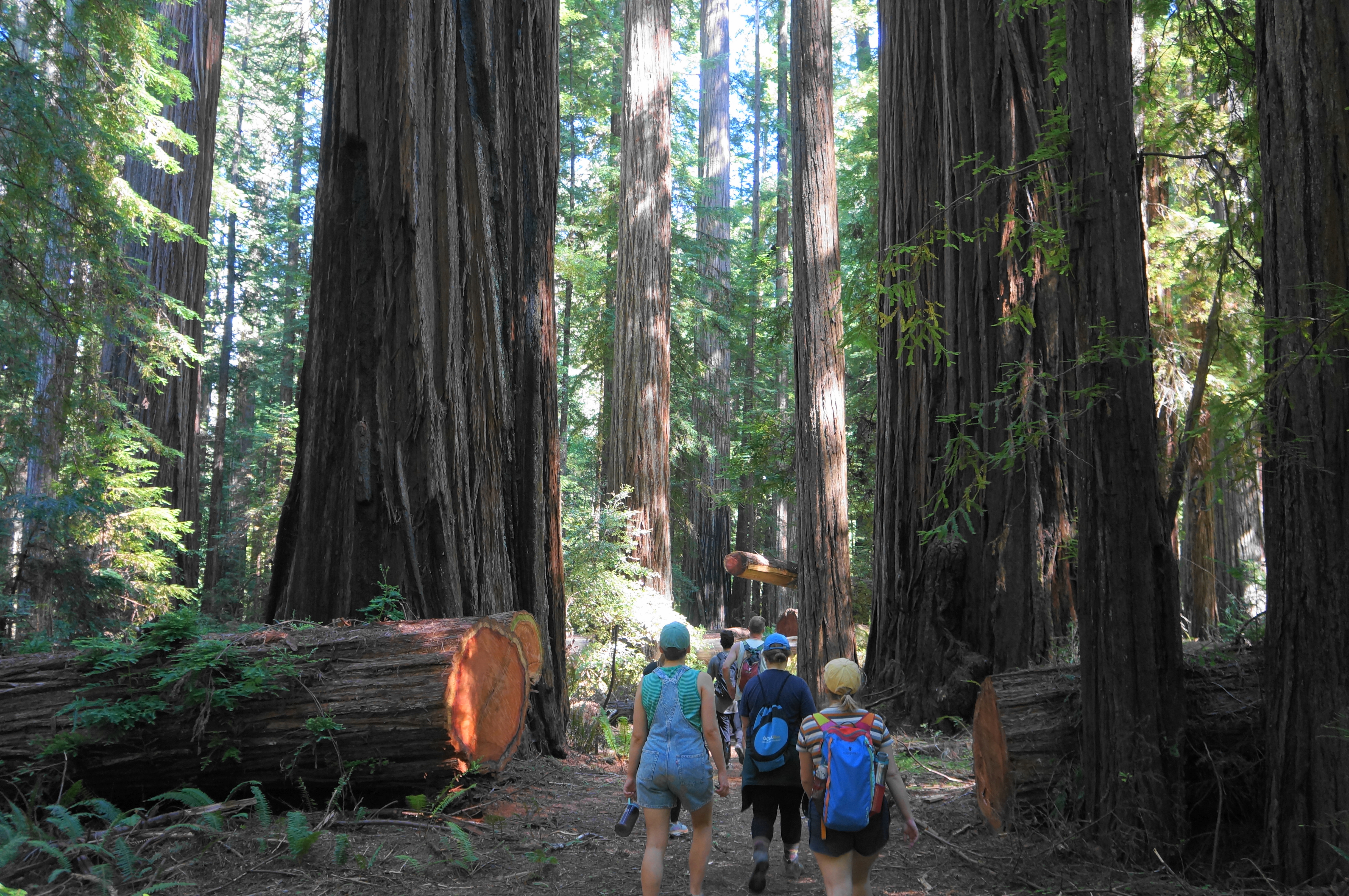
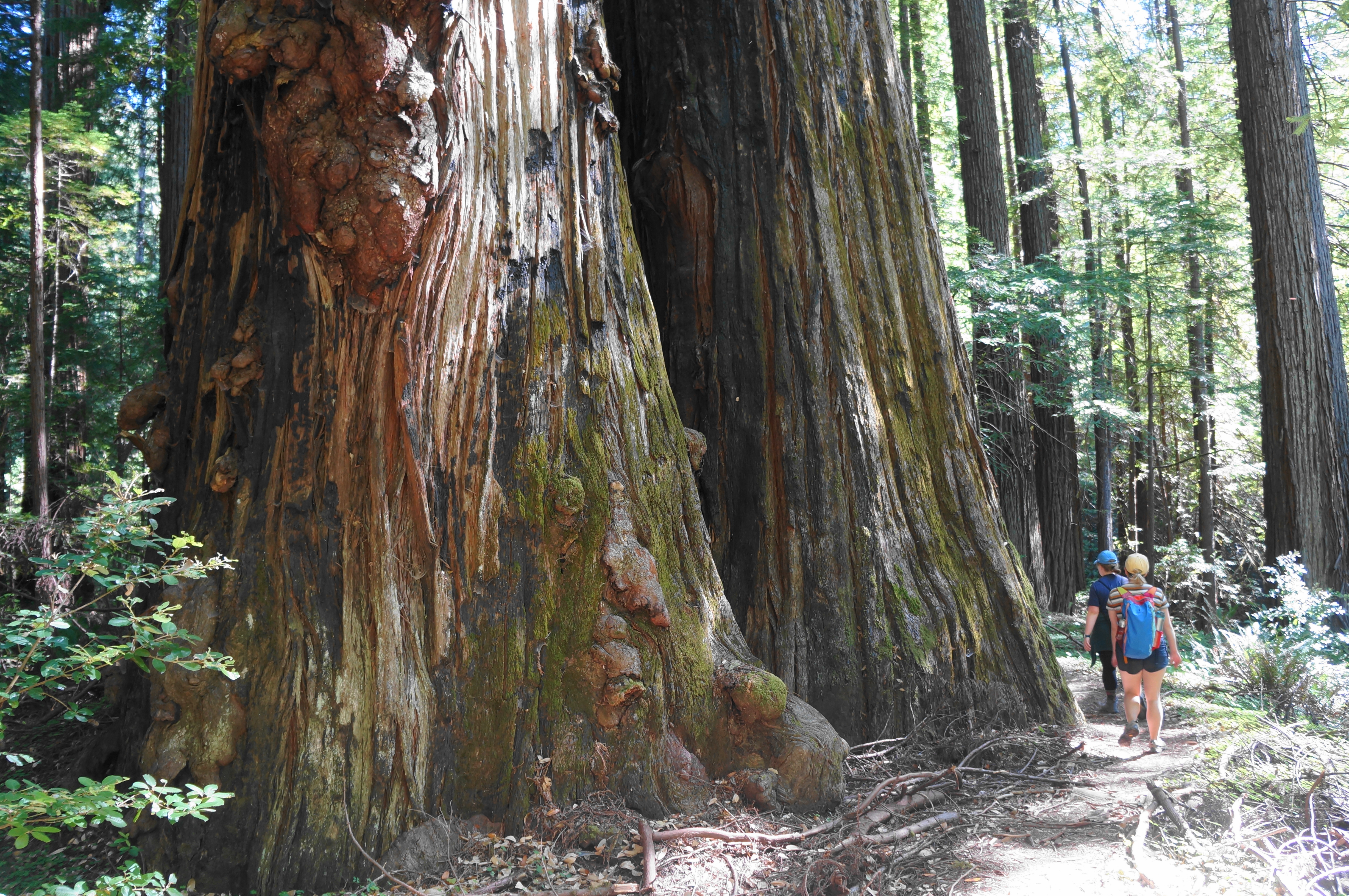
Hikers should start down the clearly-marked Rockefeller Loop Trail, which soon splits; bear right, cutting diagonally across the alluvial flat, dotted with impressive redwoods. The understory here is blanketed with ferns and redwood sorrel, the latter a clover-like herb found only in coastal Douglas fir and redwood forests the Pacific states and British Columbia. The level and easy path cuts southwest through the flat, clearing a couple of massive fallen logs which visitors can try to date (with a lot of time and patience!) by counting the hundreds—or thousands—of tree rings. Some of the living trees in this grove are 2-3,000 years old.


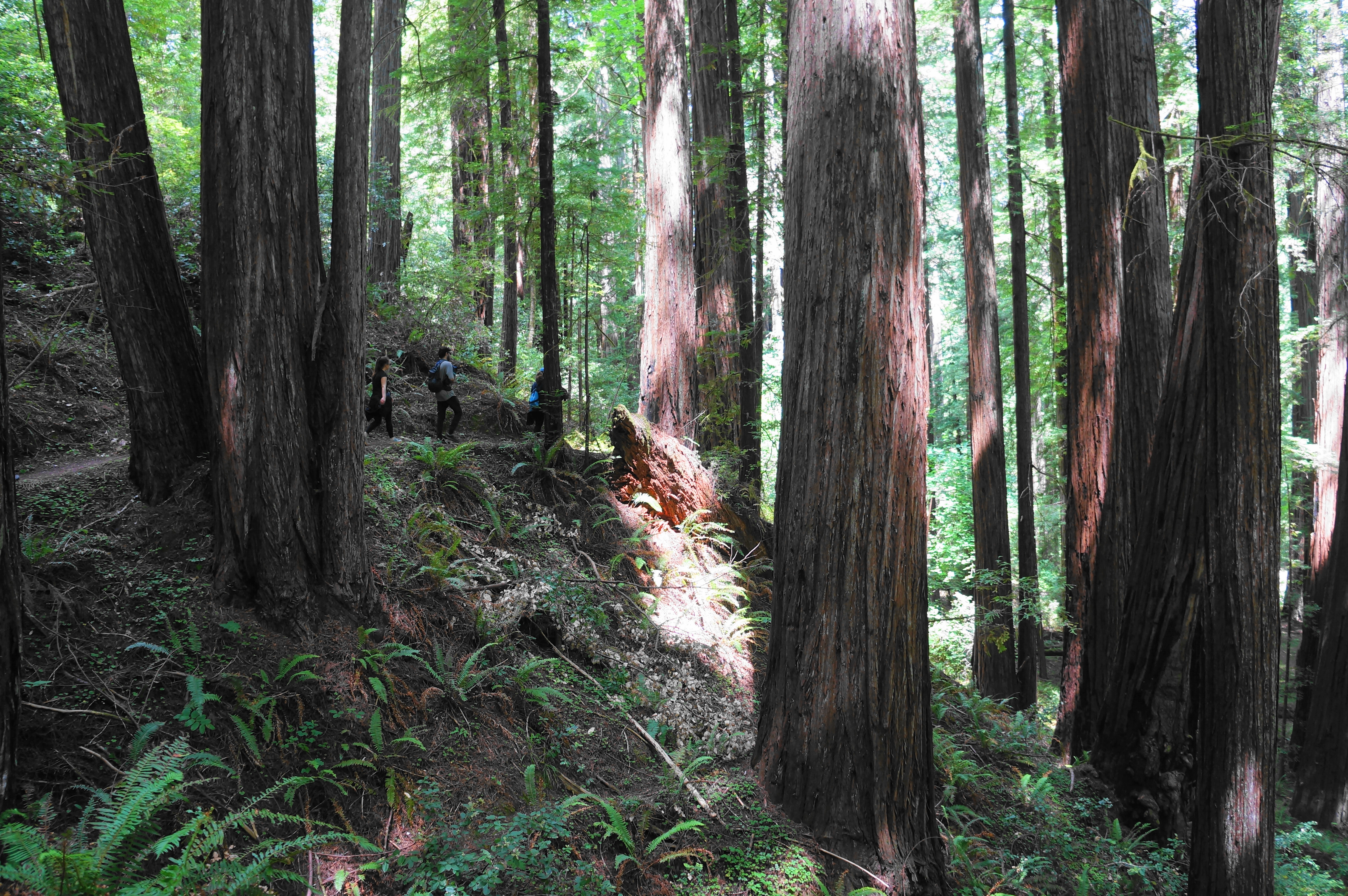
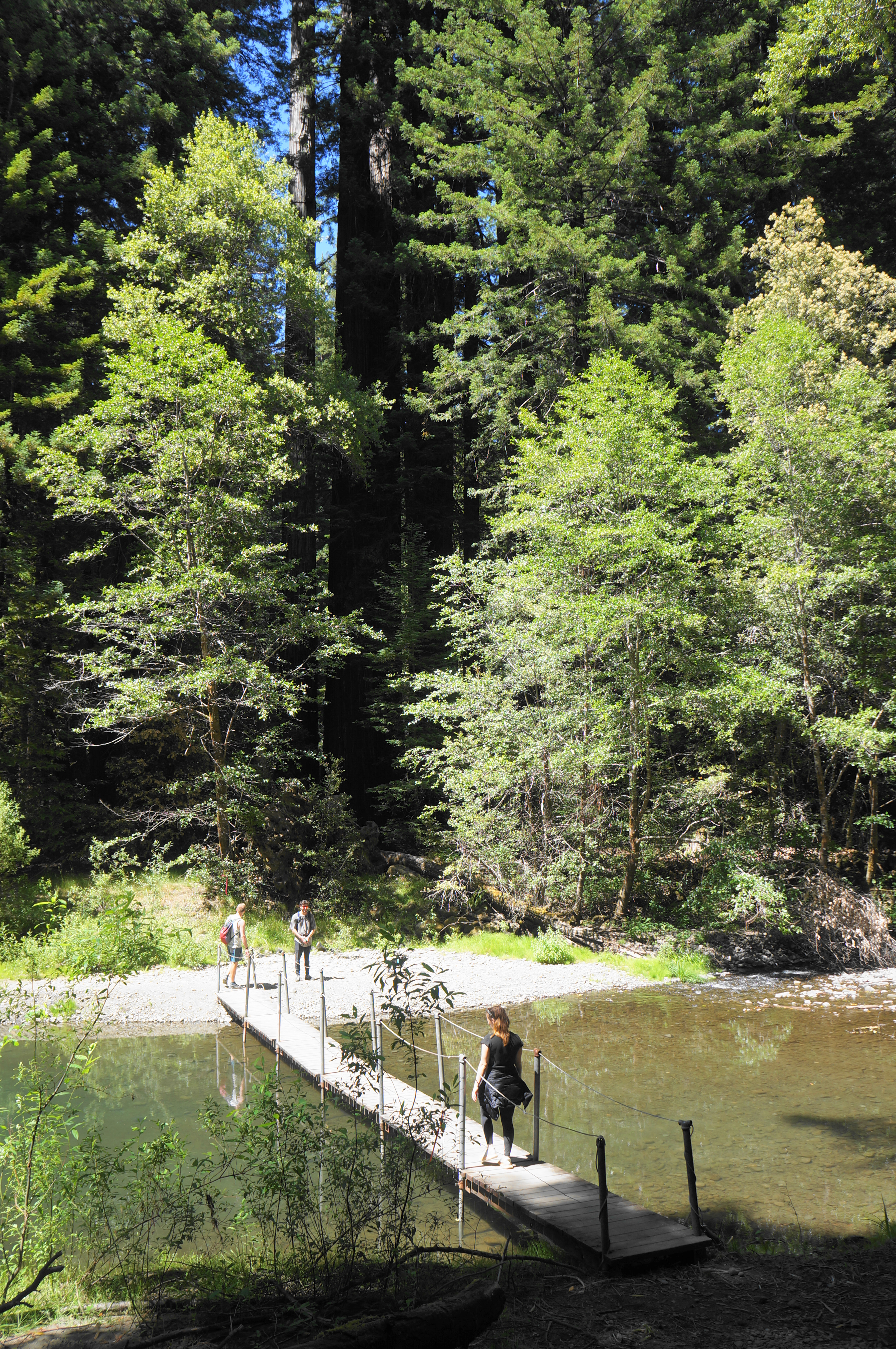
Soon the Rockefeller Loop comes to another junction at around ¼ mile; bear right, then left, in the direction of Bull Creek. Here the trail descends to the stream, where a seasonal (summer only) footbridge offers passage to the south bank. Once across, the onward path cuts left, ascends to an unofficial fork (stay left again), and begins a steady, switchbacking rise partway up the north-facing slope. With an aerial view of a nice, crowded redwood grove on the shelf below, hikers gain around 60-80 feet in about 300 yards, the only significant ascent of the entire 8-mile trek.

Stay right at the next junction, following the Bull Creek Flats Trail westward as it continues to ascend, more mildly this time. Tracing along the hillside, the route briefly ascends to a patch free of redwoods but soon drops again back into the massive forest of sequoia sempervirens. Begin a sequence of two descending bends at around 1.1 miles, culminating at a crossing of Tepee Creek, a tributary of Bull Creek.

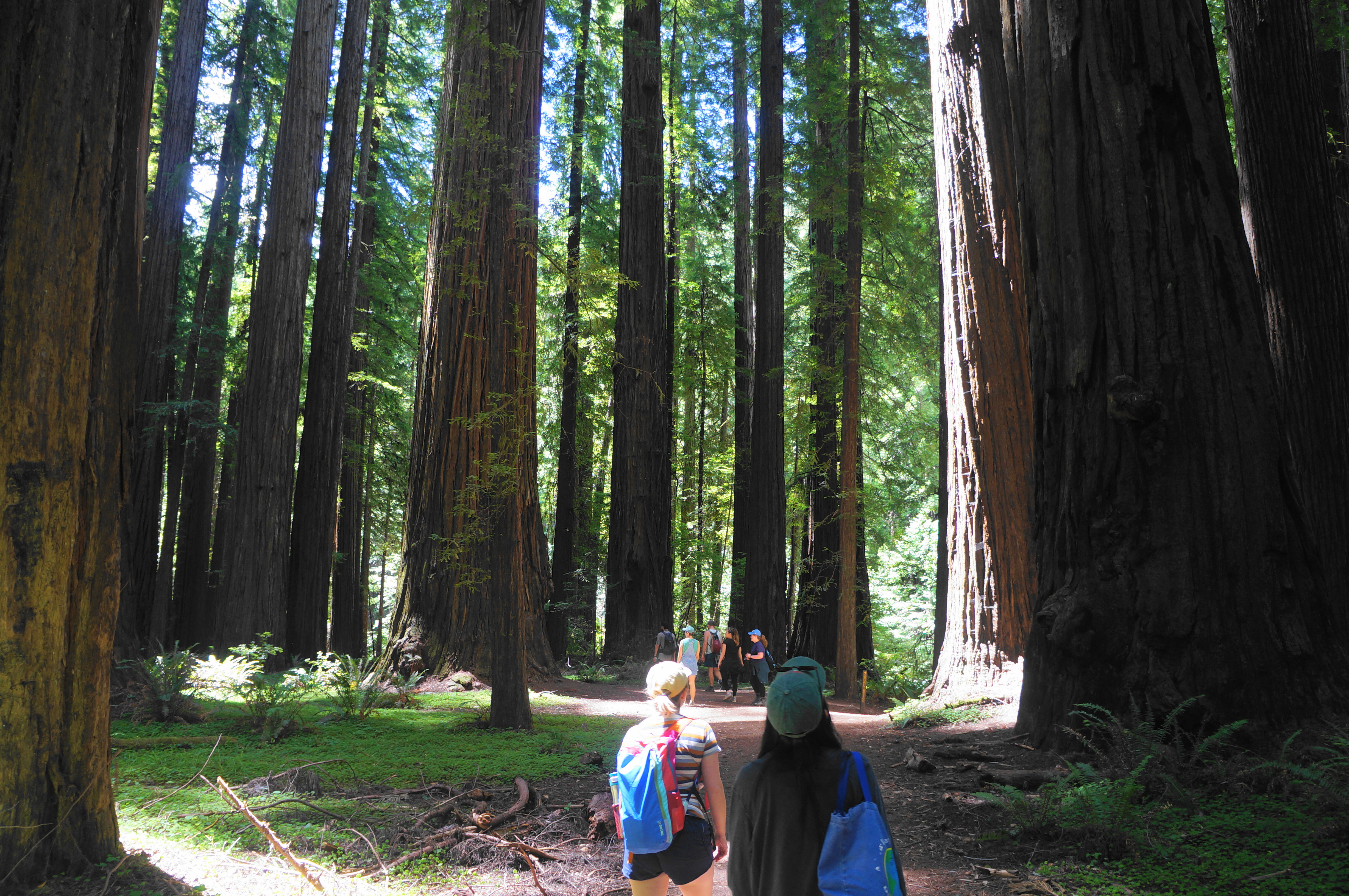
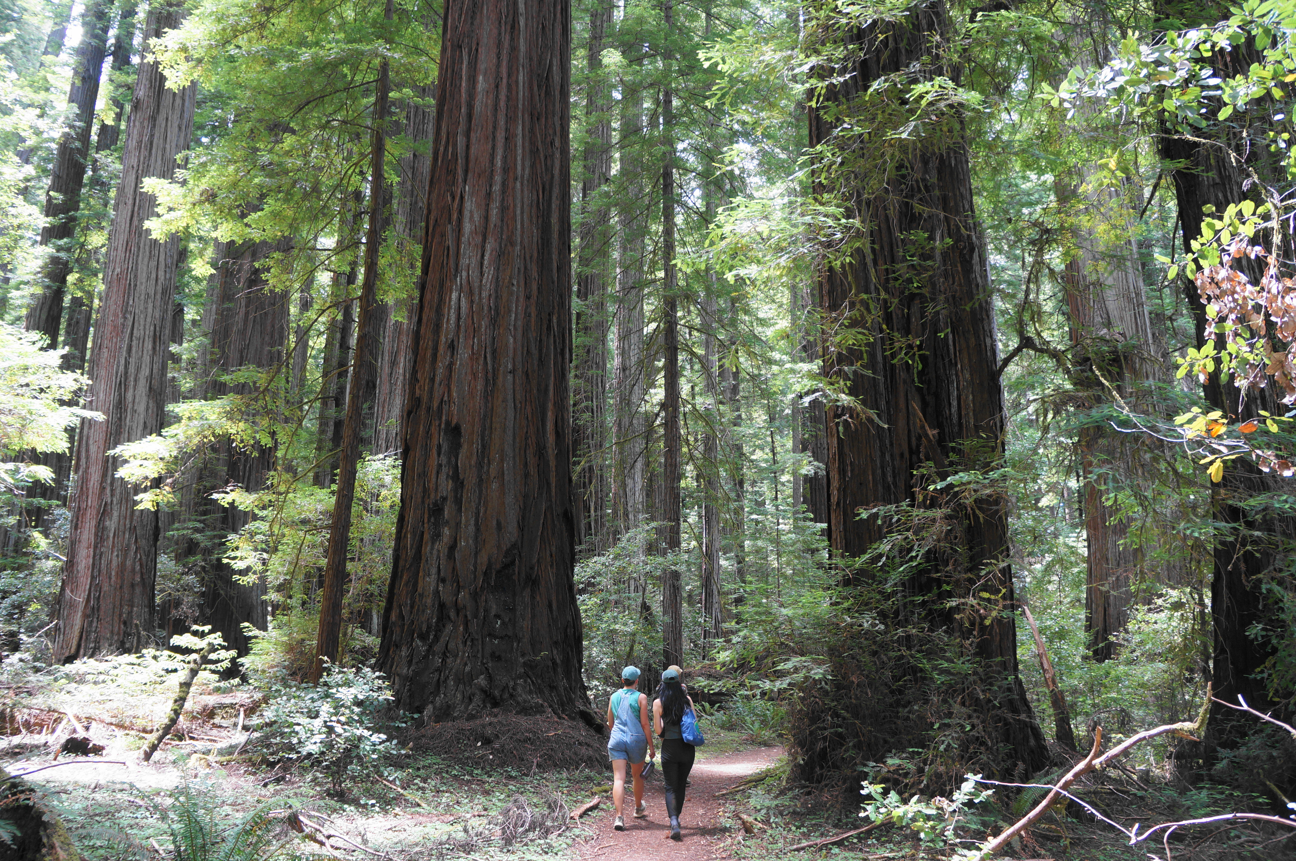
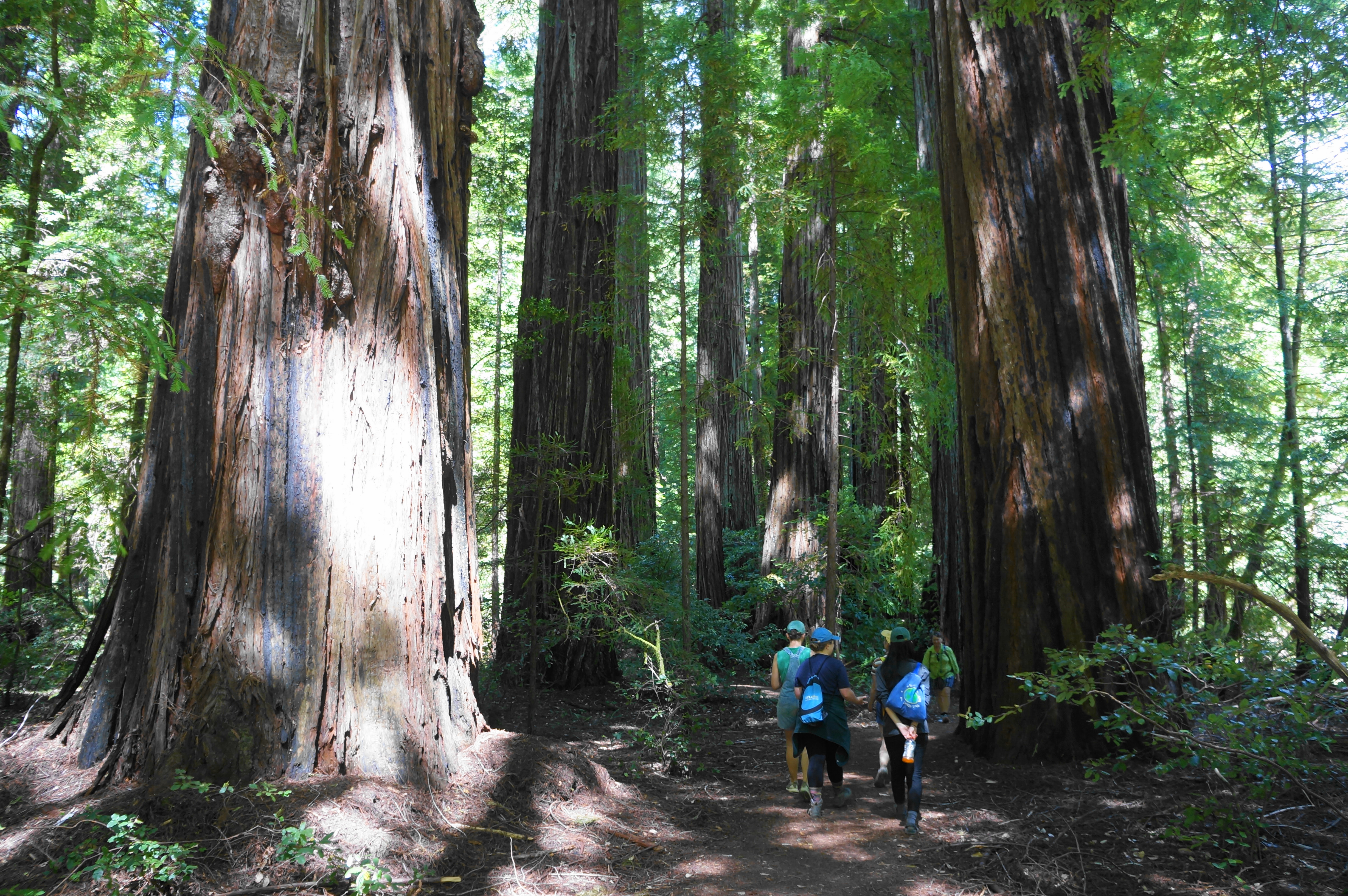
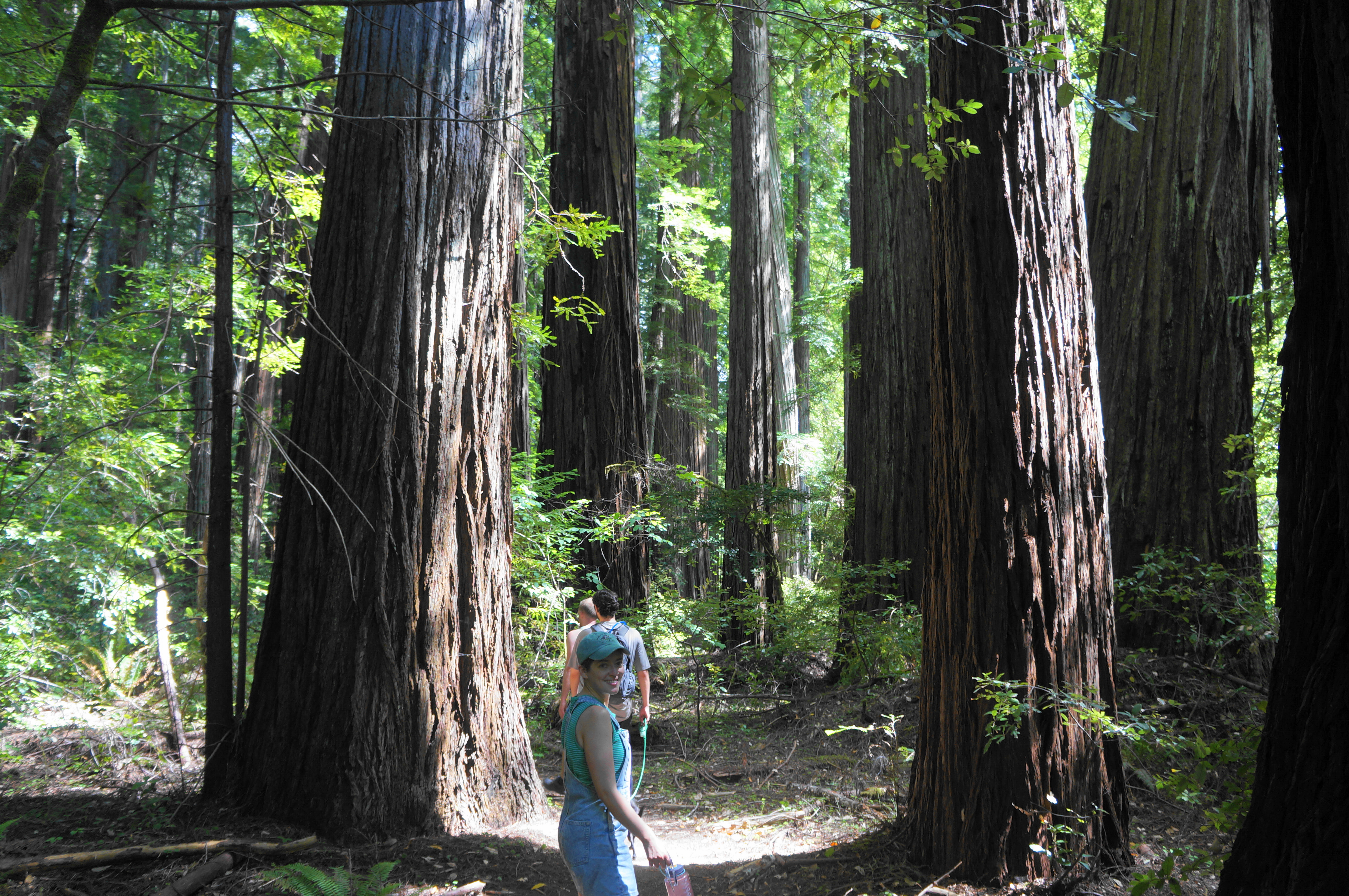
After a mild climb, the route settles into another level and pleasant trace, now quite distant from the banks of Bull Creek below. Round another right-hand bend at about 2.5 miles, clearly a lush ravine. Then the trail returns to the creekside and enters an especially scenic and memorable stretch of redwoods. Following two brief forays into the sunshine, hikers enter a beautiful grove of old-growth redwoods in what is now Upper Bull Creek Flat.

After crossing Miller Creek, another tributary, the route soon comes to a peculiar, hollowed out trunk right on the trail; it is hard to resist the temptation to pass right through the small tunnel, a memorable landmark on the hike.

The redwoods thereafter continue to be spectacular, rising high above Bull Creek. The next half-mile is perhaps the most beautiful of the whole hike, with more and more stunning redwoods at every turn. Stay right at the junction with the Johnson Camp Trail at about 3.75 miles.


Within minutes, the trail comes creekside again and follows a bridge over an unnamed tributary, with close access to Bull Creek. This is a nice place to stop for lunch before continuing on.

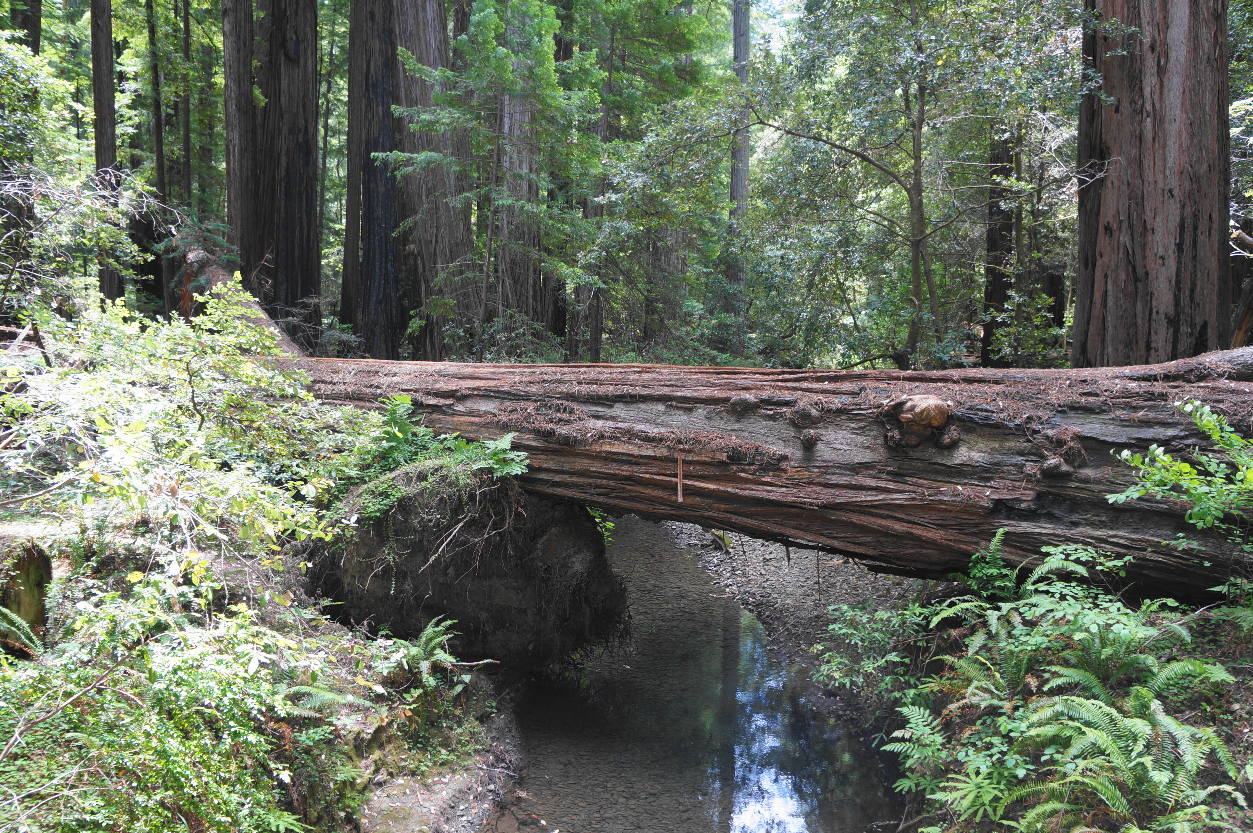
Stay right at the next three forks, passing an unmarked but particularly high-diameter tree with a wooden platform, then cross the seasonal bridge (or ford, in winter) to the Big Trees Area on the north side of Bull Creek. Bear left and rise up to a parking lot, the first seen in four miles. Here hikers can use the restroom before setting on.

The Bull Creek Flats Trail continues east from the parking area, passing close through another clump of redwoods with the stream off to the right. It is a quick walk from here to another clearing and a second, smaller parking area known as the Blue Slide Day Use Area, where the trail briefly disappears: onward hikers must follow Mattole Road for about 2/10 mile, then switch to a narrow singletrack that continues to parallel the drive for another ¼ mile.

The Bull Creek Flats Trail finally moves away from the road at around 5.1 miles, bearing south and following the creek as it meanders downstream toward the Eel River. Hikers pass redwoods by the bunches and round a hairpin left-hand bend at around 5.5 miles. There is another memorable grove about ½ mile further, after which the route comes close again to the creek, this time lined with horsetail, a bamboo look-alike.

Traverse a stone-carved cut at about 6.8 miles (evidence of trail handiwork), then enter the final stretch, a pleasant and easy (as always) meander that extends for around a mile. At last, hikers return to the Rockefeller Loop. Bear left to follow the easy track, which returns through the beautiful opening grove, for ¼ mile to find yourself back at the parking lot where the hike began, eight miles earlier.
All told, this pleasant hike would be rated as easy if it were not for the length, more than enough for many day hikers seeking a scenic jaunt in Humboldt Redwoods.

We drove the Avenue of the Giants about 20 years ago on a motorcycle trip, and I’ve wanted to return ever since. Now that we no longer have a 40 ft MH but a 24 ft one, this is on my early fall schedule. Your post is perfectly timed!
Pingback: Top 10 Hikes in 2024 – Live and Let Hike