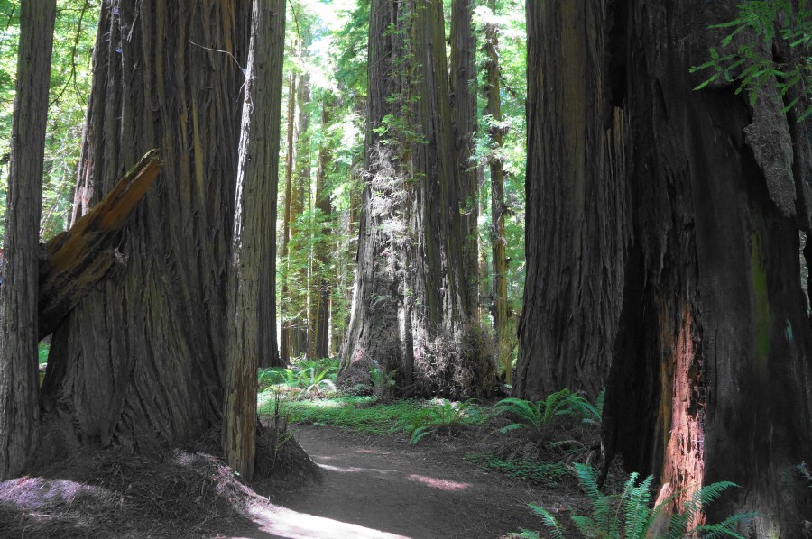
Situated in the northern reaches of California’s Humboldt Redwoods State Park, the level and easy Drury-Chaney Loop spends its entirety in a beautiful old growth redwood forest adorned with ferns and redwood sorrel. These are not the largest coastal redwoods in the area (those are found further south in the heart of the park), but the healthy state of the towering trees and verdant overgrowth that carpets the floor makes the grove exceptionally scenic. The stem-and-loop hike throughout the grove is popular, but much less so than the better-known stands elsewhere in the park. Expect to spend 1-2 hours completing the hike and gazing at the wondrous, picturesque landscapes along the easy jaunt.


The hike
The trailhead for the Drury-Chaney Loop is less than three miles from the northern terminus of the Avenue of the Giants, a world-famous scenic drive that meanders north-south through Humboldt Redwoods State Park. Here the park narrows to a thin strip of public land, wedged between Highway 101 and the tiny, unincorporated town of Pepperwood (population: 50), which likely sees far more visitors than residents on a typical day. At the southern edge of “town,” there is shoulder parking on both sides of the Avenue of the Giants. The trailhead, marked with signs and a map/kiosk, begins on the west side.

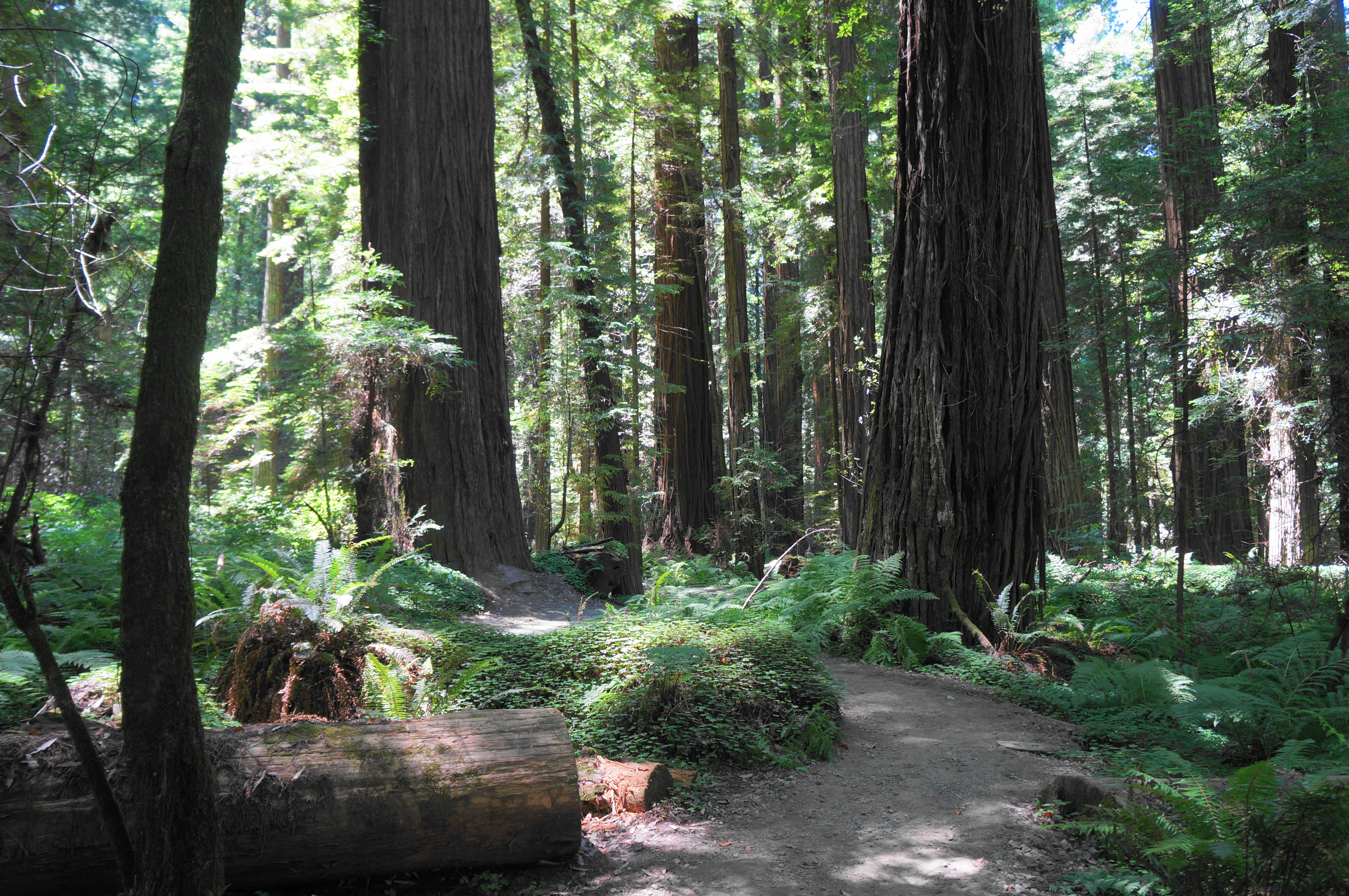
The trail, partly asphalted, traverses an entry brushland before quickly entering the dark and dense forest, where the redwoods are visible right away. New and old growth are interspersed as the trail rounds an S-curve, with the ferns soon overtaken by a lush carpet of clover-like redwood sorrel. Visitors, enamored with the showy landscape, are likely to slowly make their way through the hike, stopping to take photos whenever the light and scenery changes.

Eventually hikers come to a bench at about ¼ mile, and a peculiar one at that, as it is carved into a fallen log and marked with a sign reading “Drury Chaney Trail.” A formal (delayed) welcome, I suppose, to the loop hike.


Sometimes asphalted or graveled, sometimes dirt, the trail continues westward, deeper into the forest, finally passing several man-made rock piles and crossing an unimproved road (that appears rarely used). Thereafter, social trails become more common: thin, hiker-made paths that veer from the main path. Stay on the main, wider track, coming soon to a junction and the start of the loop portion at 0.7 miles.

Bear left first, tracing a clockwise circuit and immediately crossing a scenic wooden bridge over a seasonal stream. The trail beyond is narrower but still well-discerned, and a second bridge comes minutes later.


Now back within earshot of Highway 101, the route nonetheless keeps its distance from signs of civilization, instead meandering through further redwoods and gradually curving back north and east toward the start. As the trail makes a decisive bend east, there is a nice bench on the left. Another bench, this one named for (donors) Harry and Norma Irving, is encountered soon thereafter. The fern cover is particularly dense in this area.


After passing a large stump on the right, the trail closes the loop, and hikers return to familiar ground. Turn left, traversing the old road again, and return a little more than a half-mile back to the trailhead, capping off a 2.3-mile leg-stretcher full of scenic vantages.


Pingback: Top 10 Hikes in 2024 – Live and Let Hike