
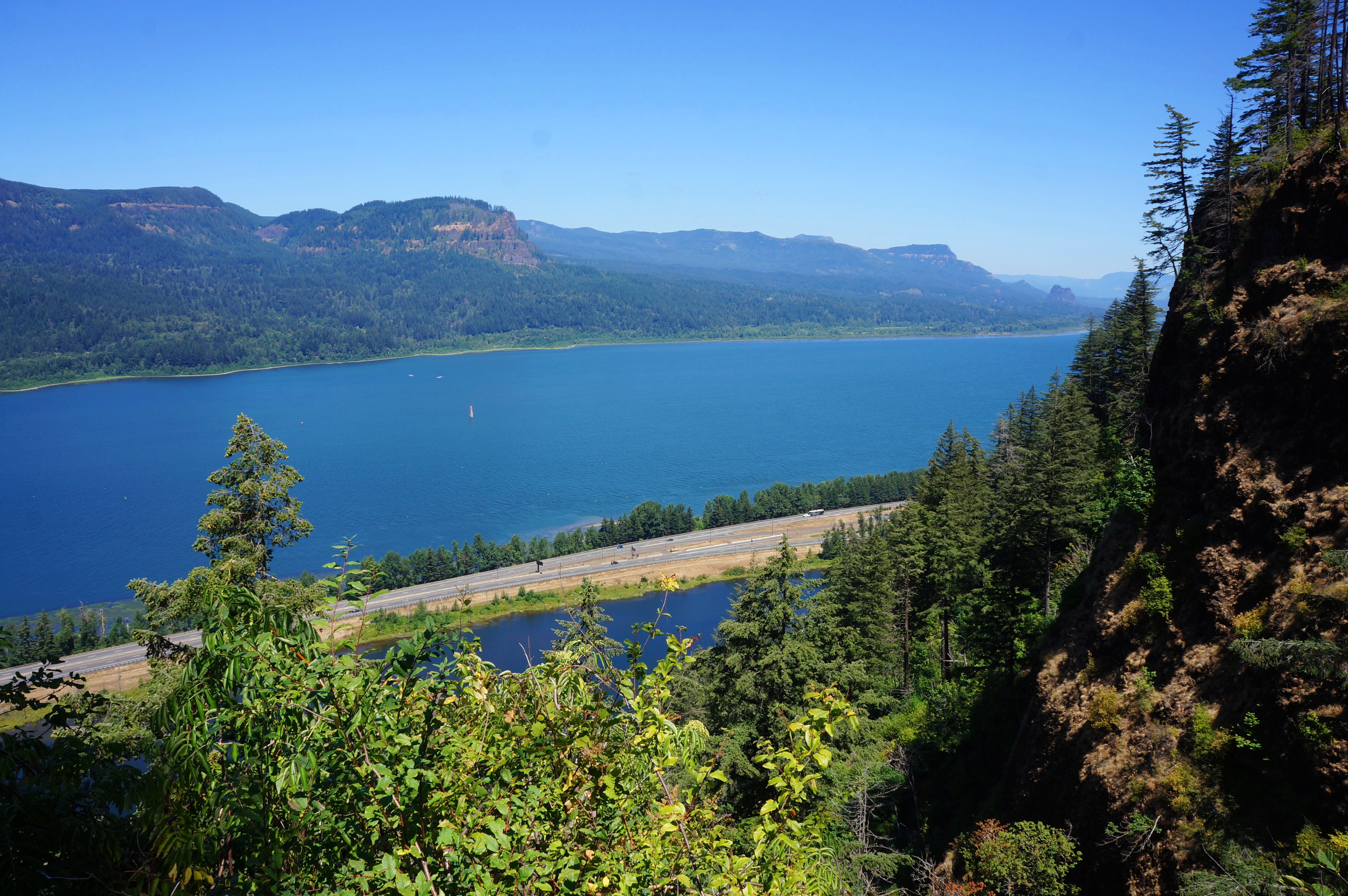
After three days on the Oregon coast, day five of the cross-country adventure brought us to Portland, Oregon—where we happened upon the annual convention of the National Parks Travelers Club—and ventured out on some hikes in the nearby Columbia River Gorge. After spending the night at Cape Disappointment in Washington state, we decided it was about time—having gone 1,000 miles out of our way—to start heading east toward the final destination: the other Washington, the nation’s capital…
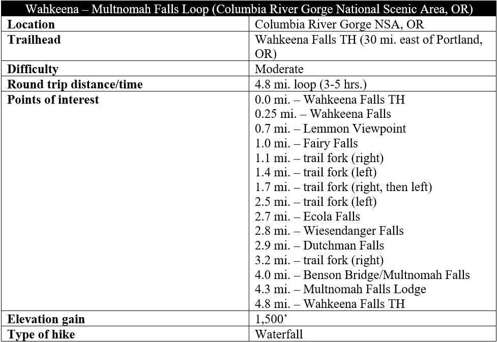
The Columbia River Gorge—situated in close proximity to Portland, Oregon—boasts a rare temperate rainforest and dozens of spectacular waterfalls. Most visitors, however, barely stray from their cars to see only the most-accessible of the bunch. It is considerably more rewarding (and with fewer parking headaches) to trace a multi-mile hike that links several of the chutes while getting the heart racing as you climb the sharp escarpment to views across the scenic gorge. One such 4.8-mile option mixes two oft-visited falls—Wahkeena and Multnomah—with four lesser-known flumes—Fairy, Ecola, Weisendanger, and Dutchman—on a moderately strenuous loop. Start at the Wahkeena Falls parking area (busy—but less so than Multnomah) and ascend 1,500 feet before dropping into the Multnomah Creek drainage and returning to the base of the canyon. The 3- to 5-hour hike is one of the most rewarding and arguably the best use of a half-day in the Columbia River Gorge.

The hike
Make your way along the Historic Columbia River Highway—which parallels noisy Interstate 84—to the Wahkeena Falls Picnic/Day Use Area, which doubles as the trailhead. The woody parking area fills up quickly on busy summer days (though there is no timed-use reservation required as there is for Multnomah). There is a restroom and picnic tables at the site.
Once you have snagged a spot, carefully cross the road to the south side, where hikers can immediately hear the rush of Wahkeena Falls—although the main cascade remains obscured from view. There are some stairs up to a stone viewing platform steps from the road; from here one can make out parts of the waterfall, though still at quite a distance.
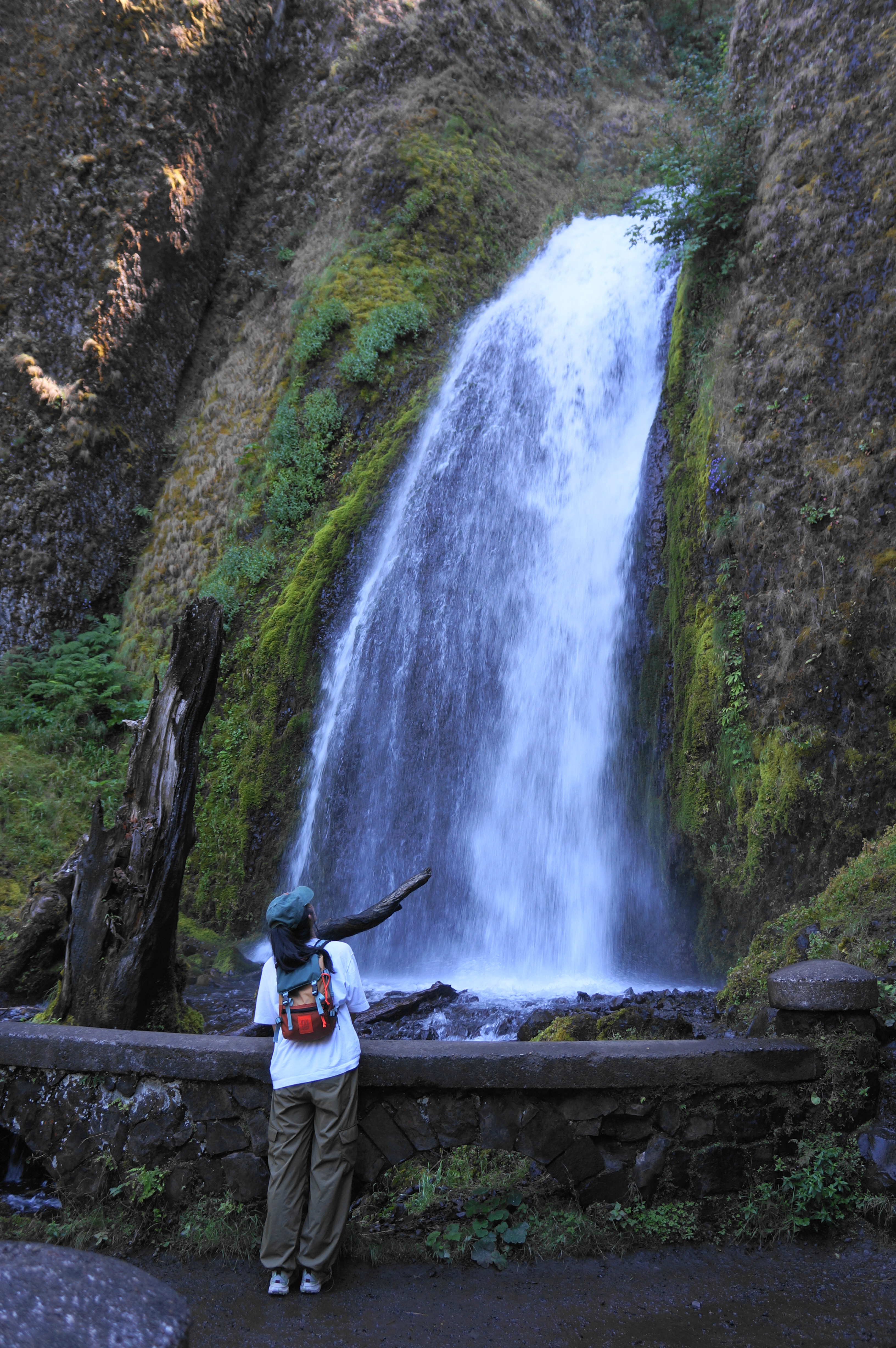
To properly see the falls and get the 5-mile hike underway, follow the paved track to a split, then bear right, ascending a steep, asphalted incline. Follow this for 1/10 mile to a switchback left, after which the trail routes back toward Wahkeena Creek. Under a canopy of firs, hemlocks, and maples, ascend to a spot ¼ mile from the start where the Wahkeena Trail crosses a bridge so close to the main falls that one can easily feel the spray. Here the creek makes its way through a narrow channel and drops about 30-40 feet (as part of a multi-tiered 242-foot drop). The stone handiwork of the bridge is also very impressive.

Only a fraction of visitors to Wahkeena Falls continue past this point, but those who do are rewarded with scenic vistas and more, tucked-away cascades. With the pavement ending, the onward trail courses eastward, then proceeds into a section with 11 switchbacks—longer at first, then coming in quick succession.

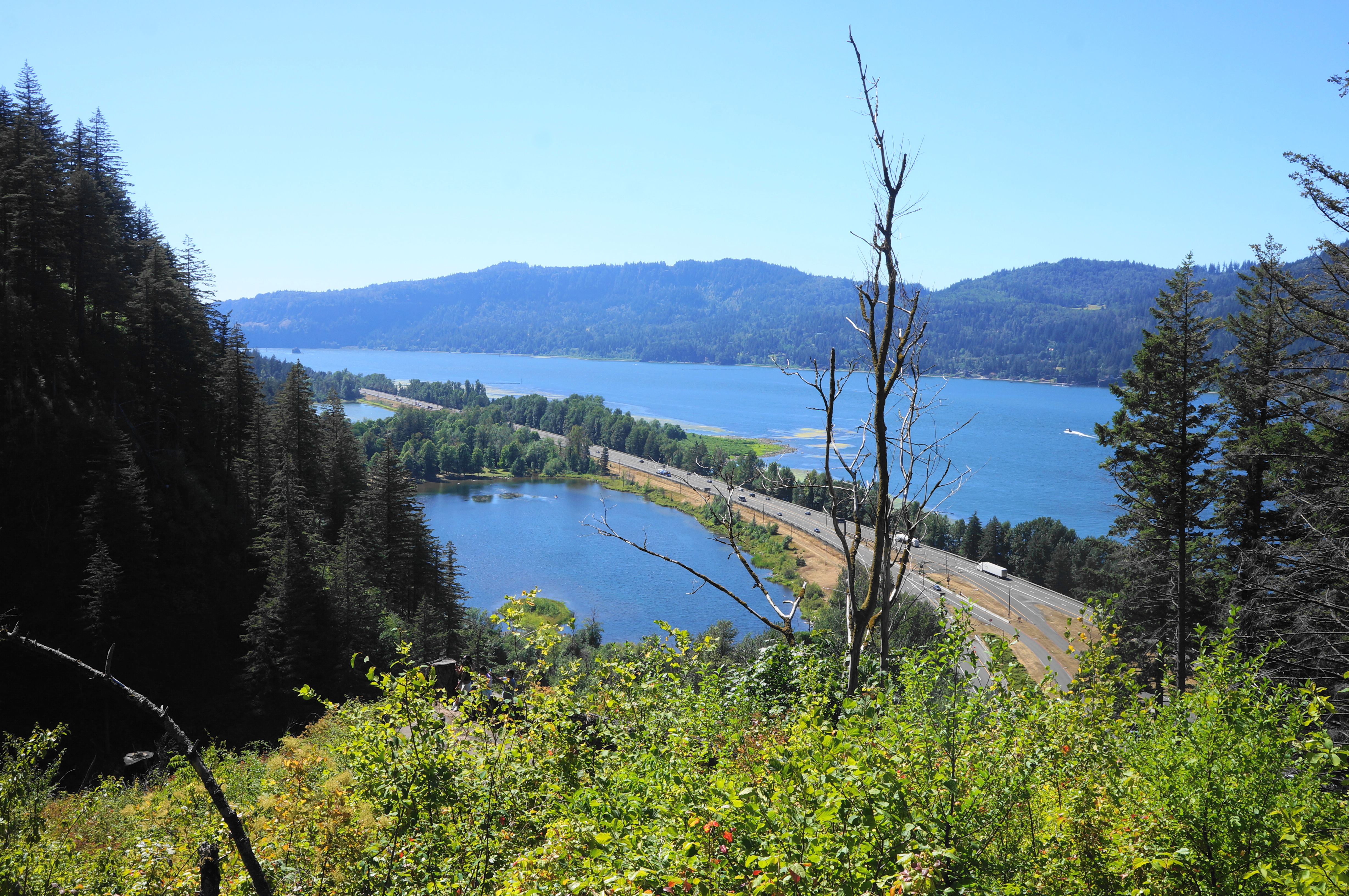
The challenging slog ends after clearing about 450 feet in elevation gain. Atop a narrow ridge, come to a trail fork: it is worth the brief detour right, which leads to the Lemmon Viewpoint, a dead-end vista with wide north-facing views across the Columbia River to Washington.

When ready, return to the fork and continue right this time, leaving behind more crowds of hikers who likely turned around at the viewpoint. From here the trail gets wilder and more remote, though the allure is tempered a bit by the destruction of the Eagle Creek Fire, which tore through the Columbia River Gorge in summer 2017. What was once lush and shady landscape feels hotter and more exposed—though some of the riparian vegetation, especially around the creek, has begun to recover.
An unmarked spur trail (that yours truly missed) leads from here down to the small and intimate Necktie Falls (a.k.a. Upper Wahkeena Falls). But the main track bears south into a narrow canyon, coming parallel to Wahkeena Creek, then crossing it on a small wooden footbridge at about ¾ mile.
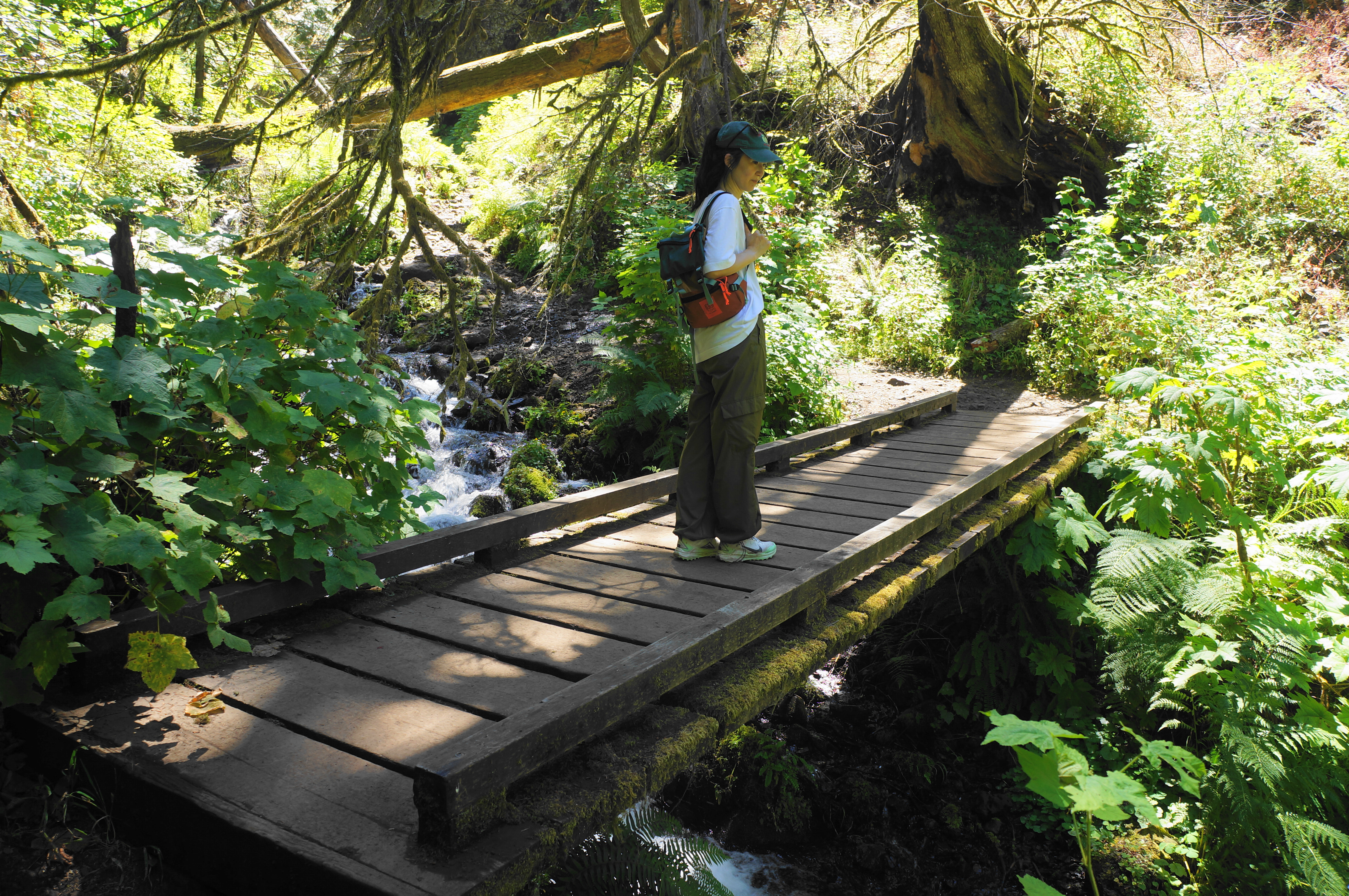

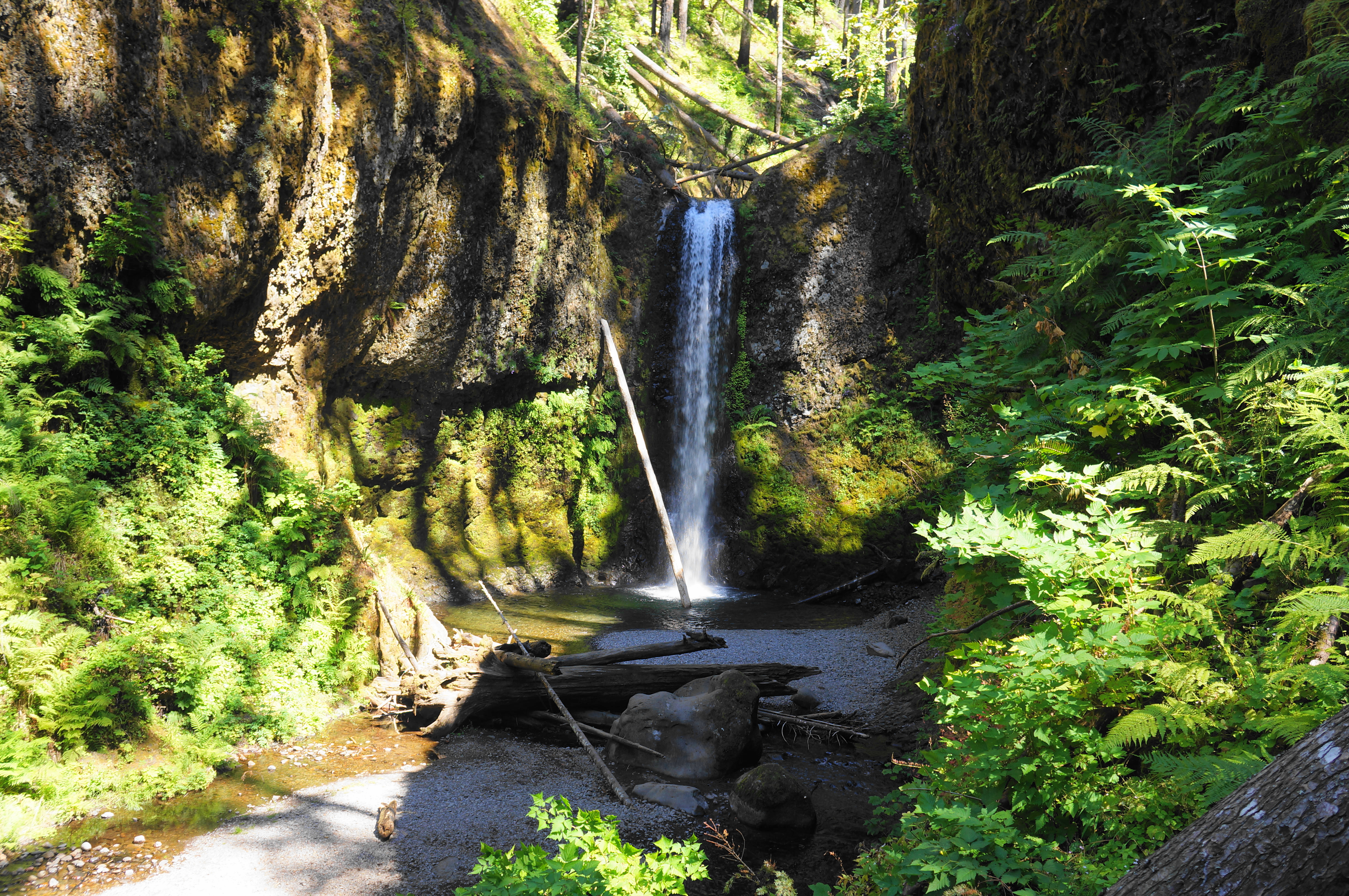
Ascend through a thin notch carved by the creek, then cross another bridge back to the east side of the creek. Proceed up two switchbacks, then ascend to a second pair of wiggles and pass the confluence of two streams. Here the path switches back and forth twice more, then comes to Fairy Falls, a more modest drop of 20-30 feet—but, again, right next to the trail. A bench offers a place to rest, with 800 feet in gain complete (but another 700 to go).

After Fairy Falls, the trail ascends another five switchbacks, with views of a pleasant cascade. Eventually the route rounds to the adjacent ravine—the one fed by the stream that forms Fairy Falls—and splits: the Vista Point Trail (#419) heads left, while the Wahkeena Trail (#420) continues right. Heading right is a little shorter—and easier—but the two routes connect again further up the mountain.

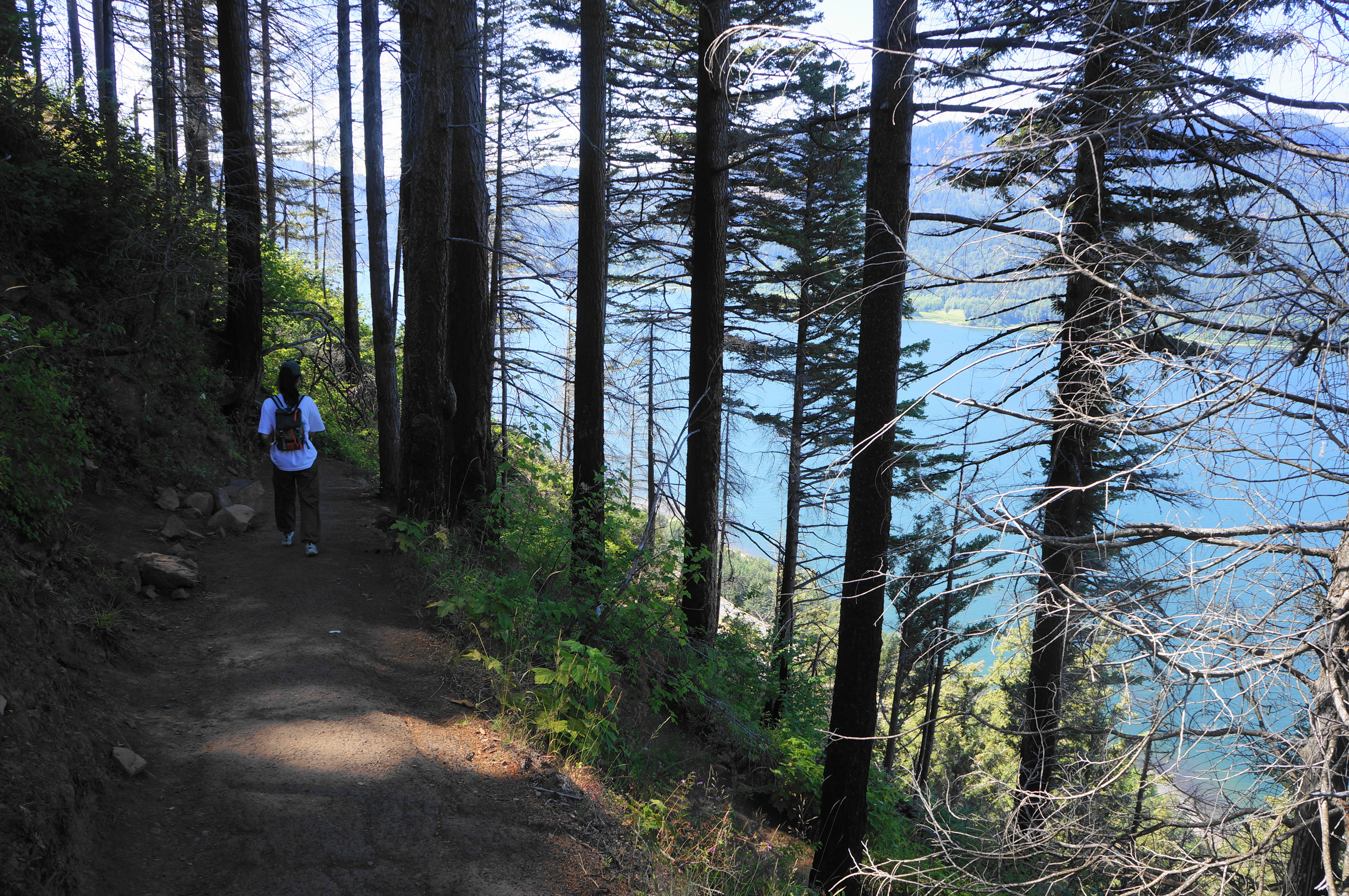
Staying on the Wahkeena Trail, the route cuts through a thick understory and pivots between the two drainages before settling on one and following it uphill to another junction (stay left). Ascend toward a ridgeline dotted with conifers. The burn damage here is pretty rough but allows for at least less obstructed views down to the Columbia River. Come to a three-way junction at around 1.7 miles, and stay right, but then left at another junction that immediately follows. Cross Shady Creek after a couple more minutes, then proceed through a relatively level section that is welcome after the earlier climb.


Coursing eastward, the trail briefly descends, with the views down to the Columbia River improving slightly. This lengthy section makes its way toward the Multnomah Creek drainage, a relatively spacious valley that hikers enter at around 2.5 miles. Dropping considerably, come to a junction that is somewhat easy to miss; instead of proceeding up-canyon, take a hard left onto the Larch Mountain Trail and continue downhill, soon coming streamside.

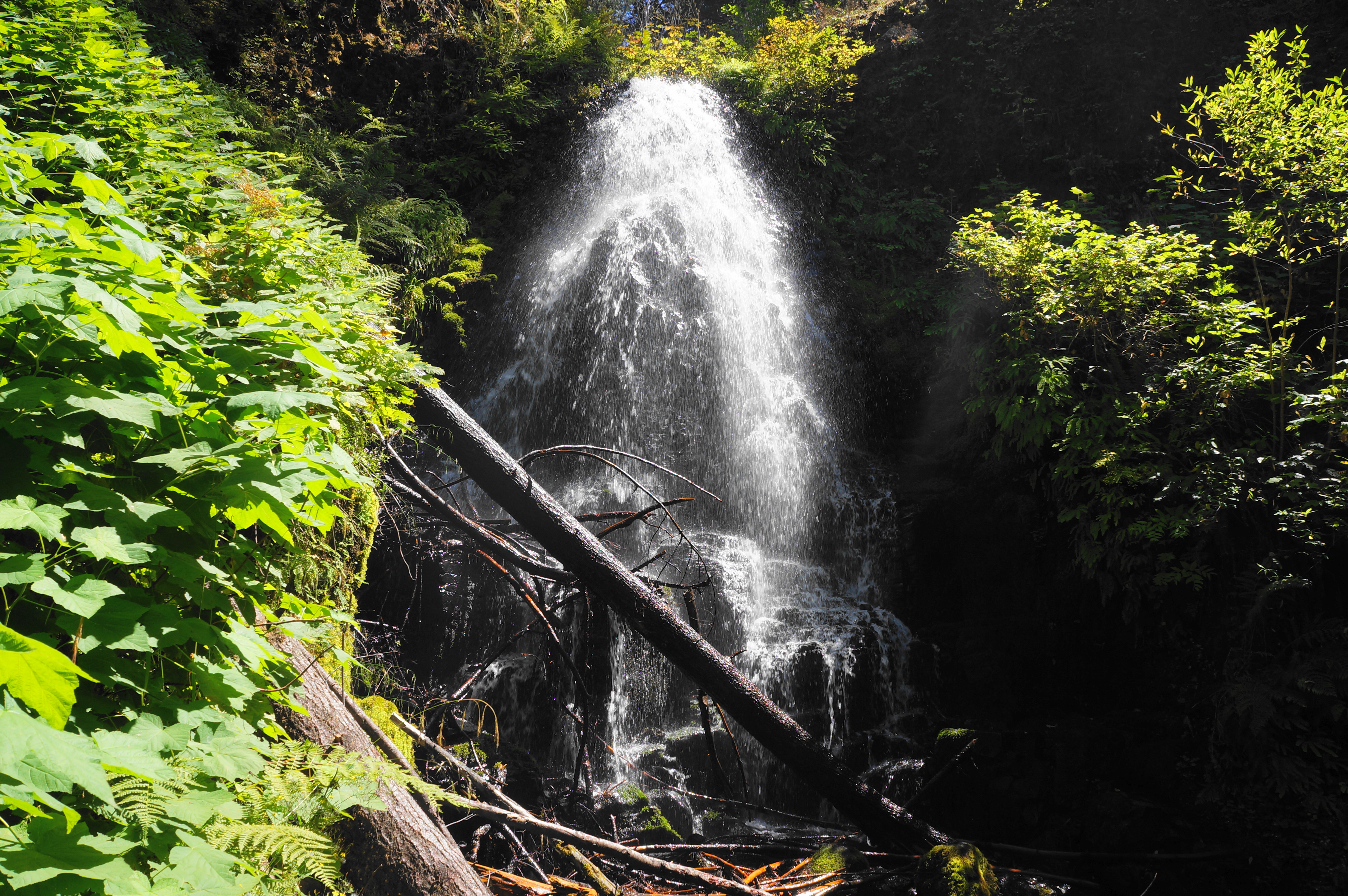
It is a relatively short walk until the clogged stream becomes a torrent, suddenly and precipitously falling 55 feet: this is Ecola Falls, which is not easy to see in full because of the deep canyon it carves. (Note: Be careful around here, as there is not a good, safe spot to view the falls, even off-trail.) Ecola is the Chinook word for whale.

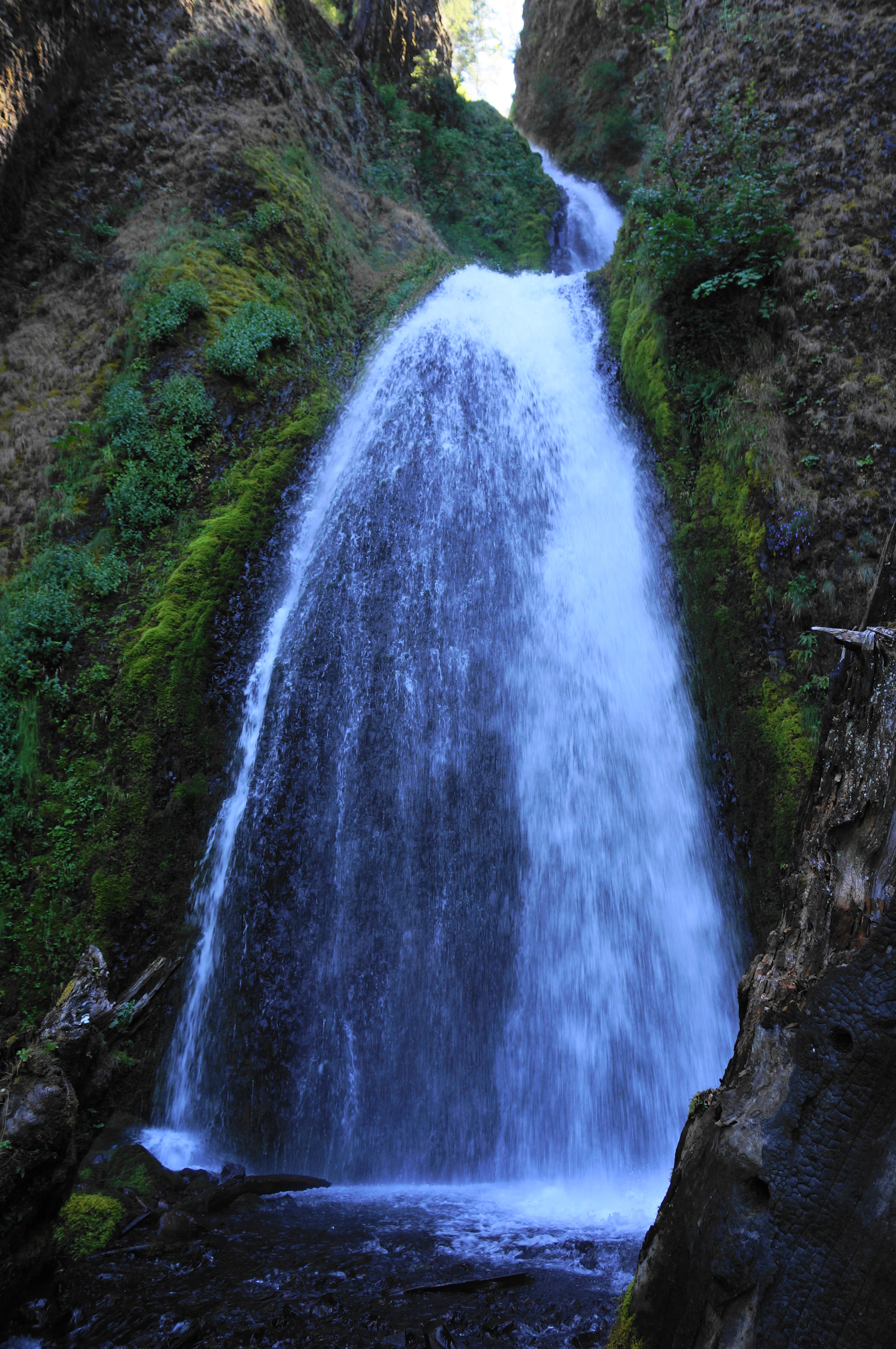
Continuing downstream, with the canyon now much narrower, the trail approaches Wiesendanger Falls, also about 55 feet and similar to Ecola, but much easier to view. The Larch Mountain Trail first passes the lip of the chute, then it switchbacks down into the gorge near its base; eager hikers can walk upstream about 50 yards to the pool fed by the single-drop falls.
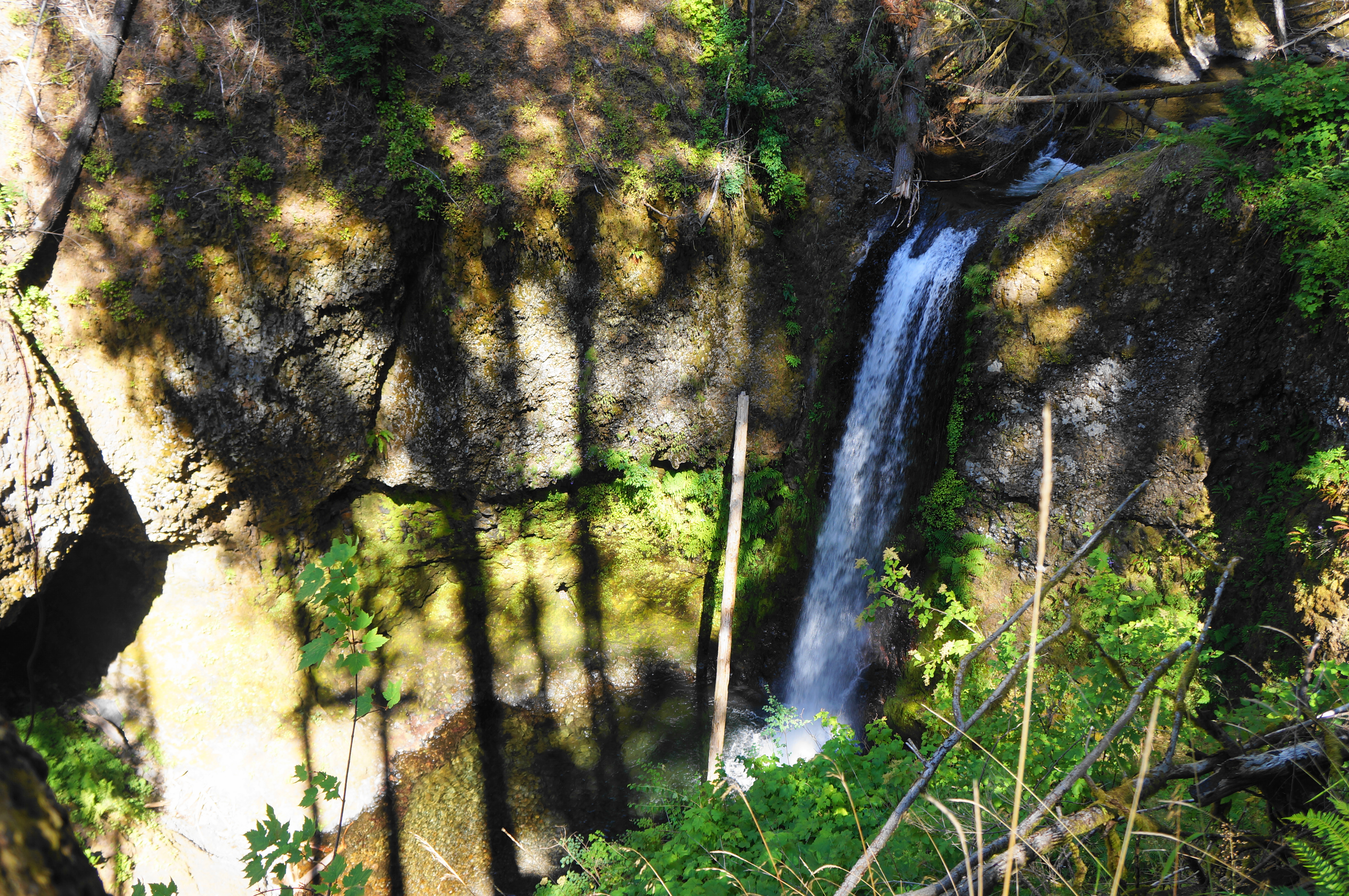

Now paralleling the left bank of the creek, the path passes under a bulging alcove. Round a gentle corner and come to the first of two much more modest cascades: both are considered to make up Dutchman Falls. The first, often highly obscured by the undergrowth, is just 10 feet and difficult to see. The second, encountered steps later, is more visible (yet was somewhat choked with logs as of summer 2024).


With the stream now jumping regularly in fits and starts, proceed further downhill until crossing a stone bridge to the north side of the canyon. The trail thereafter veers away from the creek, ascending again and re-encountering some highly-weathered asphalt. A trail junction at 3.2 miles offers a choice: many proceed left to see the top of Multnomah Falls. But given the base is much more enjoyable, I recommend skipping and staying right. Here the track mounts another ridgetop with views to the Columbia River.
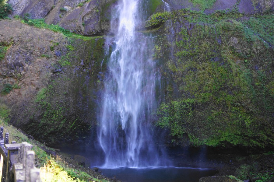
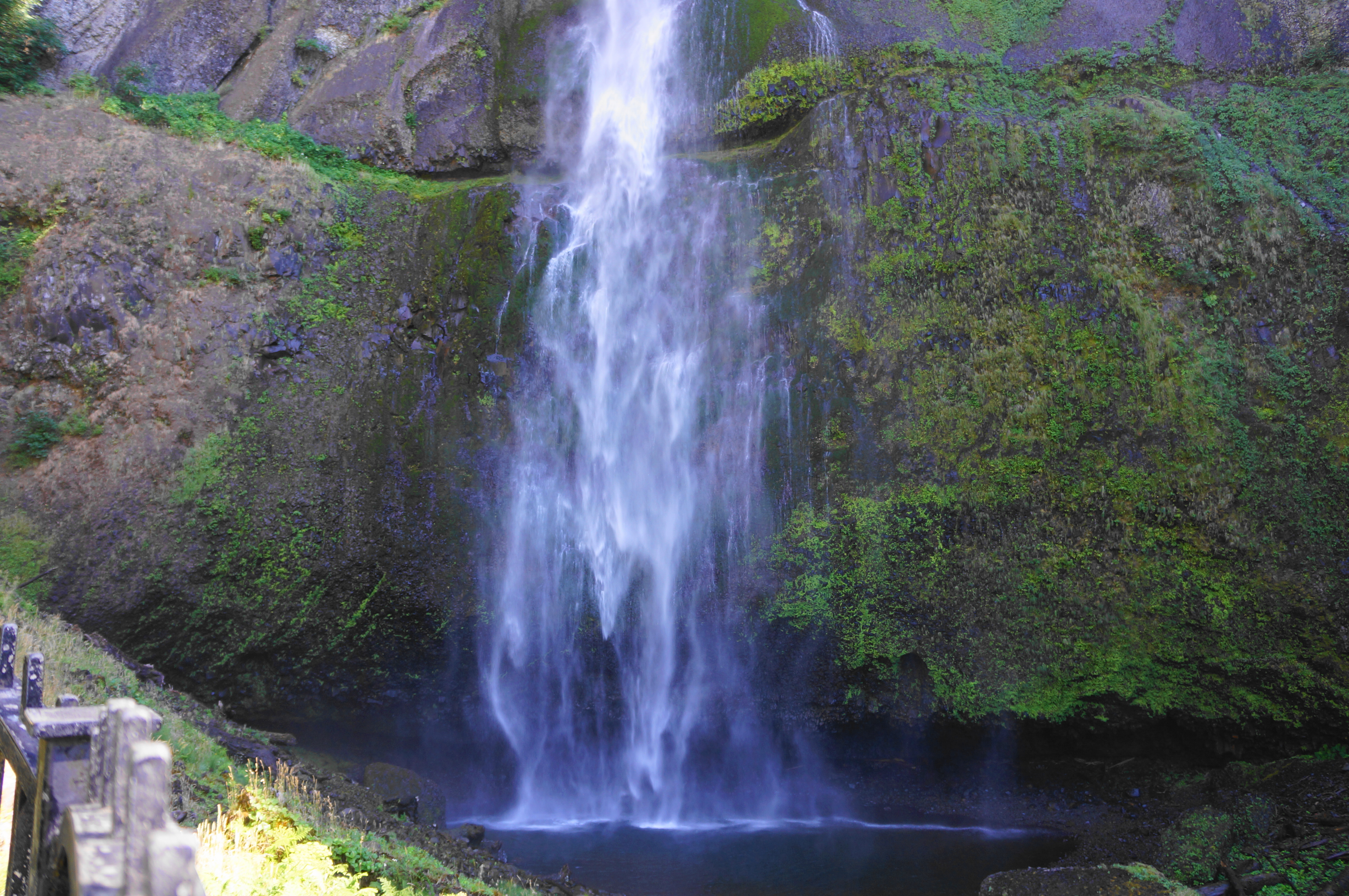
The subsequent section is all downhill, and you will likely be fighting the Multnomah Falls crowds in reverse. Begin a set of switchbacks—nine in all—as the trail drops down the north-facing flank toward the area’s most famous (and most-visited) waterfall. While views of the river are aplenty, the waterfall remains out of sight until reaching the fourth switchback (marked #5, based on the count from the bottom). Here one gets a side-angle view of Multnomah Falls, which—at 620 feet—is the tallest waterfall in all of Oregon. The majestic falls drop in just two swoops, with the tallest freefall clocking in at around 540 feet.

There are then two views of the falls, one with an official bench for resting. Then, dropping briefly away from Multnomah, the trail sheds another 100 feet and comes to a junction with the Gorge Trail; stay left, tracing back west toward the Multnomah Creek drainage again.
From here it is a short jaunt to Benson Bridge, a famous landmark set between the upper and lower falls, with the best view of the pool into which the higher drop plunges. Expect to share this bridge with dozens of other onlookers, most of which made the mild, ¼-mile climb from their cars.

With the Multnomah Falls Lodge in sight, cross the bridge and proceed down a series of paved squiggles, coming soon to another viewing platform, this one taking in both the upper and lower falls, with Benson Bridge in between.

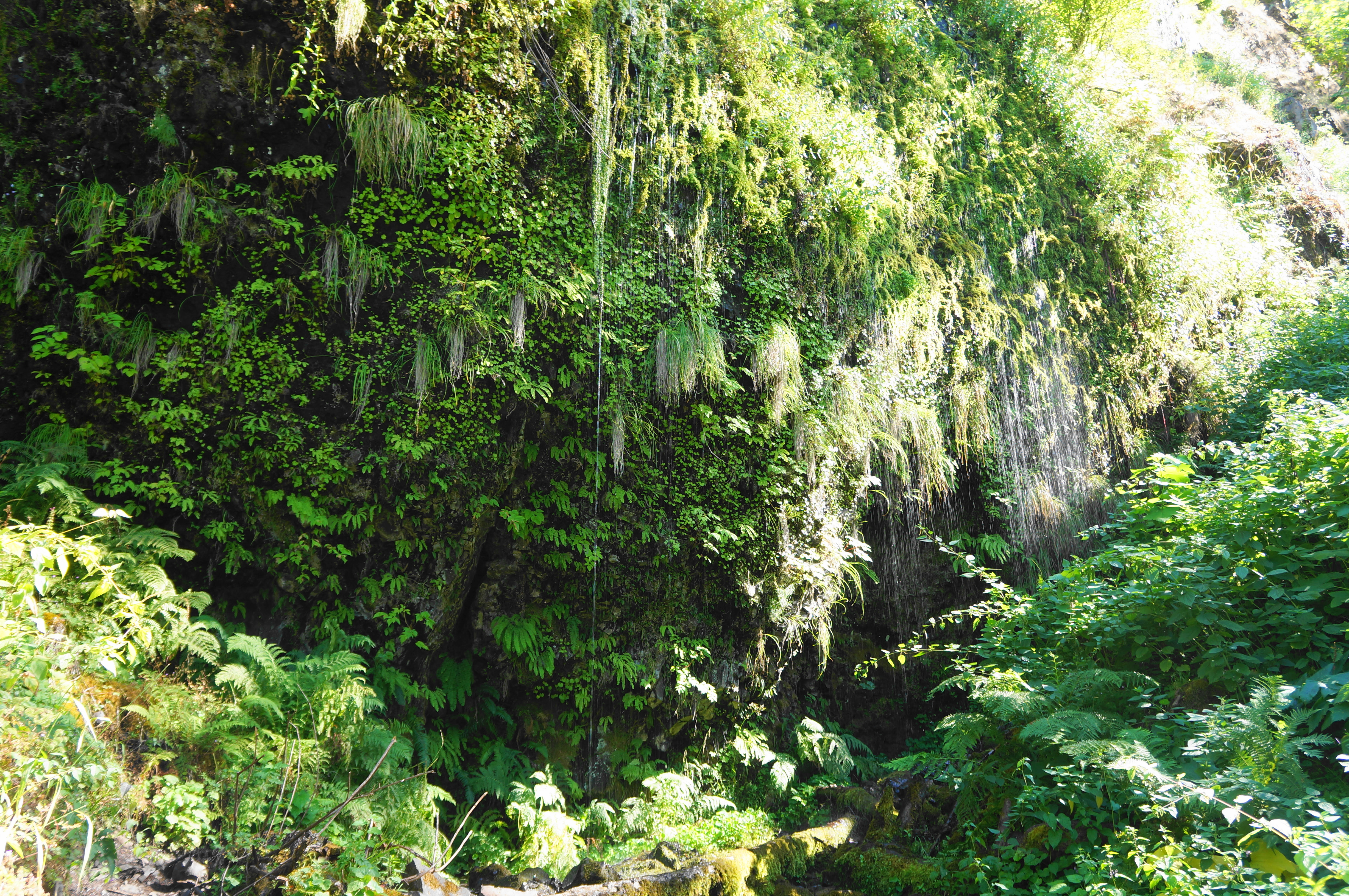
It is a short walk from here to the lodge, which sells burgers and ice cream—perhaps a worthy reward after completing (most of) the loop hike. But when you’re ready, there is still ½-mile to go to return to the Wahkeena Falls Day Use Area. Look for the so-called Return Trail, which skirts the parking lot before paralleling the historic parkway as it bears westward. This final stretch is not particularly notable compared with the rest, although a small alcove about halfway features dripping waters that make for a nice natural shower on a hot summer day…
At last, after 4.8 miles, the loop ends back at Wahkeena Falls. This moderately-challenging circuit will test those not used to elevation gain. Allot around 3-5 hours for the entire walk.

Pingback: Wahclella Falls (Columbia River Gorge National Scenic Area, OR) – Live and Let Hike
Pingback: Top 10 Hikes in 2024 – Live and Let Hike