
Heading south and east from the Bitterroot Range, I spent the night at Lewis and Clark Caverns State Park and then–in a rather spontaneous move–set out for a day in Yellowstone, America’s first national park. The park, of course, is massive, so I bit off only a sliver of the northwest section, completing a disappointing hike in the morning but compensating in the afternoon with this wonderful 7-miler.
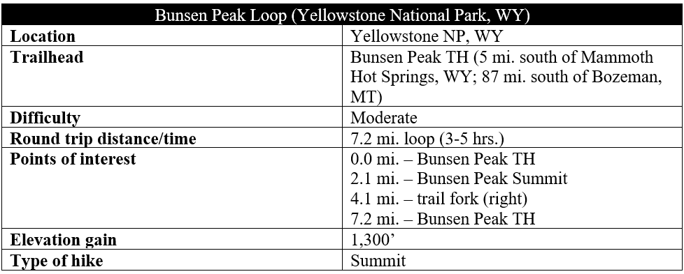
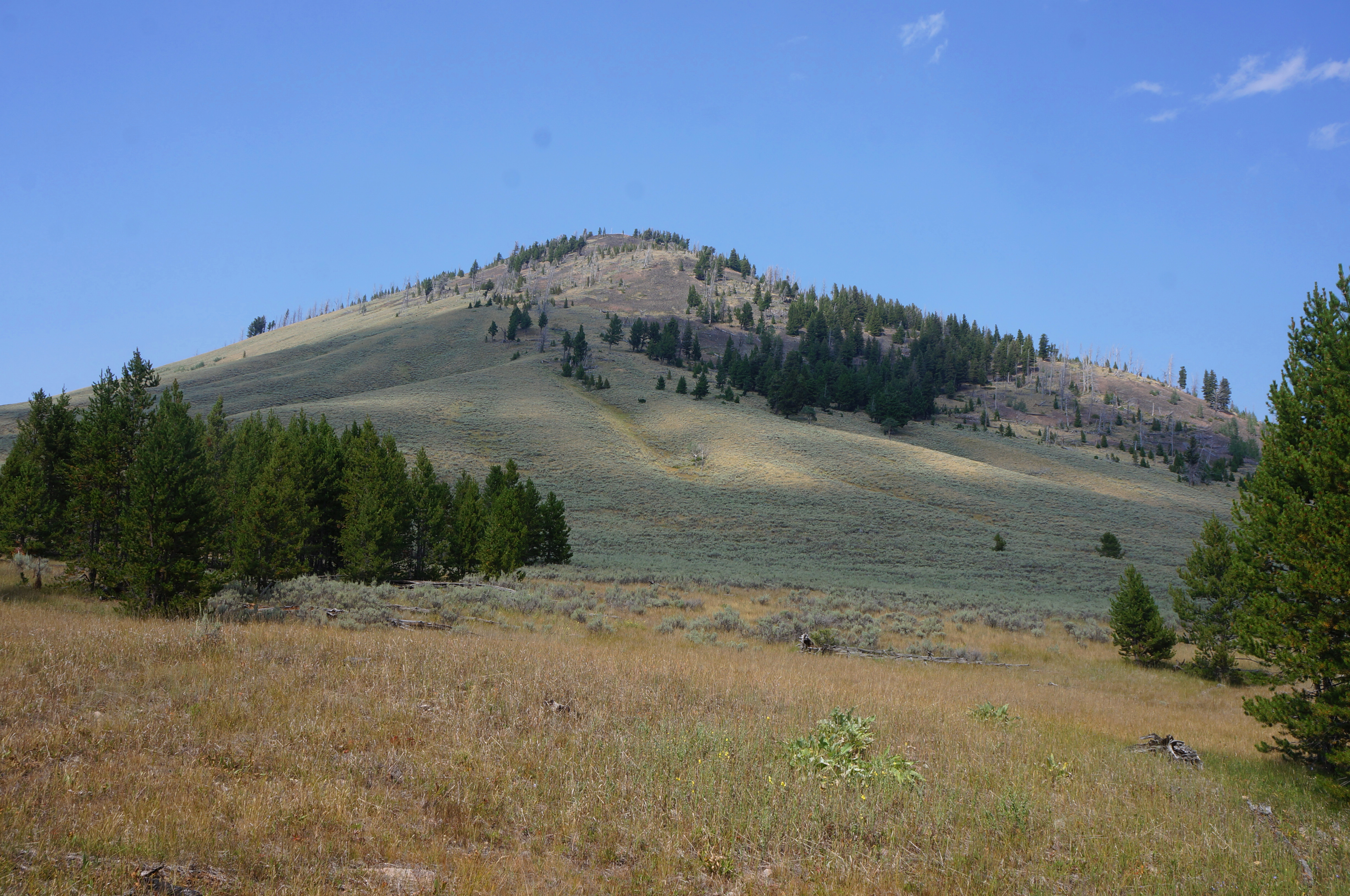
Named for the same German scientist who invented the Bunsen burner, Bunsen Peak (8,564’) is a prominent peak set high above Gardner’s Hole and Mammoth Hot Springs in northwest Yellowstone National Park. Today the summit is a popular day hike destination with panoramic vistas across the vast Wyoming/Montana landscape. Continuing on past the summit, ambitious hikers can turn this hike into a 7.2-mile loop (or a 10-miler if adding the spur to Osprey Falls).
The hike
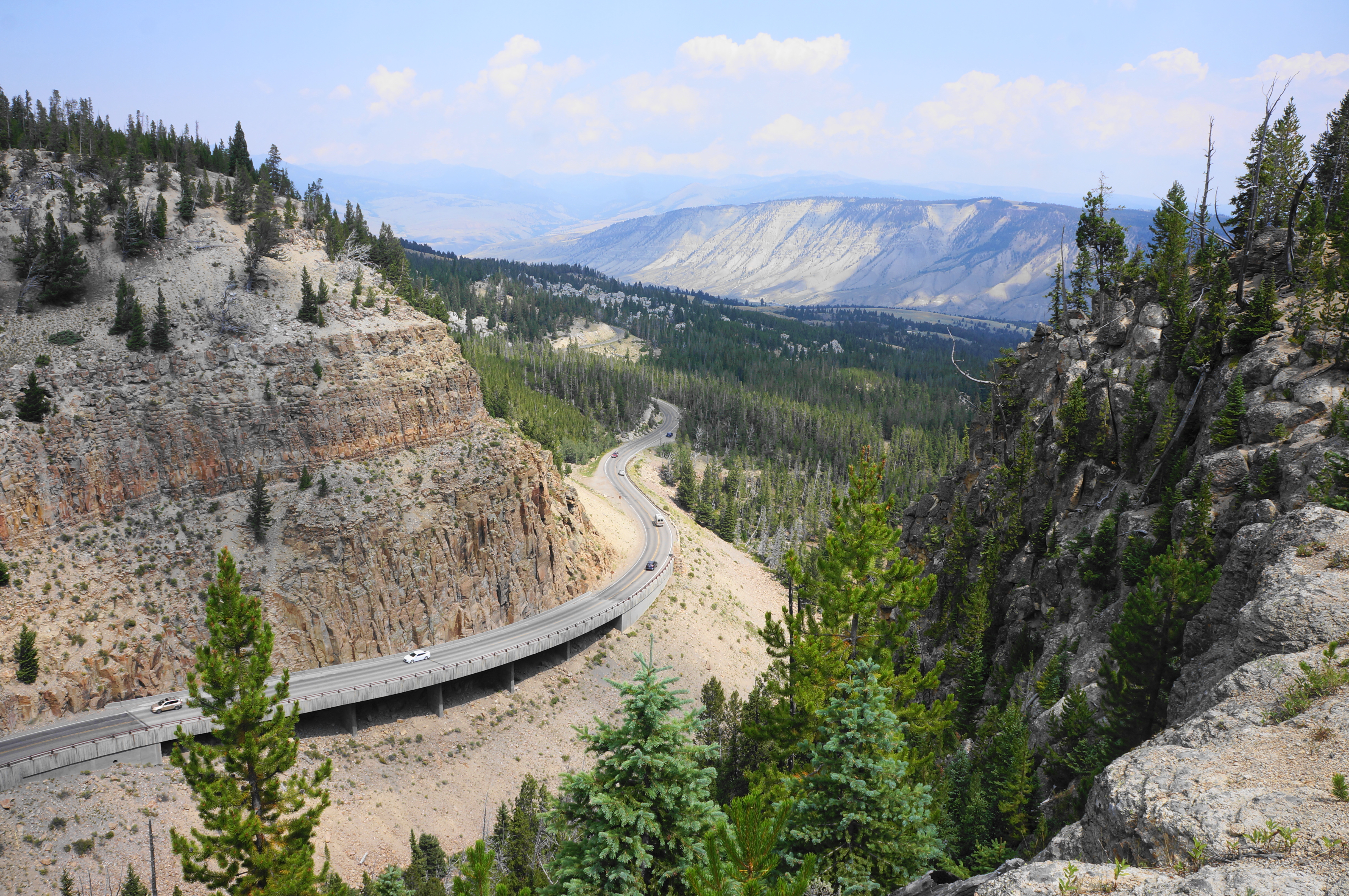
Coming from Montana to the north, US Highway 89 rises out of Gardner Canyon to Mammoth Hot Springs in northwest Yellowstone National Park, then splits into the Grand Loop Road. Continue south as the popular drive ascends from Mammoth to a narrow notch called the Golden Gate, where there is a pull-off with a view across Kingman Pass (7,120’) and roadside Rustic Falls.
Atop the basalt cliffs, the terrain suddenly levels off at Gardner’s Hole, a scrubby basin at the head of the Gardner River. Look here for the Bunsen Peak Trailhead on the left (east side of the road). (Note: The small roadside parking lot sometimes fills to the brim—however, given hiking in Yellowstone is not nearly as popular as it is in nearby Glacier, chances are there will be a spot. If not, there is another, smaller parking area across the road.)

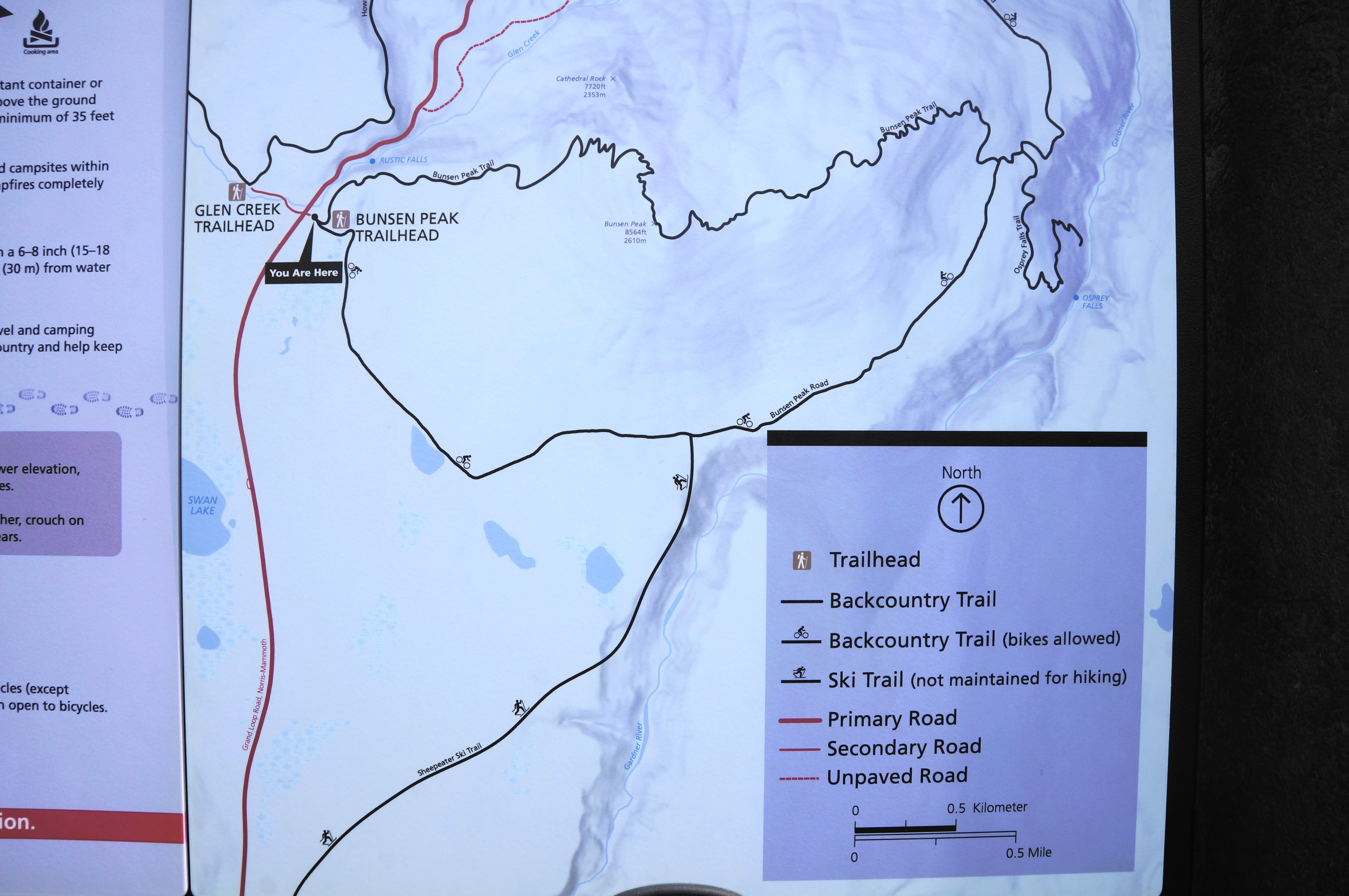
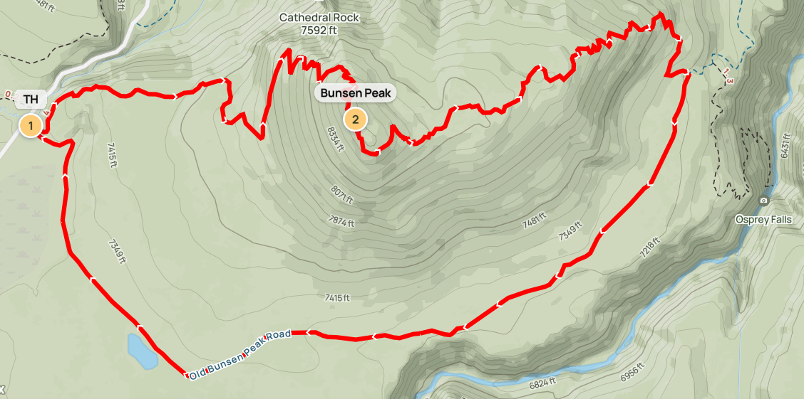
Bunsen Peak (8,564’), thought to be the eroded remains of a volcano that never blew its top, is clearly visible from the parking lot. There are two routes leading eastward from the trailhead, including the summit-mounting Bunsen Peak Trail and the milder Bunsen Peak Road, which will serve as the return route for this 7-mile loop hike.
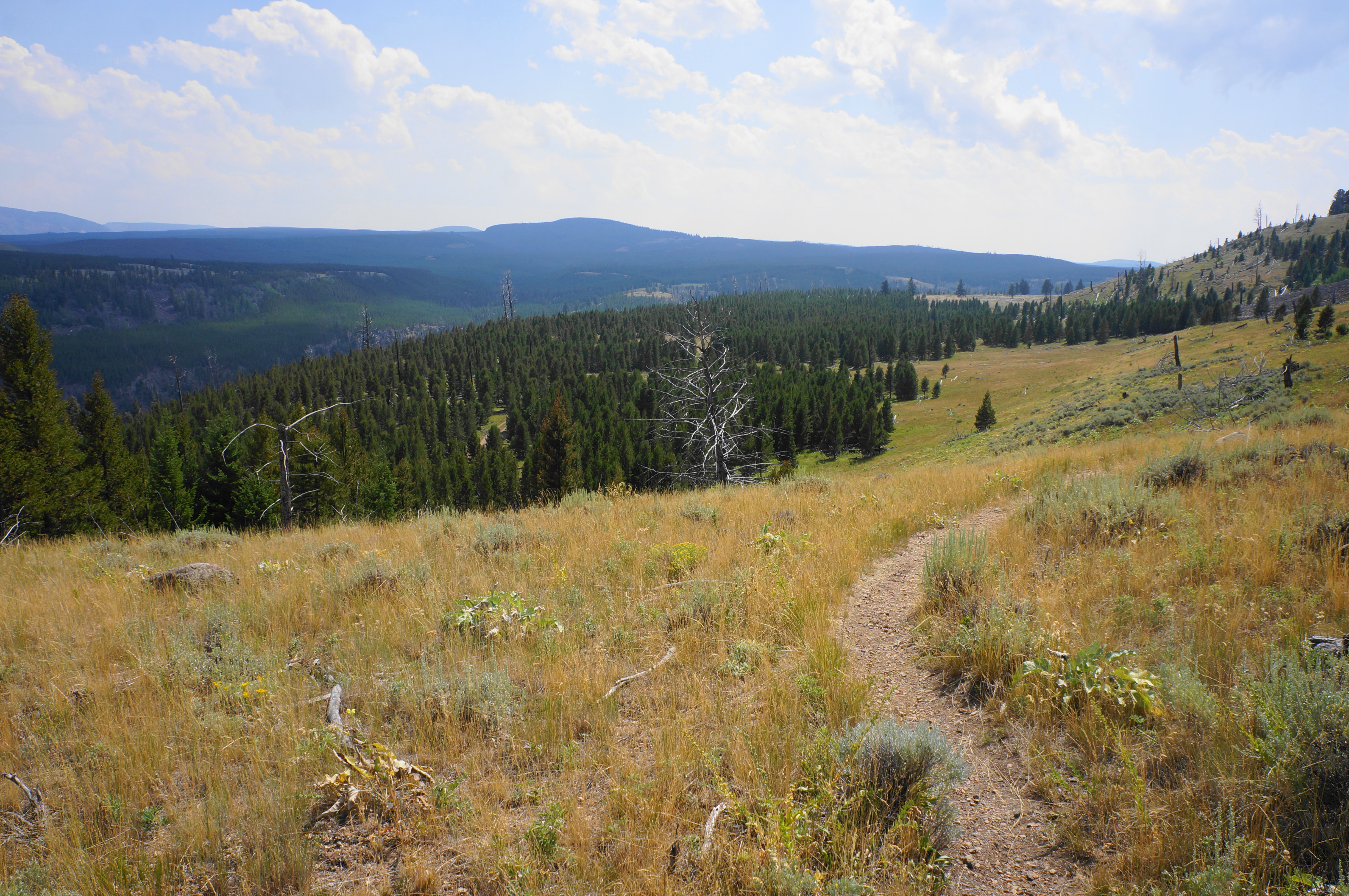
Head left on the Bunsen Peak Trail as it rises through Yellowstone’s characteristic sagebrush steppe, above Glen Creek and adjacent wetlands. The trail will climb 1,300 feet in the next two miles. After about 1/10 mile, the path arcs northward and cuts through a stand of stunted pines. From here the incline picks up, and Golden Gate returns to view below. Hikers can hear—but not see—rushing Rustic Falls. There are some scenic clifftops at around ¼ mile with window views through Golden Gate and across Grand Loop Road to Mammoth Hot Springs, Gardner Canyon, and Mount Everts (7,842’).
After skirting the high bluffs, the trail briefly turns away from the canyon and toward Bunsen Peak. A brief, level respite gives away again to a steady ascent through a sparse forest and another open stretch with an improved vantage point north to Sepulcher Mountain (9,646’) and Electric Peak (10,969’) on the Montana-Wyoming border.

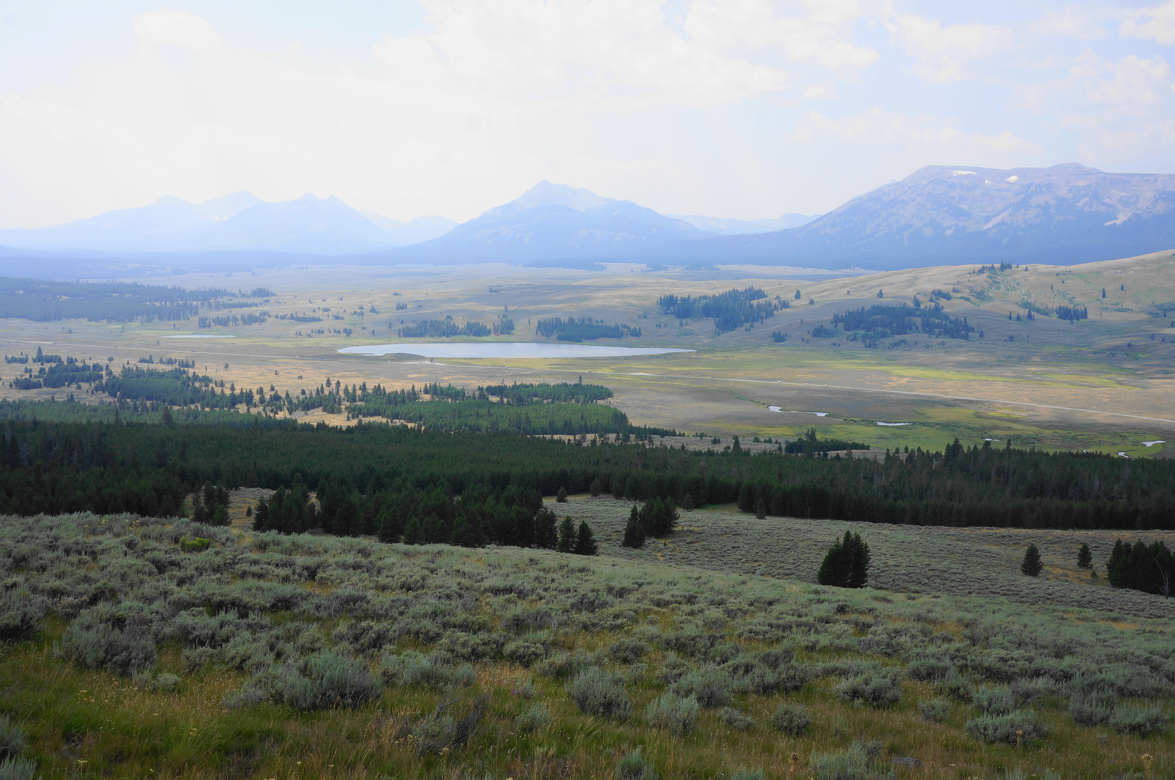
Come to another cliffside vantage at around 4/10 mile, then cut south and east across open sagebrush with unobstructed views southwest across Gardner’s Hole and Swan Lake to the rest of the Gallatin Range—headlined by Antler Peak (10,063’), Bannock Peak (10,323’), and Mount Holmes (10,336’). After a couple winding bends, settle into a long uphill switchback that cuts north through a fire-damaged area.
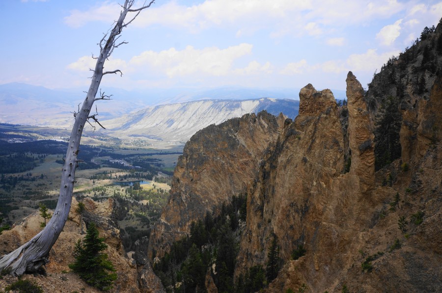
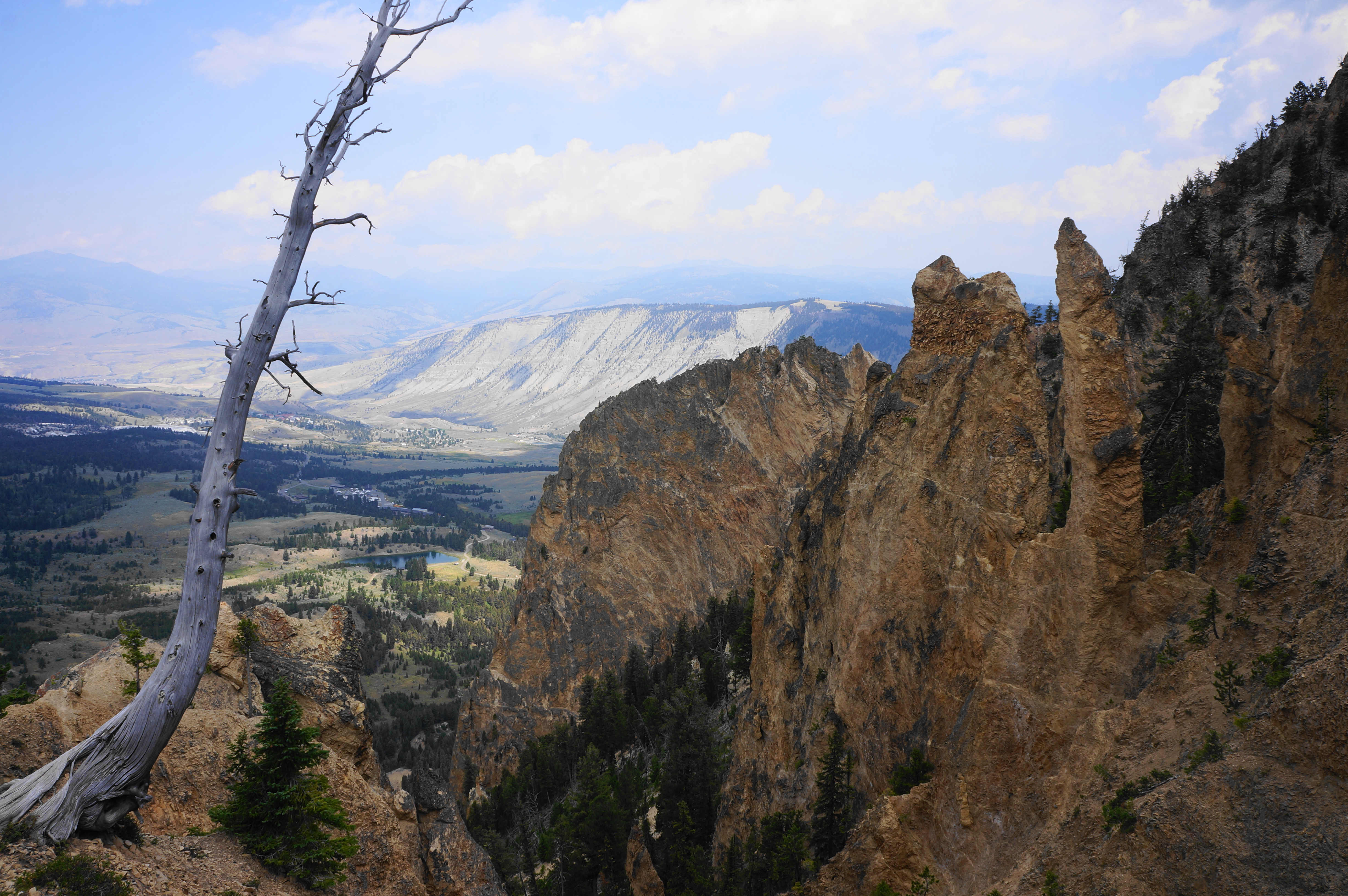
The trail leads back to the precipice of the towering bluffs, where the windswept tree bark and craggy pinnacles of Cathedral Rock (7,592’) in the foreground frame the distant view of Mammoth more than 1,200 feet below. By now hikers have travelled around 1.25 miles.
The next sequence requires negotiating a series of switchbacks and brief scree sections. Most are in the woods (9 or 10 by my count) before emerging out into the open again, where more blocky scree awaits. Round a left-hand bend with north-facing views, then pass under power lines three times as you make the final push toward the summit.


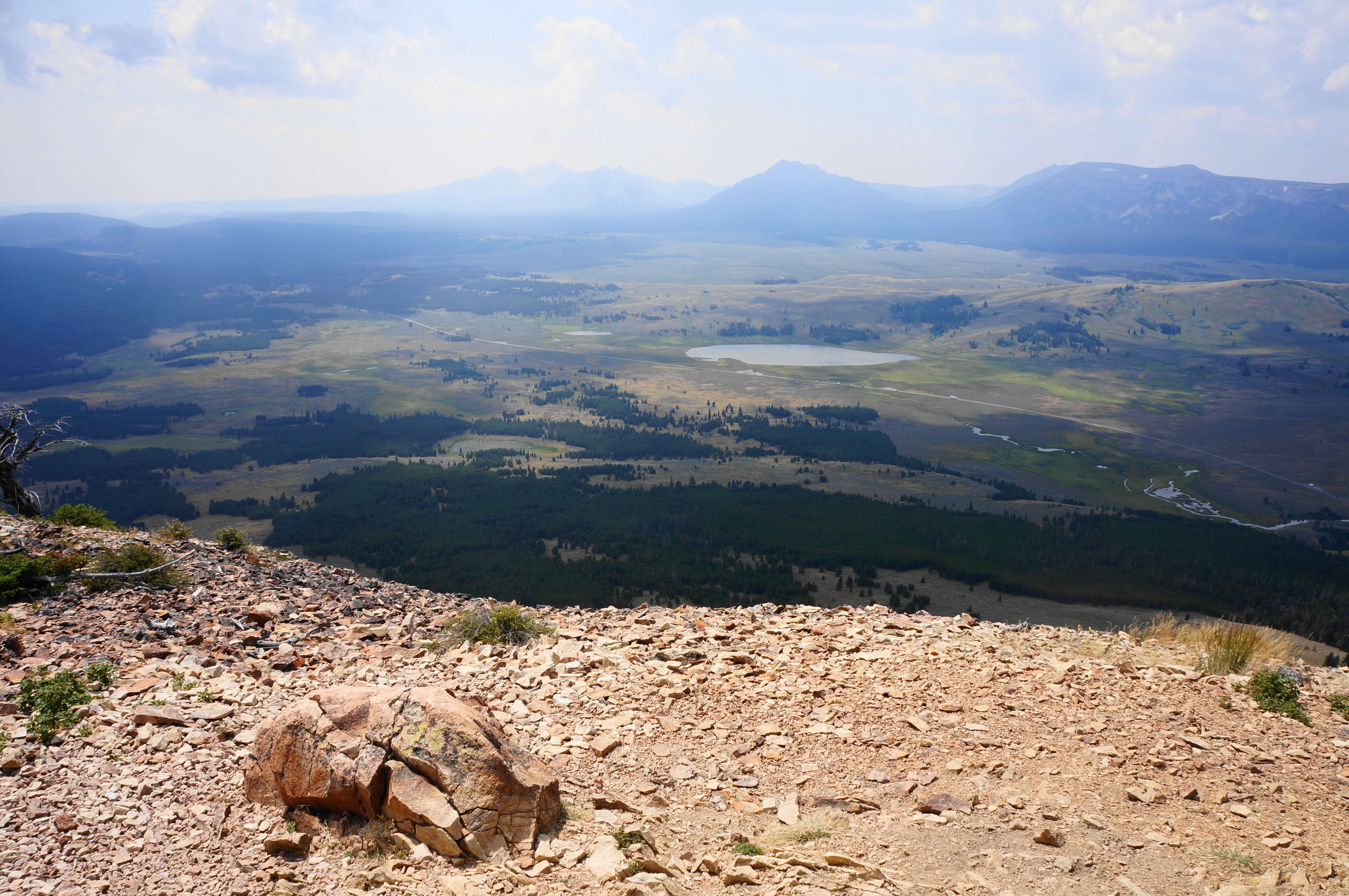
The uphill ceases suddenly at the first of Bunsen Peak’s three summits (all around the same height), where there is a small building, trail register, and communications tower. The best views from this spot are south and west, with Gardner’s Hole unfolding below, one of the best vistas in the Yellowstone caldera. Hikers can also see Sepulcher Mountain and Electric Peak again to the north, but eastward views are partly obstructed.


Some turn back at this point, but those completing the circuit can continue onward, following the rocky track to the second summit, this one with a better look down to Sheepeater Canyon to the east and south. Minutes later hikers will find a spur left to the third peak, this one with the best eastward vistas to Blacktail Deer Plateau, Folsom Peak (9,334’), and Prospect Peak (9,527’).


When ready, return to the main trail, which curves around the third peak and begins a descent down the east side of the mountain. After a right-hand switchback, angle down a windswept slope in a series of bends and curves, dropping to a lower ridgeline. Here there is actually a brief climb of 10-20 feet before the path resumes a steady decline, through a felled-tree area then a forest of stunted pines.


Still about 800 feet above the basin below, the trail drops in earnest down a set of nearly a dozen switchbacks. One final steep drop leads into a final meander, and the Bunsen Peak Trail culminates at a wide doubletrack—Bunsen Peak Road—set among bushy firs.
Hikers heading on to Osprey Falls should bear left. But those short on time and energy should bear right, beginning a 3-mile stroll back to the trailhead that is easy but somewhat tedious. The first ¼ mile or so is in the woods, but soon hikers return to the open steppe, with continued views to the Gallatin Range straight ahead.
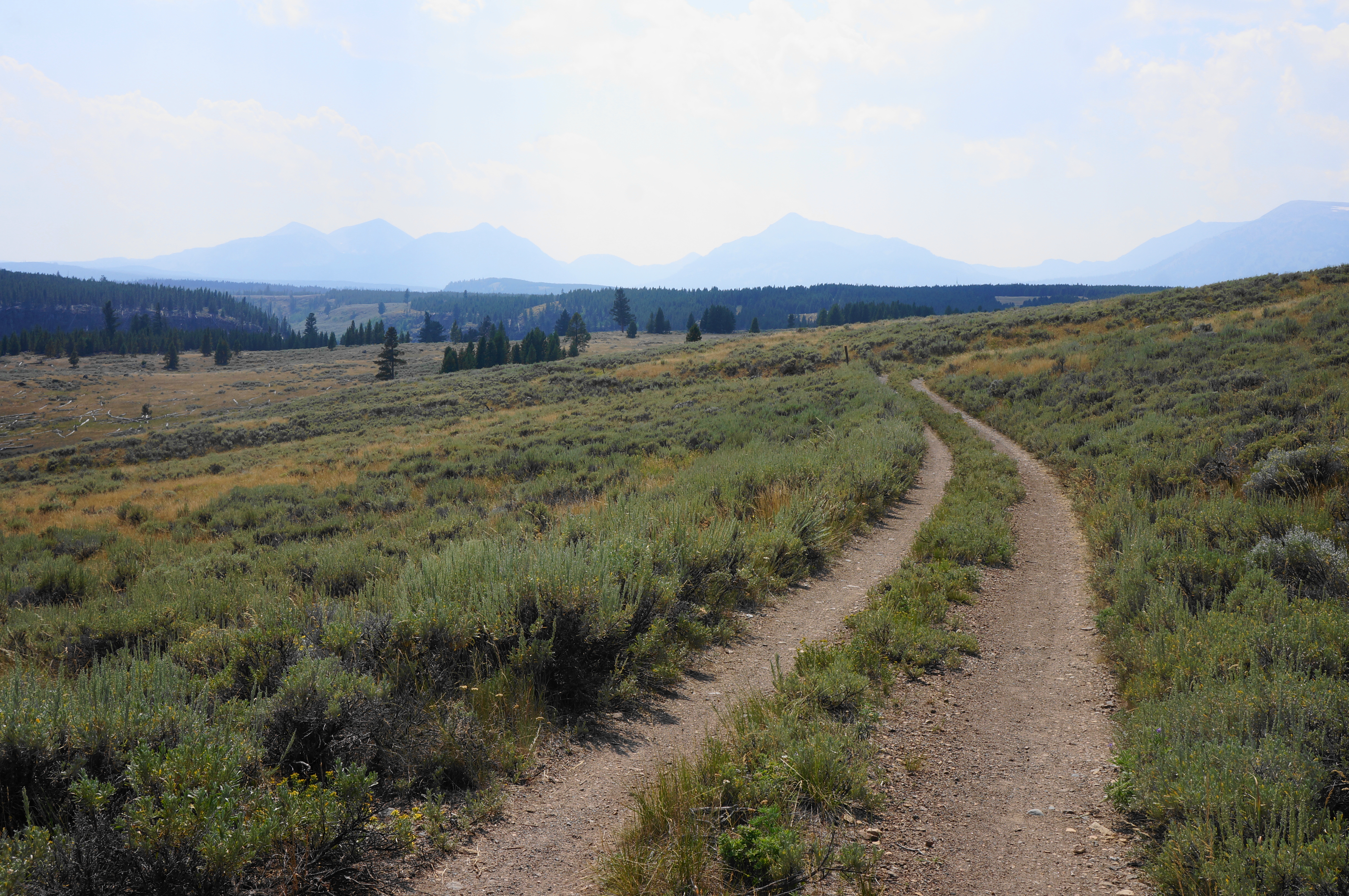
A little over a mile from the start of the “road” section, there is an excellent vista overlooking Sheepeater Canyon, carved by Gardner River. From here hikers soon reenter a patch of pines and skirt a pond on the left. Cutting through intermittent woods and meadows, the path rounds west and north, with Bunsen Peak in view on the right.

The final stretch skirts the initial wetlands, teeming with birds and frogs, before leading around a left-hand bend and ending back at the Bunsen Peak Trailhead. This marks the end of the 7.2-mile loop, a moderately challenging half-day hike.


Pingback: Wraith Falls Trail (Yellowstone National Park, WY) – Live and Let Hike
Pingback: Top 10 Hikes in 2024 – Live and Let Hike