After the disappointing failed trek up to Pine Creek Lake, yours truly was in a bit of a rotten mood, but spirits were lifted after reaching Bighorn Canyon National Recreation Area, a charming and uncrowded park on the Montana-Wyoming border. Here I did a couple of hikes with canyon views before settling in to camp outside the park, at the foot of the majestic Bighorn Mountains, at the end of Day 13 of the July/August road trip.
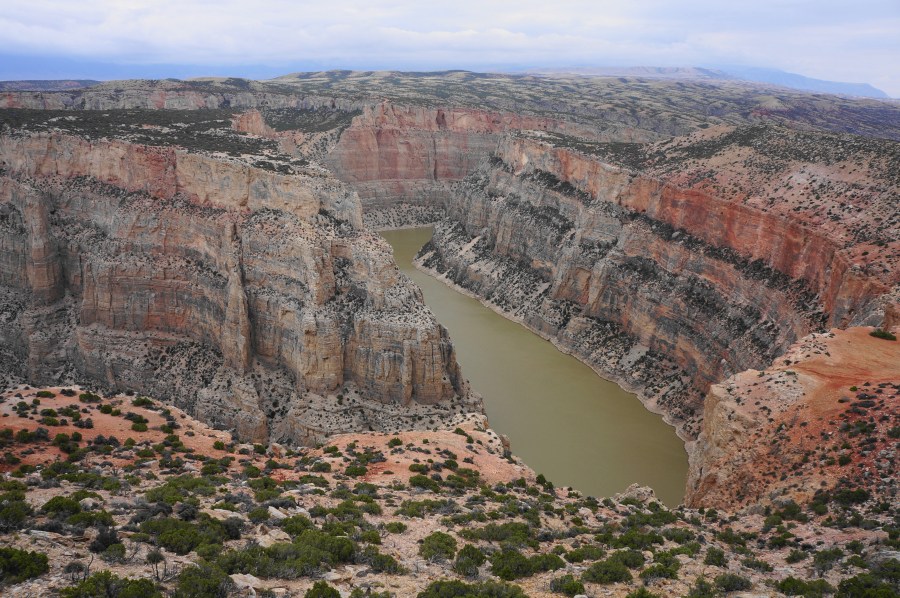
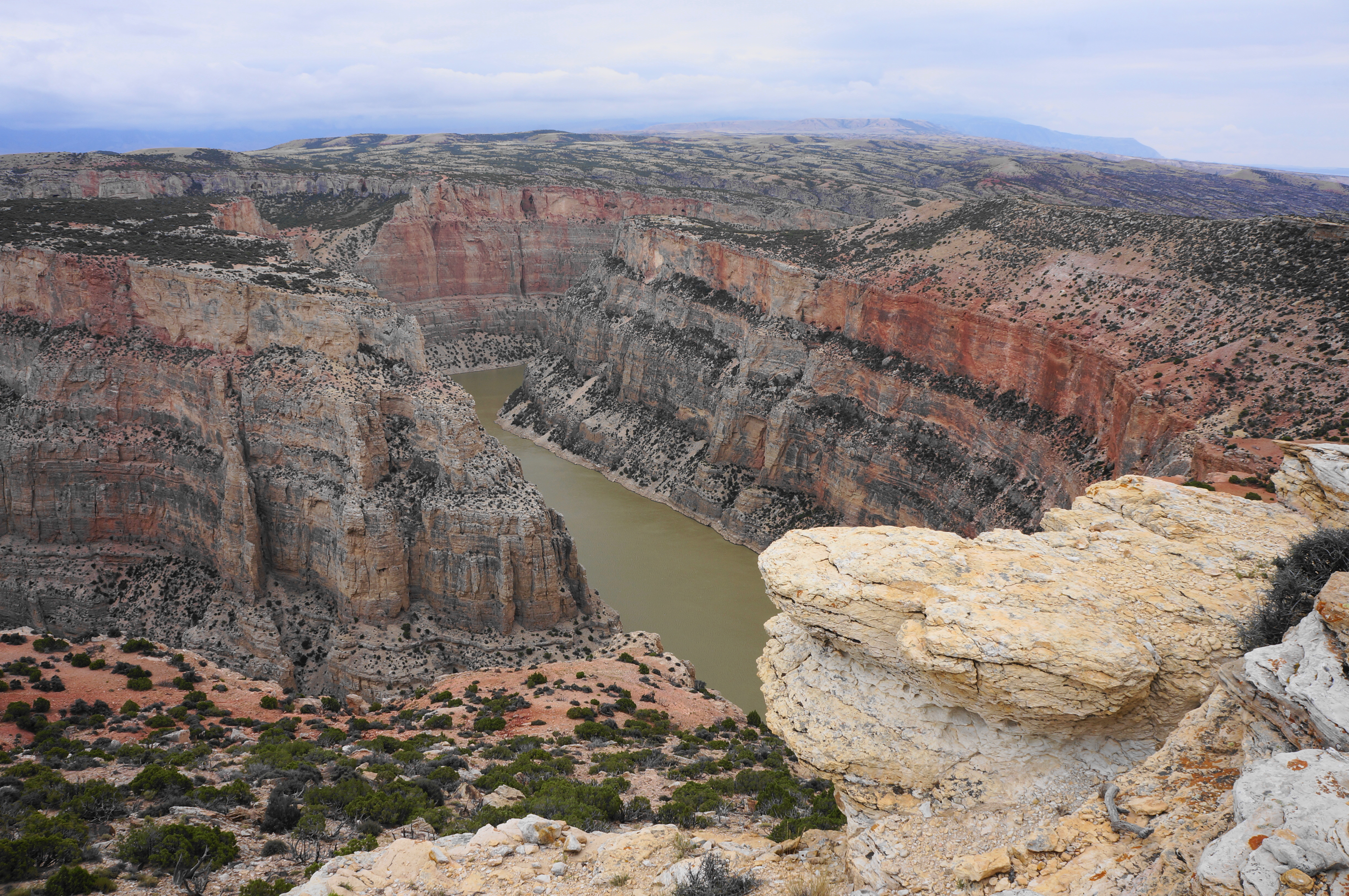
Cutting into a basin between Pryor Mountain and the Bighorn Range, Bighorn Canyon spans the Montana–Wyoming state line and features steep walls of sandstone, shale, and limestone above a man-made lakebed. Most of the action is in the southern end of the park—accessed from Route 37 outside Lovell, Wyoming—including several decent short hikes to high viewpoints on the precipice of the canyon. The Rangers Delight Trail, one of the easiest options, is situated a half mile north of the Montana state line and culminates at an unguarded outcrop above a snaking bend in the Bighorn River. While views are arguably better at Devils Canyon Overlook a little further north, this nice leg-stretcher still brings of the satisfaction advertised in the trail’s name.


The hike
To reach the trailhead, drive north for 4.3 miles from the spur to Horseshoe Bend Marina, crossing from Wyoming into Montana. Look for a pull-off on the left and a small, weathered sign for the Rangers Delight Trail on the right. Park and cross the road to the start of the route, which immediately begins to climb, with a minor ravine down to the right.


Rise among the pinyon/juniper scrub that resembles Arizona or Utah, cresting a saddle after about 300 yards. From here hikers can see Pryor Mountain to the north and the opposite walls of Bighorn Canyon to the east, though the river remains obscured for now. Descend mildly to a junction at ¼ mile, with the Ranger Delight Trail continuing left.

“Trail” is more of an aspiration than reality as the path quickly dissipates amid the sagebrush. It is relatively easy, however, to follow some of the slickrock out to the overlook, situated on a shale outcrop set above the canyon. Now one can see down to the river as it rounds a sharp bend. The shale, sandstone, and limestone walls are multihued with shades of gray, orange, yellow, and red. The oldest rocks date to the Cambrian Period, more than 350 million years old.

When ready, return the way you came, or if interested, route south on the State Line Trail, reaching back into the state of Wyoming.


Pingback: Cottonwood Creek Trail to Melody Falls (Bureau of Land Management, WY) – Live and Let Hike