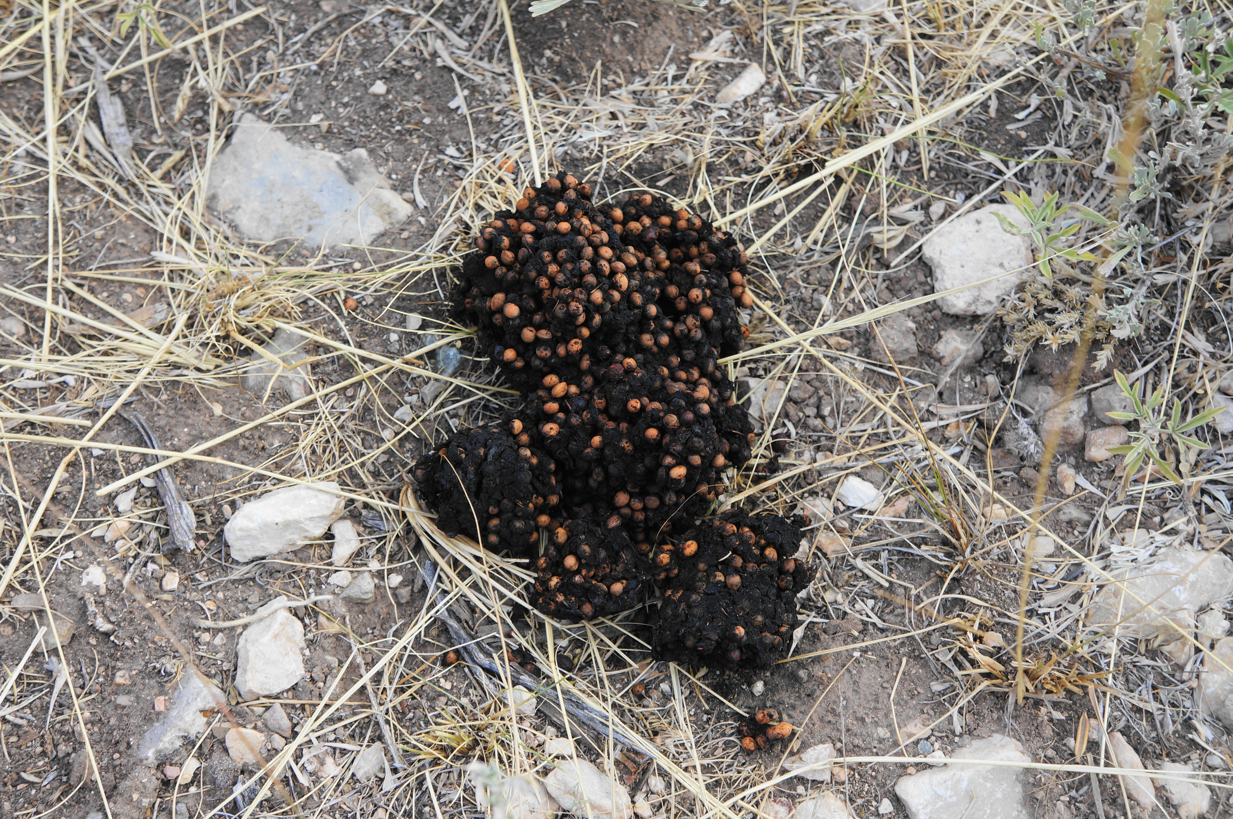
After my afternoon in Bighorn Canyon National Recreation Area, I went in search of a camping spot and settled on the modest (but free!) BLM campground at Cottonwood Creek, on the east side of Bighorn Lake. After sleeping amid the sagebrush, I ventured out in the morning on a short walk into stunning Cottonwood Canyon. It wasn’t great that I had lost my bear spray the previous day—just as I found fresh scat in the canyon. But fortunately there were no encounters, and I was on my way east across the Bighorn Mountains after completing the hike by mid-morning.
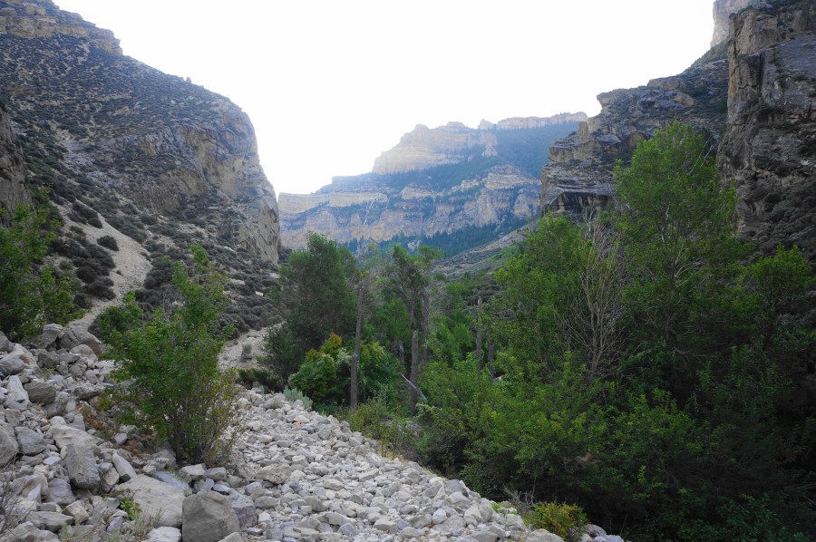
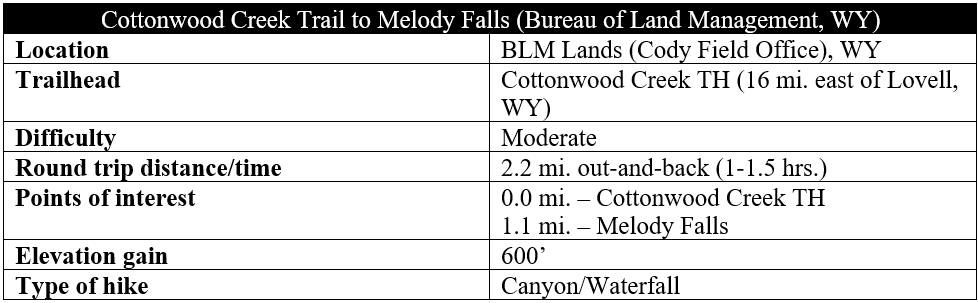
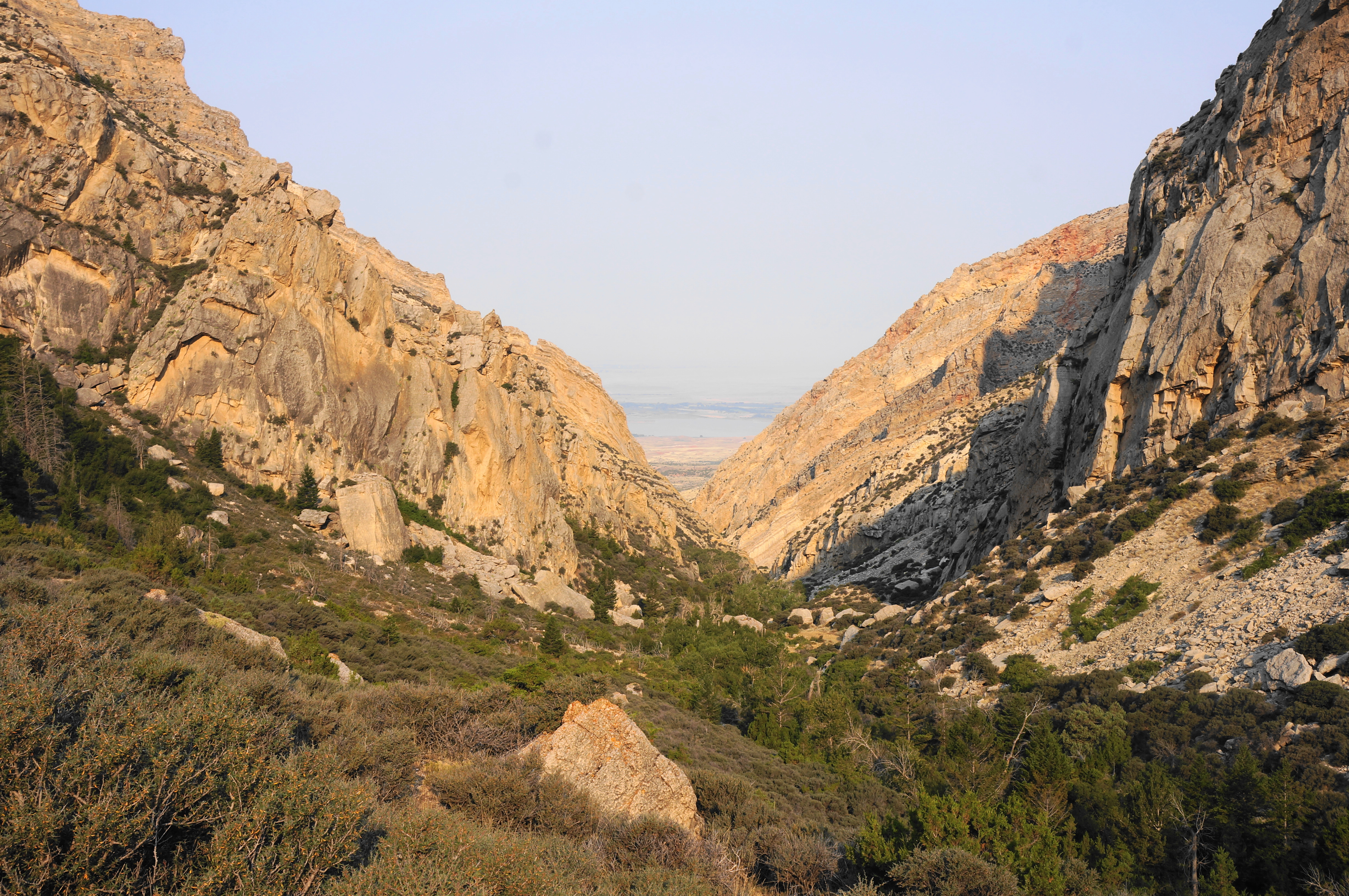
East from Bighorn Lake and its associated national recreation area, Cottonwood Creek carves a mammoth but seldom-visited canyon into the tilted limestone as it tumbles down from the Bighorn Mountains of northern Wyoming. Here an old cattle route offers passage for 4.7 miles through the mighty gorge, but hikers seeking entertainment for just an hour or two can turn around after Melody Falls. The brief foray into Cottonwood Canyon is remote but spectacular and a great complement to a visit to nearby Bighorn Canyon.
The hike
To reach the trailhead, adjacent to Cottonwood Creek Campground, bear north from US Alternate 14 onto John Blue Road, just on the east side of Bighorn Lake. Stay right on the dirt track and follow it for 5.5 miles to the campground, set at the base of the Bighorn Mountains and dramatic opening of Cottonwood Canyon.

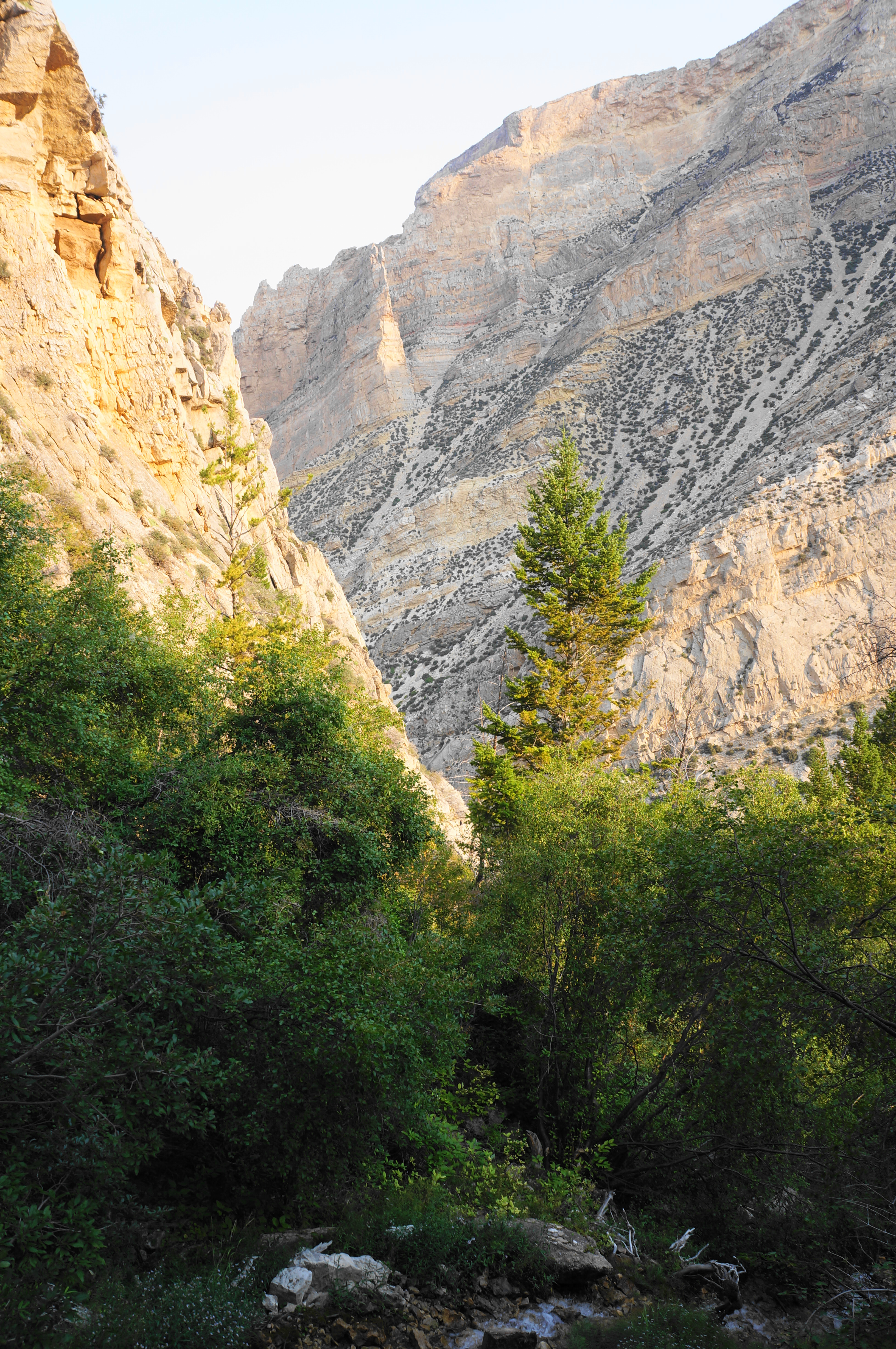
Park at the trailhead and pass through a cattle guard, heading toward the towering limestone walls ahead. The slopes on either side are dotted with junipers, sagebrush, and mountain mahogany, but the streamside area is riparian, boasting willows, dogwoods, and (of course) cottonwoods, among others. Follow the gravel doubletrack and pass through a second gate at about ¼ mile, then soon come to the banks of Cottonwood Creek as it wedges through a narrow notch with a protruding slab of limestone.
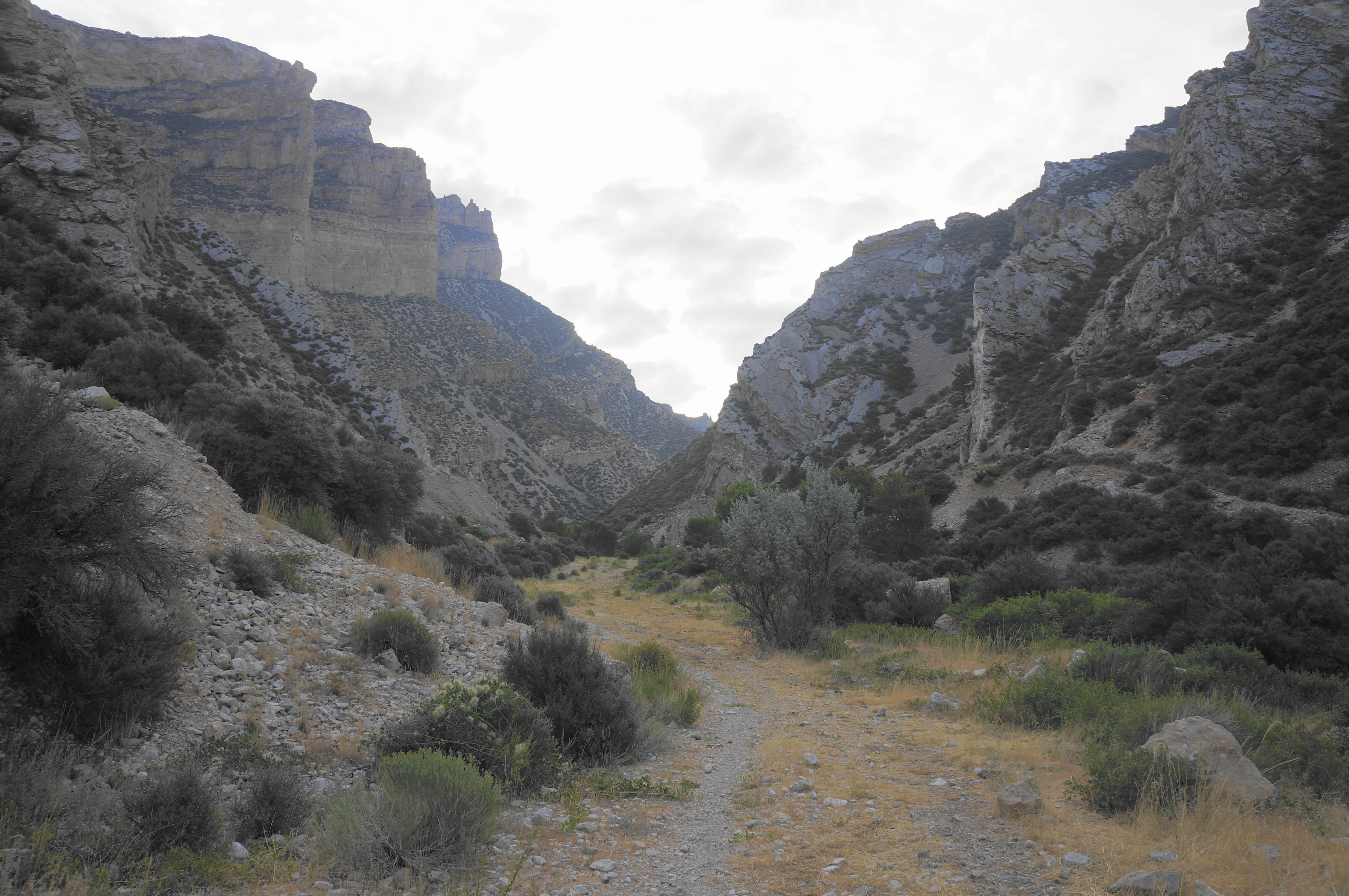

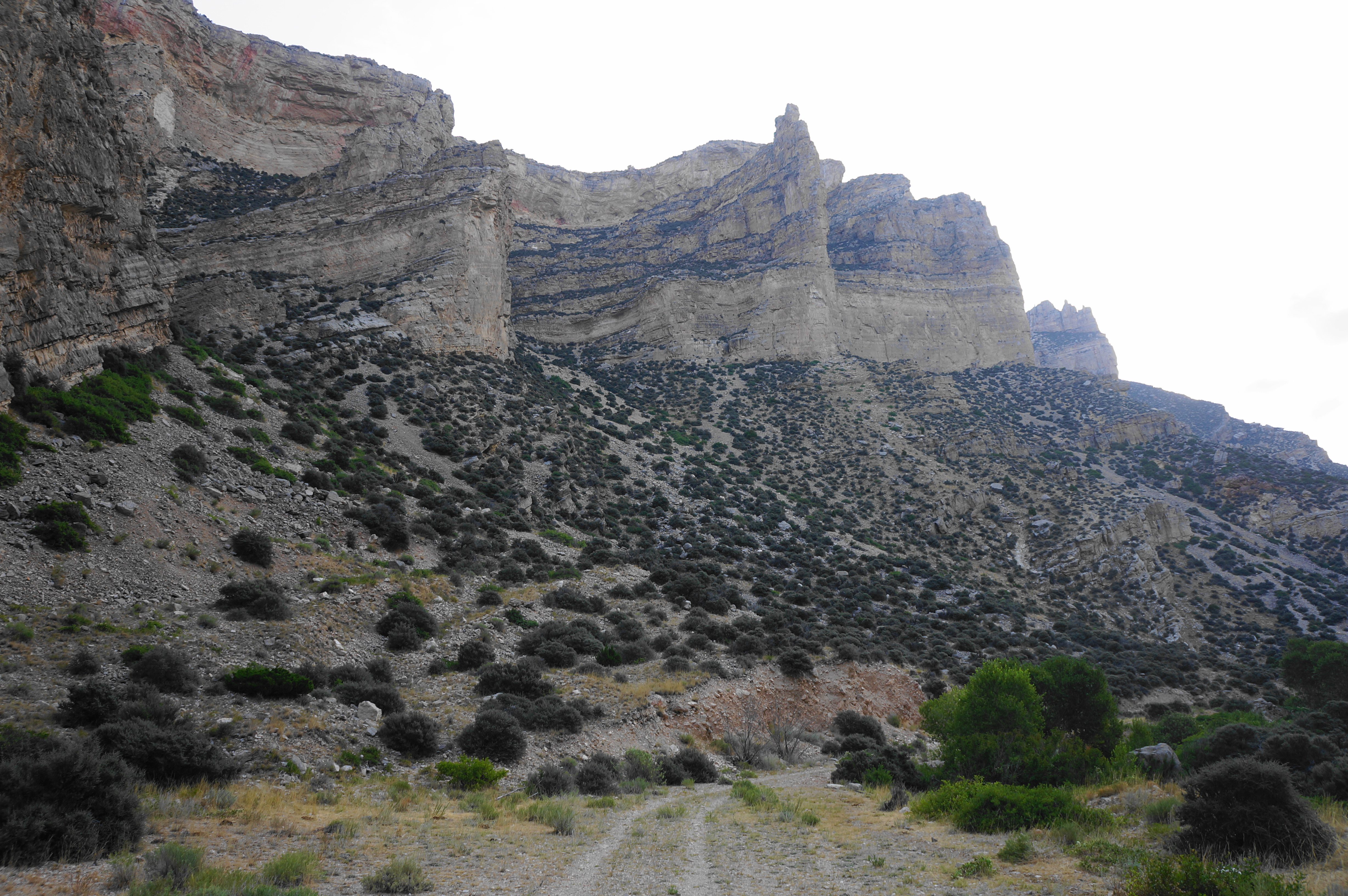
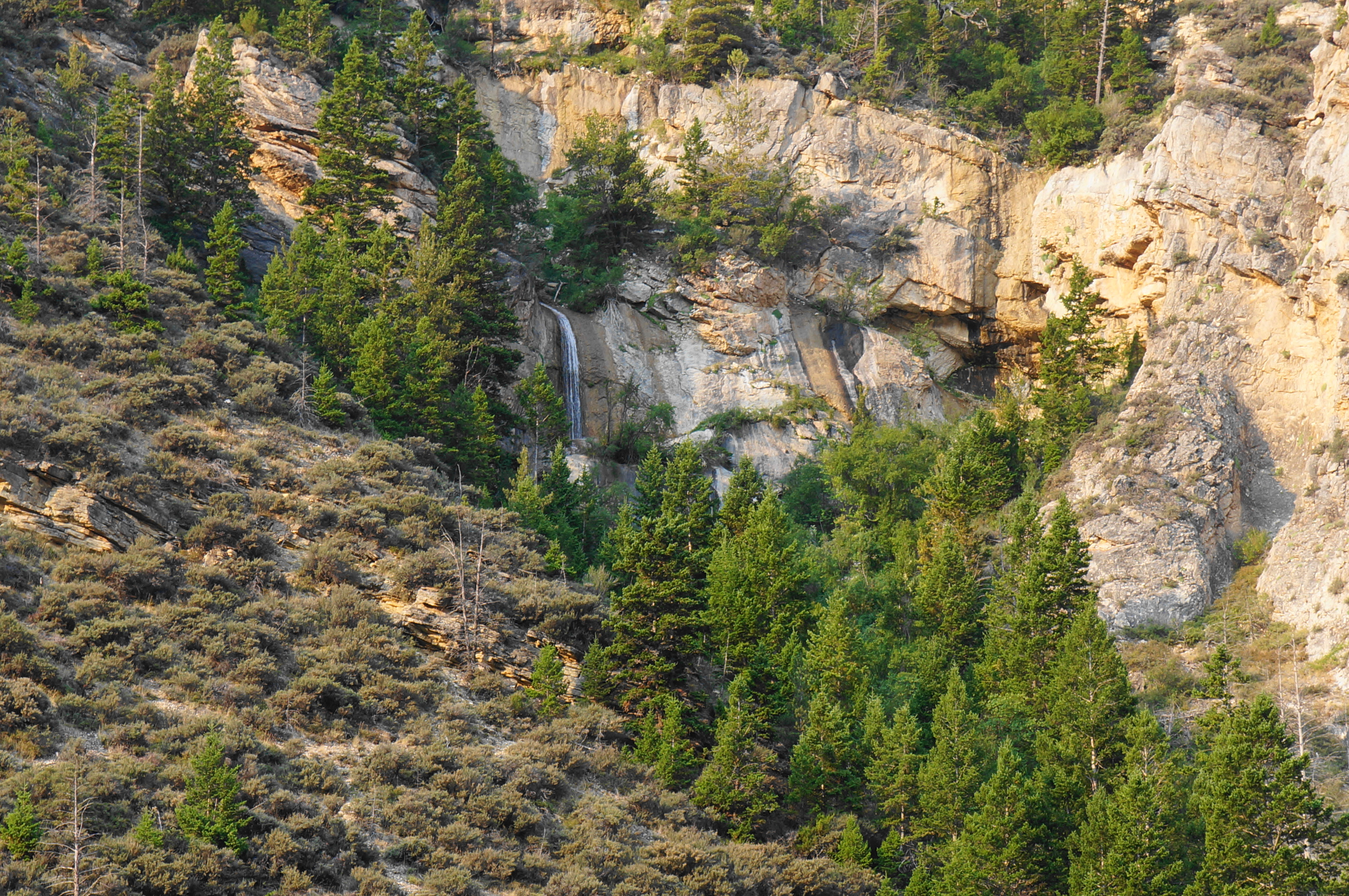
At around ½ mile, look up at a thumb-shaped pillar up on the left, then come to the end of the doubletrack, again skirting a thinner section of the canyon. The ascending trail becomes narrower and rockier beyond, and you can see around the next bend ahead, offering enticement to push further even as the elevation gain escalates. After about ¼ mile further, descend to cross the creek, after which one can see what is technically a two-tiered drop that could be characterized as a waterfall up to the right.

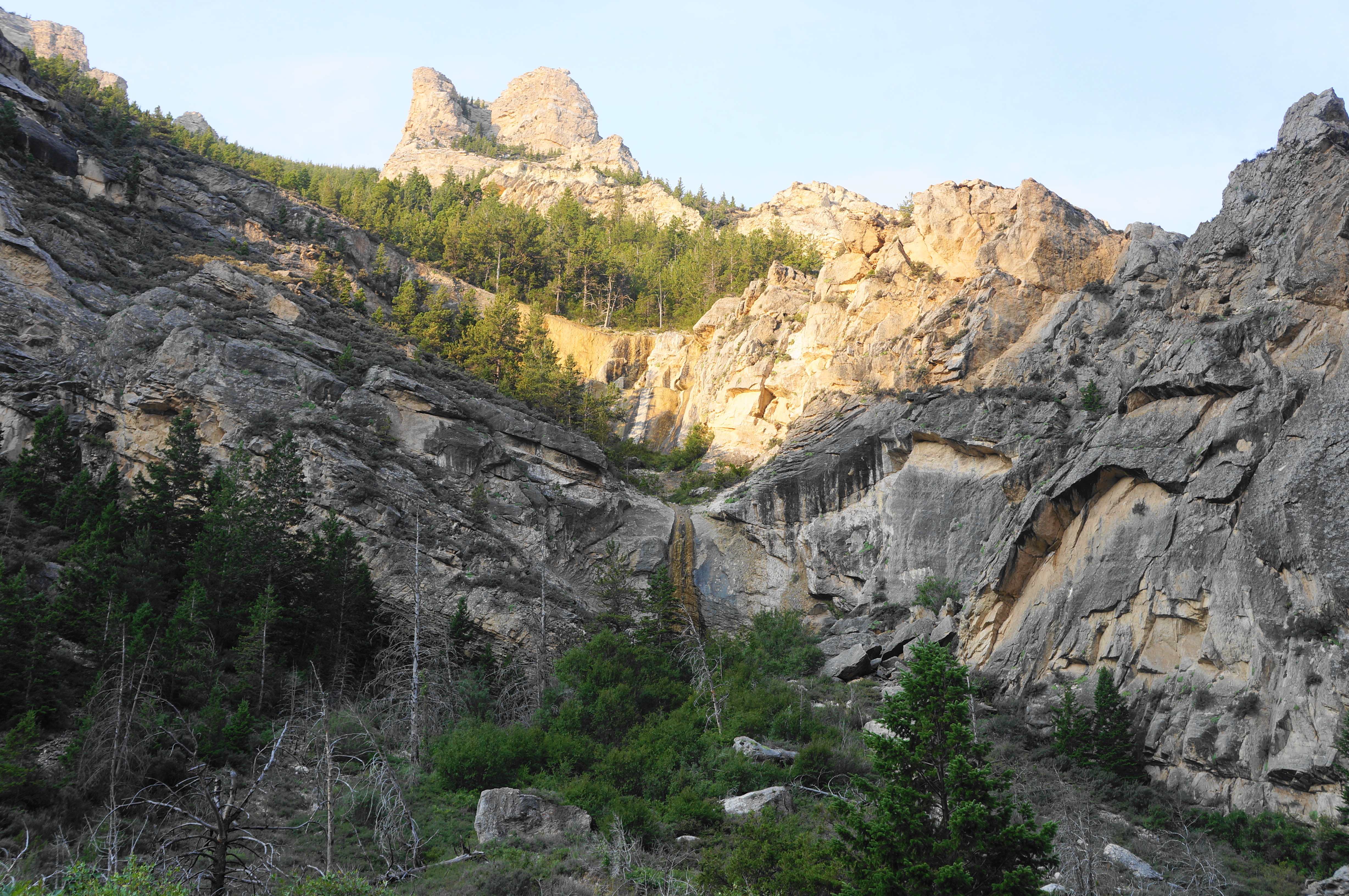
Is this Melody Falls? Well, it depends who you ask. The official BLM trail guide of the hike seems to think so. But given this waterway is clearly seasonal (it was largely dried to nothing in early August when I visited), it may not be a very satisfying destination.

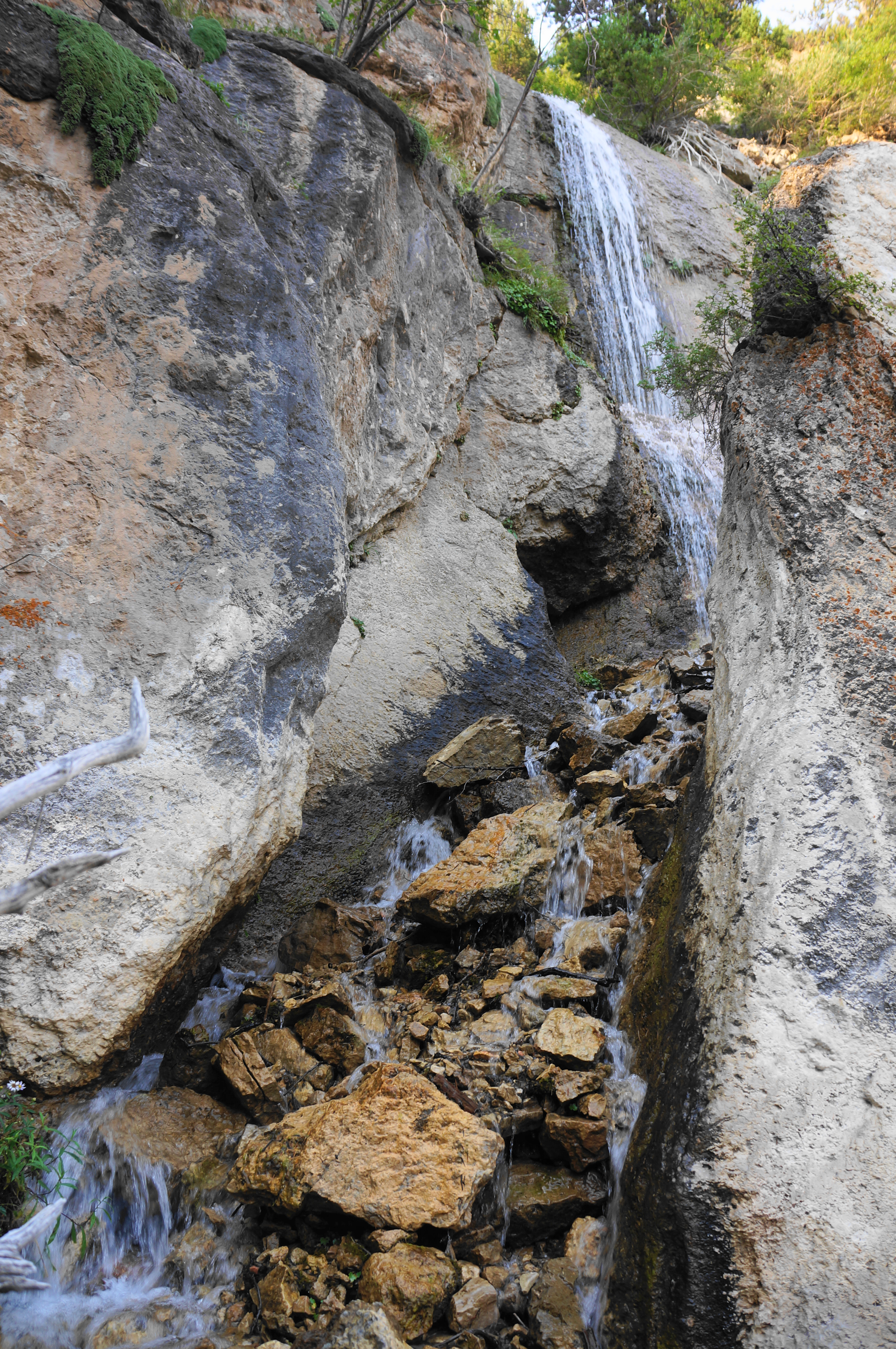
So I suggest pushing on a little further, ascending a steeper uphill on a doubletrack with chunky gravel. Soon you will see the next drainage coming in from the right: this one much woodier but with a clearly-visible perennial stream and waterfall. To me—and evidently others on the Internet—this is Melody Falls (whether officially or not). It is not a showstopper, per se—and I do not recommend trying to traverse the steep and thorny game trails to reach it (as yours truly did—but with great regret…). But its setting in the broader canyon with spectacular cliffs more than a thousand feet high makes this a terrific spot nonetheless.


Eager hikers can continue onward, with the trail extending for more than three more miles up to Forest Road 119 in Bighorn National Forest. But for those looking to return, turn around and trace your steps back to the start, concluding a roughly 2.2-mile round-trip.

Pingback: Top 10 Hikes in 2024 – Live and Let Hike