

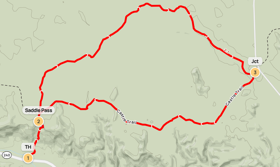
By now I was nearly three weeks into my cross-country trip, but I was savoring my last couple days out West before the relatively lackluster drive across the Great Plains to the East Coast. After making my way east from the Black Hills to Badlands National Park the day prior, I set out on several hikes during an unseasonably cool day in August. The morning hike was the 4.6-mile stem-and-loop combining the Saddle Pass, Medicine Root, and Castle Trails.
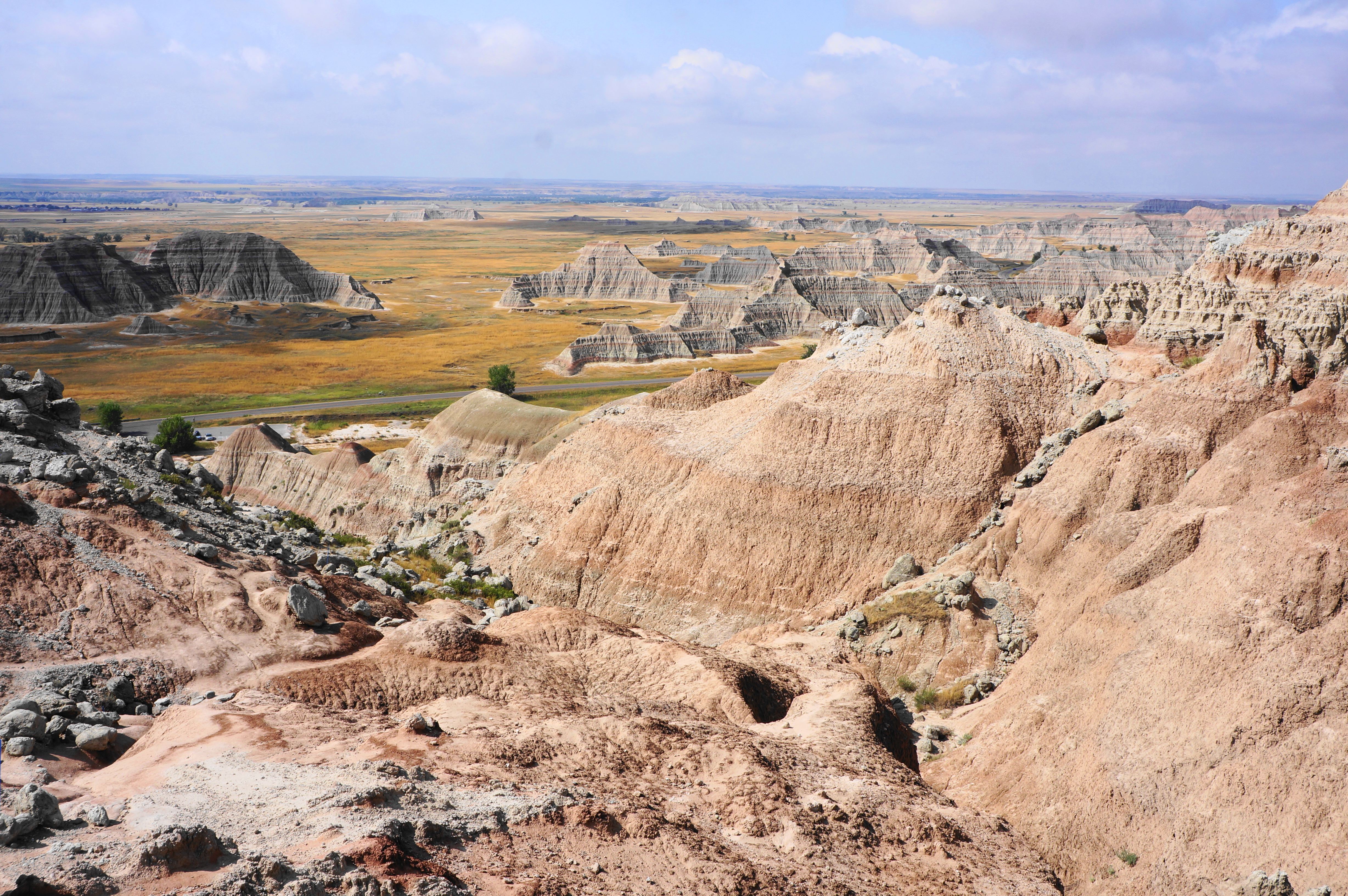
The only official hiking trails in Badlands National Park are in the easternmost tract, where the primary attraction is the imposing Badlands Wall, a colorful escarpment of highly-eroded sedimentary rock. This 4.6-mile hike traverses the wall and explores the grassy backside, combining the Saddle Pass, Medicine Root, and Castle Trails. Avoid on excessively hot days as the hike is virtually entirely devoid of shade, and be prepared for a challenging ascent to Saddle Pass before the loop mellows significantly.

The hike
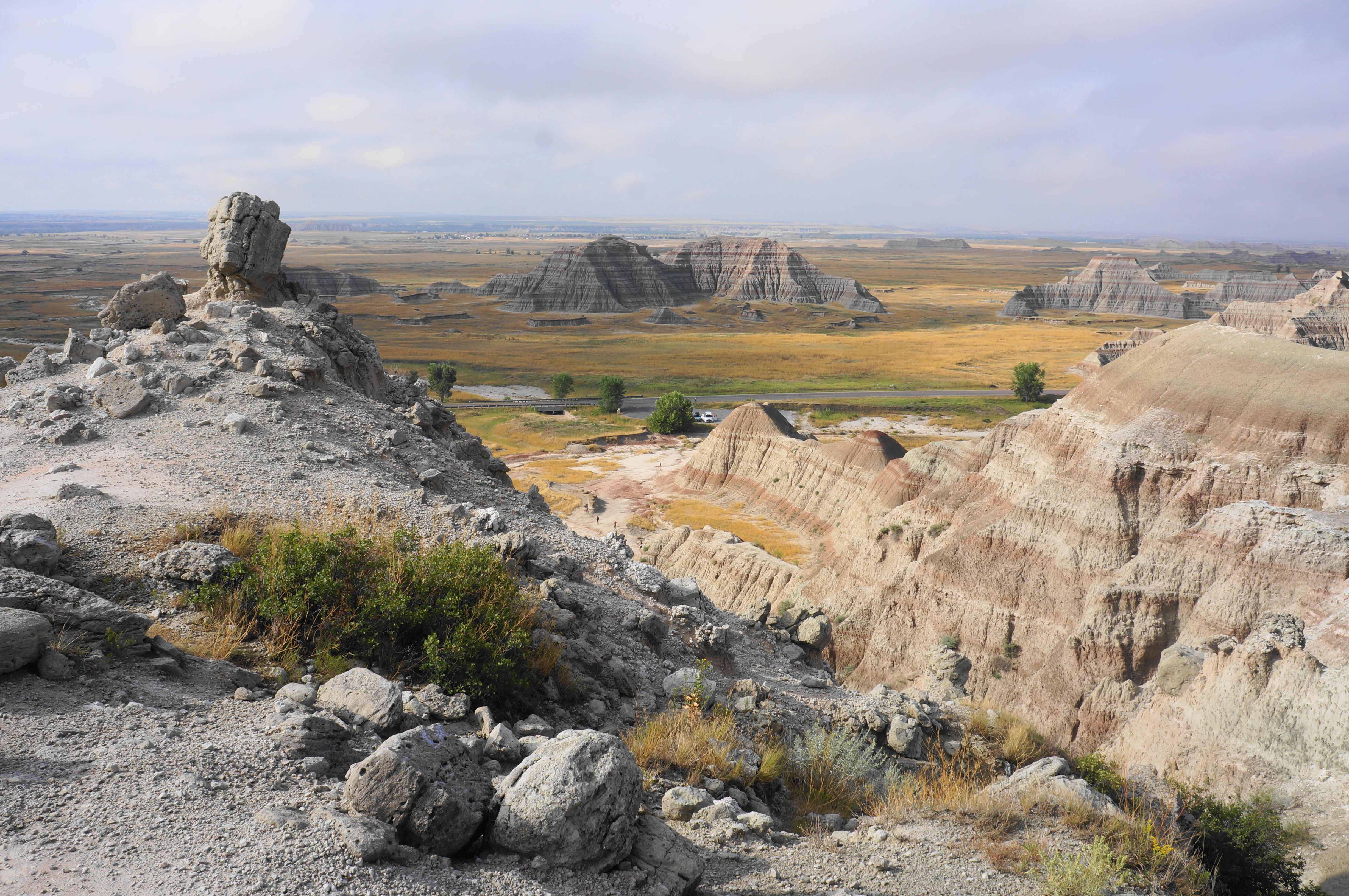
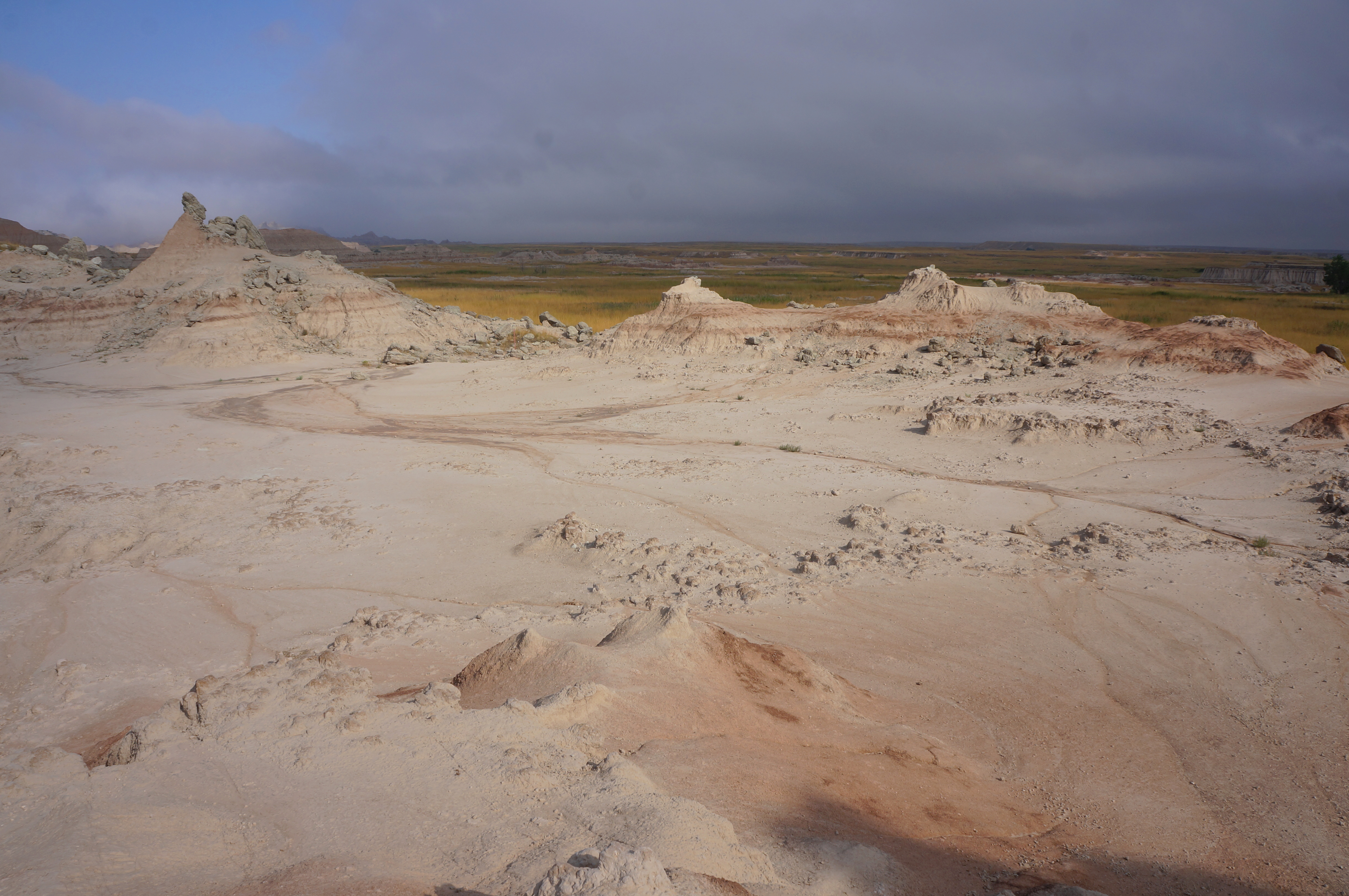
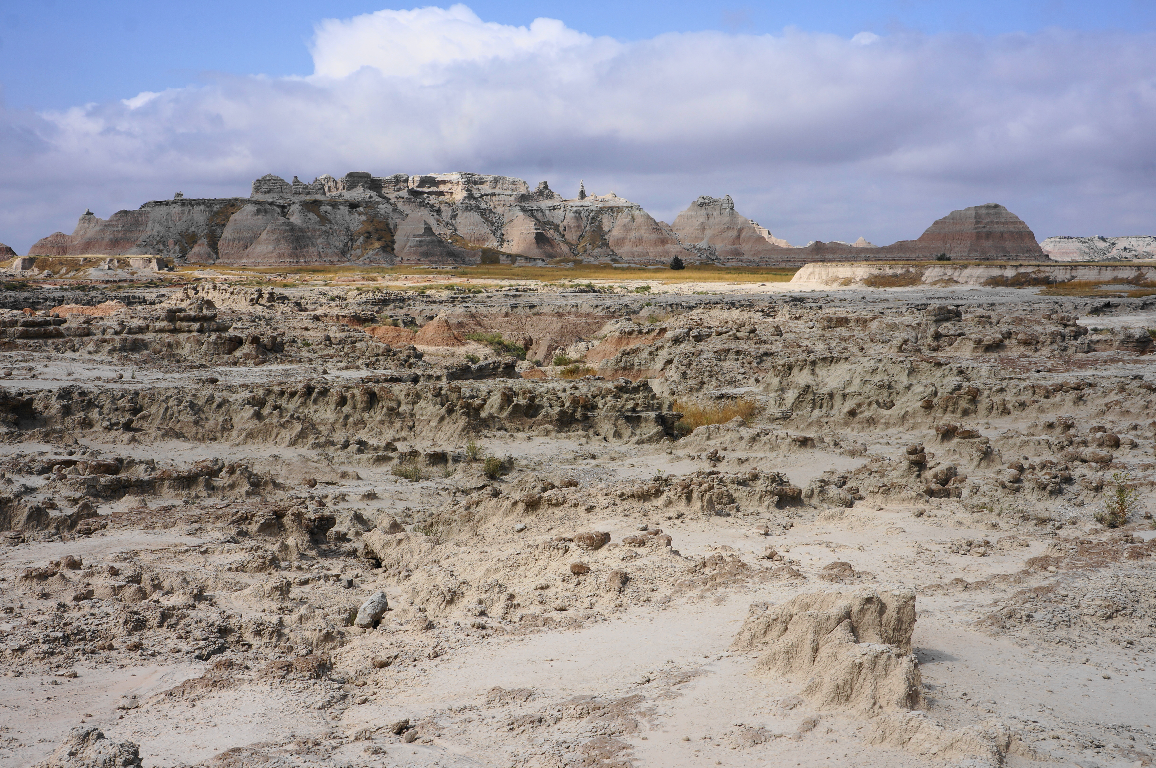
Roughly two miles west of the Ben Reifel Visitor Center and Cedar Pass Campground in Badlands National Park, the Saddle Pass Trailhead has room for around a dozen vehicles. Here the sunburned prairie runs up against the roughly 200-foot Badlands Wall—a seemingly impenetrable block of eroded spires, buttes, and pinnacles towering above the plains landscape. But sure enough, after crossing a bridge over a highly-intermittent stream, a clay path rounds a multihued butte and reveals a winding path up the “wall,” notch by notch.

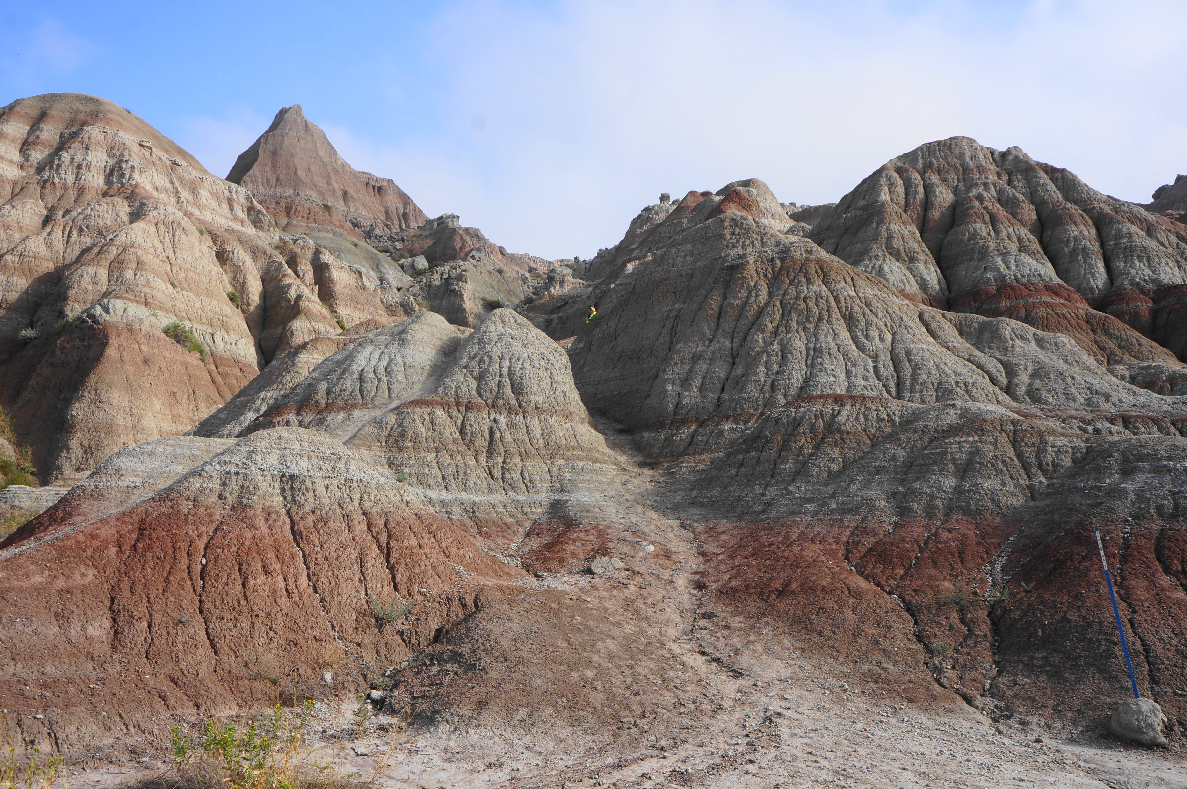
After clearing the initial badland, the Saddle Pass Trail wedges up a crumbly crack, then ascends much more steeply to clear a set of passes and ridges. Follow the blue posts as the tread levels briefly and follows a ravine on the left. Then bear right and use the posts again to negotiate a somewhat confusing sequence. (Note: Generally the trail stays left, staying above the ravine.)

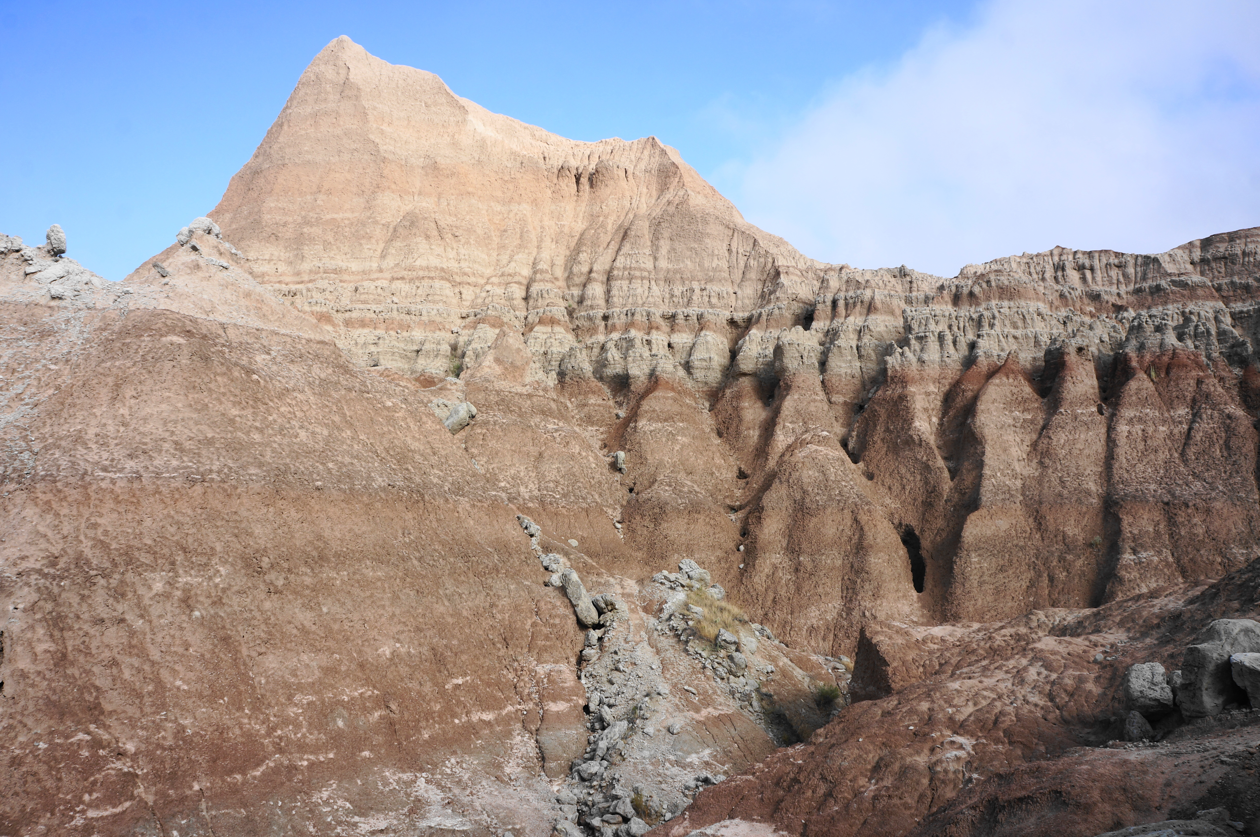
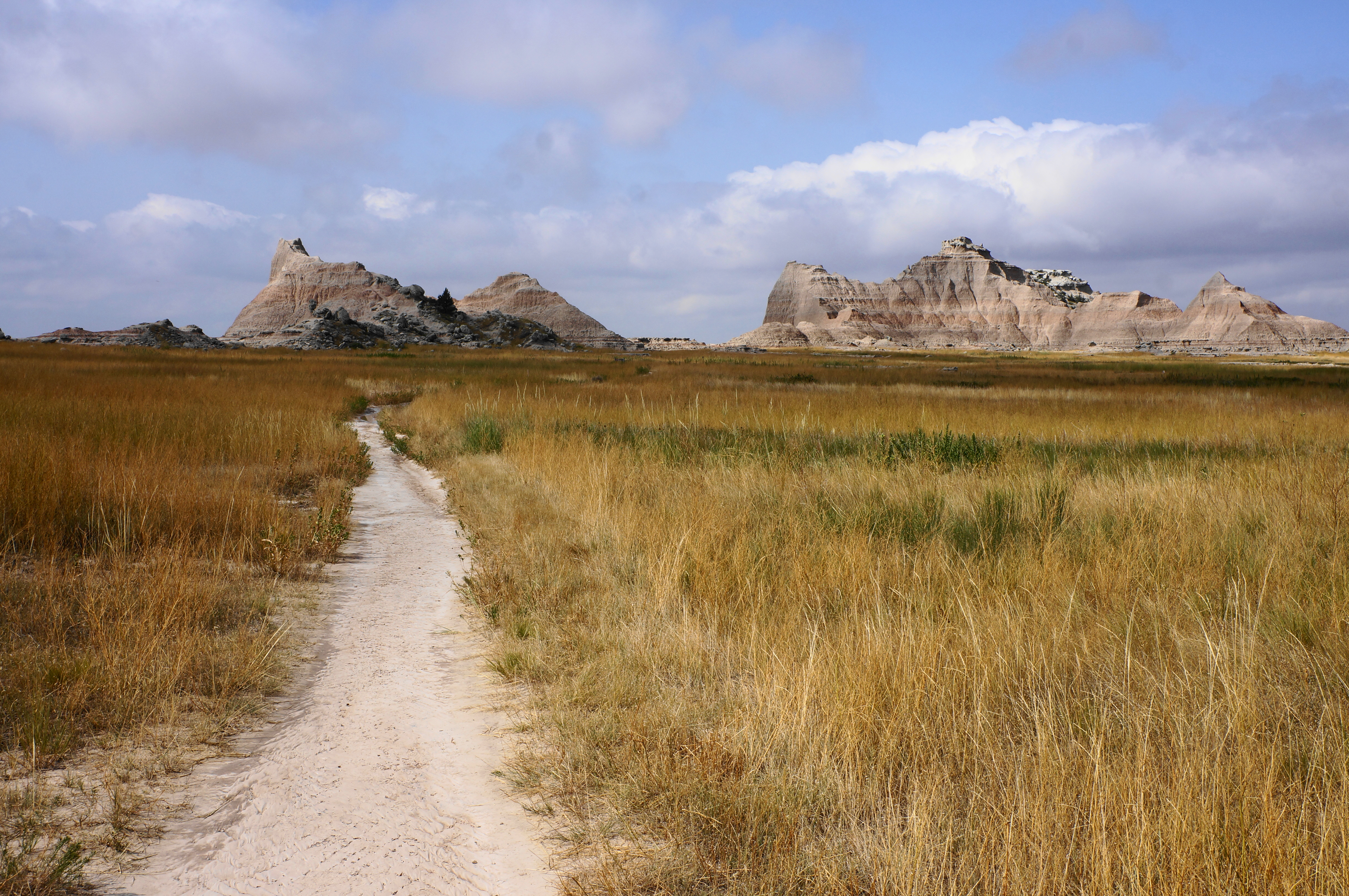
Soon the Saddle Pass Trail crests a hightop with a peachy peak off to the west. A sudden clay flat offers a vantage to the grasslands to the north. Look left to identify a red stake and follow the route onto the turfy prairie, soon reaching a 4-way junction.
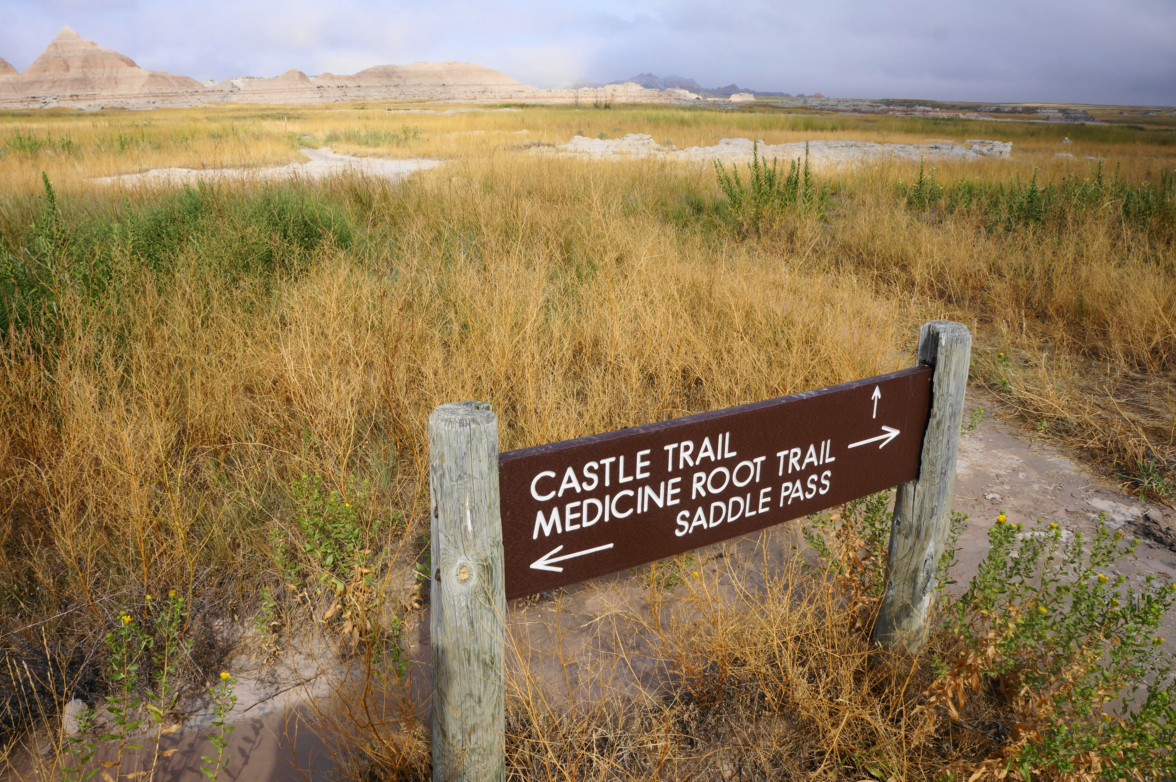
This marks the start of the loop portion. Take on the less interesting section first by staying straight on the Medicine Root Trail, setting a course for a clockwise circuit. This path tracks northward, passing some lesser formations out in the open, away from Saddle Pass and the backside of the Badlands Wall. Expect muddy conditions if there have been recent rains as the trail traverses the wispy plain and many seasonal drainages.

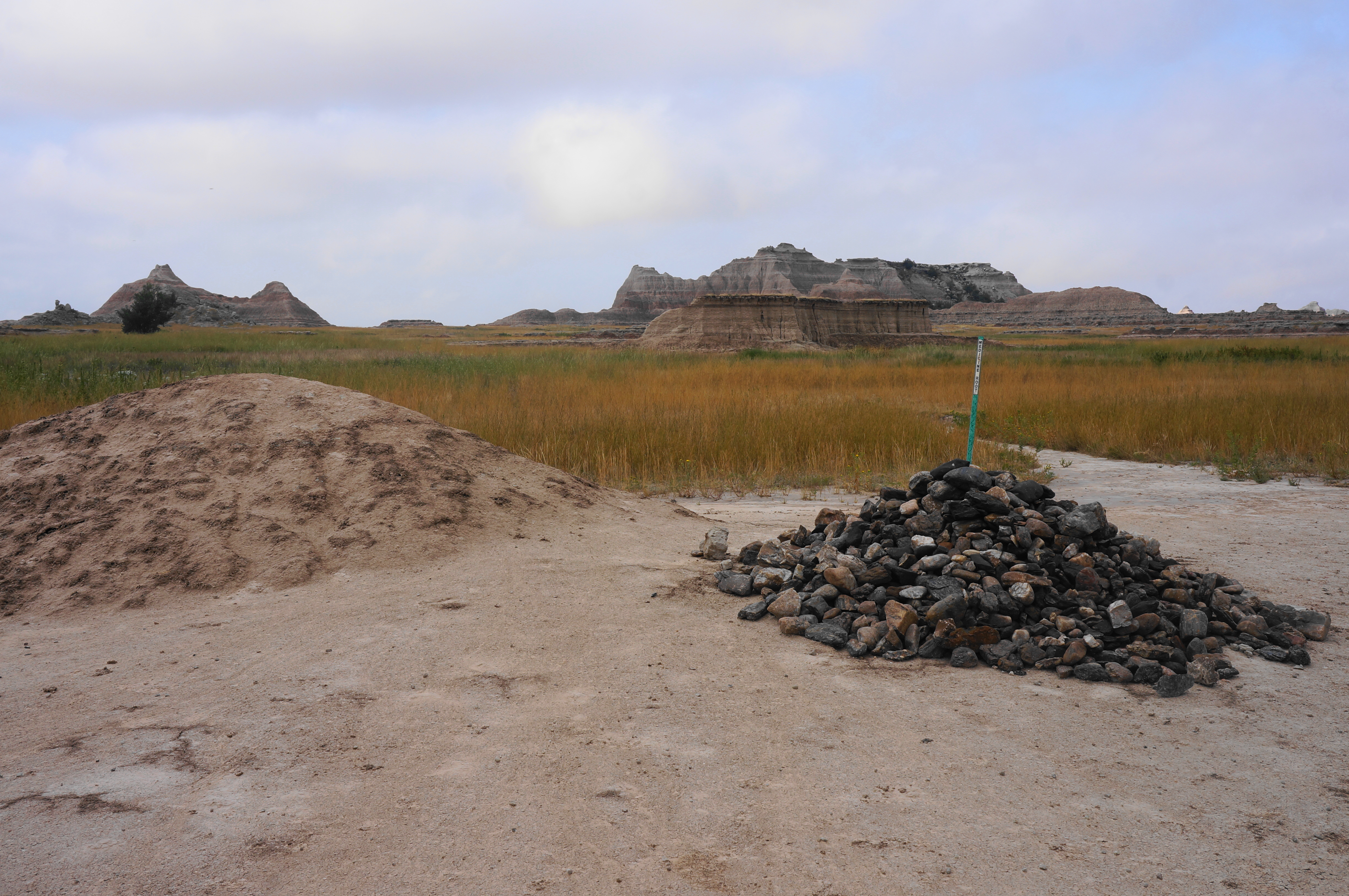
Follow the green blazes as the trail crosses the (usually dry) bed of Big Buffalo Creek and bears eastward, passing a rock pile and set of small clay mounds at about ¼ mile. Later the path crosses a flat basin peppered with seemingly volcanic rocks. Look out also for prickly pear cactus, which typically blooms in early summer.

At one point, the Medicine Root Trail rises to clear a small mound. This is followed by another mild climb of around 15 feet at about the trail’s halfway mark. Thereafter the terrain gets increasingly rugged and more interesting as sod tables give way to basins and wily ravines and the sedimentary clay of the Badlands Wall returns in force. The trail skirts a table with mild drop-offs to the north and south before coursing east (passing under power lines) to a second, alternative trailhead situated off the gravel Old Northeast Road. This marks the end of the Medicine Root Trail.

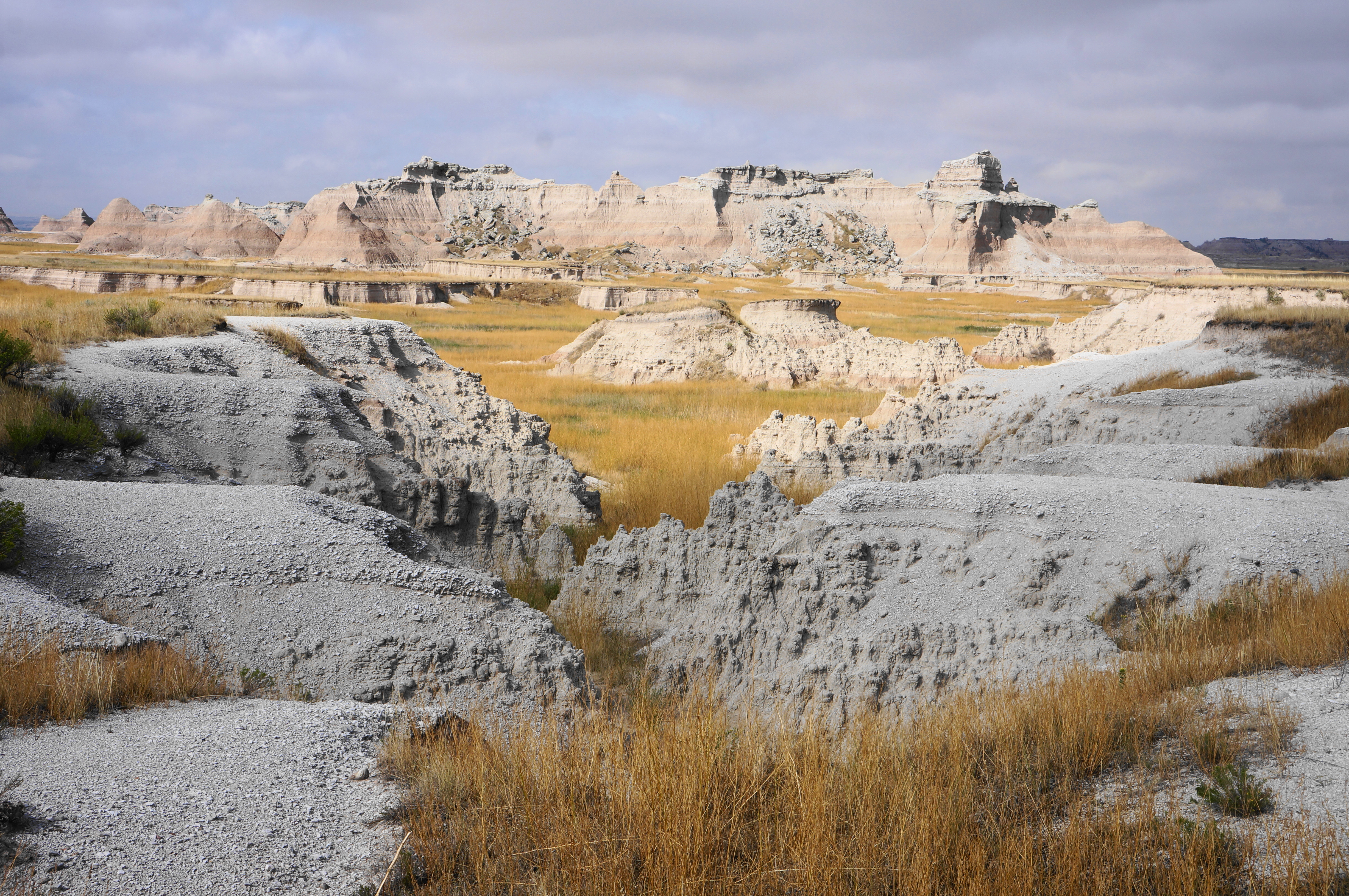

Bear right on the Castle Trail, beginning the westward return to Saddle Pass. Closer to the Badlands Wall, this path is more interesting. Pass back under the power lines and skirt some small formations and clay-studded ravines. View an eroded crevice on the left after about 1/3 mile on the Castle Trail, after which the route flirts further with the maze of fingery gullies.

Clear a couple dry washes and follow the red stakes as the trail comes close to a set of 30- to 40-foot-high buttes. Return to the open grasslands again and split a pair of crumbling “castles.” It is less than a half mile from here back to the four-way junction, where the loop portion ends.

Bear left and retrace your steps on the Saddle Pass Trail, taking care as going down a steep slope is more difficult than ascending. Soon you’ll be back at the base of the cliffs and the parking lot, having completed the 4.6-mile traverse. Expect to take about 2-3 hours for the moderately difficult hike.

I love the colorful rock formations! I will have to revisit this post when we head out to the Badlands to hike.
Pingback: Deer Haven (Badlands National Park, SD) – Live and Let Hike
Pingback: Notch Trail (Badlands National Park, SD) – Live and Let Hike
Pingback: Top 10 Hikes in 2024 – Live and Let Hike