
Note: This is part of a multi-post series chronicling the many possible day hikes in the East Bay’s Briones Regional Park, a 1,600-acre tract nestled east of the Berkeley Hills, west of Mount Diablo, and south of Martinez and Carquinez Strait. I tackled these hikes over the course of several years living in the area between 2019 and 2024. For others in this series, see here.
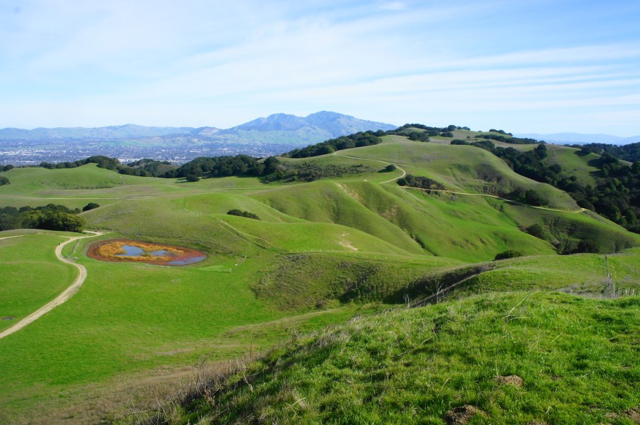
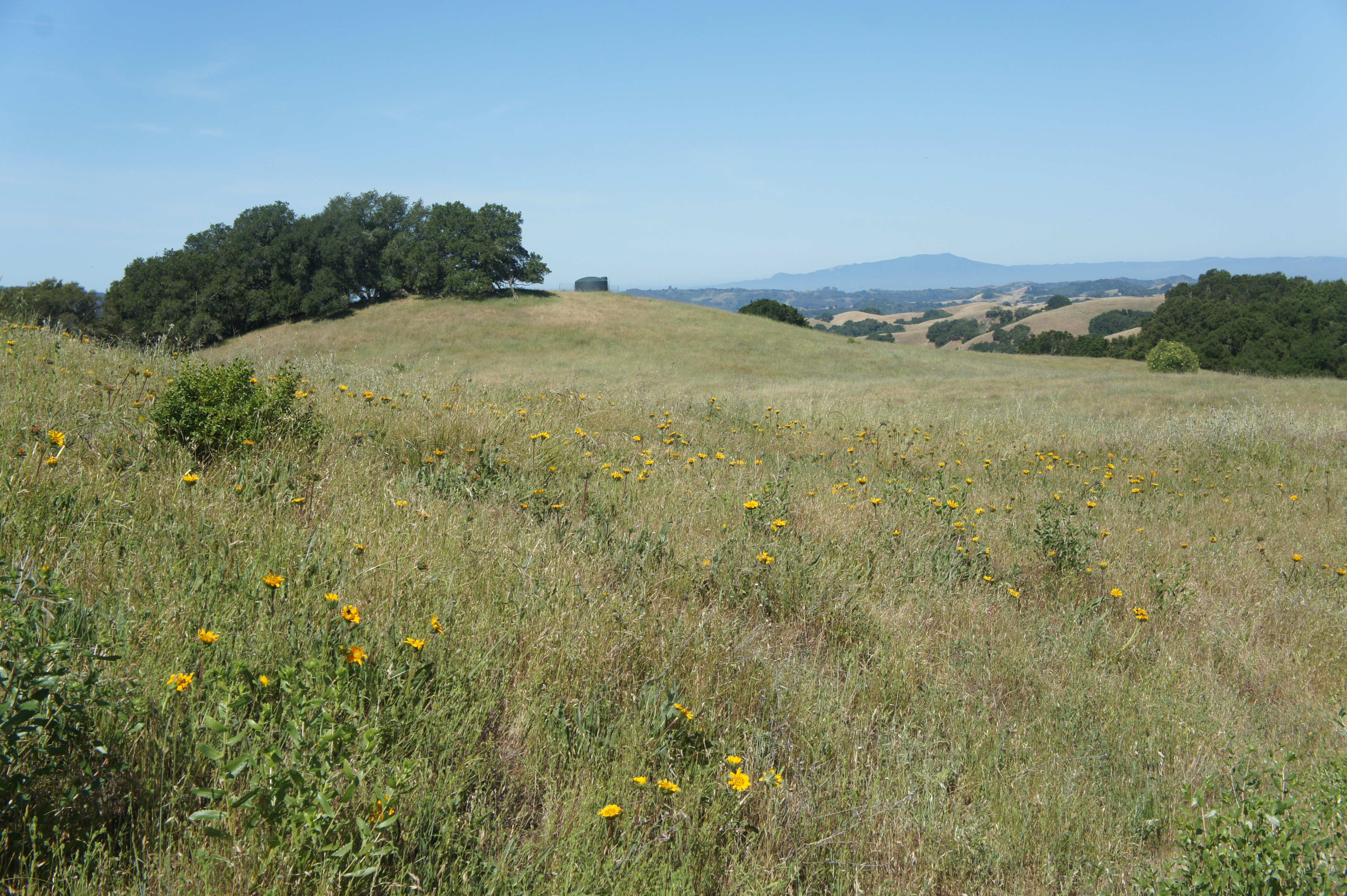
Covering 1,600 acres of former ranching territory in northern Contra Costa County, Briones Regional Park offers some of the most extensive hiking of all the many parks in the East Bay. Here a network of mostly fire roads weave in and out of woody valleys, climb to panoramic peaks, and offer ridgetop views of the Berkeley Hills, Carquinez Strait, Mount Diablo, and Ygnacio Valley. Access points are plentiful, including the Alhambra Creek (map), Bear Creek (map), Briones Road (map), Lafayette Ridge (map), Springhill Road (map), and Reliez Valley (map) Staging Areas. Each of these spots offers an entrée into the scintillating hills, which tend to be more pleasant during the winter and spring, when rains leave the hills lush with verdant green hues and wildflowers (and cool temperatures scare away the rattlesnakes!).
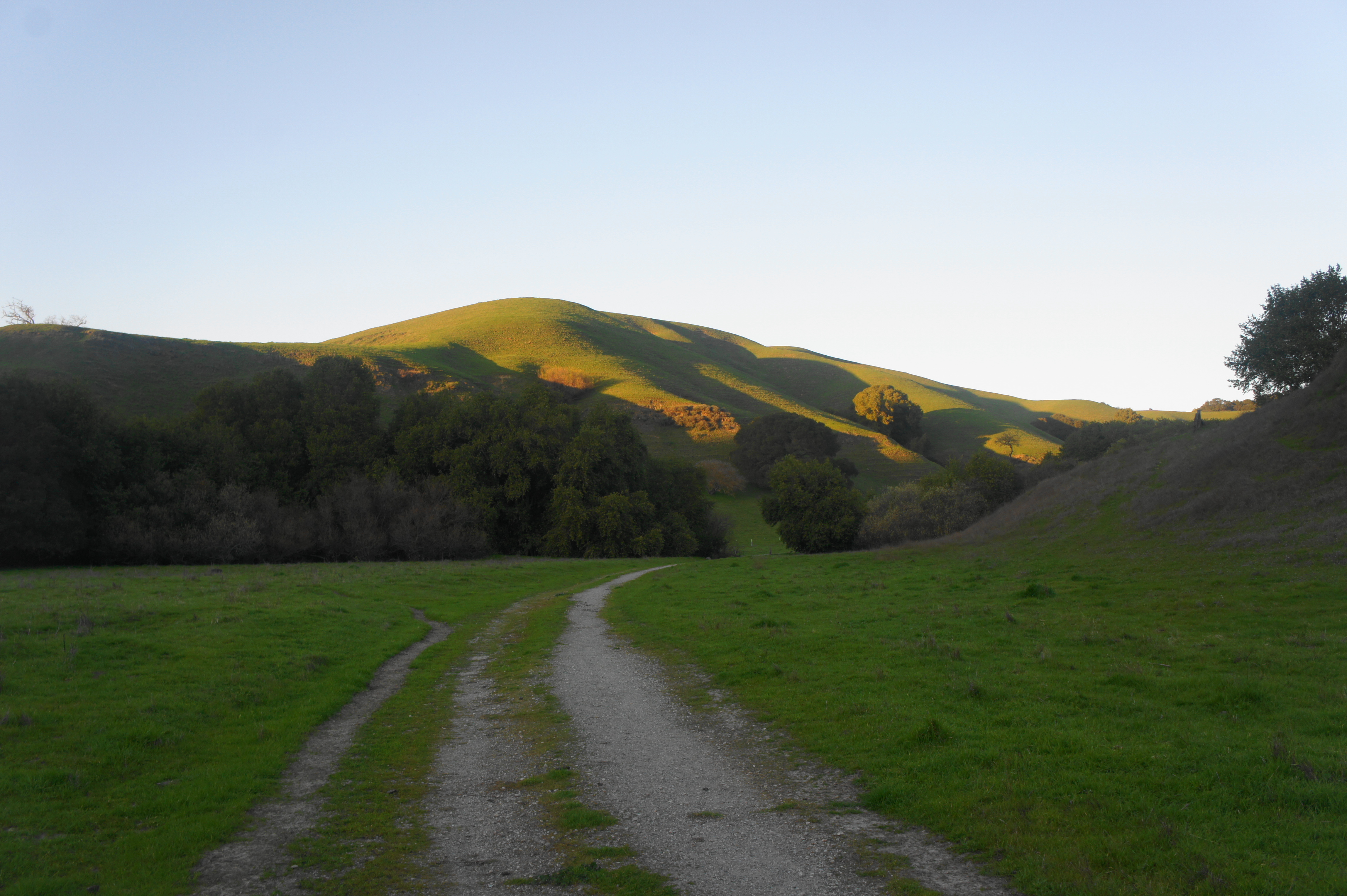
Bear Creek Staging Area
In this post, I describe hikes that start and end at the Bear Creek Staging Area (map), situated just off the winding road between Orinda and Alhambra Valley. There are three different parking lots here, making the most spacious of the Briones trailheads, and a multitude of picnic tables. Trails of varying difficulty fan out in all directions, offering access to the Briones hillscape.
Below I cover 11 different options, ranging from around two to nearly eight miles.
Bear Creek Trail Loop (1.8 mi. loop)
Difficulty: Easy
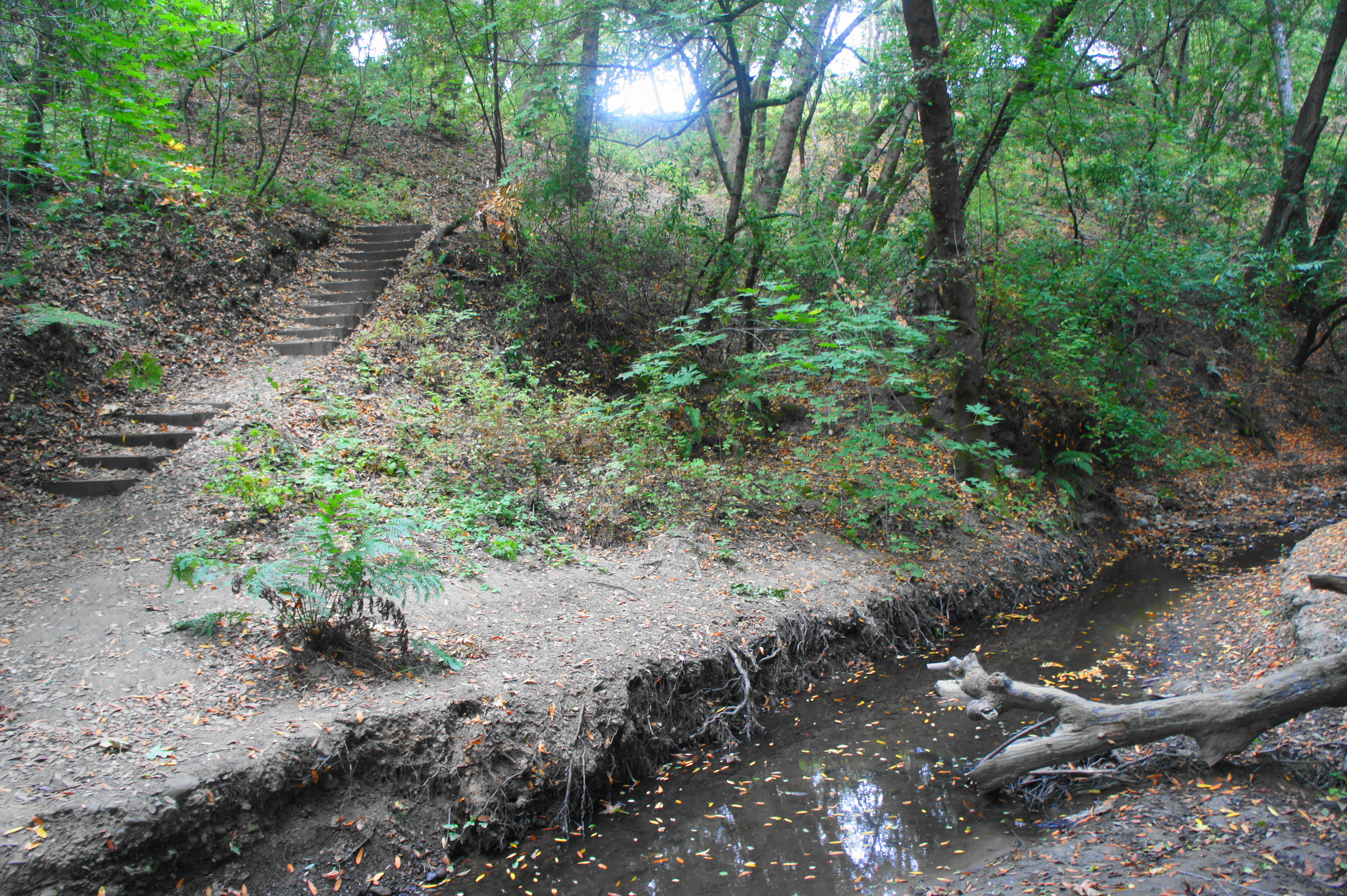
This is the shortest loop one can complete from the Bear Creek Staging Area—and a rare hike in Briones that is almost entirely in the shade. Follow the Old Briones Road Trail from the easternmost parking lot and turn right on the Ivan Dickson Trail, after which the route drops Bear Creek and climbs into Homestead Valley. Bear right on the Seaborg Trail, then quickly right again on the Bear Creek Trail, a lovely up-and-down single-track. This 1.1-mile path is almost entirely under the cover of curling bay trees. The highlight comes near the end, when the path crosses its namesake creek in the cool, shaded valley.


Deer Creek – Briones Crest Trail Loop (2.5 mi. stem-and-loop)
Difficulty: Moderate
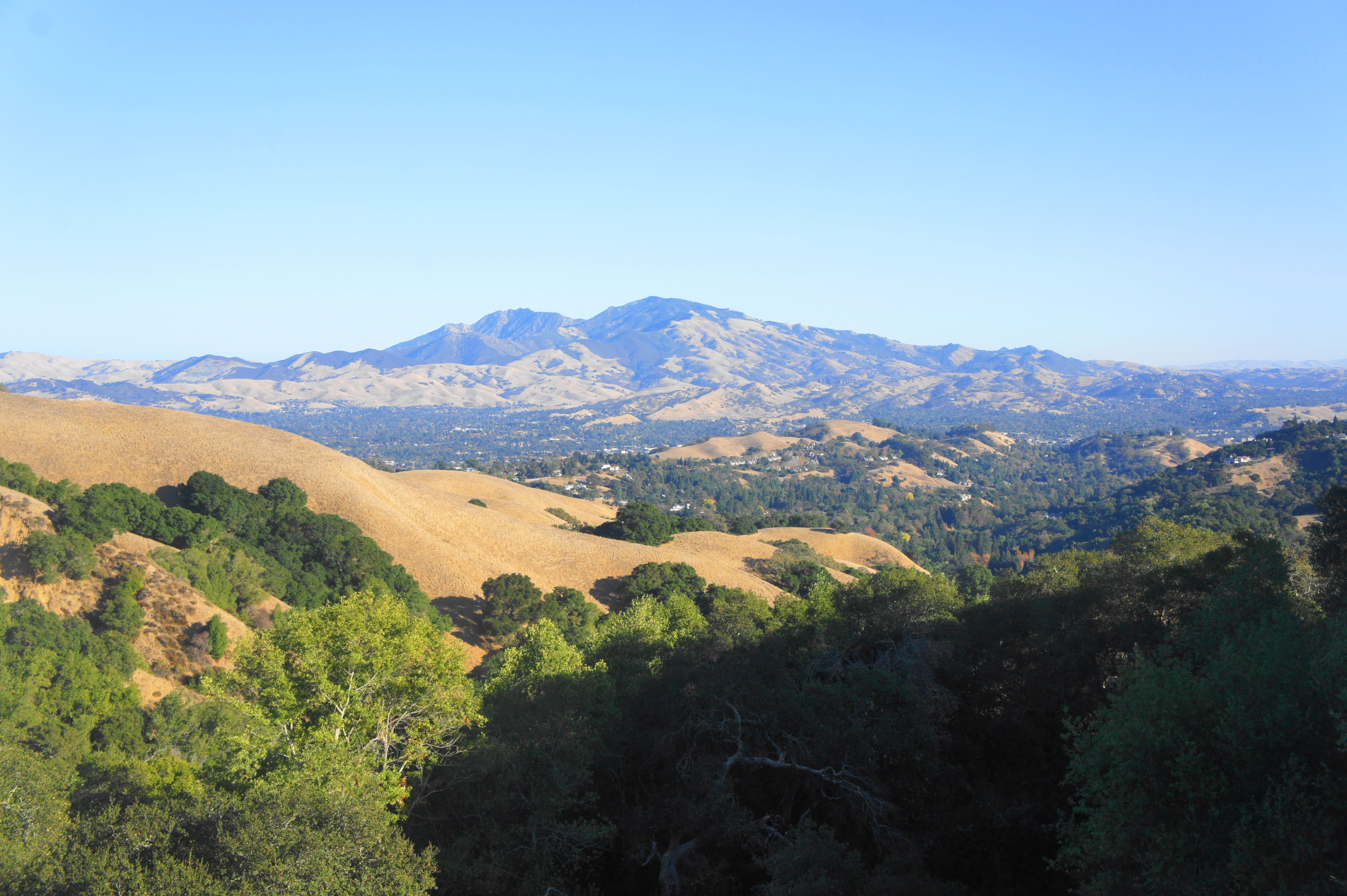
This short, moderately difficult loop ascends the Deer Creek drainage and returns via the scenic Briones Crest Trail. Start at the Oak Grove Picnic Area, swinging west to the Deer Creek drainage, treading through open flats and riparian woodlands to a trail junction at 1.1 miles. Bear right, climbing steeply to the top of a ridgeline, then stay right again at 1.4 miles. Follow the Briones Crest Trail south as it briefly climbs then begins a long descent with sweeping views of Mott Peak, Mount Diablo, and the Berkeley Hills. End back where you started at Oak Grove.


Bear Creek Valley Loop (3.4 mi. stem-and-loop)
Difficulty: Easy
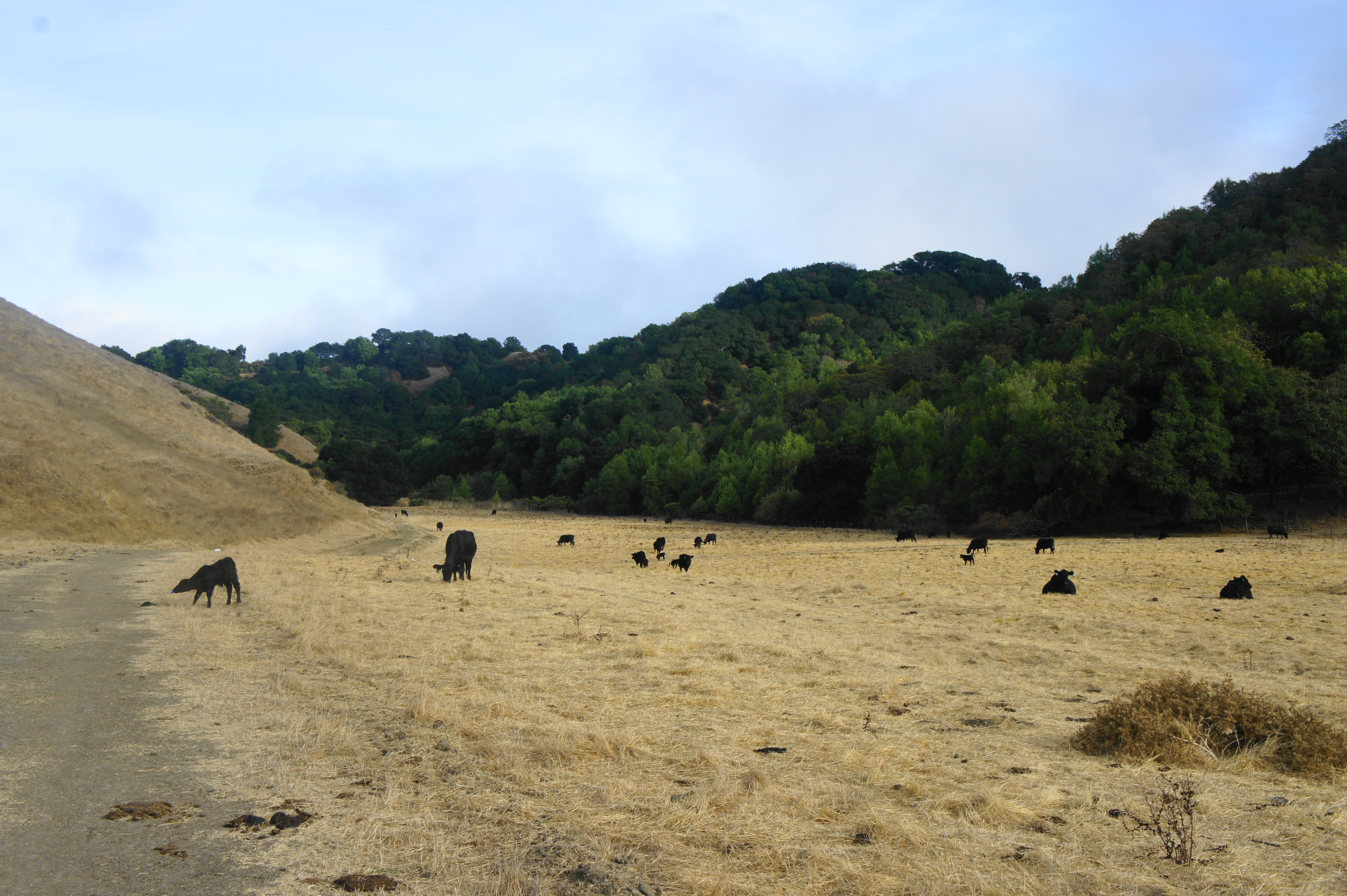
This longer route combines the Old Briones Road, Valley, Yerba Buena, Crescent Ridge and Seaborg Trails to form a circuit around Bear Creek Valley in the heart of Briones. It feels like many hikes in one, including open pastures, dense oak/bay woodlands, and high ridgeline views. After following the Old Briones Road Trail for a mile (and dodging the many cows grazing in Bear Creek Valley), bear right on the Valley Trail, which follows Bear Creek (seasonal) to near its end. At 1.5 miles, bear right on the Yerba Buena Trail, which traverses the open valley then climbs a shady hillside to the crest of Crescent Ridge. Enjoy pleasant southward views on the Crescent Ridge Trail as the path drops precipitously to Homestead Valley, passing the Briones Archery Range on the left. From here, stay left on the Seaborg Trail and follow it back through a shady ravine to Old Briones Road, with the Bear Creek Staging Area just beyond.


Abrigo Valley – Briones Crest Trail Short Loop (3.4 mi. loop)
Difficulty: Moderate
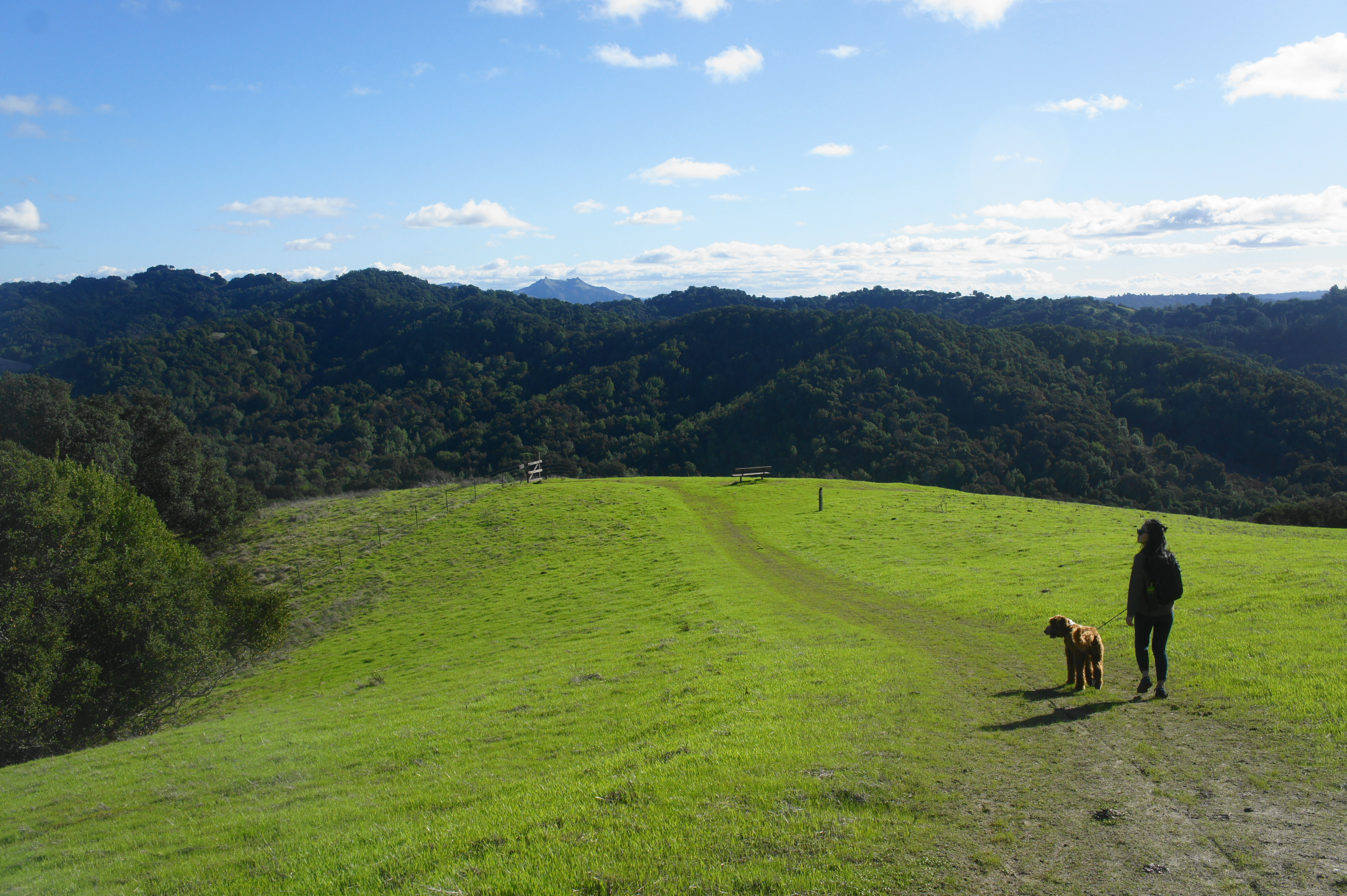
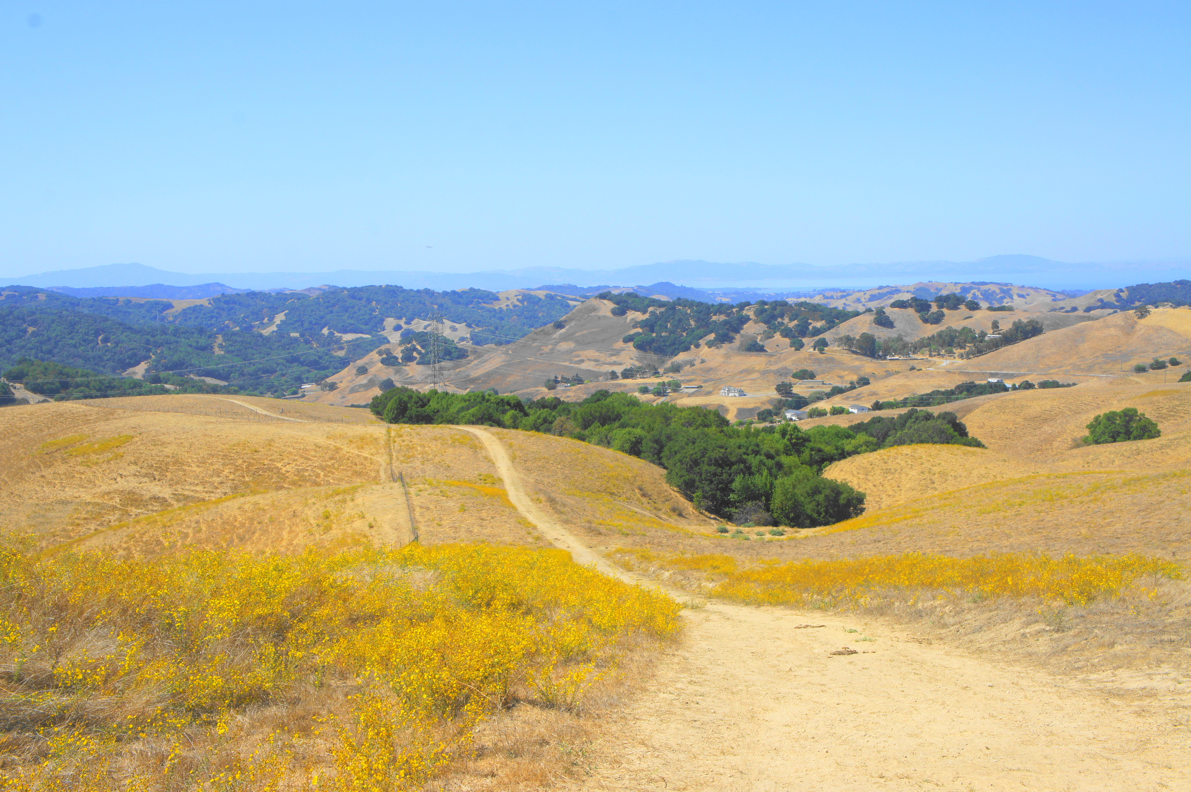
Wide-ranging views abound on this moderately difficult loop hike, which starts in Abrigo Valley and returns via the sun-soaked ridges of the Briones Crest. Starting from the Oak Ridge Picnic Area, follow the shady Abrigo Valley Trail for 9/10 mile, then bear left as the trail heads out into the open across a bowl-shaped basin. At 1.3 miles, bear left on the Santos Trail, climbing sharply to the ridgeline. Enjoy distant views of the Berkeley Hills, Carquinez Strait, San Francisco Bay, and Mount Tamalpais as you head south on the Briones Crest Trail. After passing a trail junction and a well-placed bench with splendid views, the final stretch sheds around 400 feet in a half-mile, returning to the Bear Creek Valley.


Mott Peak via Abrigo Valley & Black Oak Trails (3.9 mi. stem-and-loop)
Difficulty: Moderate
This moderate circuit climbs to Briones’ second-highest summit (1,424’) and features panoramic views of the Bear Creek Valley, Toyon Canyon, and Sindicich Lagoons. Follow the Abrigo Valley Trail north from Oak Grove Picnic Area for 9/10 mile, then bear right on the Mott Peak Trail, which climbs sharply to the Briones Crest. At 1.75 miles, follow the social trail right to the top of Mott Peak, where there is a bench and fence line. (Note: The actual summit is the hill to the southwest, but the relative elevation is about the same.) Enjoy fine views in all directions. Return to the Mott Peak Trail and follow it back west to catch the Black Oak Trail, which crests a pair of hills then descends into the pretty upper reaches of Bear Creek Valley. At 3.25 miles, bear right on the Old Briones Road Trail and follow it back to the Bear Creek Staging Area.


Seaborg – Briones Crest – Crescent Ridge Trail Loop (4.1 mi. stem-and-loop)
Difficulty: Moderate
One of the best short hikes in Briones, this scenic circuit features sweeping views across the park’s woodsy eastern slopes, with distant vistas of Mount Diablo and Las Trampas. Head east from the staging area on the Old Briones Road Trail, then right on the Ivan Dickson Trail as it drops to cross Bear Creek and reemerges from the woods into Homestead Valley. The Seaborg Trail continues right at the junction at 0.6 mile (post #78), follows the length of the valley, and climbs around 300 feet to reach the Briones Crest Trail. Bear left, enjoying the epic views over Lafayette toward Mount Diablo. The trail ascends to around 1400 feet and then splits again at 2.1 miles. Bear left, following the Crescent Ridge Trail for 1.4 miles back to the Archery Range and post #78, enjoying views of Mott Peak (1,424’) and Briones Peak (1,483’) along the way. From here, follow the wide track west for 6/10 mile back to the staging area.

Mott Peak via Abrigo Valley & Old Briones Road Trail (4.3 mi. loop)
Difficulty: Moderate
This variant of the Mott Peak hike continues beyond the summit to the Sindicich Lagoons and loops back to Bear Creek Valley via the Old Briones Road Trail. Follow the description above to the summit, then continue eastward, dropping to a junction with the Briones Crest Trail; bear right, descending to the Sindicich Lagoons at 2.25 miles. Continue east, then turn right on the southbound Old Briones Road Trail, following it down into Bear Creek Valley, with views of the hulking mass of Mott Peak. Once in the valley, head right, following the level old road for 1.1 miles to the Bear Creek Staging Area.


Abrigo Valley – Briones Crest Trail Long Loop (4.4 mi. loop)
Difficulty: Moderate
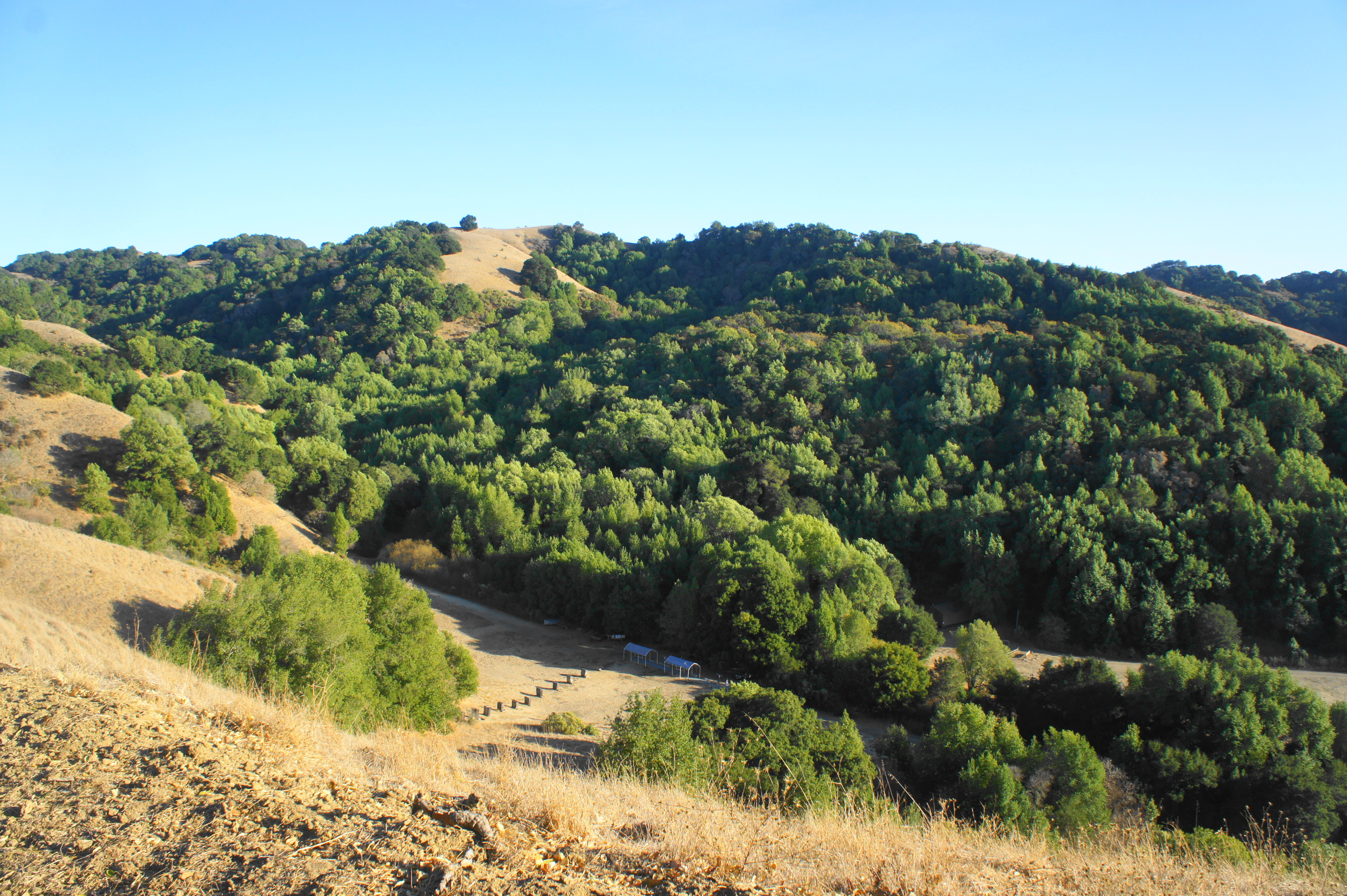
This longer version of the 3.4-mile hike described above follows Abrigo Valley to its end, then adds a particularly scenic section of the Briones Crest Trail with excellent northward views. After passing two group campsites (Maud Whalen and Wee-Ta-Chi) and the junction with the Santos Trail cutoff, the Abrigo Valley Trail climbs sharply to the Briones Crest. Bear left, following the hilltops westward and then south, with distant views of the Carquinez Strait, Sacramento River Delta, and North Bay. Continue on the Briones Crest Trail for more than two miles as it bounds up and down scenic hills before dropping to the Oak Grove Picnic Area.


Deer Creek – Pereira Trail Loop & Ivan Dickson Memorial (4.8 mi. stem-and-loop)
Difficulty: Moderate
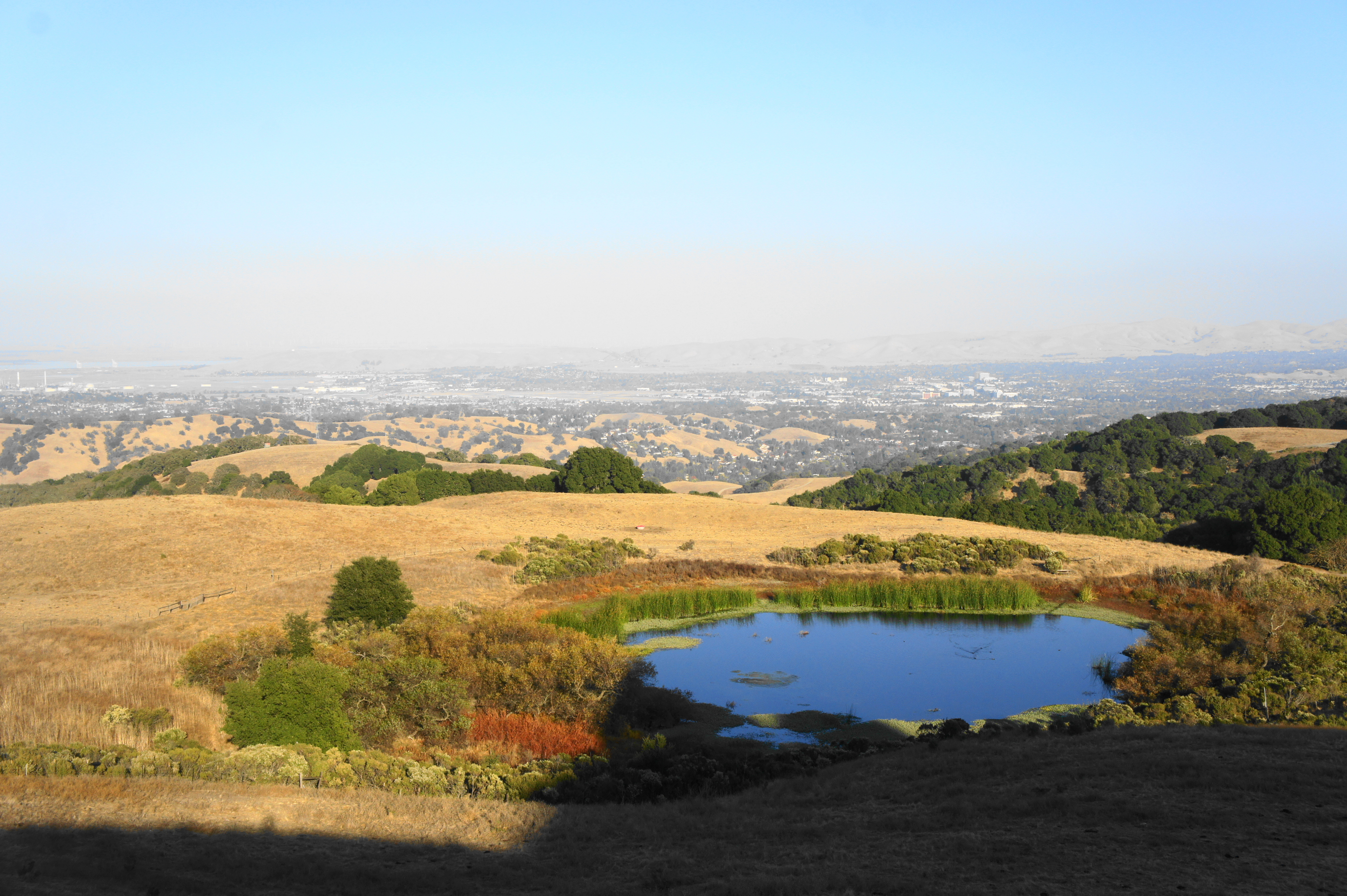
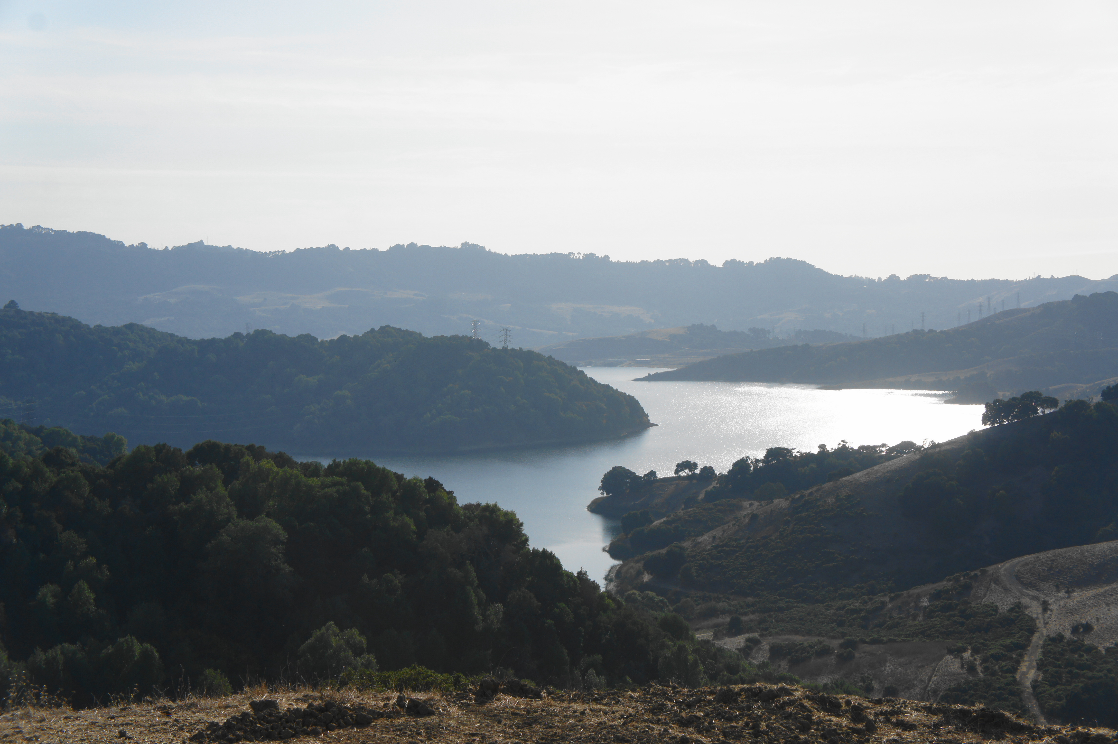
The overlook at the end of the Pereira Trail, the westernmost in Briones, is simply spectacular, the quintessential sunset spot. Below, the waters of Briones Reservoir glisten in the sun, while the undulating hills around the park add to the allure. Starting and ending at the Oak Grove Picnic Area, follow the Deer Creek Trail as it cuts west and gradually ascends a pleasant drainage. Stay right at the fork at ¾ mile, climbing the mild path as it weaves up to the upper reaches of Deer Creek. Bear left again, climbing to the Pereira Trail, and then cut right, traversing the wide path for 8/10 mile to the overlook. Retrace your steps back to the junction, then take two right turns, following the spur to the Ivan Dickson Memorial, a bench with a view dedicated to a longtime patron of Briones Regional Park. After walking back to the main trail, bear right as the Pereira Trail makes a punishingly steep descent back into Deer Creek drainage. Cross the stream and reconnect with the Deer Creek Trail, following it back to the trailhead.


Briones Peak via Old Briones Road & Valley Trails (4.8 mi. stem-and-loop)
Difficulty: Moderate
This hike traverses the length of Bear Creek Valley and climbs mildly to the highest point in the park, Briones Peak (1,483’), forming a 2- to 3-hour lollipop loop. Follow the Old Briones Road Trail for a mile from the Bear Creek Staging Area, then bear right across open grasslands on the Valley Trail. Stay left at the fork at 1.5 miles, then climb a side drainage with the hike’s first steady shade to the Briones Crest Trail at 1.8 miles. Head left, climbing at a decent clip to a clearing at 2.3 miles. Detour to the right for excellent views of Mount Diablo, then head west, following the Briones Crest Trail for 250 yards; take the unmarked but well-worn spur to the right to reach the summit of Briones Peak. While the peak itself is underwhelming, the views improve as the Briones Crest Trail continues westward across an open plateau, then drops to a junction with the Old Briones Road Trail at 3.2 miles. Head left, descending gradually to Bear Creek Valley, then head right and retrace the initial 1-mile stretch back to the parking area.


Briones Crest Trail Loop (7.75 mi. loop)
Difficulty: Strenuous
The premier path in the park, the Briones Crest Trail stays high nearly the whole time as it rounds to Briones Peak, Sindicich Lagoons, and Bear Creek Valley. Start by following the Old Briones Road, Ivan Dickson, and Seaborg Trails through Homestead Valley, then rise to the Briones Crest in a largely wooded section. Bear left and rise to the outstanding open ridgeline, charting north to Briones Peak, the park high point. From here tread westward, dropping to Sindicich Lagoons in the shadow of Mott Peak. There is a hardly a tree to act as an obstruction as the path routes west and then south, culminating with a steady descent along a fenceline. The path ends at Oak Grove Picnic Area.


Pingback: Hikes in Briones Regional Park (Park Office & Briones Road Staging Area) – Live and Let Hike
Pingback: Top 10 Hikes in Briones Regional Park – Live and Let Hike