Note: This is part of a multi-post series chronicling the many possible day hikes in the East Bay’s Briones Regional Park, a 1,600-acre tract nestled east of the Berkeley Hills, west of Mount Diablo, and south of Martinez and Carquinez Strait. I tackled these hikes over the course of several years living in the area between 2019 and 2024. For others in this series, see here.
Covering 1,600 acres of former ranching territory in northern Contra Costa County, Briones Regional Park offers some of the most extensive hiking of all the many parks in the East Bay. Here a network of mostly fire roads weave in and out of woody valleys, climb to panoramic peaks, and offer ridgetop views of the Berkeley Hills, Carquinez Strait, Mount Diablo, and Ygnacio Valley. Access points are plentiful, including the Alhambra Creek (map), Bear Creek (map), Briones Road (map), Lafayette Ridge (map), Springhill Road (map), and Reliez Valley (map) Staging Areas. Each of these spots offers an entrée into the scintillating hills, which tend to be more pleasant during the winter and spring, when rains leave the hills lush with verdant green hues and wildflowers (and cool temperatures scare away the rattlesnakes!).
Springhill Road Staging Area
Though not an official staging area marked on the EBRPD Briones map, there is indeed a parking area and trailhead at the end of Springhill Road, situated off Pleasant Hill Road in northern Lafayette. An open field gives way to hillsides and access to exquisite Lafayette Ridge, one of the highlights of the park. The Sunrise Trail is also terrific, a nice complement to the shady Buckeye Ranch route. I describe three options below.
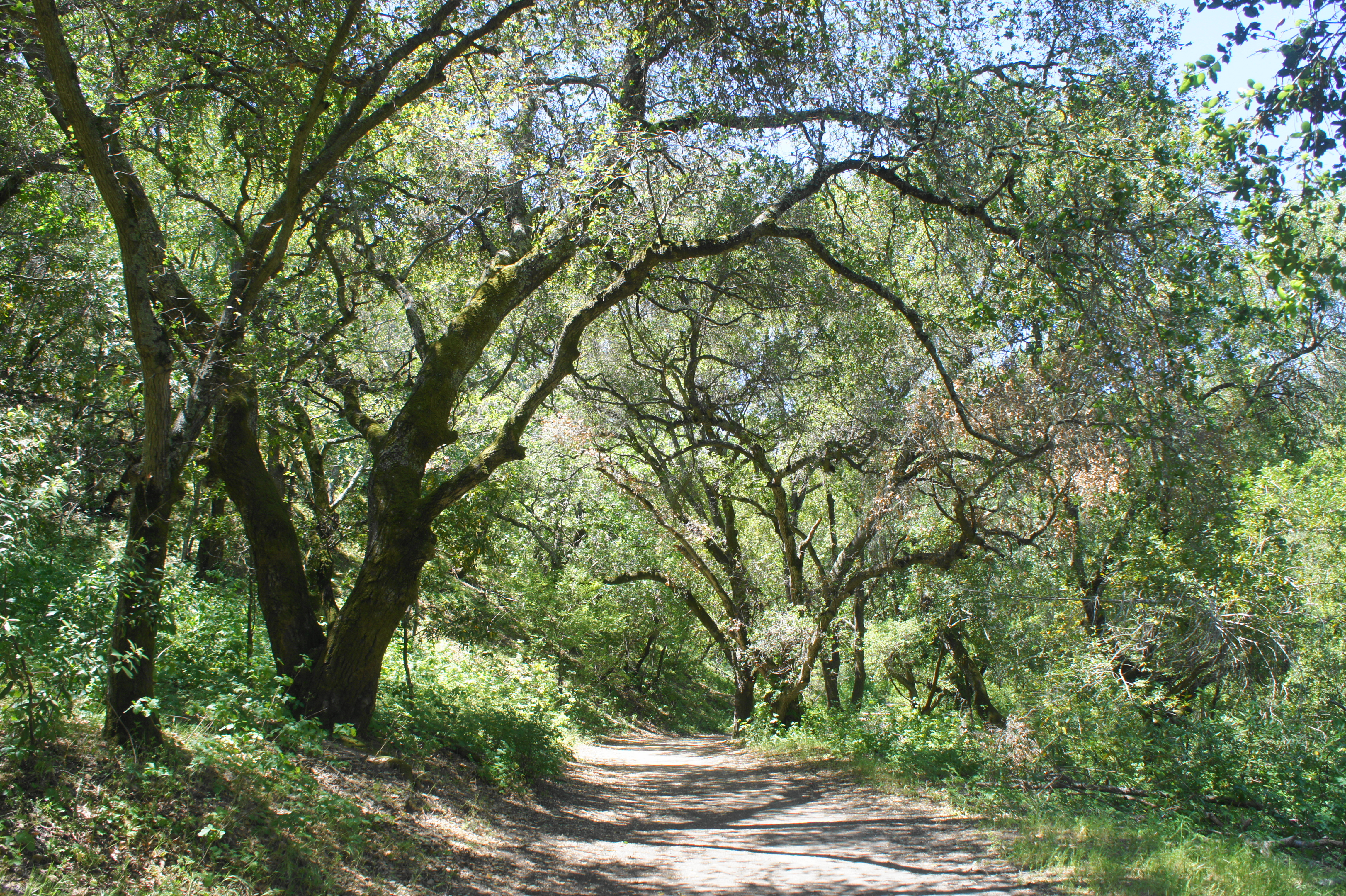
Buckeye Ranch Trail Loop (1.4 mi. stem-and-loop)
Difficulty: Easy
The Buckeye Ranch Trail is not the most scintillating hike in Briones, but its dense tree cover makes it a shady alternative in a park dominated by open, sun-soaked slopes. From the parking area, bear right, across a grassy plain, then pass through a gate and enter the oak/bay woodlands. Follow the south bank of a (usually dry) stream until the trail wraps around to the north side; stay left at the unmarked junction at 7/10 mile, then right at the next, returning to the south bank. From here, follow the wide path under the shady canopy back to the start.


Russell Peak via Buckeye Ranch and Springhill Trails (3.1 mi. stem-and-loop)
Difficulty: Strenuous
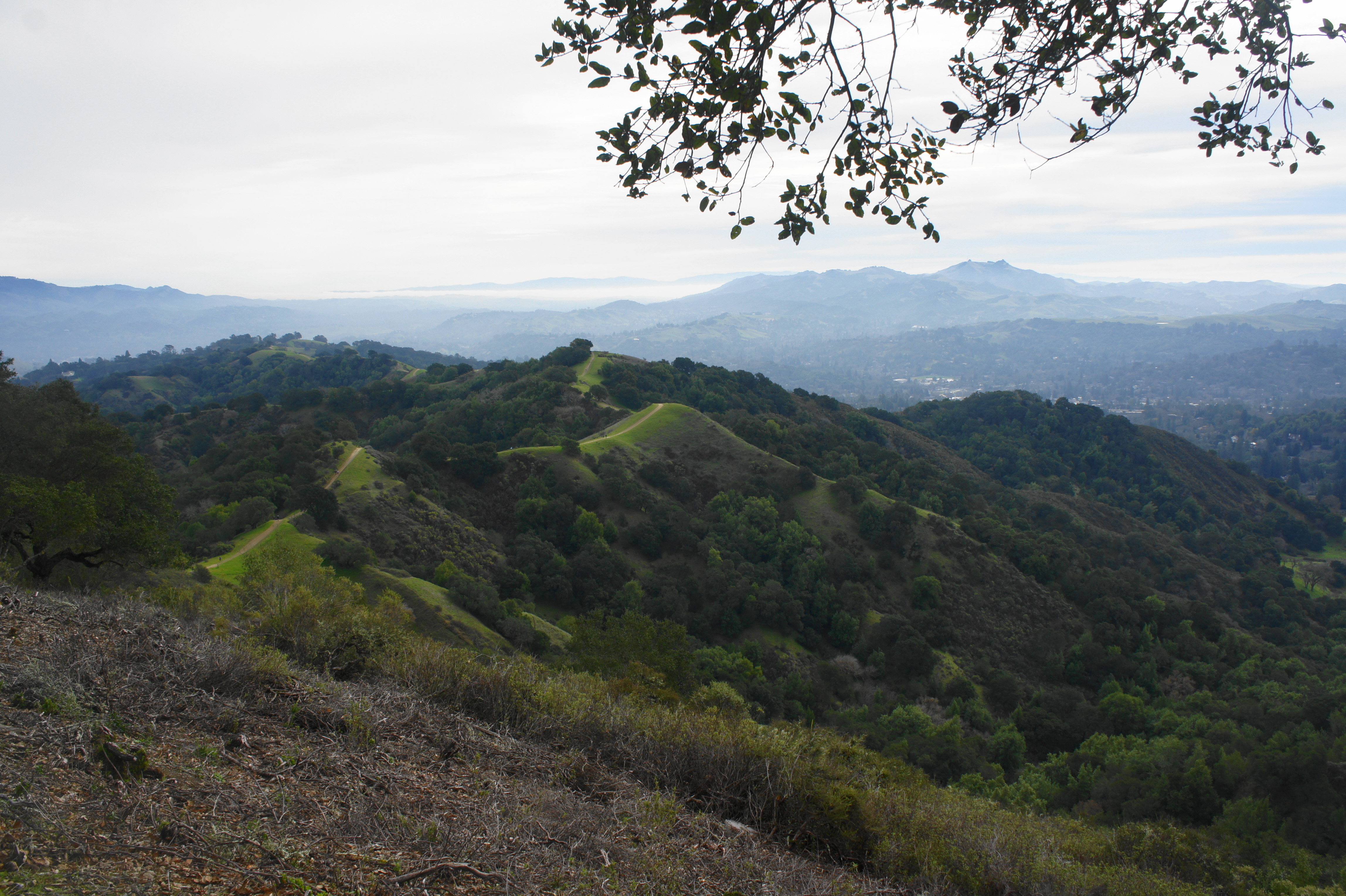
There are multiple approaches to Russell Peak, a 1,357-foot summit in southern Briones with tremendous views of Lafayette Ridge, Mount Diablo, and Las Trampas Ridge. One brief but steep option with 650 feet in elevation gain begins at Springhill Road. Follow the Buckeye Ranch Trail westward, staying left at the first three junctions. At the third fork at 7/10 mile, follow the track up one of the steepest uphill slopes in the park. Rising above the bay/oak woodlands, the trail crests Lafayette Ridge at 1.1 miles; bear right on the Briones Crest Trail, then left on the Russell Peak Trail, followed by a final left to the summit. There is a picnic table and excellent views of Lafayette Ridge and beyond to the east. Lafayette Reservoir can be seen to the south, and Briones Reservoir to the west. On the way back, return to Lafayette Ridge and continue southeast on the trail as it climbs three consecutive hills, each higher than the last. Bear left on the Springhill Trail at 2.4 miles, then descend a wooded hillside back to the trailhead.
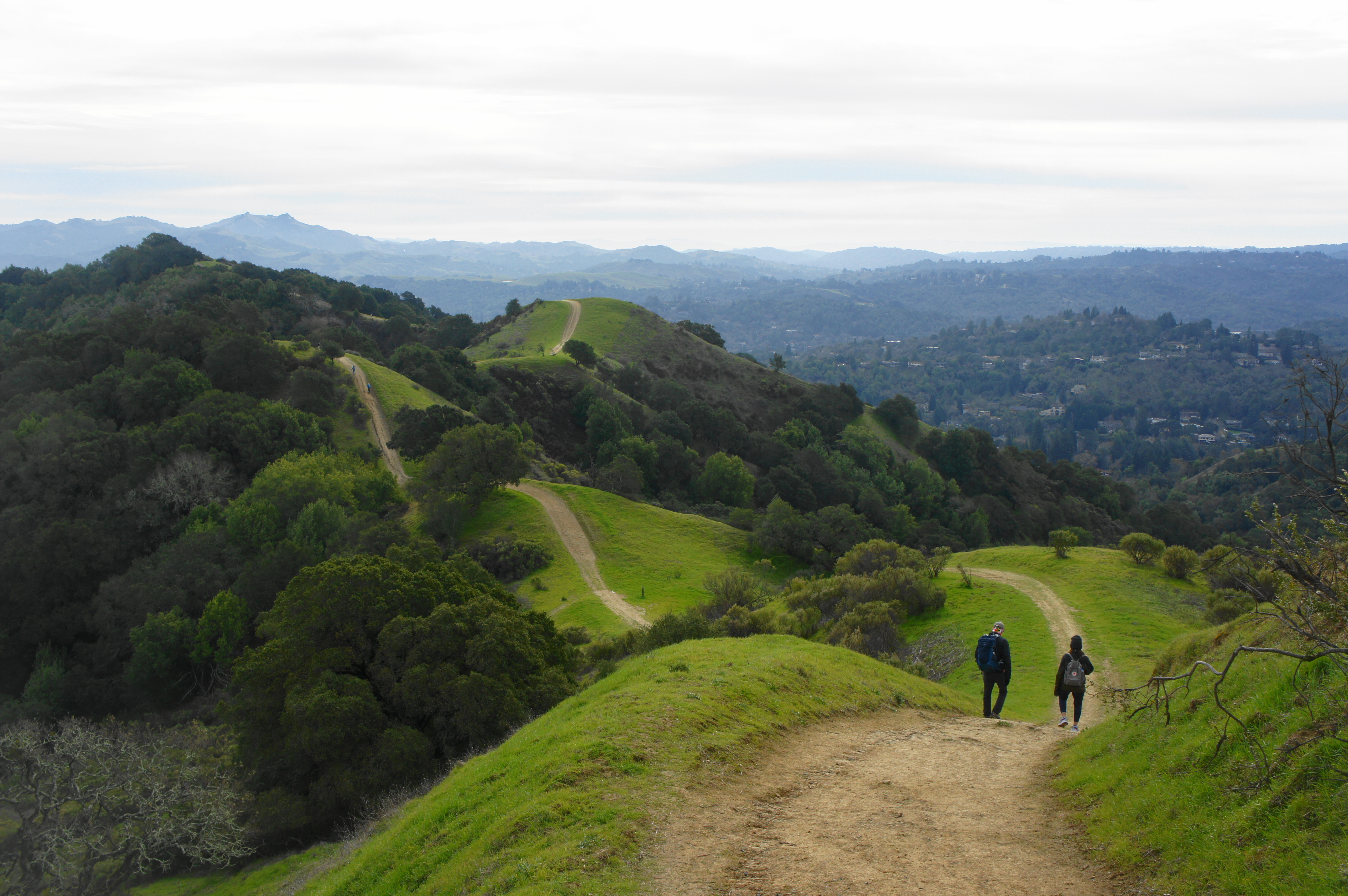

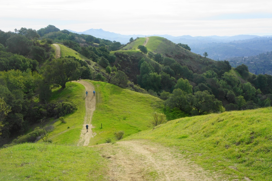
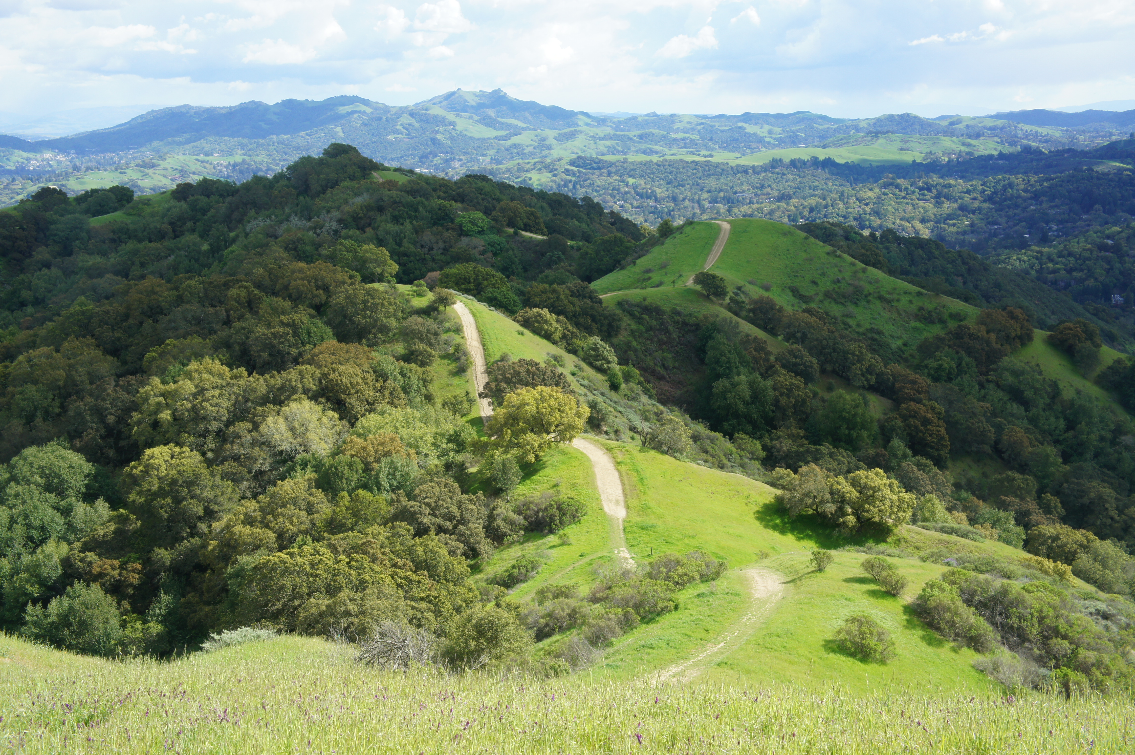
Sunrise – Briones Crest – Buckeye Ranch Trail Loop (3.7 mi. stem-and-loop)
Difficulty: Strenuous
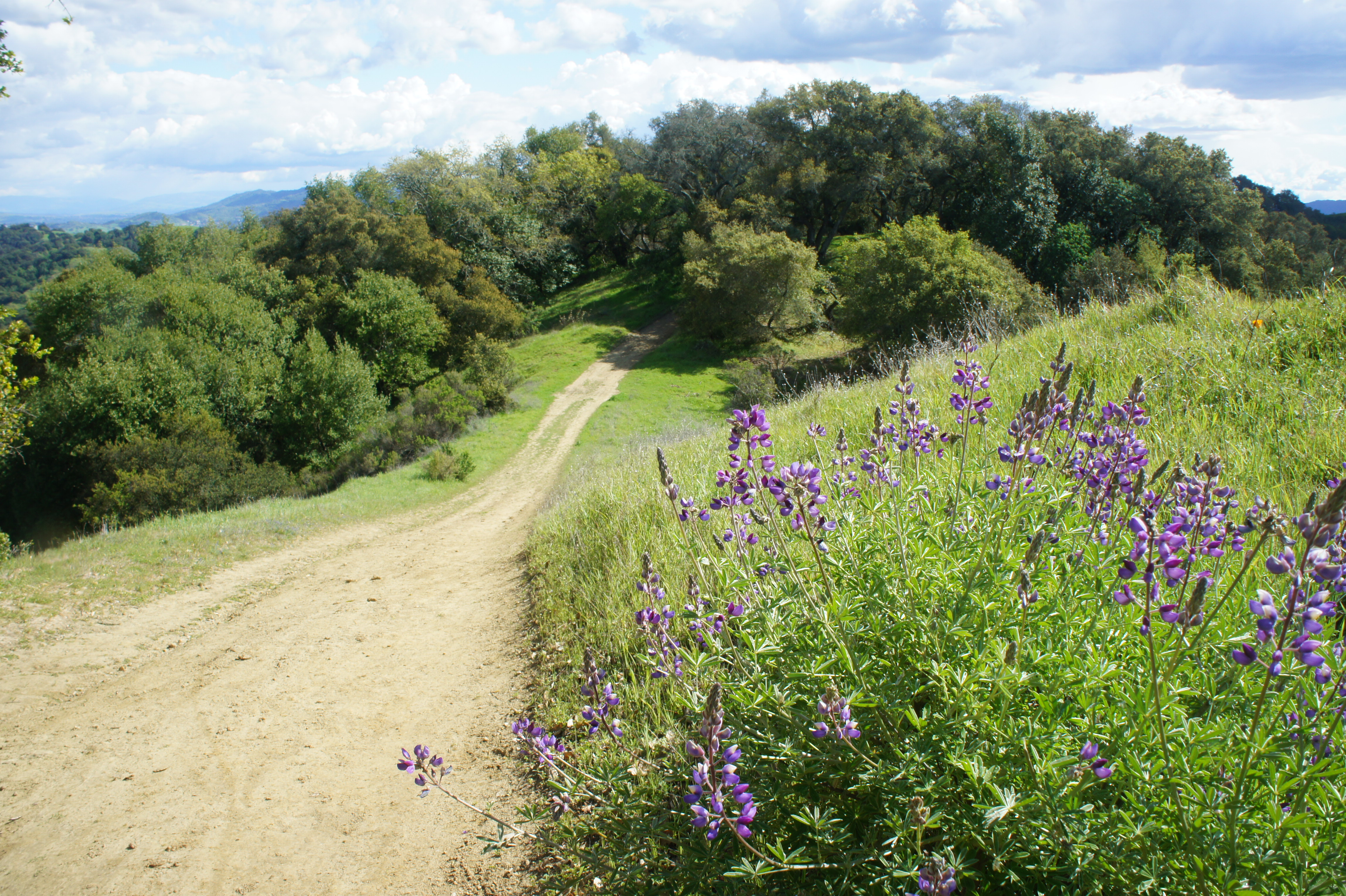
This exceptionally scenic loop climbs 800 feet in elevation but traverses diverse terrain and rewards hikers with outstanding views to the east and south. Start at the Springhill Road Trailhead, following the Buckeye Ridge Trail for 2/10 mile, then bear right and cross the (usually dry) streambed and turn right again. At ½ mile, take a left on the Sunrise Trail, which rounds a ravine and then rises to a sunny hillside with great views of Twin Canyon and Lafayette. Ascend the steep but scenic ridgeline, looking back for distant views of Acalanes Ridge, Mount Diablo, Las Trampas Ridge, and the Berkeley Hills. At 1.7 miles, the ascent eases and the Sunrise Trail merges with the Briones Crest Trail. Head left, traversing one of the finest sections in the park. At 2.3 miles, stay straight on Briones Crest, then drop down Lafayette Ridge Trail, which descends sharply. Head left on the Buckeye Ranch Trail and follow it downhill back into the initial canyon. At 3.3 miles, cross the streambed to the south side and follow the trail for 4/10 mile back to the start.


Pingback: Top 10 Hikes in Briones Regional Park – Live and Let Hike