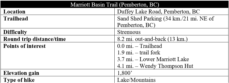
Set in a gorgeous bowl in the Cayoosh Range in western British Columbia, the Marriott Basin Trail is a less-crowded alternative to nearby Joffre Lakes. After a relatively ho-hum walk on logging roads, the route ascends through pine forests and glacial moraines to Upper Marriott Lake and Wendy Thompson Memorial Hut (a reservable site), with open views toward Mount Marriott (8,973’) and Mount Rohr (7,949’). This is a lovely but strenuous hike on the road from Whistler and Pemberton to Lillooet, within striking distance as a long day trip from Vancouver.
The hike
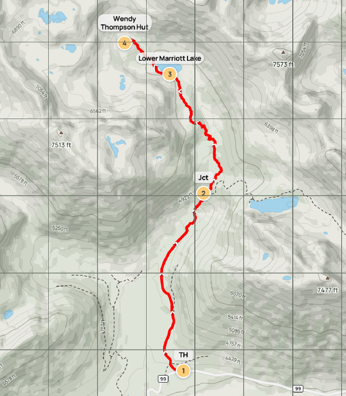
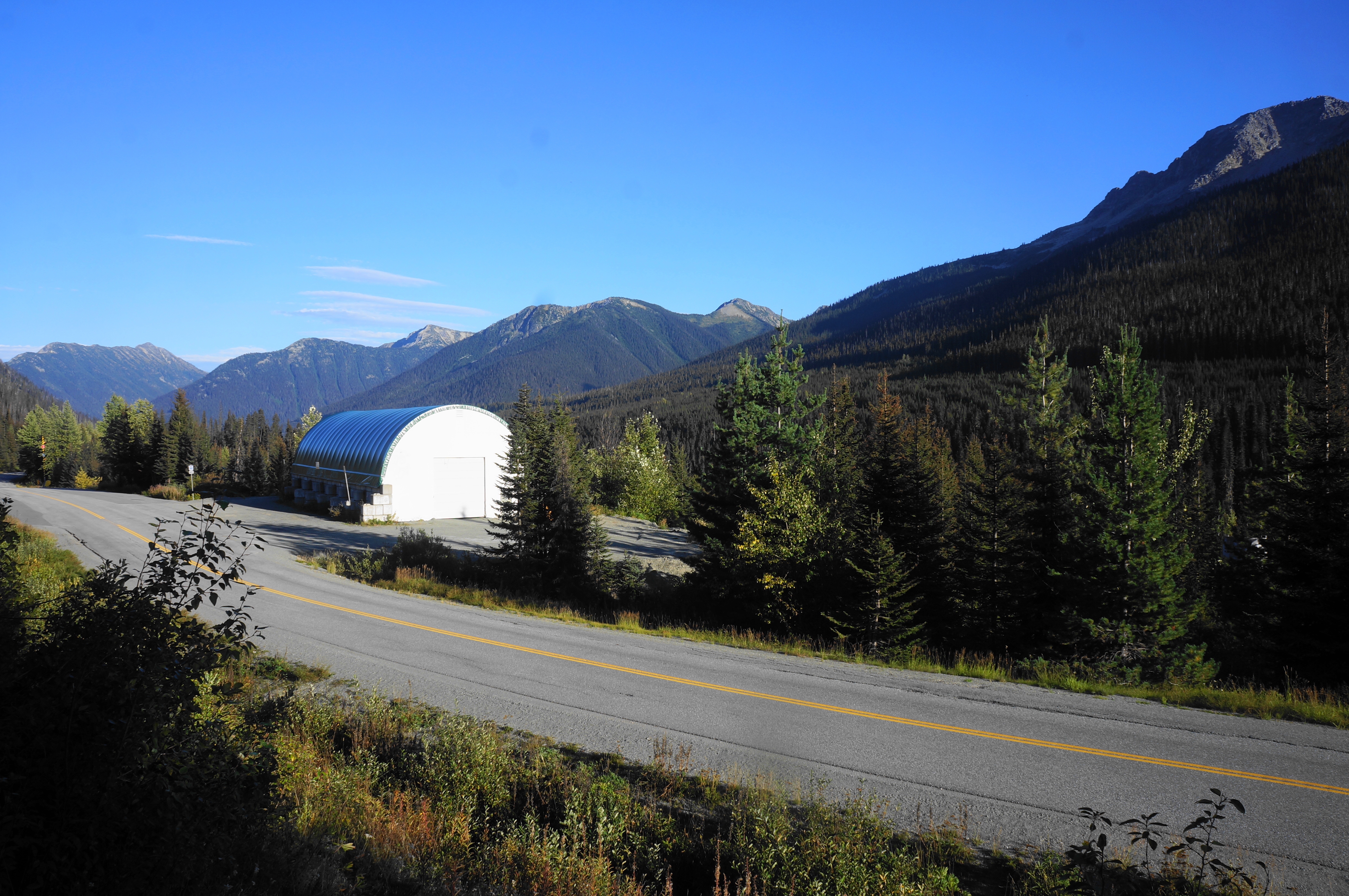
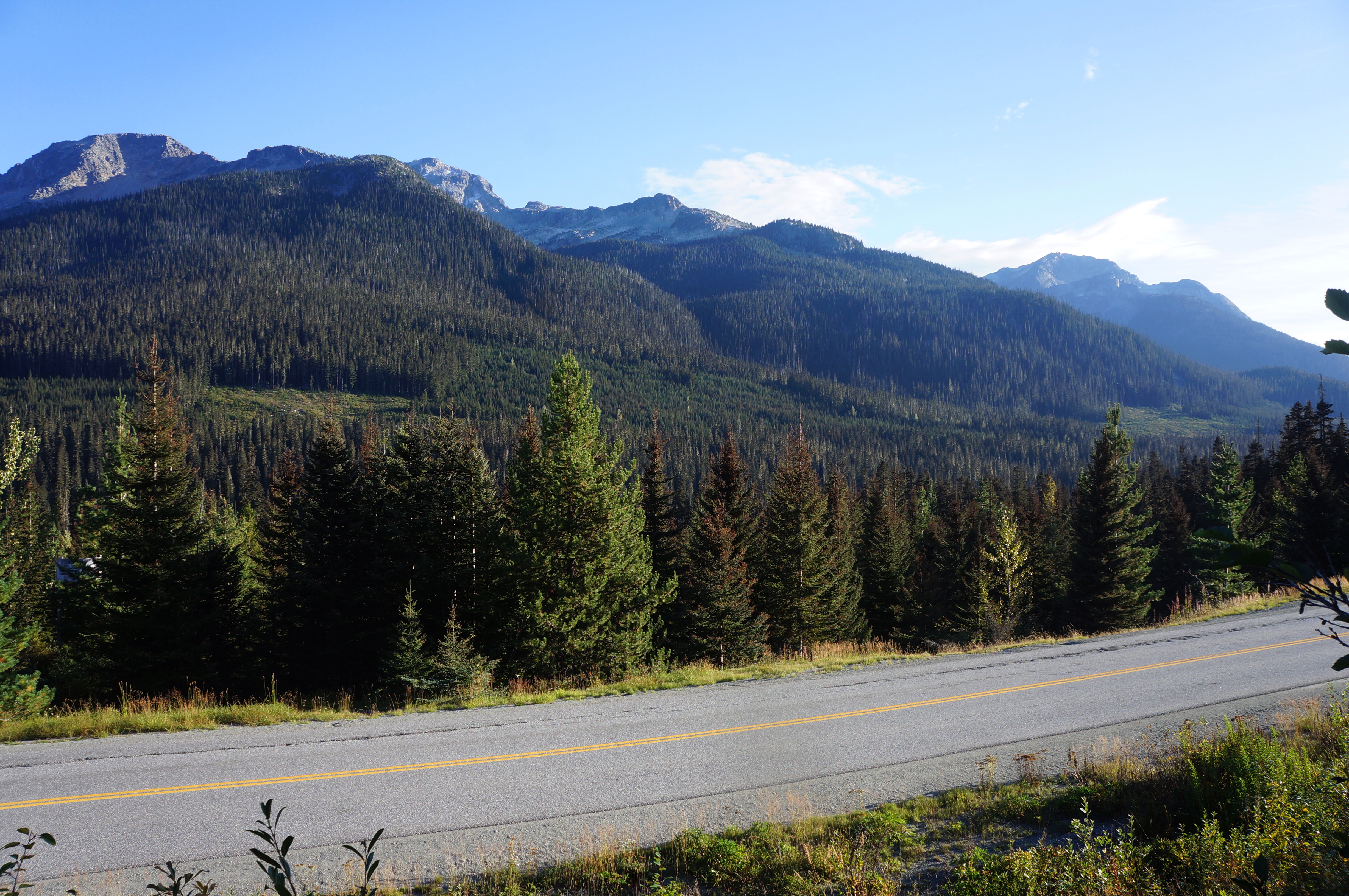
There are a pair of hikes from the Sand Shed parking area off Duffey Lakes Road between Pemberton and Lillooet, British Columbia (see map): Rohr Lake and Marriott Basin. Both hikes are spectacular, though the latter is longer and lesser-visited. There are a handful of parking lots, though some will depend on how confident you are in your vehicle: those with 4WD can shave off as much as 1.3 miles each way by parking at the end of the Cayoosh Creek Forest Service Road. (Note: There are a handful of other pull-offs too along this road, which is bumpy yet passable to most at first—but deteriorates in quality thereafter.) The easiest option for 2WD, low-clearance vehicles is simply to park at the pull-off a few hundred meters east of Cayoosh Creek road, across from the “Sand Shed.”
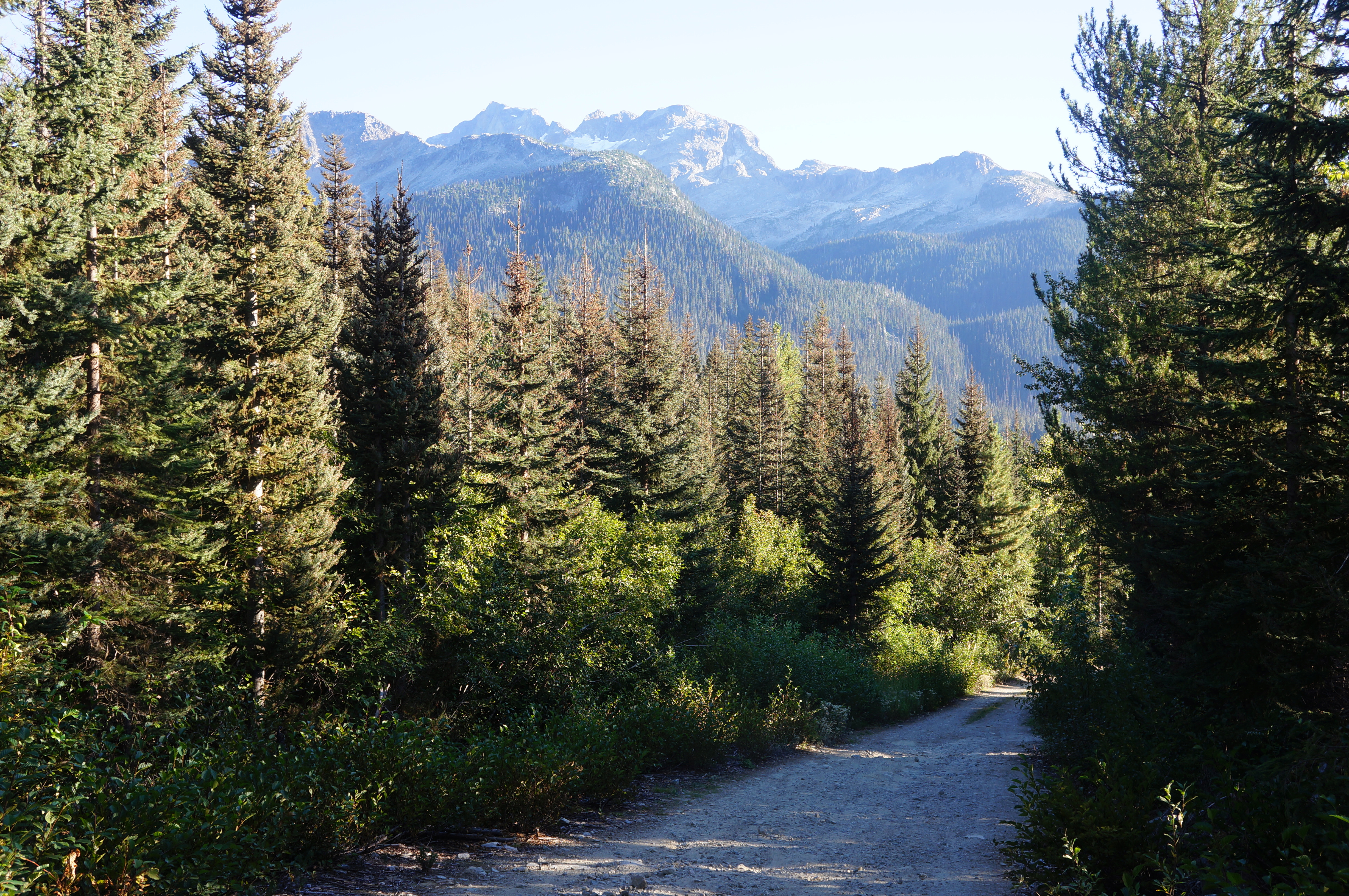
From this spot, bear west on the road shoulder for about a minute, then find an unmarked but evident footpath heading up into the mountain scrub. (Note: This is a shortcut route that helps hikers avoid having to walk all the way to the start of the Cayoosh Creek Road.) The footpath climbs briefly then levels and comes out at a second parking area at the junction of Cayoosh Creek Road and a spur road, both graveled. From here stay left, continuing northward through the coniferous forest, with window views back toward Mount Matier (9,131’) to the south.
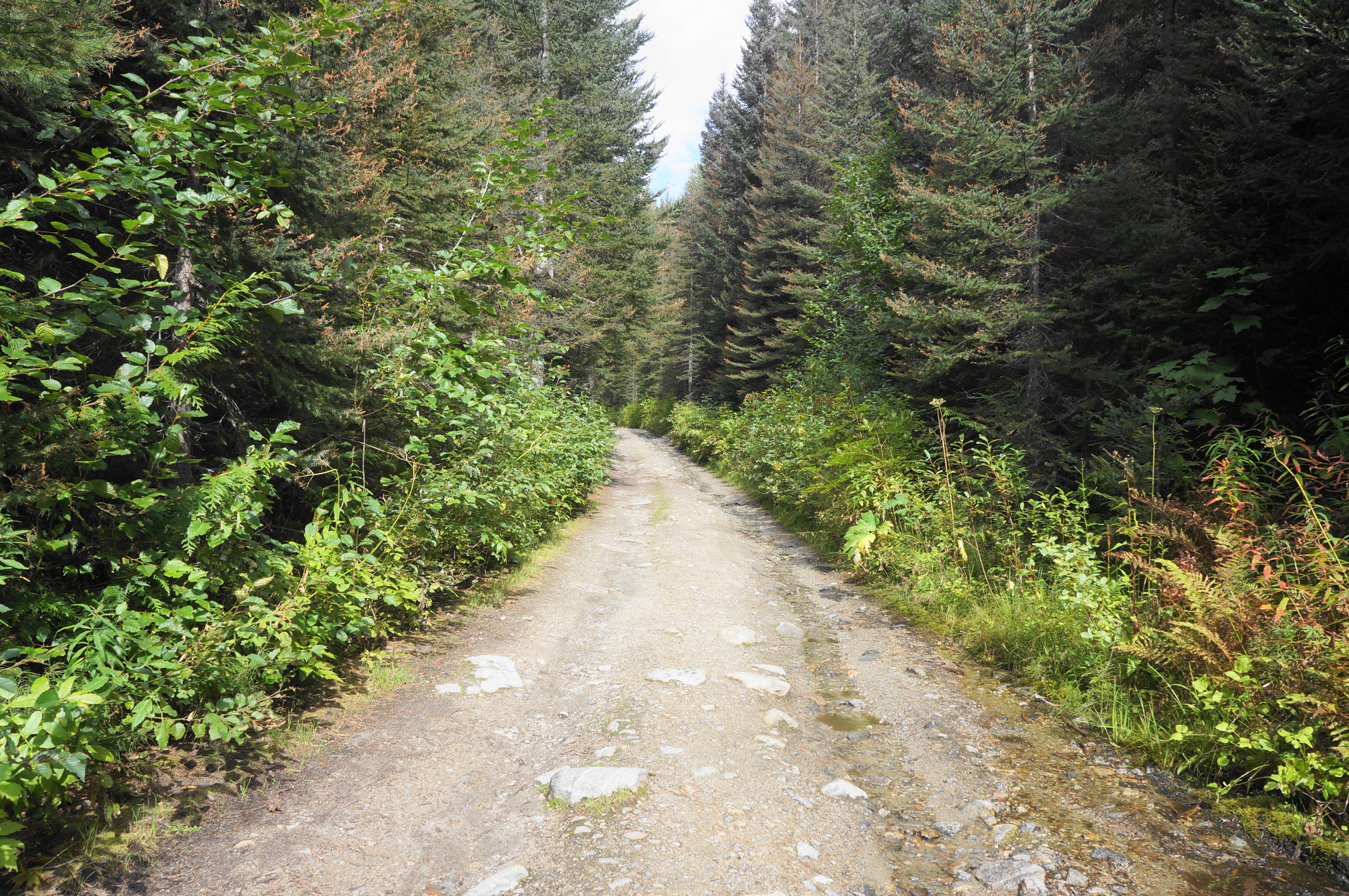
The slight uphill on the logging road is nothing to write home about but is a means to end. Pass several turnoffs on the left where more adventurous drivers have parked, with the largest having room for around seven cars. (Note: There is also a pit toilet here.) Come to a junction, staying left, briefly dropping before resuming a slight uphill. It is 1.3 miles in total from Duffey Lakes Road to the end of Cayoosh Creek Road, after which the route turns into a more interesting singletrack.

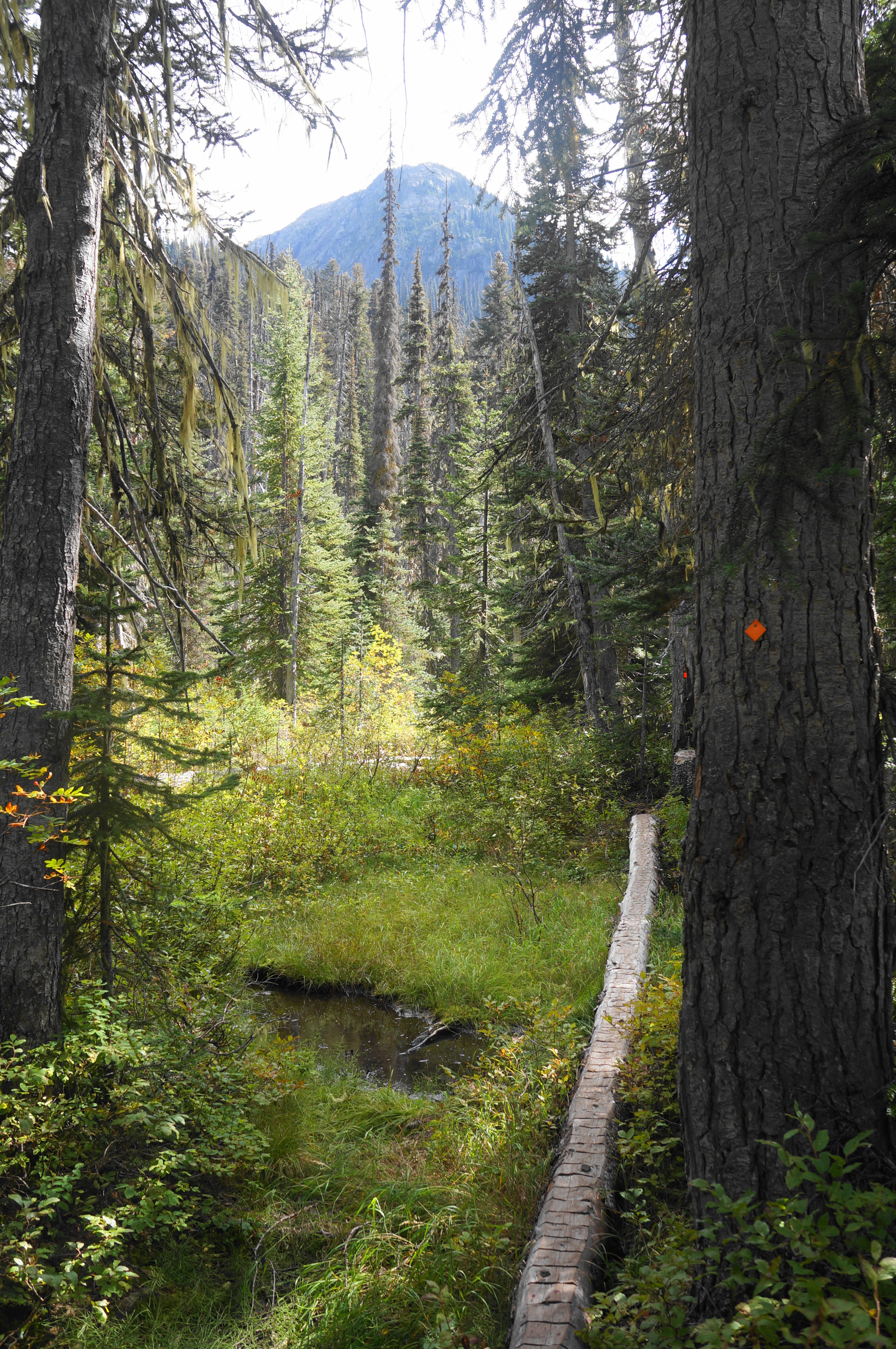
The trail beyond is rockier and dotted with small ladder bridges over a set of lush drainages. Cross a more significant rivulet, then a seasonal stream bed, then embark on a steady uphill through the deep woods for around 1/3 mile to a junction: the path to Rohr Lake heads right, while the Marriott Basin Trail (marked with “WTH”—for Wendy Thompson Hut) bears left.
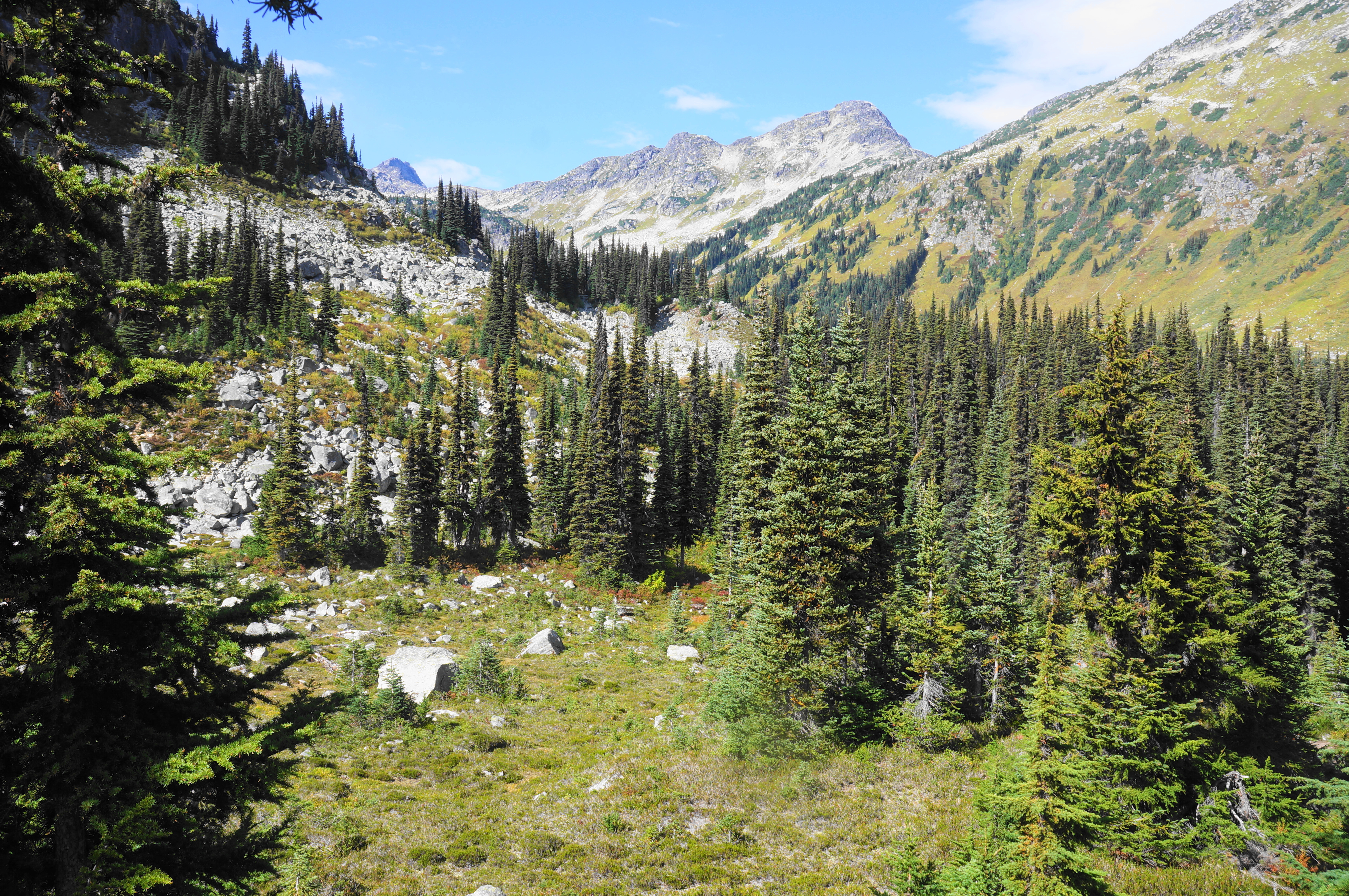
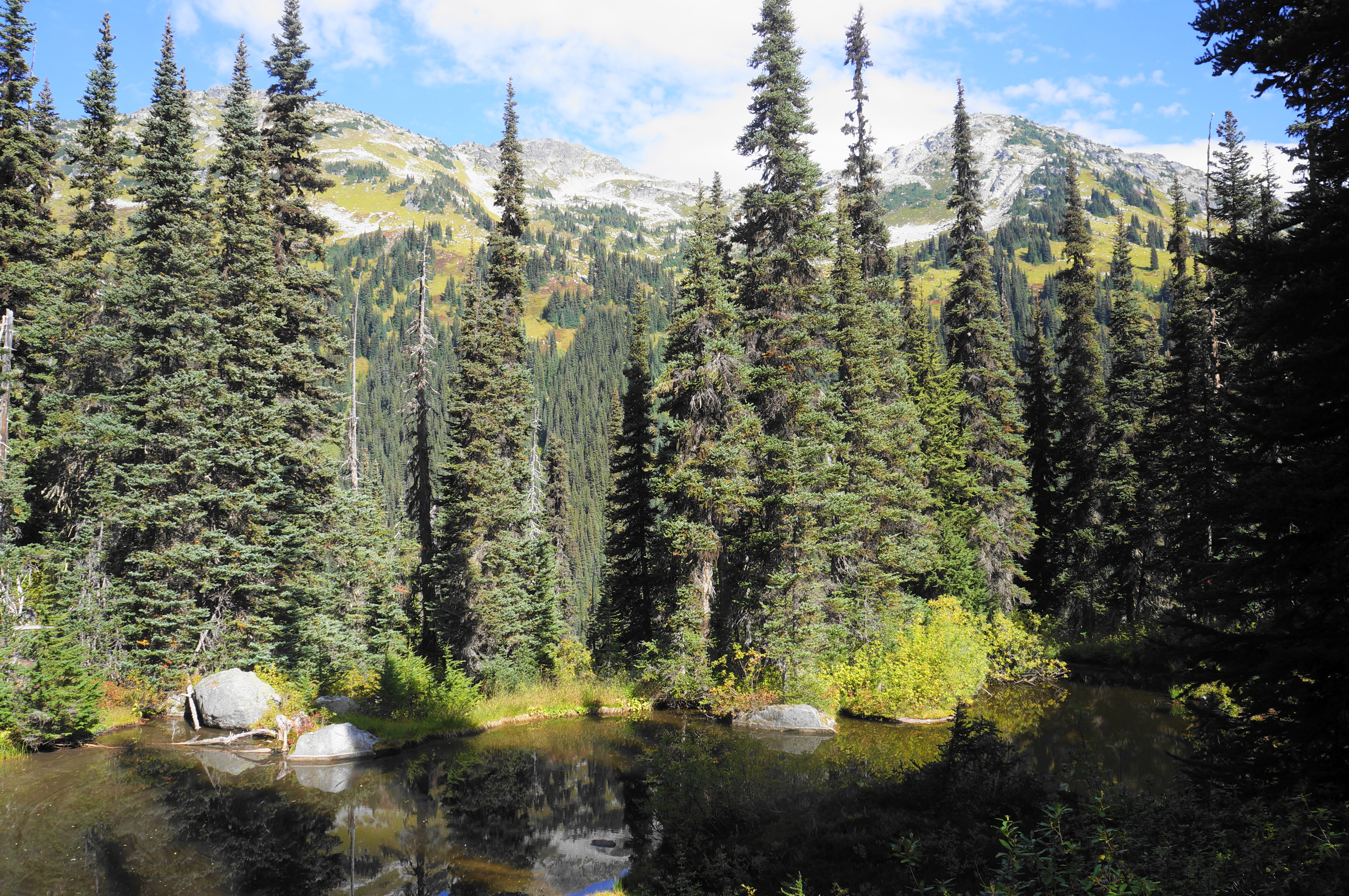
Stay left and ascend a set of five switchbacks. At the fifth, the trail comes within striking distance of a small waterfall, down in the ravine on the left. From here it is up to another stream crossing, followed by another steep incline. Still in the forest, clear a trio of quick bends, after which the trail levels off a bit, skirting a partial clearing off to the right. Keep your balance on the many log crossings over marshy sections in quick succession.
Just before another significant uphill, cross the main drainage in this basin, with a rope and log assist. Thereafter the Marriott Basin Trail briefly parallels the creek, then cuts left, passing another quaint, small meadow. Rise to find another opening on the right and a partial view up to an unnamed mountain to the east.
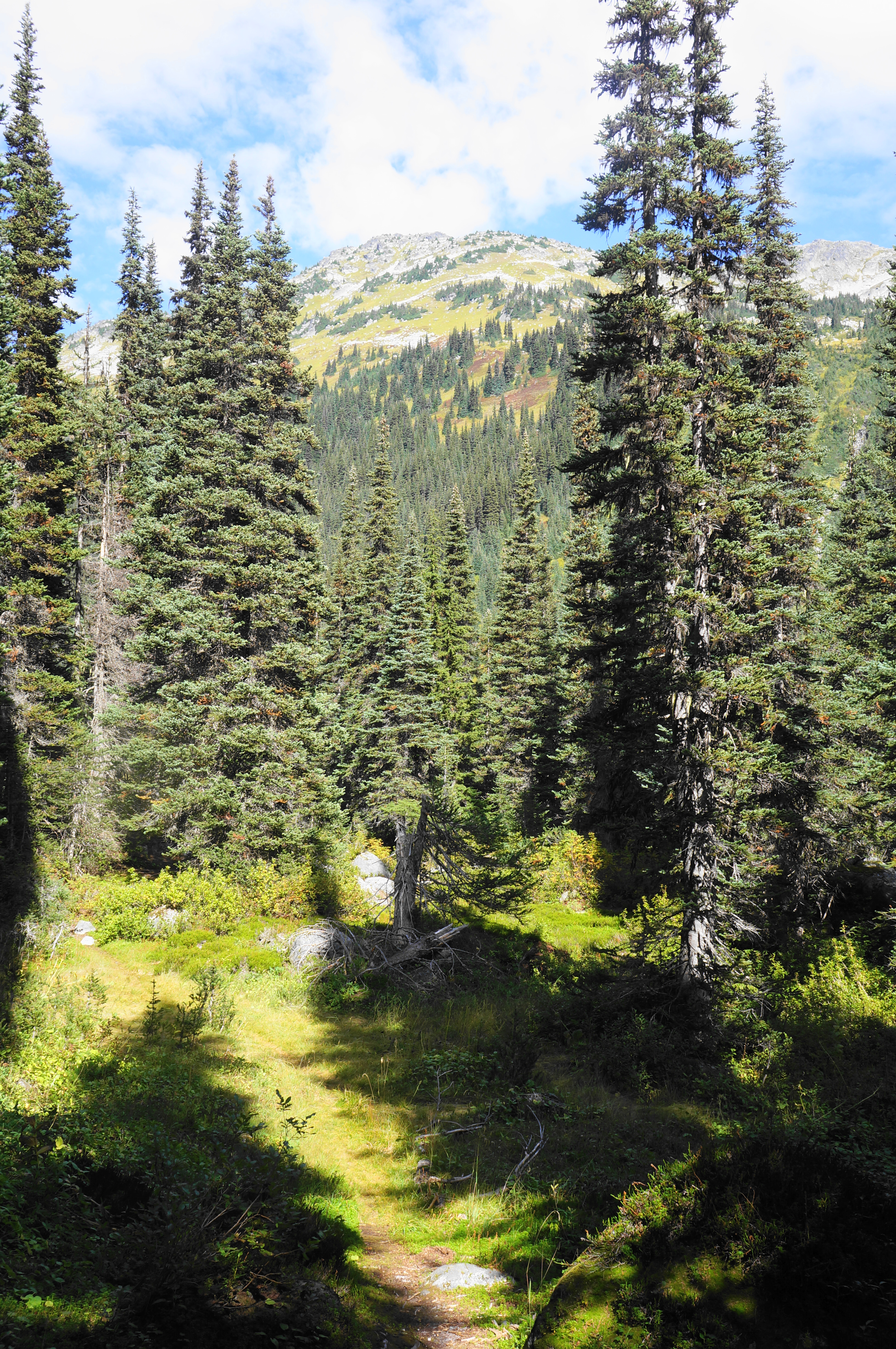
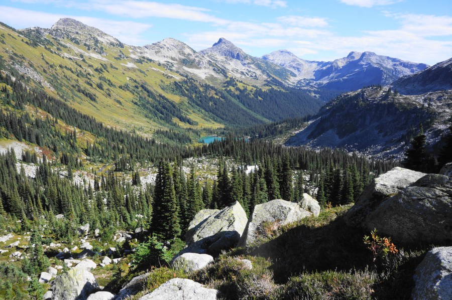
The next ascending section involves several switchbacks, rising to a shelf containing a small but charming pond. Rise from here to a break in the trees, with excellent views opening up to the west, then north and east, into Marriott Basin. The ridgeline ahead is part of Mount Marriott (8,973’), one of the higher peaks in the area.

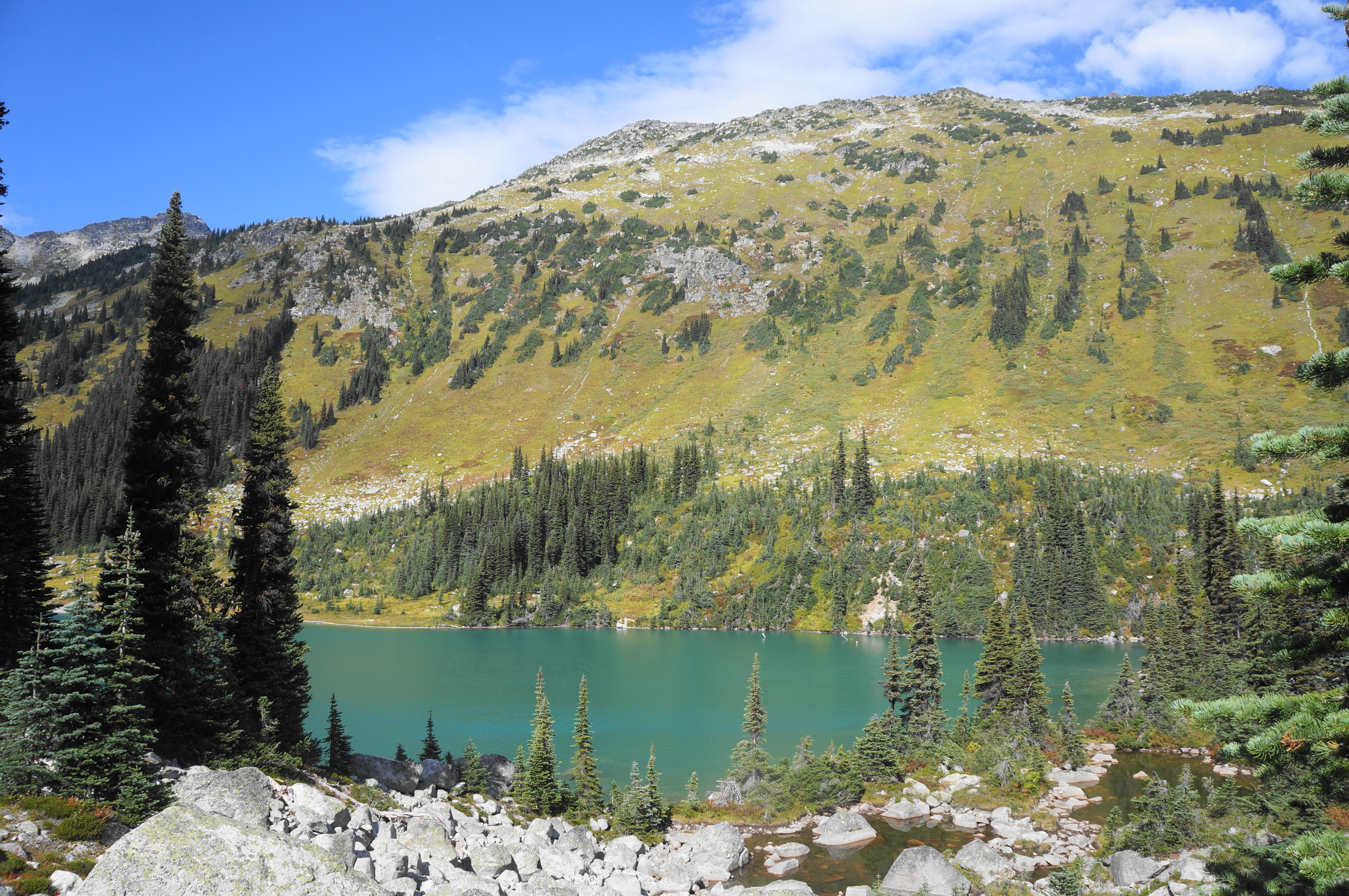
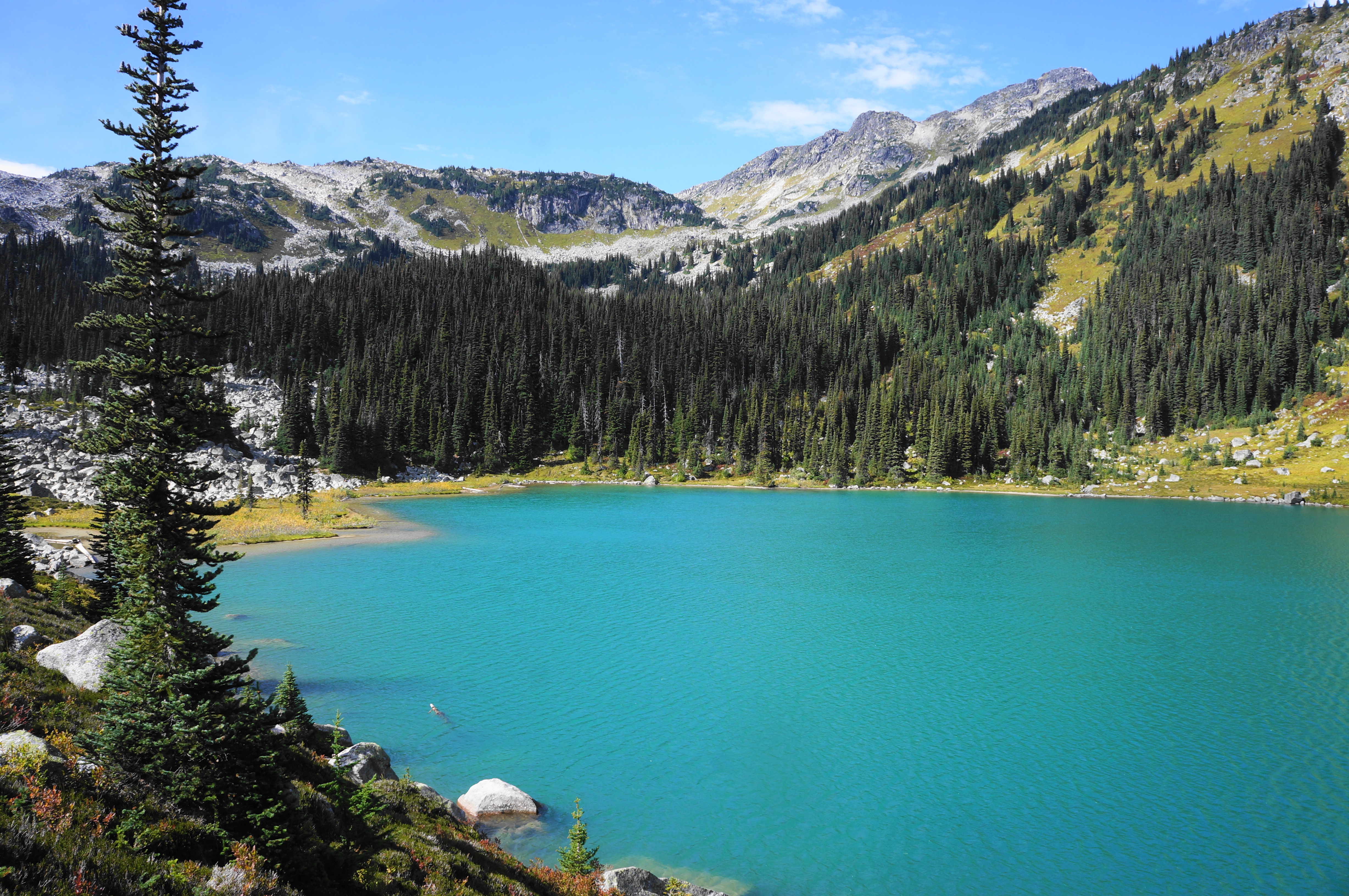
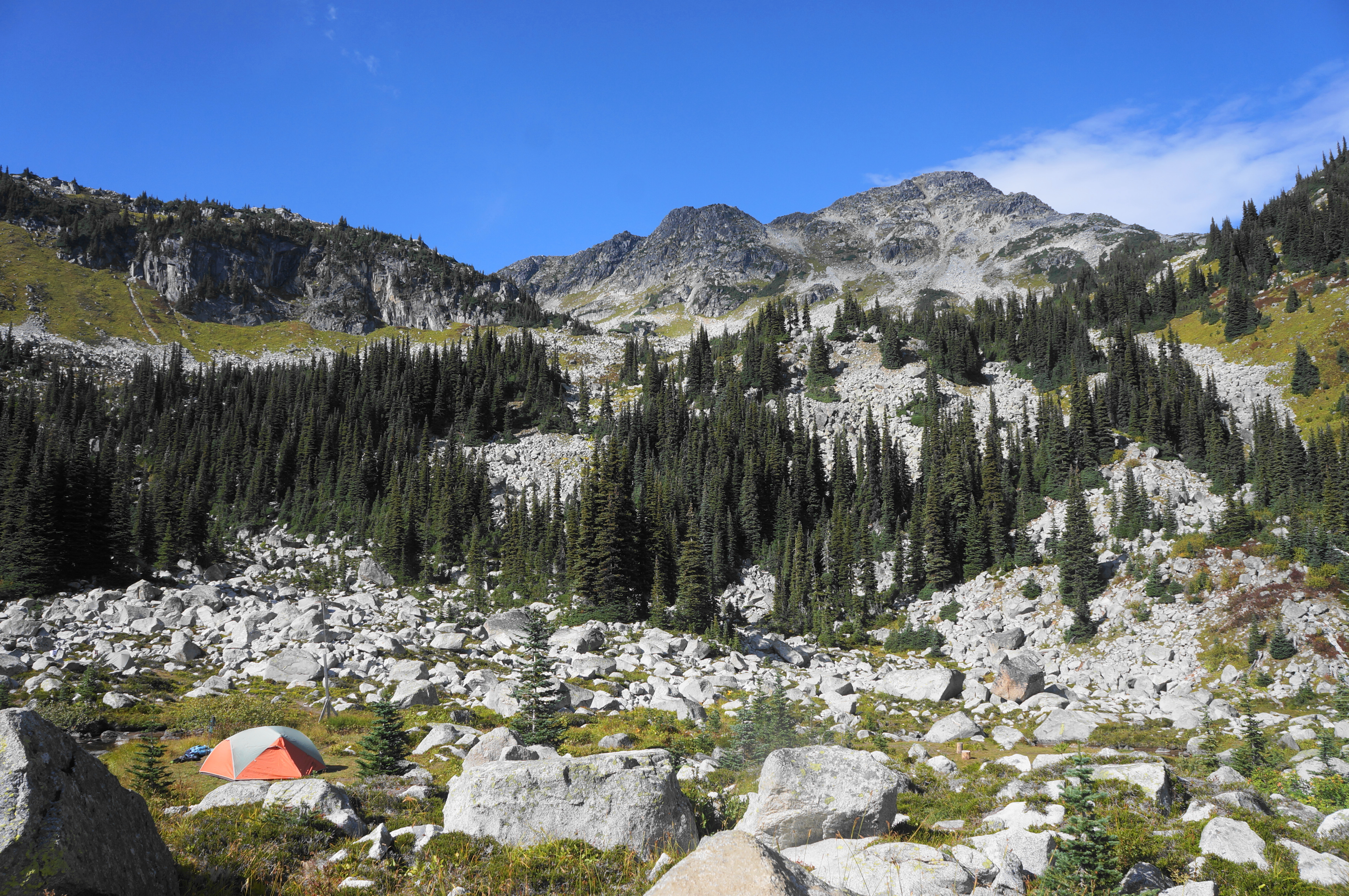
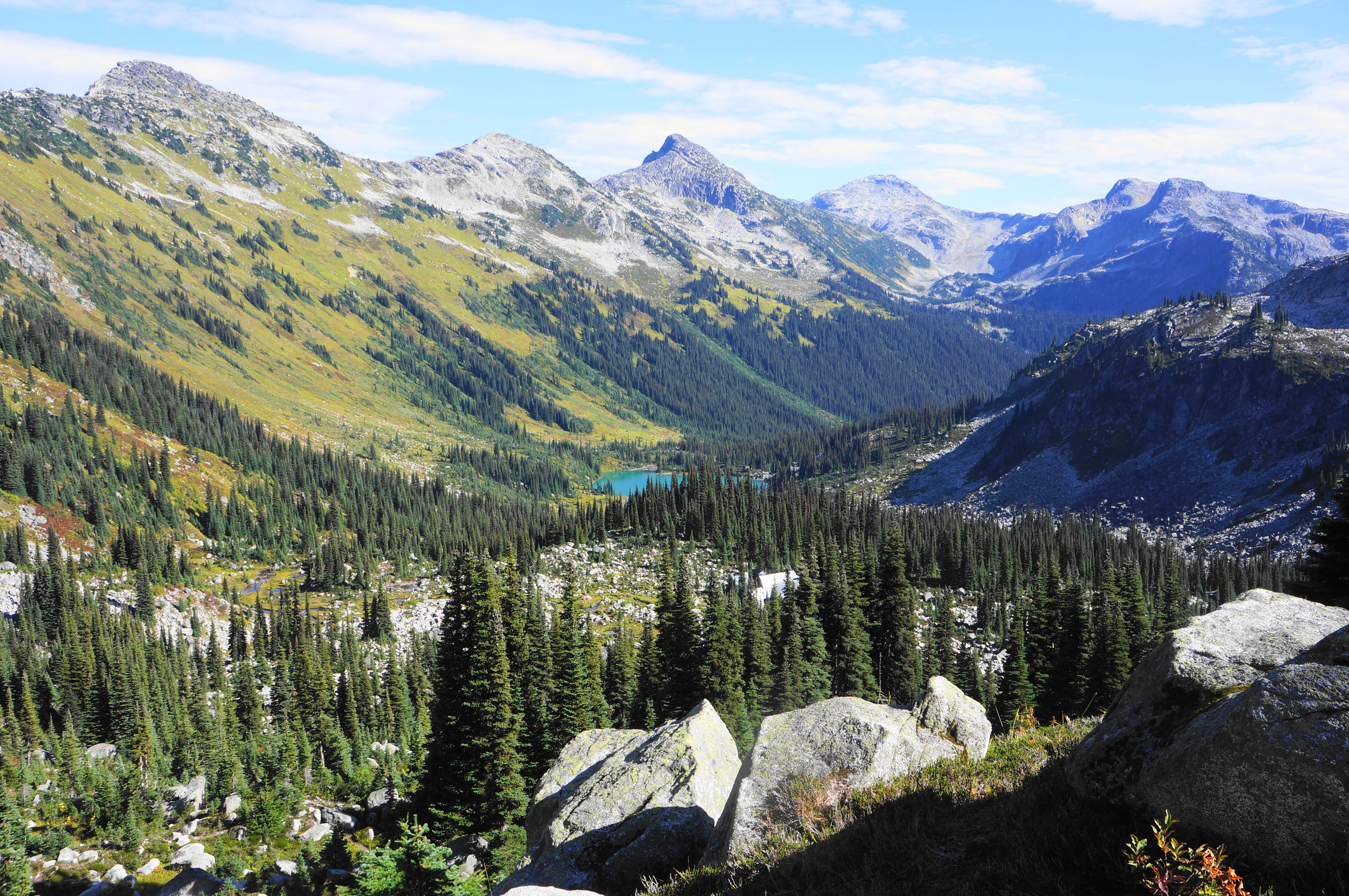
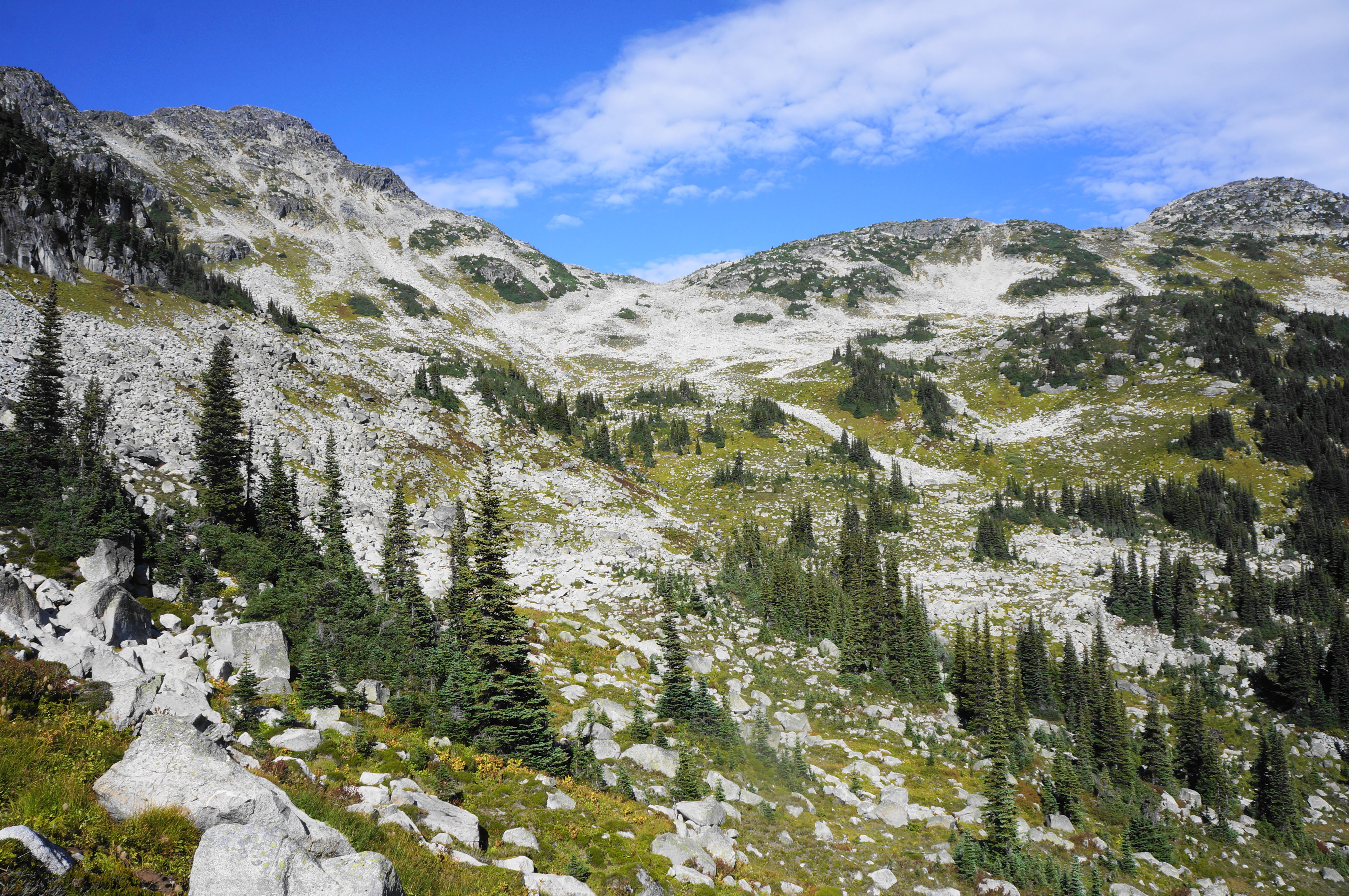
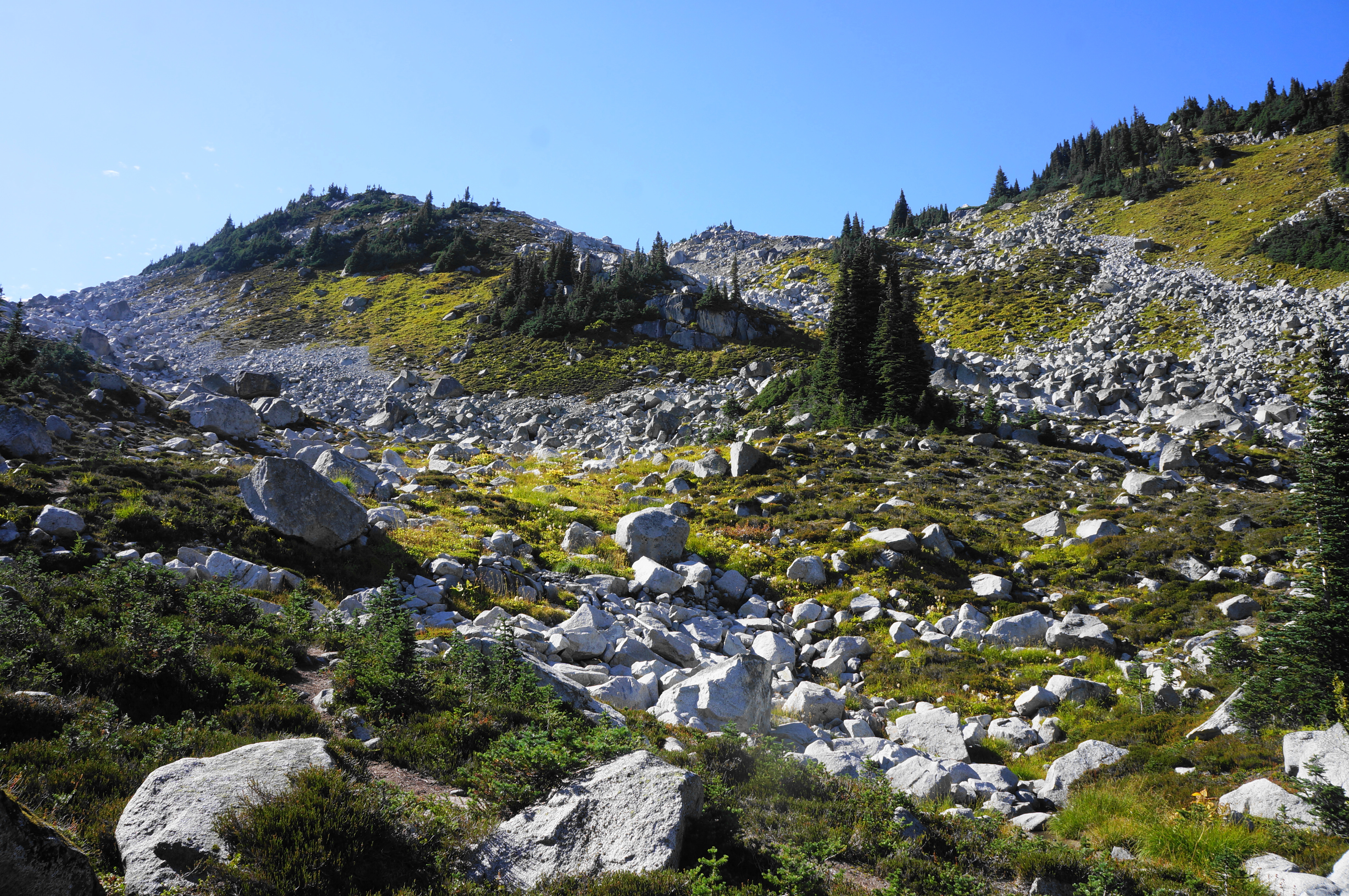
Drop briefly into the basin, then traverse a tedious talus field, which can be slow-going to navigate. Soon though the route rises to another moraine with views back to the south and east, down the valley. Rise to a crest and negotiate another boulder traverse, now with views down to Lower Marriott Lake, a magnificent turquoise tarn.

The onward route is tedious again as the unmarked trail traverses a larger rock field. Though there are no cairns, make your way generally down toward the head of the lake, with the shore making for a good spot for a break.
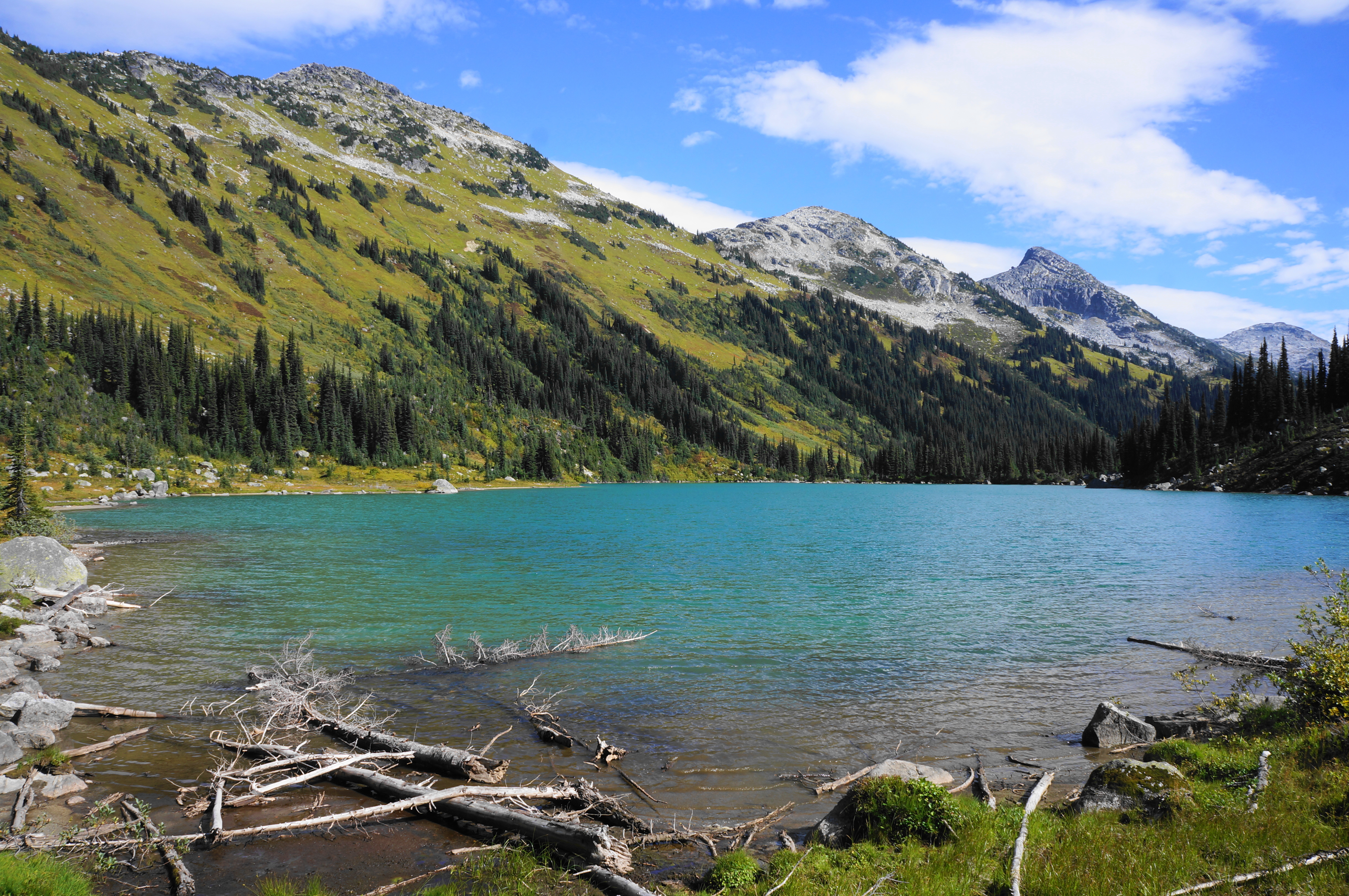
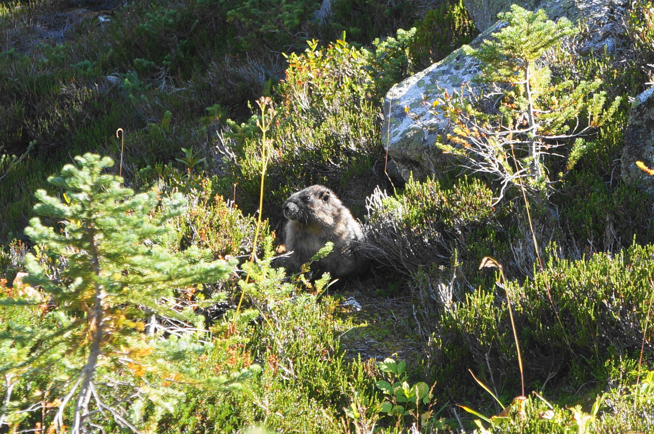
From here the onward path is not obvious at first. Ignore a social trail that immediately cuts left into the woods, instead staying on a narrow singletrack that rounds the western lip of Lower Marriott Lake. Soon the path clearly heads up into the forest again and the trail becomes wider and more evident again. (Note: As of 2025, there were yellow tree ribbons to mark the path.)
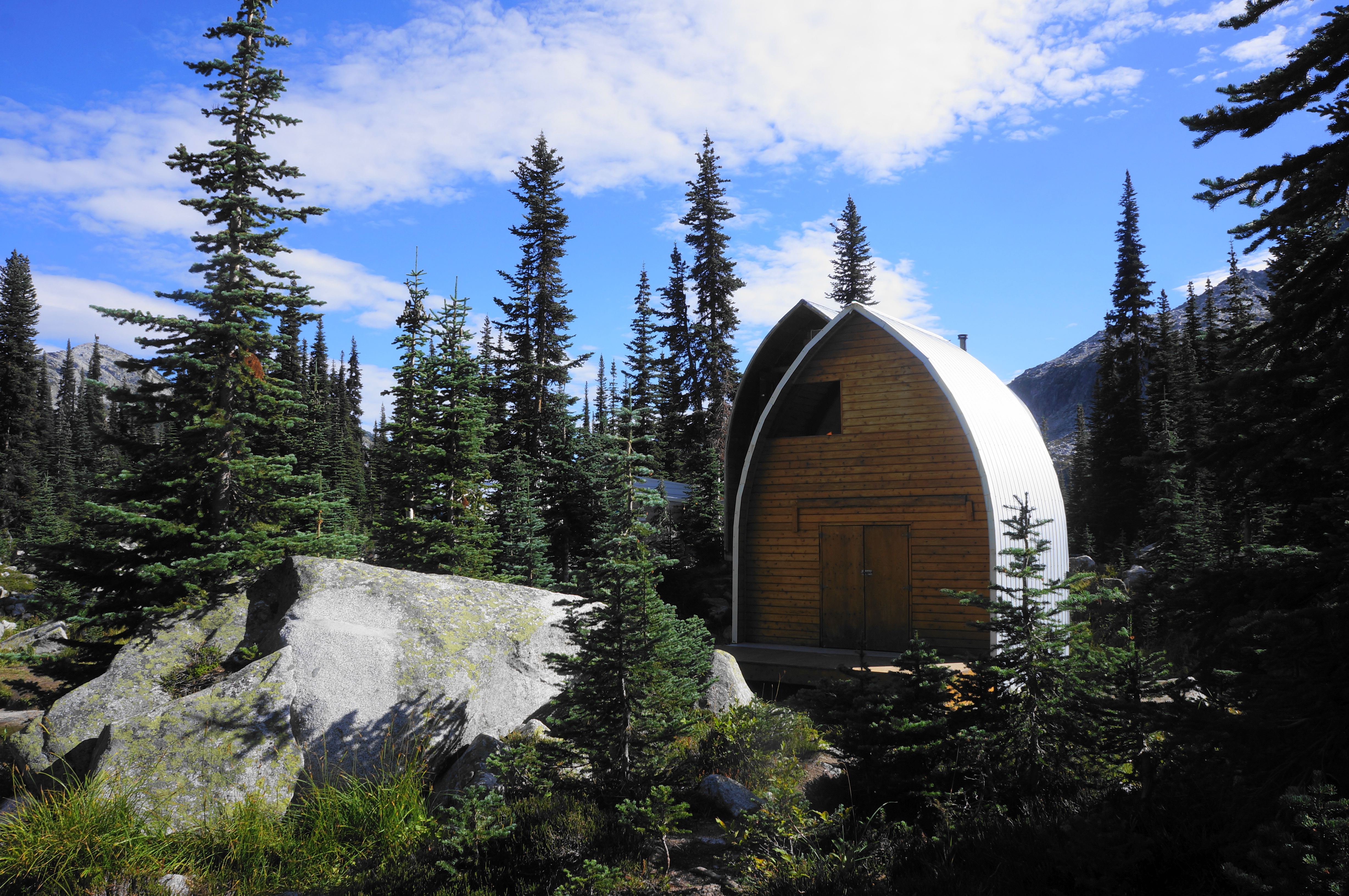
The Marriott Basin Trail follows a feeder stream for a short while then treads up to another meadow, this one containing the official turnaround point: Wendy Thompson Memorial Hut, a reservable cabin popular with local families. There are also ample spots for camping, set in a scenic basin with views back down the valley.
For those with extra time and energy, it is worth continuing a bit further—on a faint and more strenuous track—partway up the alder-lined hillside in the direction of Mount Marriott. After about ¼ mile, the faded path emerges out from the trees and scrub, offering excellent open views down to Lower Marriott Lake, Mount Rohr, and beyond. Even more ambitious hikers can continue up to another set of lakes and the summit of Mount Marriott, though these require a series of rocky scrambles.
Being an out-and-back hike, return the way you came, coming out to around a 9-mile round-trip (if you wander a little way up beyond Wendy Thompson Hut). For most, the entire hike will take around 5-7 hours, a most-of-the-day jaunt.

Beautiful water color!