

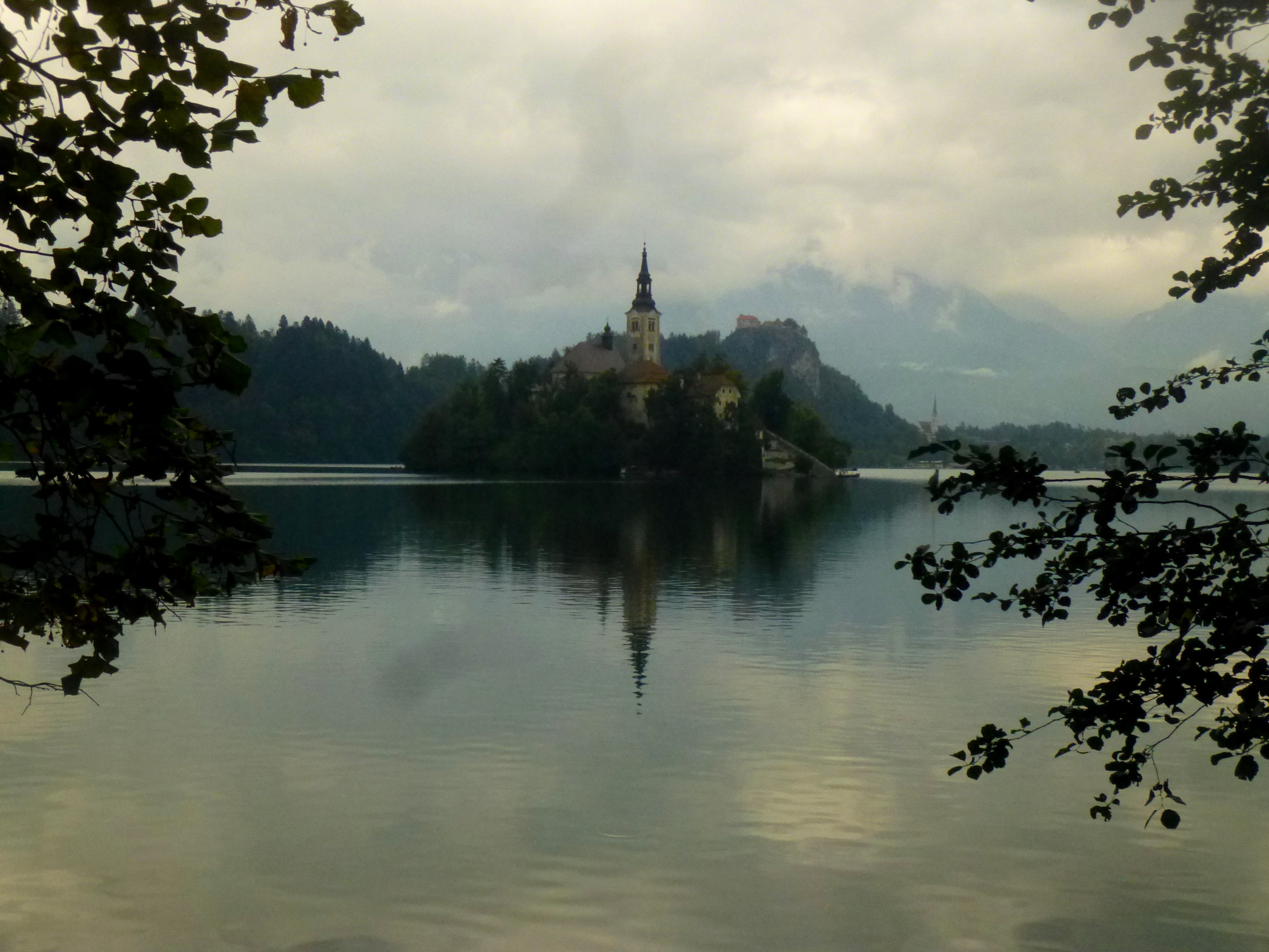
Though America remains the focus of Live and Let Hike, why not do a brief write-up on a short hike I completed last month from much further afield? Despite its petite size, the mountainous European nation of Slovenia presents considerable hiking opportunities, boasting access to the southeastern fringe of the world-famous Alps. Arguably the most stunning sight in Slovenia, the area around beautiful Lake Bled offers a great introduction to what the country has to offer. The lake, celebrated for its striking blue-green waters and the picturesque Bled Island, is nestled among nearly a dozen lush green hills, all less than 2 hours’ hike from the sandy shores. One can find perhaps the most stimulating vistas on a 2 ½- to 3-mile trek up Mala Osojnica and Ojstrica.

The hike
(Note: Due to the lack of detailed maps and trail guides, it is difficult to describe the following hike with exact precision. Hiking distances are therefore only rough estimates based on my experience. To find the trailhead on Lake Bled’s southwestern bank, first pick up a map (not great, but shows roughly where the trail starts) at the tourist information office in Bled, a short walk downhill from the bus stop. See here for a decent map.)
There are at least two options for starting this hike, the first of which is located just west of the point where the Lake Bled Walk (paved/gravel trail around the lake) meets the road, Kidriceva cesta. The second, marked with a sign indicating trail #6 (Osojnica, Ojstrica), starts on the edge of a clearing on the west side of the road (opposite the lake) roughly 100 yards south of “Bled Camping.” The first option is preferable, as the ascent is more gradual; for the complete loop (not really a loop, as about half of the route involves doubling back), ascend the Kidriceva cesta side to Mala Osojnica, then hit Ojstrica, and descend to Bled Camping and follow the Lake Bled Walk east back to the start. (Note: There is a third path leading steeply up Mala Osojnica from the Kidriceva cesta trailhead, but the trail was closed for maintenance when I visited.)

From the trailhead along Kidriceva cesta, the path passes a couple small ranch houses before merging with a wide gravel road. The path eventually turns to dirt as it climbs through the trees, skirting the southern flank of Osojnica for maybe 2/3 mile, before reaching a tree-covered pass between Osojnica on the left and Ojstrica on the right. Head left first, on the path marked “Osojnica,” a steep but brief climb that continues for around 1/3 mile before cresting another forested pass. Here the path splits again – straight to Velika Osojnica (Large Osojnica) and left to Mala Osojnica (Little Osojnica). Though higher (2,480 ft. to Mala’s 2,247 ft.), the summit at Velika Osojnica is shrouded by forest cover, affording no real views of the lake or mountains beyond.

From here it is about 10 minutes to Mala Osojnica. Note that there is an identified trail here, though ascending the larger and more traceable 4-wheel drive road leads to the same place. Atop the hill, one can take a right and continue for roughly 150 yards to a viewpoint with a bench that overlooks Bohinj Valley.

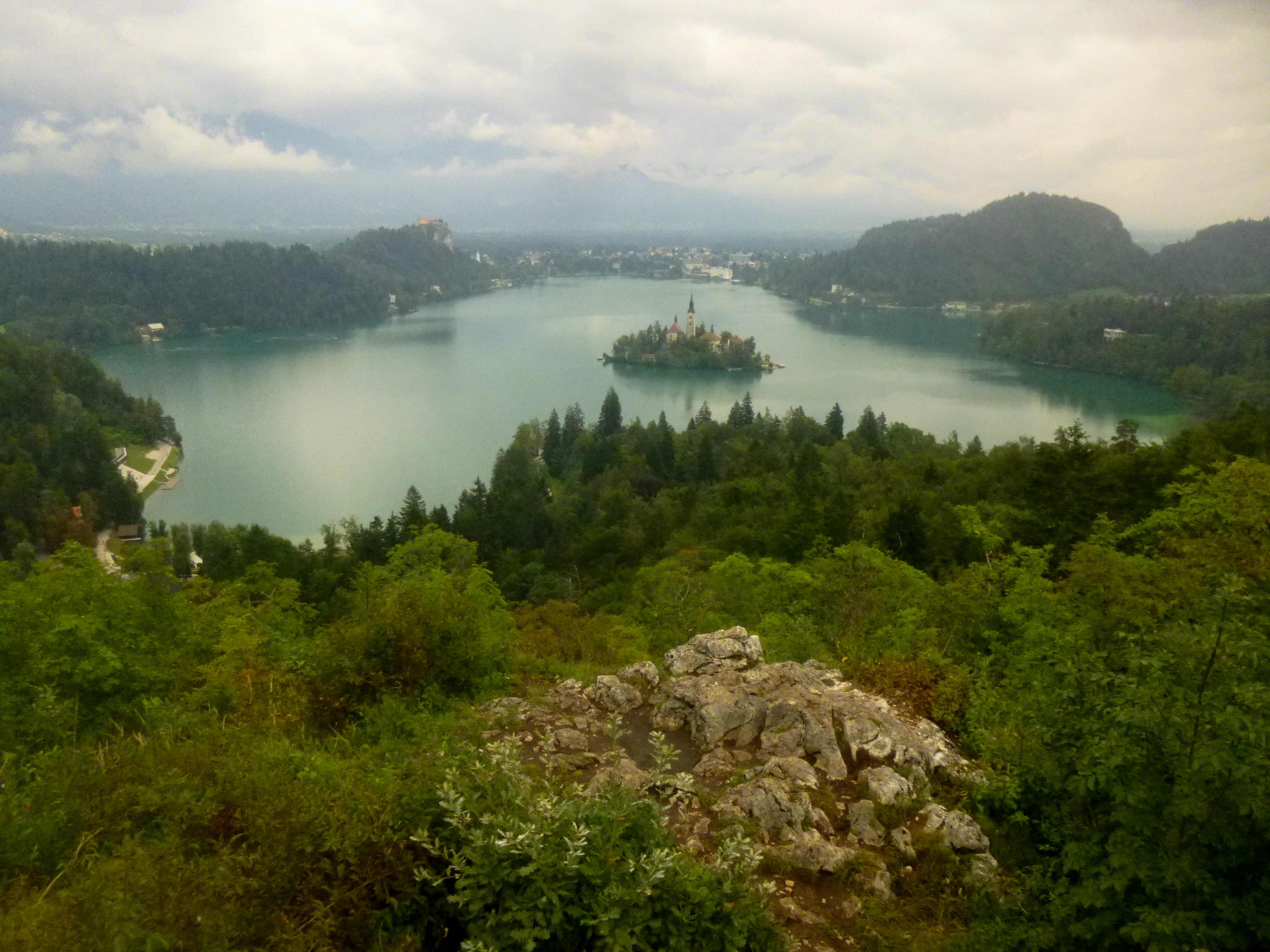
But the real attraction here is the vista 100 yards or so downhill to the left, a jaw-dropping lookout marred only by the ugly chain-link fence protecting visitors from an unfortunate fall.
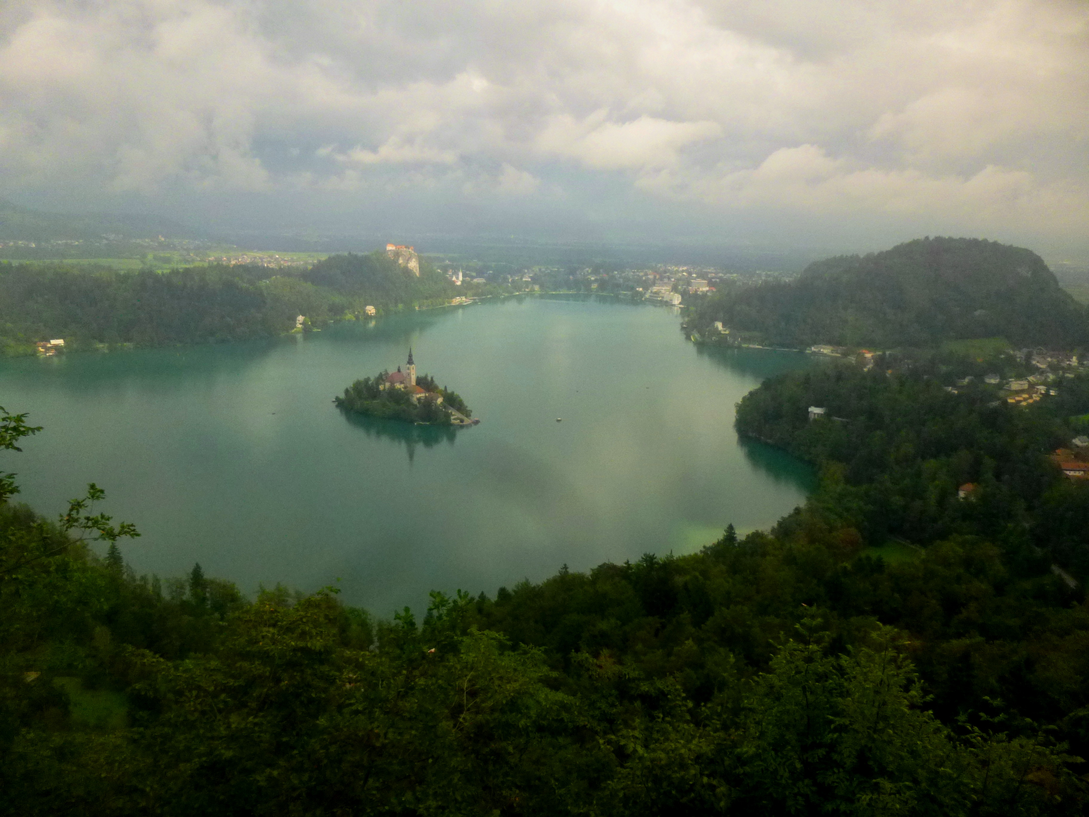
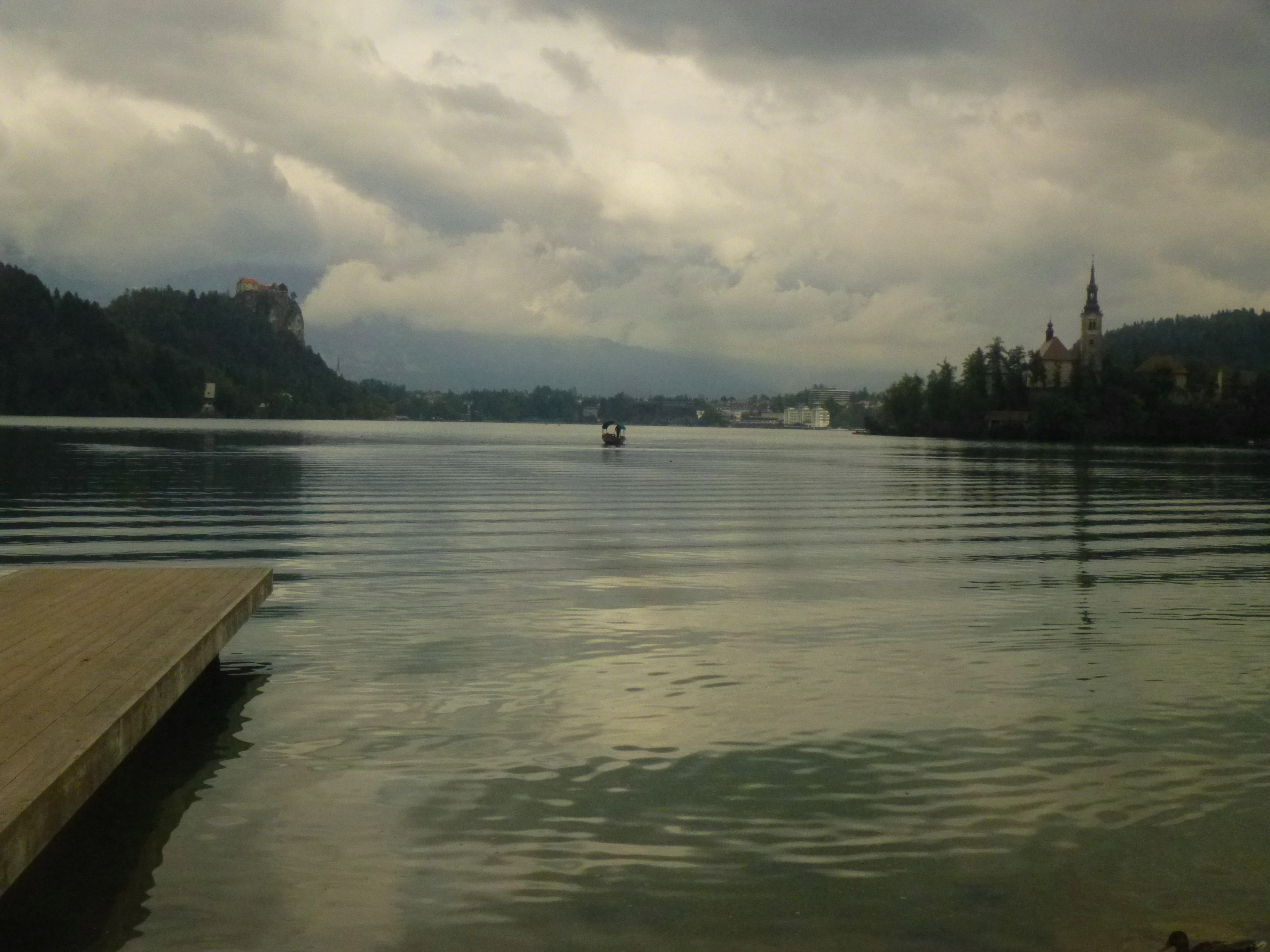
The entirety of Lake Bled unfolds below, with views of Bled Island and Bled Castle beyond; Straza hill (2,119 ft.) dominates the right flank, though all surrounding hills appear small compared to the slightly higher summit on Mala Osojnica. The small community of Mlino is situated to the right of the lake; Bled proper is straight ahead; the quaint villages of Nad Progo and Recica are tucked between Kuhovnica (2,178 ft.) and Visce (1,804 ft.) to the left. On a clear day, hikers can see across the valley to the snow-capped peaks of Karavanke ridge (or Karawanks), the dramatic mountain range marking the border between Slovenia and neighboring Austria. (Alas, they were lost in the fog during the rainy day I visited Bled in September.)

After absorbing the fantastic view from Mala Osojnica, a trip to Osojnica’s smaller cousin Ojstrica may seem repetitive. However, despite similar views of Lake Bled, the viewpoint has a distinctly different feel – a mangled, rocky outcropping accessed via a single, switch-backing path.
There is only one way (that I could find) back down Ojstrica, a short hike back to the ridge between Osojnica and Ojstrica. From here, follow the path back down toward the trail’s start, but turn left at the sign indicating “Bled Camping.” The trail descends steeply through the woods, spitting out at the clearing just east of the Bled campground after about 2/3 mile.

Pingback: Plains of Abraham Loop (Quebec, QC) | Live and Let Hike
Thanks for the excellent description and pictures to support.
Pingback: Slovenia, the green heart of Europe – Periodista Sumergida