

Note: This post is the second of two trail descriptions from a blissful October day at Pine Valley Ranch Park, an hour’s drive from the Denver area and a refreshingly quiet alternative to the crowded Jefferson County parks around Evergreen or Morrison. (The first, the 2.1-mile Buck Gulch – Strawberry Jack – Park View Trail Loop, is described in detail here.)
Park-hopping with my disabled but nature-loving sister, my family is always on the lookout for ever-elusive wheelchair-accessible trails. The Narrow Gauge Trail at Pine Valley Ranch Park may not technically fit the bill—it is packed dirt, in lieu of concrete or asphalt—yet it is virtually free of obstacles and therefore can be strolled in its entirety. On paper, the trail follows the beautiful North Fork of the South Platte River for 1.9 miles, yet hikers yearning for more can continue past the park’s eastern edge for roughly another 0.3 miles into Pike National Forest. Visitors with limited time can probably do without the less interesting western section (1.4 mi.), but the sheer rock faces and swishing rapids of the eastern section are worth following to the trail’s end.

The hike

Starting from the ranger station and public restrooms near the main parking lot, the Narrow Gauge Trail leads in two directions: west and east. (If you cross a bridge over the South Platte, you have gone too far.) The western section mostly weaves in and out of tall grass beside the South Platte, with decent views of the surrounding hills. But the eastern section (found by taking a left, facing the ranger station or picnic area) is infinitely more interesting—thus the focus of this post.
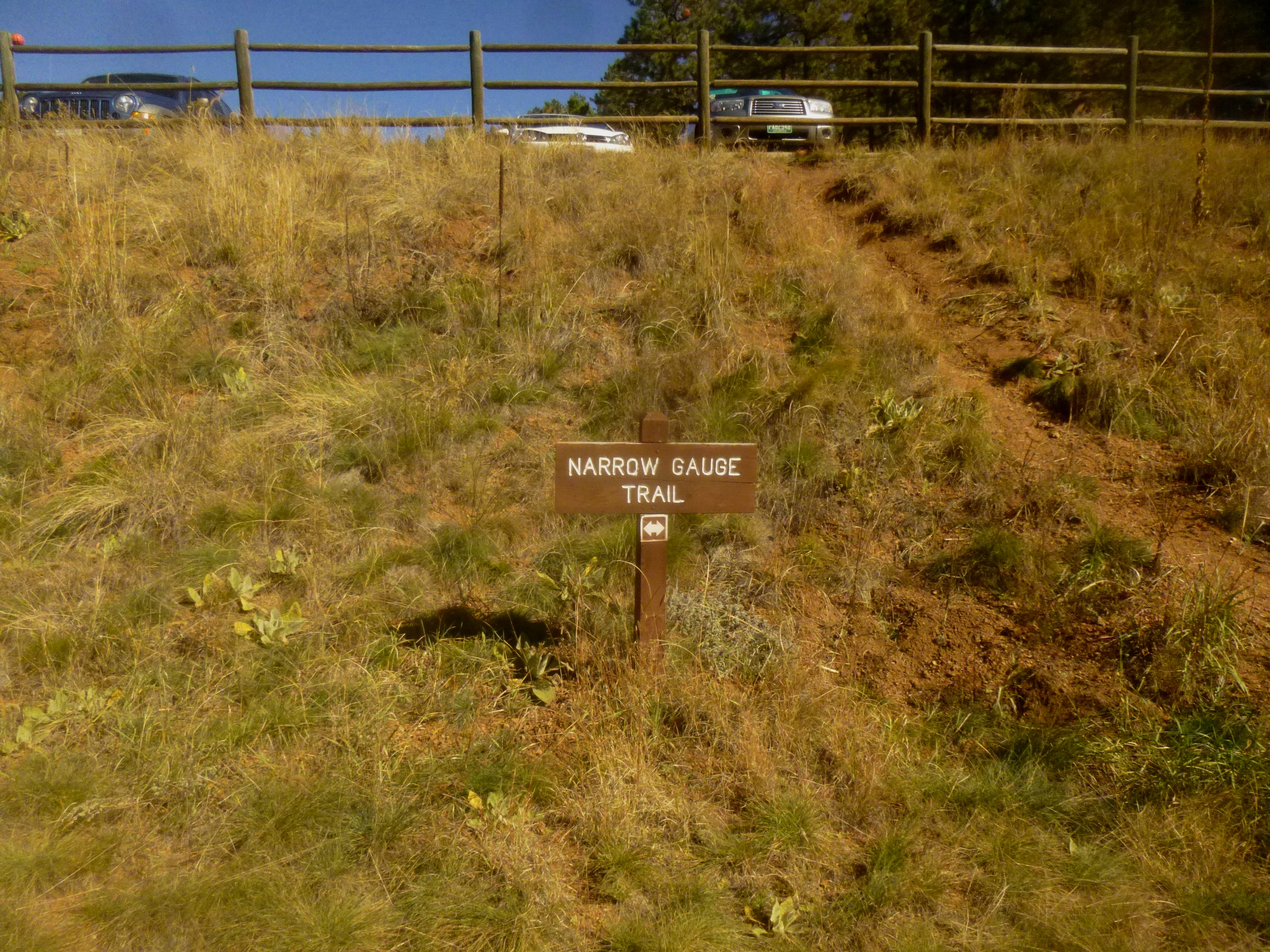
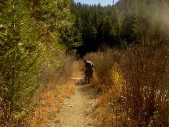
Little evidence remains of the old railroad for which the Narrow Gauge Trail was named. But the advantage of such a path is that it is wide and flat, a dusty mix of packed dirt and small rocks. With the exception of a couple sandy sections and a minor dip near the end of the trail, one can easily push a wheelchair the entire 0.8 miles without breaking a sweat.
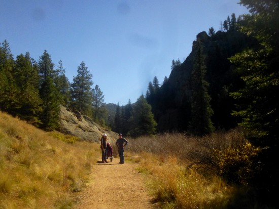
The first reminders that one is hiking in a canyon come in the form of the 400-foot rock face viewed across the river to the right, followed shortly by granite slickrock emerging on the left.

In contrast to the heavily-forested southern bank, the trail along the northern bank is sunny and more open. On the October day I visited, much of the shrubbery along the bank had shed its color for the winter.

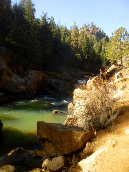
The rippling waters of the South Platte quickly gain apace; one can walk down to a rocky, picturesque spot roughly 0.3 miles down the trail for views of the first of a series of small but noisy cascades. I’d imagine this would be a lovely lunch spot, as well as a haven for trout fishers who frequent the park.

Another 1/10 mile down the trail, there is another great place to explore the water’s edge. Just beyond a natural dam, the river squeezes between wide slabs of granite slickrock, gently tumbling into a series of deeper pools.
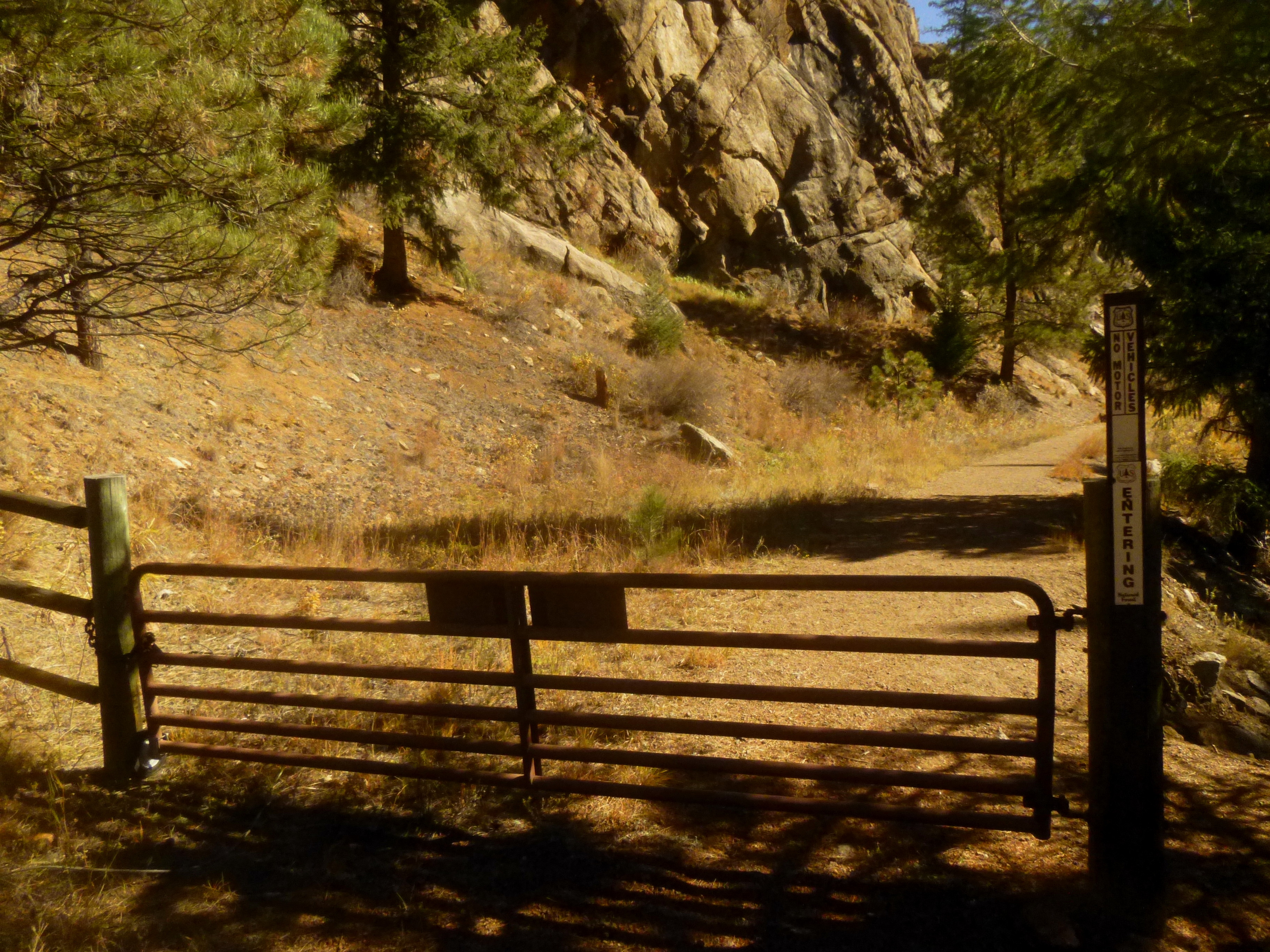
Straight ahead for 50-100 yards lies the end of the park, marked by a rusty metal gate bypassed by hikers on the right. Here you enter neighboring Pike National Forest.
Based on a cursory view of the canyon ahead, it would at first appear that the river winds over to the right. Yet it instead abruptly turns the corner to the left, and the steep rock faces of the southern flank are replaced by a sea of evergreens. The trail passes briefly through head-high brush before spitting out to more views of the river on the right.
Alas, all good things must come to an end, and the trail terminates rather brusquely as one turns a corner to find a locked gate with a sign indicating that the land beyond belongs to a “private resort”—Crystal Lake Resort—“no trespassing”. Unless you have a bed at this B&B popular with fly fishers, it’s best to turn around and retrace your steps, perhaps dropping a line of your own in the trout-filled river somewhere along the way.

Further afield: try the steeper and more challenging 2.1-mile Buck Gulch-Strawberry Jack-Park View Loop, which also begins at the main parking lot. See my October 2014 trip report here.

Pingback: Buck Gulch – Strawberry Jack – Park View Trail Loop (Pine Valley Ranch Park, CO) | Live and Let Hike