

A hike through Little Devils Stairs, featuring a narrow gorge with countless cascades, is one of the highlights of the North District in Virginia’s Shenandoah National Park. The 1,900-foot elevation gain makes this 7.4-mile “lariat” (or stem-and-loop) a demanding outing, but for those in good shape, intimate stony rambles and an abundance of peaceful waterfalls await. Completing the loop requires following a less-than-interesting fire road, though the remote—and rather haunting—Bolen Cemetery offers an interesting historical perspective on life in the Shenandoahs before the national park. Complete this hike in the spring—or after recent rainfall—to experience the full flow of the many cascades.

The hike
There are a handful of options for approaching Little Devils Stairs, including driving back roads to approach the trail from the bottom, but the most popular—and convenient—is to park at the start of the Keyser Run Fire Road along Skyline Drive, 15 miles south of Dickey Ridge Visitor Center or 2.8 miles east of the turnoff to Mathews Arm Campground. The turnoff—situated at roughly Mile 19.4—is not well-marked, so be sure to have a decent map (something better than the standard Shenandoah park map) handy. From the east, the Keyser Run Trailhead lies just beyond the Mount Marshall Overlook on the left. From the west, look for the road on the right beyond Little Hogback Overlook.
At the trailhead, park in the gravel parking area and walk out to the wooden kiosk at the end of the lot. Here the park highlights a couple of suggested hikes, including Little Devils Stairs. The expected time listed for the 7.4 miles—a whopping 6.25 hours—will probably be very conservative for most. (Note: A friend and I, both in relatively good shape, finished the loop in roughly 3.5 hours.) The hike begins just beyond the kiosk.
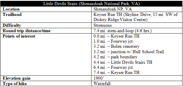
Before getting to the loop, hikers must first tackle the “stem” portion—a one-mile jaunt down the overgrown Keyser Run Fire Road (closed to vehicle traffic), mostly devoid of intrigue. In the winter months, it may be possible to peek through the trees for a view of the valley to the south. After a mile, hikers will reach the Fourway junction and face a choice: turn left to approach the Little Devils Stairs head on, or head straight to circle around to the bottom first. Most will elect to head straight for the Stairs, but I would recommend continuing on the fire road first in order to: (1) save the best for last and (2) avoid a long, boring uphill slog at the end. Continue straight at the junction to continue down the Keyser Run Fire Road. (Note: As this is a “fourway” junction, a right turn onto the Pole Bridge Link Trail rounds out the choices.)
After the Fourway, the road begins to descend at a quicker clip. Season permitting, look for butterflies—and perhaps snakes—along the trail. While less than scintillating, the walk through the forest is usually peaceful and free of crowds, and one can cover ground rather quickly.

A little over three miles from the trailhead (so about an hour to 1 ½ hours), hikers will come across a peculiar sight on the left: a gated cemetery, deep in the forest. The story behind the Bolen Cemetery is one of remorse and symbolism: the Bolen family was one of many whose land was condemned and given to the national park in the early 20th century. The cemetery was rededicated in 2002, when builders installed a plaque with an inscription of a poem titled “Why the Mountains are Blue.” A sample:
While you relax and take in all this natural beauty,
I’d be remiss if I failed in my duty
To tell of a people…
Whose way of life and culture was exaggerated by many an unjust fact,
Whose property was condemned by a legislative act…
Leaving familiar sights, their homes, their burial plots,
Most left begrudgingly for some low country spots
The blue of the mountains is not due to the atmosphere,
It’s because there is a sadness which lingers here.
Less than a minutes’ walk past the cemetery, the route again forks. To the right is the Hull School Trail, which provides access to the Piney Branch and Thornton River Trails. Continue left on the fire road. The track here is better maintained—partly graveled or even asphalted in spots.
About ½ mile from the junction, the road descends sharply as it rounds a bend and passes under a set of power lines. 10-15 minutes later, a chain strung across the road marks the park boundary. Continue past the barricade, reaching a parking lot at the foot of the mountains within 5-10 minutes. This is the Little Devils Stairs Trailhead, accessible by car by way of Virginia Highway 211 and service road 614.
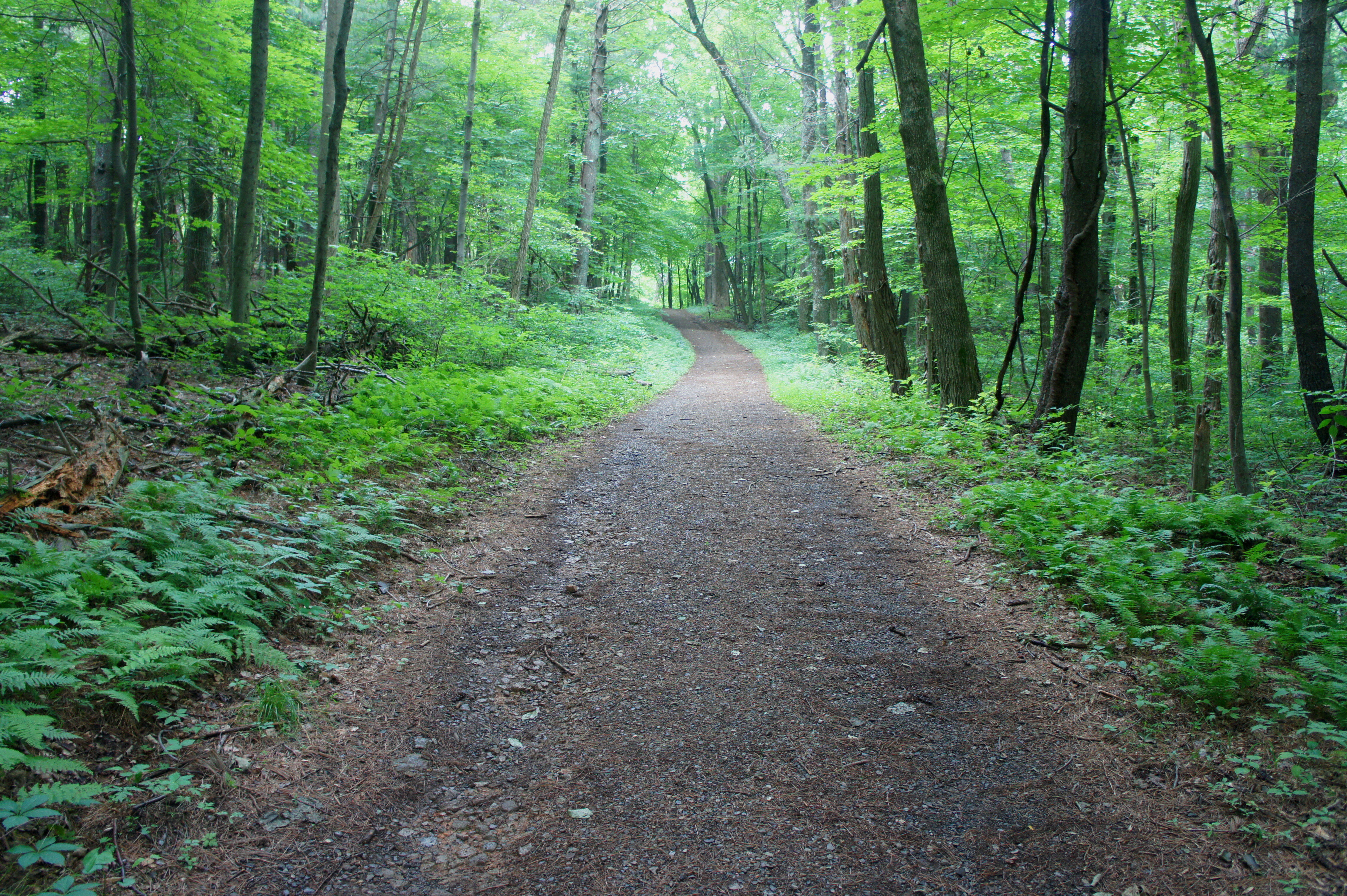
Now 4.4 miles from the start, hikers can at last abandon the Keyser Run Fire Road and embark on the much-anticipated Little Devils Stairs Trail, marked with blue blazes. The narrow, rocky route quickly crosses two gently-flowing creeks (one may be dry in summer) and, after several hundred yards, approaches—but does not cross—Keyser Run. For the next 1/3 mile, the trail ascends gradually, remaining high, well clear of the creek. At last, the trail skirts the principal stream at a point boasting additional traces of human development. Meticulously-laid stone walls line both sides of the creek, evidence of an old bridge—now dismantled—over Keyser Run. Further up the trail on the left, it is easy to spot several rock piles—perhaps the remains of homes that once housed the Bolen family.

It is perhaps 2/3 mile from the Little Devils Stairs parking lot to the first creek crossing, after which the angle of the trail steepens significantly. Be extremely careful when climbing, especially when the rocky trail is wet. In spring or summer, water tumbles down Keyser Run at a quick clip, and mosses and lichens line the rock faces.

Perhaps the most spectacular stretch of the hike comes shortly after passing a sharply angled rock field on the left. Here a wall of granite 30-40 feet high forms the creek bed’s right flank, while a much taller outcrop—hard to spot through the vegetation—boxes in the canyon on the left. The pace of stream crossings increases, and each twist and turn reveals a new, albeit small, waterfall.
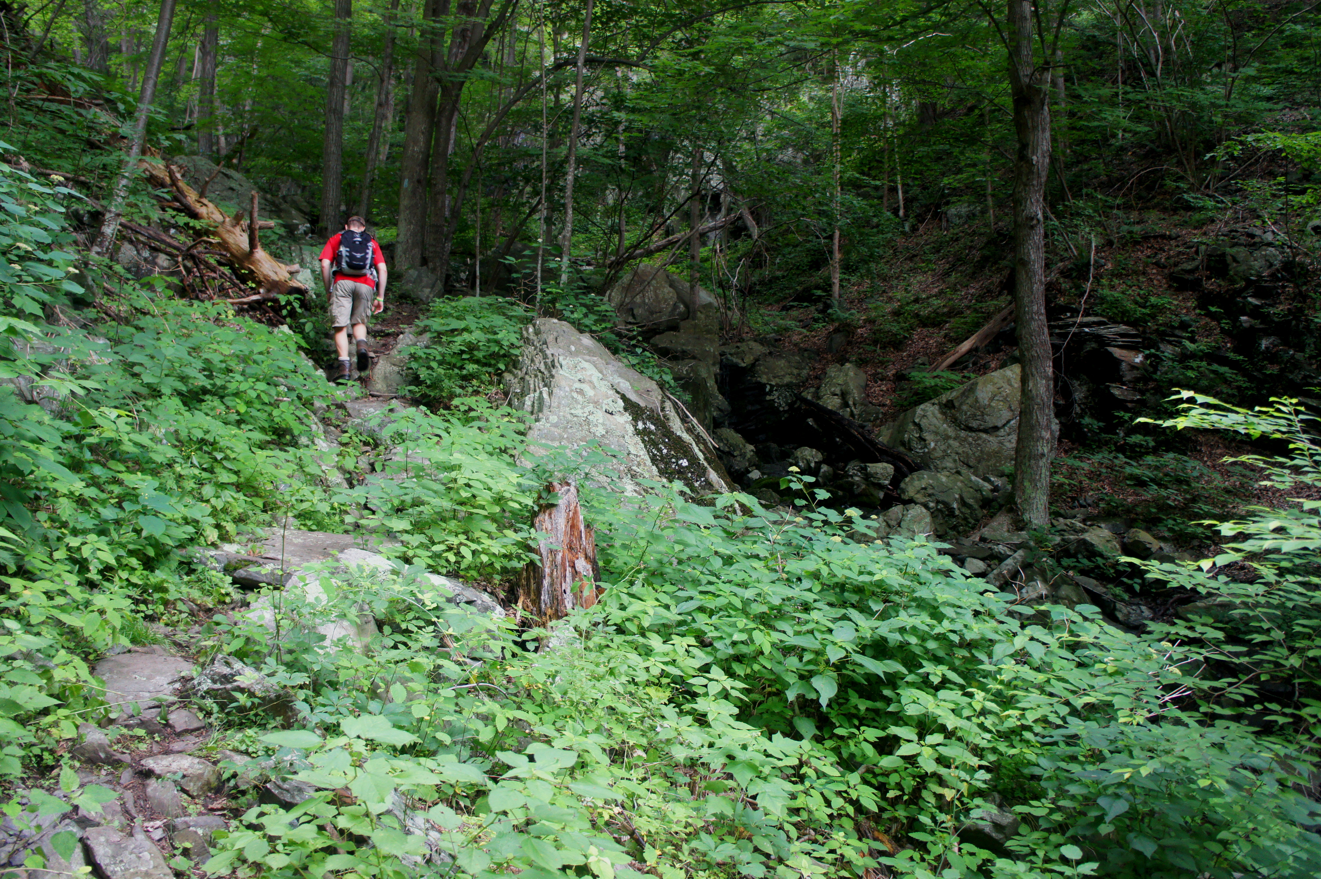

Above the gorge’s narrowest section, the trail runs through a patch of lush, green undergrowth, followed by yet more tumbling cascades and picturesque pools. The steepest incline comes about 2/3 of the way up the Little Devils Stairs Trail; here the use of hands be necessary.

The trail finally leaves Keyser Run behind with about 1/3 mile left to the Fourway junction, but not before the grand finale: a 10-15 foot waterfall that provides a nice spot for a break and a snack. From here, the final 1/3 mile ascent (400-foot elevation gain) completes the loop and returns one to the Keyser Run Fire Road.
Retrace your steps for the last mile from Fourway junction back to the trailhead along Skyline Drive. Depending on hiker’s pace, energy, and endurance, allot between 4-6 hours for the 7.4-mile lariat.

Looks like it would be fun if you got rid of all the low bushes crowding the trail:) This makes me itch thinking about mosquitos! And how were the ticks? I really have no interest in hiking in the eastern mountains. There is something about the lack of views and bugs and ticks that really don’t appeal to me. I guess I was just meant to hike in the west:) I am officially spoiled. I’ll take the rattlers! But this does look like our kind of trail:) Another great post!
Ha, fair enough! I know, I know, it doesn’t have the splendor of the West, but it’s nice in its own way. Alas, while I have a couple posts left to do from Utah, I’ve relocated to the Washington, DC area so there’s going to be a lot less red and orange and a lot more green… 😦
I suppose we can struggle to read about your hikes here in the east:) Haha! One day you too will be able to go where you want and hike more in the west!
It is a little strange seeing all of that green in one of your hikes.
Yeah, I’m trying to readjust myself – unfortunately I’ve relocated to the Washington, DC area, so there will be a lot less red and orange and lot more green!
Pingback: Hogback Mountain Loop (Shenandoah National Park, VA) | Live and Let Hike
Is the 4.9 mile stretch just as strenuous, just shorter or is it somewhere else?
Are there maps at the Kiosk you described? Also is there an entrance at this trailhead where they are checking park passes?
Hello – there are no handouts at the kiosk but there is an overview map (on the kiosk itself) that you can look at. There may also be handouts of this hike at the Dickey Ridge Visitor Center. And yes, there is an entrance station at the North Entrance, which is the closest entrance to this hike.