
At 3,474 feet, Hogback Mountain is the highest peak in the North District of Virginia’s Shenandoah National Park. Although the summit is not accessible by trail, the modest Hogback Mountain Loop offers fine vistas looking north across Shenandoah Valley to nearby Massanutten Mountain. There is also a pleasant creek crossing at Piney Branch to top off the pleasant half-day circuit hike, which takes about 3-5 hours.


The hike
There are a few options for where to begin the Hogback Mountain Loop, but the starting point closest to Dickey Ridge Visitor Center and Washington, DC is Keyser Run Trailhead, situated at about Mile Marker 22 on Skyline Drive. Turn into the parking lot here, where there are several spaces—although they are likely to fill up on a busy day, as this also doubles as the trailhead for the popular Little Devils Stairs Trail Loop.
Start the hike by leaving the parking area and crossing Skyline Drive to the north. Here hikers will catch a short, 70-yard connector to the Appalachian Trail (AT), America’s most famous long-distance path. Take a left on this white-blazed track, which bears west and gradually climbs the slopes of Little Hogback Mountain, Hogback’s shorter but scenic cousin.
Like most of the park, this section runs through a dense forest, obscuring most views. As the trail gains elevation, however, hikers will be able to peek through the trees to catch a glimpse of the Shenandoah Valley unfolding to the north and west.
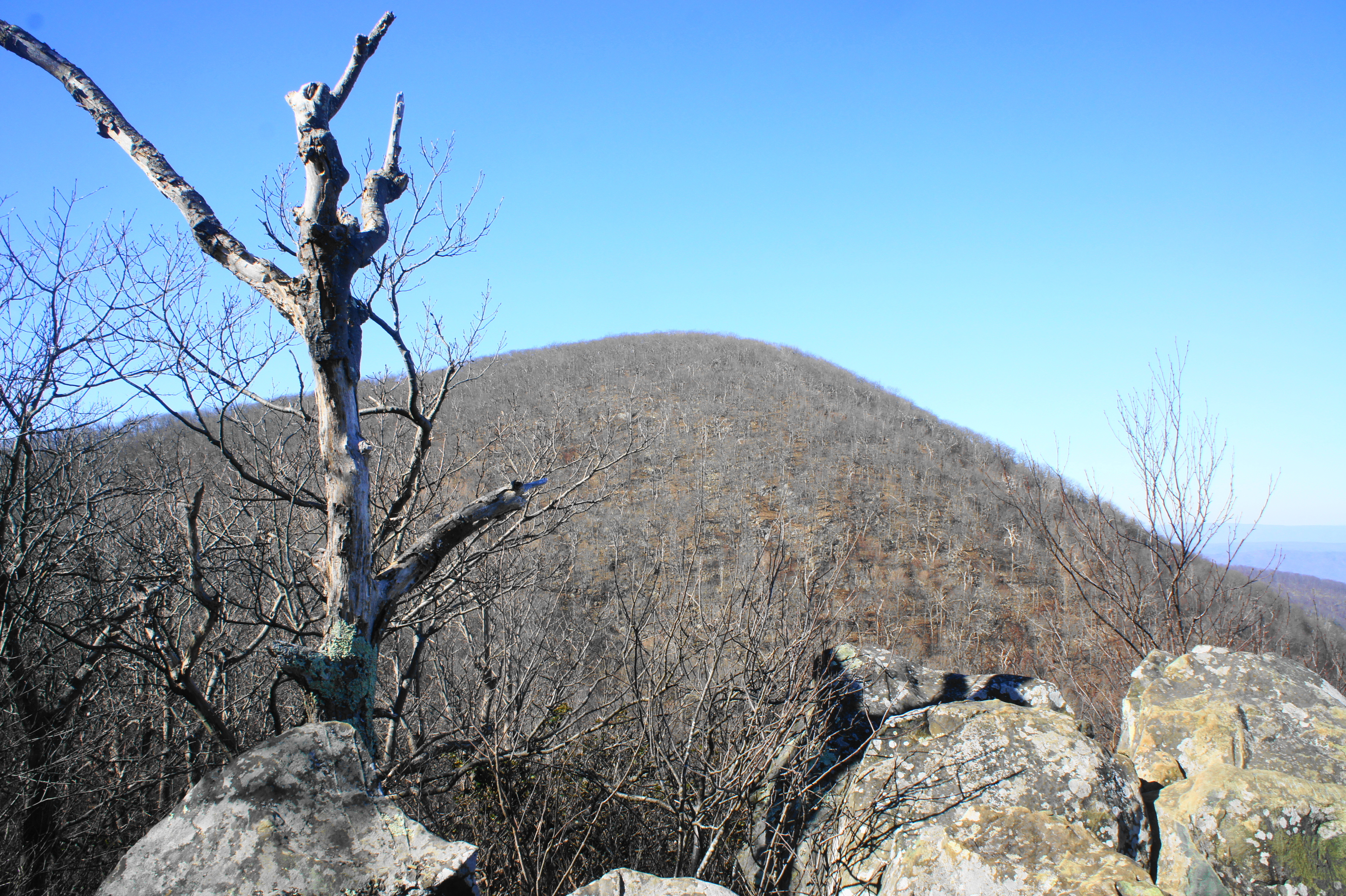
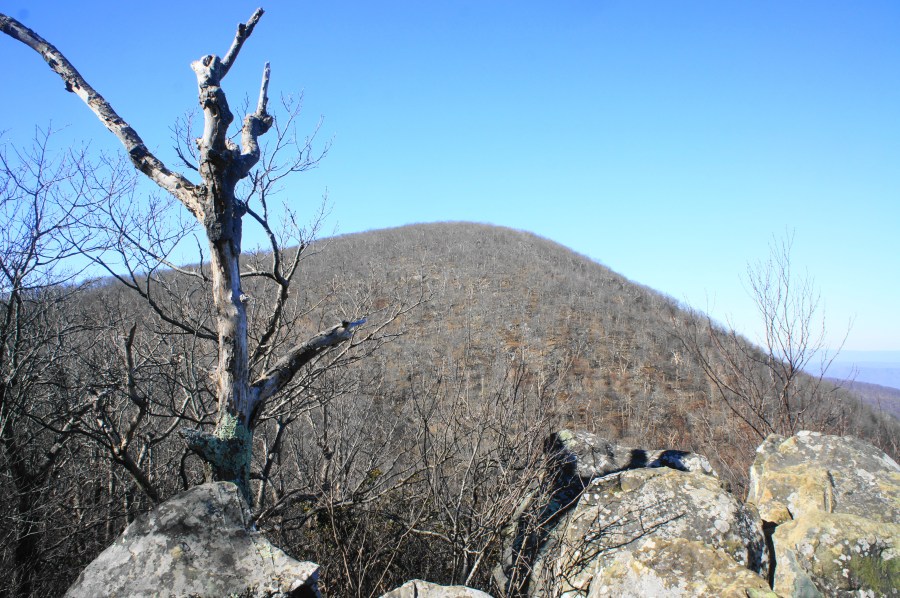
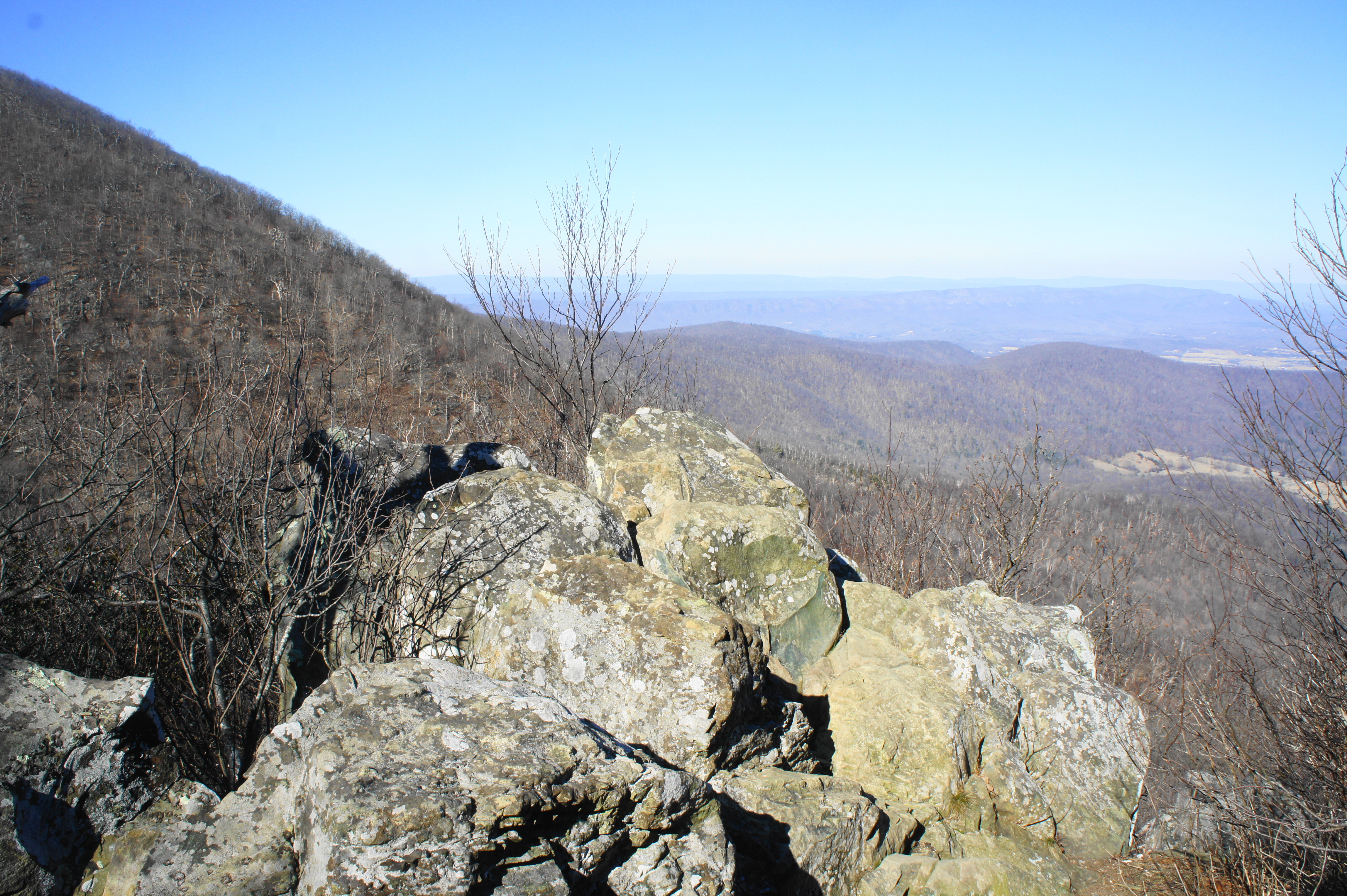
At about 1/3 mile, the AT levels off and then winds its way to the first true viewpoint of the hike: a small outcrop of rocks forms a perch overlooking the Browntown Valley, itself a segment of the broader Shenandoah Valley. Off to the west is the hulking mass of Hogback Mountain (3,474’)—the hike’s next destination to come. North of Hogback, the tree-laced slopes form Gimlet Ridge, which sticks out into the farm-studded valley below.
Off to the east, the Blue Ridge Mountains curl north, with Dickey Ridge extending off into the distance to the park’s northern end. Across the valley lies the lengthy cast of Massanutten Mountain, itself dwarfed by the taller Great North Mountain range beyond.
From this windy perch, backtrack a few strides and bear right as the trail continues southward. Within a minute, the path drops to within striking distance of the parking area at Little Hogback Overlook, but the AT cuts right at the last minute, descending a set of stairs below the viewpoint. The saddle between Little Hogback and its taller neighbor is laced with lovely mountain laurel.
At about 6/10 mile, with Skyline Drive still within eyeshot, hikers will begin the hardest climb of the hike: a roughly 400-foot gain in around 1/3 mile to the upper reaches of Hogback Mountain. Although switchbacks partly ease the ascent, this is easily one of the steepest stretches of trail in the park. It is over relatively quickly, however, as the path levels off before the one-mile mark.

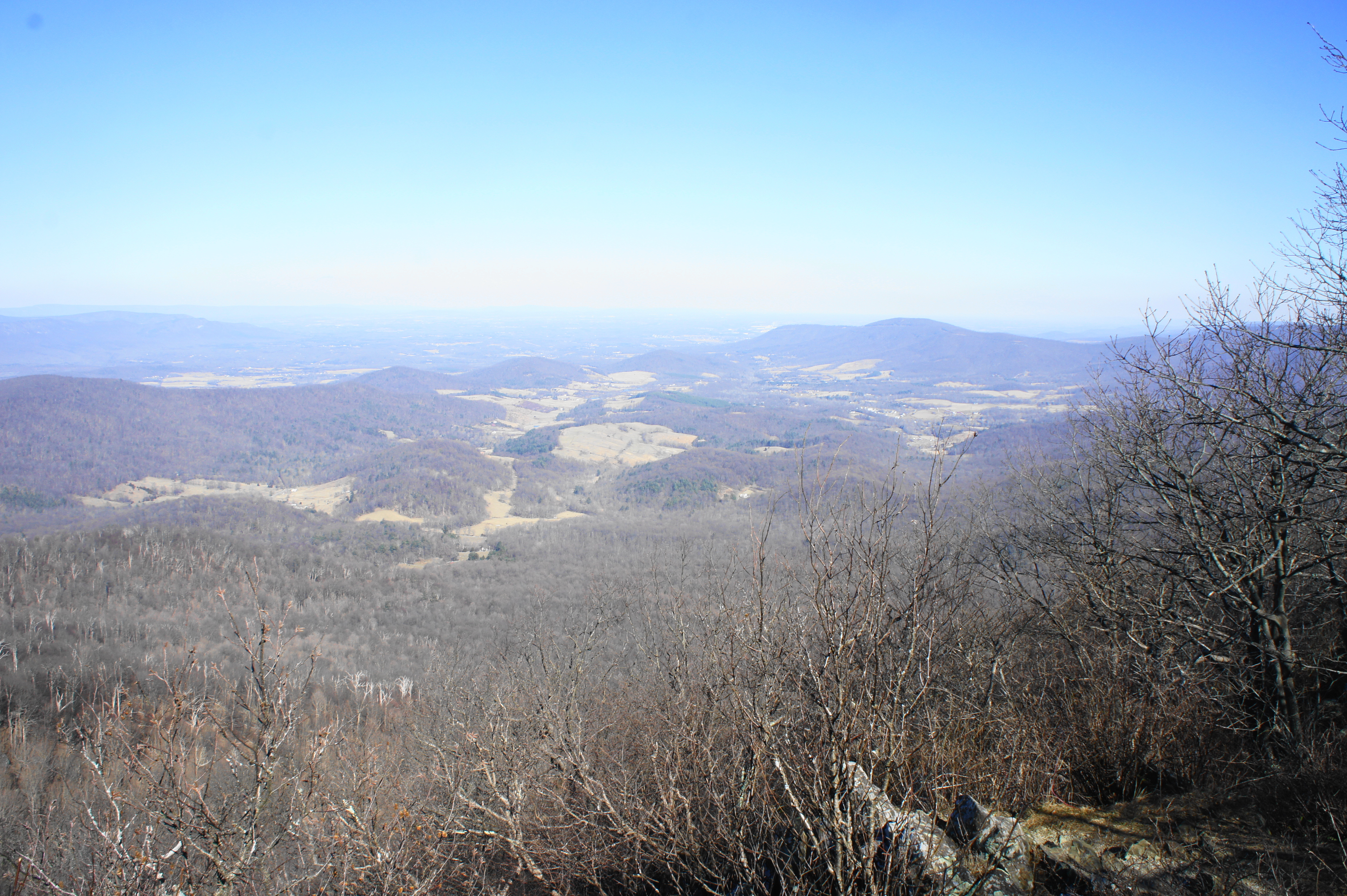
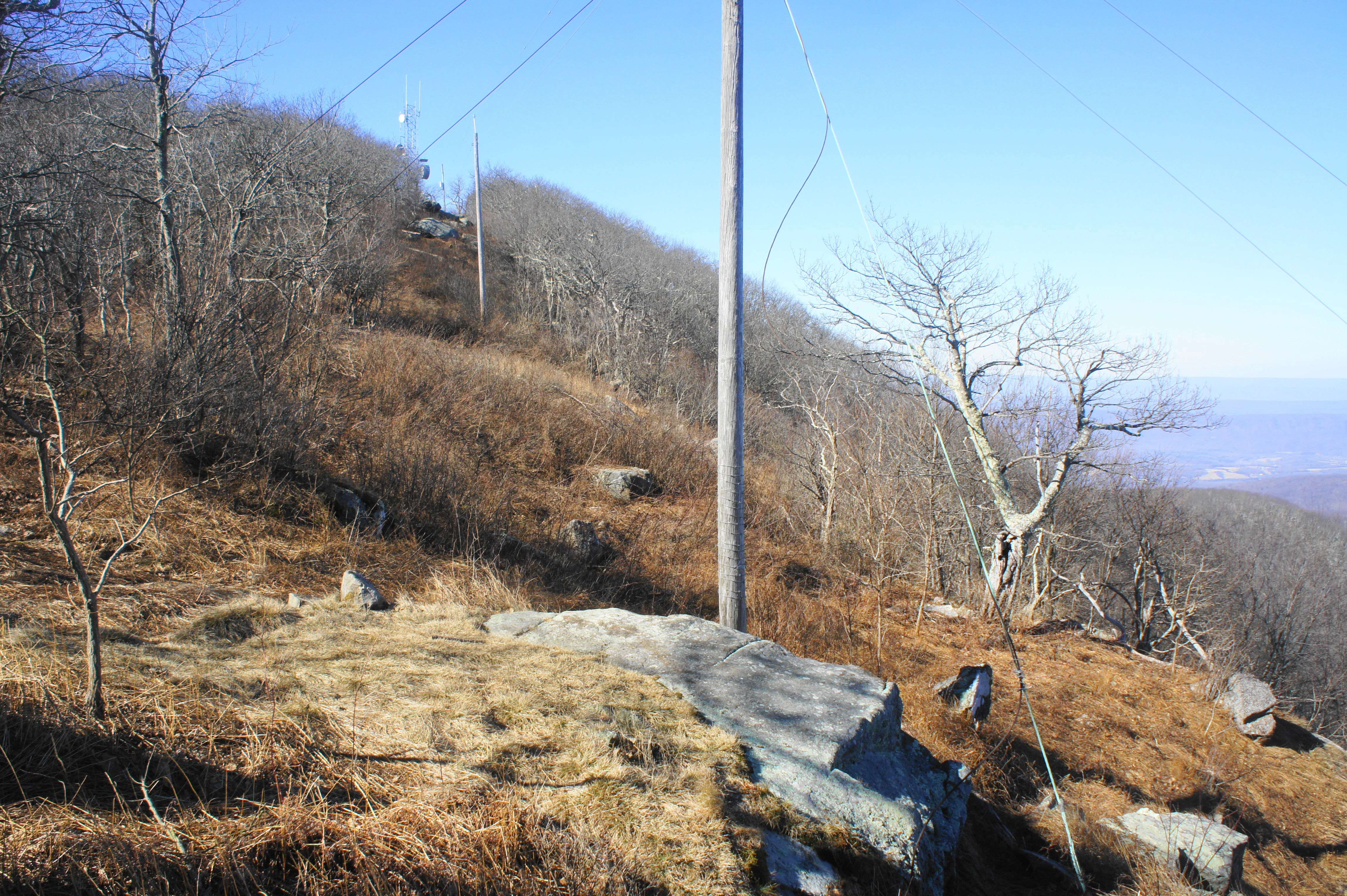
After the climb, the AT flattens out and even partly descends to a high gap on Hogback Mountain Despite being taller than Little Hogback, the views from Hogback proper are more limited. However, at 1.25 miles, the AT reaches a junction; if you stay right, the trail approaches a decent viewpoint at the local hang-gliding launch site. Although power lines detract from the charm, hikers are rewarded with sweeping views of the Browntown Valley.

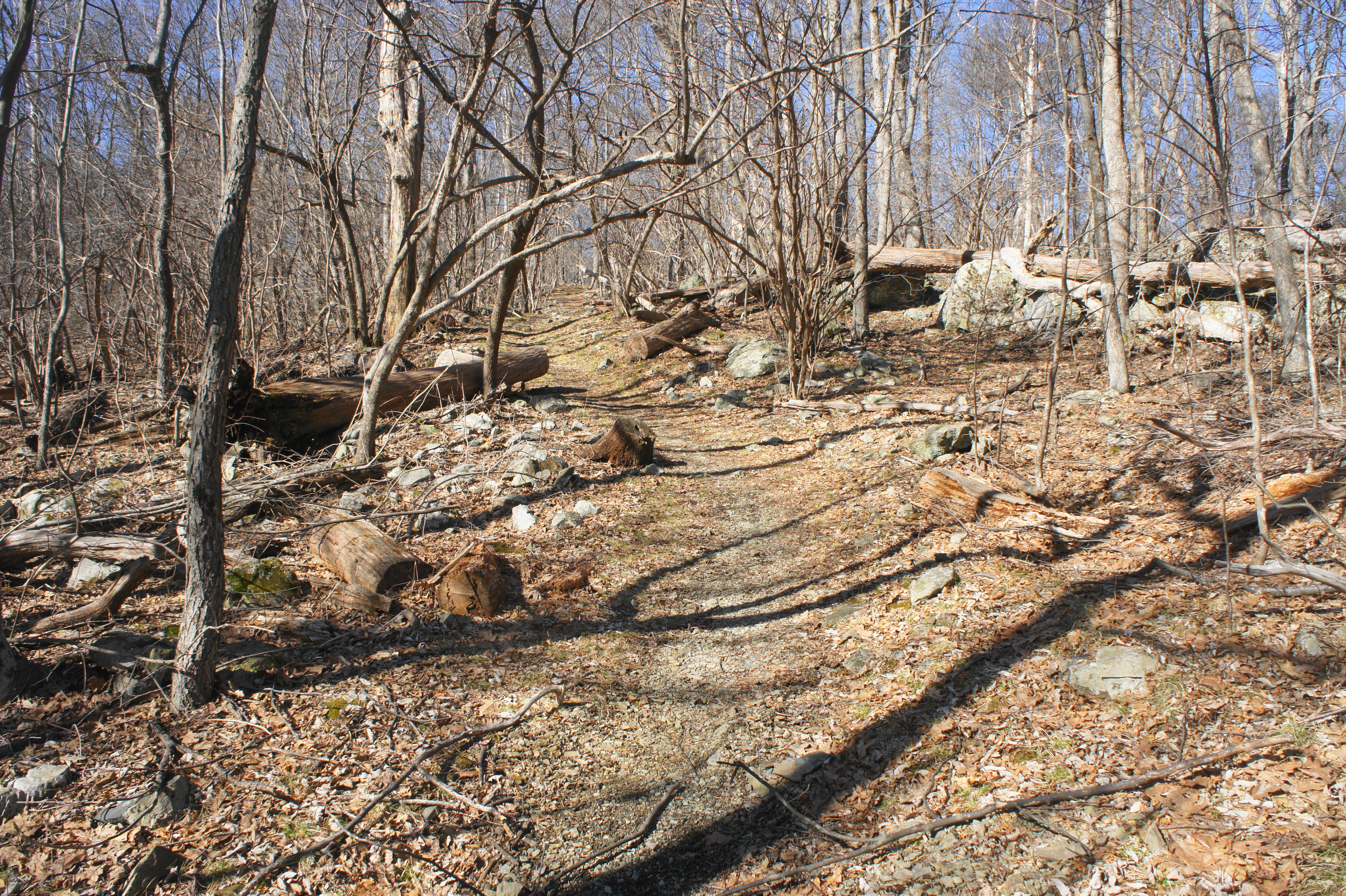
Beyond the vista, the AT drops back into the woods and then weaves south, bypassing the summit of Hogback. The relatively level path rounds the mountain, then begins to descend at around 1.5 miles through a patch of mountain laurel. Skyline Drive soon reappears on the left, and the trail spills into a gravel road at 1.6 miles. Bear left on the road, then cross Skyline, eyeing the trail continuation on the other side. As the path returns to single-track, it drops down a set of stone steps.
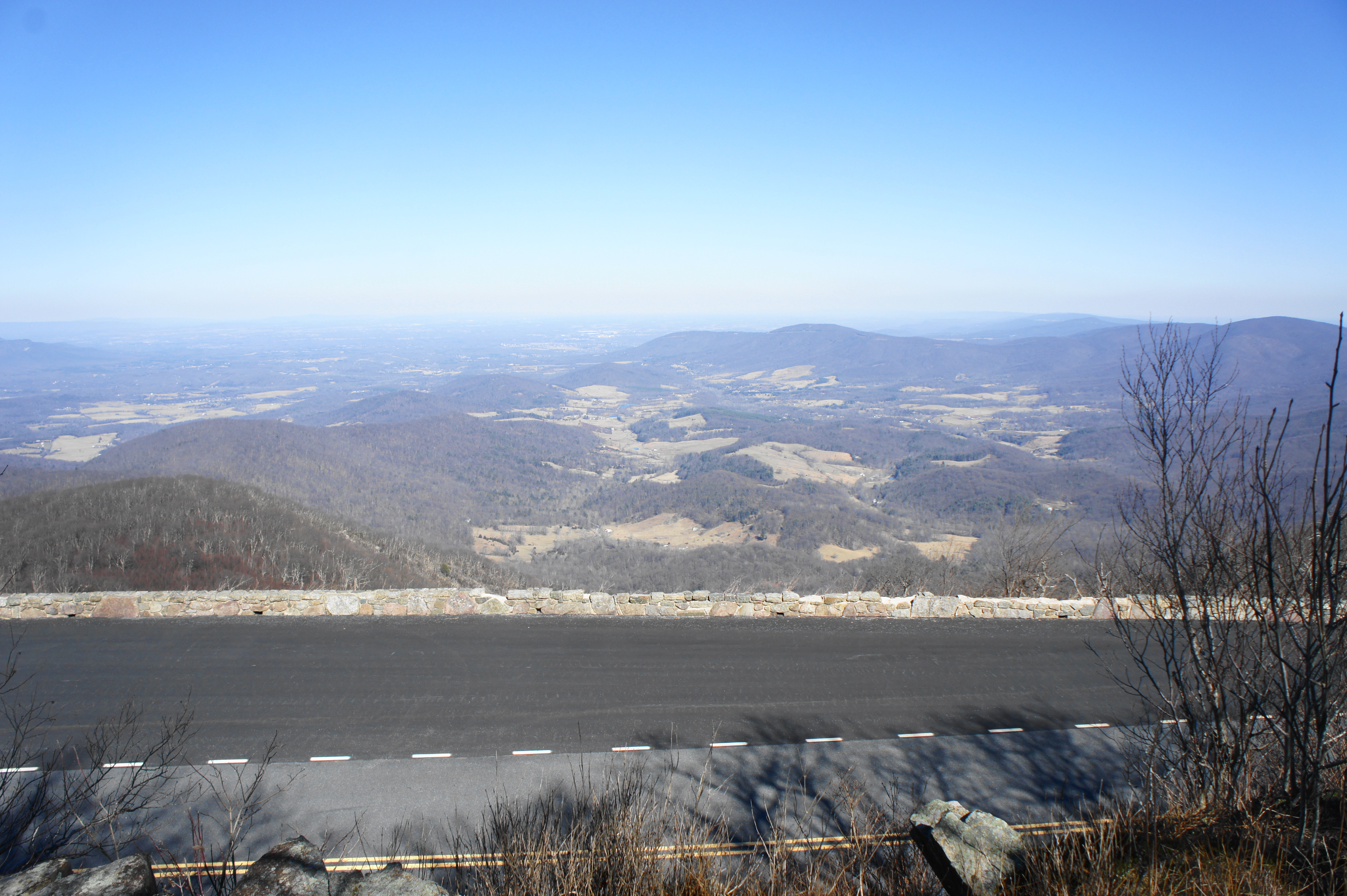
If pursuing the full circuit, stay right at the junction with the Sugarloaf Trail. (Note: Hikers seeking a shorter loop can bear right here, cutting off a couple miles from the total hike.) From the fork, the AT stays close to Skyline Drive, rising to a decent vista at about 1.75 miles, effectively a perch looking out over the drive to the valley beyond.
This marks the last unobstructed view of the hike, and the AT from here descends to cross Skyline Drive again at about 1.9 miles. Stay on the trail as it skirts to the left of a parking area, a popular starting point for the lovely hike to Overall Run Falls. The relatively wide and flat track bears southwest through the thick forest, approaching another junction at 2.25 miles. Stay left, then begin to descend a long, gradual slope. The trail briefly climbs to clear a rock outcrop at about 2.6 miles, then resumes its descent, with the incline becoming more pronounced.
At 2.9 miles, hikers will cross Skyline Drive for the final time on the hike. Here the trail continues dropping, rounding bending switchbacks. At 3.1 miles, bear right onto the Piney Branch Trail. After spending most of the hike to this point amid the heights of the Blue Ridge Mountains, the Piney Branch Trail drops precipitously toward the lowlands. Following a straightaway and sharp left-hand U bend, the path descends sharply again. A long, south-bound straightaway leads to another bend, then the Piney Branch Trail descends gradually to its namesake stream.
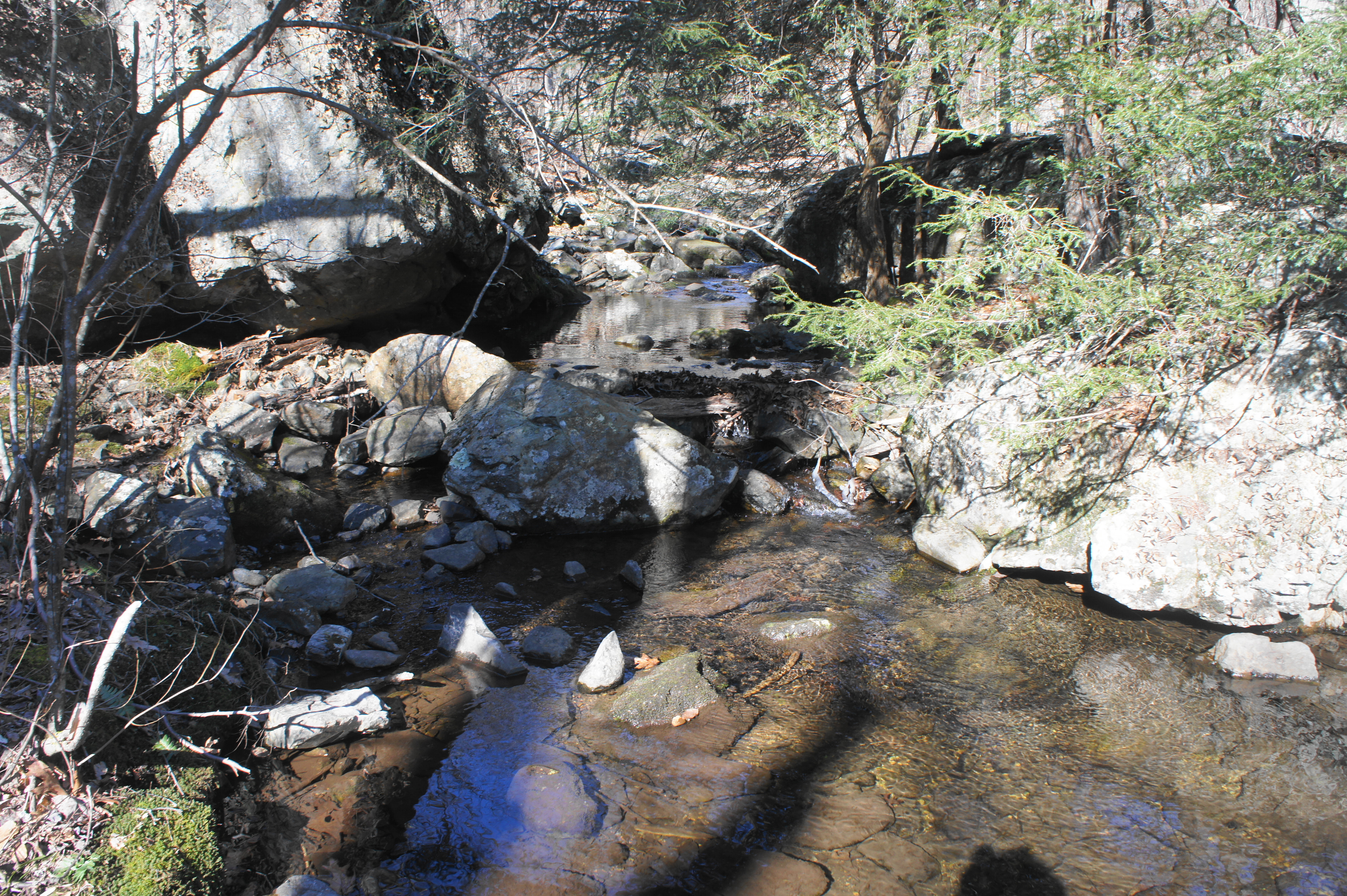
The area around Piney Branch (or Piney River) is lush and lovely, and a smattering of rocks offers a nice place to stop for a snack. Hikers are well away from civilization by now, with the traffic of Skyline Drive drowned out by the water, wind, and some 500 feet in elevation loss. The crossing of Piney River is followed shortly by another trail junction, this one at about 4.4 miles.
Here hikers should turn left, leaving the Piney Branch Trail and entering the Pole Bridge Link Trail, effectively a connector path. The trail climbs very gradually to a low saddle, immersed in woods. Stay right at the junction with the Sugarloaf Trail at 4.9 miles. From here it is a relatively uneventful ½ mile to the Keyser Run Fire Road at the so-called Fourway junction. The trail bearing straight across the road is the Little Devils Stairs Trail—a challenging but extraordinary scenic path that features a tight canyon and seemingly endless waterfalls. (Note: See here for a hike description.)
To complete the circuit, bear left on the Keyser Run Fire Road, an overgrown gravel path that is closed to vehicles but acts as a superhighway for hikers. It is roughly one mile up the gradually sloping road, which hugs the side of the mountain. Finally, at about 6.4 miles total, the hike ends back at the Keyser Run Trailhead.
Hikers aiming to complete the full Hogback Mountain Loop should allot between 3-5 hours, depending on pace. Besides the climb between Little Hogback and Hogback, the trail is relatively mild, making the circuit a nice, moderate half-day journey.

I’m putting this place on my list of “go to’s” : )
Pingback: Marys Rock via Panorama (Shenandoah National Park, VA) | Live and Let Hike
Pingback: Top 10 Hikes in 2019 | Live and Let Hike