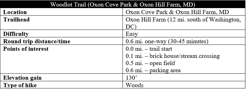
The Woodlot Trail is a short, one-way nature hike in Maryland’s Oxon Cove Park that—despite being within striking distance of Washington, DC—makes for a surprisingly scenic walk. Meandering in and out of wooded ravines, the hilly traverse follows a deep-cutting stream behind Oxon Hill Farm, ending back at the parking area.
The hike
The main attraction of Oxon Cove Park is Oxon Hill Farm, a family-friendly farm owned and operated by the National Park Service. Behind the pig pens and chicken coops, however, is a dense forest, crisscrossed by a pair of hiking trails. The longer Hiker-Biker Trail begins at the parking area off Bald Eagle Road, while the shorter Woodlot Trail starts further into the park, past the Visitor Center and heart of the farm.

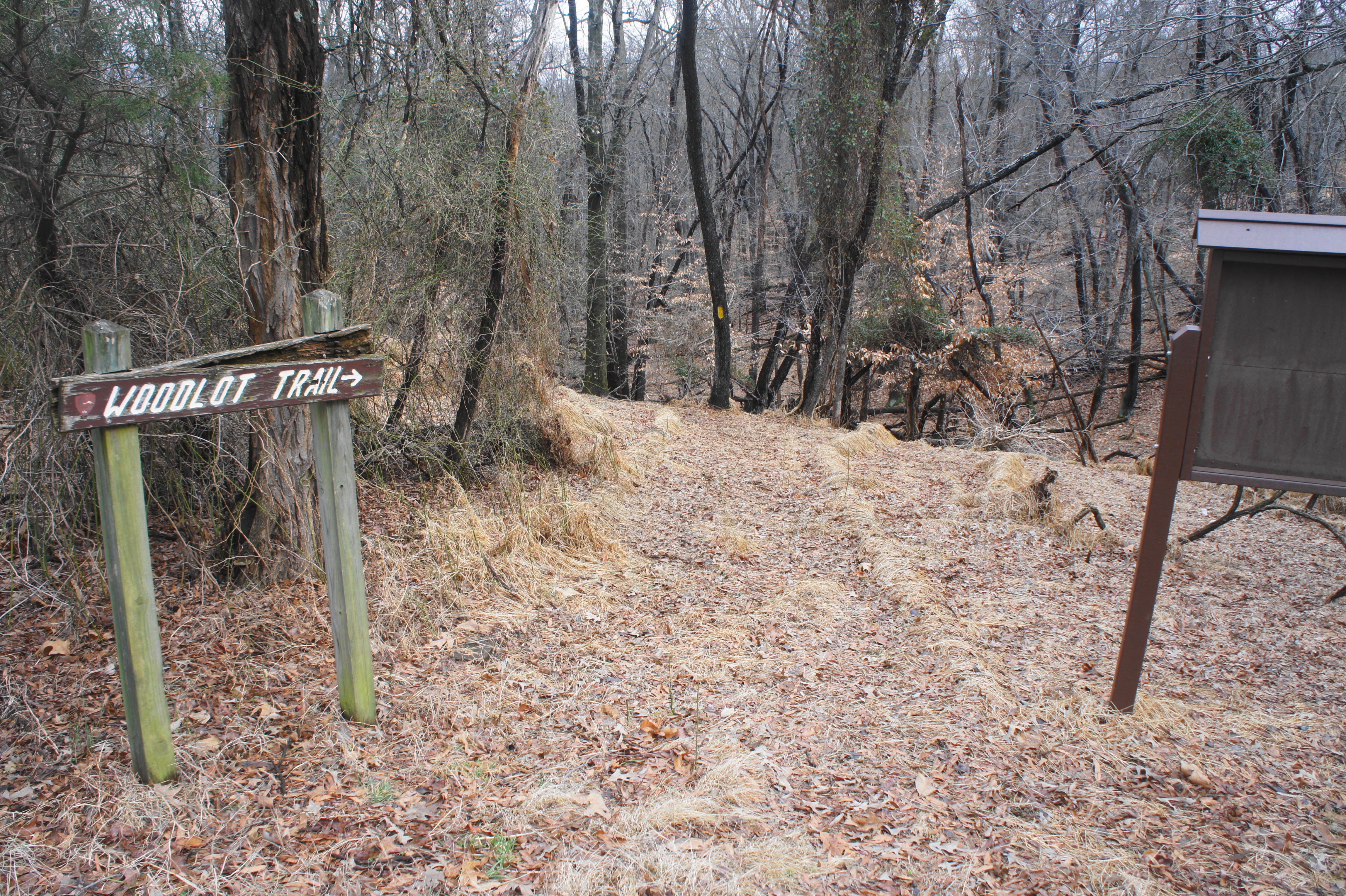
To access the Woodlot Trail, walk from the parking lot roughly ¼ mile to the Visitor Center. Then, upon exiting the building, bear left and follow the path as it winds westward, taking the second left. Continue down the gravel road until it enters the woods; the marked trail begins on your right.
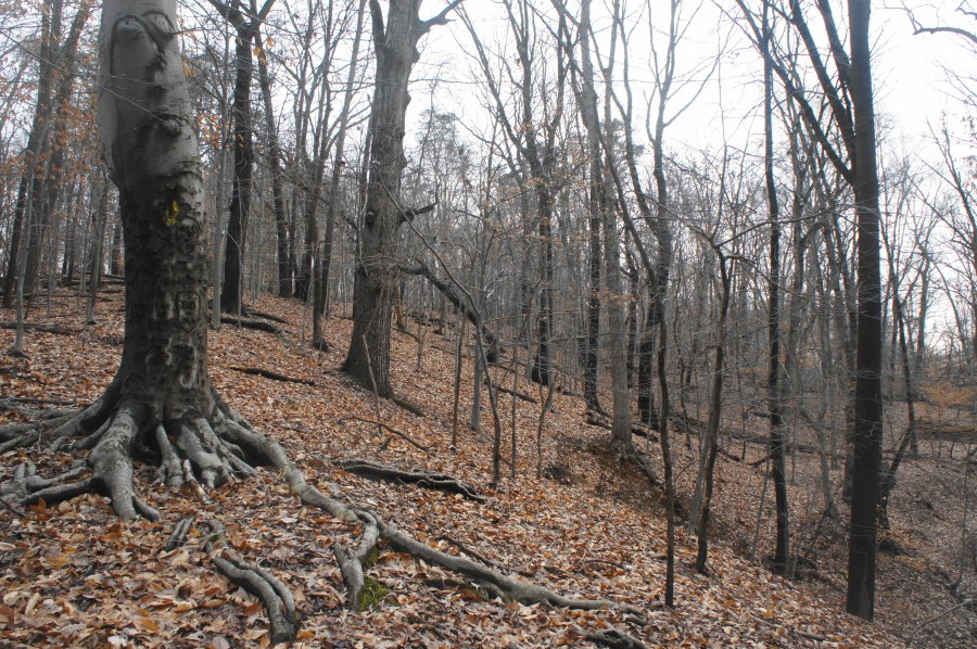
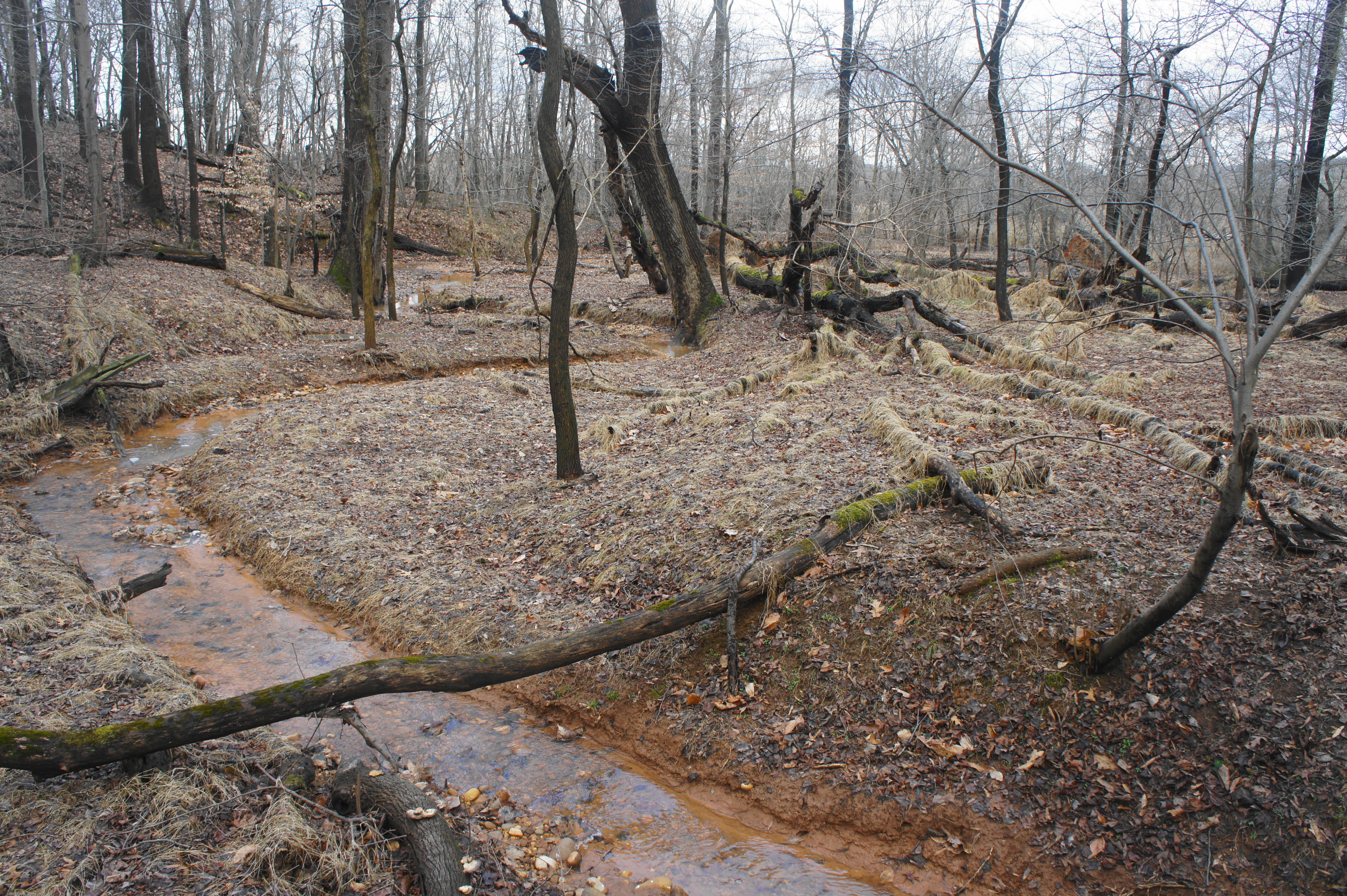
From the gravel road, the Woodlot Trail drops sharply, a rapid change from the level stroll through Oxon Hill Farm. Fallen leaves congregate here in masses in the late autumn and winter, making for a potentially slippery descent. Within about 150 yards, the trail levels off as the dipping ravine gives way to a relatively flat basin. The yellow-blazed path passes a small and unused brick structure on the left and then crosses an unnamed but perennial stream, the primary natural centerpiece of the hike.

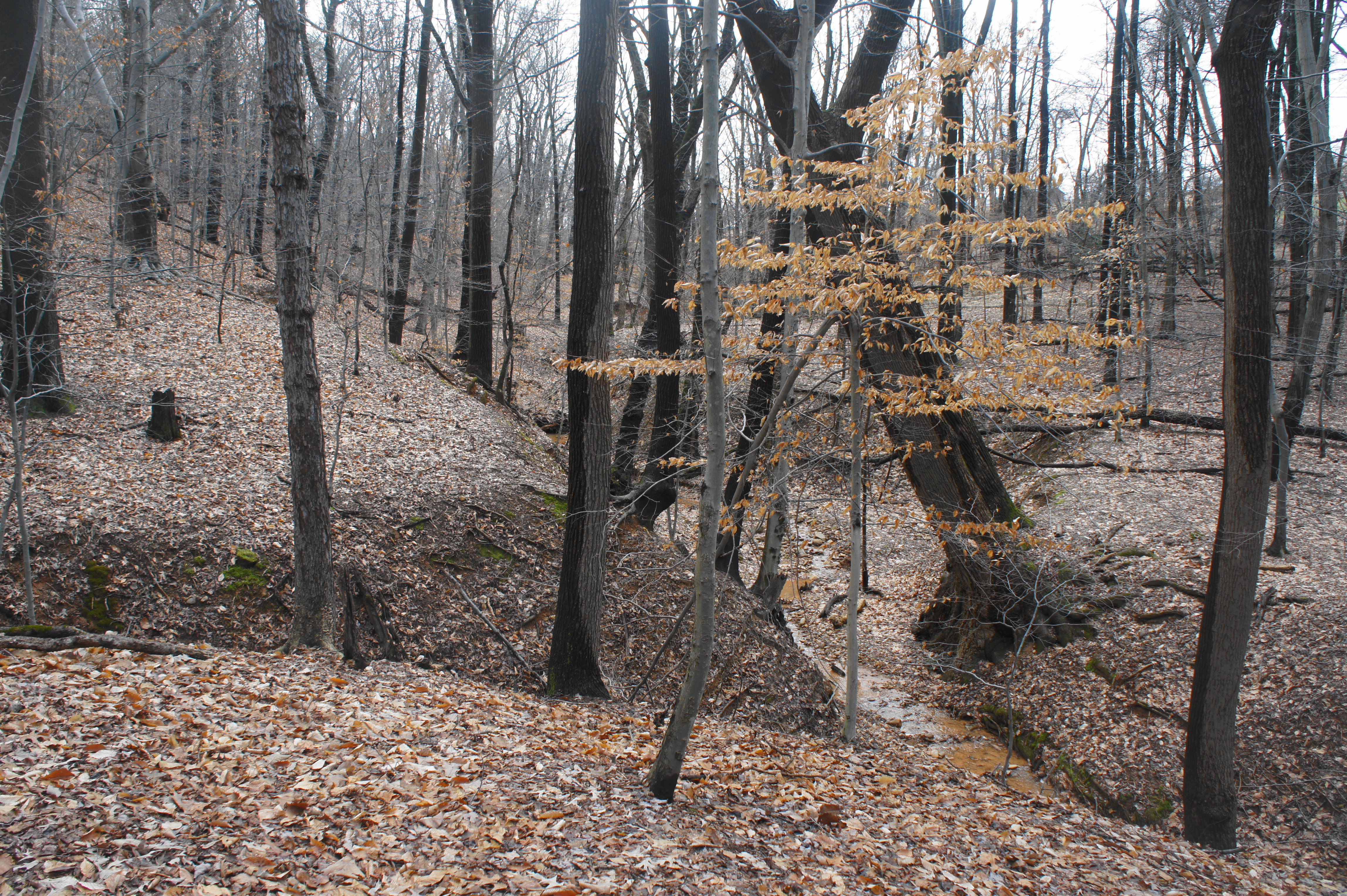
This mossy basin is extremely pleasant, but onward hikers must move on past the wooden bridge over the creek. Here the path begins to ascend sharply, almost switchbacking up a bulging, wooded slope. After leveling off again, the trail hugs the east flank of a deep-cut ravine and crosses a second bridge (over a tributary of the main creek), with the structures of Oxon Hill Harm visible through the trees to the west and south. Pay close attention to the yellow blazes, which offer passage in the absence of a clear path.
At about 4/10 mile—around which the way is most obscured—the route bears left, climbing another hillside to work its way out of the ravine. After crossing another tributary, the trail climbs a set of steep stairs, leading to a final push out into the open—the woods give way to an open pasture at around the ½-mile point.

From here, bear right on the faint path, meeting up with a gravel road. The parking area is visible up ahead. Continue for around 100 yards, passing a quaint picnic area under a mammoth oak on the left, to the parking lot—the end of the short hike. (Note: It is best to complete the Woodlot Trail after exploring the farm because it connects back to the picnic area.)


Great pictures -love the farm one!
I hear rumors that Dogs are NOT allowed on this hike, is this true?