
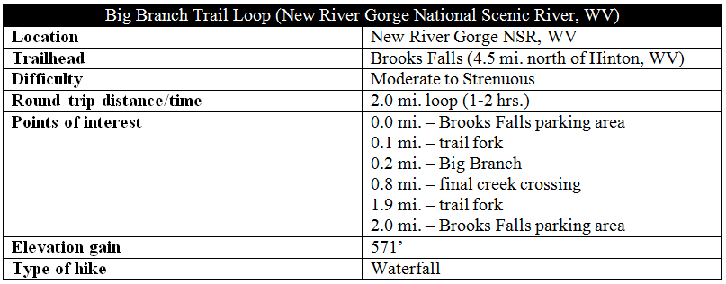
The Big Branch Trail at West Virginia’s New River Gorge National River treks through a peaceful, serene landscape of dense canopy and tumbling cascades, highlighted by a pair of waterfalls (15 and 30 feet). In winter, the ridge portion offers decent views of the gorge and Brooks Falls; in spring, the trail is dotted with colorful wildflowers. Best of all, tucked away near the southern reaches of the park, the trail is often empty, making for an intimate experience in a beautiful corner of West Virginia.
The hike
Begin at the Brooks Falls parking area, situated roughly 4.5 miles north of the charming town of Hinton, WV along Route 26 (a.k.a. River Rd.). Here the New River rushes not over a waterfall, per se, but a series of rocky rapids producing a roaring sound that disrupts the otherwise quiet valley. Cross the road to the west to find the start of the Big Branch Trail.

From the start, the trail immediately begins to climb, and within 1/10 mile, the trail forks. Turn right to begin a clockwise circuit around the 2-mile Big Branch Trail loop. After crossing a pair of lesser drainages, the narrow path reaches the Big Branch after about ¼ mile. Hop from rock to rock to reach the opposite bank, where the trail continues upstream.
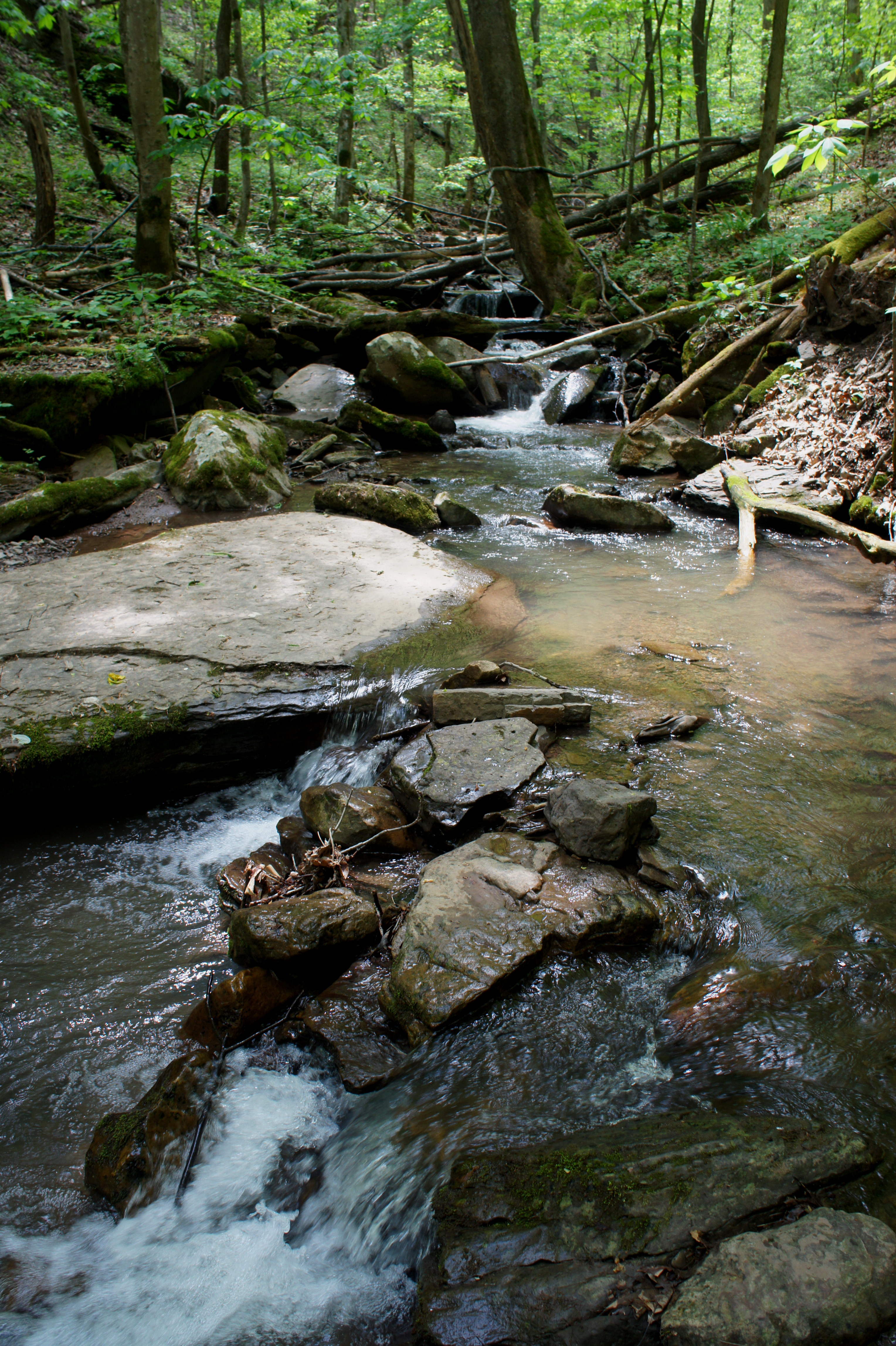
After another crossing, the ever-climbing trail parallels Big Branch and passes a series of short waterfalls, especially impressive in the spring. Just beyond a 4-footer, the trail crosses the stream again—this time assisted by a bridge composed of moss-laden logs.
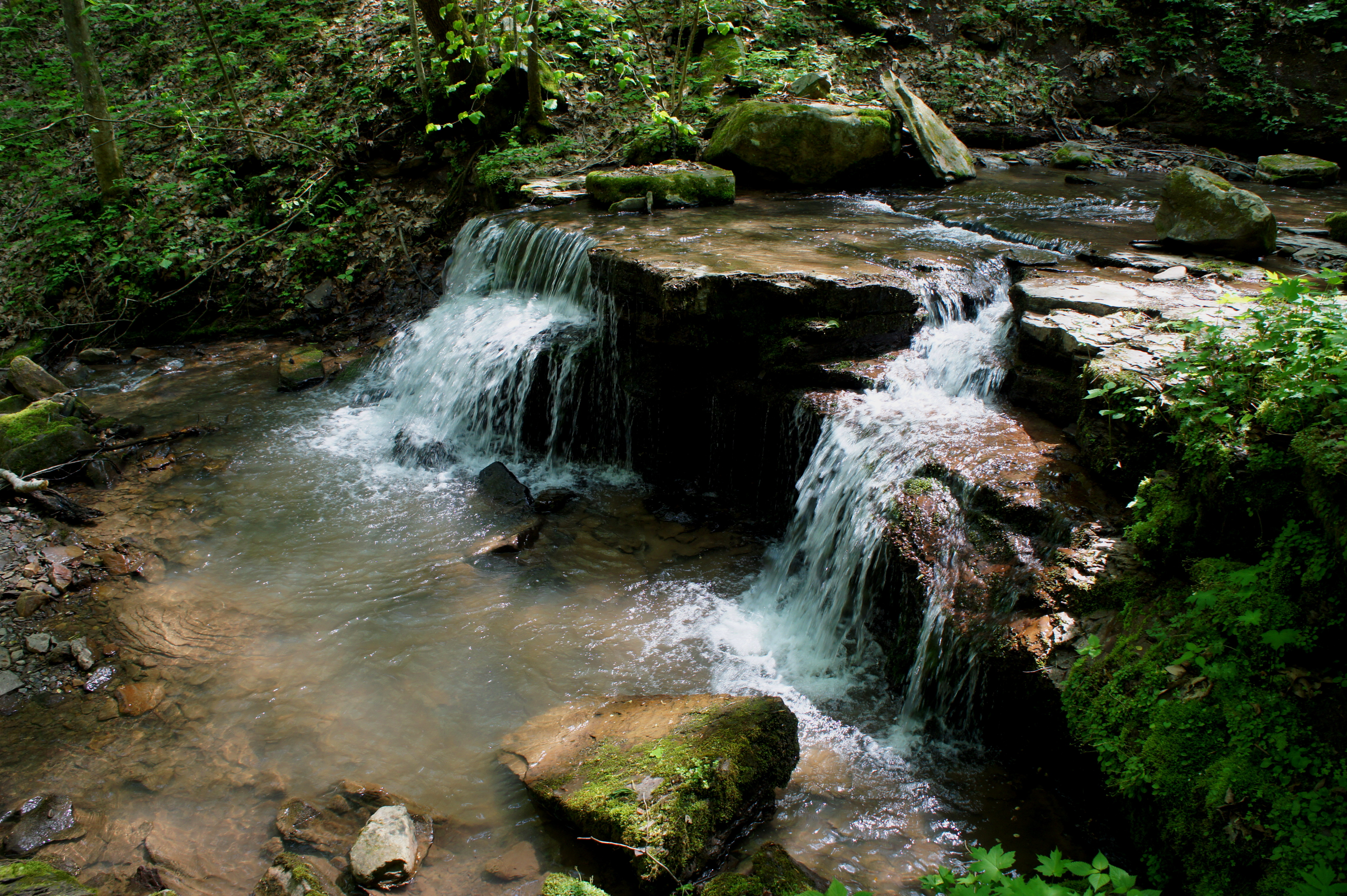
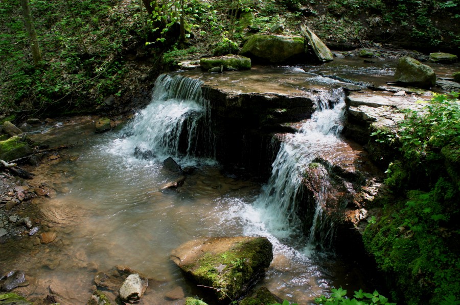
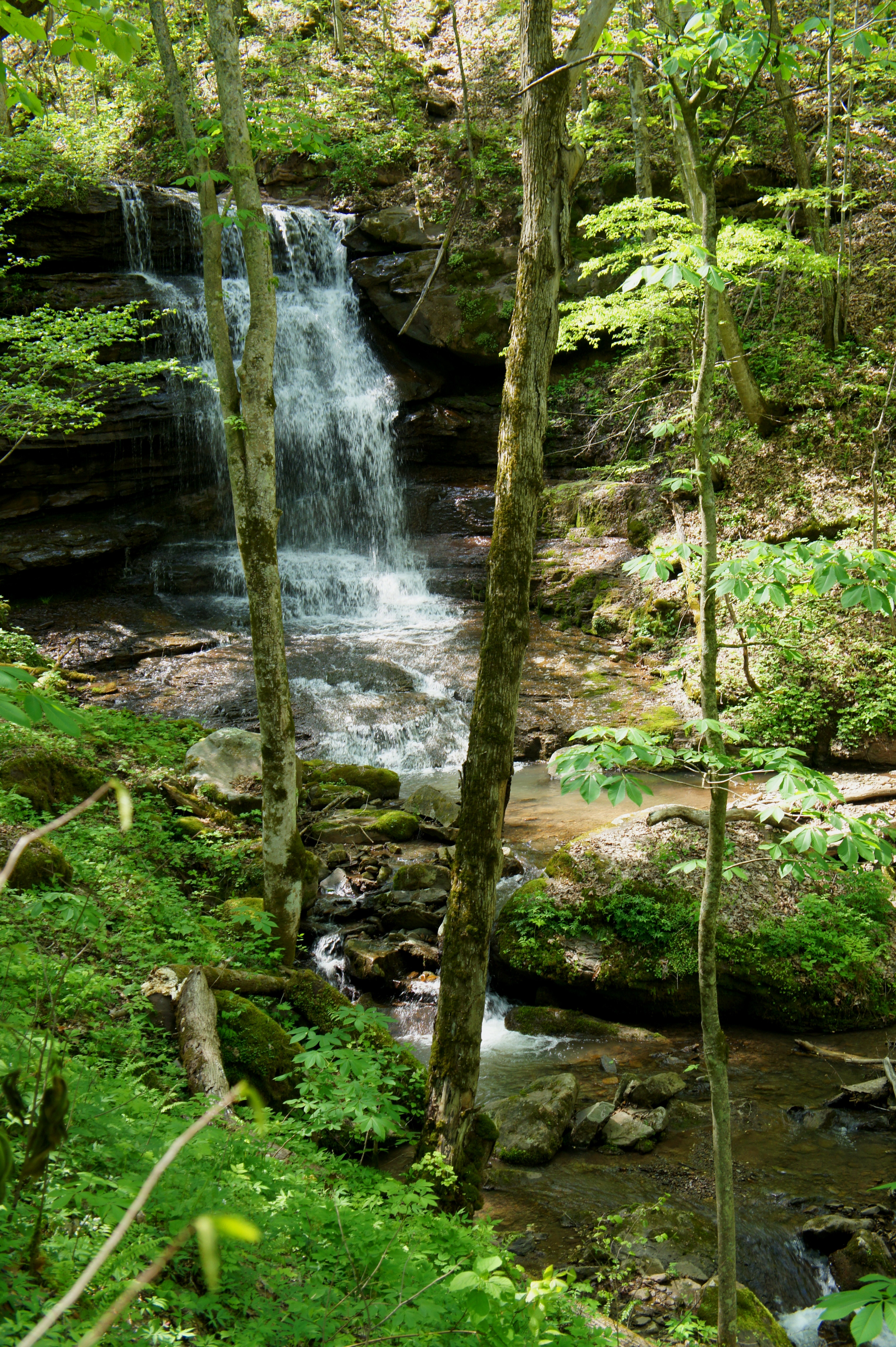
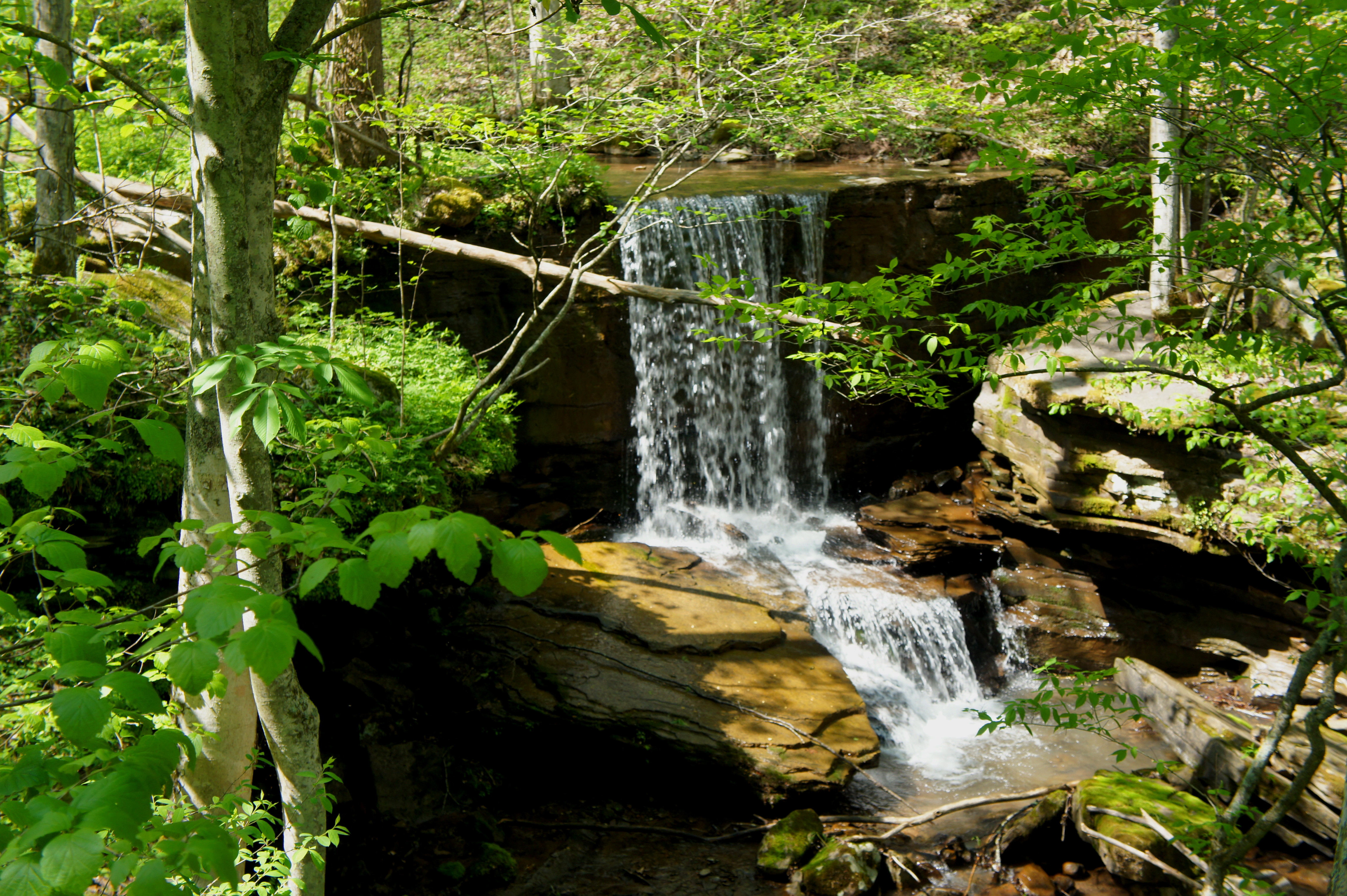
The cascades that follow are bigger and taller and offer majestic spots to stop for lunch or a snack. The most impressive is a 30-foot waterfall reached after about ¾ mile of hiking, though views of it can be obscured by the trees. Five minutes beyond the 30-footer is the final falls, this one roughly 15 feet.
Above this chute, the trail crosses Big Branch a final time and begins to follow an old road up the southern slope of a wooded ridge. After crossing under a set of power lines, the hike reaches its highest point roughly one mile from the trailhead.

Having crested the top, the Big Branch Trail then begins descending sharply down a ridgeline that, at least in leafless winter, offers views of the mountains to the northeast. After briefly heading southwest, the route switchbacks sharply back to the north at the sight of another small stream. While the trail remains relatively level, the ravine drops more than a hundred feet off to the left.

The final stretch comprises a steady southward descent past patches of wildflowers with intermittent views of the gorge. At just under two miles, hikers reach the trail fork and, minutes later, are back at the River Road and Brooks Falls.
Allot at least 1-2 hours for this steep, moderately strenuous circuit hike.

Pingback: Sandstone Falls Overlook Trail (New River Gorge National Scenic River, WV) | Live and Let Hike
Pingback: Canyon Rim Boardwalk (New River Gorge National River, WV) | Live and Let Hike
It says to go right to take the trail and a clockwise direction. When it taking the left fork take you clockwise?
Sorry for the typos autocorrect got me. What I was trying to ask was shouldn’t you take the left fork if you want to hike the trail in a clockwise direction. The body of the text says to take the Right fork.