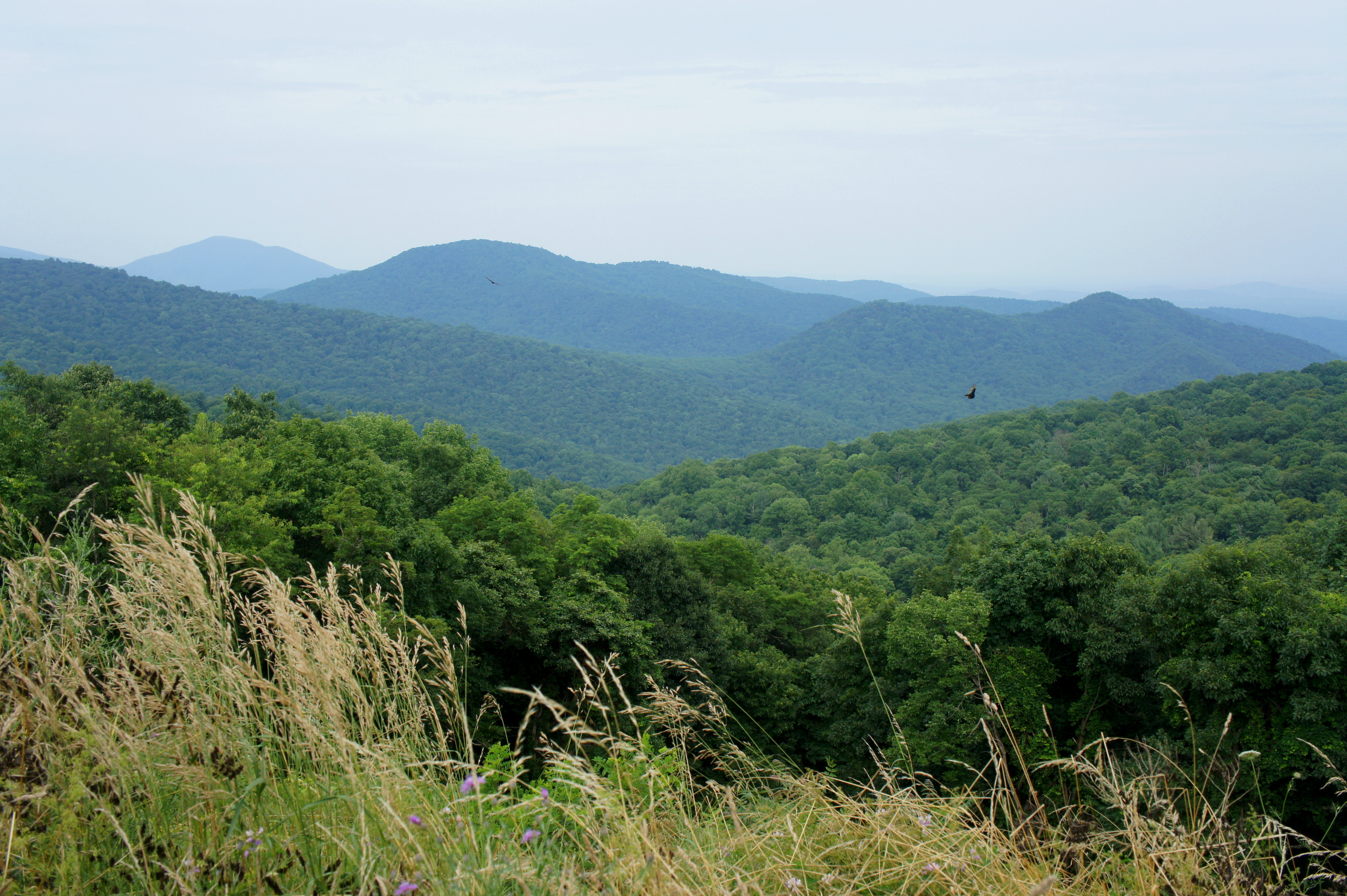
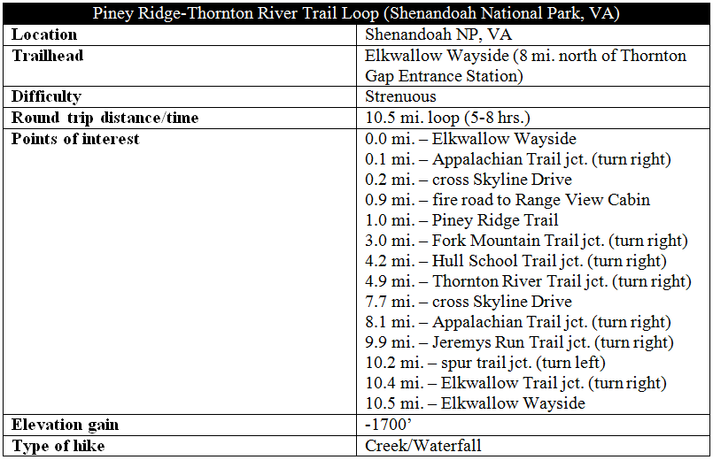
Shenandoah National Park’s nearly 11-mile Piney Ridge-Thornton River Trail circuit covers nearly 1,700 feet in elevation gain/loss—perhaps one of several reasons this loop hike is lightly traveled. On a hot Saturday in July, I encountered only one pair of hikers—on the Piney Ridge Trail—before descending through a remote pocket of Shenandoah so sparsely visited that the route had become virtually a network of wiry spider webs. While Piney Ridge leaves much to be desired, the rushing waters of Thornton River are in places quite delightful, including a double waterfall. The loop also includes a 2.5-mile section of the Appalachian Trail that is best tackled south to north to avoid a crushing ascent. Be bear aware, as this is black bear country! (Note: I saw two cubs from the parking lot at Elkwallow.)

The hike
While SR 612—from Sperryville, Virginia—provides access to the bottom of the Thornton River Trail, the following description uses the Elkwallow Wayside along Skyline Drive as the hike’s start and endpoint. Here you will find a picnic area, fast food restaurant, and camp store. The loop hike described below takes off from the RV parking lot—just east of the store near the easternmost entrance to Elkwallow.
Passing under a Virginia pine at the entrance, hikers begin on the Elkwallow Trail, which, if followed in its entirety, will end at Mathews Arm Campground. After less than 1/10 mile, however, turn right at the four-way fork onto the Appalachian Trail (AT), which, a couple minutes later, crosses Skyline Drive. Beyond, the AT ascends a series of wooden steps, rounds a bend, and passes under a set of power lines. Paralleling these human-made eyesores, the trail climbs steadily before reaching an overgrown fire road at 9/10 mile. This track—closed to vehicles—leads to Range View Cabin, operated by the Potomac Appalachian Trail Club. Follow it downhill—to the right—for a couple hundred yards, then bear right again onto the Piney Ridge Trail (marked with a distance post).
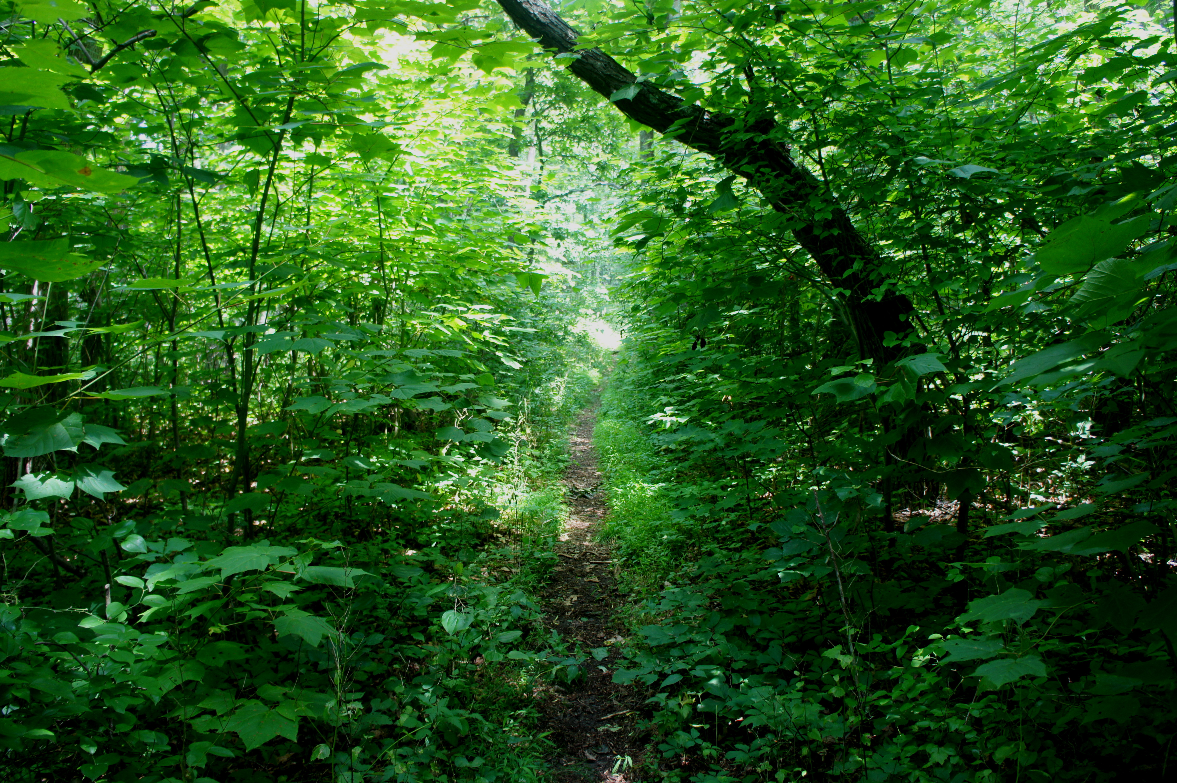
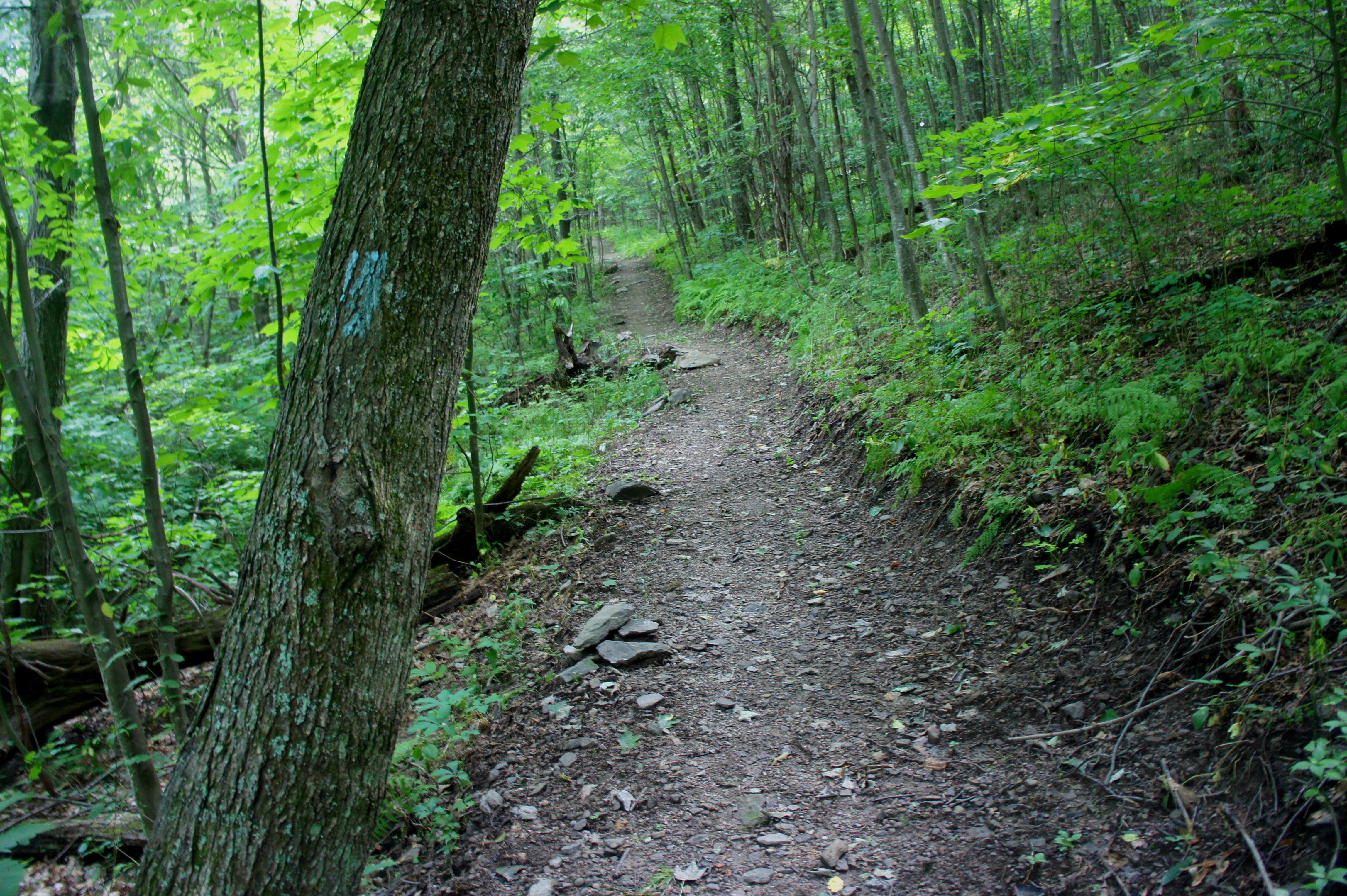
First impressions of the Piney Ridge Trail? Narrow, considerably less maintained, and choked with brush. In the first few hundred yards, the trail nearly disappears on a couple of occasions; follow the blue blazes to stay on track. Over the course of the next two miles, the Piney Ridge route passes under another set of power lines, skirts a collection of boulders, enters a hardwood forest, and gradually approaches the end of the ridge—though often it feels simply like a blur of dense thicket. Oaks, maples, black birch trees, and, of course, pines abound; in summer, the understory is blanketed with poison ivy and all kinds of nasty spider webs. (Note: Wear long pants—and perhaps bring a stick to avoid encounters with colorful arachnids.)

Hikers can fortunately make good time on Piney Ridge’s casual downhill, as well as the steeper—but not quite as rocky—Fork Mountain Trail. The Fork Mountain route drops 900 feet over the course of 1.2 miles, finishing at a junction with the east-west bearing Hull School Trail. As seems to be the rule for this hike, bear right again.

The Hull School Trail, which begins by following an old road, drops another 340 feet to reach, at last, the Thornton River Trail—nearly five miles from the trailhead. Here you can hear, but not yet see, the rushing stream. Bear right at the junction.
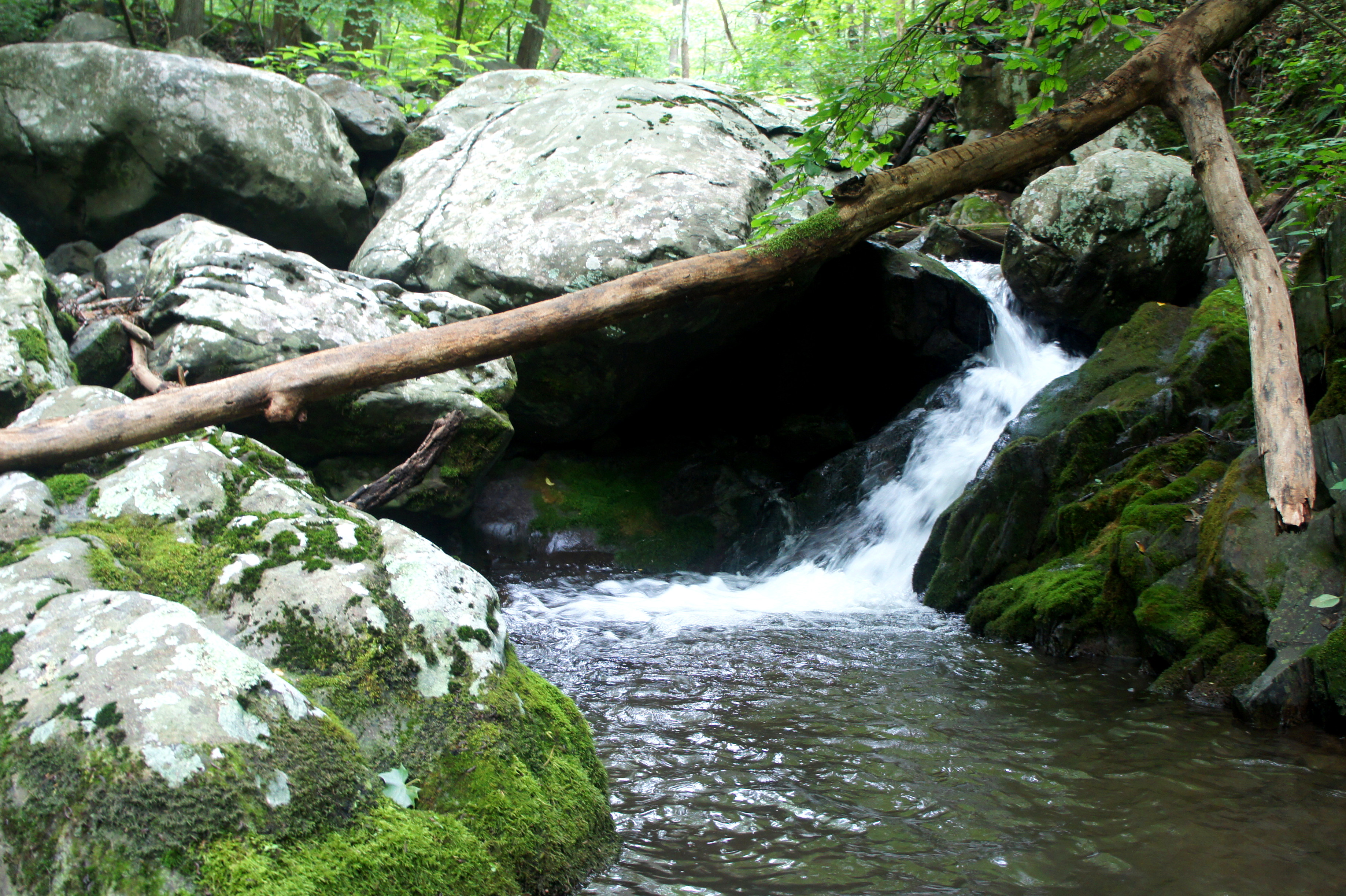
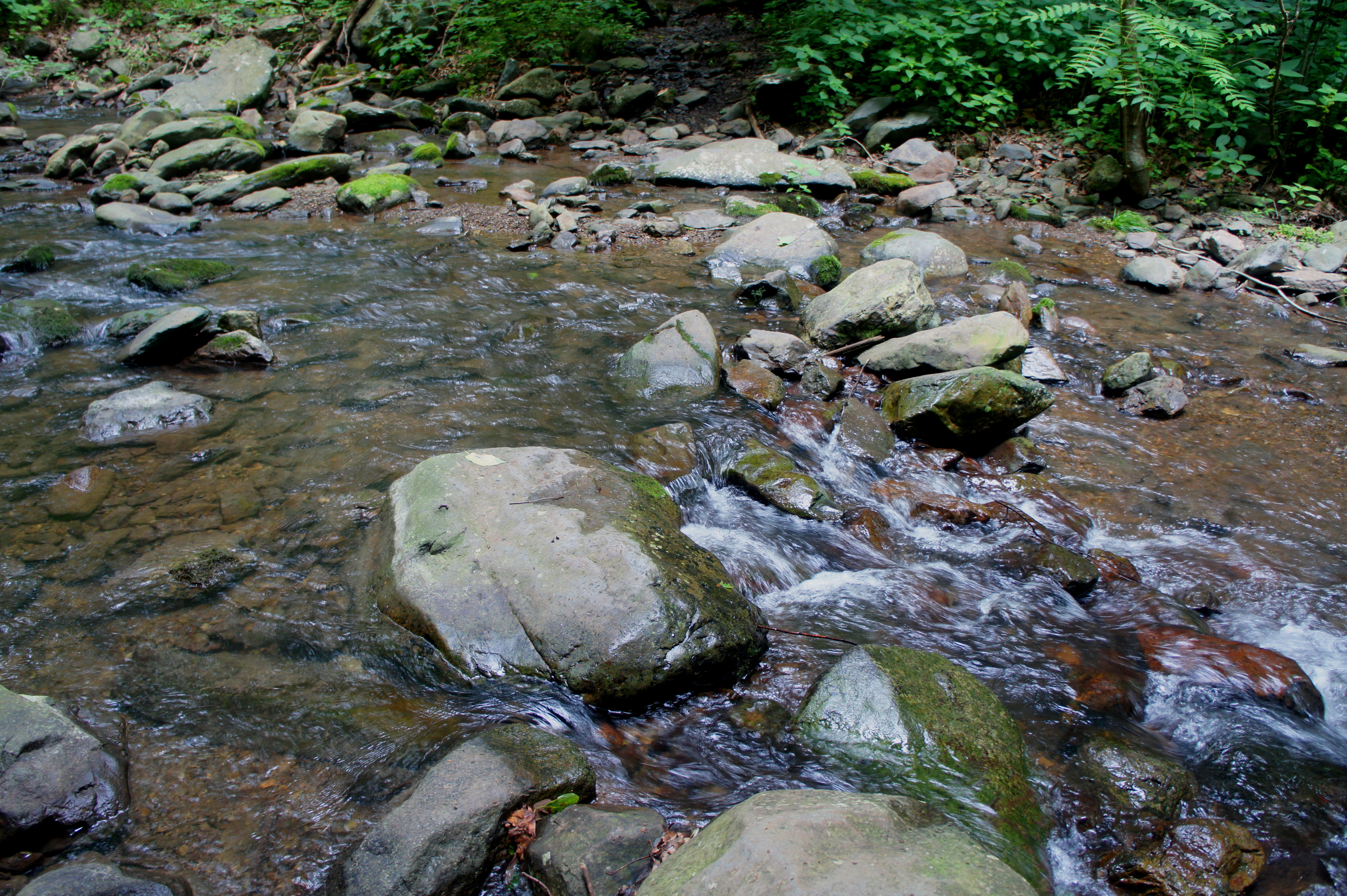
The elusive North Fork of the Thornton River finally reveals itself after 2/10 miles of walking, where hikers must brace for the first of four stream crossings. Well-placed rocks assist with the traverse, but one should take caution when crossing the Thornton.
After the first crossing, the route edges the western flank of the ravine through a particularly fresh pine-smelling section, then—within 5-10 minutes—drops back to cut across the Thornton River a second time.
Back on the east side, vestiges of human development abound. A rock wall separates the creek from what was once an old road, and the remains of a stone house—probably dating to the 19th century—are visible on the left. As far as the Shenandoah Mountains go, Thornton River seemingly had far more inhabitants and was better-traveled than surrounding drainages.

Meanwhile, the Thornton River Trail gradually ascends to a point where the creek is now some 50 feet below on the left, and tumbling cascades begin to increase in volume and intensity. Then all of a sudden, as the trail cuts west, all is quiet and serene at the next stream crossing, where water has collected in a still pool.

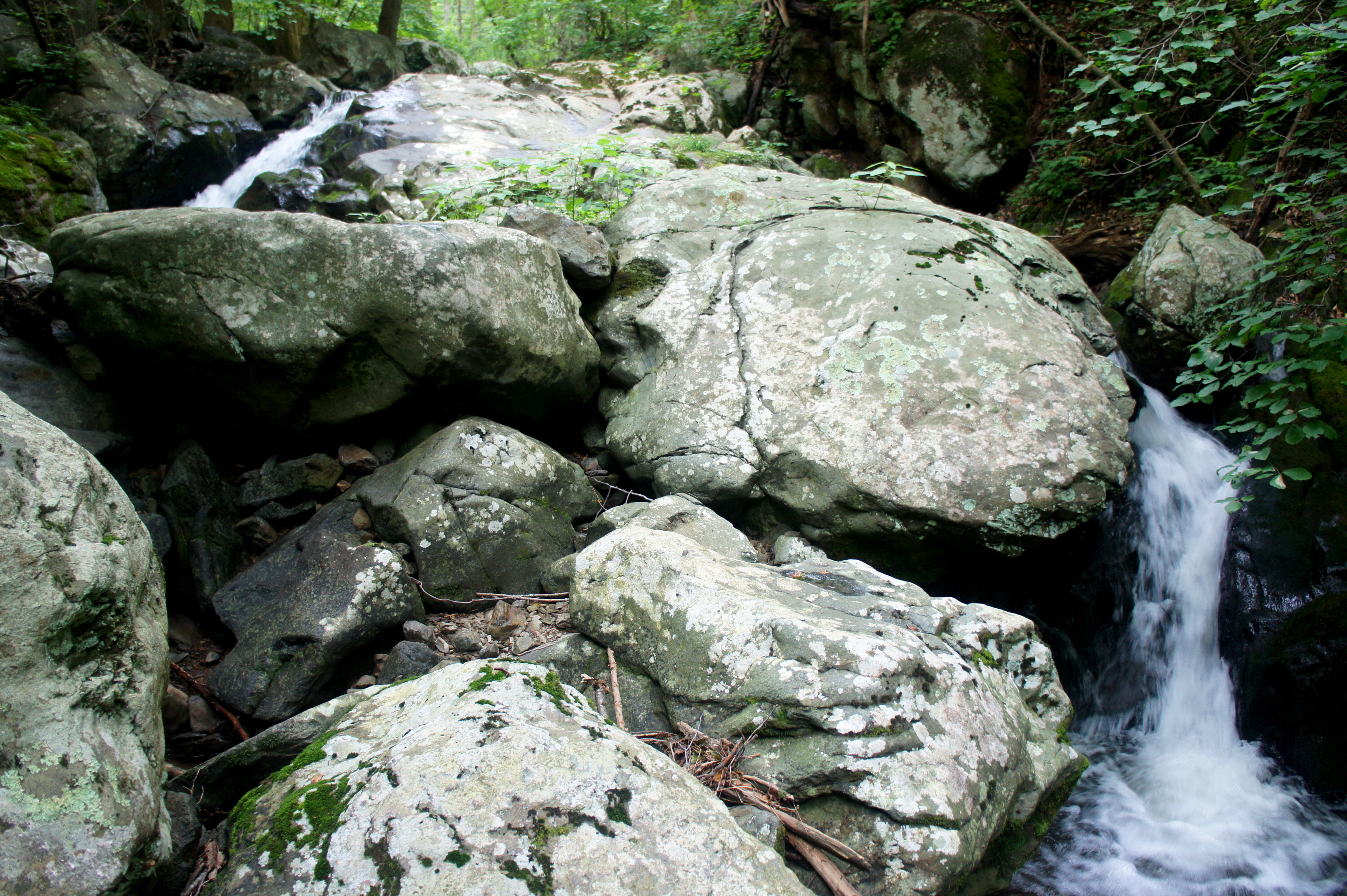
Following the third crossing, the route briefly diverges from the principal streambed, following a minor tributary instead before again rising relatively high above the ravine on the right. It’s easy to hear the rushing waters, however, squeezed ever tighter as the creek enters a thin, rocky gorge. Such a setting—combined with steeper drops in elevation—lends itself to waterfalls, and here Thornton River does not disappoint. At a point roughly 15-20 minutes from the third crossing, follow the sound of thundering waters to a double waterfall that snakes around mounds of granite. Just above the higher flume lies a series of smaller, photogenic cascades. This area is hands down the highlight of the hike—and a worthy spot for a snack break before embarking on the steep climb back up to Skyline Drive that awaits.

As with most hikes from Skyline Drive, what comes down must come back up, and the gradient of the ascent steepens after the double waterfall. After a short period of relative flat, the Thornton River Trail briefly dips to cross the creek a final time, then begins a tough uphill slog, gaining 700 feet in elevation in around a mile. More traces of the men and women who once lived here are scattered about, including rock aqueducts, rusted trinkets, and an old Model-T (now overgrown with grasses and ivy).

Leaving the Thornton River drainage behind, the trail swings around a minor hollow then switchbacks up to a thickly wooded ridge. A short time later, the route bends sharply again, then edges northward, providing sporadic views through the trees (in winter, at least) of Piney Ridge. At last, nearly three miles from the first creek crossing, the trail spits out onto Skyline Drive at an unmarked parking area.
To complete the circuit, cross the road, bear left, and walk 100 yards south along Skyline Drive, where a cement post marks the continuation of the Thornton River Trail. Alas, the climbing is not yet done, as the route ascends another 200 feet over 1/3 mile before finally flattening out at a junction with the AT. While it’s yet another 2.4 miles to Elkwallow, the AT portion is straightforward and, within the exception of a hill early on, mostly downhill. With around ½ mile remaining, the AT swings sharply to the right, then drops another 250 feet to a minor creek crossing and a junction with the Jeremys Run Trail.
Stay right, then—in another ¼ mile—bear left. (Note: the trail heading right leads to the Elkwallow picnic area, but not the Elkwallow Wayside where the loop began.) The finale comprises a couple of gradual climbs wrapping around the Elkwallow area en route to the wayside. Turn right at the final, four-way junction (Elkwallow Trail and AT) and continue 1/10 mile back to the Virginia pine and the parking lot where the circuit began…10.5 miles ago. Spring through fall, enjoy a refreshing, cold drink at the Elkwallow store.
In general, this is a demanding loop hike with significant elevation gain. Even for speedy hikers, it will likely take the good part of a day. For those without considerable stamina, consider breaking it into a 2-day backpack. (Note: I spotted at least one good campsite just past the fourth crossing of the Thornton River.)