
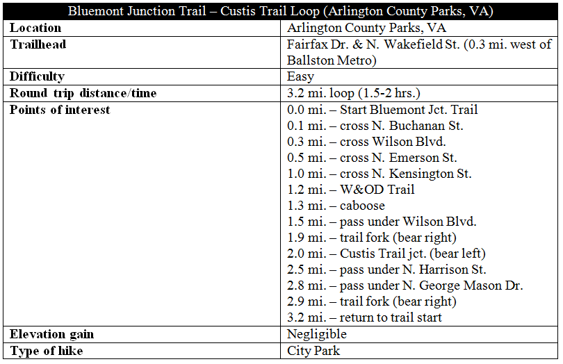
Cutting southwest through the Bluemont section of Arlington, Virginia, the paved and accessible Bluemont Junction Trail traces an old railroad line constructed in 1912. Together with segments of the Custis and Washington and Old Dominion (W&OD) Trails, the Bluemont Junction path forms a 3.2-mile loop starting and ending near the Ballston Metro Station. Have no doubt about it: buzzing with bikers and runners, this is a suburban track that is rarely out of sight or sound of houses or highways. But towering trees and historic relics offer at least a modest sense of escape from the bustling Washington, DC metro area.

The hike
The Bluemont Junction – Custis Trail Loop is easily accessible from the Ballston Metro Station on the train system’s Orange and Silver Lines. Bear west from the metro stop (left) down Fairfax Drive, continuing for roughly 1/3 mile to a point just beyond the Holiday Inn. Tucked behind a tall brown fence is the beginning of the Bluemont Junction Trail, marked by a green trail sign.
The wide, asphalt path immediately crosses Lubber Run (likely to be dry) before swerving southwest through a small park with a modest playground. Cross North Buchanan Street, following the sign indicating “Bluemont Park 1.2 mi.”
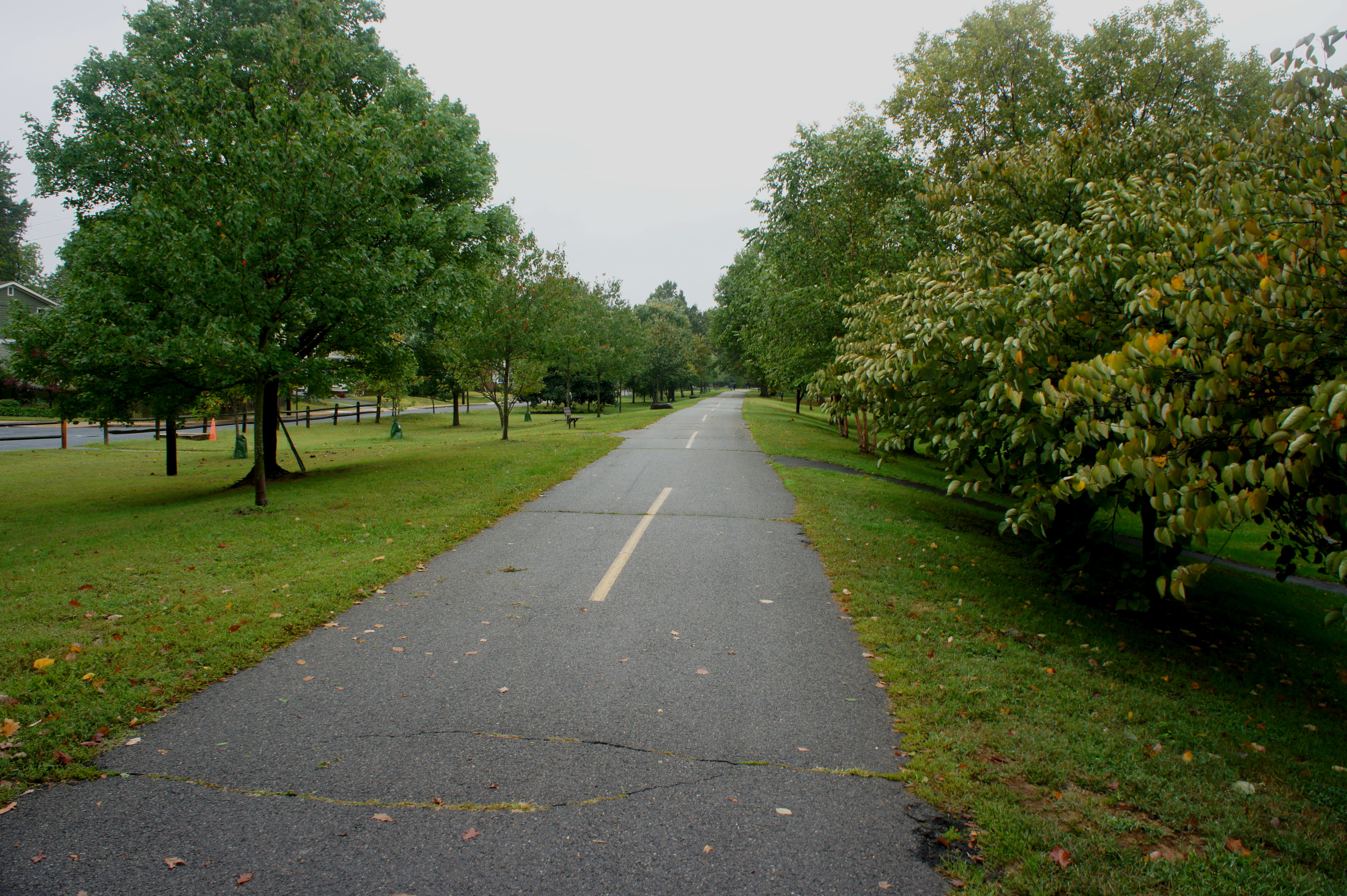
Next the Bluemont Junction Trail follows parallel rows of neatly planted trees, including an array of rosebuds, oaks, zelkova, and others. After a couple minutes, a soccer pitch emerges on the right, the centerpiece of so-called Fields Park. Around 1/3 mile into the walk, the trail crosses Wilson Boulevard and North George Mason Drive, continuing to cut southwest through the Bluemont community. Pick up the trail again after briefly following a minor paved road.
By now, it’s obvious that there is little entirely natural to the Bluemont Junction Trail: the grass is suspiciously well cut and seemingly all the vegetation has been neatly arranged. This is, after all, a semi-urban trail. Within ten minutes of crossing North Emerson Street, however, the path briefly enters a denser and taller forest. An unpaved trail marked “501” veers steeply down a hill to the left. The main path then crosses North Kensington Street and ends after merging with the Washington and Old Dominion (W&OD) Trail adjacent to Four Mile Run. Bear right at the junction, staying on the east side of the creek.
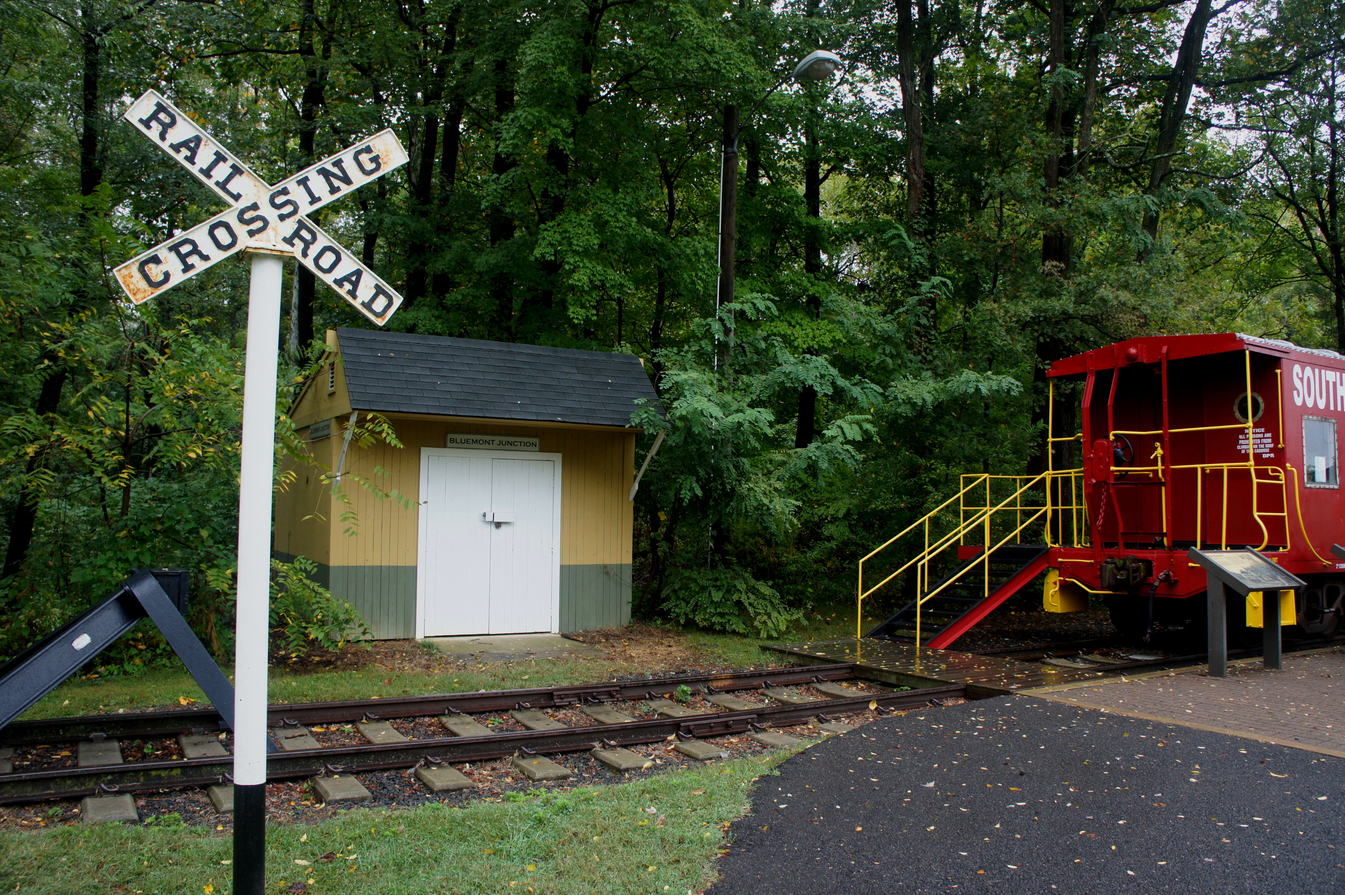
The W&OD Trail section is probably the hike’s best, as it follows the stony creek bed for about 2/3 mile and passes a historical site of note: the remains of Bluemont Junction, an old train station where the Georgetown-Arlington and Bluemont-Alexandria lines once met.

About 1/10 mile north of the end of the Bluemont Junction Trail, one will find a historic red caboose—now a museum open summer weekends (Sat. 11am-5pm; Sun. 1pm-5pm)—as well as historical interpretive exhibits. One such display offers a map of the rail junction as it once was. Turns out the much-touted W&OD Railroad—expected in the 1860s to link the agricultural riches of Shenandoah Valley in northwest Virginia with the Potomac River—was a flop, ending far short of Shenandoah and providing only sporadic freight and passenger service. The rail line was abandoned in 1968.
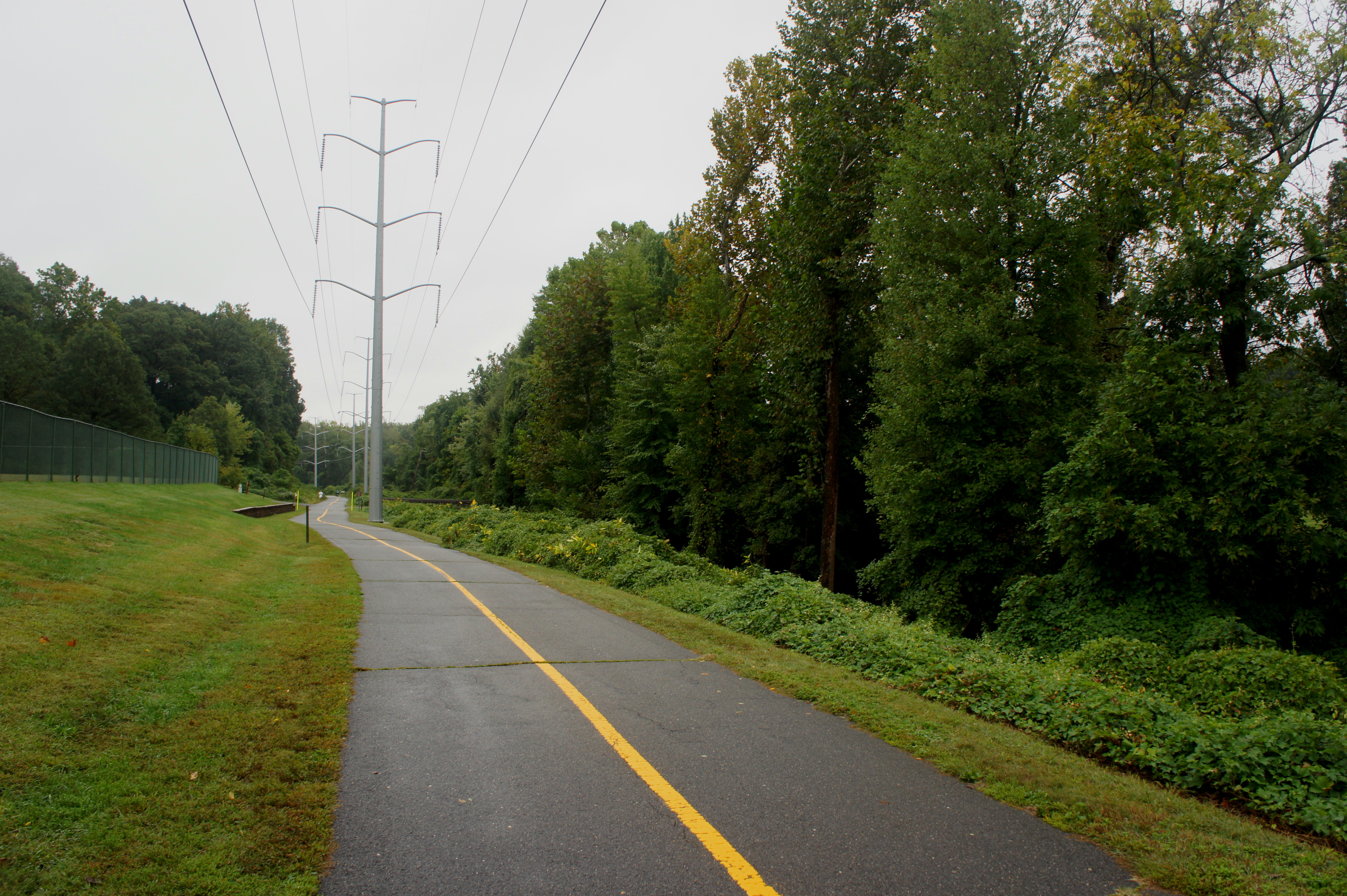
The clearing once developed for the railway is now home to a mammoth string of modern power lines, with the W&OD Trail below. Shortly after the caboose, the trail crosses cover Four Mile Run as it traverses Bluemont Park. Bear right as the path edges toward the west bank of the creek and passes under Wilson Boulevard.
On the other side lies an “ornamental tree garden” featuring a set of peculiar species such as a smooth-bark magnolia. The trail continues north by northwest as it follows Four Mile Run, entering Bon Air Park. After crossing the bridge, take a right at the next trail junction, heading east toward the start of the Custis Trail.

Mile zero of the Custis Trail is situated on the left, opposite a playground. The trail immediately passes under Interstate 66, then cuts almost due east, paralleling the busy highway. Westover Park offers public restrooms, soccer and baseball fields, and another playground.
For hikers, the Custis Trail is an easy trek, but the roller coaster inclines can offer challenges to bicyclists, of which there are many. Most of the trail is bounded on one side by a not-so-attractive wall obstructing the highway from view. Walk the paved trail for nearly a mile—passing under North Harrison Street and North George Mason Drive—before bearing right at the junction, following the signs to “Ballston.” (Note: The Custis Trail continues straight for nearly three miles, ending at Rosslyn.) This spur trail follows an exit ramp over I-66, leading back to the start of the loop.

Metro riders are a short walk away from the Ballston station. Walking at a casual pace, allot 1.5-2 hours for the round-trip.

Pingback: Lubber Run Trail (Lubber Run Park, VA) | Live and Let Hike
Pingback: Custis Trail (Arlington, VA) | Live and Let Hike