
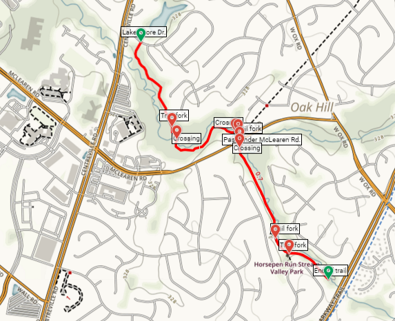
Horsepen Run (a.k.a. Horsepen Creek) is a modest stream winding through northern Virginia’s Loudoun and Fairfax Counties. Situated in the unincorporated community of Oak Hill—between the Dulles Toll Road and Interstate-66—the paved Horsepen Run Trail runs alongside the creek for 1.5 miles. To be honest, there’s not much to it—the stream, while pretty and calming at times, lacks the rocky crags and cascades of some of its neighbors. But in a relatively featureless area where the most notable sight is one of the world’s worst airports, it’s better than nothing.
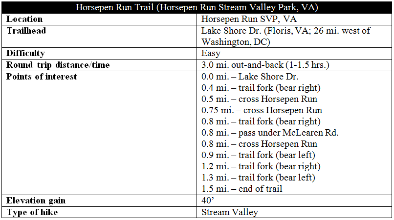
The hike
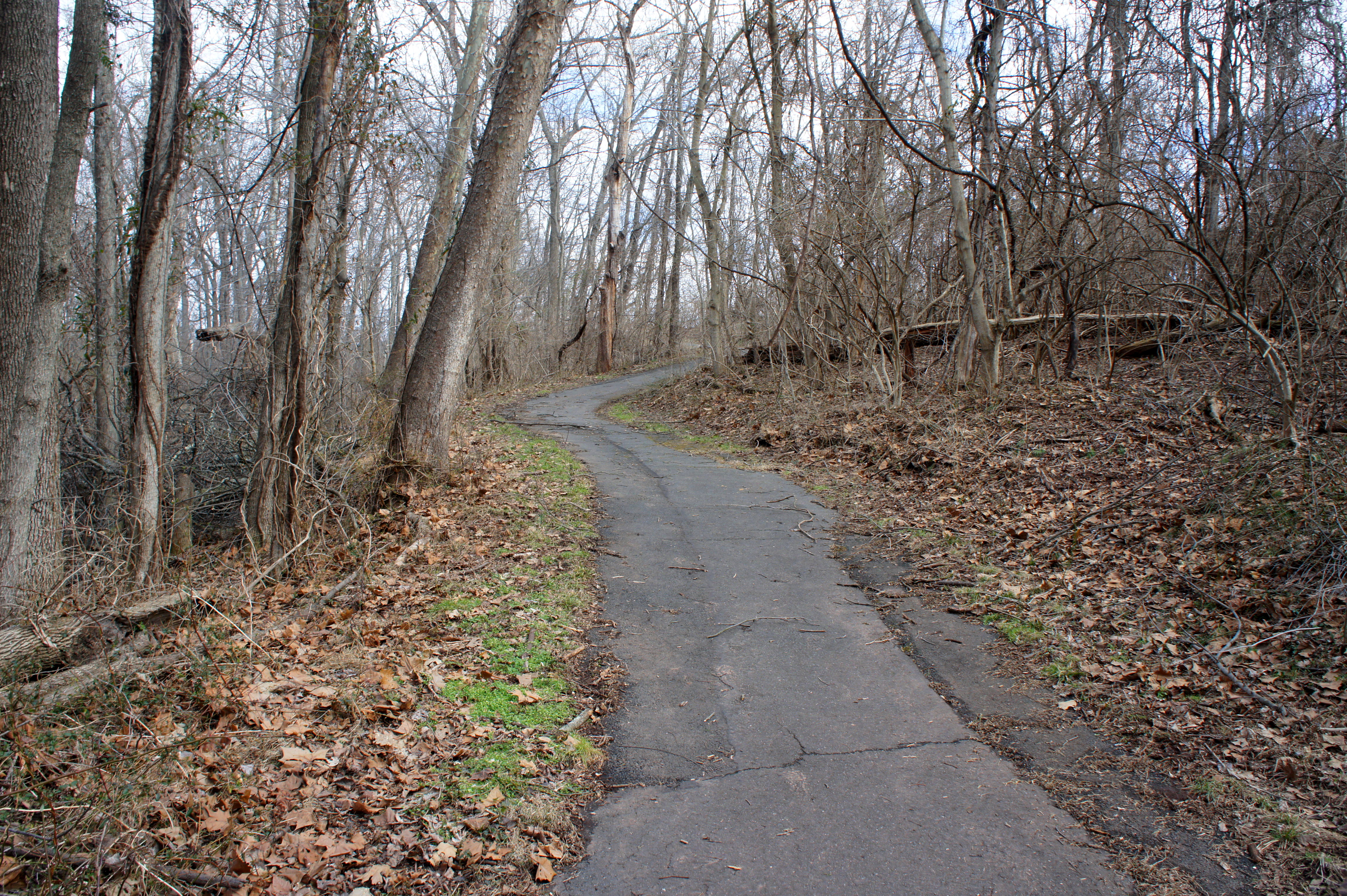
The walk begins and ends at suburban Lake Shore Drive, just off Centreville Road in Floris. Entering from Centreville Road, look for the paved path bearing off into the woods on the right; park along the curb. The asphalted trail immediately dips and climbs over a couple of small humps, then passes over a tributary of Horsepen Run. The route edges toward the creek bank at around ¼ mile, where Horsepen Run ripples at a relatively quick pace. (Note: about 100 yards into the hike, stop at the wayside to learn about “riparian buffers” for wildlife, courtesy of Fairfax County Parks.)
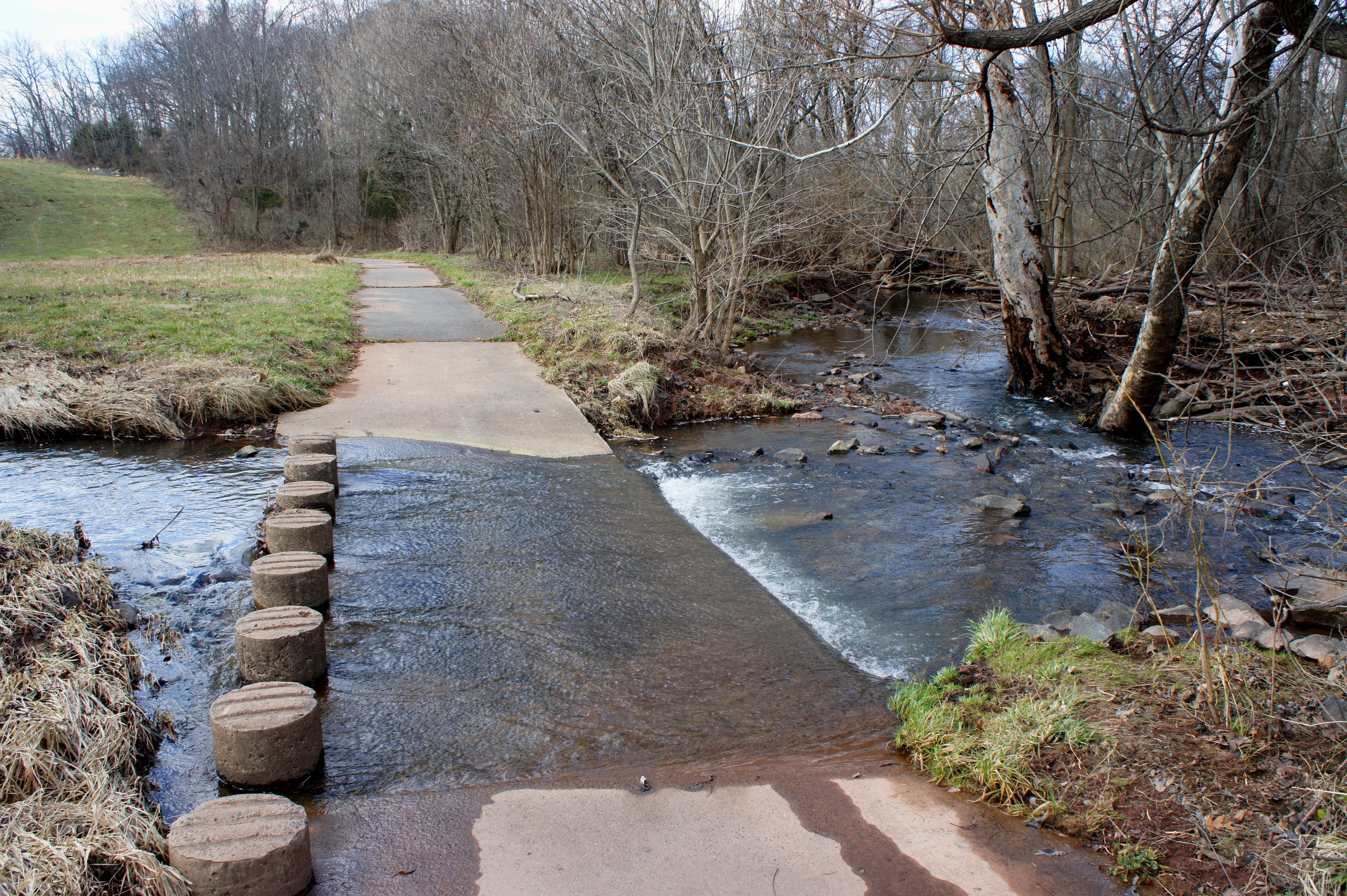
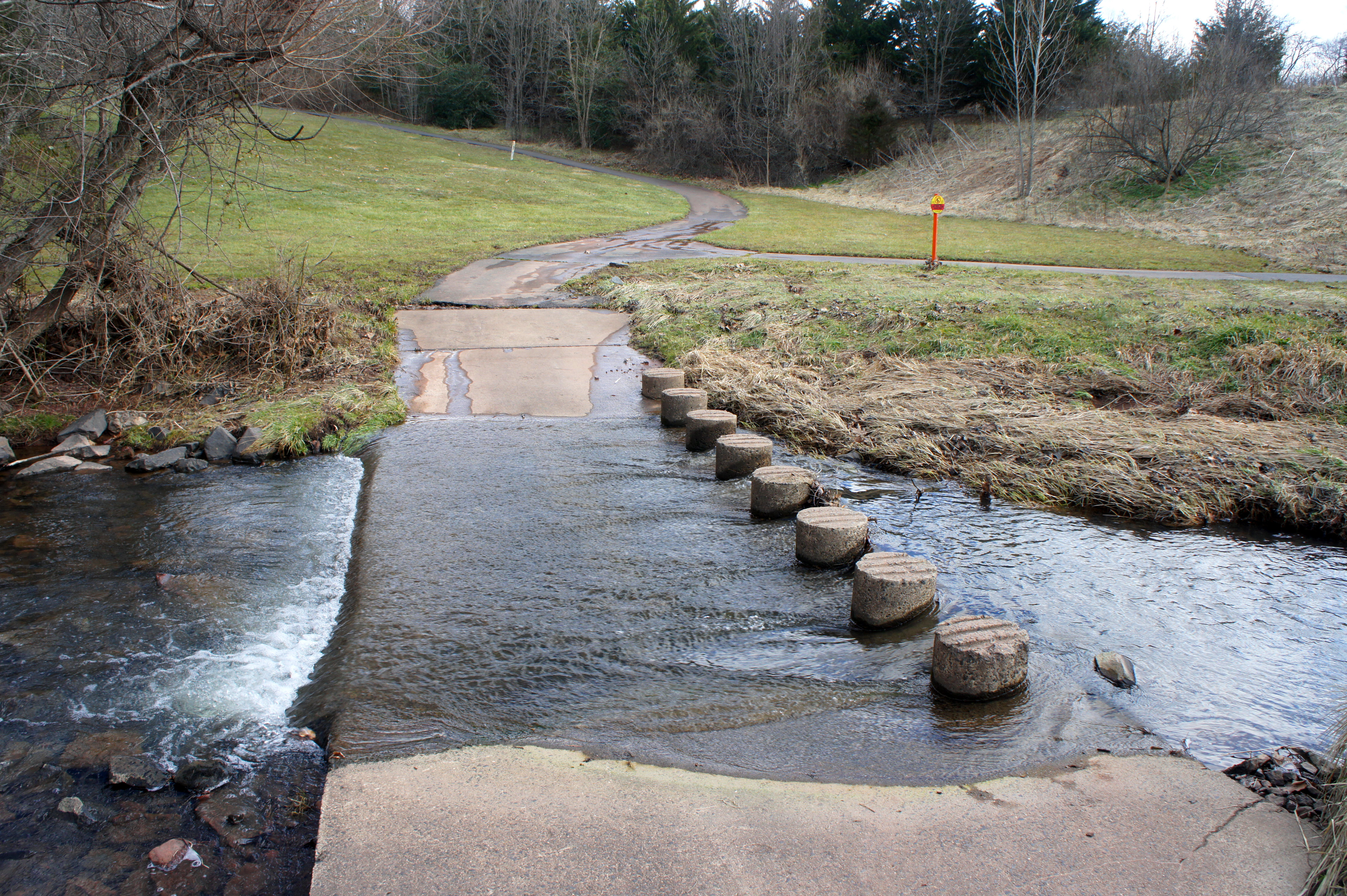
At around 4/10 mile, the now-level trail splits, with a small suburban playground and a pair of picnic tables on the left. Stay right and follow the path around a bend to the first of three creek crossings. The relatively straightforward traverse is assisted by 16 concrete stepping stones.
Beyond, the Horsepen Run Trail bears sharply left, passing a dense pine grove up the hill on the right. The route crosses a short wooden bridge. A little over a half-mile from the start, the path climbs relatively steeply to a point about 15 feet above the Horsepen Run drainage. A clear meadow is visible up the hill on the right.
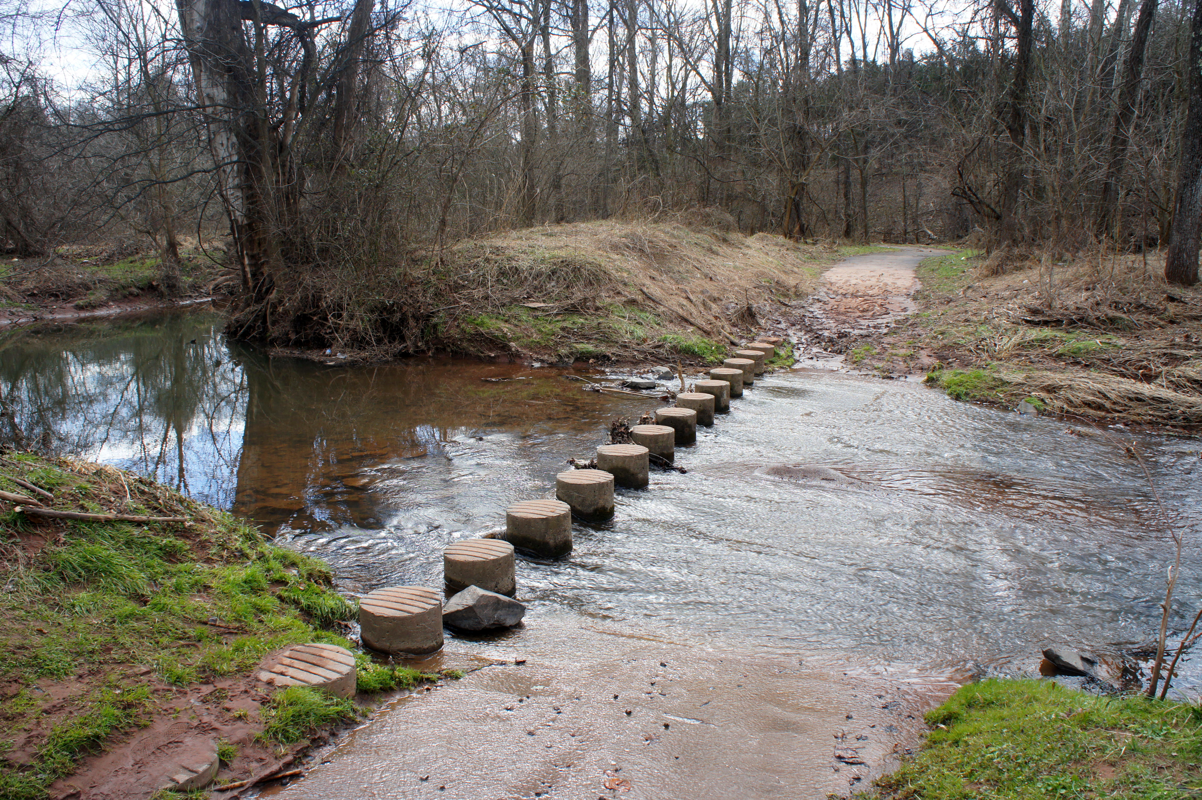
By ¾ mile, however, the trail returns to creek level and crosses Horsepen Run again. This is perhaps the prettiest part of the walk: the fast-moving water glistens in the sun, and a small bamboo stand is visible on the right. Bear right at the next trail fork and pass through the dark (but light enough) tunnel under McLearen Road.
Just past McLearen, the trail crosses Horsepen Run a final time, again in the full sun. At 9/10 mile, an access trail enters from the right, and an interesting wayside at the junction maps out the various watersheds of Fairfax County. (Note: This is the Horsepen Creek watershed, which flows into Broad Run, and eventually the Potomac River, downstream.) For the next ¼ mile, the trail runs straight as an arrow, with the narrowing creek on the left and two-story houses on the right. At 1.2 miles, Horsepen Run (naturally) dams up and a spur trail crosses the creek heading left. Stay right, passing behind a yellow bench. Shortly beyond, the paved path thins to about two-thirds its original size—but stays level as it bears southeast. Stay left at the next trail fork.
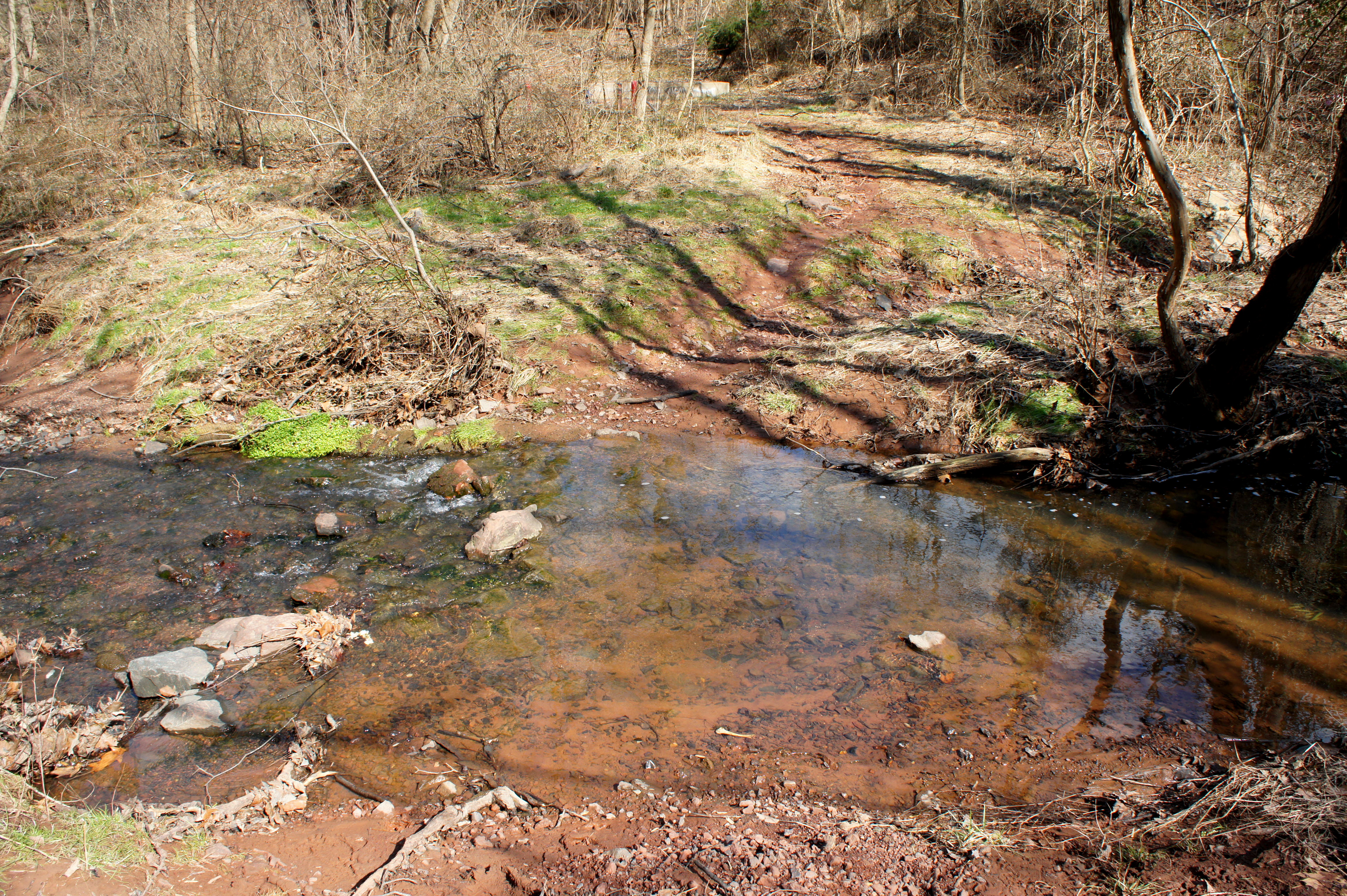
With the noise of Fairfax County Parkway looming ahead, the Horsepen Run Trail ends abruptly, 1.5 miles from Lake Shore Drive. A social trail continues down to the creek (now around 4 feet wide and a few inches deep), but continuing onward is discouraged. The underpass below the Parkway is dark, damp, long, and cramped, with little expectation of rewarding scenery beyond.
Therefore, turn around at this point and return the way you came. The 3-mile round-trip should take around 1-1.5 hours, depending on pace. Much of the path is wheelchair-accessible, save for the three creek crossings.
