
Situated 2-3 hours’ drive north of Quebec City, Parc National du Fjord-du-Saguenay boasts one of the world’s longest and southernmost fjords, a rare sight along the Atlantic coast of North America. Here the Saguenay River, a prominent waterway flowing into the even larger Saint Lawrence, twists and weaves through a glacial valley, the result of a collapse 175 million years ago. Sheer cliffs give rise to waterfalls of extraordinary height and frequency, including the Grosse Chute, the star of this hike in the L’Anse-Saint Jean area.


The hike
Believe it or not, there is life north of Canada’s Quebec City—though the drive from Quebec’s capital toward Saguenay covers some very isolated territory. L’Anse-Saint Jean, a quaint town known for its fjords and a covered bridge, is about an hour’s drive east from Saguenay, or three hours northeast of Quebec City. (Note: Bear north off of Route 170 onto Rue Saint-Jean-Baptiste.) It sits on the doorstep of Parc National du Fjord-du-Saguenay at L’Anse-de-Tabatière, a quieter section of the park. (Note: The nearby Secteur de la Baie-Éternité receives far more visitors.)
Sentier des Chutes—or Falls Path—is, in theory, one of the area’s best hikes—though here in the wild, scrubby north, it spends more than half the year buried in snow. To reach the trailhead, bear north on Rue Saint-Jean-Baptiste into L’Anse-Saint-Jean for six kilometers (roughly 3.7 miles), then turn left onto Rue du Faubourg, which continues northeast along the banks of the creek. Turn left at the next junction, crossing the covered bridge. Turn left again after ½ mile, following the sign for “Sentier des Chutes.” This road—Chemin Saint-Thomas—provides access to the trailhead; look for a green sign on the right after about two minutes on the unpaved but well-maintained drive.

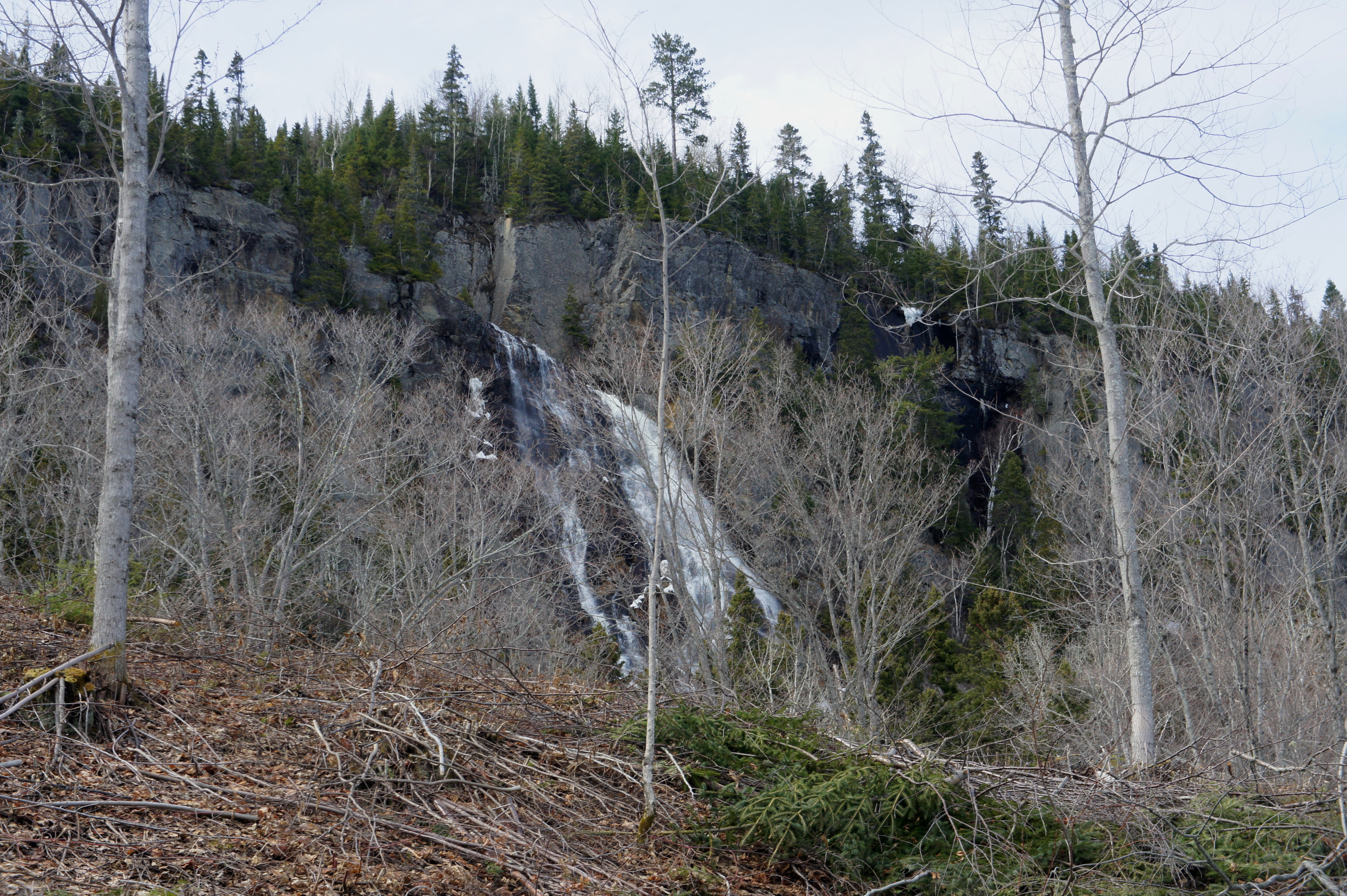
(Note: A disclaimer is in order: while Sentier des Chutes totals 6.9 kilometers (4.3 miles)—ending at the summit of Montagne Blanche—residual snowpack in early May limited our hike to the first mile. Moreover, the snow, more than a foot deep, concealed all obvious paths to the base of Grosse Chute, leaving us slightly disappointed with the nice but obscured views of the falls. Maps and internet beta, however, suggest it is possible to reach a decent view of the falls as the route crosses the associated creek.)
The trail begins amid a thicket of birches and occasional pines and bears northwest alongside a minor stream. A few minutes into the hike, the Sentier des Chutes begins to climb the first of several switchbacks. (Note: These were quite a challenge in the icy conditions) These first few switchbacks take care of most of the one-mile hike’s elevation gain, and the trail levels off after around 1/3 mile.


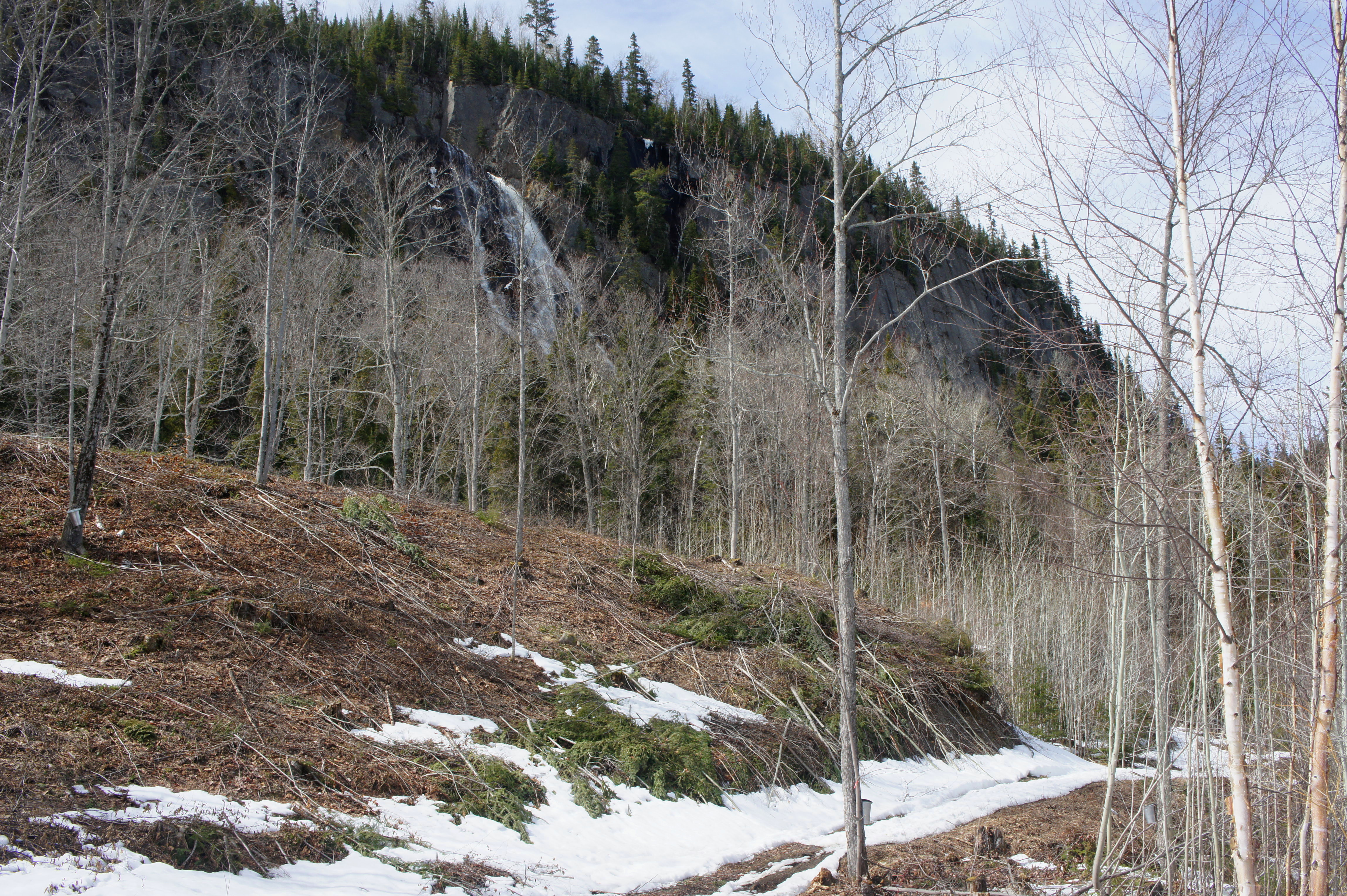
After a short respite, the climb resumes again at the “0.5 km” sign, and the trail approaches an unpaved road. Cross the road and continue westward, keeping the road in sight on the left while approaching the edge of a ravine on the right. Here the mighty falls pop in and out of view.

Turn right at the sight of the unexpected outpost at around ¾ miles. Keeping the outpost on the hill on the left, the trail edges northwest toward the falls…and this is where we lost the trail. While the falls are tantalizingly within reach, amid the snow, there was no obvious path through the trees to the base of the falls. And so the hike description ends here, suddenly and disappointedly. (Note: There is, however, a nice view of the Saguenay River and fjords from the outpost.)

Oh well, c’est la vie in Quebec.

Pingback: Quebec-Saguenay Loop Drive | Live and Let Hike