
Today, Kane’s Creek is a quiet and peaceful estuary in Virginia’s Fairfax County that provides a habitat for dozens of species of birds, including bald eagles, ospreys, and great blue herons. Going back in time to 1964, however, and Kane’s Creek was under threat: a pair of local landowners had just proposed turning the estuary—as well as much of the Mason Neck Peninsula—into a suburban jungle. Waterfront townhouses. Industrial parks. Estate homes. Even a golf course. Enter Elizabeth Hartwell, local resident and champion of conservation, who tirelessly lobbied local, state, and federal officials throughout the 1960s to intervene, an effort that eventually succeeds in halting a spate of proposed development projects on the peninsula. By 1966, 1,800 acres, including the Kane’s Creek habitat, are set aside for a new state park (among other preserves) on the shores of the Potomac: Mason Neck State Park, a triumph for conservationists in a sea of urbanization.


The hike
Mason Neck State Park has nine named hiking trails, and a combination of the Kane’s Creek and Eagle Spur Trail offers the easiest access to the Kane’s Creek estuary.
Begin at the Visitor Center, which is the situated at the end of the main paved road in the park. Here you will find impressive exhibits on Mason Neck’s natural and human history, a flurry of hiking maps (one for each trail), and waterside views of Belmont Bay, a wide inlet feeding into the Potomac River.
Kane’s Creek Trail
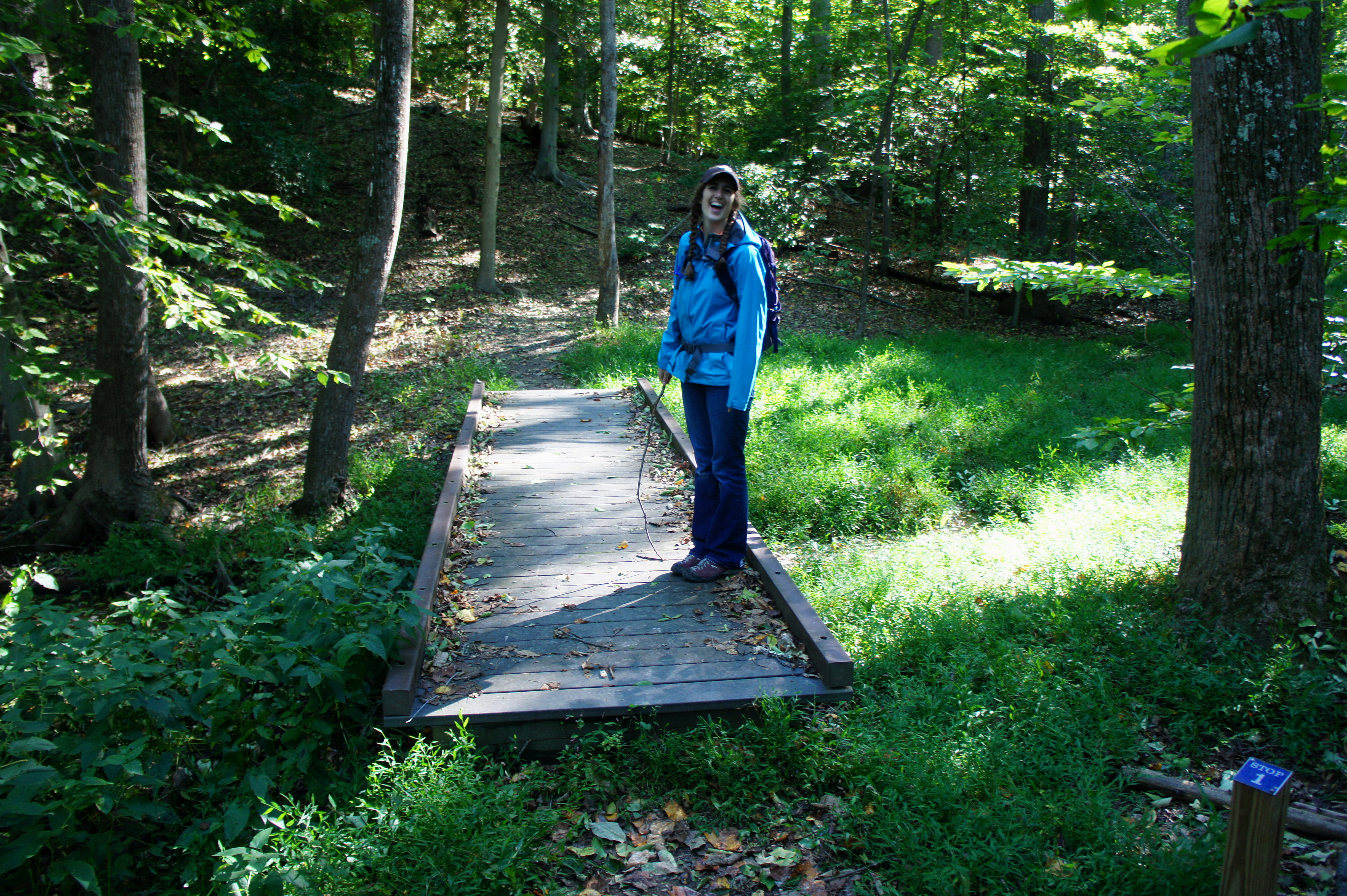
The Kane’s Creek Trail starts well clear of the bay, over on the opposite side of the parking area at the southeast end (back toward the entrance). The large, well-marked kiosk at the trailhead includes a map of the park and information on the rules and regulations. Just beyond, the dirt trail drops down a set of steps and immediately traverses a woody ravine, facilitated by one of the park’s many wooden boardwalks. In spring and early summer, water fills in the grassy basin below, providing a habitat for the Green Frog and Southern Leopard Frog.
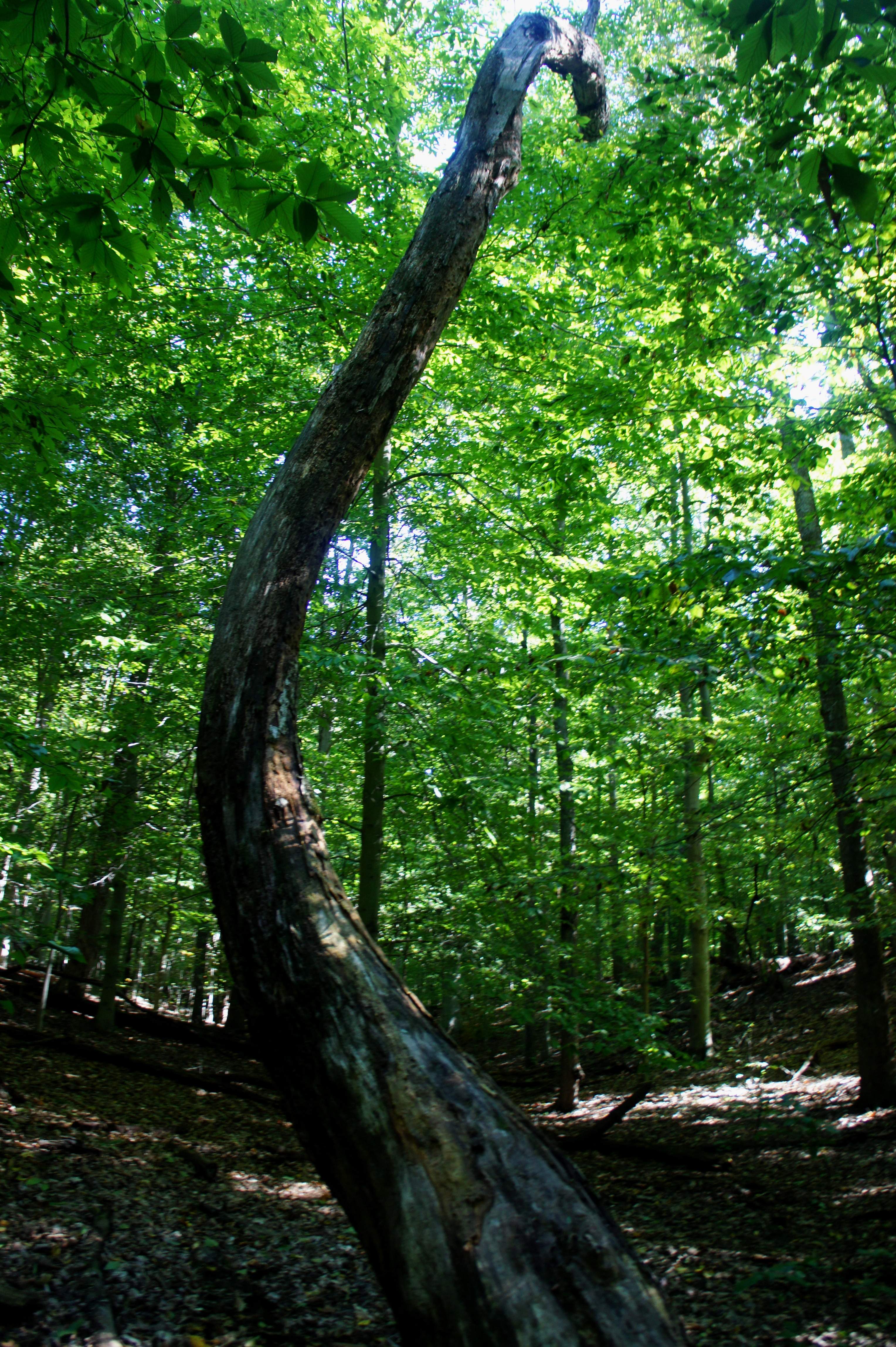
From here the path briefly climbs, leveling off on flat highlands replete with American beech trees, poplars, hickories, maples, and others. Bush-sized holly, too, makes an appearance. The Kane’s Creek Trail forks at around 1/3 mile. Heading in either direction, the route eventually links up with the Eagle Spur Trail; it’s a distinction without much of a difference, as either way is roughly equidistant.
Heading left, the trail rounds a left-hand bend at around 4/10 mile and then heads southwest to meet the Eagle Spur Trail at about 6/10 mile. Take a left.
Eagle Spur Trail
Ending at an observation deck good for spotting the iconic American bird, the Eagle Spur Trail was actually named for the Eagle Scouts who constructed this dusty path to Kane’s Creek. Edging southeast, the trail weaves through mature woodlands and crosses a small bridge 7/10 mile from the Visitor Center. From here, the path heads northeast across mostly level ground. In addition to more holly, mountain laurel begins to dot the understory.
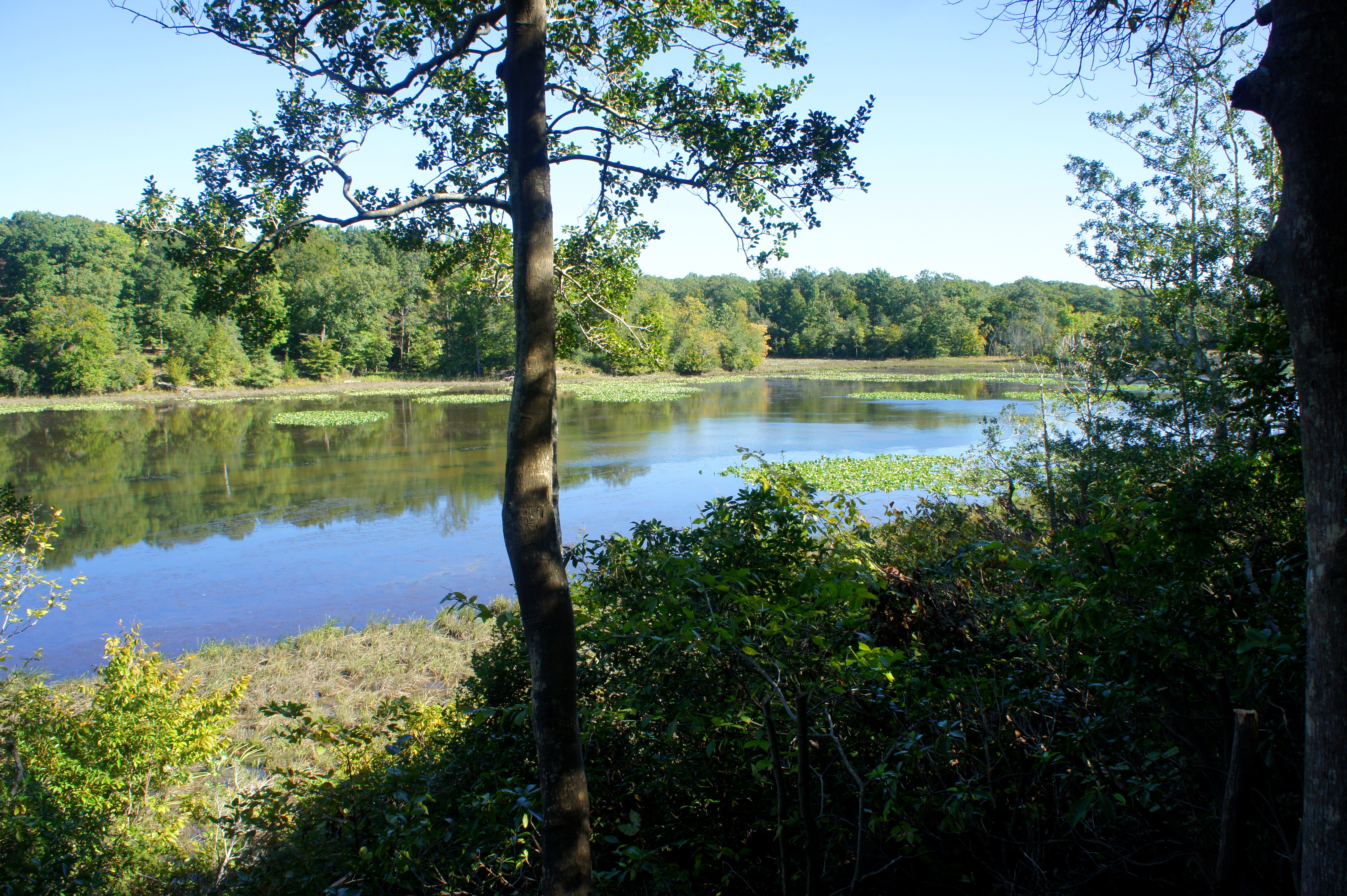
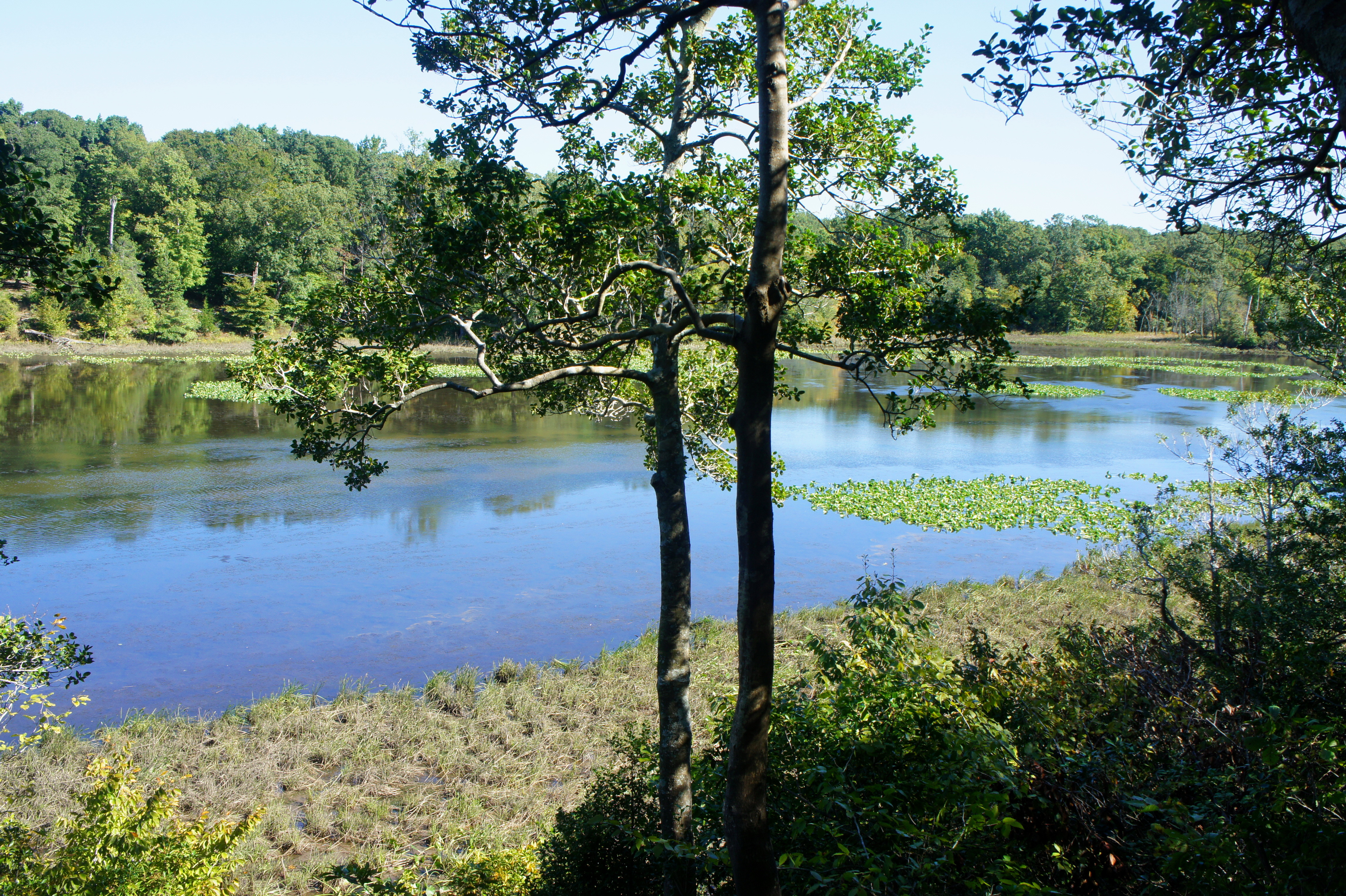
The terrain becomes more varied within a half-mile of the terminus. At around mile 1.5, the trail crosses a pair of bridges, then skirts downward-sloping hillsides on the left. In the final stretch, the path treads across a narrowing finger, and the sounds and smells of the marshlands ahead become more apparent. At last, 1.9 miles from the start, the trail ends at a small observation blind overlooking Kane’s Creek.
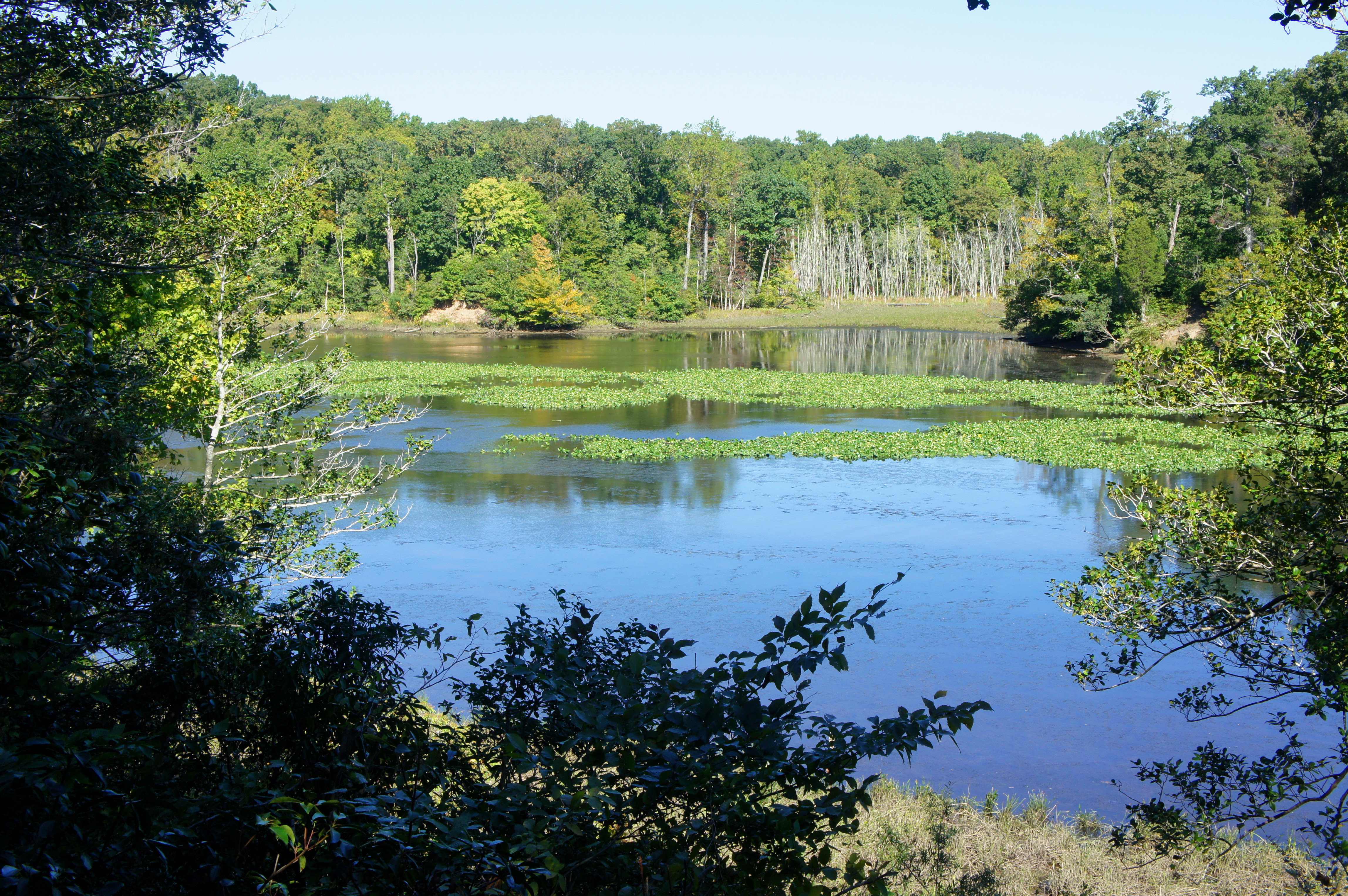
Kane’s Creek is a peaceful and secluded estuary, dotted with lily pads and surrounded by tall grasses. It is also a sanctuary for eagles, ospreys, blue herons, puddle ducks, and others—as well as a popular destination for kayakers, who get an up-close look at the wildlife habitat. A ranger-guided tour on the Eagle’s Spur Trail offers more detail on the flora and fauna, but for those who travel alone, take a snack break at the observation blind then head back the way you came, returning to the Visitor Center.
Allot 2-3 hours for this easy, 3.8-mile out-and-back hike.

Pingback: Dogue Trail & Meadow View Trail (Mason Neck State Park, VA) | Live and Let Hike