– Revolutionary War Series –
While the majority of the historical sites are across the river, the north side of Pennsylvania’s Valley Forge National Historical Park offers some quiet hiking along the gentle Schuylkill River. Those looking for a circuit hike can find tranquility on a roughly 3-mile stroll along the River, Commissary, and Walnut Hill Trails. Highlights include a riverside jaunt for 1.5 miles, followed by a woodsy walk and a traverse of Pawling Farm, which hosted the local commissary for General George Washington’s troops stationed at Valley Forge in 1777-78.


The hike
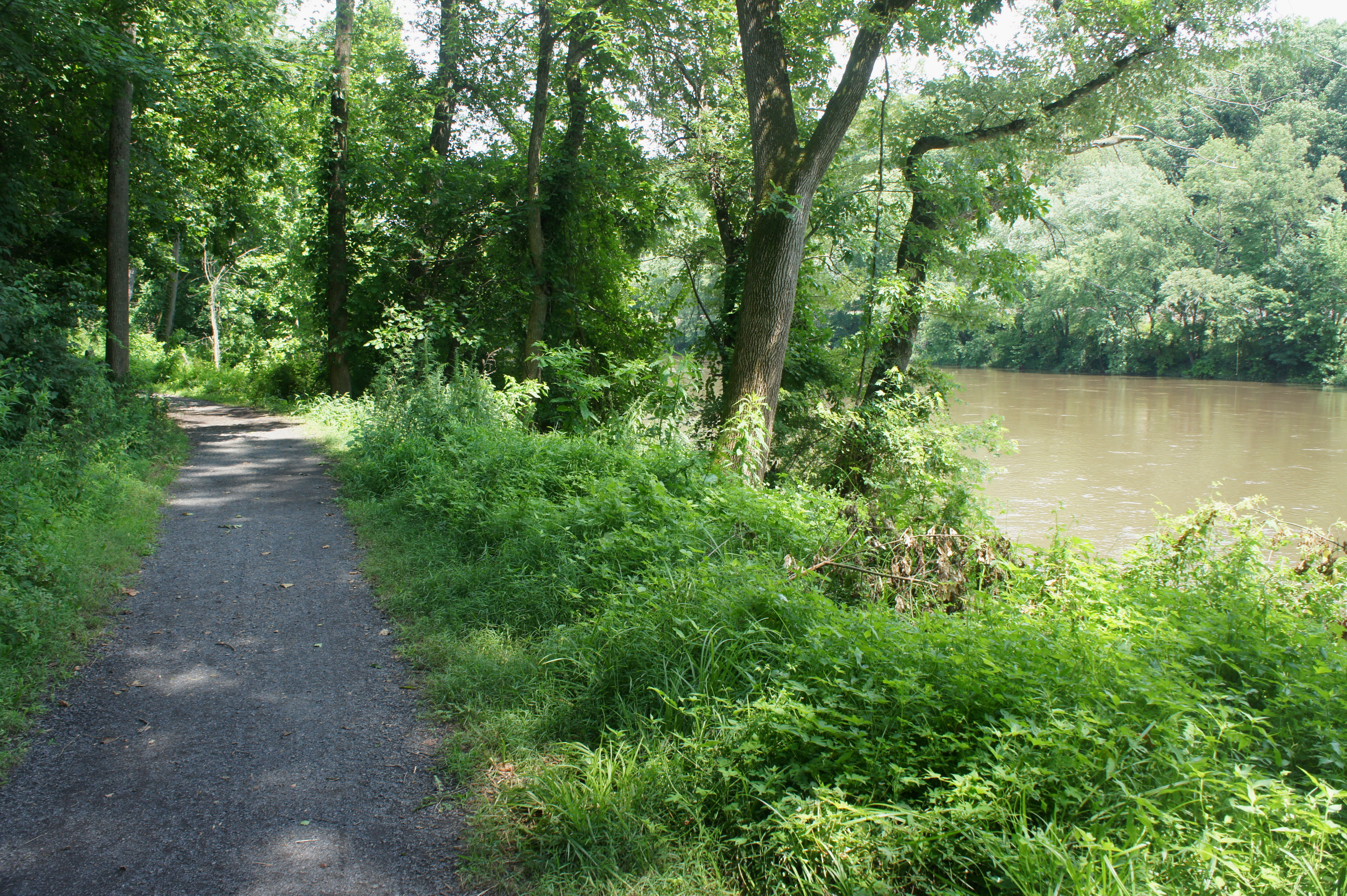
Begin the hike at Pawling’s Parking Area, situated at about 1511 Pawling’s Road, just before the street crosses the river heading west. The River Trail (not to be confused with the nearby Schuylkill River Trail) begins at the southwest end of the gravel lot, where a pair of signs offer some limited interpretation of the hike. The Schuylkill River is visible right away on the right.
In December 1777, Washington’s Continental Army used the Schuylkill River to its advantage, retreating across it and destroying the bridge to escape British troops. For the rest of the winter, Washington’s forces took up a defensive position west of the Schuylkill.

Continue down the path for 3/10 mile, where a side trail leads off into the brush to the left. Stay straight for another 1.25 miles as the path gradually narrows and bends eastward. (Note: At 0.9 mile, look for a short railroad bridge along the opposite bank; just beyond is the site of Washington’s headquarters during the winter at Valley Forge.) Pay attention at around 1.5 miles, where an unmarked but apparent trail bears left into the woods, leaving the river behind. (Note: If you reach a footbridge on the River Trail, you have gone too far.) Follow the dirt footpath—the Commissary Trail—as it bends westward and approaches the edge of a field at 1.65 miles.

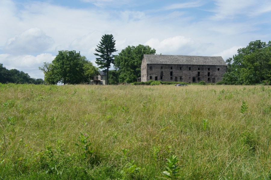
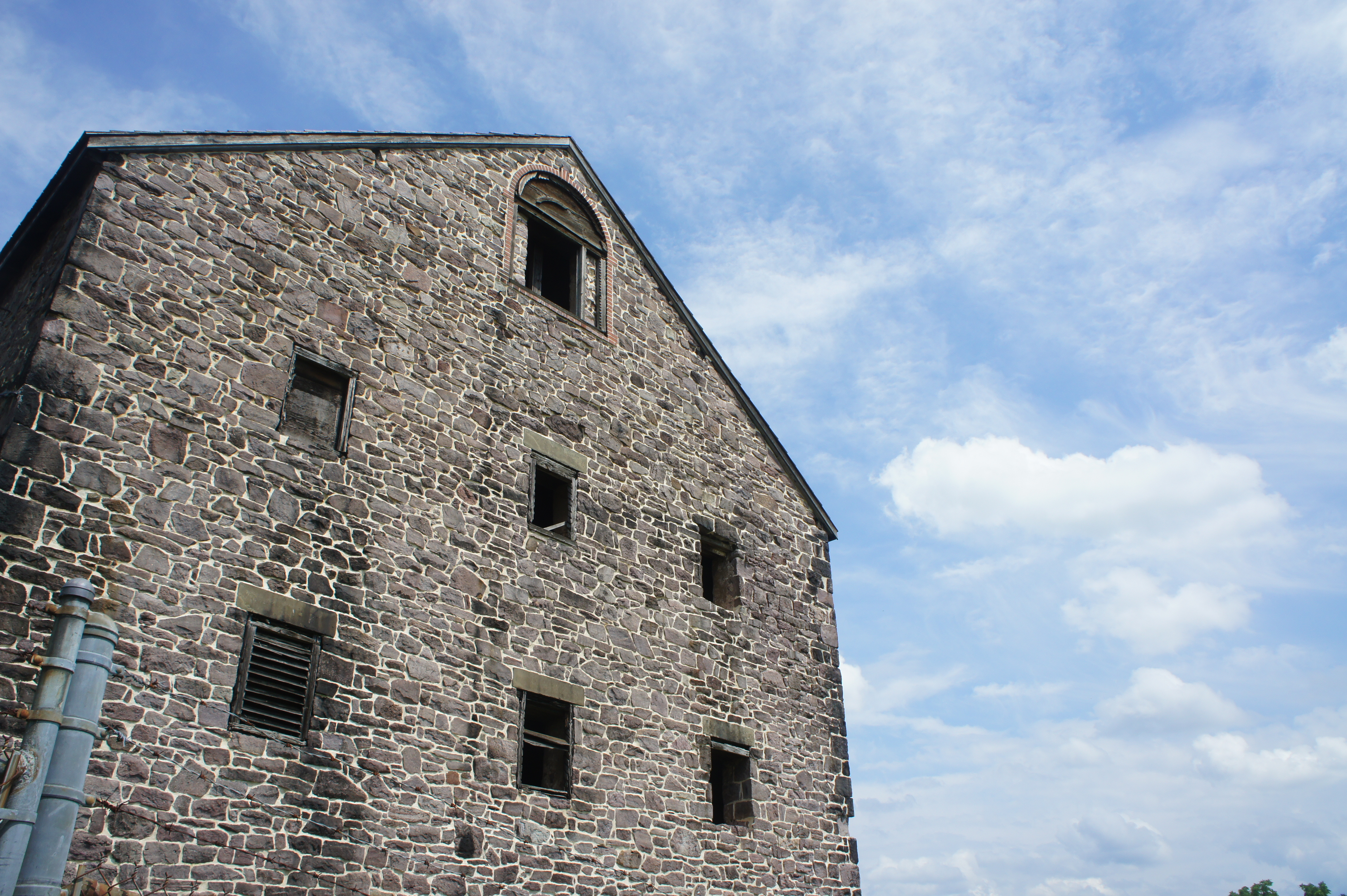
After crossing a bridge at 1.75 miles, the trail bears north and emerges suddenly onto an open plain, where the path cuts westward toward Walnut Hill, also known as Pawling Farm. Walnut Hill was purchased by the Henry Pawling in 1719 and remained in the family through the Revolutionary War, when the site was used as a market for the Continental Army that was lodged across the Schuylkill. The large stone barn on the property—which remains today but is closed to the public—was constructed by the Wetherill family, which purchased Walnut Hill in 1826.

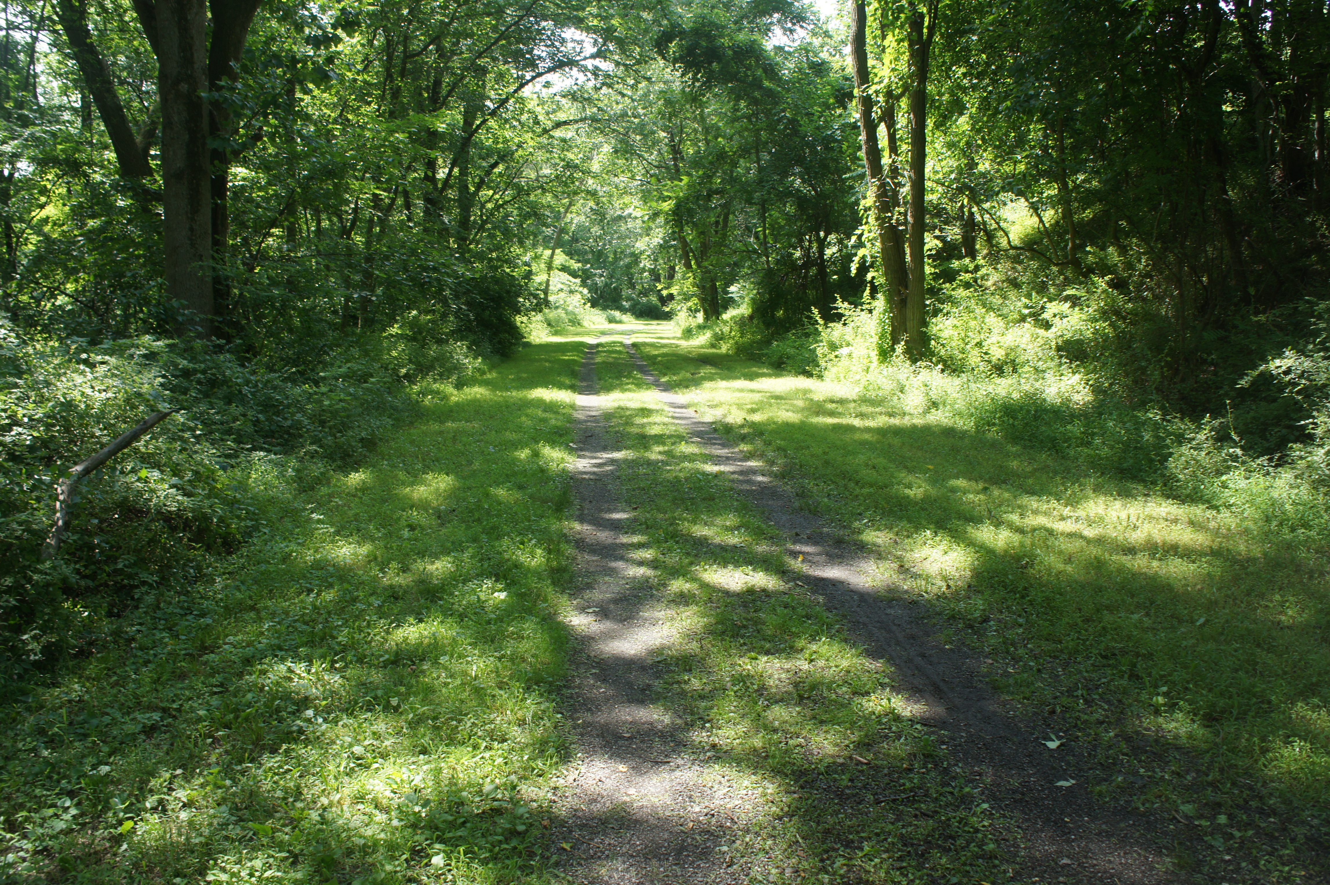
The Commissary Trail spills into an old road at a spot just south of the barn. Bear left on the road—heading south—then follow the track as it makes a 90-degree turn to the west. After briefly following the farm on the right, the road reenters a dense forest and ends at a lonely cul-de-sac of sorts. Continue past a metal gate to an overgrown dirt track, now the Walnut Hill Trail. At 2.6 miles, the trail passes through a tree cut and then curves northward. With a residential neighborhood in sight straight away, cut left at the trail junction at 2.7 miles. Here the trail follows a grassy downhill slope and weaves in and out of the woods, returning to the River Trail at about 2.9 miles.
Bear left and retrace the original 3/10 mile of the hike, ending where you started at the Pawling’s Parking Area. Allot 1-2 hours for this easy stem-and-loop hike.

3 years later – but this article really made this an enjoyable walk – thank you