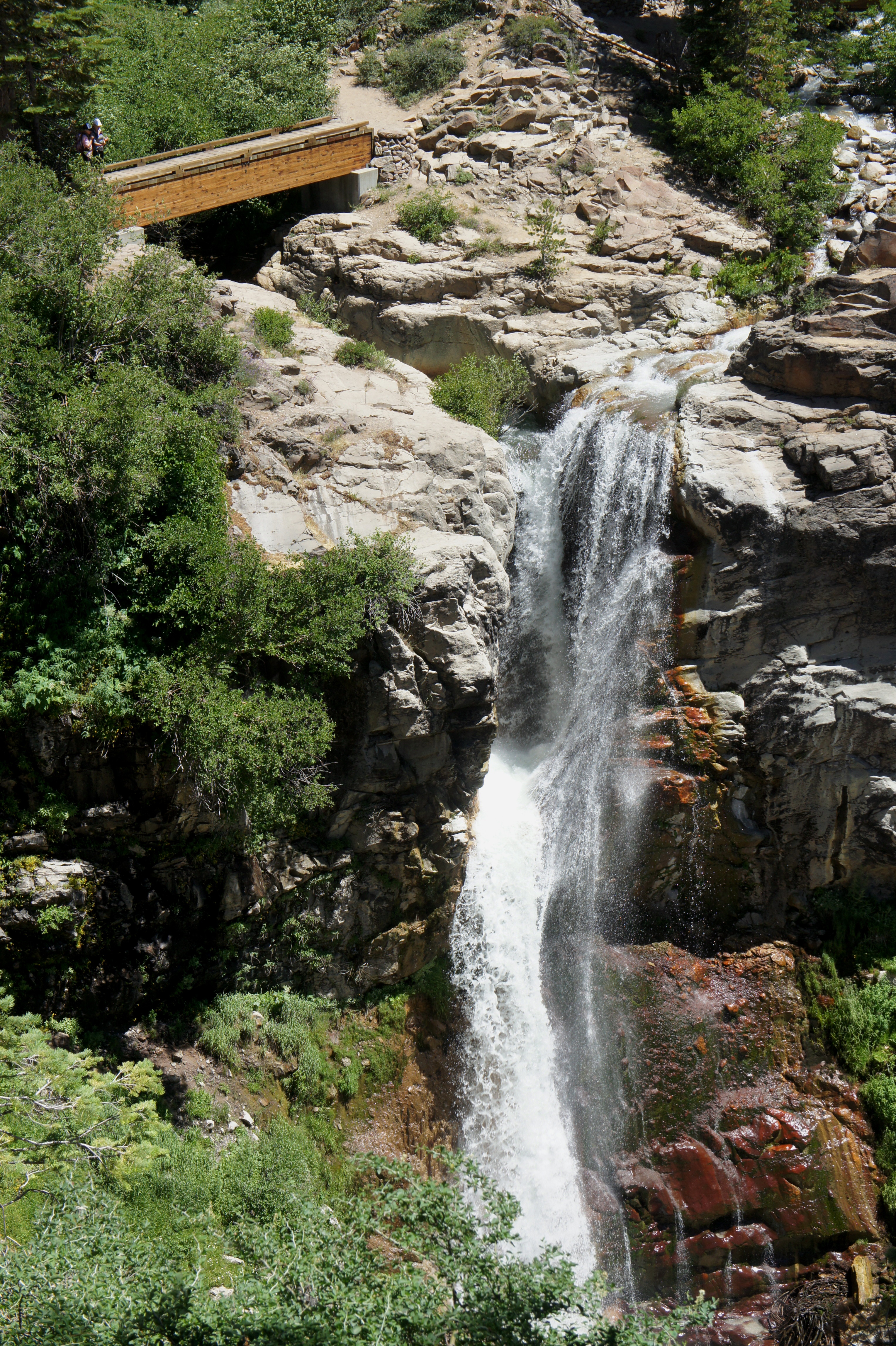
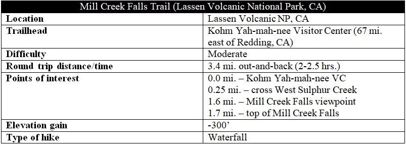
At 75 feet, Mill Creek Falls is the highest waterfall in northern California’s Lassen Volcanic National Park. Situated just 1.7 miles from the Kohm Yah-mah-nee Visitor Center, the Mill Creek Falls Trail is a popular half-day hike on the park’s southern side. Hugging the slopes of a broad valley, the trail winds up and down through dense pine thicket and open meadows, with fine views of the mountain scenery. There is no reliable access to the base of the falls, but a shady viewpoint near the end of the hike provides an excellent view of the rushing waters. Continue 1/10 mile farther to reach the top of the waterfall.
The hike
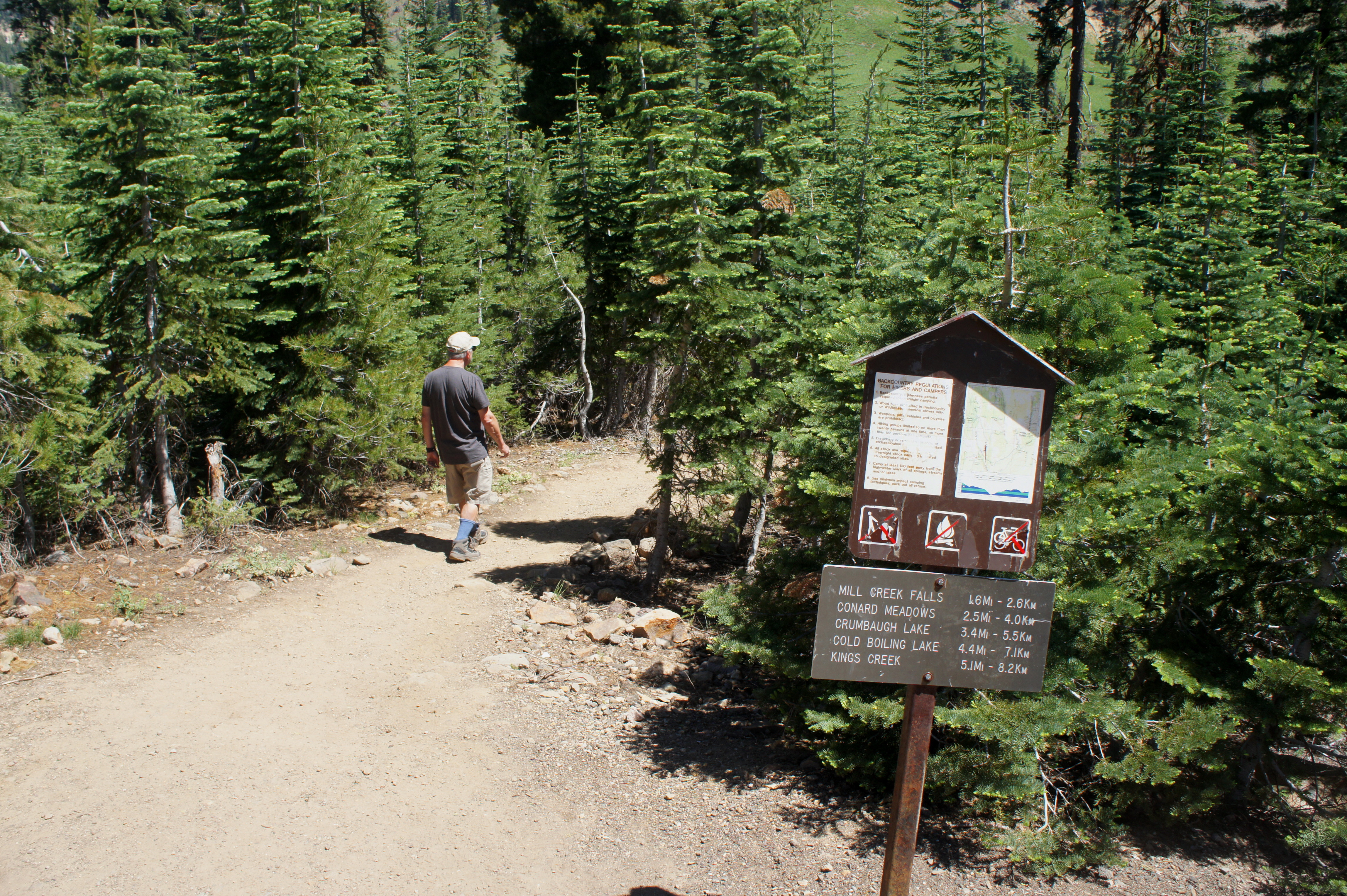
From the parking area at Kohm Yah-mah-nee Visitor Center, look for the start of the trail behind the small amphitheater, just east of the main visitor building. The path bears left on a dusty surface as a paved track bears right to the Southwest Walk-In Campground. A small sign marks distances—Mill Creek Falls, 1.6 miles.
The Mill Creek Falls Trail begins to descend immediately through a forest of lodgepole pines and red firs, weaving southeast at first. After around 150 yards, the path rounds a switchback and bears north, with obscured views of the valley below. After dropping another 100 feet in elevation, the trail crosses West Sulphur Creek at the ¼-mile mark. A beautiful meadow awaits on the other side.

Once across, the trail begins to climb along a sunny hillside, coated with yellow wildflowers in July. As the trail veers south, look back north for views of Mount Diller (9,085’) and the Pilot Pinnacle (8,886’) and, to the west, Brokeoff Mountain (9,235’). After cresting a minor ridge, the trail descends again, this time reentering the woods.
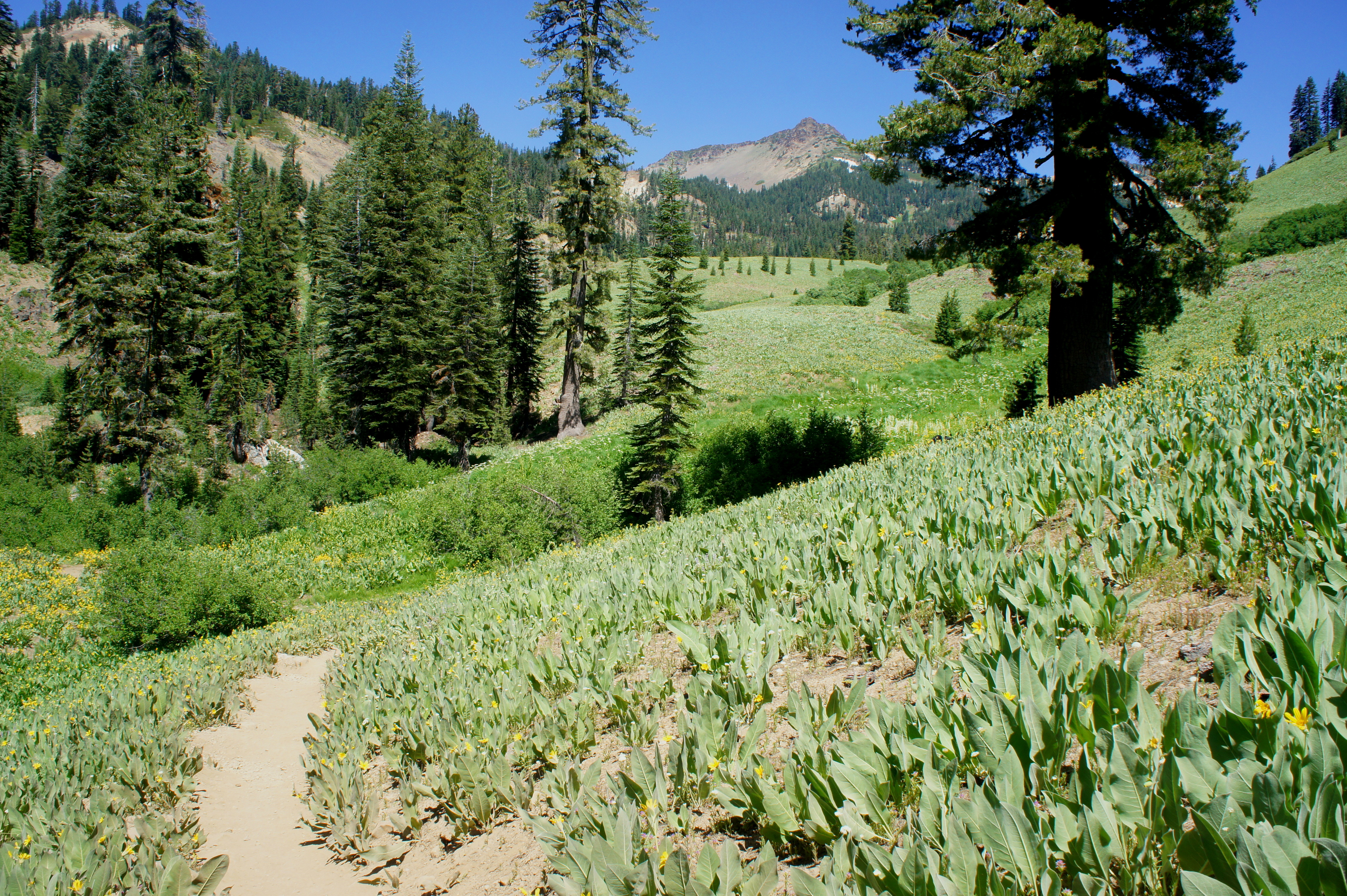
At around 8/10 mile, the Mill Creek Falls Trail bears east through a minor clearing, dropping to the lowest elevation of the hike (about 6,350’). Beyond, the path begins a slow and steady climb as it hugs the valley’s south-facing slopes. Cross a minor stream at 9/10 mile, then brace for a short but sharp ascent. After briefly descending again, the climbing returns as the trail clears a rock outcrop on the right. Cresting again at about 1.25 miles, the trail descends and enters another minor clearing; a brief window offers views of Mount Conard (8,204’) across the valley.

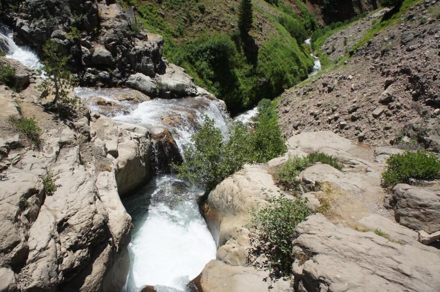
There are a couple more clearings as the trail continues northeast, reaching another local high point at around 1.45 miles. From here, the path descends steadily, dropping around 100 feet in around 1/10 mile. At 1.6 miles—perhaps 45 minutes to an hour into the hike—the silvery flume of Mill Creek Falls appears; you are at the viewpoint.

The falls were formed at the junction of two streams—East Sulphur Creek tumbles in from the left, while Bumpass Creek drops in from the right. The waters from the two creeks meet about 1/3 of way down the falls, then flow together as one into the valley below.
While there is no safe access to the base of the falls, the trail continues 1/10 mile past the overlook to the top of the flume. Two bridges come in quick succession—one over East Sulphur Creek, followed by a second over Bumpass Creek. From the former, you can peer down into the rock cut that gives way to the falls.

The path continues beyond, becoming the Crumbaugh Lake Trail as it meanders through Conard Meadows, eventually joins with the Bumpass Hell Trail, and ends at Kings Creek Picnic Area. Unless you are ambitious and up for some steep climbs, however, Mills Creek Falls will be your end point; turn around and return the way you came.
The return journey is arguably more difficult, with two steep ascents—one from the falls to the overlook and a second from West Sulphur Creek to the trailhead. All in all, hikers should allot at least 2-2.5 hours for this out-and-back journey.

Pingback: Top 10 Hikes in 2017 | Live and Let Hike
Pingback: Capitol Reef National Park Pictures – Nature Wallpapers