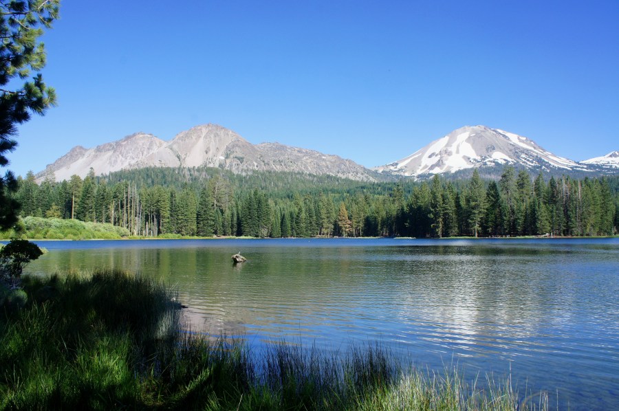

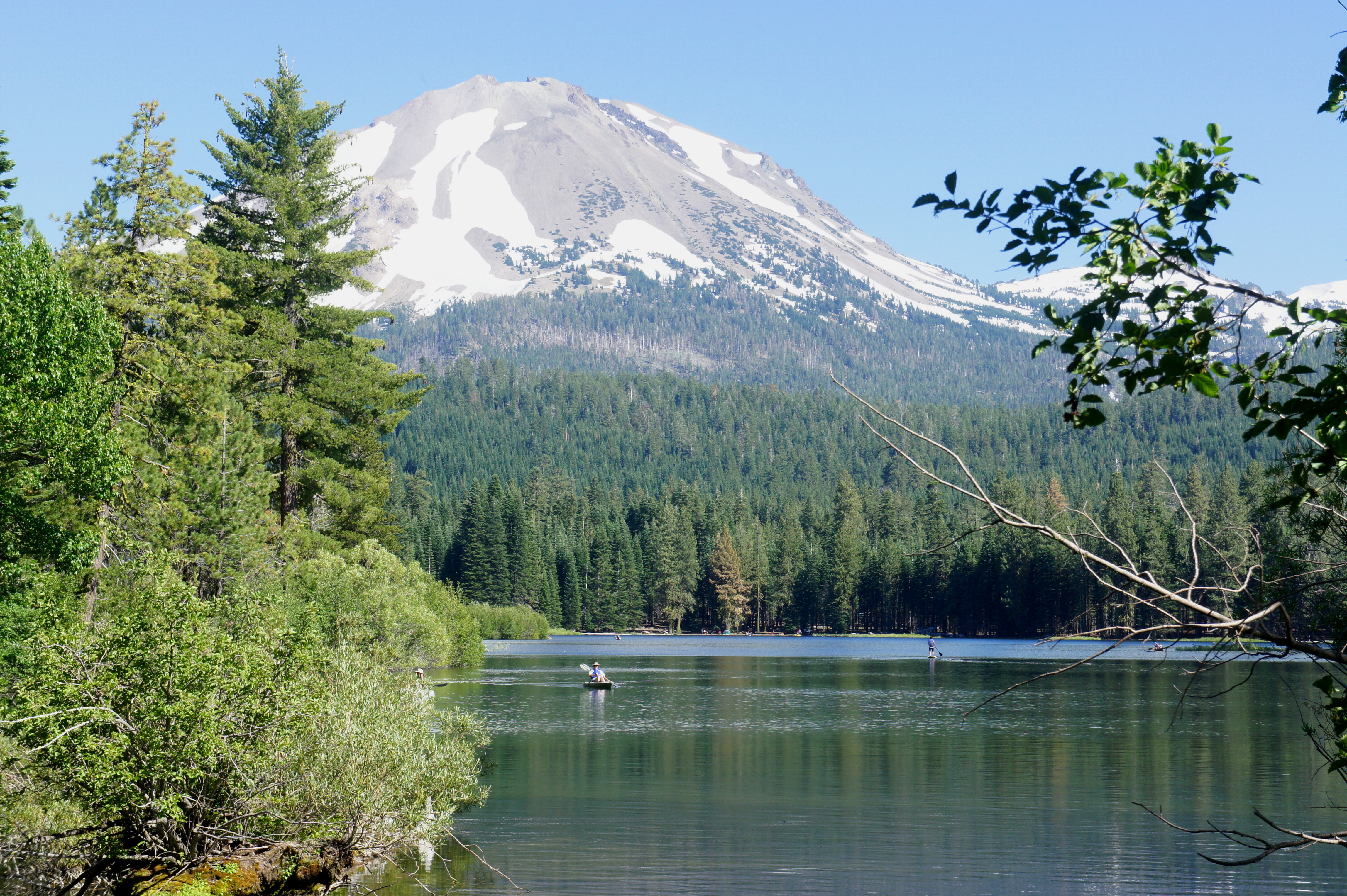
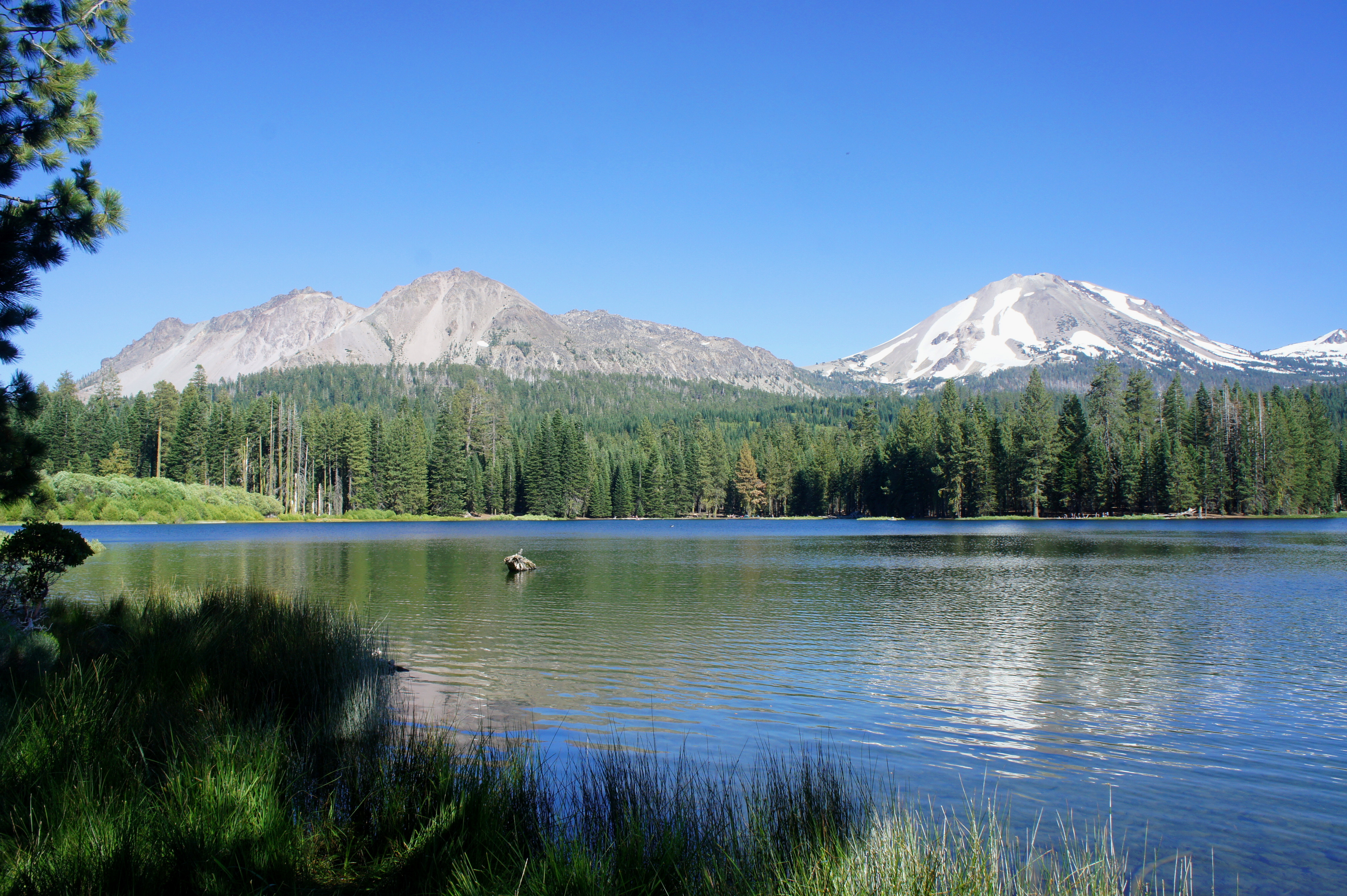
Manzanita Lake in California’s Lassen Volcanic National Park brings together visitors of all stripes: photographers, casual hikers, anglers, and kayakers. Around the water, the 1.9-mile Manzanita Lake Trail offers a relatively easy stroll through pine forests and along lakeside beaches, while offering picturesque views of snow-capped Lassen Peak, the park’s volcanic centerpiece.

The hike
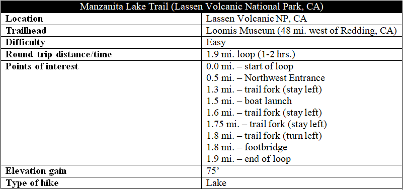
There are a number of access points for this hike, but the entry at the Loomis Museum—just past the park’s Northwest Entrance—offers the easiest parking. The museum also serves as the de facto visitor center for the area and provides a fine introduction on the story of Lassen Peak (10,457’) and its most recent eruptions in 1914-1917. The most significant flare-up came on May 22, 1915, when the mountain sent a huge plume of gas and ash more than 30,000 feet in the air; it deposited ash as far as Elko, Nevada, 280 miles away.
After exploring the museum, take a right out the front entrance and follow a large, paved pathway as it bears south toward Manzanita Lake. (Note: The restrooms will be on your left.) With the lake not yet visible, the concrete track gives way to dirt, and the path splits in two: left, across a footbridge, or right on a graveled path. Heading right, the Manzanita Lake Trail crosses relatively level terrain amid sporadic pine trees. The path soon begins a gradual descent, dropping to the lakeshore at the ¼-mile mark.
Manzanita Lake was formed around 1670 by a series of avalanches from nearby Chaos Crags, a large protrusion to the northwest of Lassen. As debris filled the valley, it dammed Manzanita Creek and formed the lake; a small, man-made dam was added in 1972, which added to the water’s volume.
After briefly bearing away from the lake, a spur trail at 3/10 mile offers access to the shores. Beyond, the trail becomes rockier and crosses a set of minor ravines. The buzz of cars can be heard up to the right, and the path approaches a small parking area at 4/10 mile. Around 175 yards later, the trail hugs the edge of the road as it passes the Northeast Entrance Station.

Taking a left at the station, the Manzanita Lake Trail enters a fantastic section that offers the first good views of Lassen Peak from a small and peaceful inlet in the lake’s northwest corner.

As the trail rounds a bend, it climbs slightly and crosses Manzanita Creek at 0.65 mile. Shady and cool, the pleasant trail meanders south and east around a small thumb of land that juts into Manzanita Lake. The south flank of the thumb offers fantastic views of Lassen Peak and Chaos Crags. Behind Lassen is the smaller Eagle Peak (9,222’), while the tree-lined Loomis Peak (8,658’) dominates the foreground further west.
After bearing west, the trail climbs abruptly to the man-made bank built in 1912 to dam Manzanita Lake. By now you are in thick woods, where the fresh smell of pines predominates. After bearing southeast for 3/10 mile, the trail crosses a dry flat at the end of a shady inlet; stay straight at the trail fork. (Note: Turning right leads to the Manzanita Lake Campground.)
Beyond the inlet, the trail climbs and splits in two; the two paths rejoin each other, however, within 1/10 mile. Dropping out of the woods again, the trail approaches the popular boat launch, where dozens of kayakers head out onto the lake on summer days. Passing the parking area on the right, stay in the strip of woods that hugs the shoreline; eventually the path connects again with an upper parking lot and picnic area at 1.6 miles. Manzanita Creek reemerges again on the left after another 100 yards. (Note: A number of social trails head off in different directions in the section; in general, stay left at each fork until you reach the creek.)

At 1.7 miles, the trail bears away from the creek and climbs up an old road; stay straight on the road until it merges with another track coming from in the right at 1.8 miles. Bear left, and cross the lengthy footbridge over Manzanita Creek; on the other side lies the start of the loop, with Loomis Museum just beyond.
Allot 1-2 hours for a casual stroll on this easy loop hike.

Very nice post with good details about the Manzanita Lake trail.
Beautiful views and especially the view of Lassen Peak from Manzanita Lake. Nice photo!
Thanks for sharing
Pingback: Top 10 Hikes in 2017 | Live and Let Hike
Pingback: Lassen Peak Trail (Lassen Volcanic National Park, CA) | Live and Let Hike
Pingback: Lassen Peak Trail (Lassen Volcanic National Park, CA) - Rumba For Life