Lassen Volcanic National Park in northern California is most famous for its hellish and tormented volcanic landscape—but you would never know it on the park’s beautiful and green Paradise Meadows Trail. This 2.8-mile out-and-back follows a cascading tributary of Hat Creek as it tumbles through verdant hillsides and lush conifer forests and then culminates at its namesake sight: a sun-soaked field at the base of a rocky amphitheater between Lassen Peak and Reading Peak, often brimming with wildflowers.

The hike
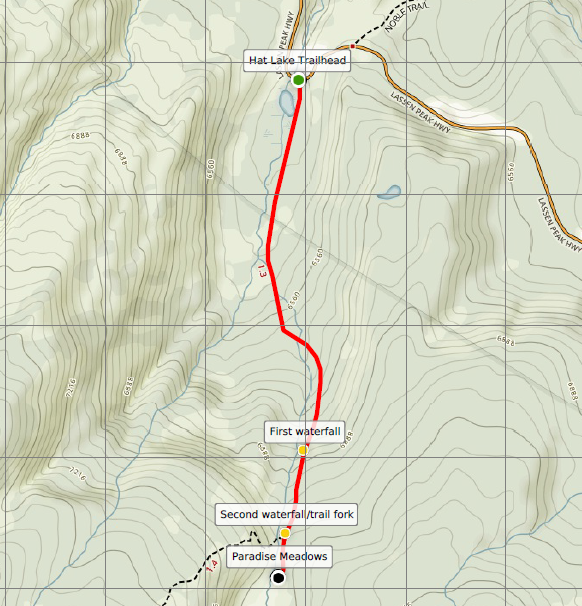
The Paradise Meadows Trail can be accessed from two points—the Hat Lake Trailhead (the bottom) and Terrace Lake Trailhead (the top)—though most hikers will probably start at the Hat Lake Trailhead and hike up to the meadows. (Note: The ideal is to hike downhill from Terrace Lake to Hat Lake, but this requires either a shuttle pick-up or a grueling return journey.) From the Hat Lake Trailhead, cross Highway 89 (Volcanic Legacy Scenic Byway) to the south, where a sign and map mark the start of the Paradise Meadows Trail.

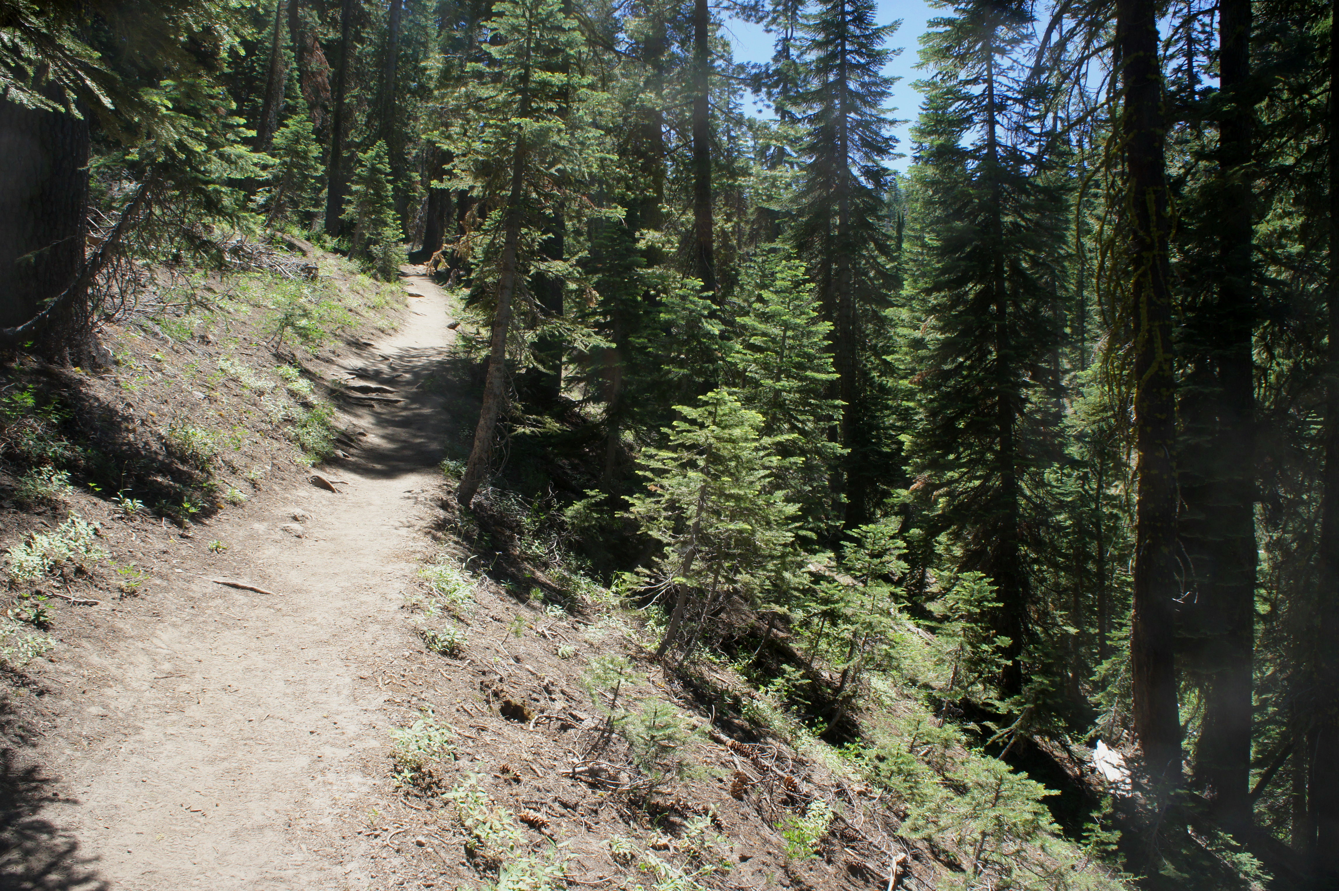
The path begins as a relatively wide and sandy trail, climbing only ever so slightly through the woods, which are dominated by mountain hemlocks. Hat Lake, although less than 50 yards to the right, is not visible from the trail. After passing a gargantuan boulder on the left, the path begins to climb more steeply, revealing occasional views of Lassen Peak (10,457’). At around 6/10 mile, the Paradise Meadows Trail drops into a shady ravine, then climbs again. At ¾ mile, a pair of wooden footbridges offer passage over a minor stream.
Beyond, the trail ascends sharply to clear a ridgeline, and the main creek—a tributary of the West Fork of Hat Creek—emerges in the woody gully below. The sound of cascades deepens as the path approaches the first of two waterfalls on the right, now just over one mile from the trailhead.
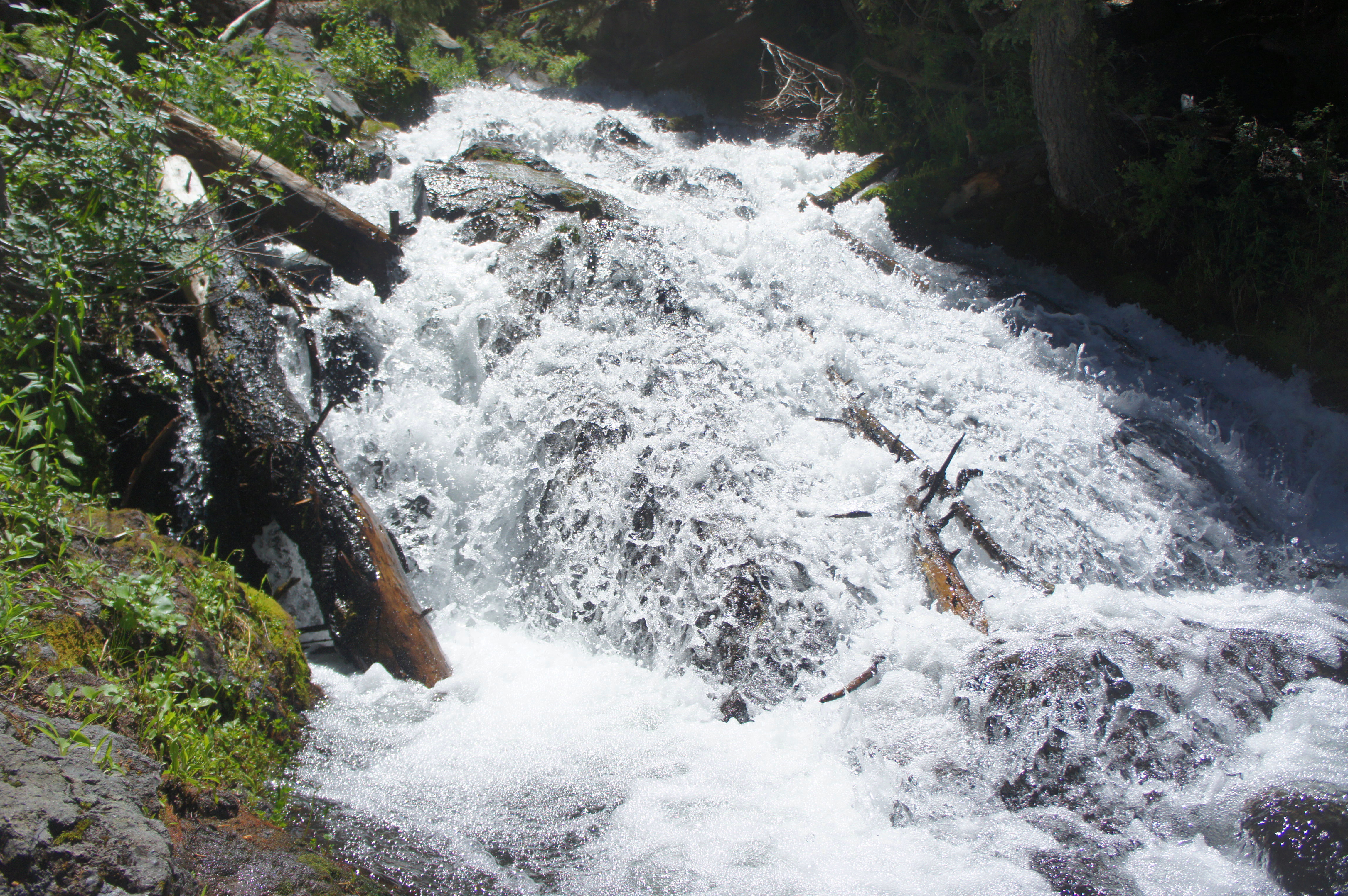
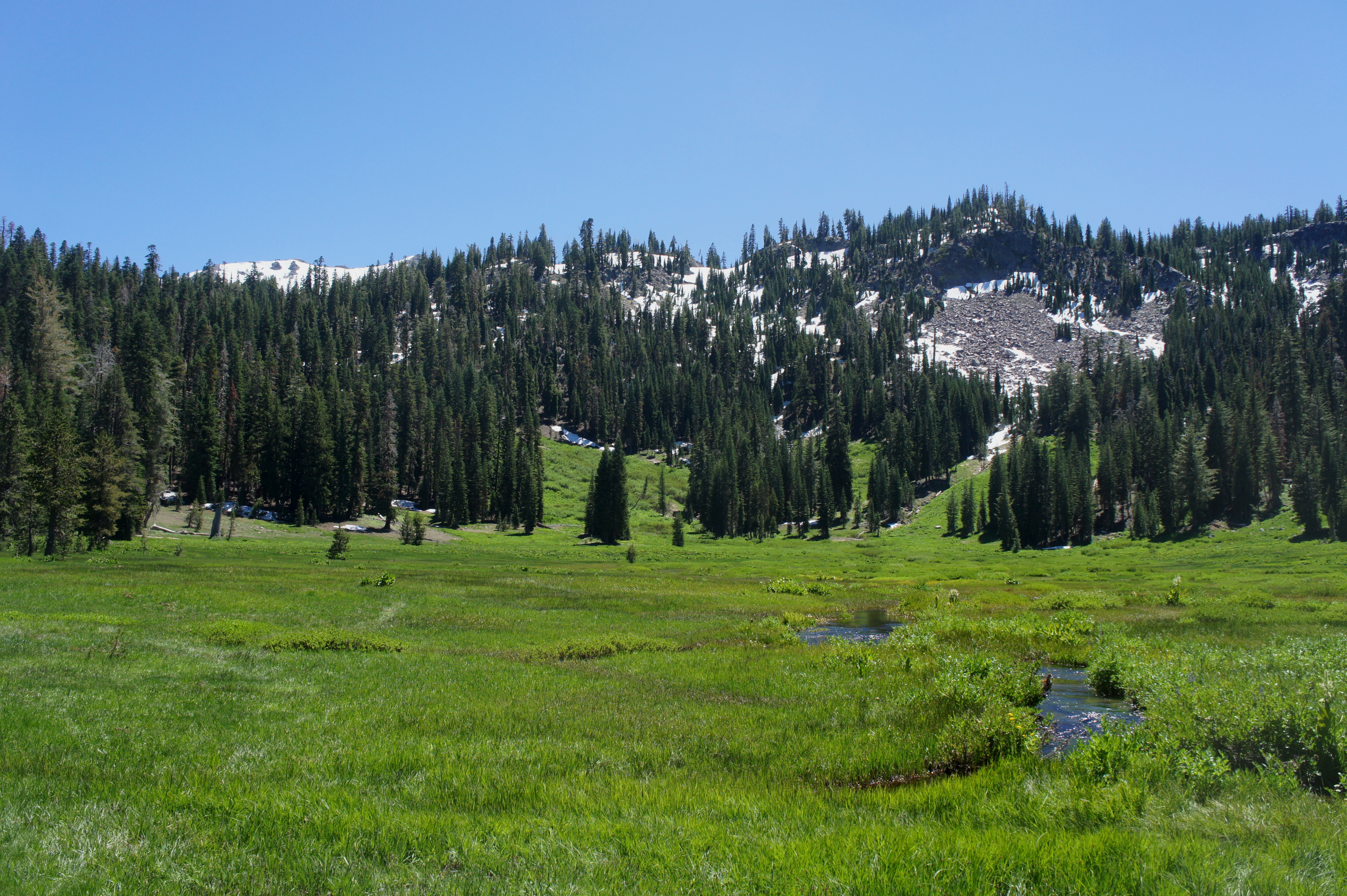
A second waterfall at 1.3 miles is arguably more impressive, though its relative distance off the trail makes it harder to access. Here the creek drops 20 feet, gleaming in the afternoon sun as the hillside to the west gives way to open meadows.
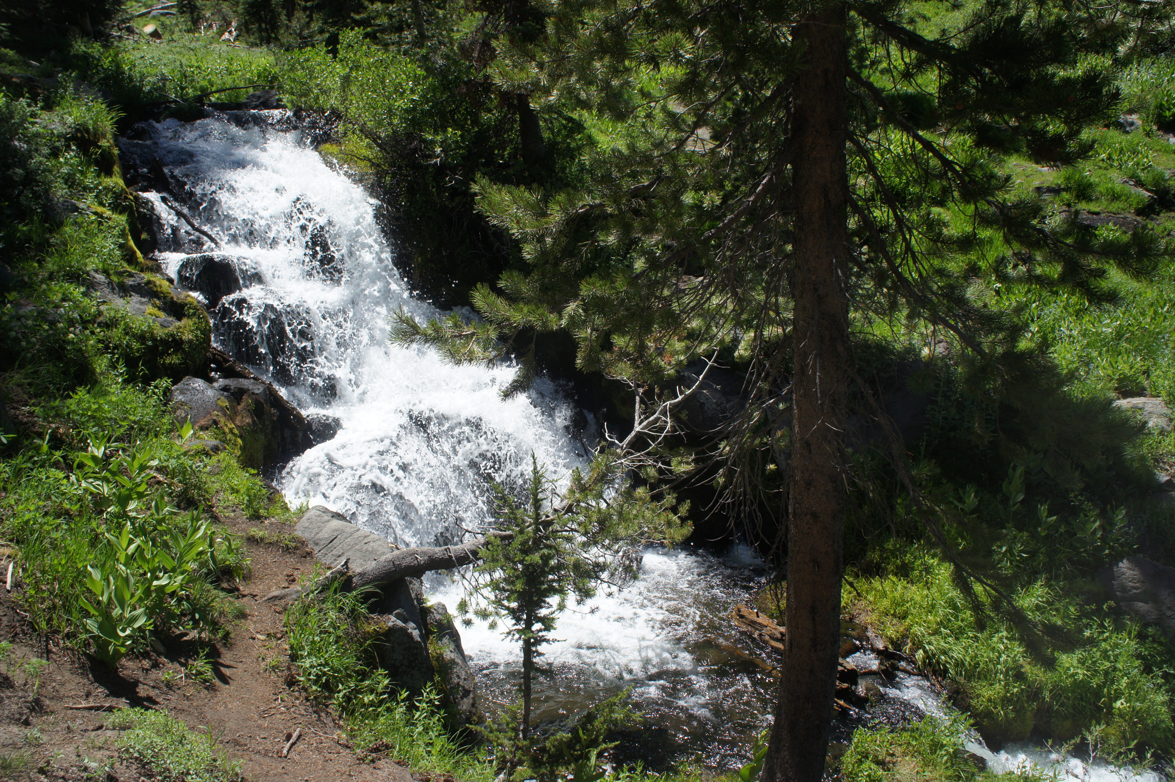

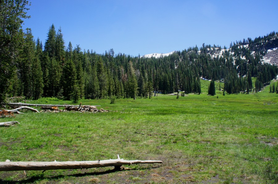
Less than two minutes from the second falls, the trail enters a clearing and then forks; the main Paradise Meadows Trail heads right, crossing a short bridge, but the meadows themselves are straight ahead. From here it’s a short and mostly level walk to the terminus, where the trees suddenly cease and beautiful, green grasses blanket the base of an amphitheater of rocky slopes.

Paradise Meadows is situated in a cirque, a bowl-shaped hollow formed from ancient glaciation. Reading Peak (8,714’) is visible straight ahead, on the horizon; Lassen Peak is visible if you walk a short distance into the boggy meadow.

From the meadow, turn around and retrace your steps, heading back downhill to Hat Lake Trailhead. Allot between 1.5-2.5 hours for this moderately difficult hike.

Pingback: Top 10 Hikes in 2017 | Live and Let Hike