
After 27,000 years of inactivity, Lassen Peak in northern California reasserted its presence as an active volcano in a series of eruptions between 1914 and 1917, including a massive explosion on May 22, 2015 that rained ash as far as Elko, Nevada, nearly 300 miles to the east. The outburst was the first volcanic eruption in the contiguous United States since the establishment of the United States in 1776 and one of only two volcanoes in the lower 48 states to have erupted since 1900. Although it has since returned to its somnolent state, Lassen Peak—at 10,457 feet—dominates the landscape east of Redding, California, rising well above the rest of the southern Cascades between the Klamath Mountains and the Sierra Nevada.
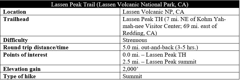
The volcano is now the centerpiece of Lassen Volcanic National Park, which spans more than 100,000 acres of lush forests, serene lakes, craggy peaks, and active hydrothermal areas. The Lassen Peak Trail, which takes off from the Lassen Volcanic National Park Highway (roughly 7 miles from the Kohm Yah-mah-nee Visitor Center) leads to the summit that overlooks it all. This strenuous climb ascends nearly 2,000 feet in 2.5 miles, but the panoramic views and opportunity to peer into the caldera at the top make this one of the most popular hikes in the park. (Note: Expect Lassen Peak to be snow-covered through at least early June; after heavy-snow winters, the highway leading to the trailhead may be closed until late July or even August.)

The hike
The Lassen Peak Trailhead is situated just shy of the highest point on the Lassen Volcanic National Park Highway at roughly 8,500 feet above sea level—a 7-mile drive from the Kohm Yah-mah-nee Visitor Center in the southwest of the park. The parking area is large but often crowded and has a pair of restrooms. The towering volcano is visible right from the start, and the obvious trail leading up the peak is immaculately crafted and easy to follow for the entire length of the hike.

The uphill begins right away as the wide Lassen Peak Trail bears north toward the massive mountain, then cuts right at the first of many switchbacks after 300 yards. The bowl off to the west may bear snow or water into mid-summer, making for a beautiful sight right at the start. The 9,222-foot peak in the distance is Eagle Peak, easily shrouded by its taller cousins.
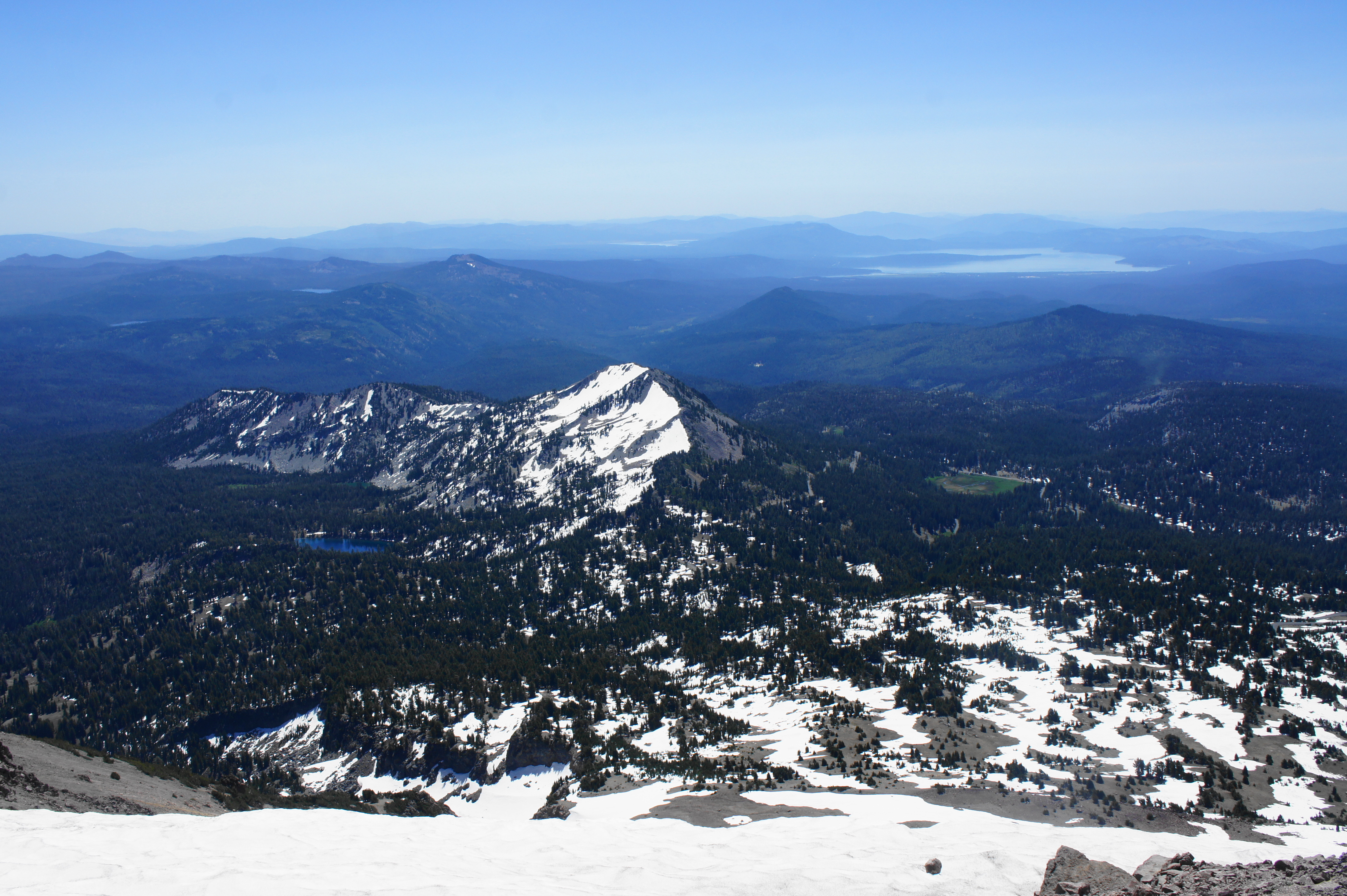
As the trail approaches a second bend at ¼ mile, it weaves through a small grove of whitebark pines, the last real forest on the hike: load up on sunscreen, as the rest of the walk will be highly exposed with little shade. As the trail continues northward, it skirts the forest on the left, then bears right and climbs to a shelf with the hike’s first views southeast to Lake Almanor, a manmade reservoir and popular boating area outside the park. The lake sits at roughly the boundary between the Cascade Range and Sierra Nevada, the two most prominent ranges in eastern California.
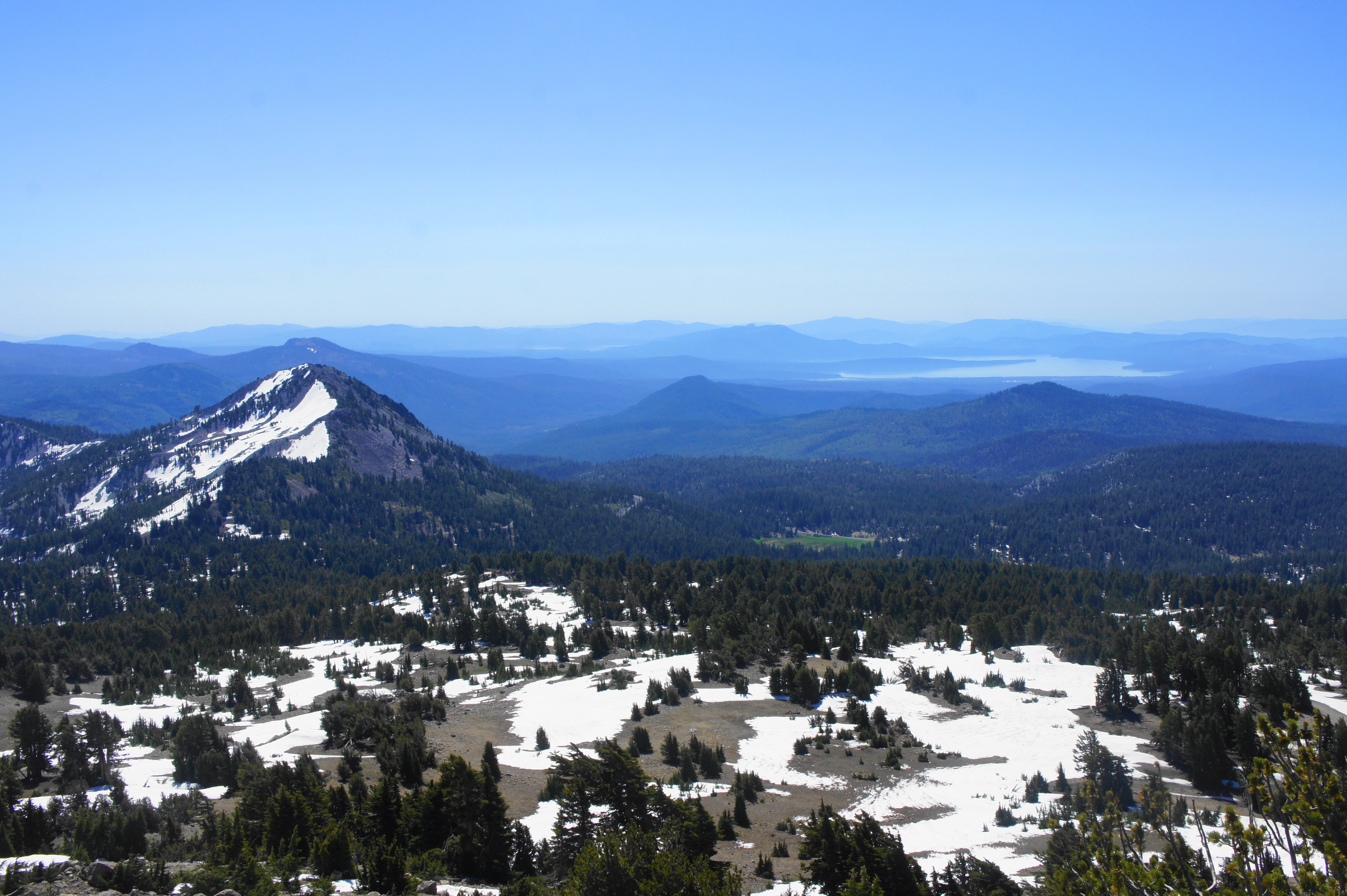
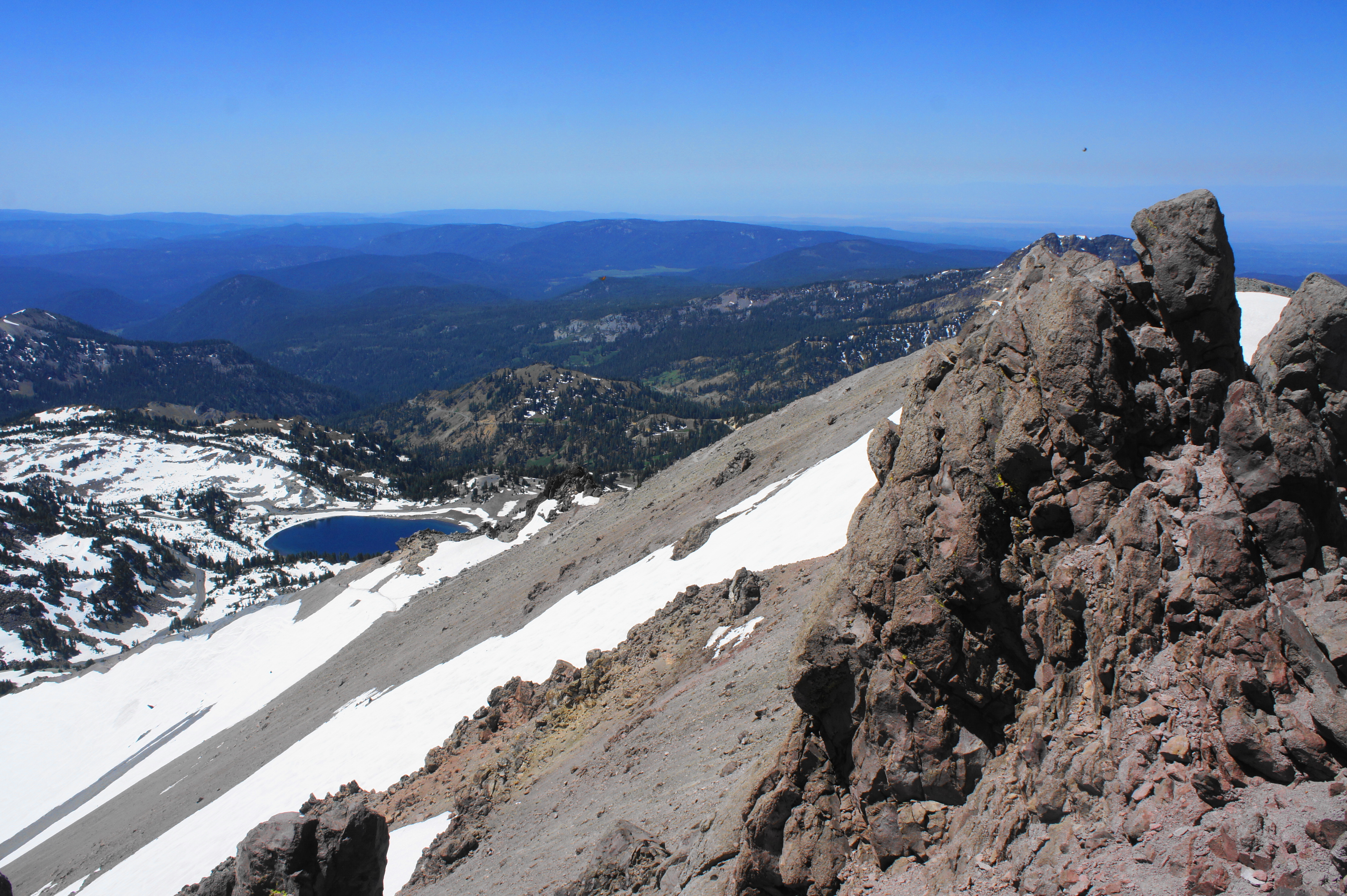
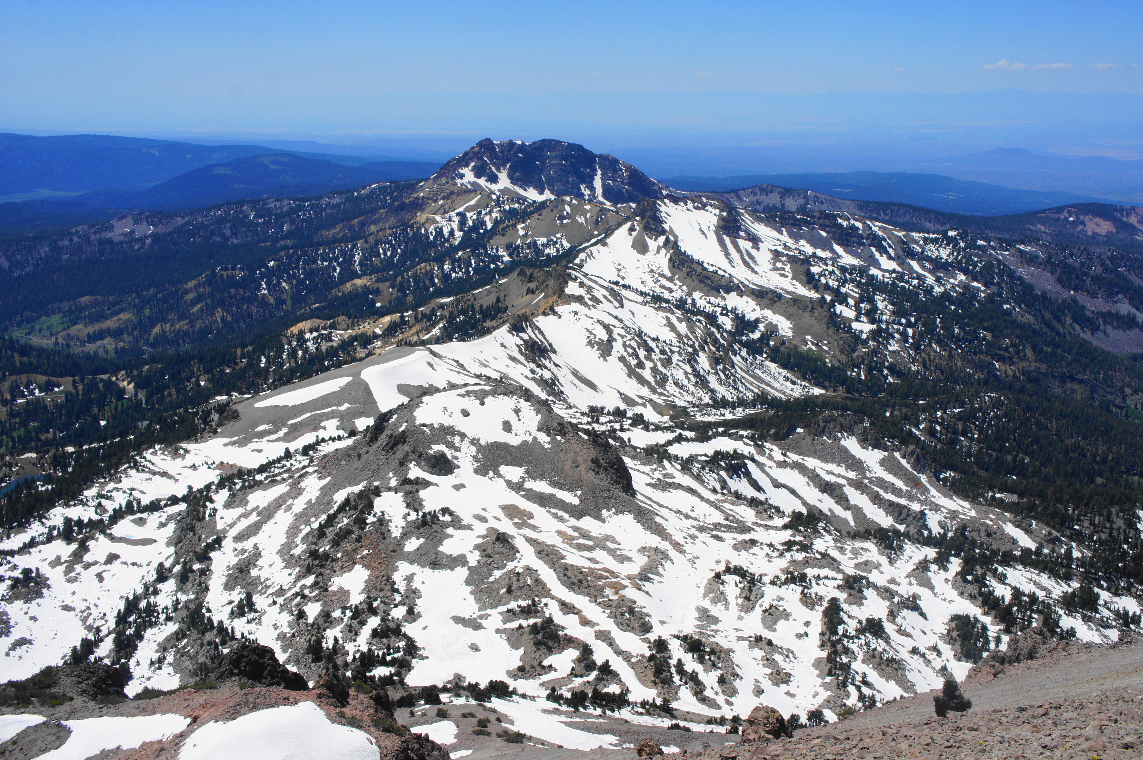
At 6/10 mile, the trail cuts left and rises to a spot that offers views of Helen Lake and Brokeoff Mountain (9,235’) to the southwest. Brokeoff is the second highest peak in the park and the most prominent remains of a stratovolcano called Mount Tehama that was partly eroded away by receding glaciers. After another pair of switchbacks, the broad Central Valley—with the California Coast Range beyond—comes into view to the west, and a small wayside (titled “Piercing the Rubble”) points out the talus slopes on Lassen Peak, formed during the latest eruptions in 1914-17. By now you have travelled about one mile and gained about 650 feet in elevation.
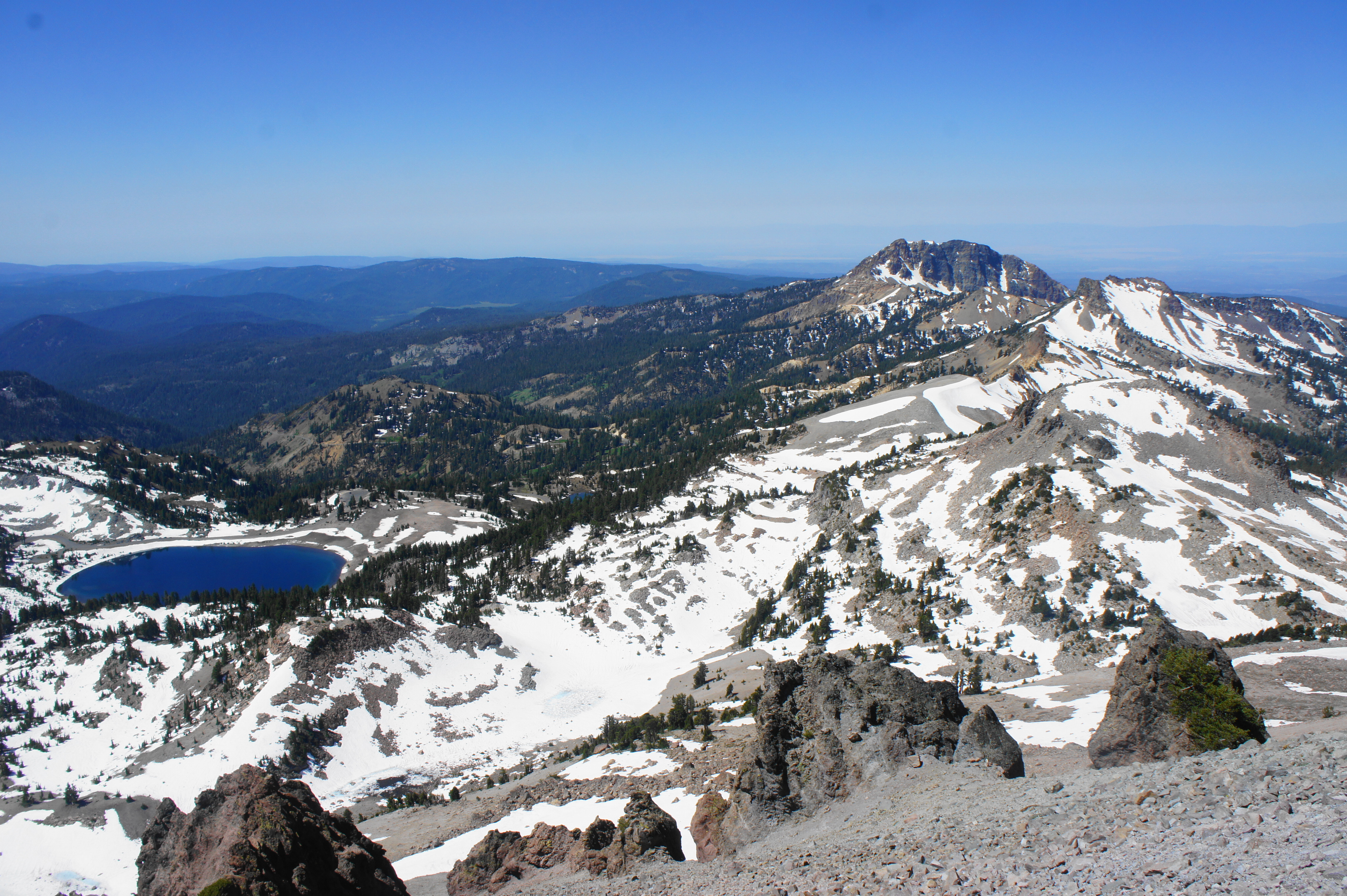
Each switchback brings better and better views: to the southwest, the entire range—from Lassen to Eagle Peak to Mount Diller (9,085’) and Brokeoff Mountain—comes into view, while vistas broaden to the south and east as well: the primary bulge below is Reading Peak (8,714’), which overlooks the still waters of Shadow Lake. One can also see as far east as the desolate ranges of western Nevada.
At 1.25 miles, the route ascends its first stone steps, then climbs to clear a set of volcanic crags on the left. At 1.8 miles, the trail skirts a rock cleft with a little archway on the left. By now hikers have gained around 1,400 feet from the trailhead.
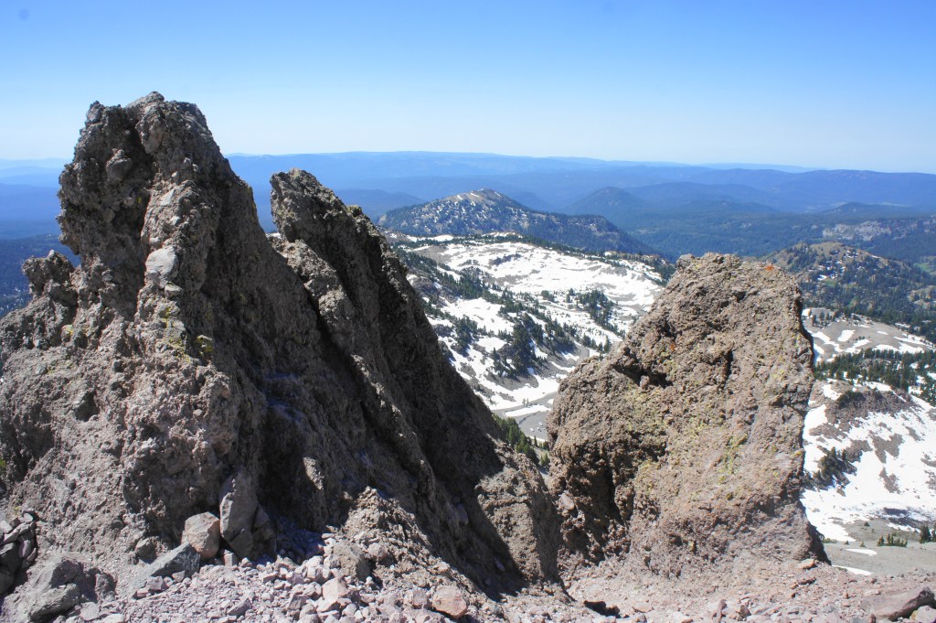
Crags along the Lassen Peak Trail 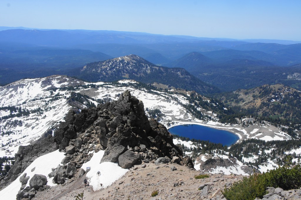
View southwest across Lake Helen
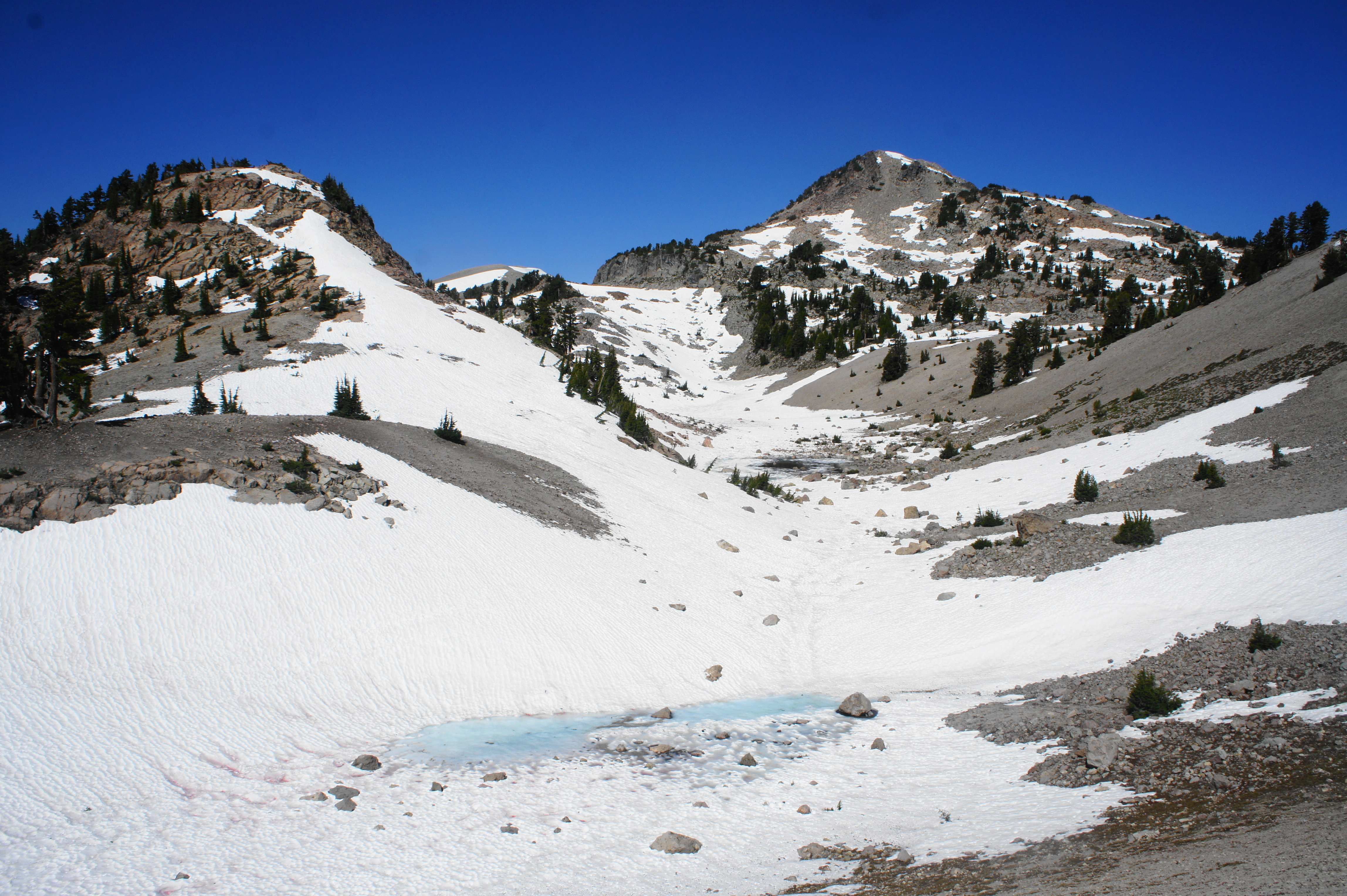
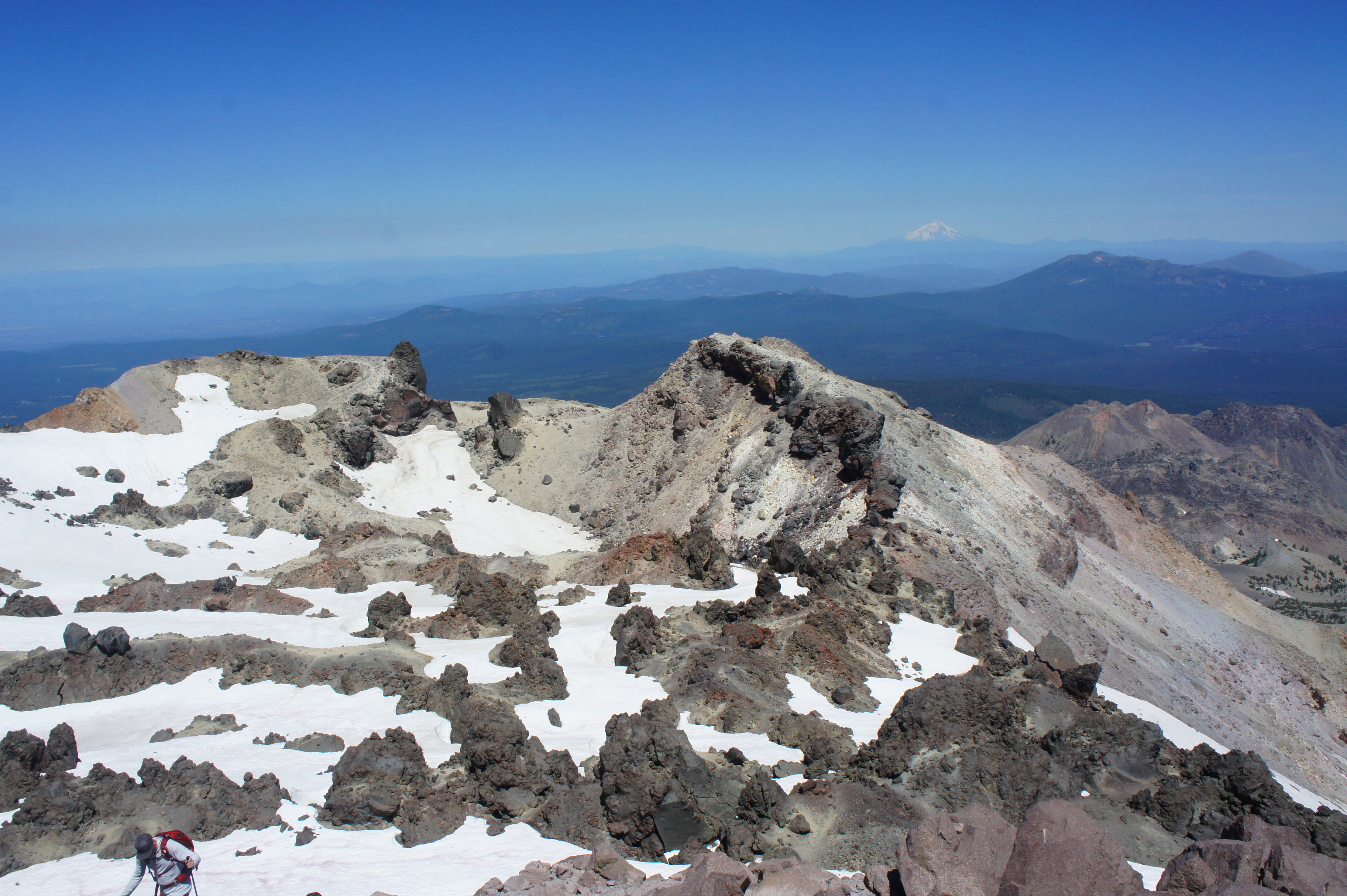
The final stretch to the top is certain to be the most exposed to the sun and wind, and the seemingly endless switchbacks leave hikers huffing and puffing, happy to stop to let downhill hikers pass. At last, the trail levels off at 2.25 miles—though not the true summit, one can see northward to the volcanic caldera and beyond for the first time. Though lacking a steaming hole like one might see at, say, Hawaii’s Kilauea, the remains of past explosions are evident: deep clefts in the mountaintop, surrounded by volcanic black crags.
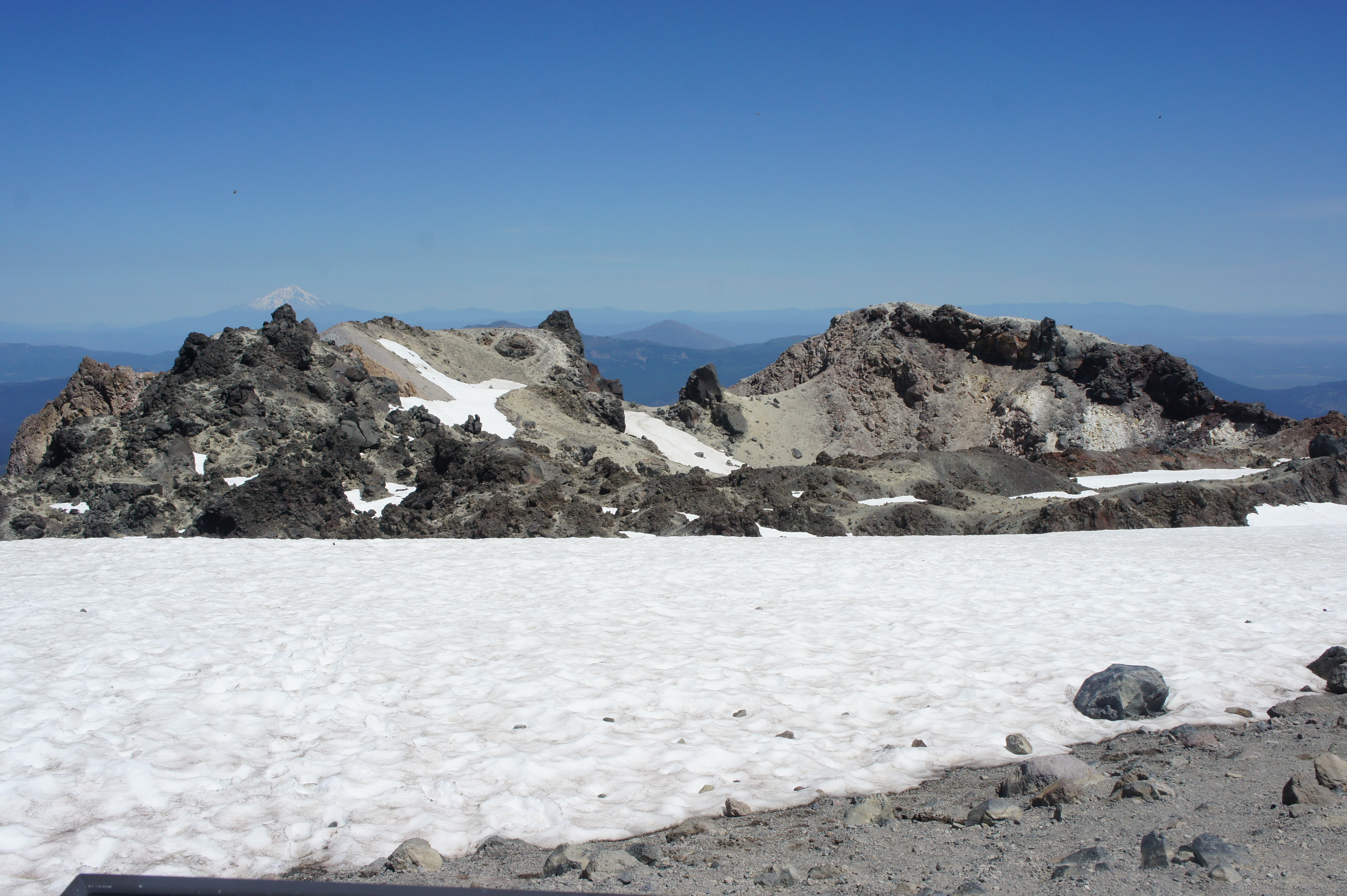
From the “false summit,” one can also see the perennially snow-capped Mount Shasta (14,179’) to the north, perhaps an even more impressive volcano that also has remained dormant for thousands of years. Also to the northwest are the Trinity Alps, a beautiful range of often snow-topped peaks, as well as the northernmost reaches of the Central Valley.
There are several waysides at this point, including a bit about the crater and the droves of tortoiseshell butterflies that frequent the summit in early summer.
The hike is not yet done, however: the true summit lies another 300 yards farther, requiring hikers to dip down into a brief notch before climbing again, this time up a steep and rocky traverse that requires some careful footing. Space at the true summit is relatively limited, but there are plenty of spaces to stop for a snack and rest just below the top.
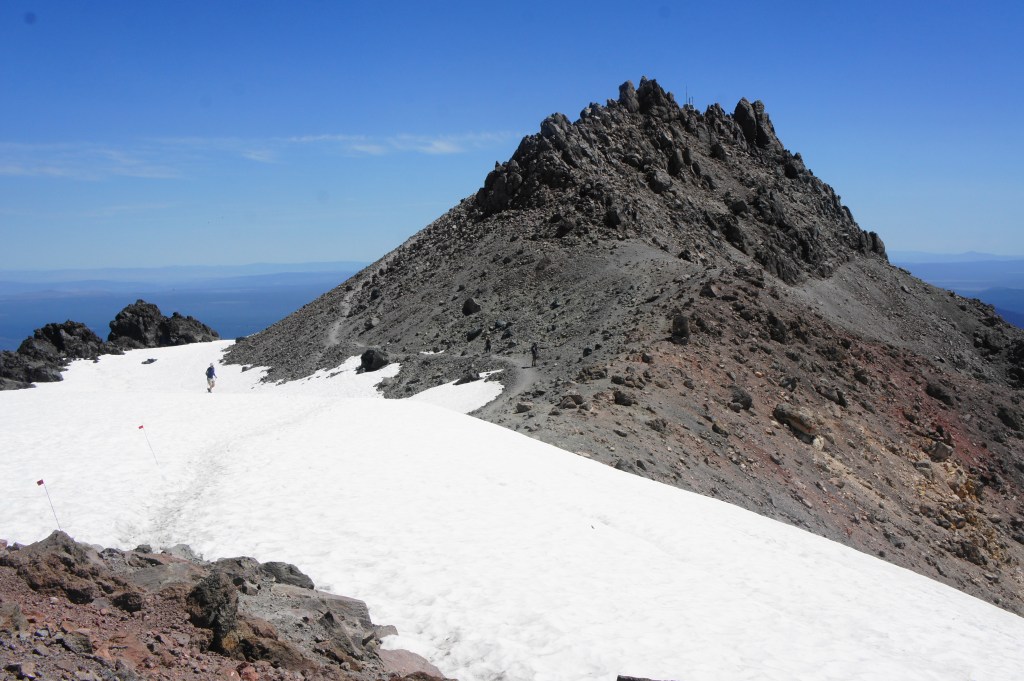
Final ascent to the summit 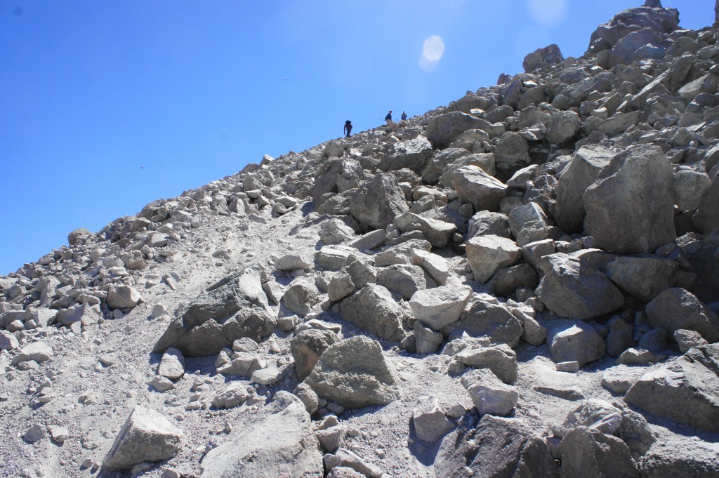
Rocky traverse to the summit of Lassen Peak
From the summit, hikers finally complete the panorama with fine views to the northeast—to the Butte Lake area and Cinder Cone (6,907’), another volcanic feature of the park. In fact, from Lassen Peak, hikers can see one of each of the four types of volcanoes in the world: cinder cone (Cinder Cone), shield (Prospect Peak), composite (Brokeoff), and plug dome (Lassen Peak).
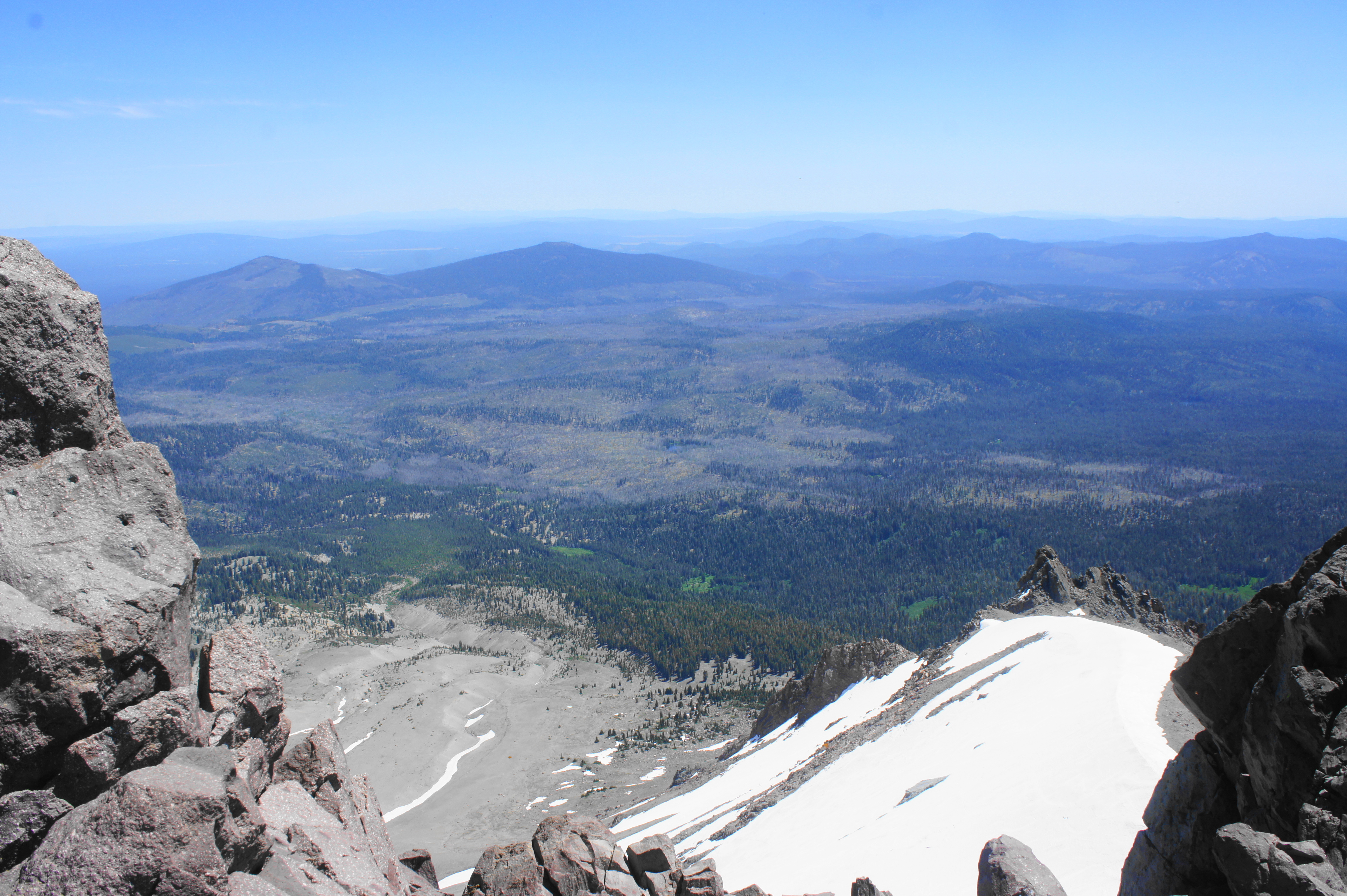
Backtracking from the summit, it is also common to spot visitors veering off to the north to explore the crater area: do so with caution, as the area is often snow-covered and has lots of loose gravel, and the climb to the western rim of the peak is surprisingly steep. Hikers are rewarded, however, with views of Manzanita Lake and Chaos Crags to the northwest, as well as unobstructed vistas of Mount Shasta and the Trinities.
From here it is a long and winding return back the way you came to the trailhead. Yet the wide-reaching vistas, blissful downhill, and satisfaction of having climbed a recently active volcano are likely to leave visitors cheery on the way down. All told, the out-and-back hike clocks in at just under five miles, a roughly 3- to 5-hour journey.

Pingback: Top 10 Hikes in 2020 | Live and Let Hike
Pingback: Lassen Volcanic Center, California |