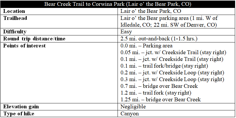
One of the easiest mountain hikes in the Denver area, the Bear Creek Trail offers a family-friendly adventure through Lair o’ the Bear Park, which is roughly halfway between Morrison and Evergreen, Colorado. Heading west from the Lair o’ the Bear parking area, the hard-packed trail hugs a gently-flowing stream before entering shady Bear Creek Canyon, flanked by walls of stone. The 1.25-mile hike is mostly flat and level, ending at a trail fork as the path enters Corwina Park. (Note: Ambitious hikers can continue on as the Bear Creek Trail narrows and climbs steeply through Corwina and O’Fallon Parks to Panorama Point and beyond.)
The hike
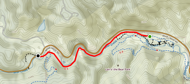
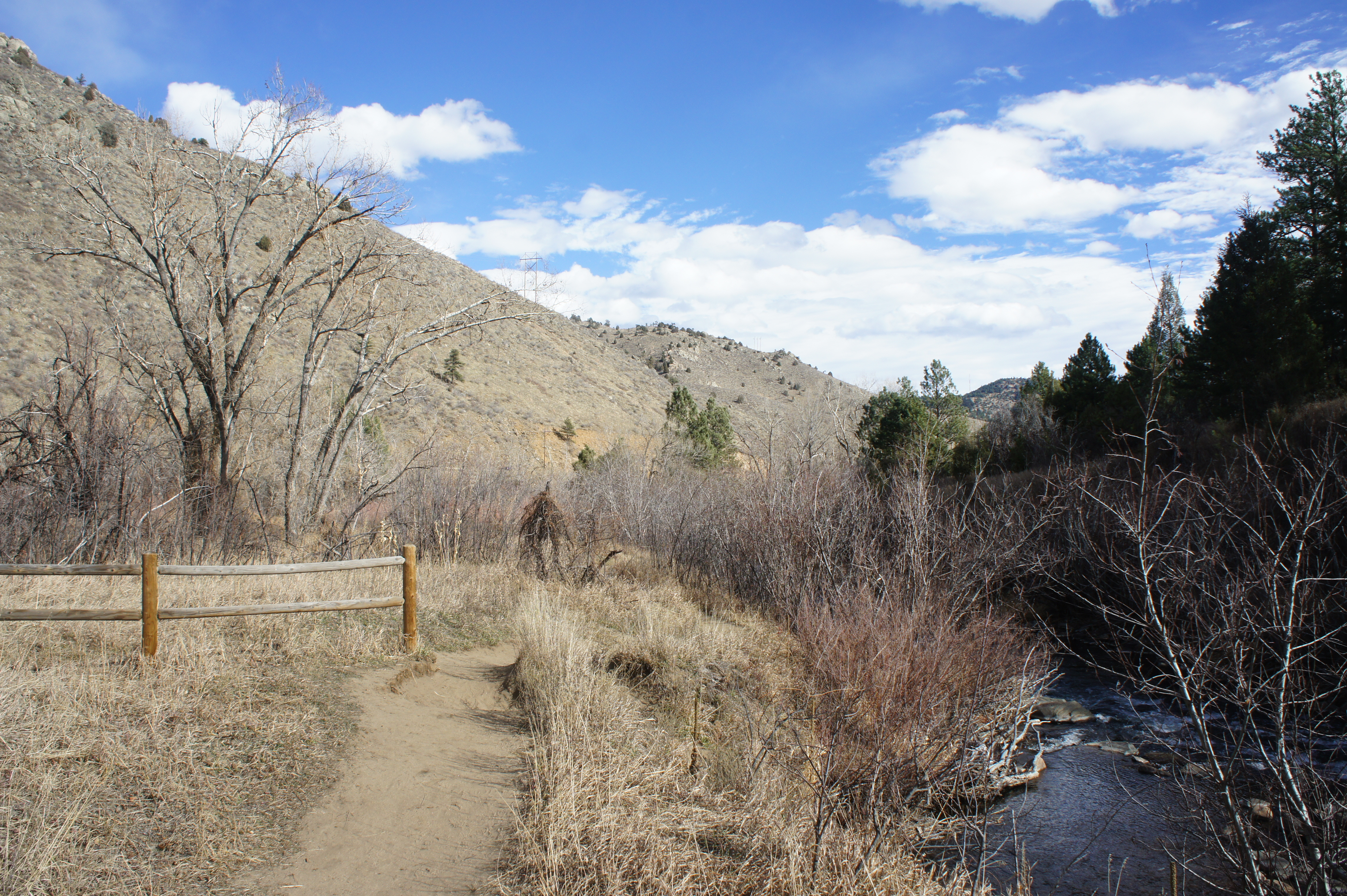
The parking area at Lair o’ the Bear Park is a 5-mile drive west from Morrison on Colorado State Highway 74. Bear left into the parking lot, which is sure to be close to capacity on most sunny weekends. (Note: Lair o’ the Bear is one of the busiest parks in the Jefferson County park system.) Dusty trails circle the lot in all directions, but the Bear Creek Trail is the most evident, heading west through relatively dense vegetation. (Note: The Bear Creek Trail also heads southeast, past the bathrooms, toward Idledale; this section is shorter, however, and less scenic.)
Stay straight on the main trail as a series of spurs head off to the left, including the junction with the Bruin Bluff Trail at Dipper Bridge at around 1/10 mile. By now the woods have opened up, revealing a sun-soaked meadow across the stream to the north, while tall grasses and willows line the creek. Approach the first of two junctions with the Creekside Loop Trail at about 2/10 mile. Take a left and follow this short detour for streamside views, or continue straight over a minor tributary before emerging at the second junction, where the two trails come back together, at 3/10 mile.
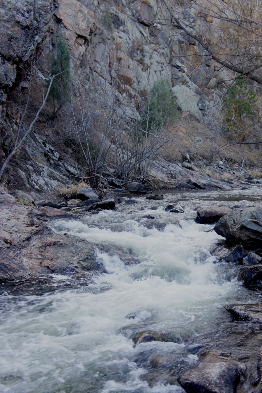
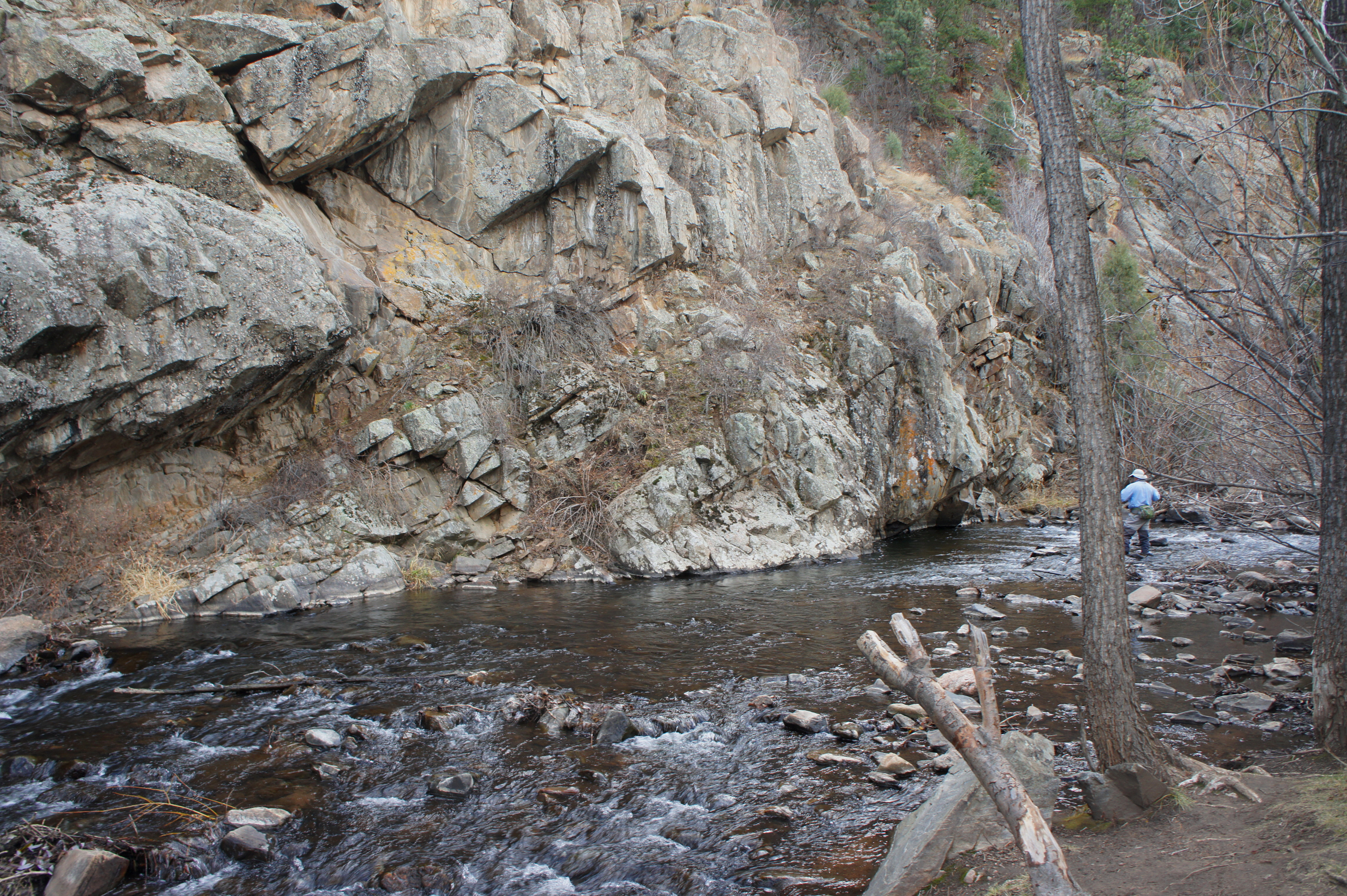
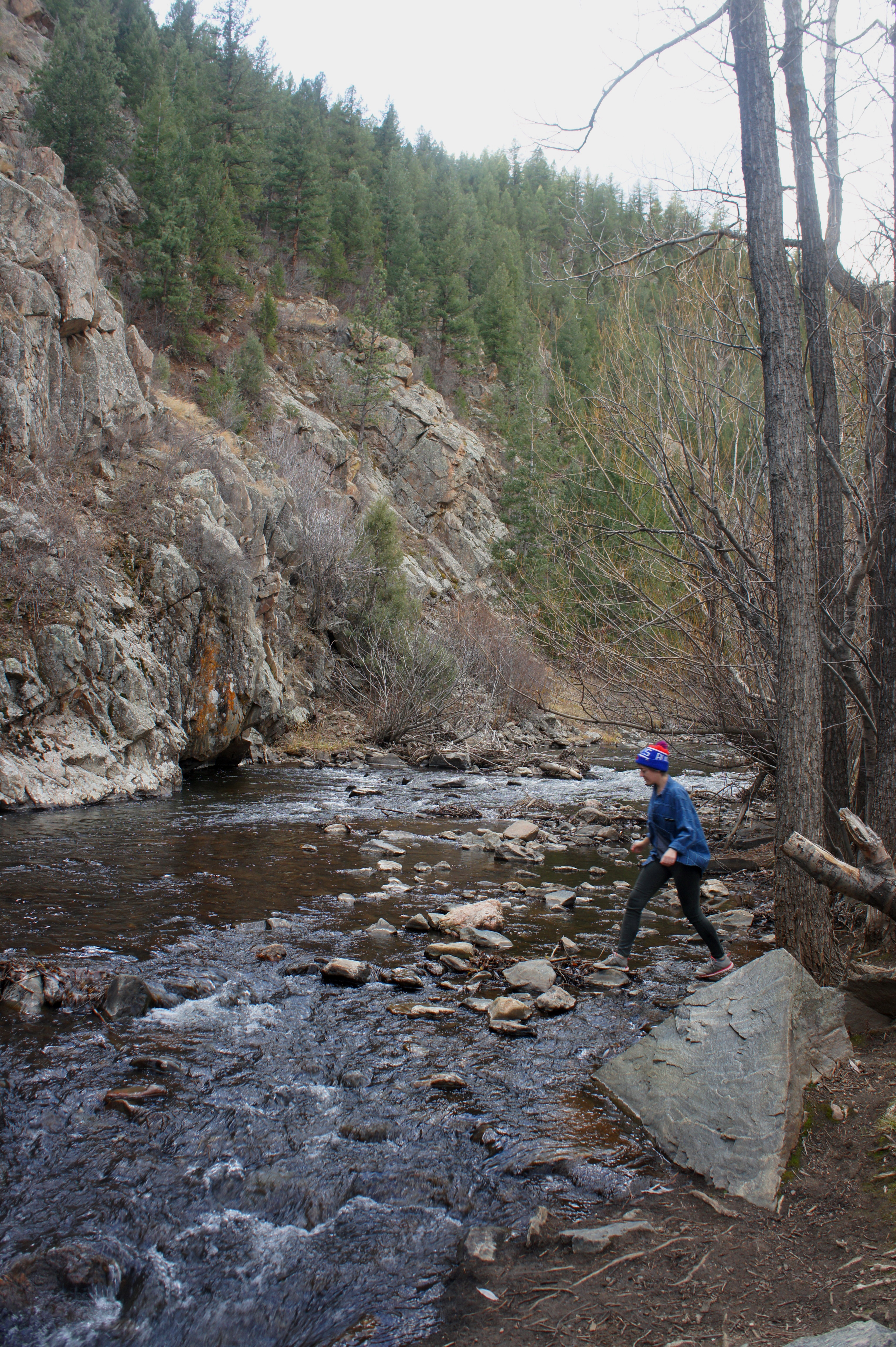
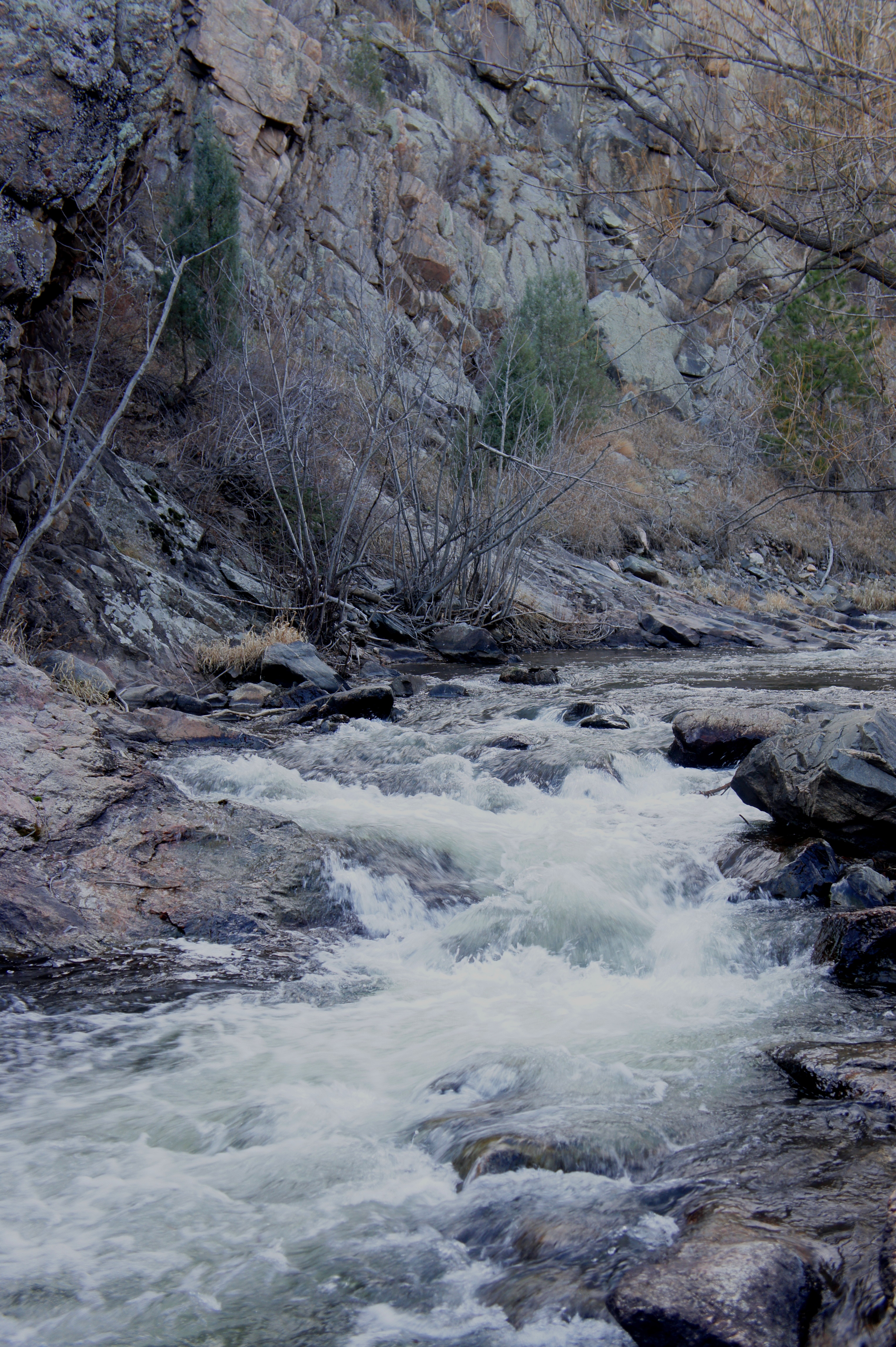
As the Bear Creek Trail continues southwest, it passes over a second, shaded tributary that is difficult, but possible, to pass in a wheelchair. As the trees dissipate again, the buzz of Highway 74, emanating from atop the slope to the right, is omnipresent and is by far the trail’s biggest flaw. Just beyond, however, the sounds of vehicle traffic are mitigated by the charming flow of Bear Creek, which squeezes through a narrow notch at about the ½-mile mark. Spruce-strewn hillsides and high, blocky walls dominate the far side of the creek, making this a picturesque place to stop for a snack or to try your hand at fly-fishing, which is popular in the park.
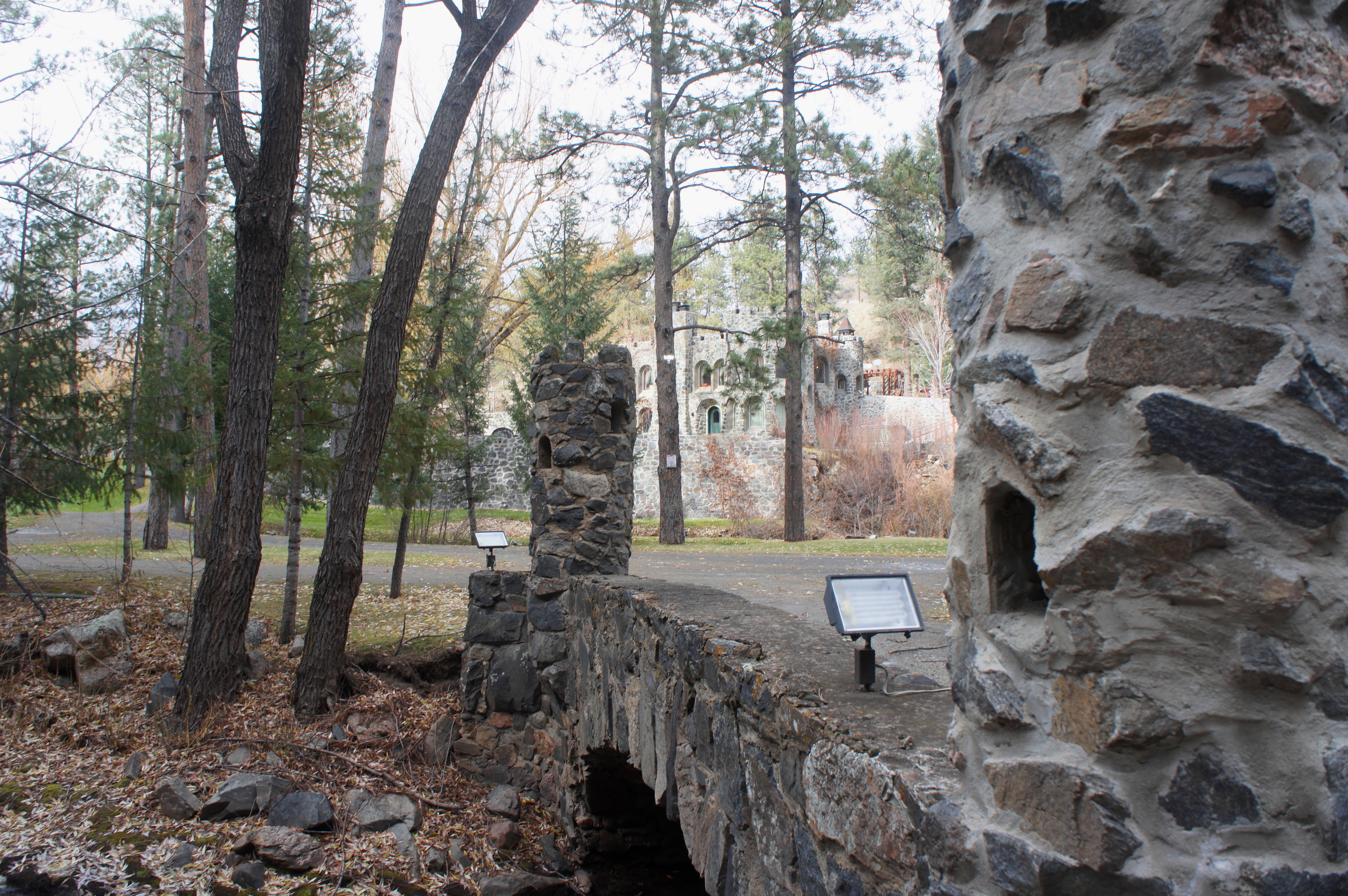
Now heading northeast, traverse the wide, steel bridge over Bear Creek at around 7/10 mile. Soon after, the trail rounds a sharp left-hand bend and continues to follow the creek southeast. With high rock walls on the left, a peculiar sight comes into view, across the creek, at 9/10 mile: Dunafon Castle, built in 1941. Once an extravagant private home, this is now a popular wedding venue, complete with a Medieval-like appearance, a well-manicured lawn, a water wheel, and several man-made waterfalls. It is off-limits to passersby, however, as the “private property” signs facing the trail make abundantly clear.
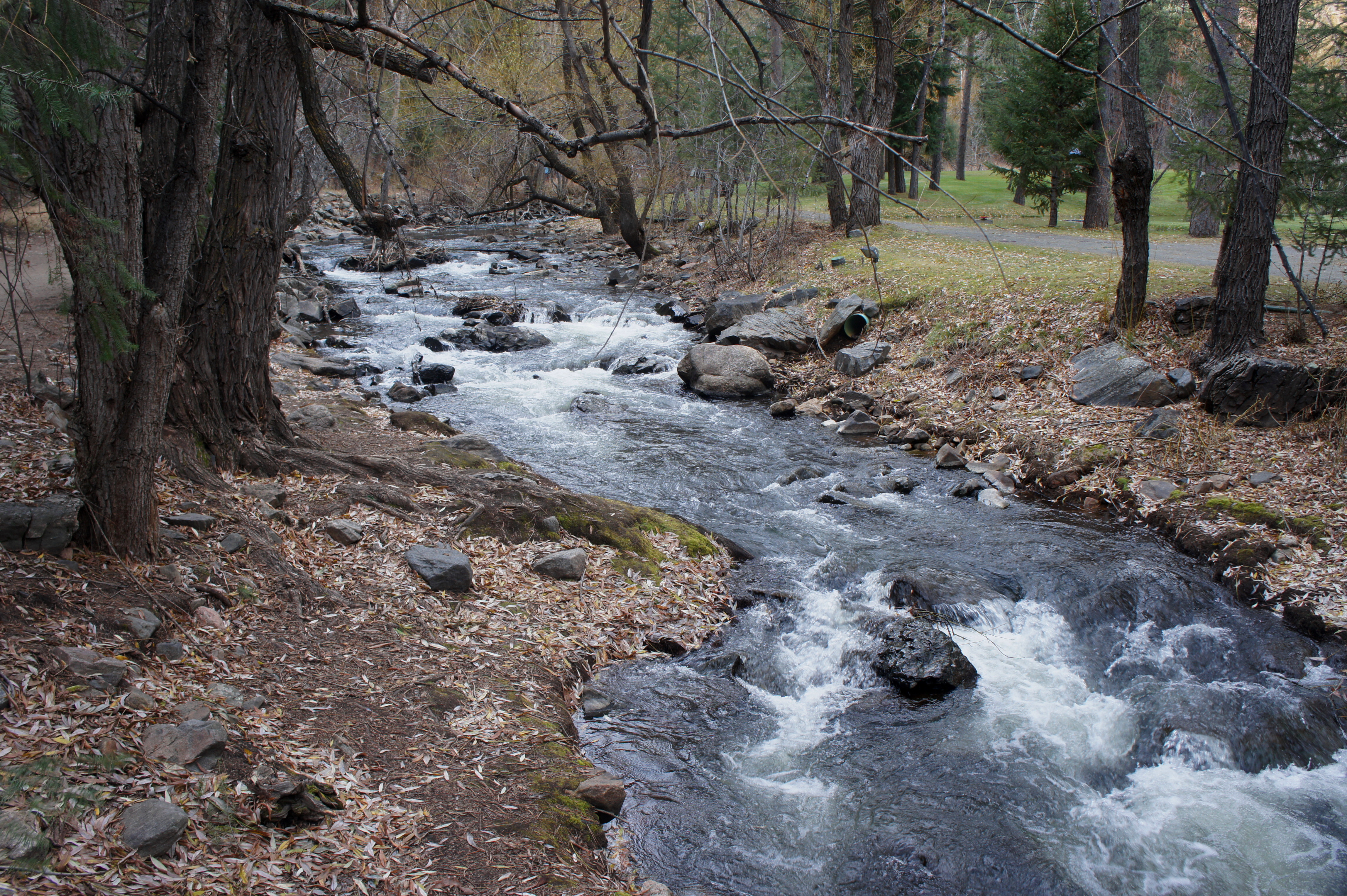
Beyond the castle, the increasingly rocky trail follows the creek, now flowing from the northwest, for another ¼ mile to the end of the hike. At 1.2 miles, the Bear Creek Trail abruptly cuts left, climbing a steep slope as it enters Corwina Park. The larger, smoother path continues straight to the western reaches of Lair o’ the Bear Park, which ends with little fanfare at a metal gate. A wide bridge leads across Bear Creek, followed by a steep, gravel ascent to a very small parking area along Highway 74.
Hikers with time and energy can continue up the steep Bear Creek Trail continuation to Panorama Point, which offers views of Mount Evans and the Front Range. (Note: Use caution while hiking, as the trail is chock-full of speedy mountain bikers.) All others should turn around, retracing your steps back to the start of the 1.25-mile walk.
Extra credit
Try the 1.5-mile Bruin Bluff Trail Loop, which connects with the Bear Creek Trail, climbs to vistas of the valley, and weaves through conifer forests.

Pingback: Bruin Bluff Trail Loop (Lair o’ the Bear Park, CO) | Live and Let Hike
Good Luck