
Highway 50, which stretches for more than 400 miles across central Nevada, is called the “Loneliest Road in America” for a reason. Services and cell service are in limited supply as travelers skirt the desolate mountain ranges and sagebrush-studded valleys of the Great Basin region. While a pretty-enough drive on its own, the trip is made better with the occasional opportunity to get out and stretch one’s legs along the way. Hickison Petroglyphs Recreation Area, which boasts ancient rock carvings potentially up to 10,000 years old, offers such an occasion. The site is located between Austin and Eureka—two modest towns along Route 50—and between the Toquima Range and Simpson Park Mountains, two scarcely-visited ranges in this remote part of Nevada. A short, ADA-accessible trail circuits the petroglyph area, and a brief spur leads to a decent vista overlooking Big Smoky Valley.

The hike
Hickison Petroglyphs Recreation Area is situated roughly 25 miles east of Austin—and 46 miles west of Eureka—along Highway 50 in central Nevada. The small park is nestled in a cleft near Hickison Summit, a low pass between the Toquima Range and Simpson Park Mountains. Turn at the large sign indicating the entrance to the park, then bear left at the first junction, following signs for the campground. (Note: This can be confusing, as the right fork indicates “trailhead”—but this much rougher, rocky track leads instead to some obscure horse and biking trails to the north.)
The improved dirt road ends at a cul-de-sac, where there is a restroom and parking for the short hiking trail. (Note: The campground is off to the right.) A large sign marks the start of the Hickison Petroglyphs Recreation Area Interpretive Trail, an entirely wheelchair-accessible hike. If you’re lucky, there will be some self-guided hike brochures at the kiosk, but don’t count on it.
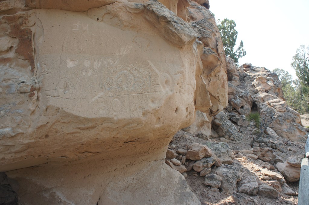
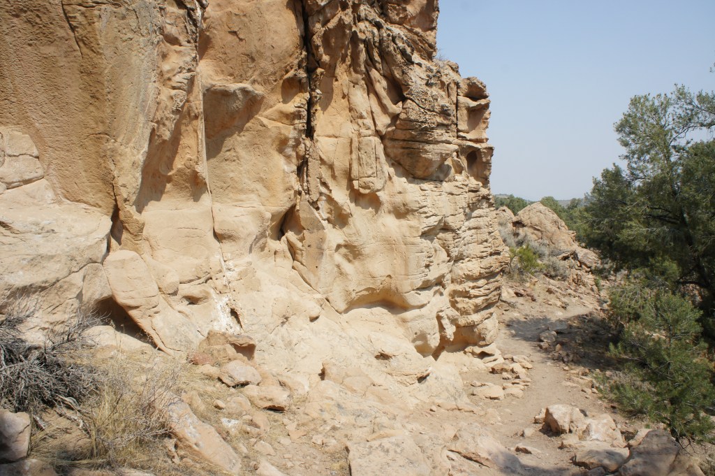
The short loop hike, heading in a clockwise direction, begins just to the right of the sign. The route is well-packed dirt and gravel, and neatly-arranged stones line the boundaries of the path. The trail climbs at a slight uphill through a sparse pinyon-juniper forest, then edges to the base of a sandstone wall with elaborate notches, knobs, and desert varnish. Gradually the first of the petroglyphs come into view: most are merely etched lines, but the most prominent remains of this Great Basin curvilinear style are a pair of horseshoe-shaped etchings and separate scrawling of several rainbow-looking figures, situated high up on a shady wall. Unfortunately, as time has passed, the indentations have faded—and more modern-day graffiti vandals have marred much of the wall.
Horseshoe figures on the sandstone wall 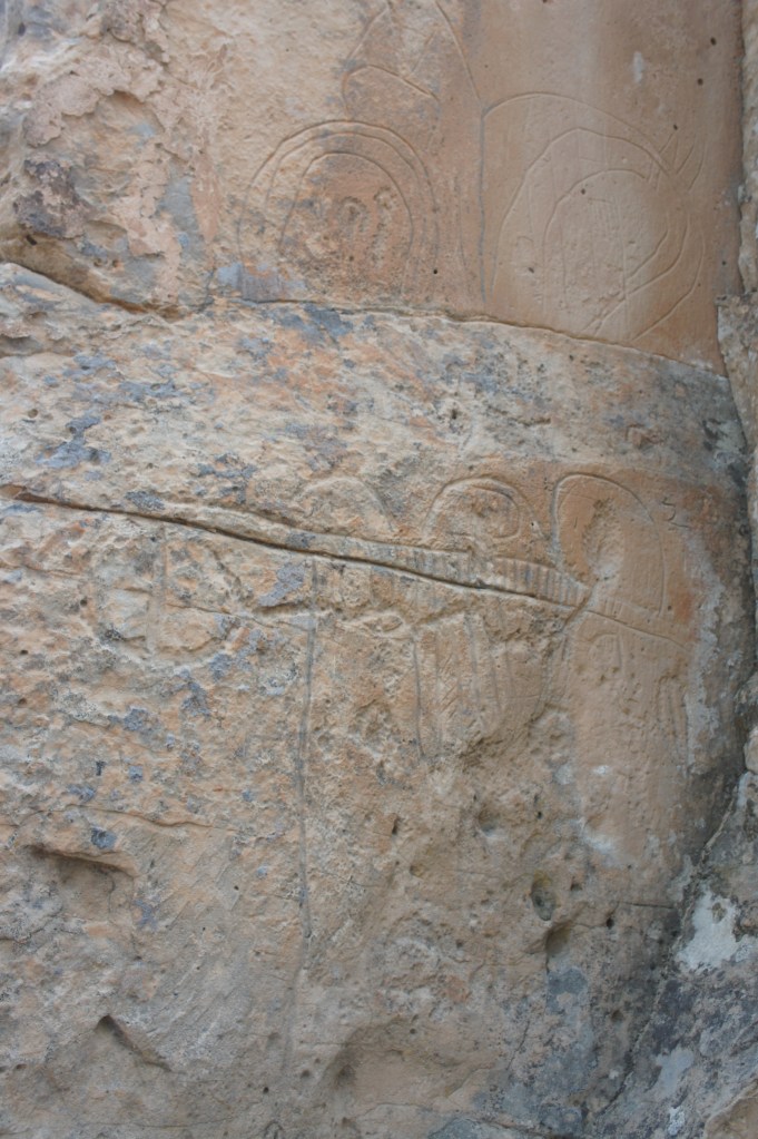
Curvilinear petroglyphs
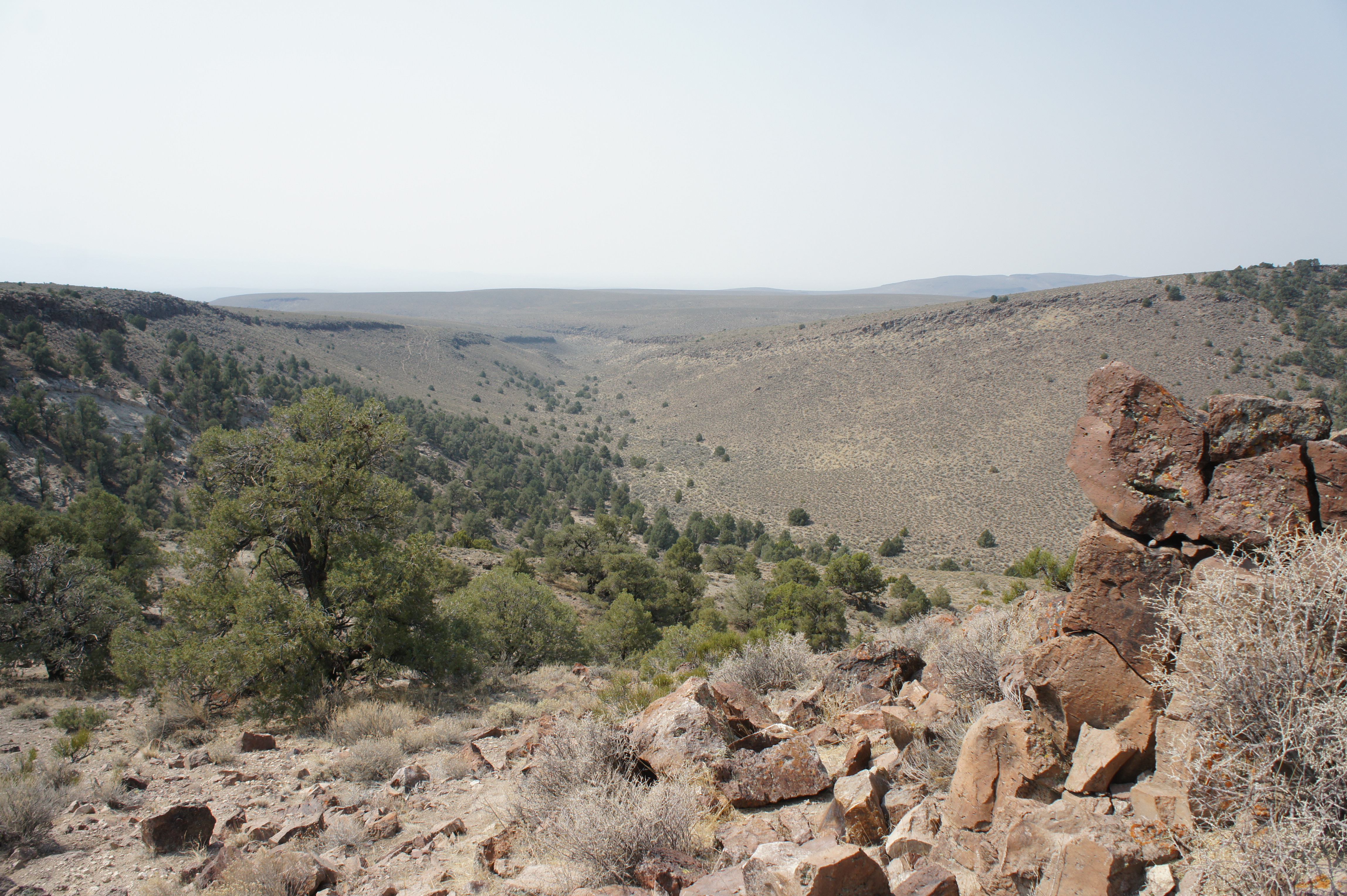
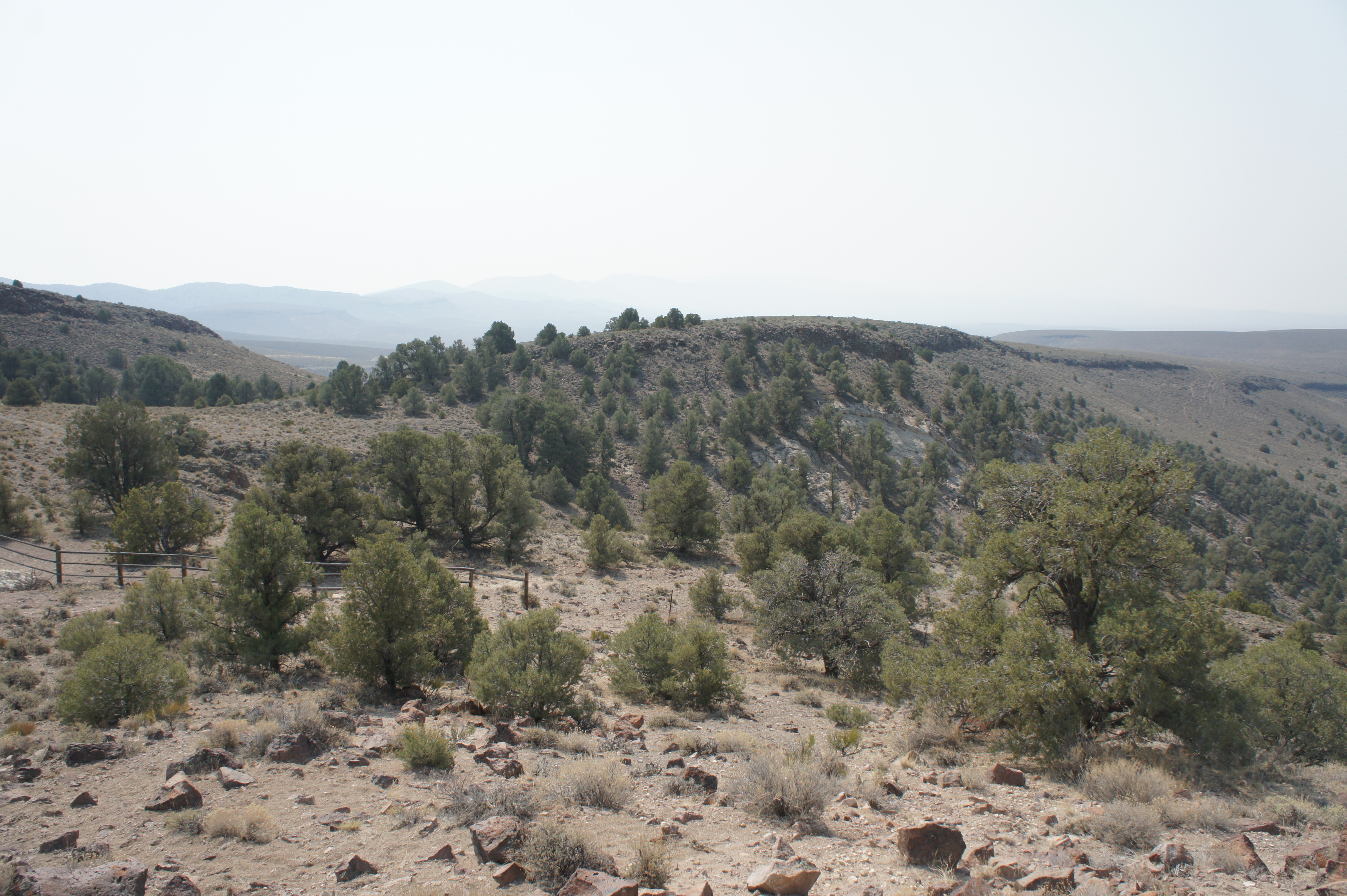
Beyond this initial set of petroglyphs, the trail zig-zags up a modest hill, reaching a fork at about 1/10 mile. Head left on a short spur, which leads to a scenic overlook. Here one can see down Big Smoky Valley toward the Toquima Mountains and Toiyabe Range. Climbing the rock outcrop on the right offers the best vantage point, while the trail continues briefly to a wooden fence at the park boundary to the left.
Returning back to the main trail, head left to continue the loop. At about 4/10 mile (at sign 7), another spur bears left. This one is much harder and climbs steeply to the summit of a hill at elevation 6,873’. Explore this challenging climb or stay right on the ADA-accessible trail, which continues as a much thinner path and skirts another pockmarked sandstone wall on the left. This wall also has a handful of etchings, although it is unclear whether they are true petroglyphs or modern graffiti.
Sandstone walls 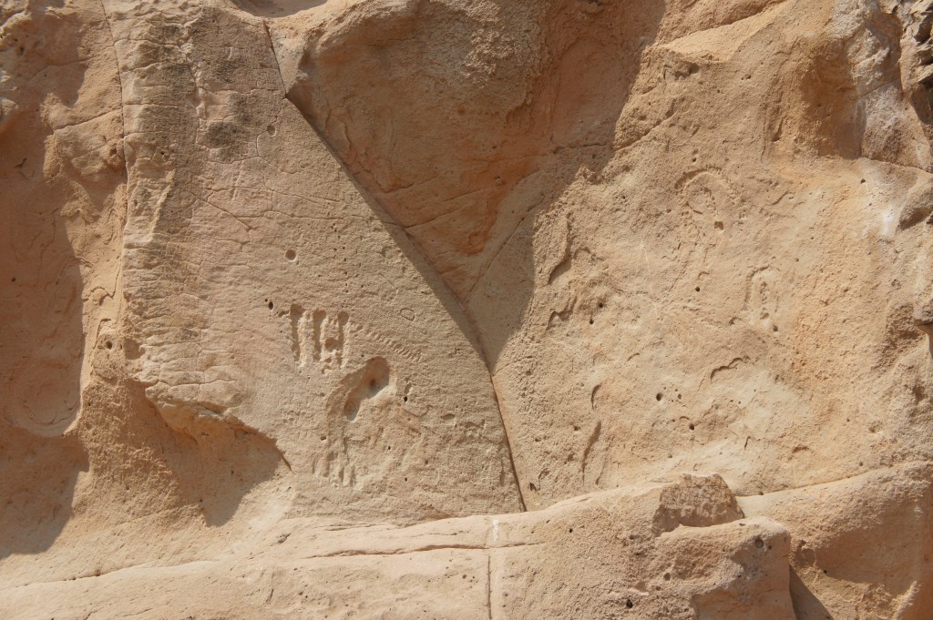
Petroglyphs?
The trail eventually splits again, but stay left and descend to a chunky boulder, the last waypoint on the hike. Here one can see the etched lines in the desert varnish up close, although it is unclear again what they depict.
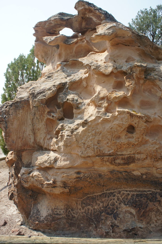
Boulder chunk 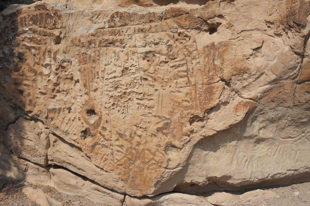
Rock etchings in the boulder
From the boulder, the trail turns east, descending steadily back to the parking area. All told, this short, ½-hour hike makes for a decent rest stop along the Loneliest Road, but it is otherwise not worth going out of your way to visit.

I have stopped at this quiet site since the 1980s. After taking Nevada State Board Exams in Reno I rewarded myself with a trip into the desert for a little R&R, and found myself camping at the summit, lullabied to sleep by a pack of coyotes somewhere to the north. I had discovered the petroglyphs a year or two earlier as I drove Hwy 50 to Wheeler Peak, and the Colorado Plateau.
If you are not prepared for self-contained, boon docking, this is not the place for you to camp. Stop, take a hike to get out of the car seat for a bit, and then head to your destination. The clear nights do make for great stargazing.
Pingback: Grimes Point Petroglyph Trail (Grimes Point Archaeological Area, NV) | Live and Let Hike
Pingback: Austin, Nevada and Hickison Petroglyphs