
At the Grand Canyon’s North Rim, much of the visiting population spends the bulk of their time in the narrow wedge of land that includes the campground, Visitor Center, and Grand Canyon Lodge. Surrounding on three sides by precipitous drop-offs to the canyon below, this area boasts a network of interlocking hiking trails, including the popular Bright Angel Point Trail, as well as this roughly 3-mile circuit, which combines the Bridge Path, Transept Trail, and a connector route that traverses the campground area. Named for a difficult-to reach, woody side canyon, the Transept Trail looks down on its namesake before snaking around to the base of the lodge and Bright Angel Point, with excellent views of the broader Grand Canyon. This is not the best hike on the North Rim, but it is convenient for those staying at the campground or lodge.
The hike
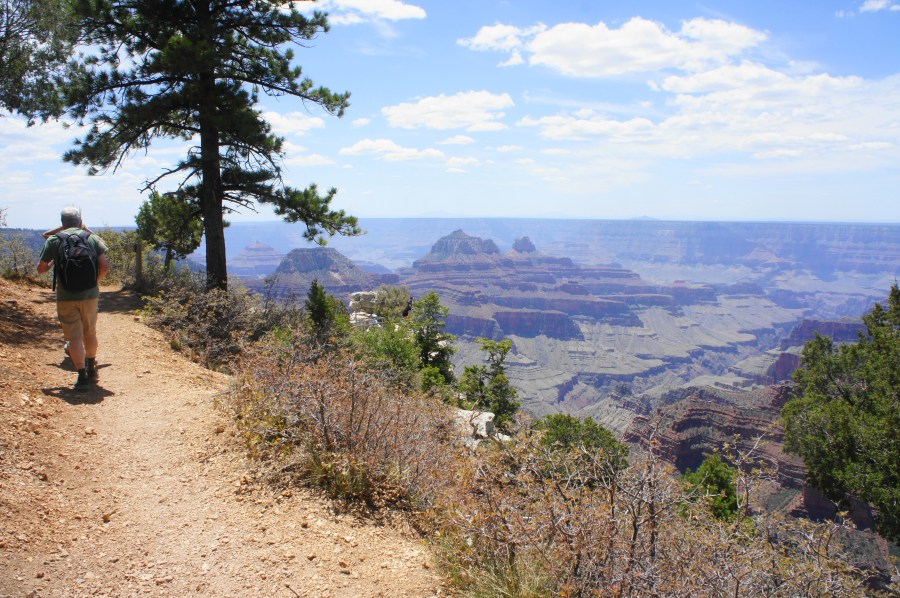
The circuit described here begins and ends at the large parking area adjacent to the North Rim Visitor Center and guest cabins, near the tip of Bright Angel Point in Grand Canyon National Park. The short hike to the overlook at Bright Angel Point heads south from here, while the Bridle Path parallels the east flank of the parking lot. Follow this track as it gradually pulls away from the parking area and teases views, between the firs and pines, of Roaring Springs Canyon, a tributary of Bright Angel Canyon and the main gorge carved by the Colorado River.
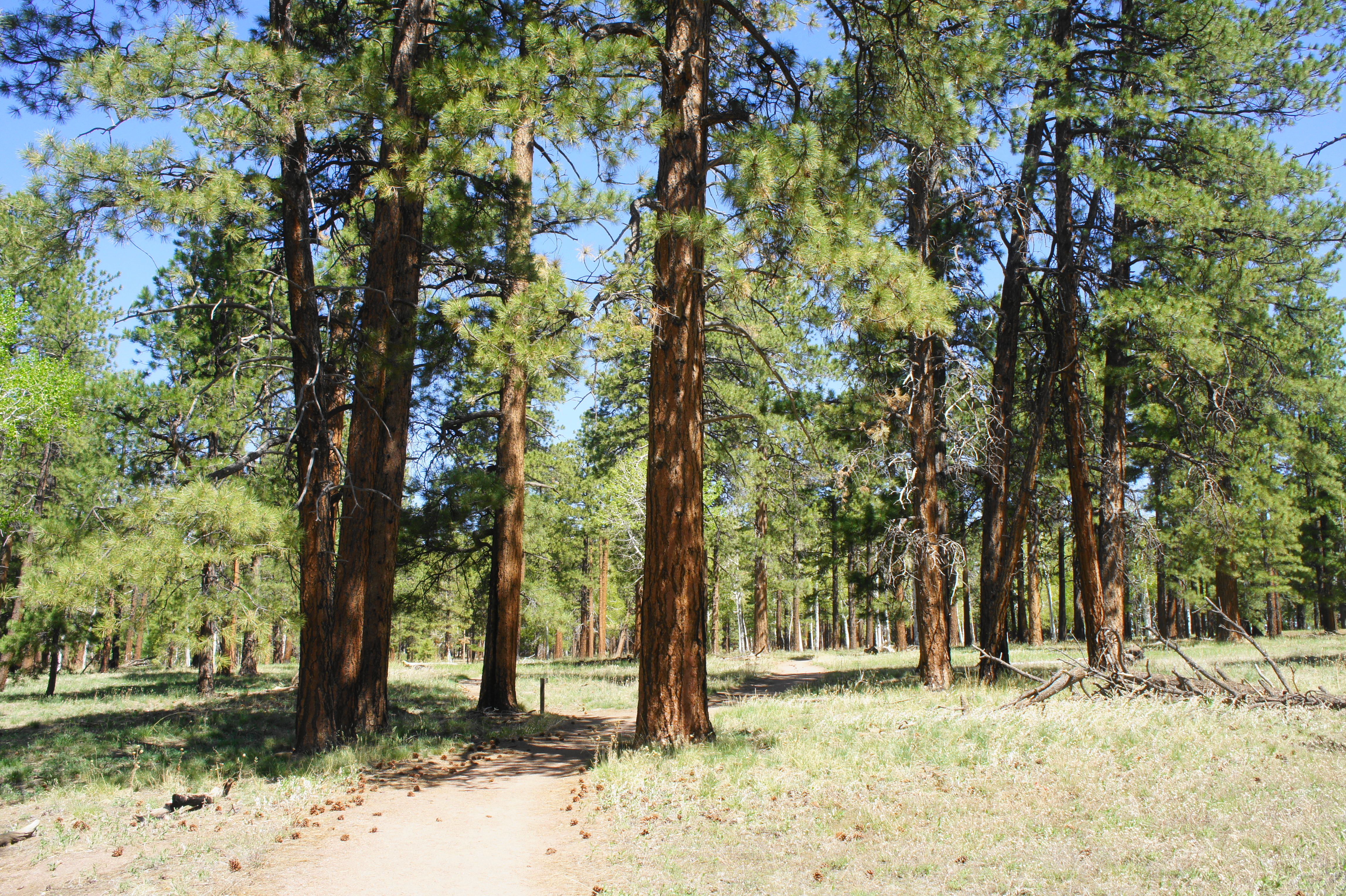
After ¼ mile, the wide Bridle Path clears the parking area and crosses Route 67, dipping to the west side and continuing north. Stay right at the junction with the Nature Trail, a short connector path, then left on the Bridle Path again as a doubletrack leads back up to the road to the right. From here the trail briefly ditches the intersecting trail network, meandering amid ponderosa pines, spruce firs, and other conifers, ubiquitous on the high Kaibab Plateau. At one point, the somewhat drab trail dips to clear a ravine, then climbs again to a level surface.
Make your way north on the Bridle Path, crossing a spur road to an administrative area at 9/10 mile, then take a left at the small sign indicating the way to the amphitheater/campground. Here a narrow singletrack leads away from the Bridle Path and bears west through the trees. One can continue straight here on the Bridle Path, connecting with the Transept Trail in another 4/10 mile, but heading left offers a shortcut that bypasses some more relatively uninteresting trees and gets one to canyon views sooner. So, bear left, following the dirt tread as it passes the outdoor amphitheater and then emerges at the entrance to the North Rim Campground.
From here, make your way south toward the General Store, at which point one should peer right – follow the track leading west from here, astride some maintenance buildings; it connects with the Transept Trail, the highlight of the loop.

Bearing left on the single-track, dense tree cover tends to obscure initial views of The Transept, a deep and narrow side canyon with cliffs that drop more than 3,000 feet. After around 5-10 minutes of walking, however, the visibility improves, with hikers able to make out the multiple rock layers along the opposite wall of The Transept to the west. The cream-colored Coconino Sandstone is largely interrupted, forming vertical cliff faces, while the crumbly Hermit Shale gives way to the ruddy Supai Group and Redwall Limestone.

To the south is Oza Butte (8,095’), a prominent landmark that ushers in the rest of the canyon ahead: on all but the haziest days, hikers should be able to see across to the South Rim. On clear days, the views extend as far as the San Francisco Peaks of the Flagstaff area beyond.
As the trail continues, it begins to cut in and out of shady ravines, mildly descending as a series of connector paths comes in from the left. At about 2.5 miles, the route finds the southern terminus of the Nature Trail, followed by one of the best overlooks along the Transept Trail: a wooden picnic table, set in the shade, with sweeping views of The Transept and Bright Angel Canyon.

From here the path descends rather sharply to clear another ravine, then treads southward toward the tip of Bright Angel Point, rounding a left-hand bend at about 2.9 miles that leads one to within striking distance of the Grand Canyon Lodge. A spur to a railed-in overlook offers an excellent look at the canyon, after which the onward trail passes below the lodge and its lovely terrace on the left. Bear left on the staircase heading up to the lodge, or complete the loop by staying straight, dropping down a level to another junction, where hikers find the highly-trafficked thoroughfare to Bright Angel Point. Bear left here and follow the wide path back to the parking lot.

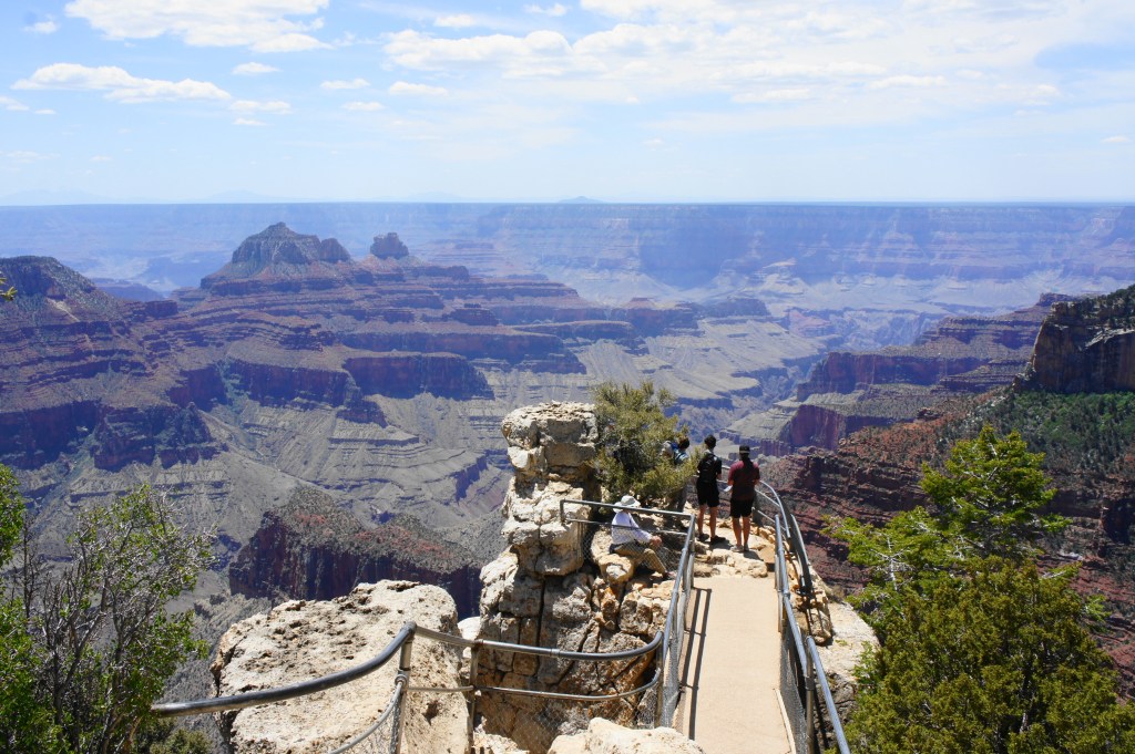
Popular overlook 
The North Rim from the viewpoint
This completes the circuit, clocking in at about 3.3 miles and perhaps 1.5-2 hours of relatively easy hiking.
Extra credit
Add in the short spur to Bright Angel Point for dramatic views, at the cost of only an additional half-mile of walking.
