
Arizona’s magnificent Grand Canyon National Park has a lot going for it, although perhaps creative naming conventions is not one of them. One of the most ubiquitous names for various features in the park is “Bright Angel”: south of the Colorado River, the popular Bright Angel Trail descends from the Bright Angel Lodge on the South Rim to Phantom Ranch, while the congruously-named Bright Angel Canyon leads north from the Colorado, past the Bright Angel Campground, all the way to the North Rim. Here on the northern rim of the Grand Canyon is one last kindred namesake: Bright Angel Point, a panoramic overlook situated at the far extremity of a narrow jut of land more than 3,500 feet above the canyon below. The ¼-mile Bright Angel Point Trail is by far the most popular “hike” on the North Rim and offers an introductory—though not necessarily the best—view of one of the world’s most famous natural wonders.
The hike
Definitely the most crowded section of Grand Canyon National Park’s North Rim is the area around the North Rim Visitor Center and Grand Canyon Lodge, crammed near the tip of a leafy finger of land jutting out above the canyon. From here, there are two avenues for reaching the Bright Angel Point Trail. The first, briefly following the level Bridle Path, begins just behind the Visitor Center at the southeast edge of the main parking area. The second option starts from a narrow staircase to the east of the lodge.
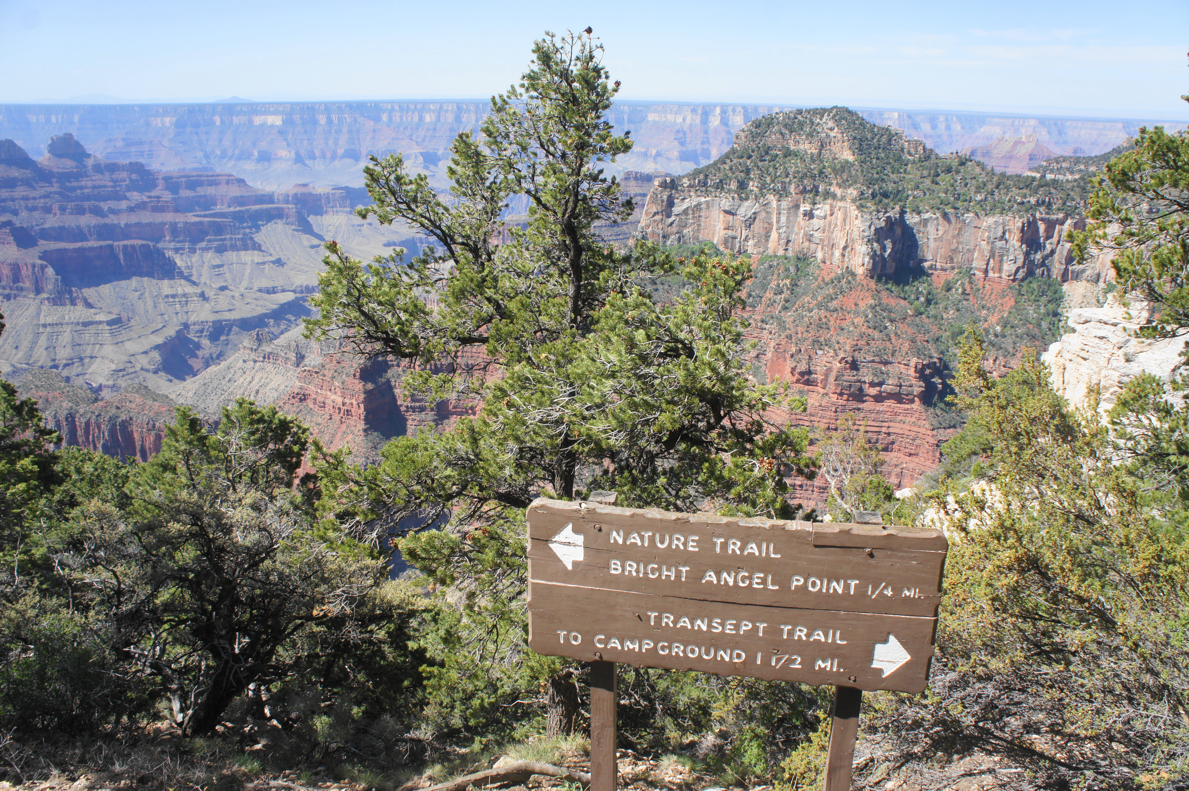
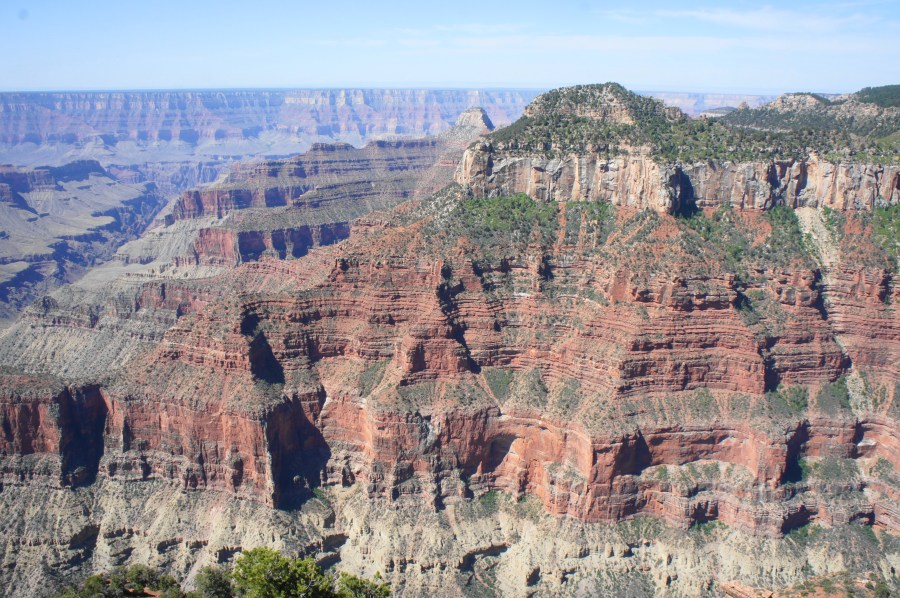
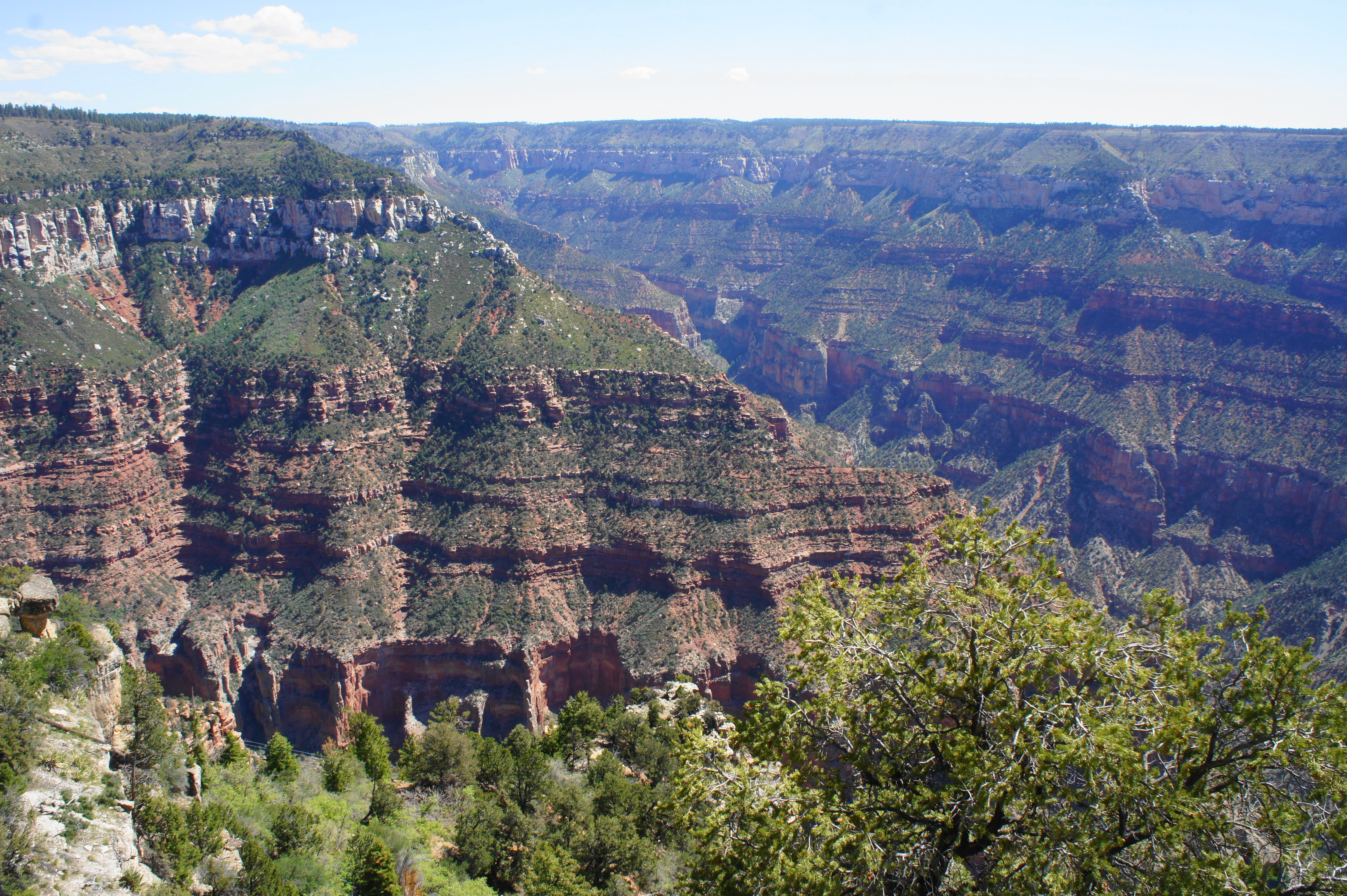
Taking the second choice, the stony staircase leads to a snaking path that ends at a junction, just below the terrace of the lodge on the right. Head left, following the signs for the Nature Trail and Bright Angel Point, then pass an initial overlook on the right. This first promontory offers views across a deep side canyon called The Transept, flanked on the opposite side by the rim and Oza Butte (8,065’). At the top of the canyon walls is the Kaibab Limestone, a Permian-period layer that is the youngest rock in the Grand Canyon (but often the oldest in nearby Utah parks like Capitol Reef). Below this is the less-discernable Toroweap Formation and the cliff-forming Coconino Sandstone, followed by the crumbly Hermit Shale and the reddish Supai Group, culminating with the sheer drop-offs of the ruddy Redwall Limestone.

Beyond the initial overlook, the onward path hugs the rim on the right, passing gnarly junipers, and then intersects with a broader, paved track coming in from the left (this is the path from the Visitor Center). Take a right here, heading southeast as the more heavily-vegetated Roaring Springs Canyon comes into view down to the left.

Paved path to Bright Angel Point 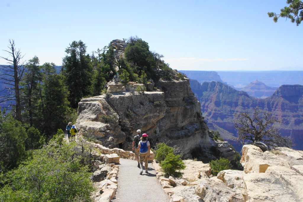
Approaching the short bridge
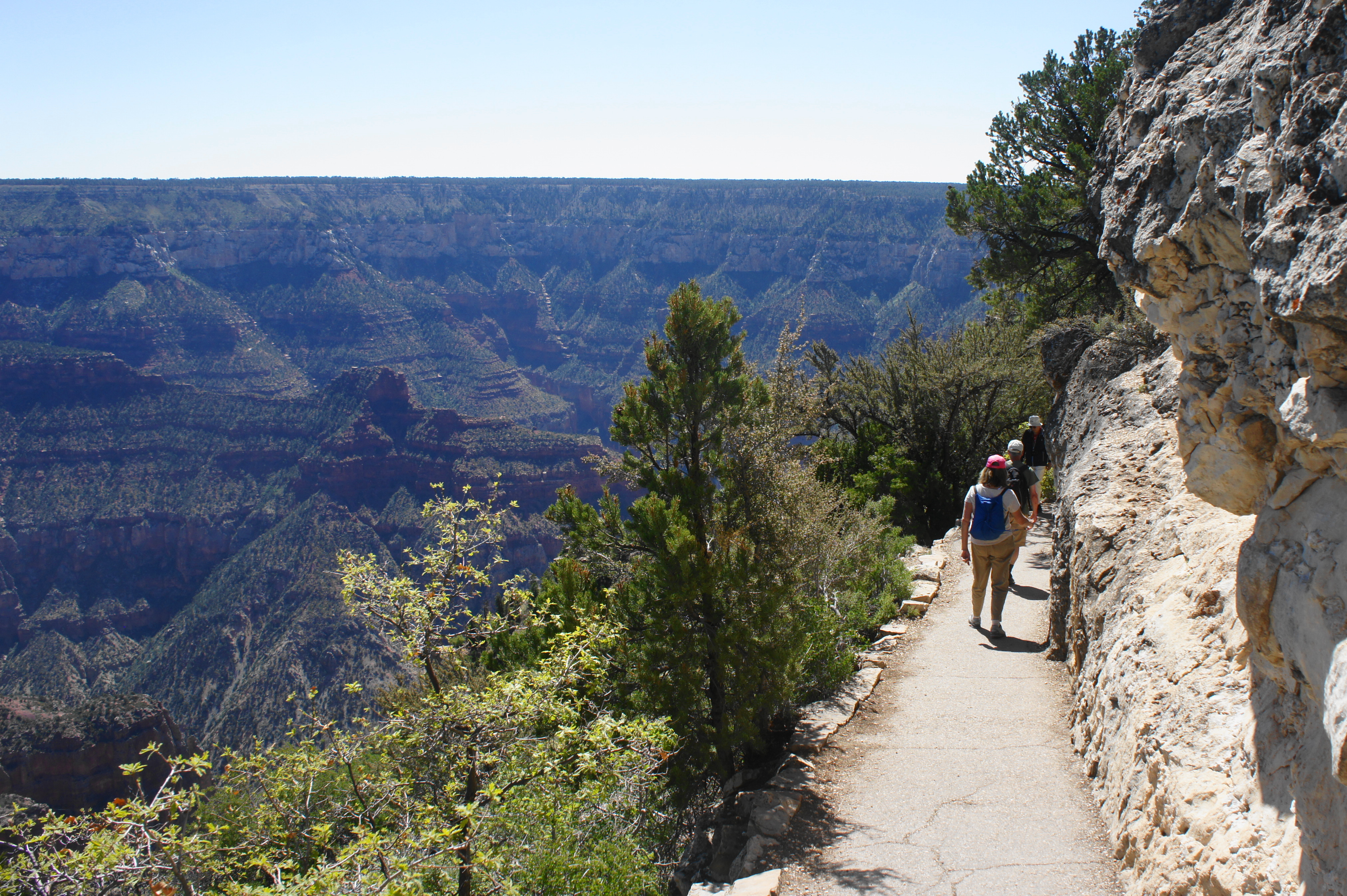

The narrowing path hugs a whitish wall of Kaibab limestone on the right, then rises out into the open amid some windswept trees. From here the trail drops to clear a neatly-crafted bridge at what might be the rocky ridge’s narrowest point. For the final approach, the paved but steep trail ascends steadily, keeping the high rock outcrops on the right, culminating at the railed-in overlook. This is Bright Angel Point (8,161’).

The near-panorama from the viewpoint is excellent. Ahead, to the south, The Transept feeds into the broader Bright Angel Canyon, which in turn steadily routes southwest toward the Colorado River. Though the Colorado is not visible, one can make out the deep drainage cut by the river in the distance, with the South Rim beyond on the horizon. On clear days, one can see as far south as the San Francisco Peaks in the Flagstaff area.
Back on this side of the Colorado, the walls to the east of Bright Angel Canyon are decorated with a series of colorful buttes: Deva Temple (7,339’), Brahma Temple (7,553’), and Zoroaster Temple (7,128’). Off to the right, visible in the background, just to the left of closer Oza Butte, is the towering Buddha Temple (7,203’).

It remains somewhat of a mystery why the Grand Canyon is much wider north of the Colorado than south of it, but the primary crafter of these side canyons, clefts, and buttes is not the Colorado but rather its tributaries—as well as the other main culprits of erosion: rain, freezing, and thawing.
The downside of Bright Angel Point, of course, is the crowds: visitors are likely to barely get a chance to take in the view and snap a few photos before giving in to peer pressure to move along and let others have their turn. There are finer and quieter viewpoints elsewhere along the North Rim, but consider this the appetizer.
When ready, return the way you came, venturing back toward the lodge, visitor center, or parking area. All told, the round-trip from the Grand Canyon Lodge is about 8/10 mile.

The view out across Bright Angel Canyon looks really nice and I am sure that in reality is very impressive!
Pingback: Bridle Path – Transept Trail Loop (Grand Canyon National Park, AZ) | Live and Let Hike
Pingback: Cape Royal & Angel’s Window (Grand Canyon National Park, AZ) | Live and Let Hike