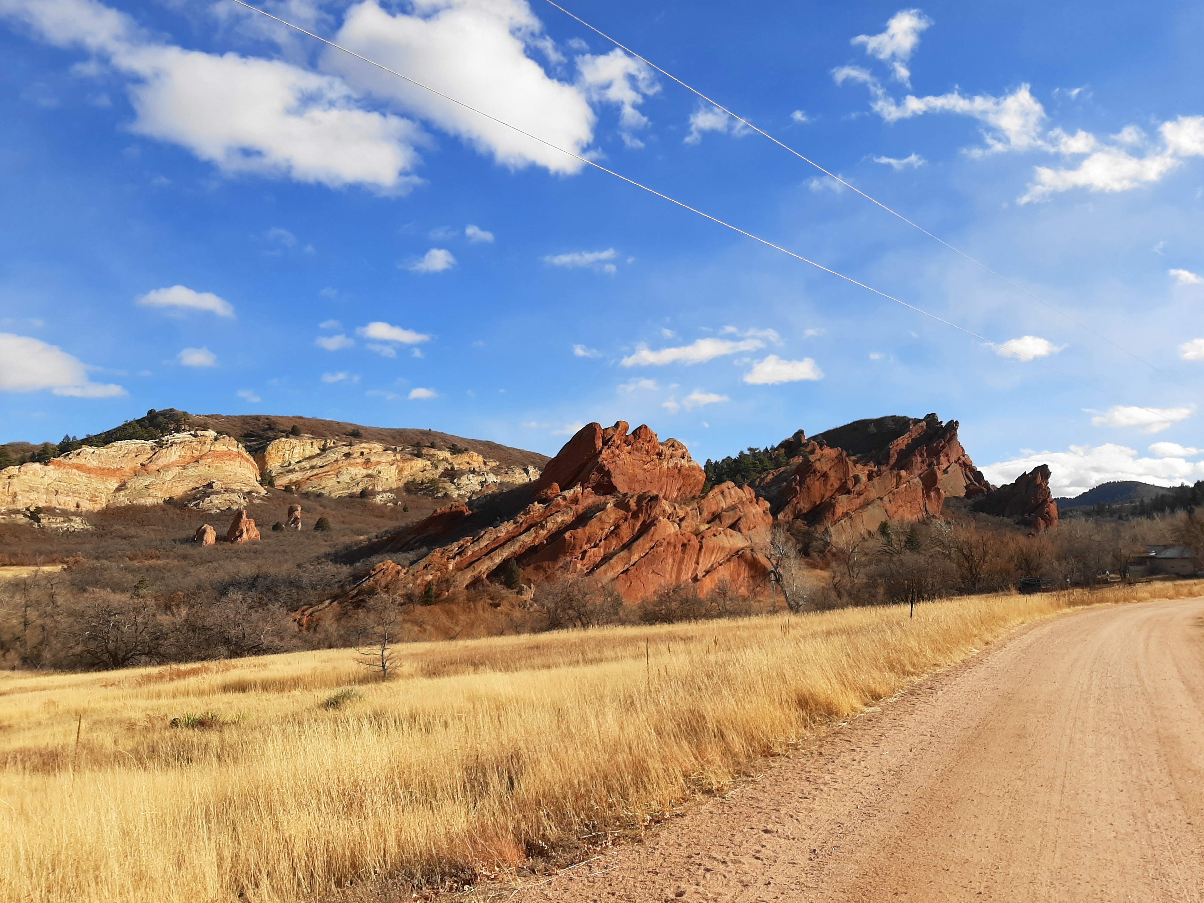
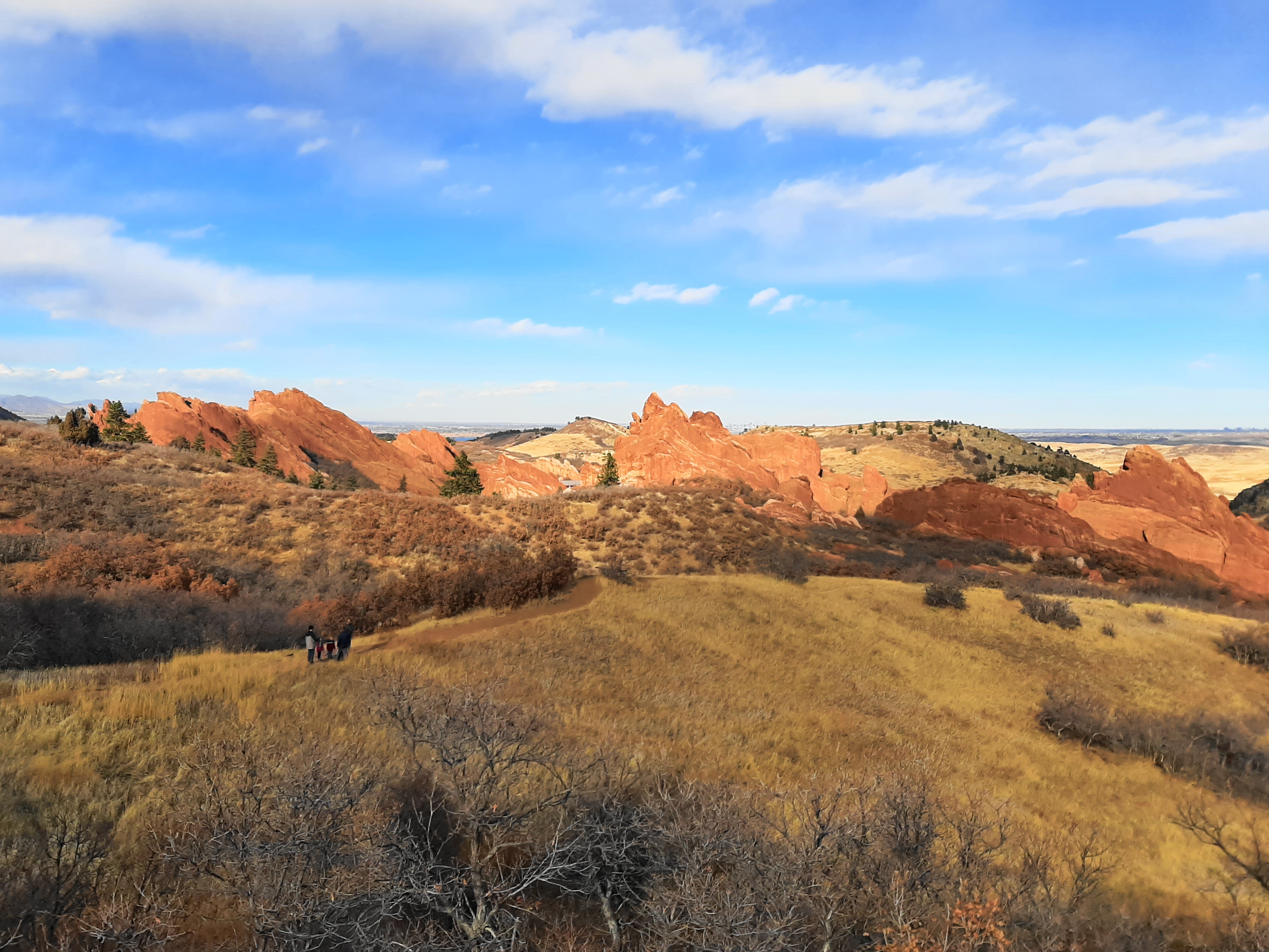
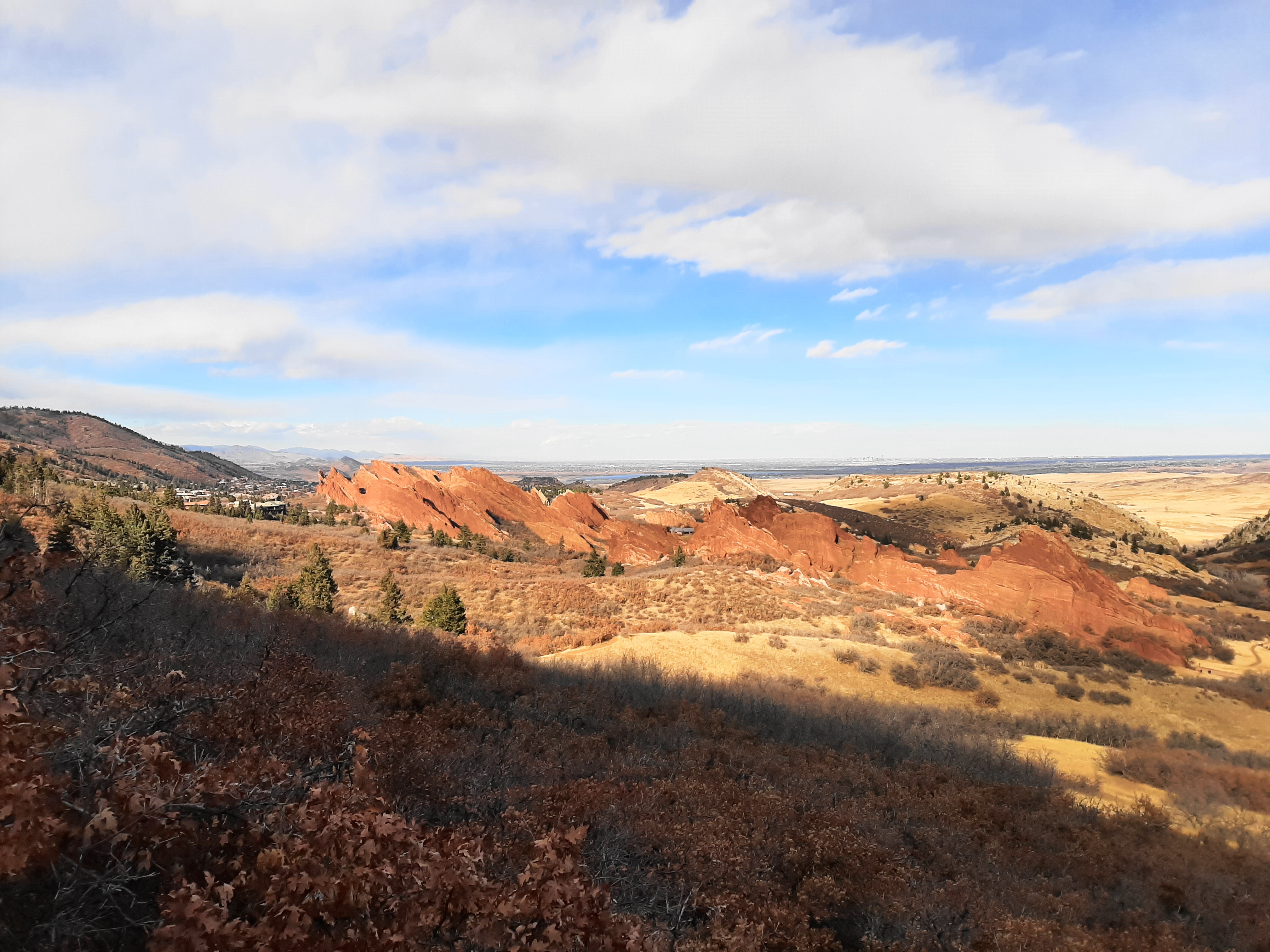
The primary attraction of Roxborough State Park—situated at the edge of the Front Range to the southwest of Denver, Colorado—is a stunning collection of red-hued sandstone outcrops, rising from the earth at a roughly 60 degree angle and stretching for more than two miles north to south. Here the slanted fins and monoliths serve as one of the area’s best examples of the Fountain Formation (see also nearby Red Rocks Park), a sedimentary layer deposited more than 300 million years ago, punctuating the otherwise gray, brown, and yellow foothills of the Colorado Rockies. While visitors can get an up-close view of the tilted sandstone from the park’s Fountain Valley or South Rim Trails, perhaps the most rewarding view comes from the summit of Carpenter Peak (7,160 feet). From here the entire range of the stony fins can be admired from 1,000 feet above the valley, in addition to expansive views of the Front Range and the Denver metropolis. The hike to Carpenter Peak is a moderately challenging half-day hike and, barring recent ice and snowfall, is usually accessible year-round.


The hike
Begin the hike from the Roxborough State Park Visitor Center, a short walk from the final parking area at the end of Roxborough Drive. (Note: There is a $10 vehicle fee per day to enter the park.) The sandstone outcrops of the Fountain Formation are visible immediately from the Visitor Center; here visitors are in the bowl of a small valley wedged between the fins and a sandstone and shale ridgeline called the Hogback, which forms the easternmost edge of the foothills. Mixed in are shades of orange and yellow rock comprising the Lyons sandstone, Lykins Formation, and Morrison shale. By the time hikers reach Carpenter Peak, they will have transitioned from the sedimentary bedrock to the igneous mountains, composed here of granite and gneiss.

After situating oneself at the Visitor Center, bear west on the well-marked Willow Creek Trail, an oft-trodden track that quickly veers south and passes under a canopy of Gambel oaks. The relatively level trail reaches an open grassland after about 250 yards, offering a look east to a slanted cut in the Hogback through which Roxborough Drive travels. Thereafter the trail climbs mildly, interrupted by brief downhills, and reaches a junction at 0.45 miles. Leave the Willow Creek Loop behind, instead bearing right on the Carpenter Peak Trail, which hikers will follow all the way to the summit.

After skirting a scrubby slope with more open views across the valley, hikers reach another fork at around the half-mile mark: stay right again as the South Rim Trail veers left. Cross an open grassland in the vicinity of ruddy sandstone monoliths and cross a gravel road, following the onward path up a short staircase. Stay right again at the intersection with a new path (as of 2021, it was hand-drawn on the Roxborough SP maps!) called the Bear Canyon Trail.
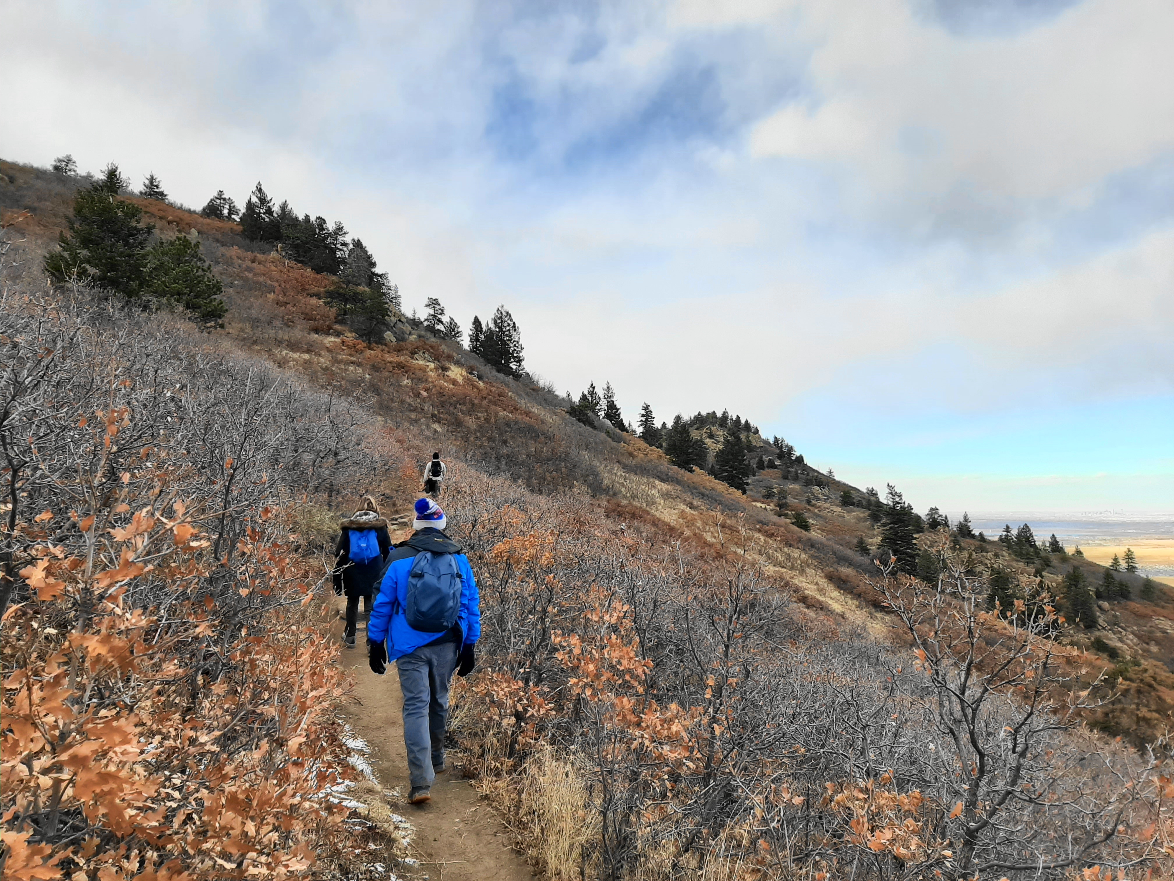
From here the ascent begins in earnest, with hikers having to mount occasionally steep steps as the landscape transitions from mixed grass prairie to scrubby hillslopes. After bearing southward, hikers reach a ridgetop with a short spur left to a magnificent viewpoint at 0.85 miles. From here one can admire the protruding sandstone outcrops to the north and south, with the striated Lyons sandstone and Hogback beyond.
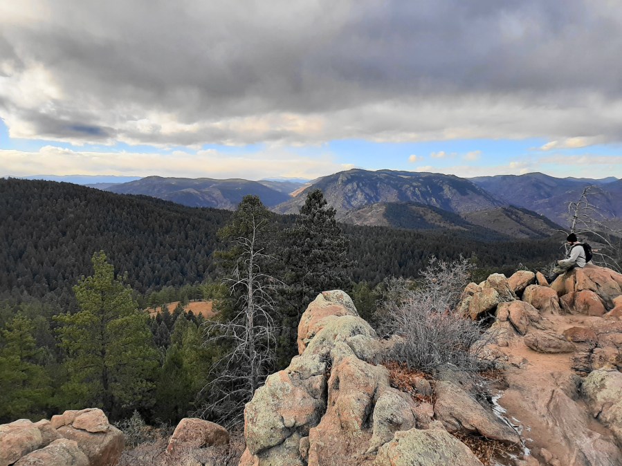
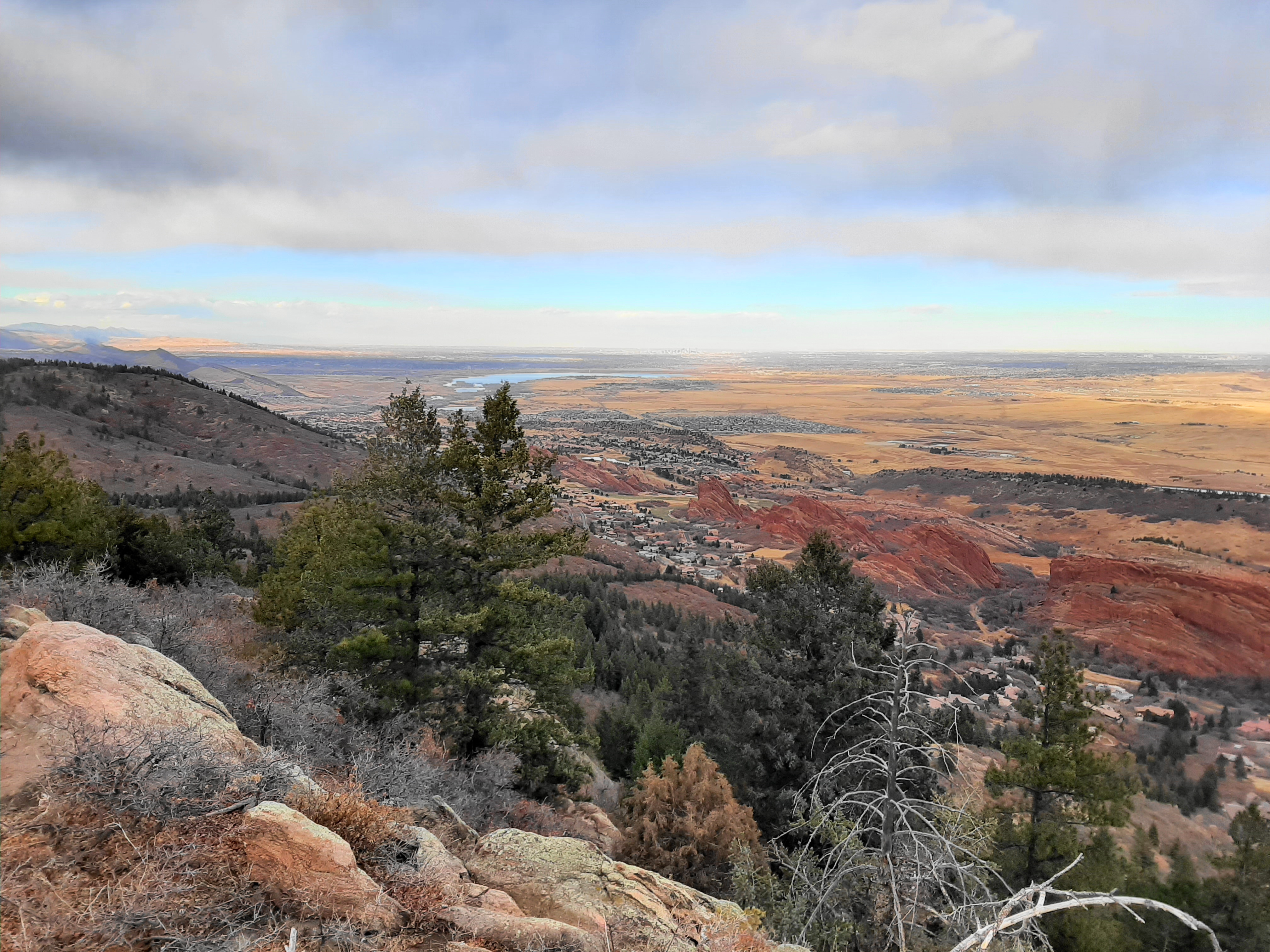
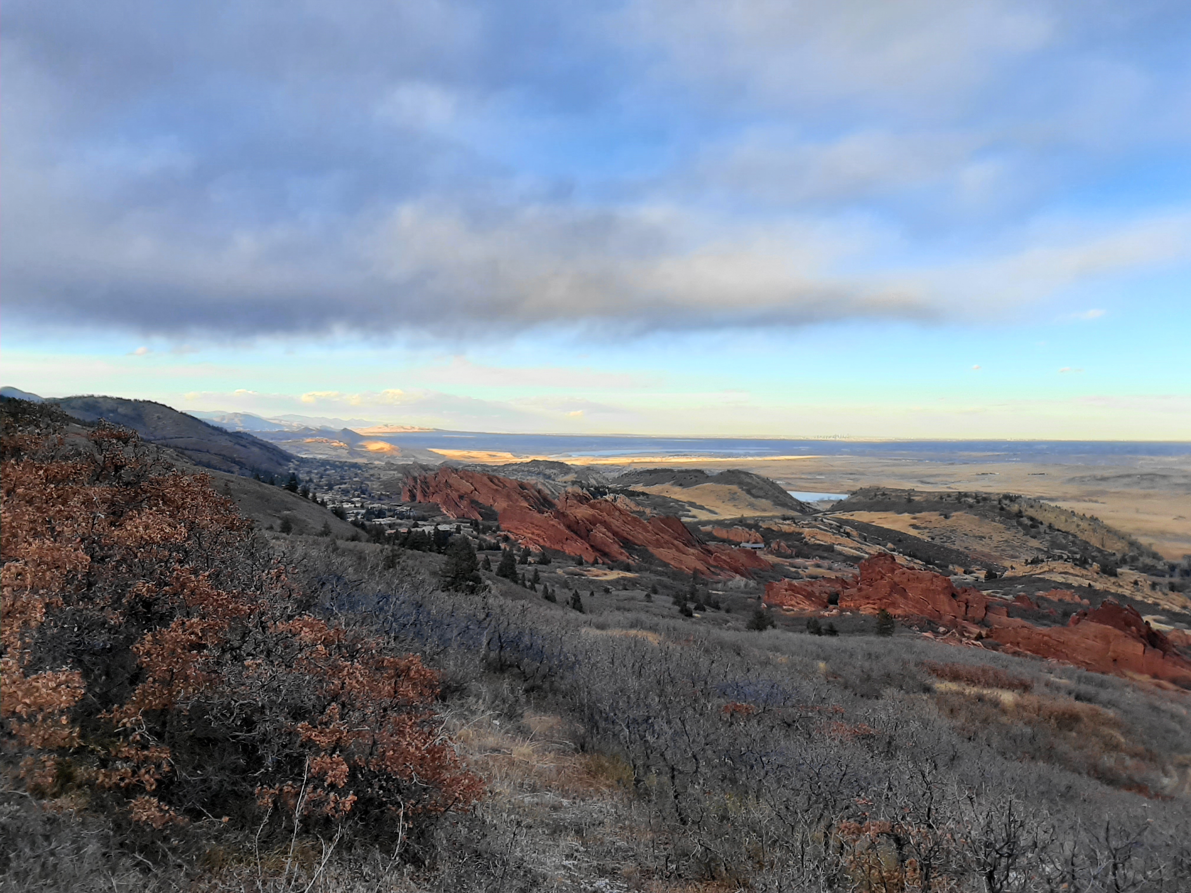
From the vista point, the Carpenter Peak Trail continues on a largely southward trajectory but does so through a series of bends and switchbacks that bring hikers higher and higher. At 1.25 miles, hikers skirt a pine-studded ravine and pass a bench on the left, after which the trail rises through an open section with the most expansive views yet. Beyond the Hogback, one can spot the skyscrapers of downtown Denver in the distance, as well as the blue waters of Chatfield Reservoir.

At about 1.5 miles, the ascending trail reaches its southernmost point, a sharp right-hand switchback that cuts back to the north before settling into a westward traverse. After reentering the shade of the conifers, the Carpenter Peak Trail intersects with the start of the Elk Valley Trail at 1.75 miles. Stay right, continuing uphill mildly as the trail hugs a north-facing slope.

At around two miles, the trail crests a ridgeline with low shrubs and the first good view of the Carpenter Peak summit, ahead to the north. Before reaching the peak, however, the trail must drop to clear a lengthy gully, descending to a pleasant flat section before turning northward again. As the trail ascends a modest incline, the trail passes two alternative summits off to the west—both in fact are higher than Carpenter Peak but not nearly as scenic.

After a lengthy approach, the trail finally reaches a junction at 3.1 miles, where hikers should follow a spur heading right to the summit. The final 1/10 mile ascends some stony steps and ends at a jumble of granite and gneiss outcrops—the summit of Carpenter Peak.

Peering out from the outcrops, hikers are rewarded with panoramic views—not just east and north to Denver and Roxborough but also westward across Waterton Canyon and toward Mount Evans. The landscape to the west is considerably more vegetated, with tall pines blanketing the hills, a contrast to the scrubby, windswept slope of the Front Range’s east side.

After enjoying the views at the peak, return the way you came—or continue north from the spur junction to form a bonus circuit that combines the Powerline and Elk Valley Trails, adding about two miles to the round-trip. If taking the out-and-back, expect to spend 3-5 hours in total to complete this satisfying Front Range hike.

This is such a good hike. You had really good lighting it looks like; the red in the rocks really pops out I’m your photos!
I think you have a typo this park is in Colorado (CO) not CA!
Oops yes. I have corrected it!
Pingback: Carpenter Peak Trail (Roxborough State Park, CO) - justaglobe.com