

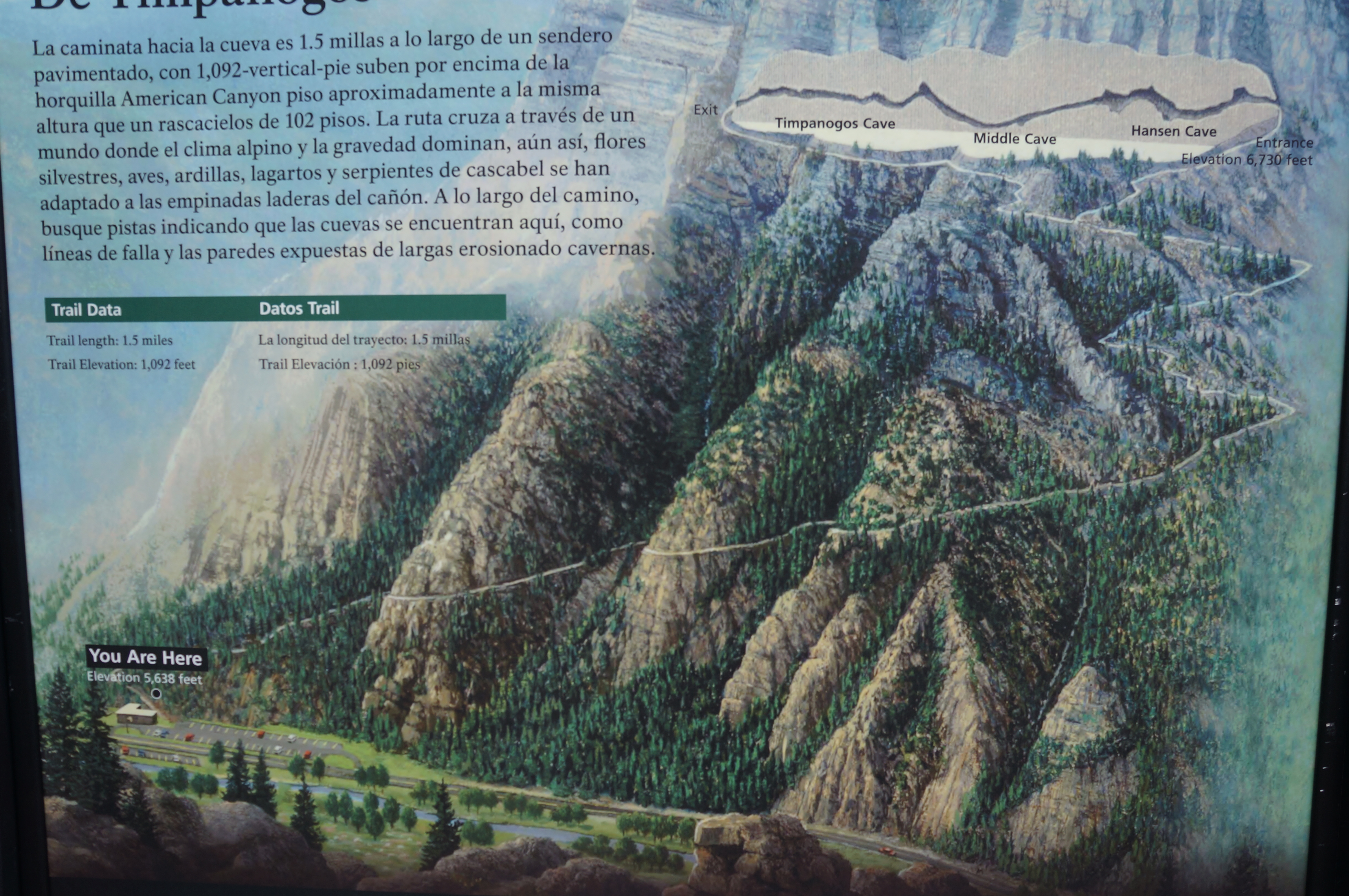
Nestled high above American Fork Canyon in northern Utah’s Wasatch Range, three limestone caves—connected today by man-made tunnels—are the prime attractions of Timpanogos Cave National Monument, a popular park in the Salt Lake City/Provo area. Discovered around the turn of the 20th century, the three caves were placed under federal protection in 1922 and can now be explored as part of an hour-long guided cave tour. But there is a hitch: not only are reservations often required to secure your spot on the tour, but reaching the cave system requires a 1.4-mile one-way hike, gaining nearly 1,100 feet in elevation. At the end of the trail, hikers are greeted by a park ranger, who regulates timed entry to the three caves.
While the hot daytime temperatures and relentless ascent leave many visitors sweating and out of breath, entry to the marvelous caves gives hikers new life: inside is a cool (average 45 degrees) and wet wonderland of colorful stalactites, stalagmites, flowstone, cave popcorn, and many other common features of a limestone cavern environment. The ranger-guided tours are informative and well worth the price of admission ($12), and the out-and-back trail includes outstanding views down American Fork Canyon to Utah Valley. Budget at least 3-3.5 hours for the round-trip journey, including the cave tour.

The hike
Timpanogos Cave National Monument is a short drive from the major metropolis of Salt Lake City and nearby Provo and located about two miles up the popular drive known as the Alpine Loop Scenic Byway. Entering from the west, visitors heading only to the cave can bypass the entrance station at the mouth of American Fork Canyon. (Note: However, visitors who seek to recreate elsewhere along the 20-mile drive should pay the $6 entrance fee—or present an America the Beautiful national park pass.) Parking at the monument can be tight, but the steady flow of visitors in and out of the area generally yields availability most of the day.
Visitors without a cave tour reservation can try to acquire one at the Visitor Center, while all others can present their online tickets via smartphone at the base of the Timpanogos Cave Trail. Hikers have 1 ½ hours to complete the 1.4-mile trail to the cave entrance (the start time on your ticket denotes when one should begin hiking), which should be plenty of time for most visitors. Being a very popular trail for visitors of all ages, there are several benches and “fitness checkpoints” along the way to assist with the challenging climb. The path is also paved and without steps the entire way—but the significant incline prevents the Timpanogos Cave Trail from being wheelchair-accessible.
Before departing, check in with the ranger outside for a security briefing, in which visitors are encouraged to bring plenty of water and to be on the lookout for rattlesnakes and rockfalls. The latter are a common occurrence along the route: look for yellow and red lines lining the middle of the trail, marking sections where you should not stop and congregate due to heightened rockfall risk.
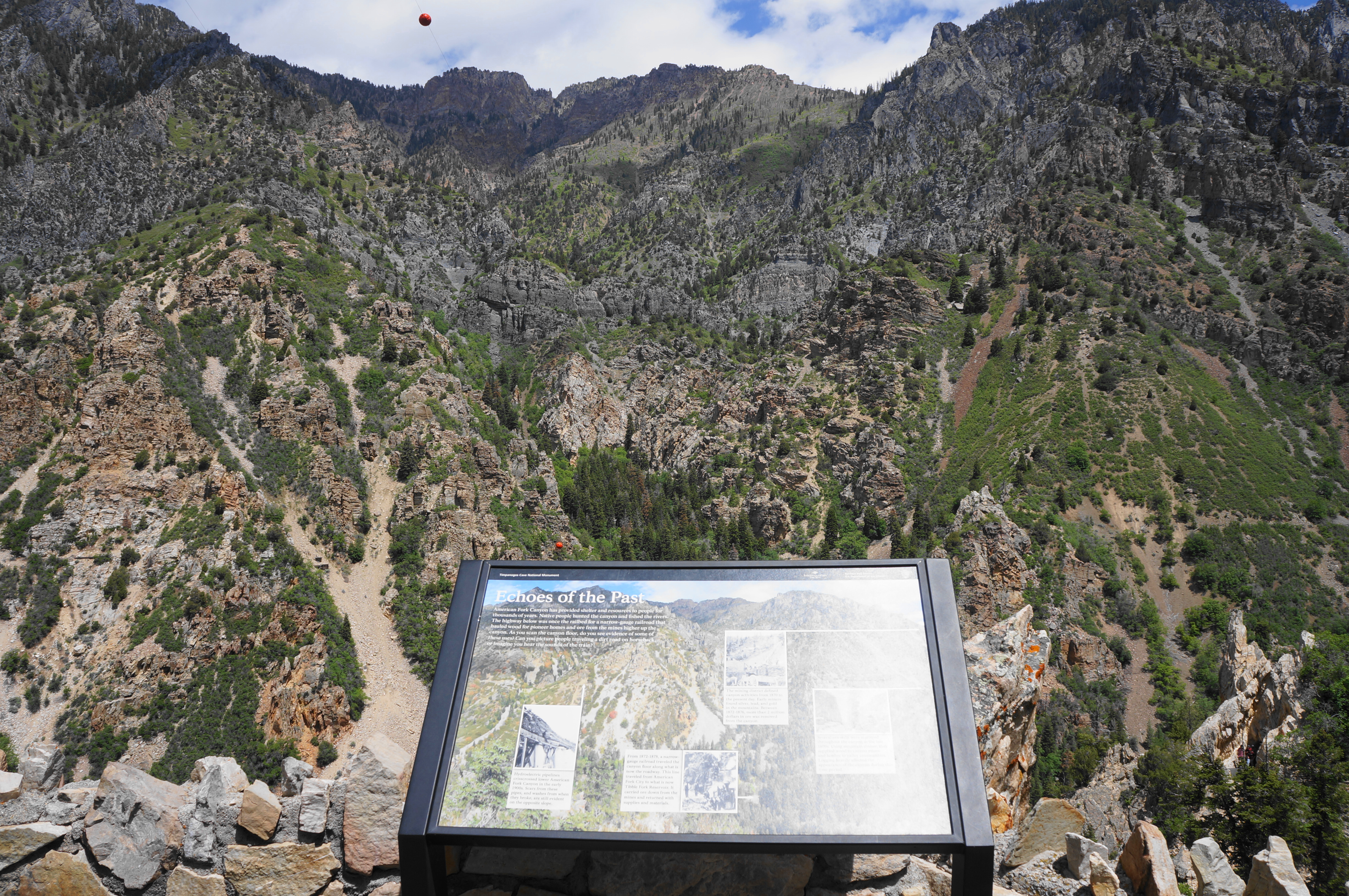
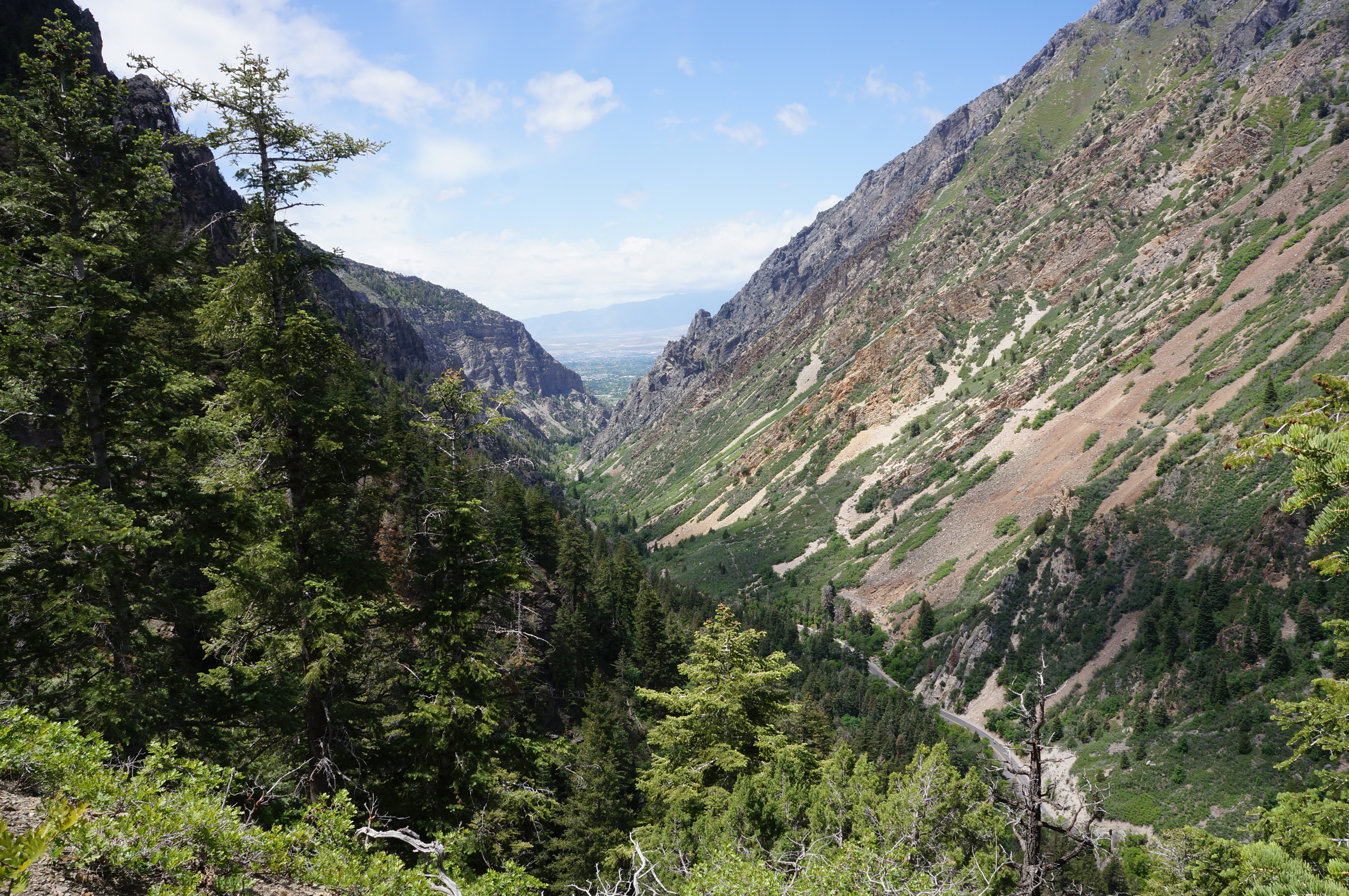
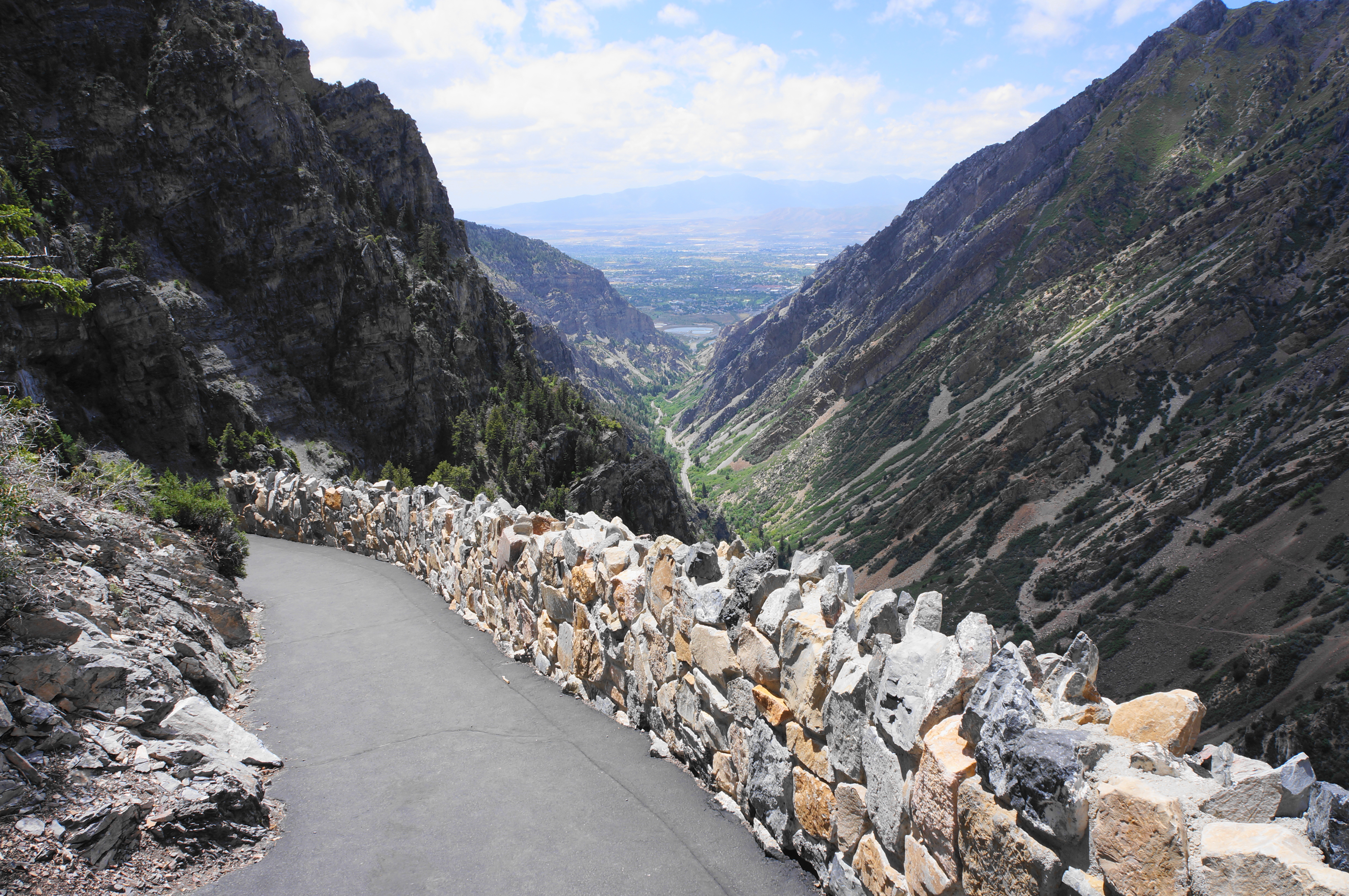
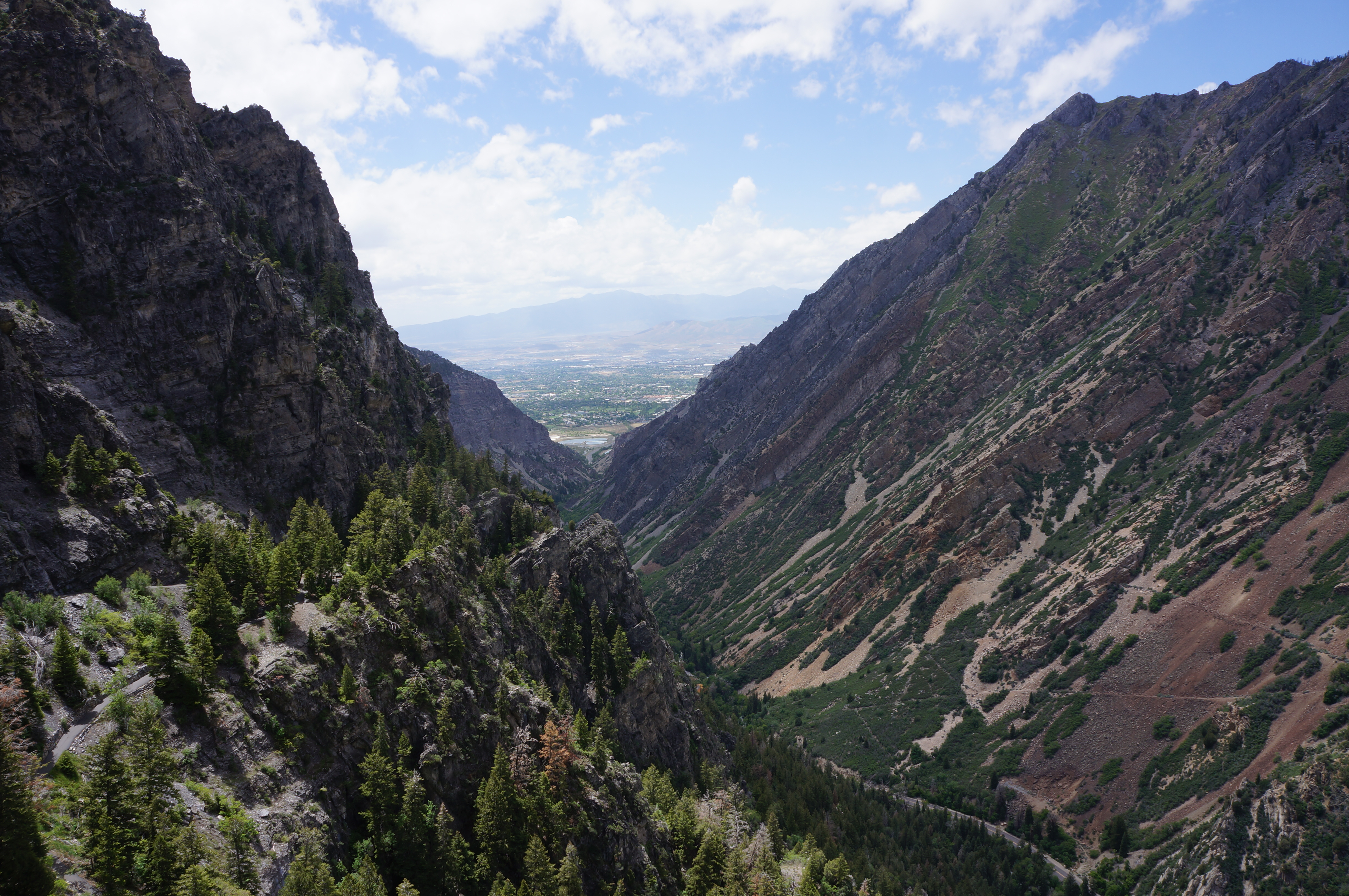
The frequent crowds—including both cave tourists and locals who use the hike as a regular fitness challenge—make the Timpanogos Cave Trail far from a solitary experience. But the nature around you is splendid: the hike ascends through more than a half-dozen rock layers, and the ubiquitous flora—including Douglas fir, Boxelder maple, Rocky Mountain juniper, and Gambel oak—provide some decent shade even on a hot day. The views down into American Fork Canyon and Utah Valley improve as you climb, with several nice overlooks along the way.
Timpanogos Cave Trail (1.4 mi. to cave entrance)
The trail to the caves begins past the hike information sign, ringing the parking lot for a short while before cutting back left and rising through a dense thicket of firs. After a second switchback, the route settles into its westerly tread and rises alongside the first of several rockfalls—don’t stop during the sections marked by red and yellow lines, painted onto the asphalted trail. The beginnings of the hike lie in the multihued rock layer known as the Mutual Formation, an amalgam of sandstones, shales, and quartzite deposited some 600 million years ago. Just past the first apparent rock slide (hemmed in by a retaining wall), hikers pass under a black and orange cliff that is characteristic of this layer.

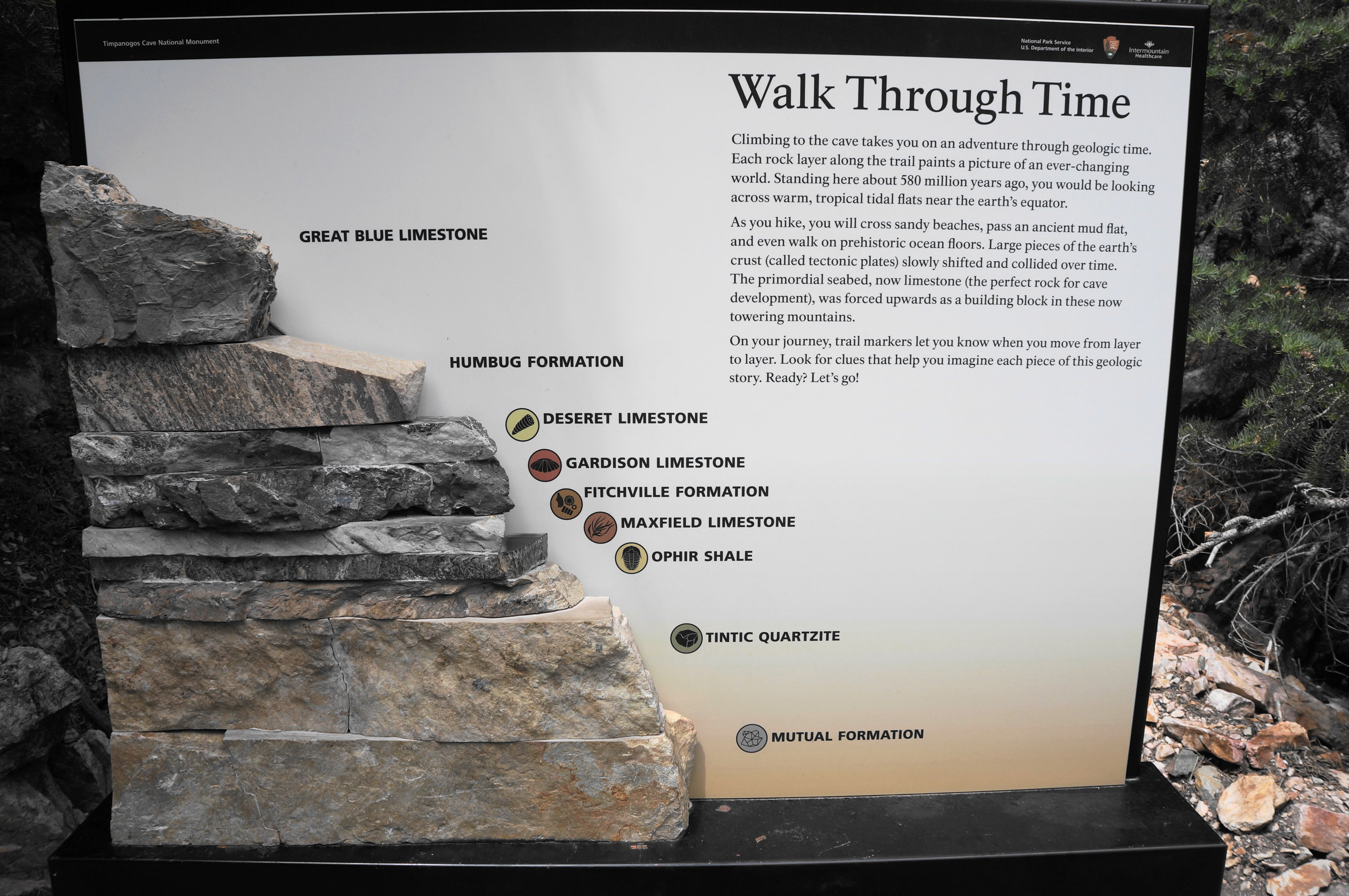
At about 2/10 mile, hikers reach the first of several “fitness checkpoints,” spots to stop for a drink of water or perhaps rest on a trailside bench. From here the path immediately courses around a left-hand bend. A minute later, the route cuts left again at a hairpin turn, and an information wayside discusses the local geology, outlining the nine rock layers that compose this section of the broader Mount Timpanogos (11,752’), a behemoth that is the ninth-highest peak in Utah and second-highest in the Wasatch Range.
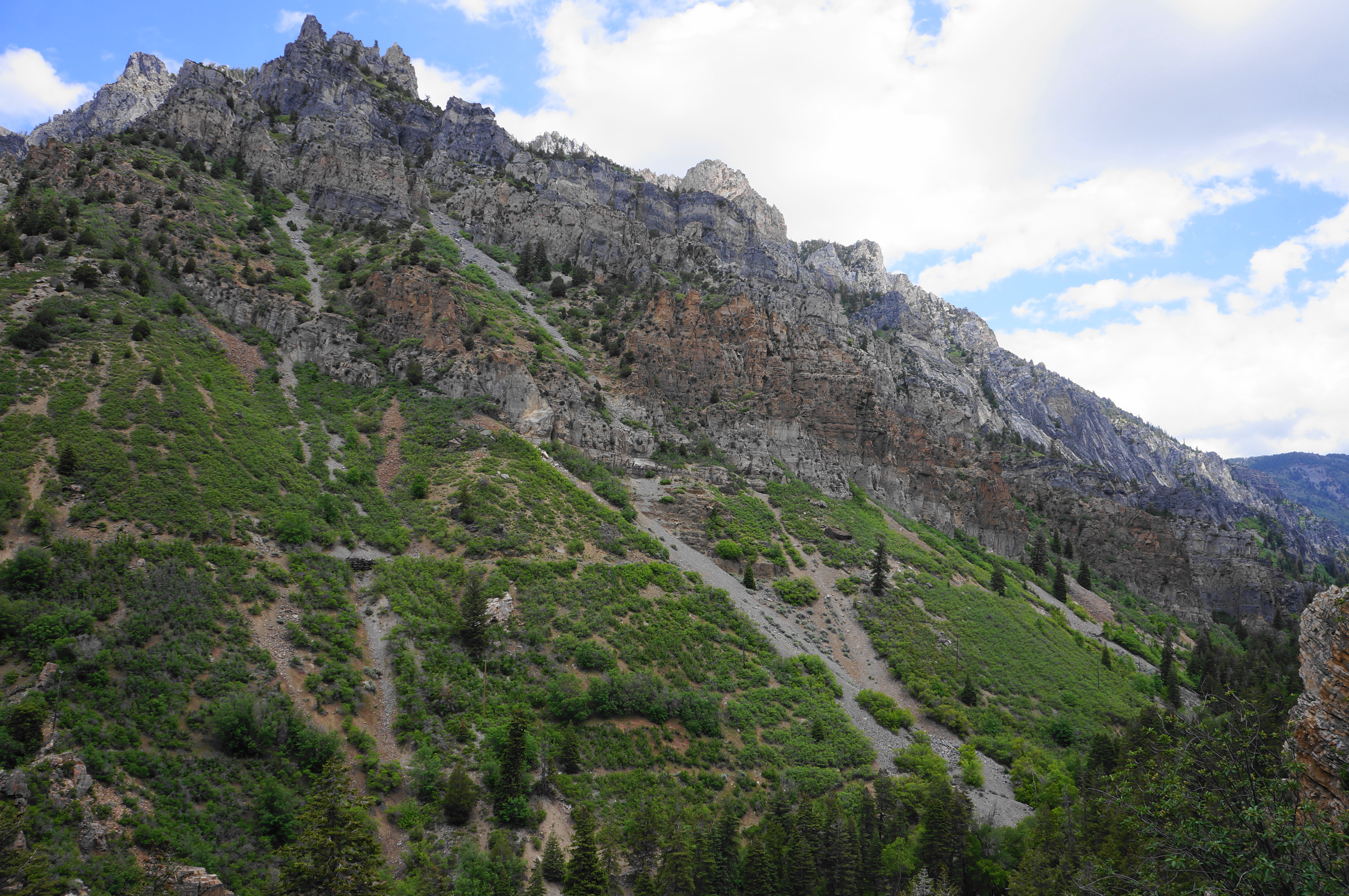
From here the trail proceeds up a right-hand switchback, then edges along rock faces to the first of two tunnels, at about 4/10 mile. A few steps beyond, there is a bench and a nice overlook with views down American Fork Canyon toward Utah Valley and Provo. Hikers are now about one-quarter of the way to the cave entrance.
Soon the Timpanogos Cave Trail leaves the Mutual Formation behind and rises into the Tintic Quartzite, a largely chalky-colored layer composed of sand deposited along a shallow sea around 540 million years ago.
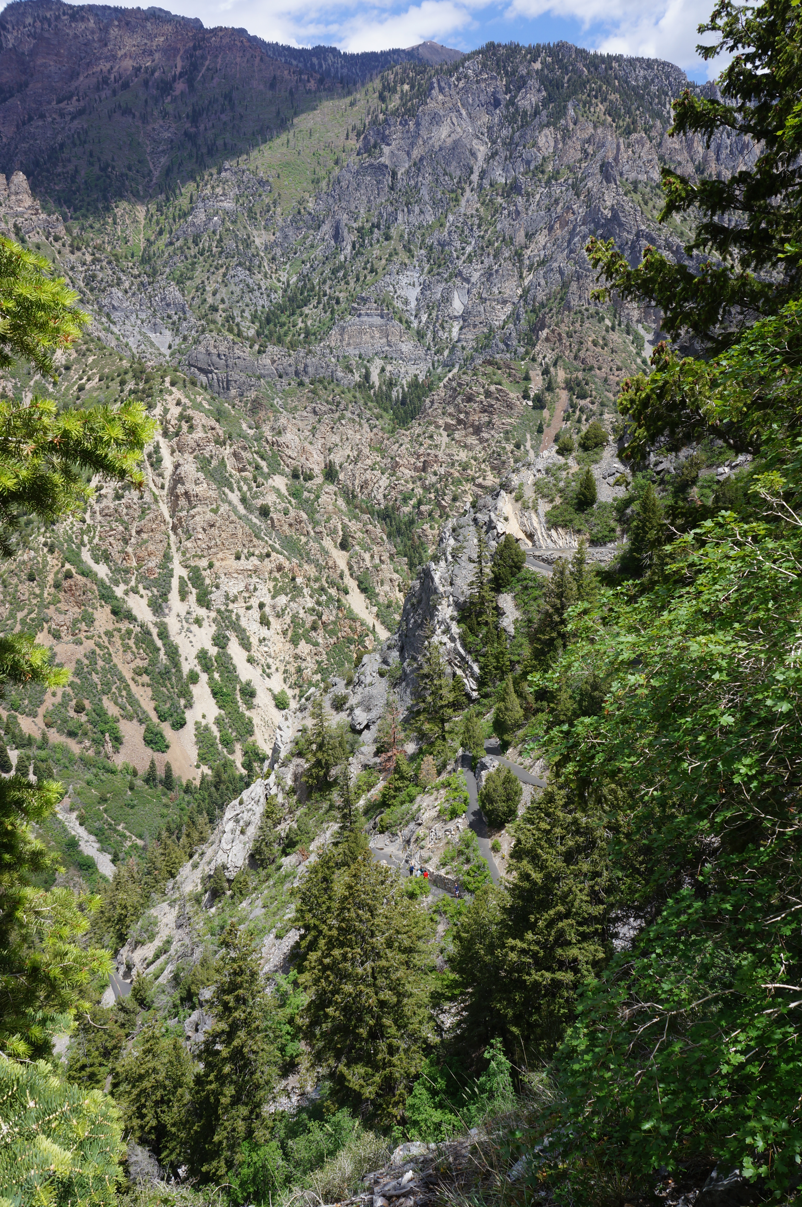
Pass through a second tunnel at around ½ mile, then take in the view at the overlook with two waysides—one on past mining and another on the slanted quartzite cliffs. One can see the remains of old mining roads and structures along the opposite wall of the canyon. Many of the early European settlers of the area sought to tap the various ores of the Wasatch Range, although the difficulty of transport stunted the emergence of large mining operations.
The views improve as the trail rises further, weaving in and out of steep drainages and approaching the second “fitness checkpoint” at 6/10 mile. From here the trail enters the Ophir Formation, a grayish layer of siltstone and shale. After passing under a high rock wall of Ophir, the bedrock changes again, this time to Maxfield Limestone. But this does not last long as the rocks change yet again, settling on the slightly thicker Fitchville Formation. Here there lies an “unconformity”—a break in the geological record where some known layers are conspicuously missing.
It is another 1/10 mile to the next layer—the Gardison Limestone—as well as an abrupt left-hand bend, a bench, and the final “fitness checkpoint.” Hikers are over halfway to the cave entrance by this point.
Thereafter, the Timpanogos Cave Trail ascends five sunny switchbacks and passes the one-mile mark. After a partly exposed section with hand railings (not necessary but available), the trail passes another bench and two additional waysides, including one on local tree varieties. It is a short walk from here to the trail junction at 1.3 miles, where the route from the cave exit comes in from the left. Bear right, continuing up toward the cavern entrance.


Rising ever higher, the onward path rounds two more switchbacks and passes a pit toilet on the left. At some point the trail passes into the Deseret Limestone layer (where the cave is located) and edges upward to a tunnel and finally the covered waiting platform for cave tours. Just beyond is the cave entrance—with a locked door opened only by the rangers—and an area called “The Grotto,” a partly covered area where there is bench seating and a detailed map of the cave system.


Cave Tour (0.3 miles)
Here one waits for the start of the Cave Tour: early arrivers may be able to jump on an earlier tour if available, but the ranger-guided walks are limited to 16 people each. The modern cave entrance is a modest passage, with two steel doors, situated just under the oblong-shaped natural entrance above. The first small room, where attendees are given a short security briefing again (the upshot: don’t touch anything in the caves!), is the most likely spot to view Townsend’s Big Eared Bats, the local variety of Chiroptera (but don’t count it – sightings are relatively rare).

After shutting a second door behind you, the tour makes a brief foray through Hansen Cave, which was the first of the three caves discovered. Mormon pioneer and local logger Martin Hansen discovered the cave while following mountain lions tracks in October 1887; he went on to explore the length of the cave and offered tours of the site for a handful of years before they were no longer profitable.
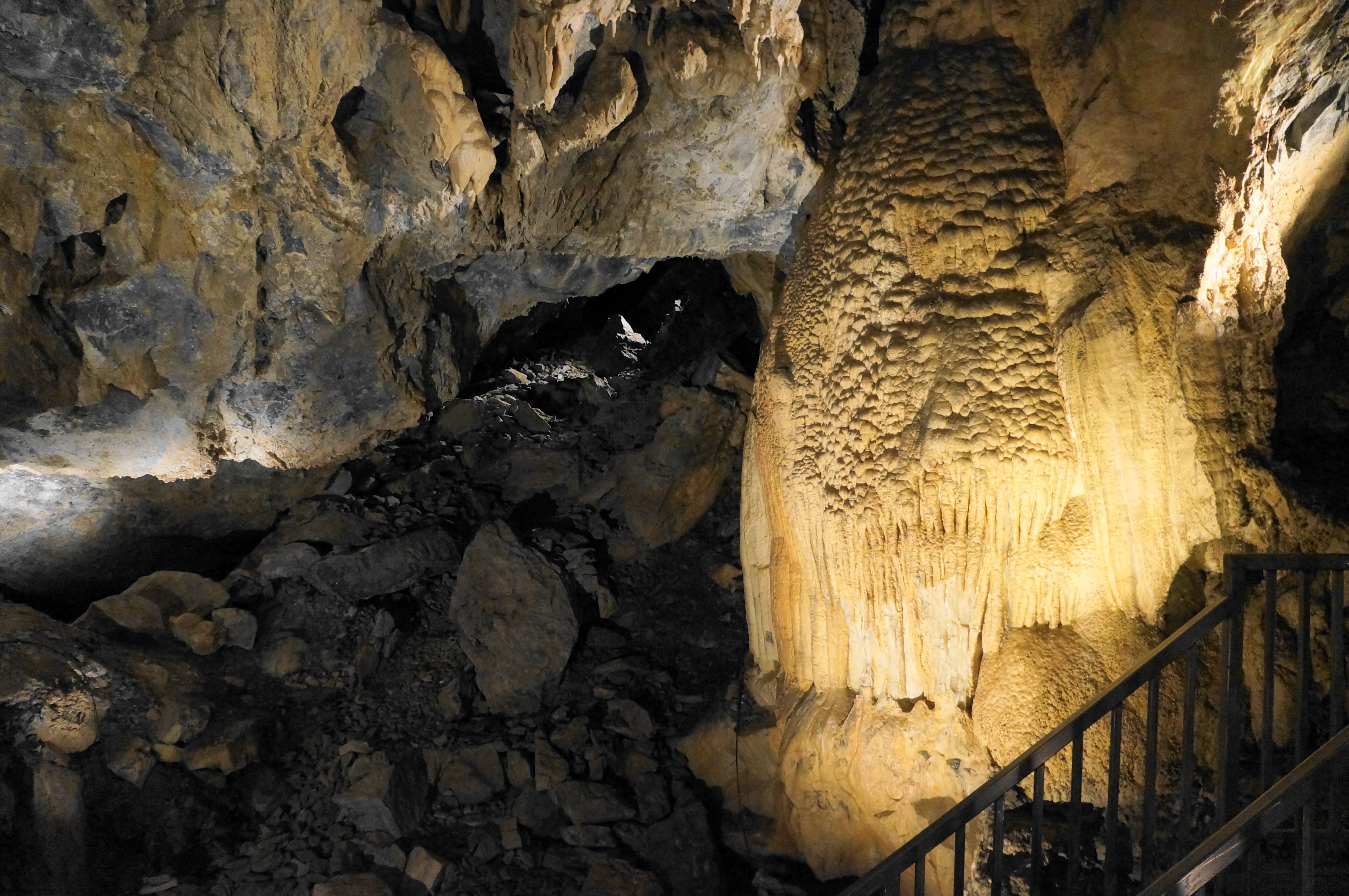
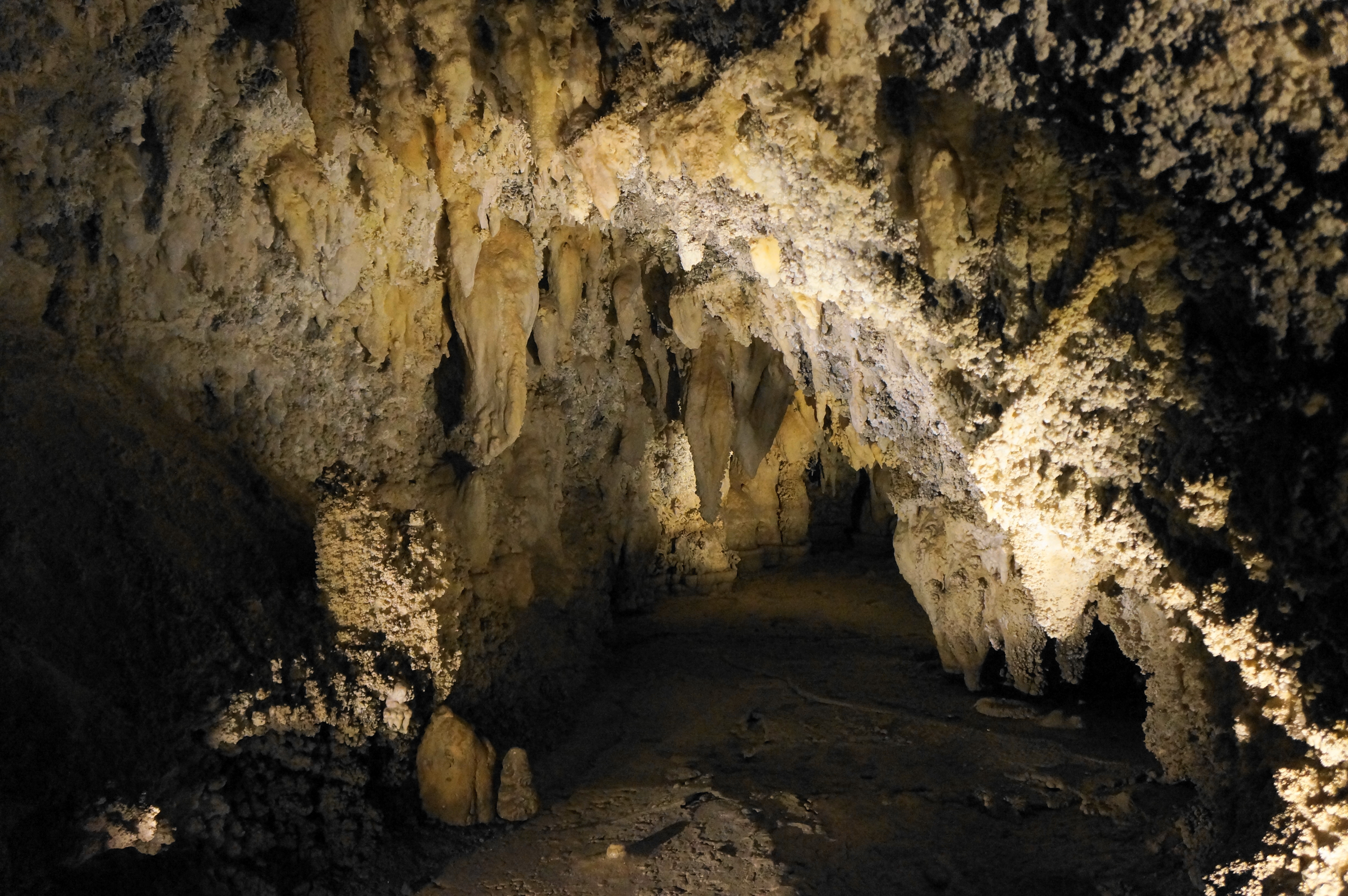
The cave runs west from here for about a football field’s length, but the standard tour covers only a portion of it. The entry chamber, known as the Organ Pipe Room, features a relatively high ceiling and nice examples of flowstone—a calcite-studded terrace formed from water running through the cavern’s mineral deposits.
Time in Hansen Cave is very brief, with visitors quickly ushered through a set of doors marking the transition into the next cave. Given the close proximity of Hansen, Middle, and Timpanogos Caves (and awkward natural entrances of the three caverns), the National Park Service found it easier to connect them via man-made tunnels.
The tunnel eventually gives way to a long but narrow passage that is entirely natural, the result of a fault line running through Middle Cave, the second cavern on the hike. Duck your head as the protruding cave walls ebb and flow, and then pass over a shallow pool known as Middle Cave Lake.
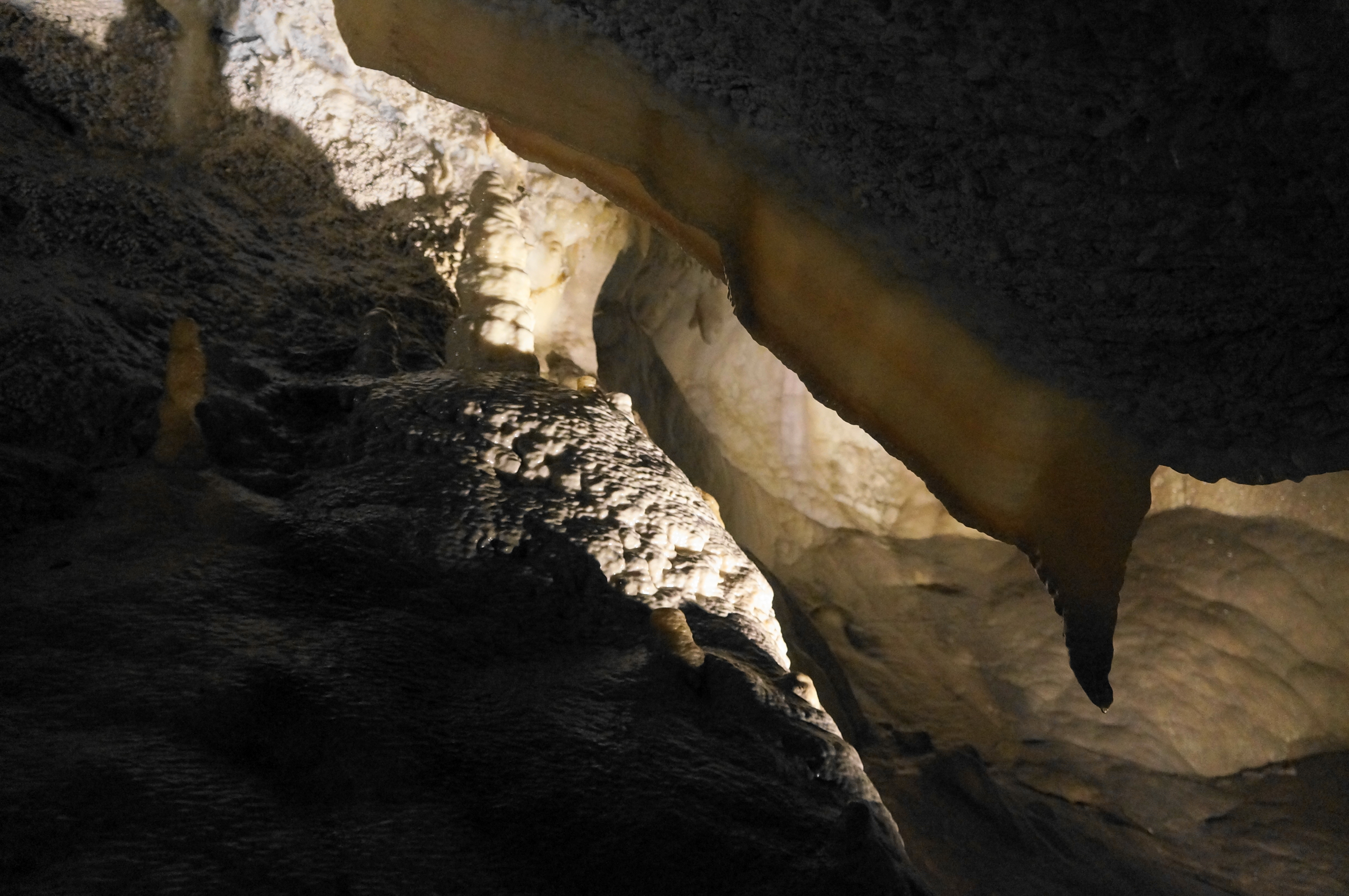
Several smaller examples of stalactites, stalagmites, and columns can be found in Middle Cave, but the headliner is the aptly-named Big Room, where the tour stops for a decent while. Here the calcite walls erupt in an elaborate display of flowstone.


Adjacent to the Big Room is another area called Coral Gardens, which features impressive stalactites and extensive cave popcorn. The smooth surface of the floor is evidence of a recently-dried pool.


After Coral Gardens, the tour proceeds downhill through two doors and the Timpanogos Tunnel, another man-made passage connecting Middle Cave with the largest and most impressive Timpanogos Cave. This final cave was first discovered in 1913—but quickly lost again, only to be “rediscovered” again in 1921. The discovery helped advance efforts at preservation, leading to the designation of Timpanogos Cave National Monument in 1922.


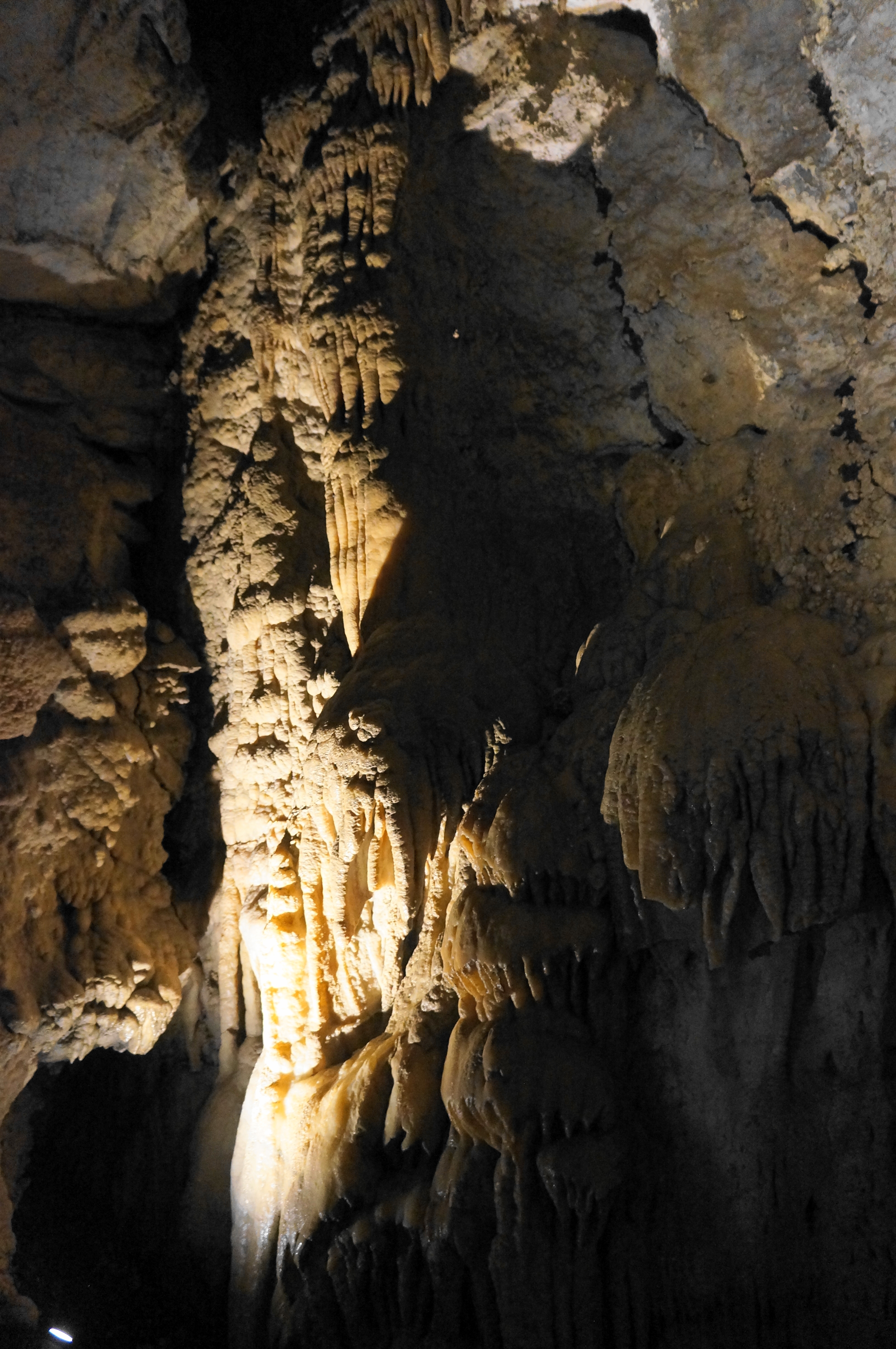
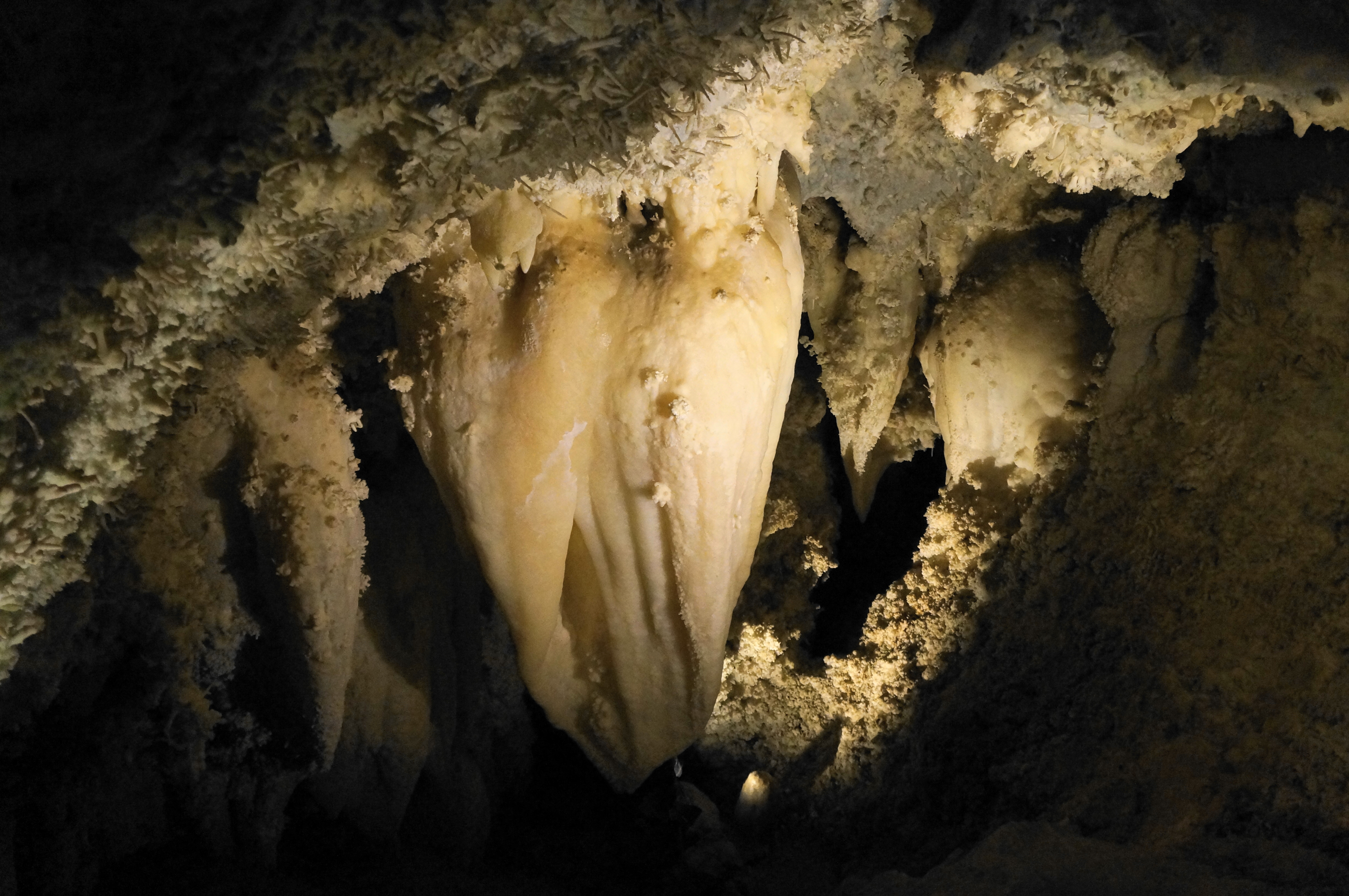
After exiting the tunnel and entering Timpanogos Cave, hikers are greeted by many stalactites, including one likened to a chipped tooth, where the base has clearly broken off. After traversing another pool (called Hidden Lake), the route climbs an initial set of stairs and passes perhaps the most famous attraction in the caves: a multi-ton stalactite—largest in the monument—known as the Great Heart of Timpanogos.
Just beyond, the trail splits, with tours taking a brief detour left before returning to the junction and proceeding up the staircase ahead. The diversion culminates at the Chimes Chamber, a diverse room featuring many different cave formations, including draperies (a.k.a. “cave bacon,” stalactites, stalagmites, cave popcorn, and wily, delicate features known as helictites.

From Chimes Chamber, tour participants will retrace their steps and return to the junction, then bear left and climb a staircase until reaching the Camel Room, named for an outcrop that looks a bit like the animal. There are also some nice stalactites and columns in the chamber.

From here the route rises again and then drops down a staircase with tight passages, skirting two flowstone features known as the Cascade of Energy and Caramel Falls, the latter appearing to ooze with a brownish sludge.

Thereafter the remaining portions of the cave are relatively narrow tunnels (with several limestone protrusions seemingly perfectly placed to bang you in the head). Just before exiting the cave, hikers can look right to see the natural entrance to Timpanogos Cave. Upon exiting a final door, visitors are greeted again by the warm sun, although tempered slightly by a shaded pavilion.
Timpanogos Cave Trail (1.5 mi. to Visitor Center)
Now back out in the light, hikers pick up the paved Timpanogos Cave Trail again, this time snaking along ledges and below rock faces until an open area with a few switchbacks and fine views down American Fork Canyon. Enjoy the various overlooks, then proceed back down to the one and only trail junction; here the path merges with the trail up to the cave entrance, and the rest of the hike involves retracing steps from the ascent. This time, however, the going is much easier, with much of the time spent cheering on the much slower uphill hikers.
All told, the stem-and-loop—including the full Timpanogos Cave Trail and the cave tour—clocks in at around 3.2 miles total. The park suggests budgeting at least 3-3.5 hours for the round-trip, although speedy hikers are likely able to complete the entire journey in less time.

Pingback: Timpanogos Falls (Mount Timpanogos Wilderness, UT) | Live and Let Hike
Pingback: Top 10 Hikes in 2022 | Live and Let Hike