
Below the imposing massif of Mount Timpanogos (11,749’)—the second-highest peak in northern Utah’s Wasatch Range—lies a wonderland of aspen groves, cascading streams, and verdant meadows, many of which are a stone’s throw from the popular, 20-mile Alpine Loop Scenic Byway. Ambitious day hikers can set out to tackle Mount Timpanogos (or “Timp” as it is lovingly known) on a strenuous out-and-back hike, while others are likely to be satisfied with a more modest walk amid the impressive scenery in the shadow of the mountain. One such shorter hike is the 2.4-mile out-and-back to Timpanogos Falls, a set of tumbling waterfalls situated near the base of Primrose Cirque, a glacier-carved valley on the east flank of Timp. A moderately difficult ascent leads to a pair of reachable waterfalls, with pleasant views back east toward the North Fork of Provo River and the Sundance area.


The hike
The out-and-back hike follows a portion of the Mount Timpanogos Trail, one of two primary access routes to the summit of the high peak, and begins at the Mount Timpanogos Trailhead (a.k.a. Aspen Grove Trailhead)—a large parking lot situated just inside the eastern entrance station for the Alpine Loop ($6 daily; NPS annual passes accepted). (Note: There are in fact two trails that begin here, including a slightly longer jaunt to nearby Stewart Cascade.)
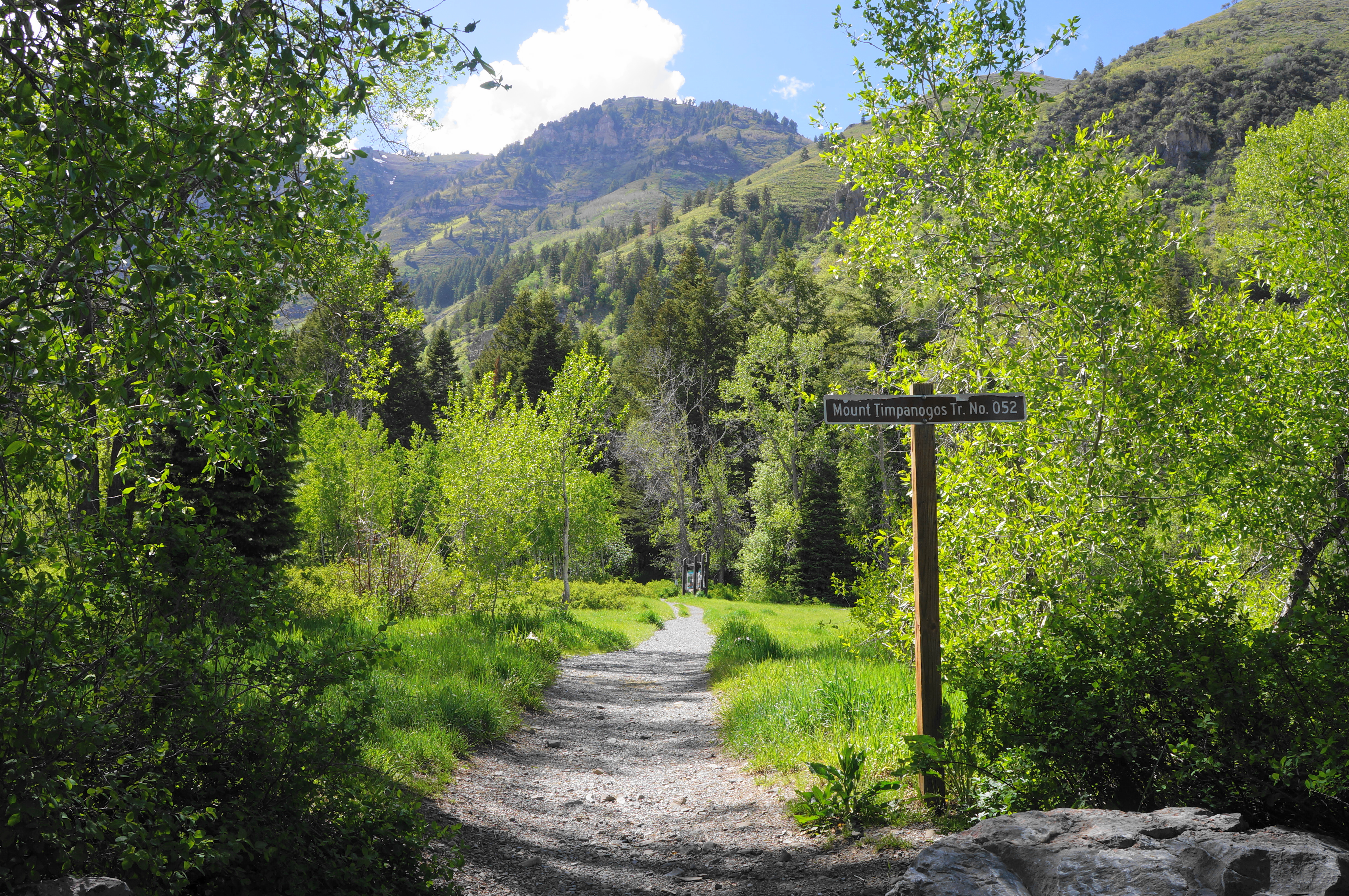
Hikers will find the Mount Timpanogos Trail back near the entry to the parking area: the well-trodden path heads west toward the imposing eastern face of Mount Timpanogos, climbing up a set of steps then traversing a level meadow with open views. Return to the shade as the trail passes a trail map, sign, and TERT station on the right. (Note: TERT stands for Timpanogos Emergency Response Team.)

Continuing through the woods on a wide, graveled trail, hikers will pass under a canopy of maples, Douglas firs, aspens, and others, with the low hum of passing cars gradually becoming more muted off to the right. At 2/10 mile, the route bears right at a trail sign; the trail clearly used to push left, but no longer. Minutes later, hikers will pass a short bridge over a seasonal stream, then push on to a set of two switchbacks, the first notable ascent of the hike.

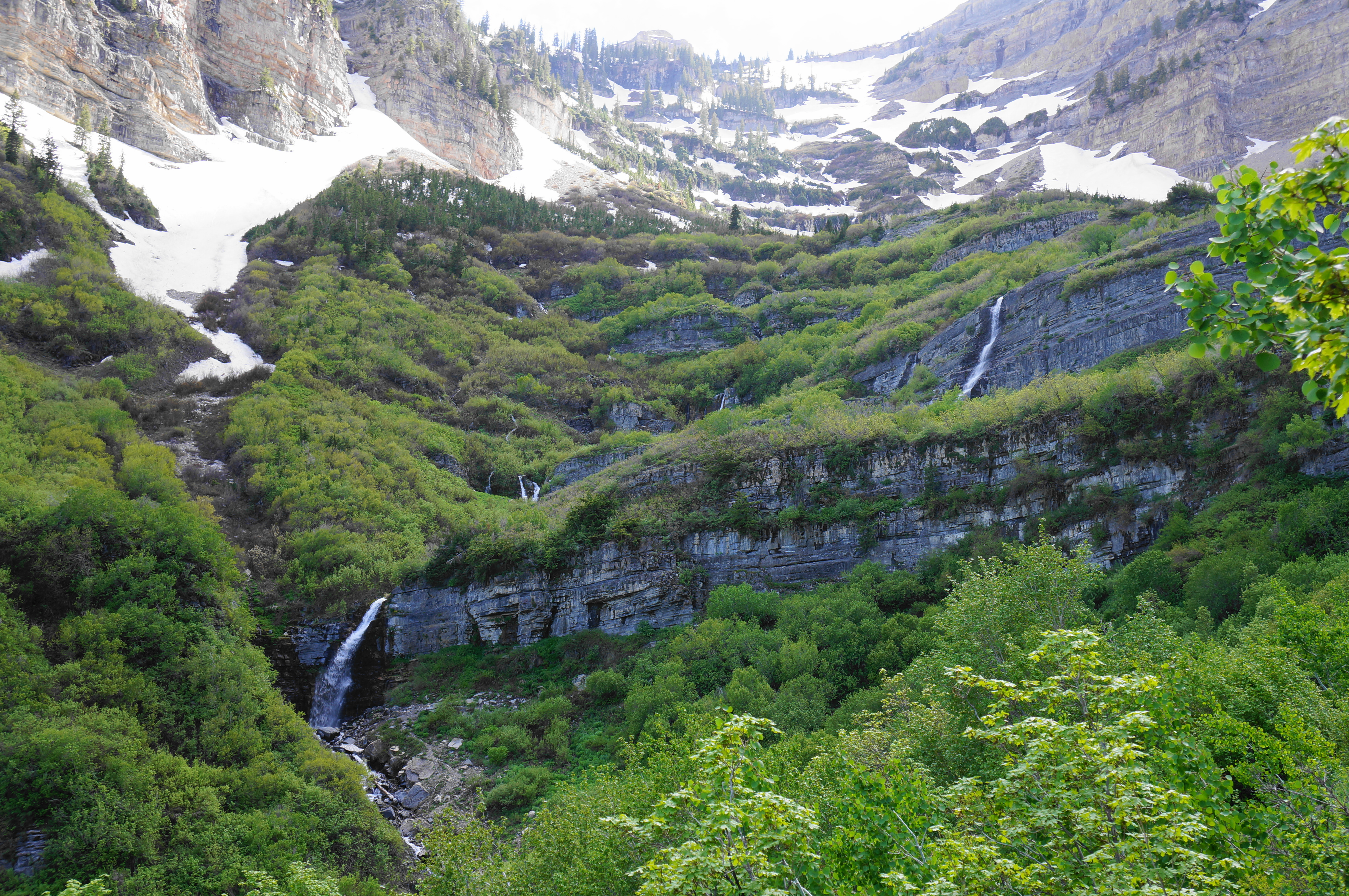
At 0.35 miles, the Mount Timpanogos Trail diverges from the Lame Horse Trail, and visitors should bear left at the junction, quickly entering Mount Timpanogos Wilderness for the first time. Ahead, as the heavy woods recede into thick but petite brush, one can see a series of cliff faces and, at least in spring and early summer, two waterfalls: a tall drop and a shorter, closer tumble downstream. Only the latter of the two, however, is easily accessible from the trail, and the main attraction—what is loosely known as Upper Timpanogos Falls—remains out of sight, tucked behind a bluff, for now. (Note: The Mount Timpanogos Trail continues up above the higher, distant falls, but reaching it would require a significant detour through brush with no discernable trail.)

Curiously, as the trail steadily climbs in the direction of the falls, the dirt path is intermittently replaced with faded asphalt, a reminder of a time when local residents, starting in 1912, completed the annual “Timp Hike”: a summitting tradition that lasted six decades until being discontinued due to trail over-use.
Looking back down Primrose Cirque, hikers can see as far as the North Fork Provo River drainage and North Fork Ridge, with more lowland hills beyond. Just out of view, behind Elk Point to the right, lies the Sundance area—of skiing and film festival lore.

After gaining nearly 600 feet in what feels like a steady but manageable climb, the Mount Timpanogos Trail approaches the lower portion of Timpanogos Falls (sometimes called First Falls) off to the left. By waterfall standards, this is perhaps a mere cascade, but the twisting flow is pleasant enough to warrant a short but steep side trip down to its base.


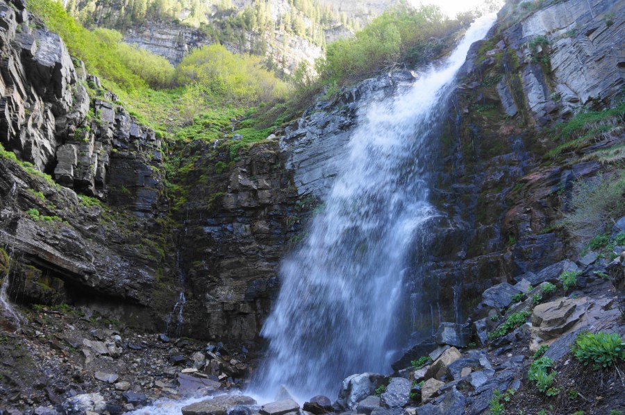
Many hikers turn around here, but it is well worth continuing the extra ¼ mile to the much more impressive upper falls. From the lower falls, the onward trail cuts back northeast, beginning a steady climb that treads away from the creek. But soon enough, after rounding a switchback, the path cuts back west, and Upper Timpanogos Falls comes into view—this higher spray tumbles straight off a cliff and empties into a pool surrounded by steep sides.
After first spotting the falls, it is about 1/10 mile to the base, where hikers can get rather close to the waterfall. The falls are quite impressive, one of the best in northern Utah, and well worth the moderately challenging climb. Once ready, return the way you came—or, if continuing on to Mount Timpanogos, bear right and continue switchbacking up Primrose Cirque to Emerald Lake and the summit.


The 2.4-mile out-and-back to Upper Timpanogos Falls should take most hikers about 1-2 hours and can be combined with some of the area’s other day hikes (such as the trek to Timpanogos Cave) for a nice outing in the Wasatch Range.

Pingback: Top 10 Hikes in 2022 | Live and Let Hike