

Although most famous for its prehistoric fossils, Dinosaur National Monument in northeast Utah and northwest Colorado covers more than 200,000 acres of canyon country that rivals the “Mighty Five” national parks farther south. Here the Green and Yampa Rivers—and their various tributaries—have carved a labyrinth of snaking gorges, narrow slots, and towering cliffs, including many of the same rock sandstone layers found in southern Utah. Entering this network of canyons from the north is the dramatic defile of Jones Hole, which features of one of the best day hikes in the park. From the Jones Hole Fish Hatchery in the north, the 3.5- to 4-mile trail heads down-stream, following the perennial Jones Hole Creek past hidden petroglyphs and minor waterfalls to its confluence with the mighty Green River. It is also worth the short detour around the half-way point to see the modest but pretty Ely Creek Falls.


The hike
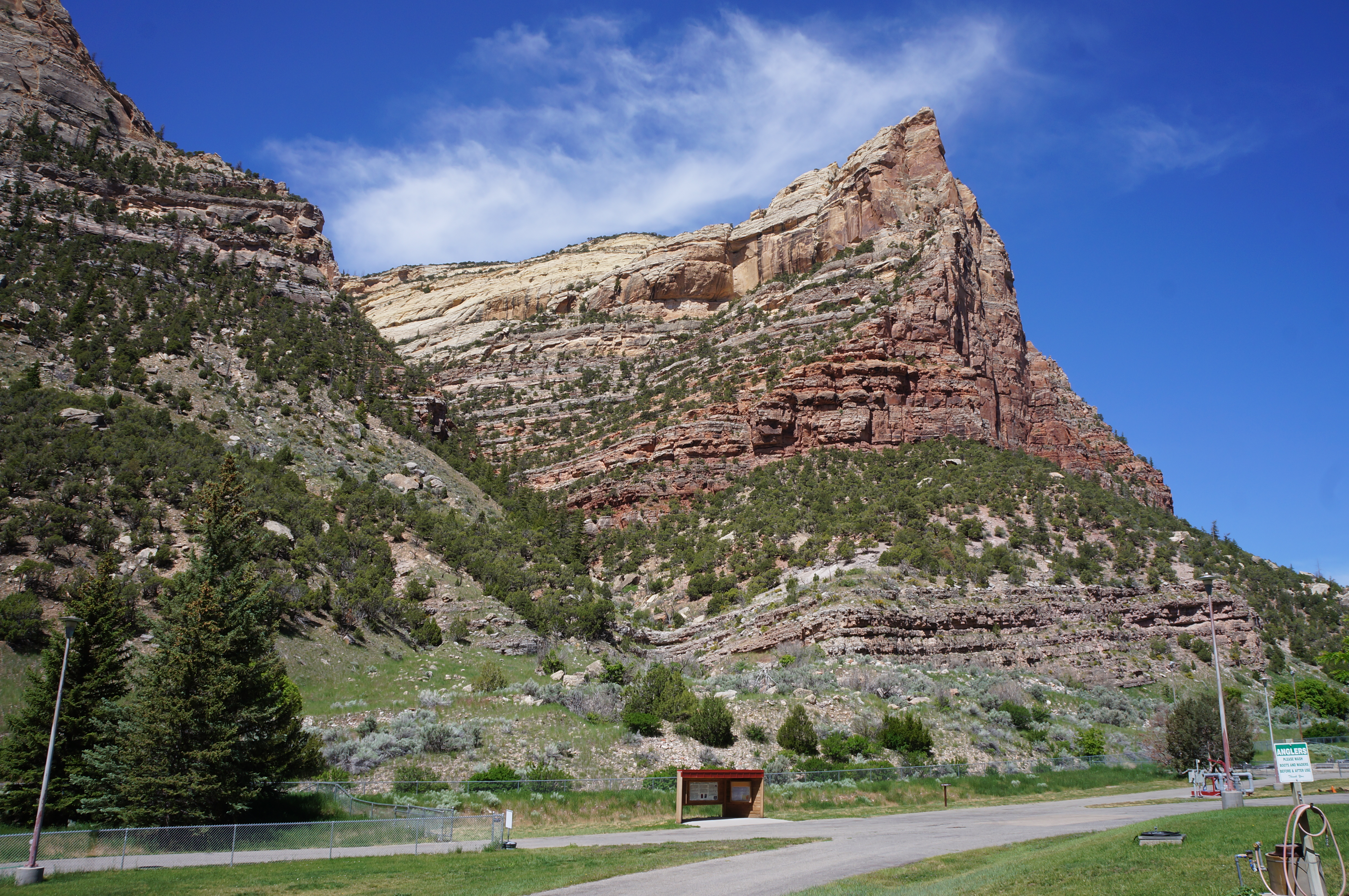
Perhaps the greatest deterrent to hiking Jones Hole is the lengthy drive to the trailhead. The drainage is located on the Utah side of the park but remains about an hour from Vernal (the nearest town) and the Quarry Visitor Center. The drive is pleasant enough, however, beginning by climbing to a high plateau called Diamond Mountain before descending sharply into Diamond Gulch, which is ringed with high sandstone cliffs.
Follow the signs for the Jones Hole Fish Hatchery as the winding road drops to a basin at the foot of the Weber Sandstone, a Pennsylvania-age sedimentary layer. Fed by Jones Hole Springs, the area is surprisingly lush and riparian—a contrast with many of the nearby dry beds.

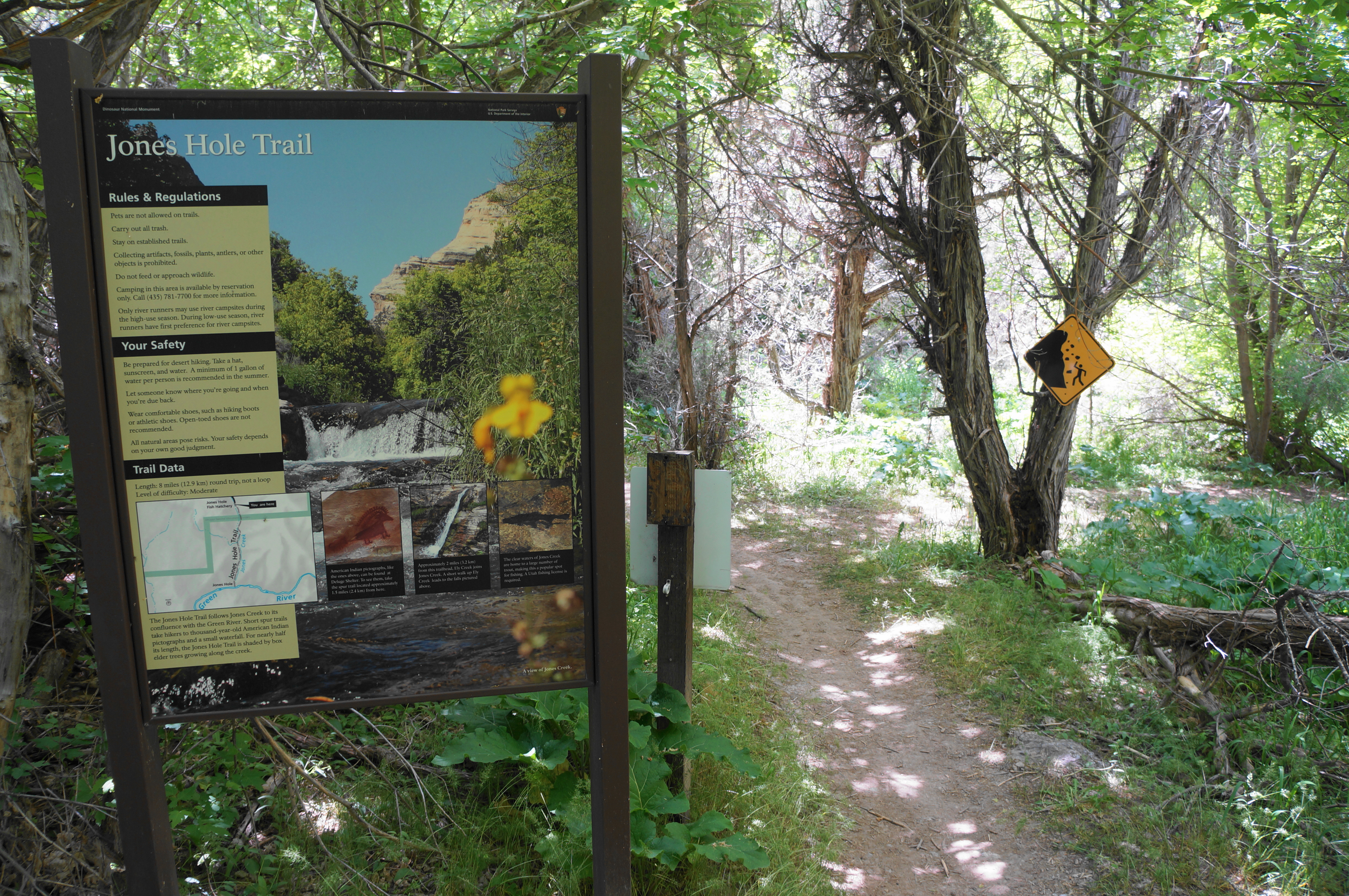
Park in the small parking lot adjacent to the fish hatchery, the latter of which covers much of the flat floodplain in this part of the canyon. Visitors by this point have not yet entered Dinosaur National Monument. The hike begins by crossing Jones Hole Road, then treads southward, passing several informational kiosks and the main hatchery on the right, where hikers can see hundreds of fish. The wide track parallels the facility on the left before leaving it behind at around .15 miles, where there is another information board.

Continue straight as the trail lunges into the woods, passing a picnic table and the first views of Jones Hole Creek on the right. After running under a protruding outcrop, the Jones Hole Trail parallels the stream for a short distance, then briefly moves away again as it finally enters Dinosaur National Monument, marked by yet another large map/sign, this one directly about the trail.

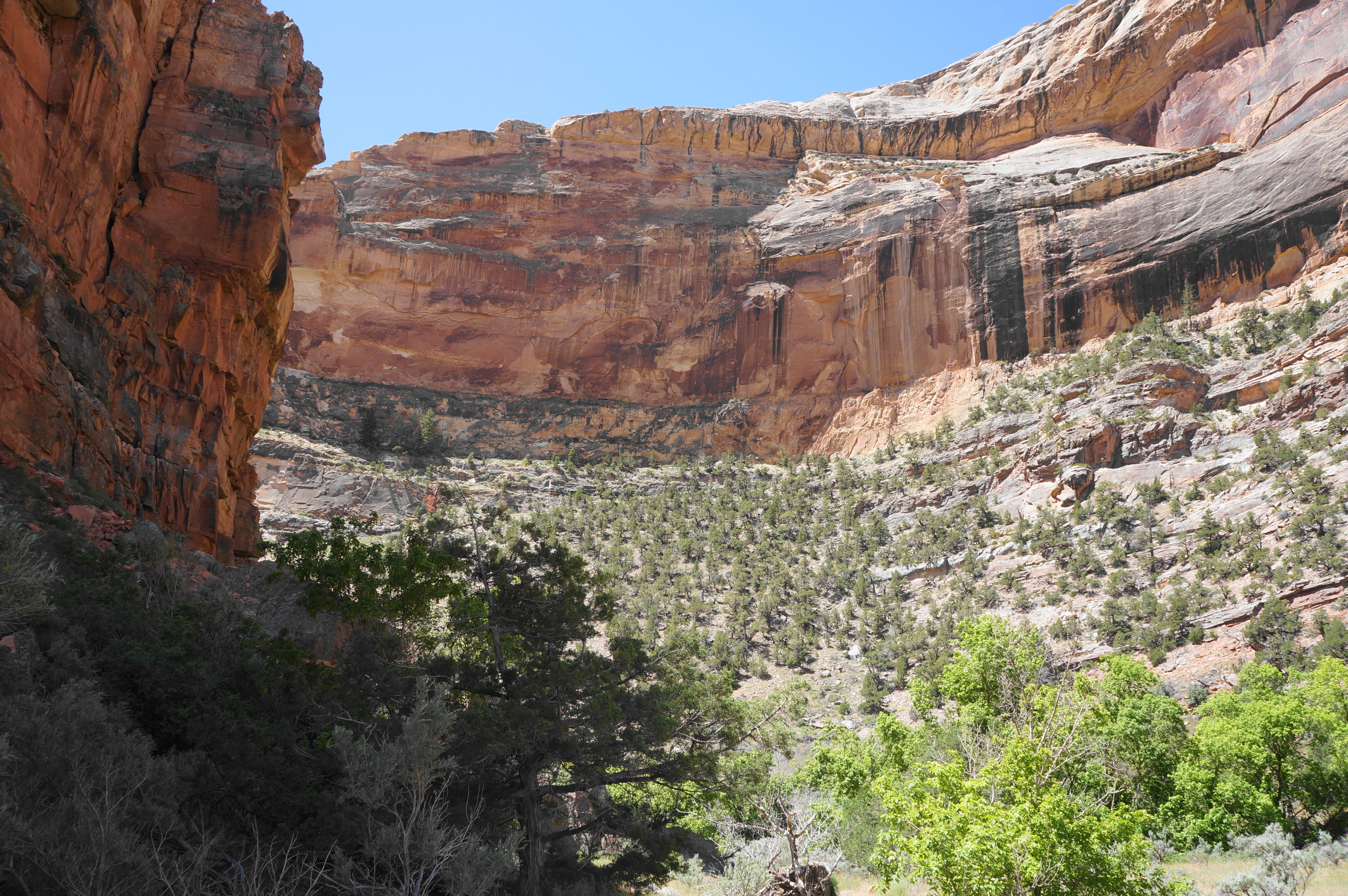
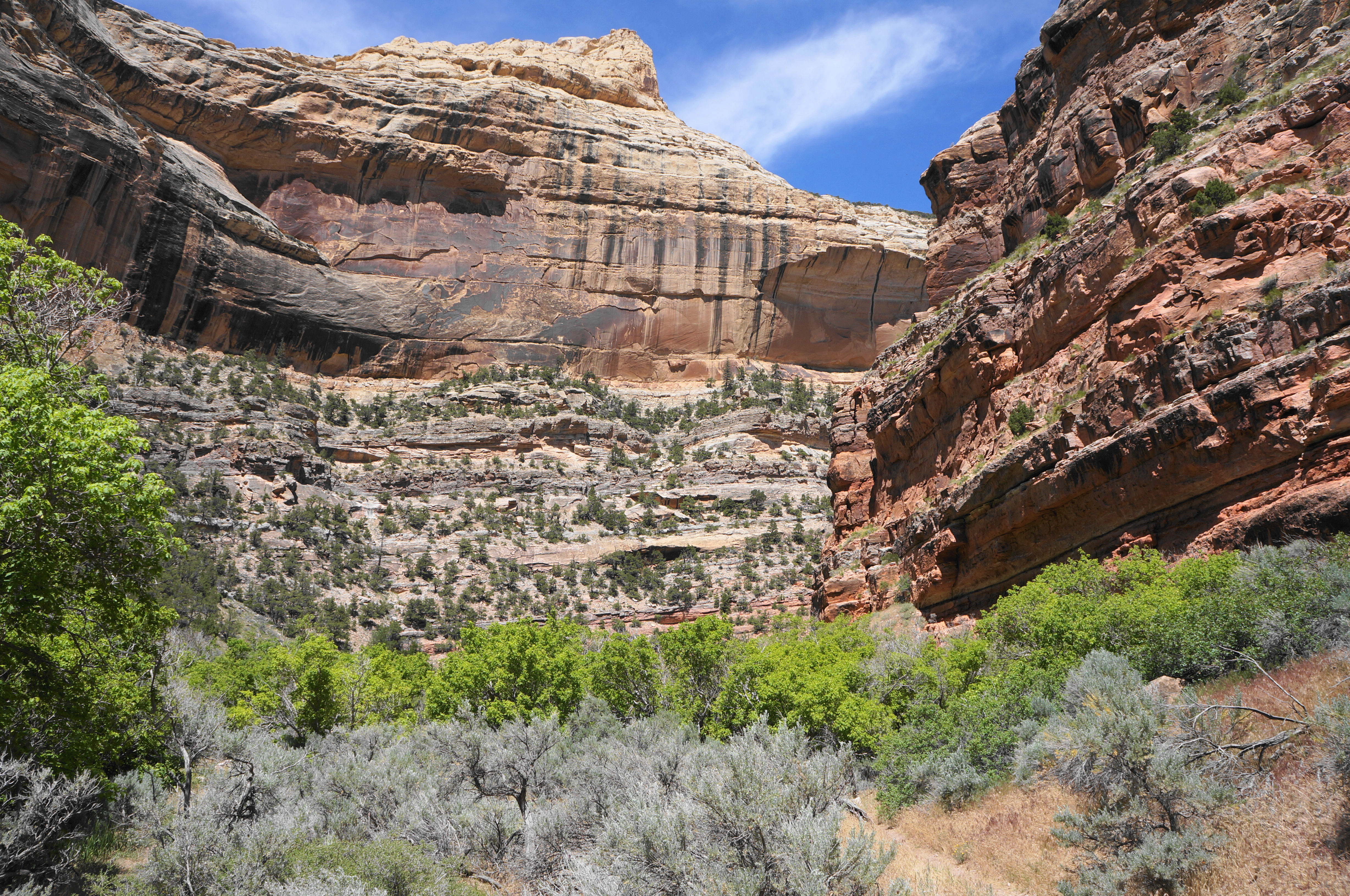
The lovely stream is nice, but it is the dramatic, multi-hued cliffs that make this hike spectacular, so it is welcome around ½ mile when the vegetation recedes for a brief period, revealing views down to a canyon bend. Here the red- and cream-colored Weber Sandstone still predominates, although this will later change to Round Valley Limestone and Doughnut Shale (part of the Lodore Formation) as the canyon cuts deeper.

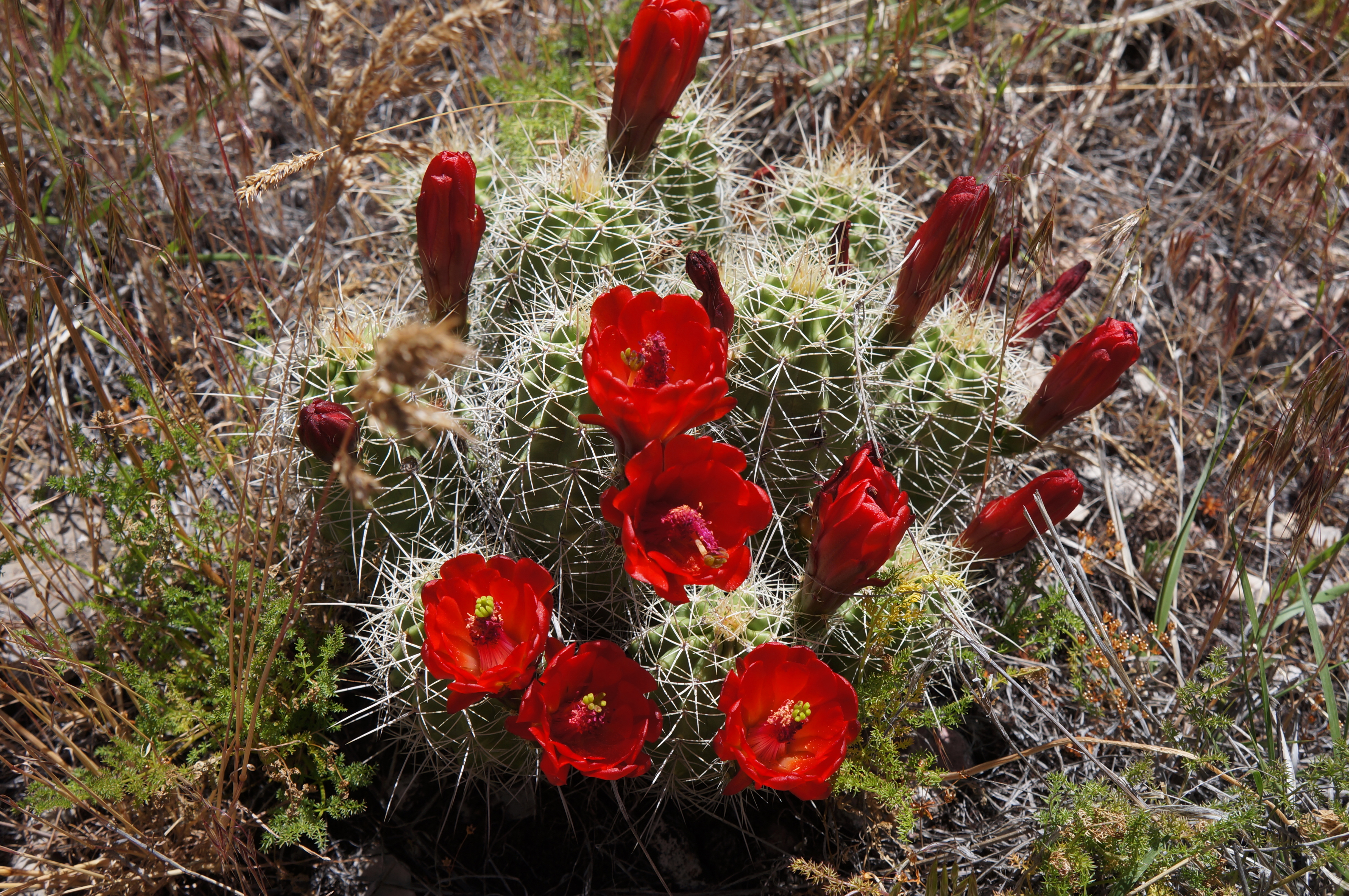
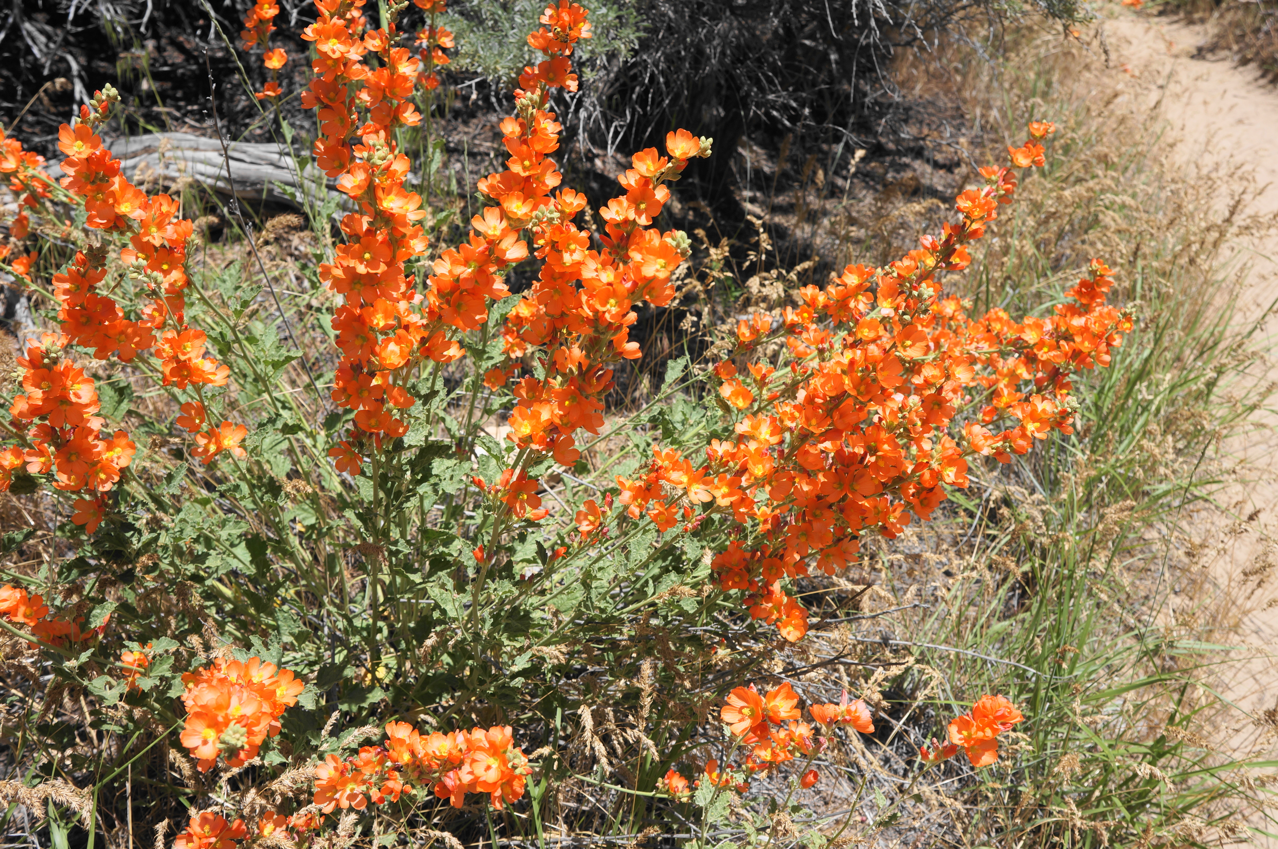
After returning to the woods—populated by birch, Douglas firs, and other tree varieties—the route descends a set of steps, followed soon by an uphill staircase. Notice the impressive cryptobiotic soil, a living soil crust comprising cyanobacteria that help to stabilize the ground cover. Again with open vistas down-canyon, the Jones Hole Trail settles into a steady descent through a grove of gnarly juniper trees, interspersed with lovely specimens of claret cup cactus (blooming in late spring).
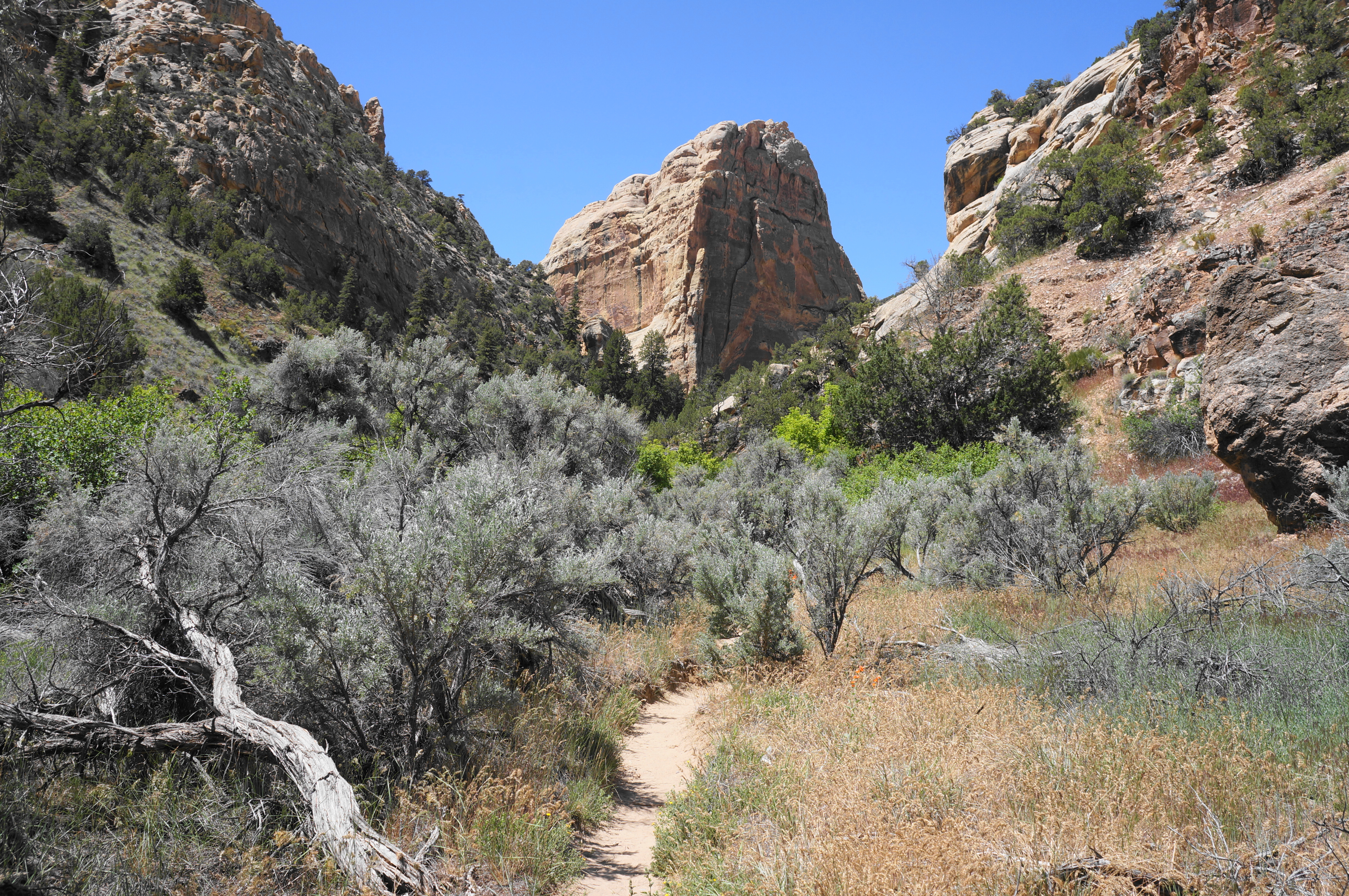
By the one-mile mark, the trail is rounding a left-hand bend, edging through the narrowest part of the canyon. Look back west for a look at the gorge’s most impressive wall, rising hundreds of feet to a sandstone knob high above Jones Hole.
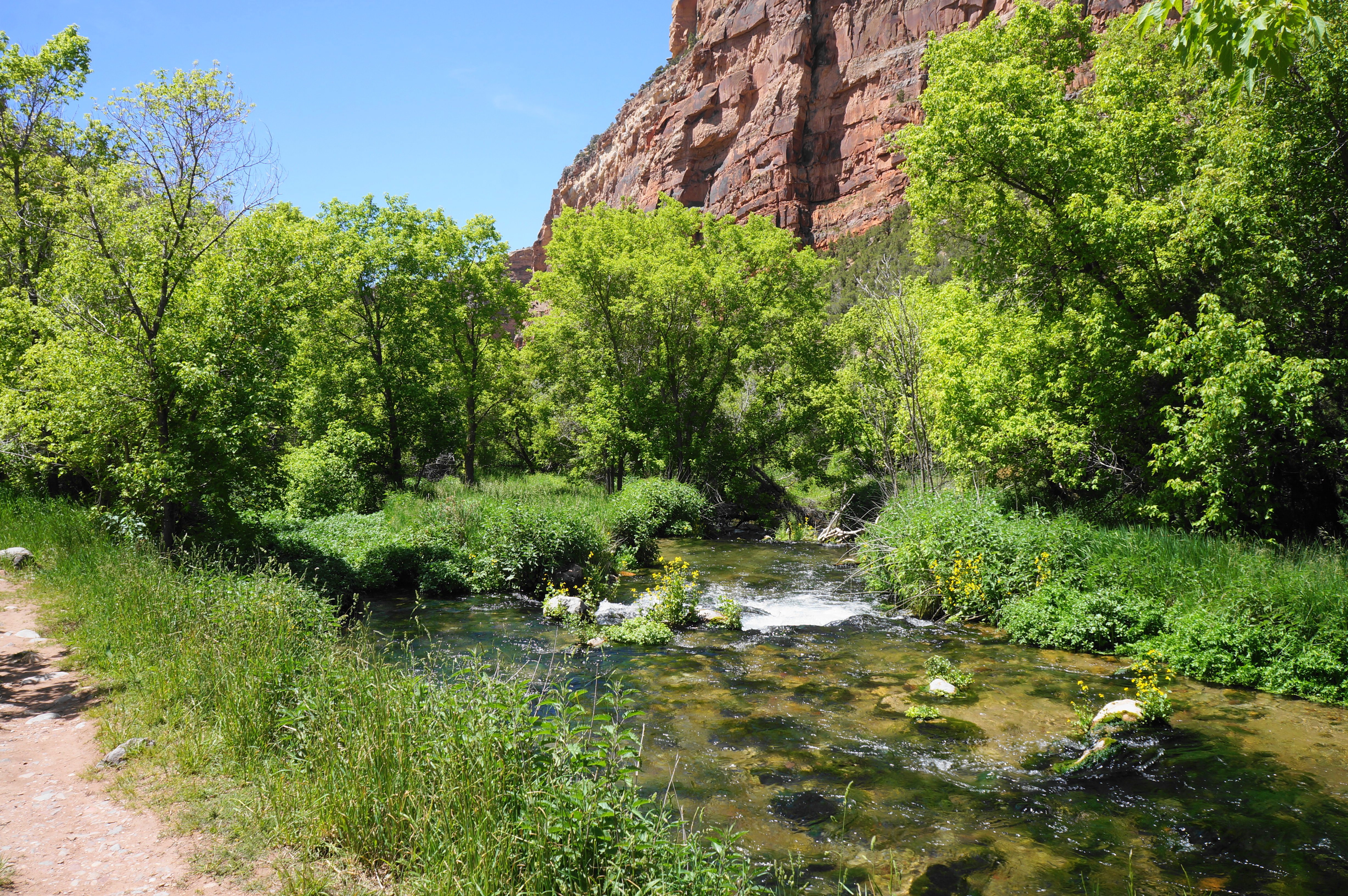
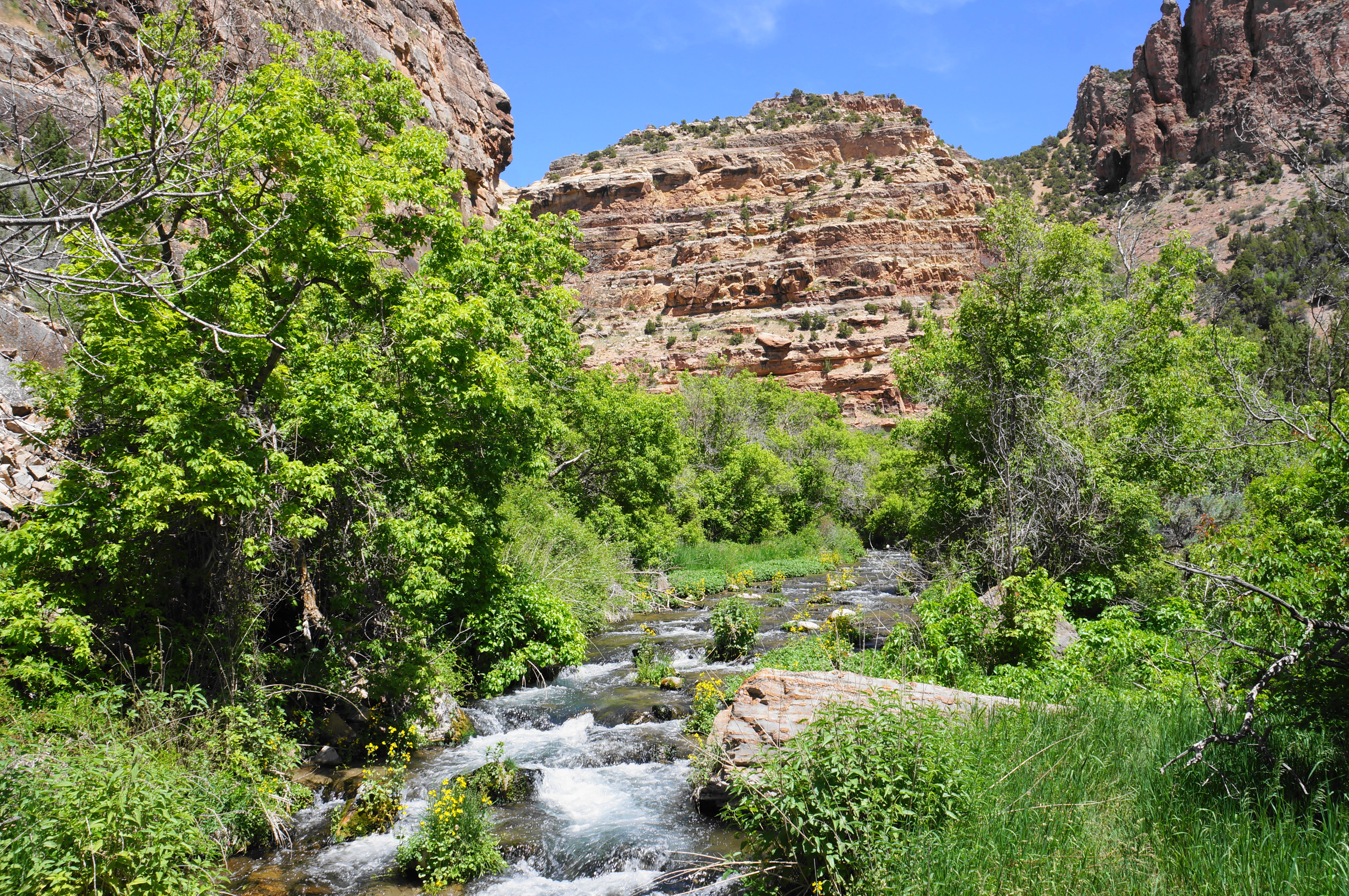
Here the trail comes streamside again, passing a protruding jut on the opposite bank before the canyon widens again. Continue in and out of the shade as the Jones Hole Trail follows the creek and eventually crosses it at a scenic bridge about 1.4 miles from the start.
Pay attention as the trail continues south from the bridge, as there are a series of spur trails that lead to centuries-old petroglyphs and pictographs off to the right. The first is denoted by a small white marker and leads to a slab with some relatively faded etchings scrawled by indigenous peoples known by archaeologists as the “Fremont culture.” Relatively little is known about these native hunter-gatherers, but they have left markings and symbols throughout parts of present-day Utah (see also Capitol Reef NP).

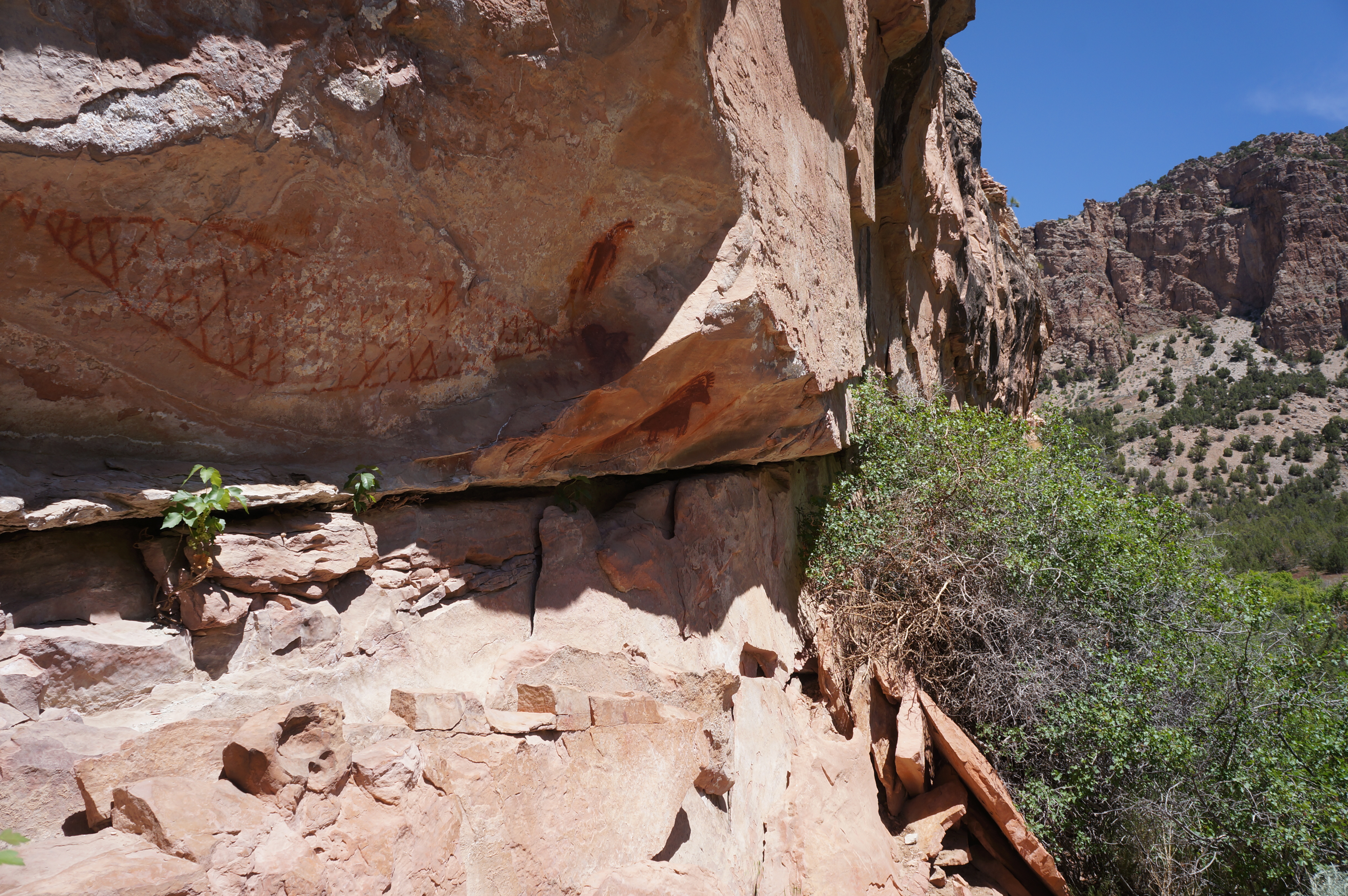
The spur trail continues for 1/10 mile or so and eventually connects back with the main trail. But soon after this initial foray, a second spur heads right again – this one leading to the much more impressive Deluge Shelter Pictographs. Unlike petroglyphs, which are carved into the rock, petroglyphs use pigments to “paint” the surface, producing more dramatic illustrations.


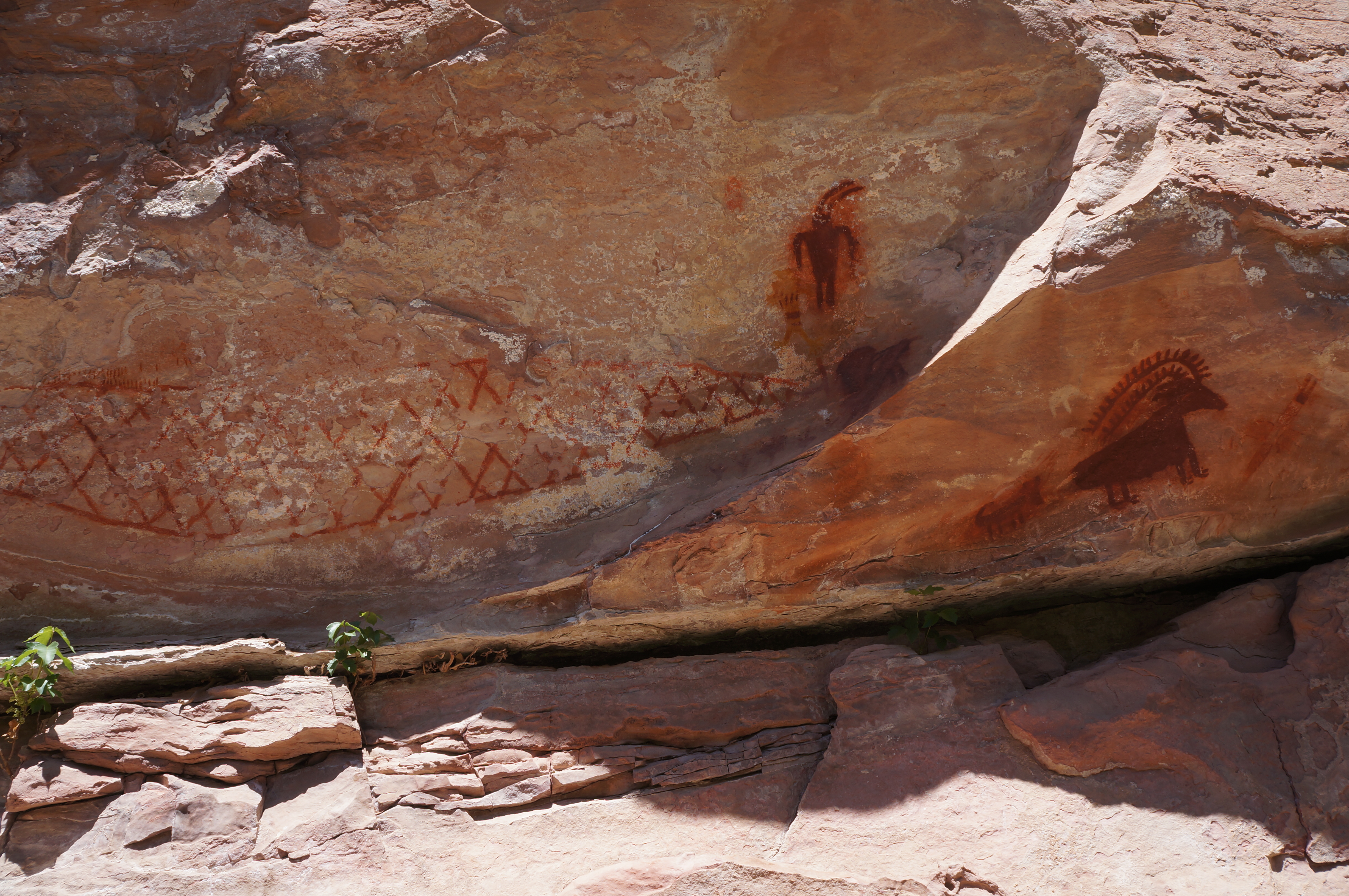
The Deluge Shelter is one of the best examples of pictographs in Dinosaur, with a representation of bighorn sheep (often found in the canyon today), an anthropoid figure, and what appears to be a large net or bed of straw. Farther down the trail, there is another depiction of what looks like three anthropoid figures.

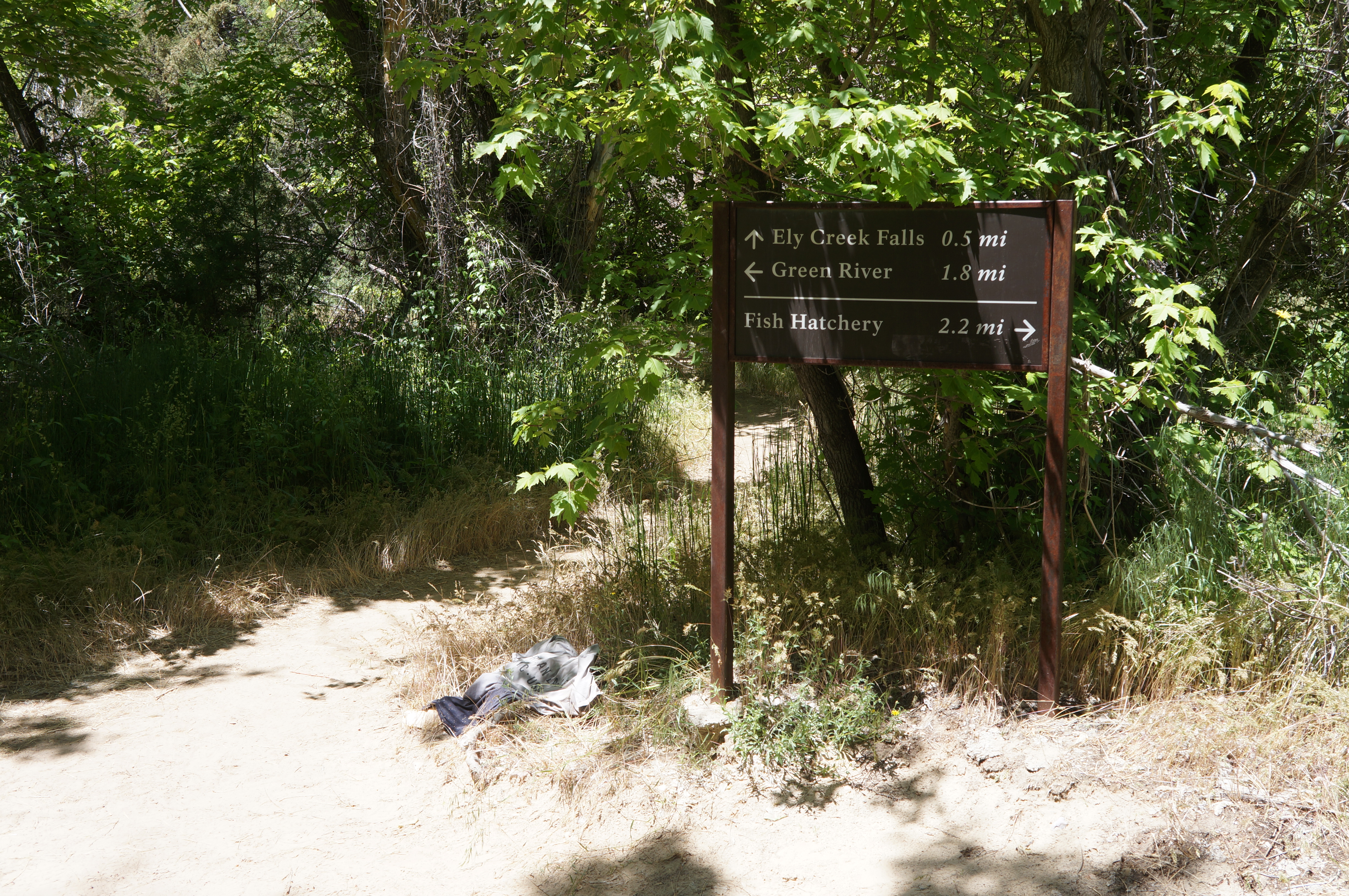
This second spur trail also loops back to the main trail, where the southward route continues between the riparian area on the left and the scrubby hillside below the towering walls on the right. It is a short walk from here to the only trail junction on the hike: here the Island Park Trail heads west toward Ely Creek Falls and beyond. (Note: The distances, however, are erratic: While the 1.8 miles to the Green River is more or less correct, the other two distances—2.2 miles to the fish hatchery and 0.5 miles to Ely Creek Falls—are gross exaggerations. I tracked 1.75 miles from the fish hatchery to this point and a mere .15 miles or so to the falls.)
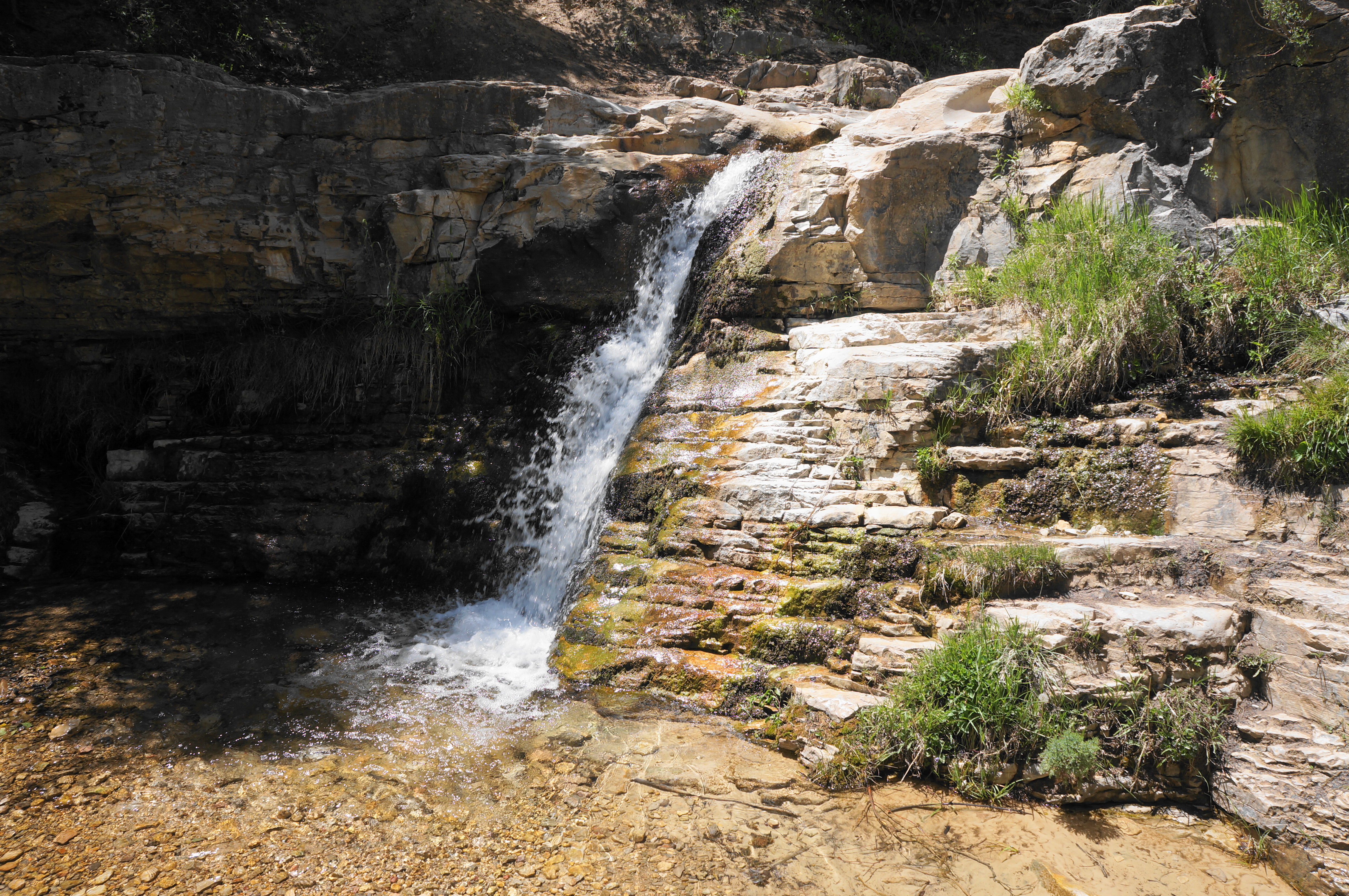
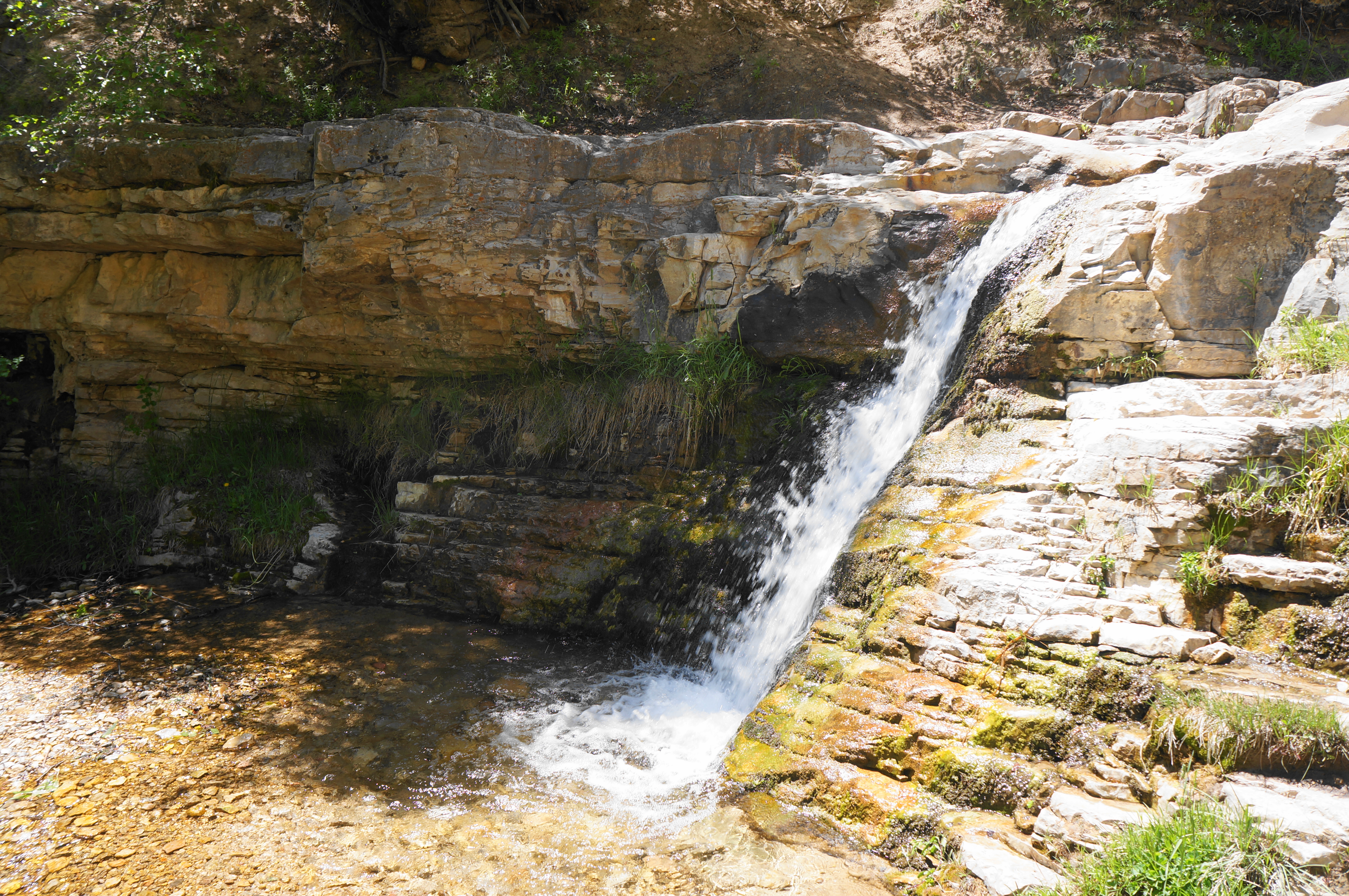
For those seeking to cool off in the shade by the falls, head right at the junction and follow the narrower path up the Ely Creek drainage. This tributary is brief and has its source on Diamond Mountain just a couple miles upstream. After a mere 250-300 yards, the trail approaches Ely Creek Falls on the right. The tumble is relatively modest, but pleasantly situated in a scenic gulch in the heart of canyon country.
The Island Park Trail continues on from here (by clambering up to a rock bench above the falls), but there is more of Jones Hole to see, so backtrack the way you came, returning to the junction. By now your journey to the Green River is a little more than halfway complete.
After turning right at the junction, cross a short footbridge over Ely Creek, then pass a large camp site (with a bear locker) on the right. Much of the rest of the trail is in the riparian area along Jones Hole Creek, which comes back into clear view within about ¼ mile. Hugging the right bank of the creek, look for trout and other fish life in the waters.
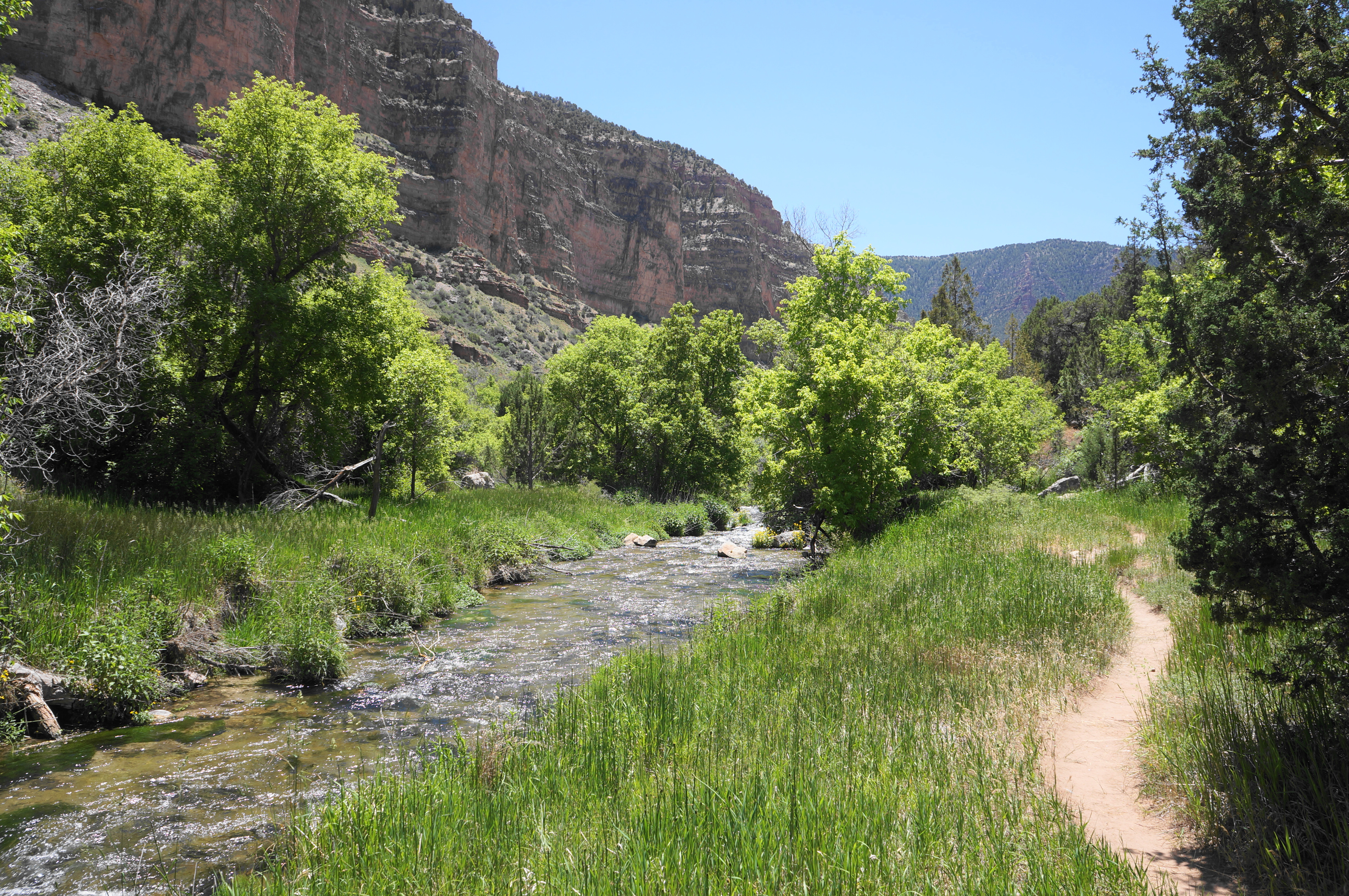

At around 2.5 miles, the trail traverses an open grassy area, covers a sudden but short up and down, and skirts a rumbling, three-foot cascade on the left. Notice, as one traverses another open and scenic plain, that the canyon walls are no longer Weber Sandstone but have shifted to a multihued limestone, an older rock layer that continues down to the Green. Looking back up-canyon, the Weber layer is no longer visible, hidden behind a hillslope.
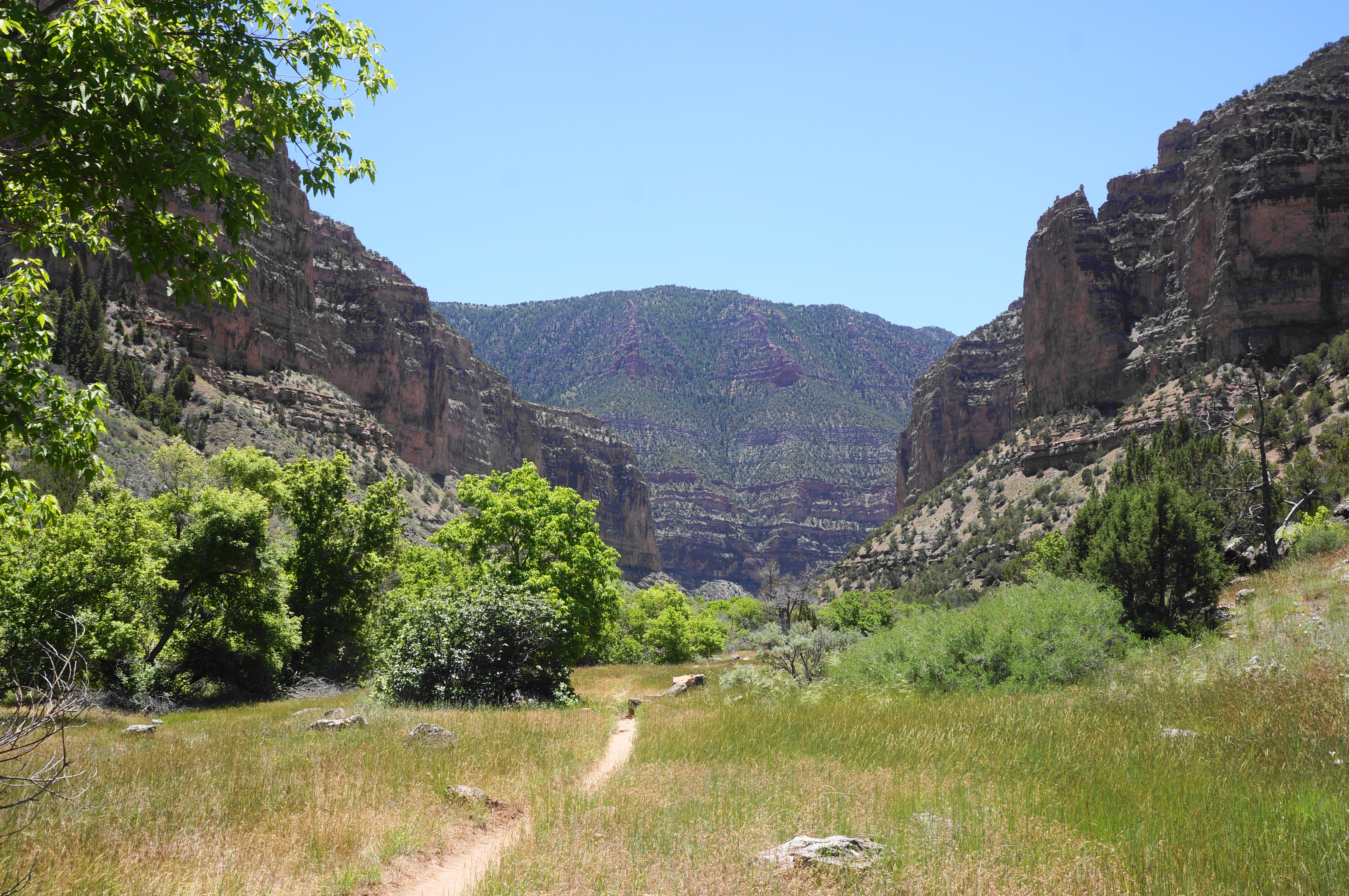

The Jones Hole Trail comes streamside again at about 3.3 miles, roughly following the creek for the next half mile. At around 3.8 miles, pass a sign for the “day use area” right – but skip this relatively uninspiring detour in favor of the left-hand trail. As the mouth of the canyon opens up and the high walls recede, Jones Hole Creek runs through a sandy alluvial delta—surprisingly calm at its culmination because it is dammed (naturally?) just near its terminus.
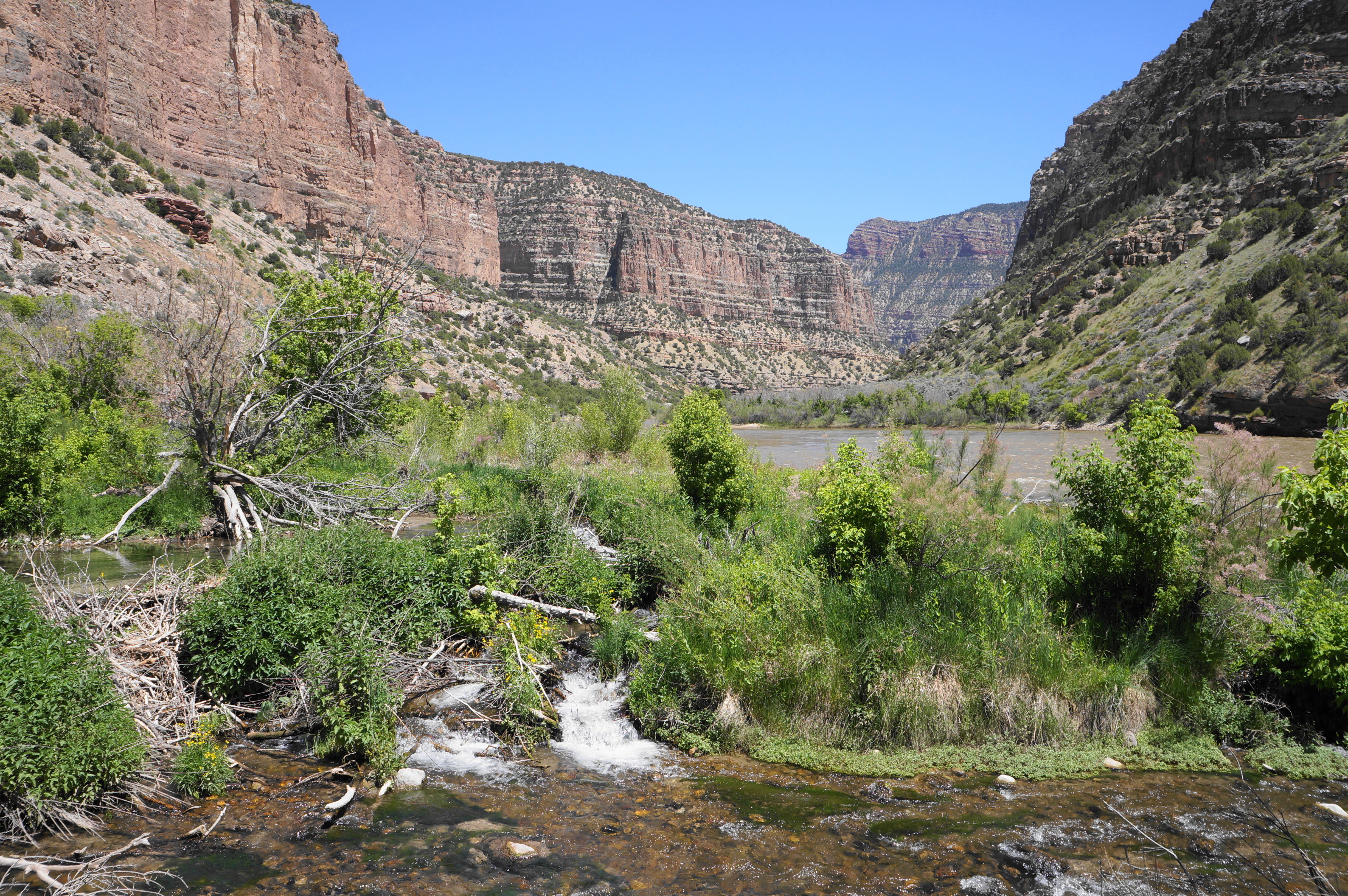
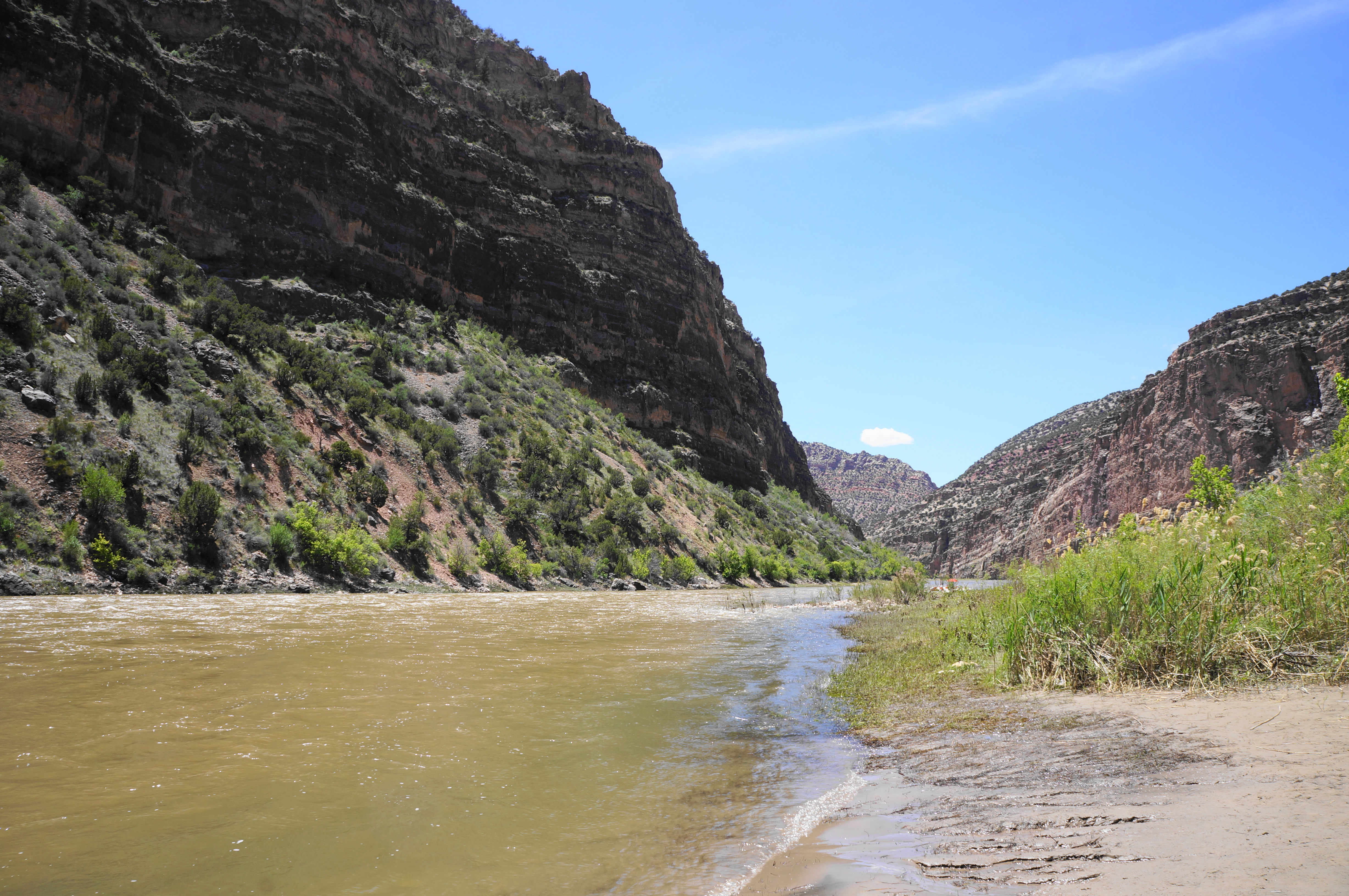
Follow one of the many sandy paths down to the Green River. This mighty tributary runs 730 miles from southwest Wyoming to its confluence with the Colorado River in Utah’s Canyonlands National Park. The river was famously explored and surveyed during the John Wesley Powell Expedition in 1869 and crossed by many travelers heading westward on the California, Oregon, and Mormon Pioneer Trails. Today it is dammed in several areas but preserved nearly in its natural state through Dinosaur National Monument.

There are at least three easily accessible put-ins at Jones Hole, and hikers are likely to encounter river parties running the challenging rapids of the Green. All the beaches are sun-exposed, but there is ample shade farther back.

From the shore, one can see upstream (left) through Whirlpool Canyon to the Colorado state line and beyond. Tucked around the corner, out of view, is the famous Steamboat Rock and Echo Park area. Downstream (right), the fast-flowing river heads toward Island Park and the main Quarry area of the National Monument, although again onward views are thwarted by the high cliffs.
Enjoy a rest at the banks of the Green River, then return the way you came, heading up the mild incline for 3.7 miles to return to the Jones Hole Fish Hatchery and trailhead. Stop back at the waterfall or petroglyphs if you’d like, or simply enjoy the terrific views of this hideaway canyon.


All told, the Jones Hole Trail is best considered to be a most-of-the-day hike, with travelers typically taking around 5-7 hours to complete the round-trip.

Pingback: Harpers Corner Trail (Dinosaur National Monument, CO) | Live and Let Hike
Pingback: Top 10 Hikes in 2022 | Live and Let Hike