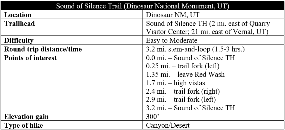
Like Canyonlands or Capitol Reef in southern Utah, Dinosaur National Monument in Utah and Colorado features nearly two dozen sedimentary rock layers that span the Permian through Cretaceous periods (66-300 million years ago). The view from Cub Creek Road at the trailhead for the Sound of Silence Trail offers a cross-section of nine “newer” rock layers, from the imposing Nugget Sandstone (late Triassic) to the diminutive Frontier Formation (late Cretaceous). Why not explore this area up-close? The 3.2-mile Sound of Silence Trail casts off across an open plain before snaking between prehistoric outcrops and up and down rugged ridgelines, offering a geological tour de force in the scenic lowlands below Split Mountain. With the informative trail guide ($1.00 at the Visitor Center), this is an interesting and moderately difficult hike in a scenic section of Dinosaur National Monument, worthy of 2-3 hours of exploration after a trip to the Dinosaur Quarry and nearby Box and Hog Canyons.
The hike
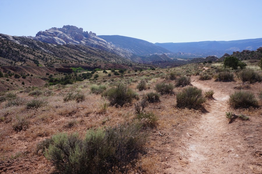
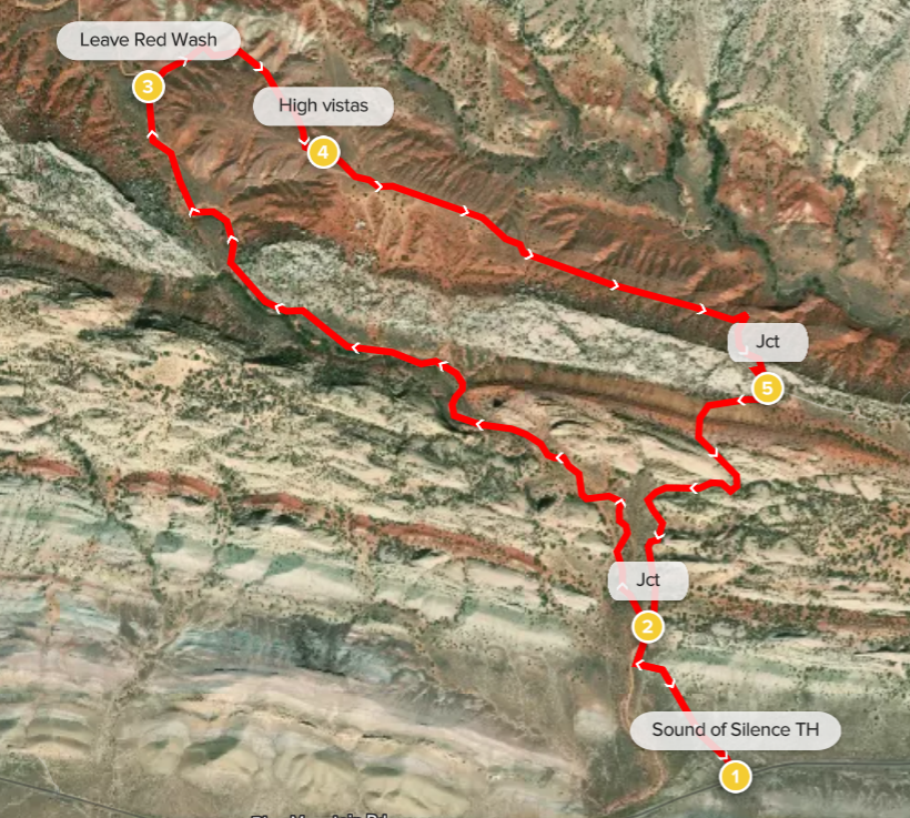
The peculiarly-named Sound of Silence Trail begins and ends at a modest but signed pull-off along Cub Creek Road, roughly two miles east of the entrance and Quarry Visitor Center in the Utah portion of Dinosaur National Monument. After skirting a ridge rimmed by the Morrison Formation (prime dinosaur fossil viewing), the road sets out across a flat desert plain dotted with saltbush, greasewood, and other shrubs. The hulking mass of Split Mountain—bisected by the Green River—dominates the skyline to north.
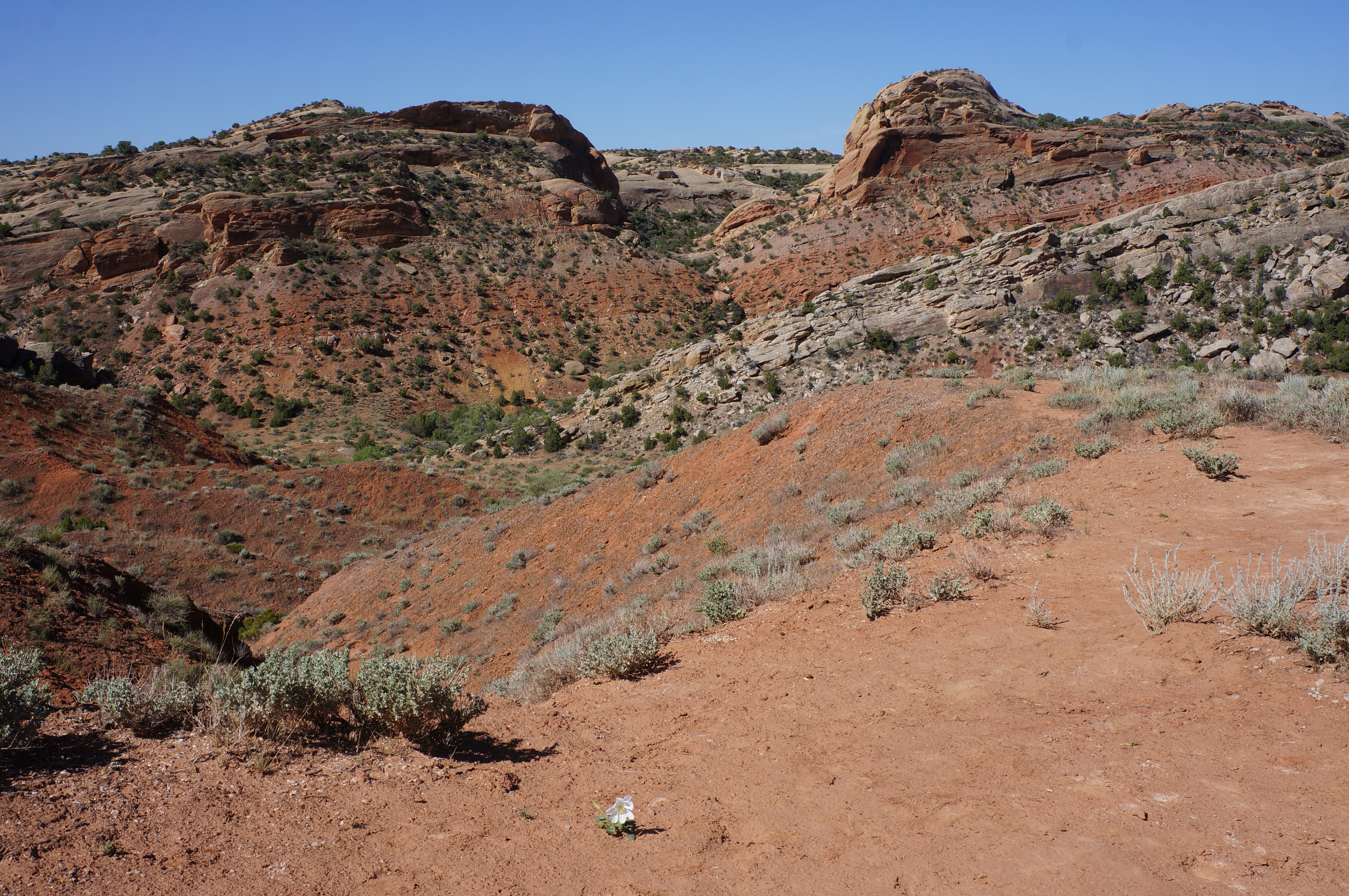
Park in the small parking area at the trailhead, check out the map and trail sign, and grab a $1.00 brochure (also available at the Visitor Center). From here the Sound of Silence Trail sets out across the shrubland, with the broad cross-section of nine rock layers visible ahead. The multi-hued landscape is the impressive product of sedimentation and uplift, with the width of each layer roughly reflecting the length of time taken to lay the bedrock.

The path begins by quickly clearing a dry wash and then cuts in a northwesterly direction across flat and sun-exposed terrain. Pass signpost #1 at roughly 0.15 miles, then drop into the usually dry arroyo known as Red Wash. This tributary of the Green River is a centerpiece of the first 1/3 of the hike.
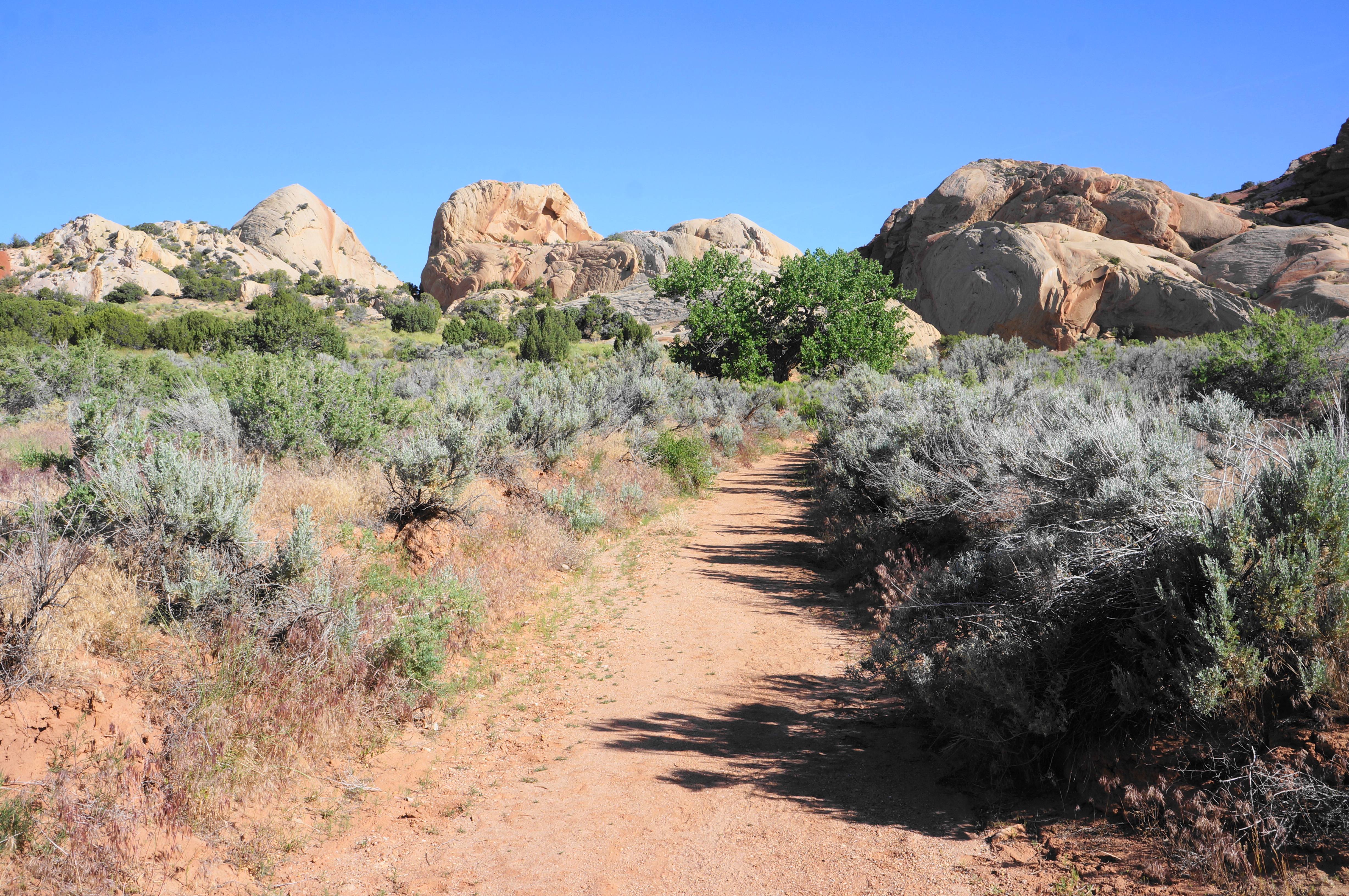
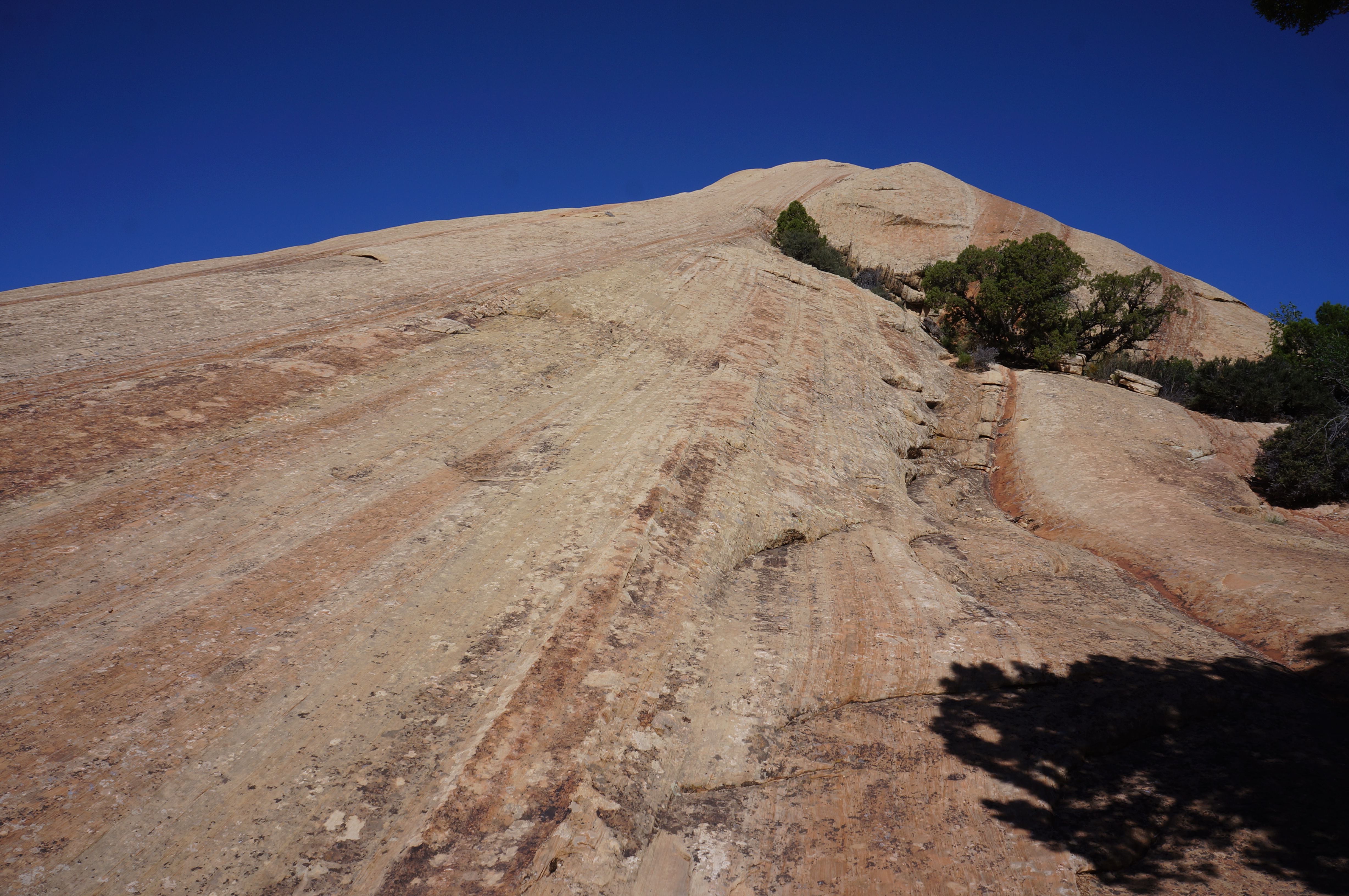
From here the trail is the wash itself, which hikers should follow up-stream, passing a junction (and start of the loop portion) at ¼ mile. Bear left, soon passing under a Fremont cottonwood tree on the left at 3/10 mile. As the route continues, it approaches two high outcrops of Nugget sandstone and then rounds a left-hand bend with a deep, eroded bank. Look for cross-bedding in the rock outcrops as the trail continues, with the high walls shielding hikers from views of the newer rock layers to the west and south. From here on, the predominant layer is Nugget sandstone, a very close cousin of the better-known Navajo sandstone.
Stay in the wash until a marker indicates the trail rising up the right bank to a shelf dominated by the greasewood, sagebrush, and small Utah junipers, skirting a denser riparian area with several cottonwood trees below. Clear a rocky gulch, then continue high above Red Wash until the trail suddenly sheds elevation and switchbacks back down to the wash bottom.

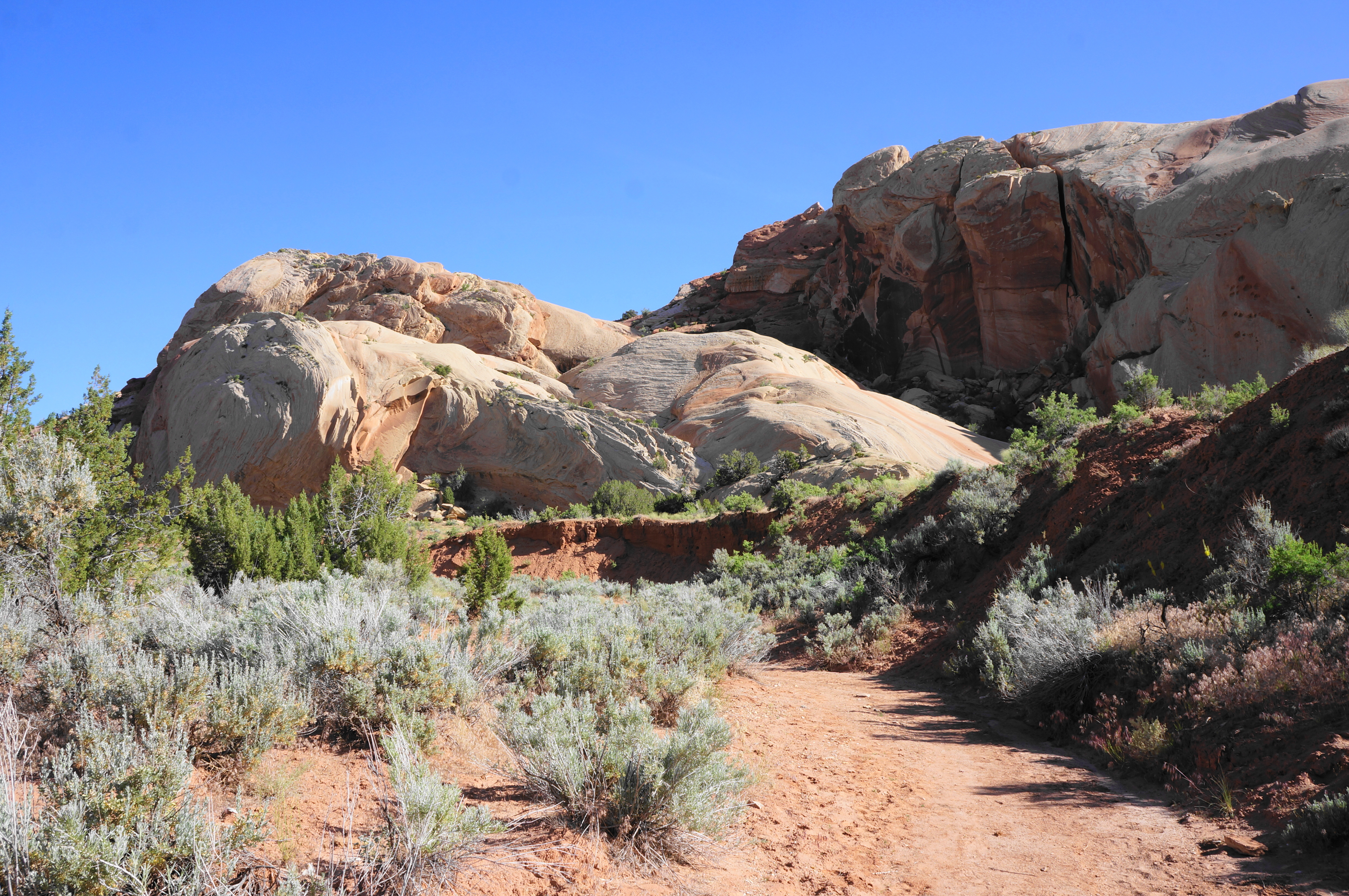
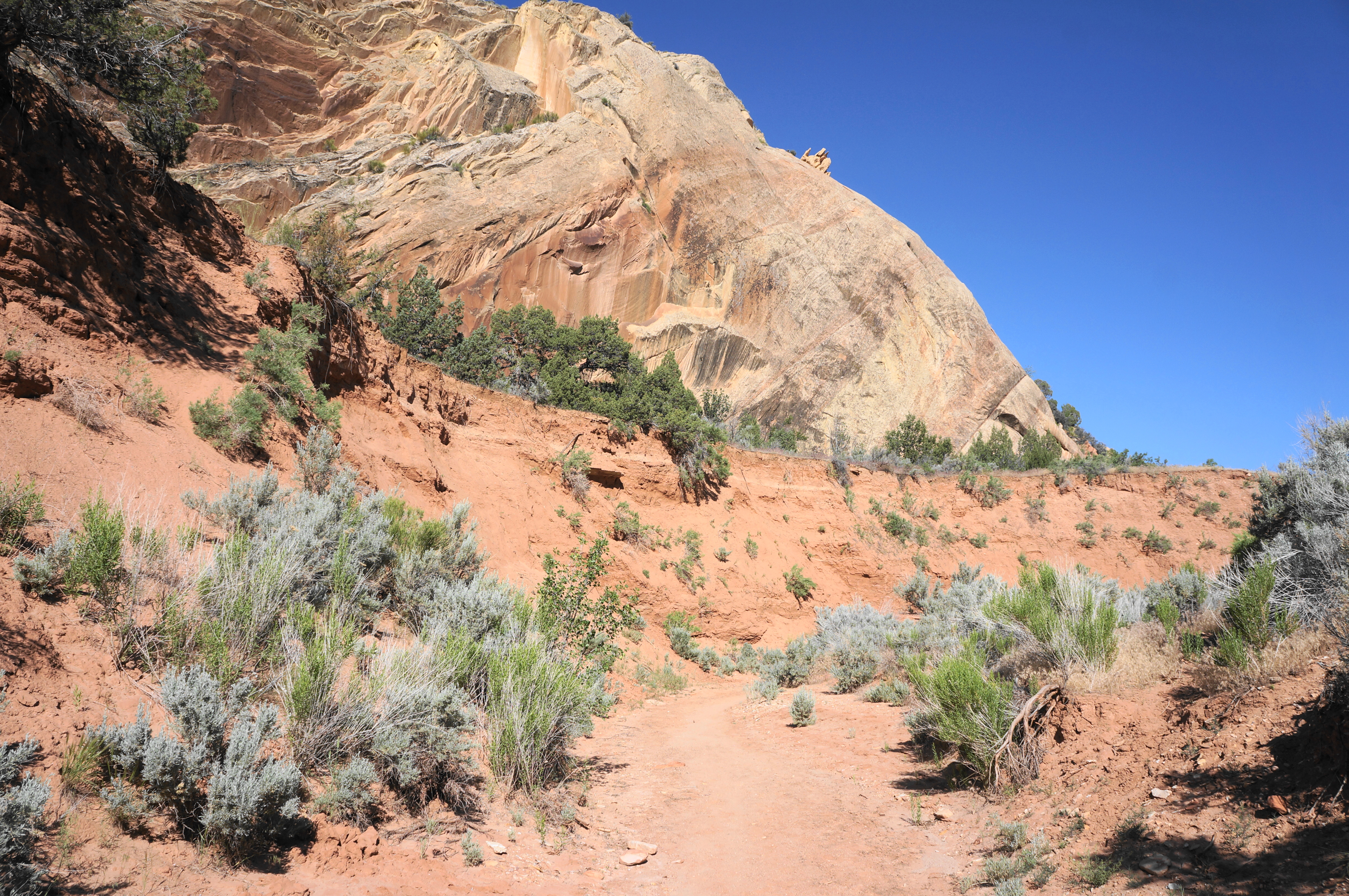
Head right, following Red Wash again as it edges northwestward. Walk through a passage between large boulders at about 1.25 miles, then turn right and leave the wash minutes later. The next section traverses the crumbly red clay and mudstones of the Moenkopi Formation, following a side drainage uphill at a modest clip.

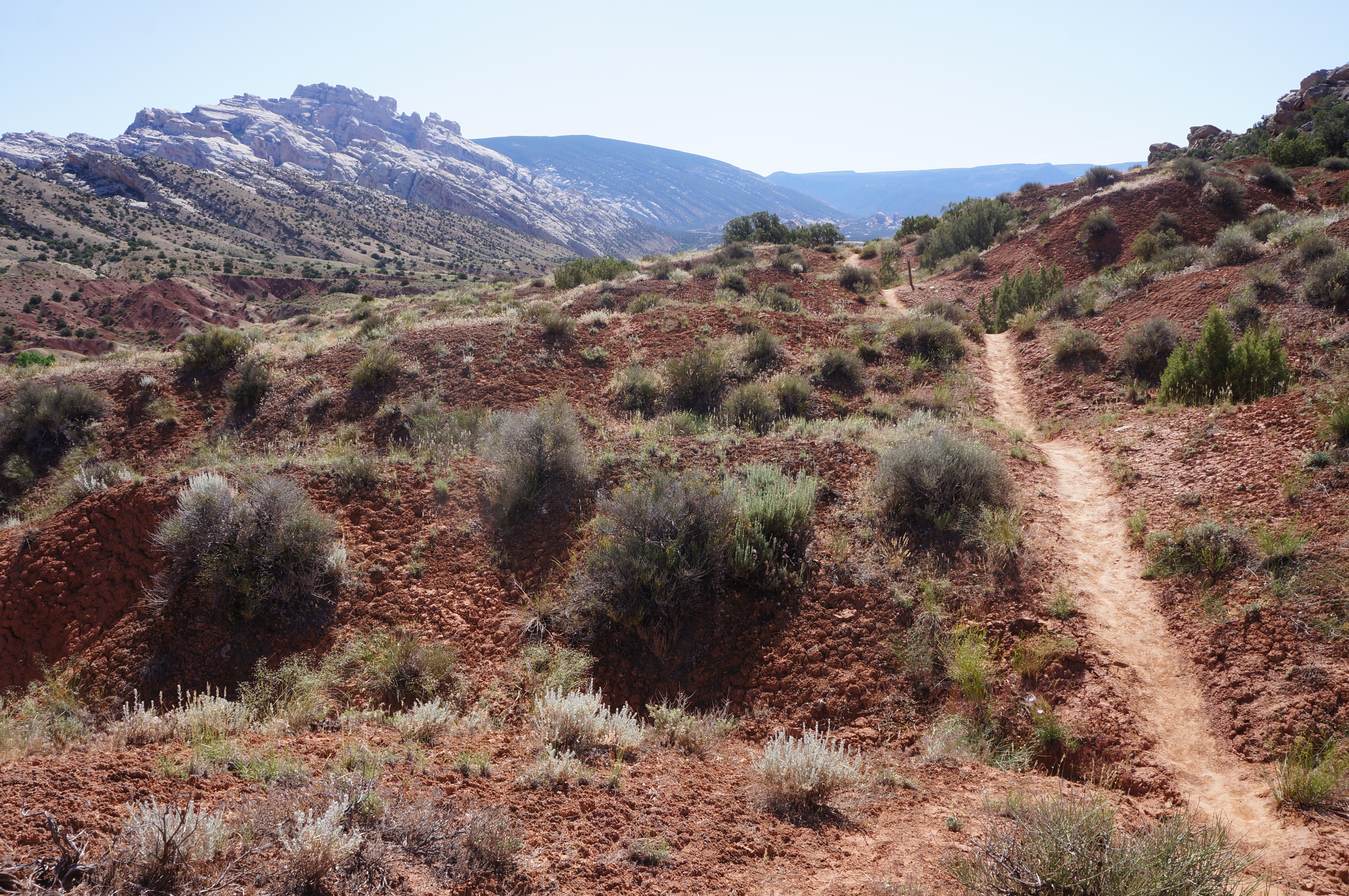
Enjoy the views up to the Nugget sandstone and down to Red Wash as the Sound of Silence Trail emerges atop a high flat, then rises a little more to a scrubby ridgeline with panoramic views. Look ahead (east) to the slanted anticline of Split Mountain, one of the most iconic formations in Dinosaur.

Also look back northwest to observe the ruddy bend known as “The Racetrack”—formed by the Triassic period Chinle and Moenkopi Formations. Iron gives the ridges above Red Wash their yellow, orange, and greenish hues.

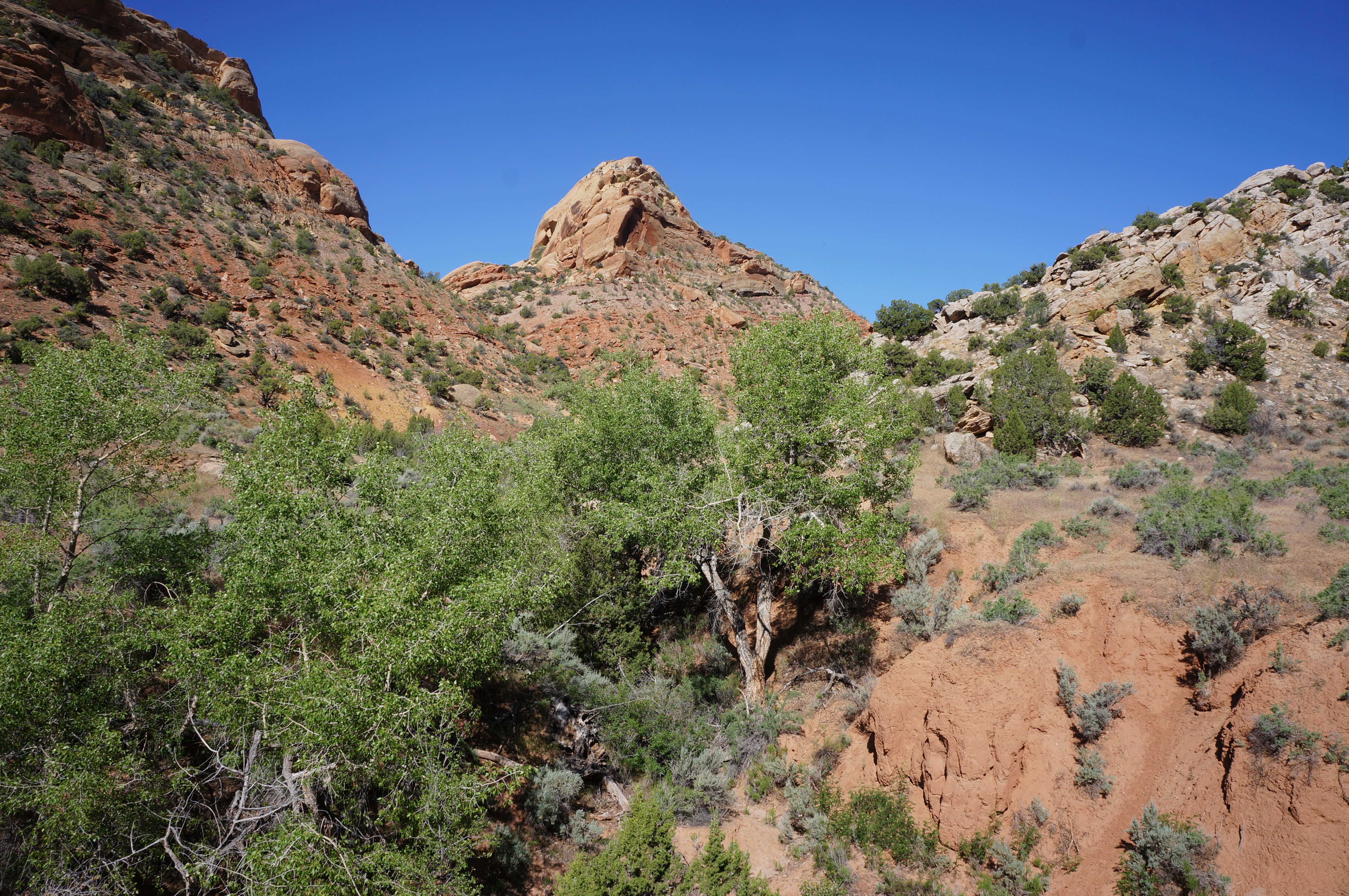
The Sound of Silence Trail follows this ridgetop for nearly ¾ mile, continuing to climb mildly in the direction of Split Mountain and the Yampa Plateau. Ahead is also the Green River, although it remains (for now) out of view.

After a brief period of up and down, the trail passes signpost #12 and a large juniper, a nice resting place ahead of the steep climb ahead. When ready, head up the steep but short slope, rising to a crest at 2.35 miles. From here you may be able to view the Green River in the distance to the south, with farmland beyond.
Follow the rock cairns as the trail descends staircases and slickrock on the south side of the ridge. It is a short walk to the junction with the Connector Trail, which heads left and, sure enough, connects with the Desert Voices Trail. (Note: Some will extend the loop by also adding this adjoining route, making for a 5.5-mile round-trip.)

Continuing right on the Sound of Silence Trail, hikers will descend to an open gully between parallel ridges—one composed of Nugget sandstone and the other comprising parts of the Chinle and Moenkopi. Ascend a low gap on the latter ridge, then take on a sharp descent between the ridge and a hulk of Nugget sandstone. Drop to marker #15, where hikers can partake in a short detour of climbing the slickrock slope to the right, or continue straight, rounding a sharp right-hand bend. Beyond is the most difficult part of the hike: a sharp descent through a notch that may require the use of hands.


The descent empties into a very sandy wash, which hikers follow for a brief period before climbing up and out on the left. Soon enough though, it is back into an adjoining wash, which hikers more or less follow back to the initial junction near signpost #2.
Bear left, then follow the path as it leaves Red Wash and completes the final return across the open shrublands. All told, the hike clocks in at a little under 3.2 miles, a surprisingly lengthy and fulfilling journey for a simple “nature trail” near the Visitor Center. This nice but exposed hike should be avoided in the midday sun on hot days. Combine with a visit to the Dinosaur Quarry and Box/Hog Canyons for a nice full day in the Utah section of Dinosaur National Monument.

Looks like a pretty hot spot in summer.
Indeed it was warm, so I tried to finish in the morning.
Pingback: Dinosaur Quarry (Dinosaur National Monument, UT) | Live and Let Hike
Super hot. We were there the week of July 19. Take lots of water. Sun hat. Go early! It was beautiful, especially after the first mile.
could you send information about this trail and when the weather is good to go.
More in formation plus weather best to come.